|
 |
 |
 |
 |
|
|
|
|
|
|
Saturday, September 18 - 14 miles to Bobtail Creek
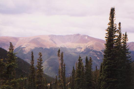
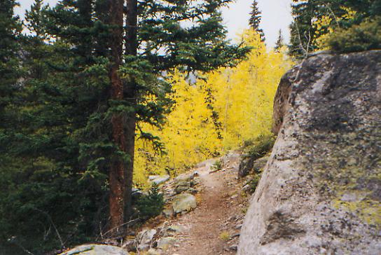
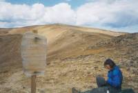
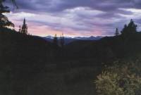
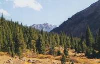
We got a late start due to a leisurely (and expensive) breakfast, a long chat with Kahley, and a slow hitch out of town. Our ride into town was interesting, as we were picked up by a young man on his way to the state-wide Ultimate Frisbee Championship in which he was competing. It is a different world. We reached Berthoud Pass at 11:00 a.m. The day is mixed sunshine and big black cumulus clouds. The peaks are magnificent. We had a 1000' climb out of the pass, then easy ups and downs on new trail along the ridge, then a steep switchback down to Vasquez Pass. The new trail is way too narrow, only about 12" wide. Its bad now, with sections that are already worn away, and will be gone entirely in five years.
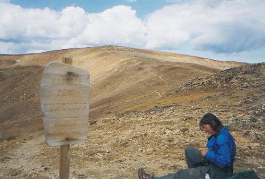
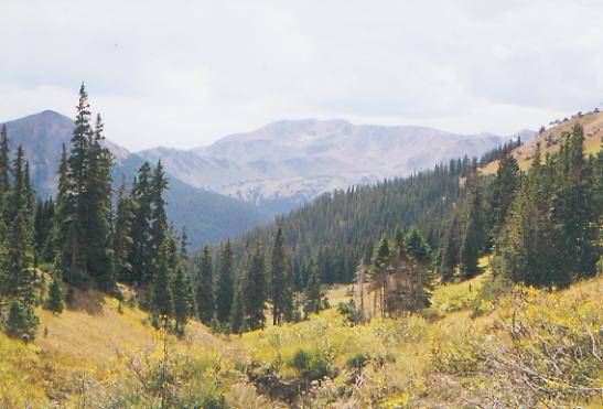
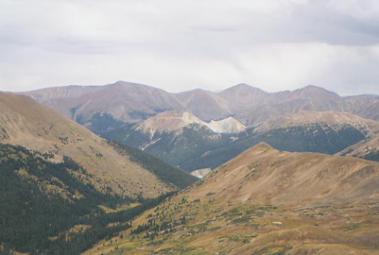
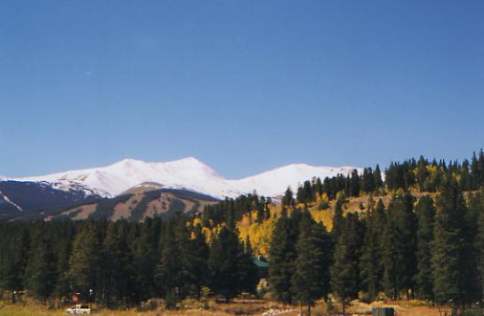
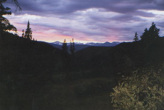
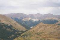
Today turned out to be a good day after all. Even though we didnt get much sleep (we never do in town), we started out in a more cheerful frame of mind. Amazing what a good meal and a hot shower can do. The sun shone on and off, though we got snow flurries mid-afternoon. By late afternoon it was dark and windy and we could see snow falling on the peaks to the south. The hills all around were massive, covered in red and gold ferns and grasses with dark green spruce/fir forest, and blue-grey lakes and streams far below. We had been told that there was new trail beyond Vasquez Pass, but no one was sure exactly where it went. The old route was either cross-country along the Divide, or a contour around Vasquez Peak to avoid some of the roller coaster effort. Well, it turned out they had built new trail for the entire section. Some of it was badly built, too narrow and with too much soft fill, but it was clear and easy to follow, and made fairly easy climbs and descents. Jim and I took notes on the new trail for JW. That was fun. I enjoyed being useful. The official route is supposed to head over the ridge beyond Jones Pass toward Greys Peak, but we saw no sign of trail leading from the pass. We never intended to follow that route, as it is about 50 miles longer, is more exposed and follows miles of jeep roads. JWs route heads straight through the mountains to Silverthorn, our next resupply town.

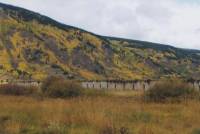
The whole area was beautiful, except the molybdenum mine below that we circled. The only wildlife we saw were marmots, chipmunks and ptarmigans. There wasnt a lot of climbing, though the descent at the end of the day from Jones Pass to Bobtail Creek on a gravel road seemed interminable. We were in a race with darkness and the storm we could see up the valley. We managed to get set up before dark, but dinner will be by moonlight, if there is a moon hidden behind the clouds.
Jim: Well, now we know where the new trail out of Vasquez Pass goes and where theyll be working again in a couple years. Theres newly dug sidehill from Vasquez pass to Jones pass its nice walking right now. But ---- some of it is well built and other sections will need to be redug in a couple years. We could tell that there were several trail crews that worked on the sidehill because there were sections of trail that had obviously been done by people who didnt know what they were doing mixed with sections that were well built. We camped on an abandoned road again just at dark. We had picked up water from a stream about a mile back up the road. The weather is a little worrisome as we made that 2500 descent I could see the storm thats been sitting on the mountains ahead all day and is apparently dumping snow up there. Hope it clears off tonight.
Sunday, September 19 - 3 miles up Bobtail Creek (Elev gain/loss: +1120/-410)
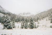
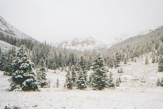
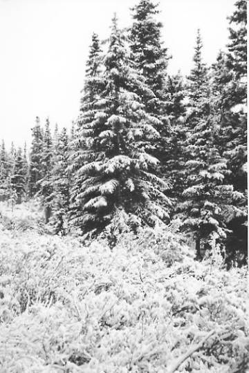
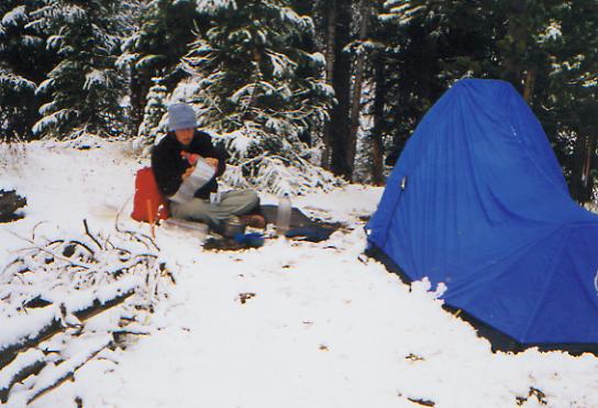
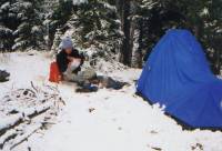
Well, for the moment, were snowbound. About half an hour after we started up Bobtail Creek, it started to rain. Soon after, the rain turned to sleet, then snow. We thought it would pass. Most storms out here have been of short duration, but the snow just got thicker and started to stick. Soon we couldnt see the trail, we were soaking wet, and the trail description said we were supposed to climb steeply above treeline. No way. We found a sheltered spot, set up the tent, and crawled inside to warm up. By 10:00 a.m., we were back in bed. Its cold, but bearable. So much for reaching Silverthorn today. Continuing would have been stupid though. This is not the time to look for obscure trail above treeline. The snow may stop in an hour, or last all day. Well see.
LATER: The snow has stopped for now, but grey clouds sit low on the ridges. Whiteout conditions, Im sure. The question now is whether we go back to Jones Pass Road and hope for a ride out (iffy--the hunters have probably left already), or stay put until tomorrow, or walk five miles to the next valley and set up again there, hoping we dont get caught 1000' higher in zero visibility or more snow. Bad choices all. I dont want to back out; it breaks the continuity of the hike and makes our chances of finishing the trail much less. (Its a thruhiker thing!) Nor do I want to risk my life going over a 12,000' ridge in whiteout conditions, snow and lightning. Is it bad enough to back out? I dont know. Bad enough to stop and wait, certainly. It was too wet and cold to continue this morning, especially when the trail vanished under the snow. For now, well wait and see. We may run out of food if this lasts past tomorrow. Rain, hail and thundersnow - what a joy.

LATER: The snow stopped about 4:00 p.m., too late to move on. The tent is leaking at the foot and my bag is soaked. Grr. Time to fix dinner. Its a good thing our water bottles are full, as we would get soaked wading through the snow-covered willows to get to the stream. At 6:00 p.m. it started snowing again. In our sheltered hollow it is hard to tell how much has fallen. It has been dark all day, making it hard to see our books. Occasionally, we get thunder and hail. What a day! Tomorrow well have to bail out. Its two miles to a dirt road, and several miles from there to the highway, but the alternative is 17 miles over two 12,000' snow-covered passes with several miles along open ridge. Unless the snow is light and tomorrow is fair, that is an unlikely choice. My ego says no to bailing out, but my sanity (and Jim) urge it as the best option. This isnt worth dying for.
Jim: This is probably our second disagreement since we started the CDT pretty good considering what weve been through so far. Ginny wants to keep going over the ridge I think its too dangerous unless the weather clears completely tomorrow. If its cold and clear Ill go for it. If not, we have at least 8 miles out of the next 17 that are above 12,000 and the trail is obscure. That means its hard to find when its clear and dry and snow-free. Dont want to do that in blizzard conditions. Our campsite is right at treeline in the last grove of trees that offer any shelter at all just over 11,000. If we keep going, well have to climb another 1000 or 1500 into the storm. Considering what its doing here, I dont want to face what its doing 1000 higher.
Monday, September 20 - 9 miles to Silverthorn/Breckenridge
We woke to patches of blue sky and big black clouds. We decided to bail out. There wasnt much snow where we were camped, only a couple of inches, but up on Jones Pass at 12,000' there were drifts that were more than a foot deep and growing. It started to snow again soon after we started, getting worse the higher we went. By treeline we were in total cloud cover, with ice pelting our faces. We kept climbing over the pass and down the other side. It started out being sort of fun, but after a while I got scared. It was really slow slogging through the snow, and Jim kept getting farther and farther ahead of me. At times all I could see was the green of his pack and the rapidly disappearing footprints. Once I followed them into the ditch he had stumbled into. If he had gone off the road on the other side, we might still be there. The snow persisted until we were almost down at the molybdenum mine. Then it cleared, but we could see it was still snowing in the high country.

Jim: There was some blue sky this morning but not up the ridge where wed have to go. Up there it was BLACK and I could still see the snow falling. So we packed up and headed back toward the hunting camp that wed passed this morning. The disappointment was that the hunters had bailed out earlier about half an hour earlier. We followed the truck tracks up the road. They didnt get out much too soon either they were having trouble driving in this stuff. We had to go back up the ridge to Jones Pass which meant climbing the 2500 that wed come down 2 days ago and it was snowing up there. Not as heavily as on the trail south of here, but the last 3 miles over the pass were literally blizzard conditions I managed to walk right off the road into a ditch. Now I think Ginny understands why I didnt want to keep going south.
Tuesday, September 21 - Rest day in Breckenridge - 2 miles

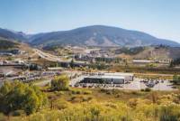
It took two rides to get to Silverthorn, where we dropped our packs at the hostel, and headed to the Post Office, where we were met by John Kincheloe, an AT hiker who offered us hospitality at his apartment in Breckenridge. He works at Keystone Resort, along with his three roommates. John was contacted via Kahley and Fanny Pack, an AT Trail Angel. Im not sure how it happened, but it was kind of him to offer us hospitality, so we accepted, happily. Trouble is, his car is out of commission, and Breckenridge is pretty spread out. Silverthorn would have been easier to manage. Weve done a lot of walking, up and down and all around, getting groceries, looking (in vain) for new boots, eating etc. Breckenridge is a nice town, though very touristy, with some really interesting shops, if we only had the time and money. Well go back to Silverthorn tomorrow and try again to find new boots. I like the free public transportation between towns up here.
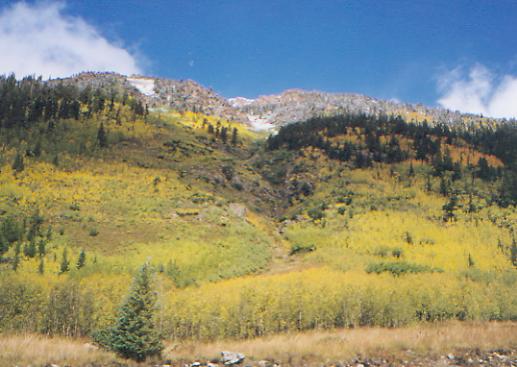
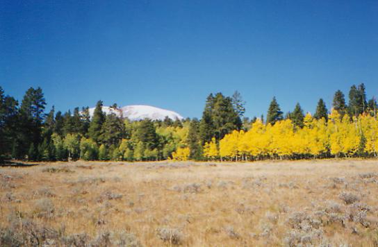
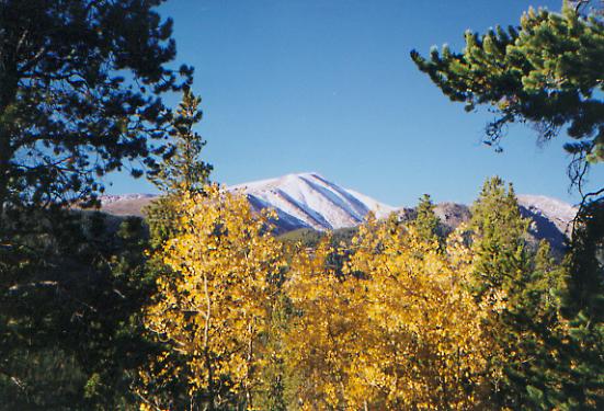
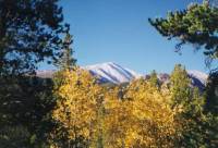
It is very beautiful here, especially surrounded by snowy peaks and golden aspen leaves. We were happy to watch the snow melt as the day went on. Getting caught in the snow, essentially unprepared, was an eye opener. In some ways, we did well. In others, we took risks that were not so good. Our winter gear was mailed to us in Silverthorn (warmer sleeping bag, balaclavas, etc.), so we should be better prepared for the next storm.
Jim: Were a day late and a dollar short again. We got our winter gear in Silverthorn one day too late.
Wednesday, September 22 - 13.2 miles to North Tenmile Creek
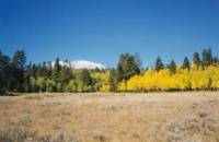
It was a beautiful day for a hike. Warm and sunny, fall at its best, with snowy peaks above and golden aspen below. Glen, one of Johns roommates, dropped us off in Silverthorn on his way to work. We drank coffee and coke and ate a bad cinnamon roll while we waited for the outdoor store to open. I knew I needed leather boots for the snow travel, so selection was pretty easy. There werent many all-leather boots to choose from, and of those, even fewer were available in my size. I bought a pair of Scarpas, an Italian boot, and hope they work out. Desperation can make for some bad shopping choices, but I think these will do. (I still remember the AT hiker who bought boots 3 sizes too big because that was all the store carried. They were boats!) My boots will take a couple of weeks to break in and they arent as cushy as my old fabric boots, but theyll be warmer and drier in the snow. I was certainly glad to have them when we began to run into snow, and worse, slushy snowmelt, this morning.
Anyhow, we finally got on the trail at 10:00, climbing into the Eagles Nest Wilderness south of Silverthorn. We ate lunch beside a waterfall, along with a group of 15 seniors, mostly in their seventies, including one totally blind woman who was hiking with the group. We climbed up to snowy Eccles Pass, meeting still more day hikers. It was beautiful. I was surprised that even after two warm sunny days, there was still 12" of snow on the pass. The south side was almost snow-free though. We then descended 2000' to Tenmile Creek and will begin the 2000' climb back up to Uneva Pass in the morning.
I was glad to get back on the trail today. Towns are exhausting. Breckenridge is pretty, surrounded as it is by dramatic mountains, but very self-consciously quaint. There were lots of nice tourist shops and restaurants. Silverthorn is more blue-collar, but still aims at the tourist trade with factory outlets everywhere. We were treated very well by John and his roommates, who drove us miles out of their way, and had to put up with two stinky hikers taking over their living room. The business people we met were also very friendly and helpful. It was a good stop, but Im happy to be surrounded by trees and sunshine again.

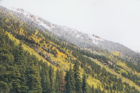
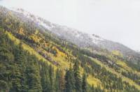
Jim: Early winter?? Maybe - even the ski areas arent ready yet theyre still hiring. Most of the aspen still have leaves. The contrast of the snow, the mountains and the yellow of the aspen is really beautiful. We seem to have taken a lot of pictures to try to capture that.
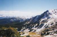
Thursday, September 23 20.6 miles to campsite just beyond Kokomo Pass
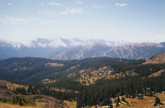
We barely made it to camp before dark. Dinner will be eaten by moonlight again. We didnt want to camp above treeline and there was a five-mile stretch between 11,900 - 12,300. Dark clouds surrounded us and it seemed safer to go lower, and warmer too. It was a good day all in all. We climbed three passes: Uneva, with 12" of virgin snow, Searle, almost snow-free, and Kokomo, half and half. We did a lot of slipping and sliding in mud where the snow was recently melted. We ate lunch in the ugly resort of Copper Mountain (Condo Mountain more like!) We took our time, eating pizza, then sitting in the sun eating ice cream. Our route joined the Colorado Trail there. Its well marked with easy grades and clear trail. The mountains all around are beautiful, just lightly dusted with snow. We had a lovely sunset with the storm clouds behind us.
Jim: We might have made it a shorter day, but the clouds were gathering again and we wanted to get over the pass and drop as much elevation as possible. We managed to get a couple miles and about 1000 off the ridge. And we actually found water and a relatively flat spot to camp.
Friday, September 24 17 miles to Longs Gulch
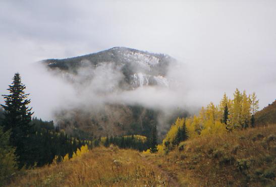
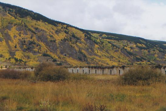
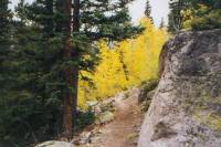
We woke in the night to the sound of rain and sleet on the tent. By 7:00 a.m., there was an inch and a half of fresh snow covering us. It was quite beautiful, but made us very glad we had pushed for the extra miles last night. Losing 1000' probably made the difference between having two inches of snow or having six inches. As we descended this morning, the trail was pretty much clear by the time we reached 10,000'. It was really pretty when we reached the valley. The peak to our left was covered with snow, light clouds and golden aspen. The whole valley was lined with aspen groves. We passed Camp Hale, a WW II training base for the 10th Mountain Division. There were bunkers and concrete posts and platforms, but not a lot else remained except the firing range. Then the trail climbed in the woods. We missed a turn and ended up following roads for about a mile before we reconnected with the trail. The map was wrong and we were paying more attention to it than to the written description. The error actually saved time, but it is always a bit annoying to misplace the trail. The Colorado Trail is generally very well marked. There have been no CDT markers though in the past 20 miles. Typical.
We saw our first Colorado deer last night. For a place with as many hunters as weve seen, game is very scarce. The hunters must get very frustrated. We saw deer tracks in the snow yesterday, way up high, but Ive been really disappointed in the lack of wildlife in Colorado. One odd thing: despite the snow, we still occasionally find wildflowers in bloom: gentians, purple daisies, lupine, cinquefoil, etc. Most of the ground cover is turning brown now after two good snows and a lot of cold nights. The clouds come and go. We could get another storm today, though I hope not. I was feeling really good this morning, looking at the snow covering everything, but knowing it would likely be gone by noon. My new boots are a bit painful, but I expected break-in to last a couple of weeks. With all the wet snow, Im glad I got them, despite the heel blisters.

LATER: We stopped early, thanks to a heavy hail and rain shower that started us on a desperate search for a protected campsite. Our planned one was in an open grassy spot, not as good as the sheltered spot under the spruce that we finally found. Our campsite is tiny, but well hidden in the trees. I barely had time to start dinner before the rains came back. Looking up the valley, we could see the trail disappear into solid cloud cover.
The afternoon was mostly uneventful as we went up and down past Tennessee Pass and through the woods to this creek in the Holy Cross Wilderness. We stopped seeing Colorado Trail markers after one stream crossing, which made me very nervous, but the trail description matched reality, so we kept going, following blue ski trail markers.
The best part of the afternoon was glimpsing three elk. They vanished quickly, but we saw what they were. We also saw tracks that looked like a mountain lion or wolf. (Big, with no claws showing.)
Jim: We seem to have a talent for finding tiny well hidden campsites or maybe the talent is for needing them. In any case, we did need this one the afternoon turned into one of those soaking rains and the temperature was in the hypothermia range. Its a good day to stop early.
Saturday, September 25 17 miles
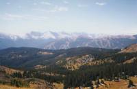
We spent the night listening to the pitter-patter of rain and pine needles on the tent. Neither of us slept much, since we were worried about getting snowbound again. We woke to blue skies and high winds, cold but dry. I somehow managed to wrench my back reaching for the water bag--agony time! I can walk, though it hurts to breathe. I just cant bend over without screaming. The morning walk was up and down past several small lakes with beautiful views of snow-covered Mt. Massive and Mt. Elbert. Im really slow because of my back, but Im determined to push on. It is worrisome to think about how far we still have to go in Colorado, and how much of it is above 10,000'. I want to do it all, but winter is definitely arriving.
LATER: It wasnt a very exciting afternoon, but the trail was mostly very good, with lots of side-hill contouring around Mt. Massive. There are side trails to the top of both Massive and Elbert that I would like to climb someday, but not in the snow with full packs and a bad back. We had occasional views of the mountains and the town of Leadville down in the valley, but mostly it was just up and down through the woods. We saw two groups of dayhikers and a couple who were out fishing, but no other backpackers.
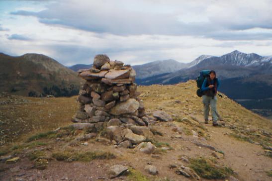
I was amused to notice that this section of the Mt. Massive Wilderness is marked in almost every way a trail can be marked, from signs saying, Colorado Trail, to single slash axe blazes, to the i shaped axe blaze, to an orange metal version of the same, to blue snowmobile/ski trail diamonds, to red metal tabs, to plastic CT blazes with their distinctive logo, to wooden posts with the CT and CDT symbols carved on them. Only ducks, cairns and plain CDT markers were missing.
Jim: For a while this morning, I thought the trip might be finished. Ginny evidently pulled a muscle in her back and thats really painful. She seems to be a little better once she gets the pack on the pack helps to keep her back rigid. Well see how she feels when we get to Twin Lakes.
Sunday, September 26 - 9 miles to Twin Lakes
An odd day, all in all. It started out well, warm and windy. The leaves shone brilliant gold overhead and underfoot. We lost the trail a couple of times, but ended up descending right into town on a side trail. (A happy error, since the CDT ends a few miles outside town. Sometimes there will be a sign that says Trail -- that doesnt mean its the right trail, just that its a trail.) We got a room at the colorful Nordic Inn, picked up our maildrop at the tiny general store next door, ate an overpriced hamburger, and asked about laundry. The owner yelled at us, I dont have time for your petty problems! My dog is sick and Im sick of all of you bothering me. Take my truck to the laundromat down by the highway. Evidently, his dog is having seizures and everyone is all upset. They closed down the restaurant an hour early, were rude to all their guests (not just us) and scared off some. If we hadnt already paid for the room, I wouldnt have stayed. He really scared me. But then, after yelling at us, he gave us the keys to his truck. What do you do with that, besides say thank you and get out of the way? The cafe next door was closed because the owner was participating in a race over Mt. Elbert. That probably didnt help, since the Inn got all the business at noon. We met a couple of runners as we hiked in. The Nordic Inn is a former brothel (pre-WW I) turned German restaurant and inn. It is full of books. Ordinarily it would be my kind of place, but the upset staff got me upset. The owner, John, apologized later, saying he is totally burned out since he has had no time off since last January and is really worried about his dog, but I still wasnt comfortable. Im really not used to dealing with that kind of anger, even if its not really aimed at me.

Twin Lakes is a beautiful area, with beautiful blue lakes, dark green spruce and golden aspen covering the hills, surrounded by tall mountains still powdered with snow. It is good to be clean again, but I think we would have done better to keep going.
Jim: Food, a shower, resupply, a clean bed even laundry. What more could I ask for? Ice cream?
Home | Links| Trail Journals |
The Thruhiking Papers | Bun-bunMontana | Wyoming | Colorado | New Mexico
Created: Fri, 16 Jan 2004
Revised: 30 Sept 2016Copyright © 1999-2017 Spirit Eagle