|
 |
 |
 |
 |
|
|
|
|
|
|
Tuesday, August 31 - 15 miles to Teton Reservoir
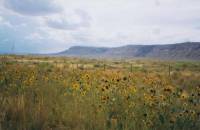
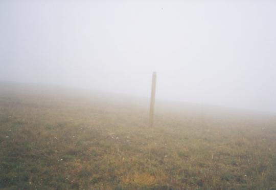
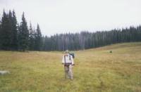
We finally managed to leave town about 11:00 am, after more phone calls, breakfast, and a stop at the Post Office. With eight days of food in our packs, our load is horrendously heavy. Fortunately, were not going far today, just to a reservoir 14 miles out of town. It is very cloudy, with big black thunderheads, and windy. We had thunderstorms every day we were in Rawlins, but the wind is new. The trail leaving Rawlins follows a paved road, but it is nowhere near as busy as the highway into town. It is hilly country, with reservoirs every couple of miles, so for the first couple of days water shouldnt be a problem. With the clouds and wind, it feels nice and cool 70ish, I think, though the chocolate and cheese both melted a bit. Between the clouds, sage, rocks and dust, the world looks very grey and dull. Only the yellow rabbitbrush flowers liven up the landscape.
I was ready to leave Rawlins. It was a restful stay, despite all the frustrations of closed restaurants, computer unavailability, and the distances from our motel to any place else, but by this morning, Id had enough of town food, late nights, noisy streets, and errands. Walking all day seems quite restful in comparison.
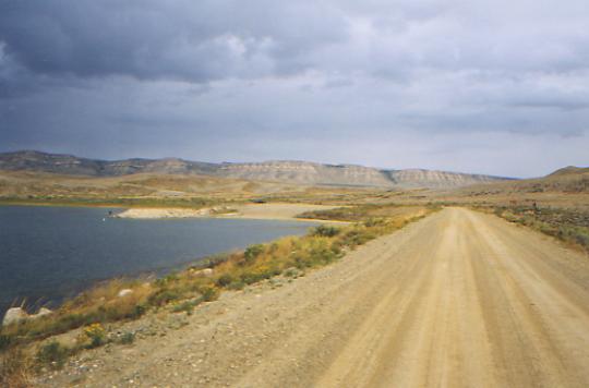
LATER: We made it to the Teton Reservoir without getting rained on, though it was close. Black clouds surrounded us while we walked in sunshine. The reservoir is a fenced BLM recreation site with a couple of picnic tables and an outhouse. There are a couple of people fishing in the lake. The country around it is interesting with tall buttes lining the road. It looked more like New Mexico than Wyoming. We walked quickly up the road, but took a long lunch, napping in the sunshine in a ditch near a well. It was very peaceful, and nice to know it would be a short day. Jim saw an antelope, but I only saw a grey snake and a horny toad, a hawk and a couple of gulls by the reservoir.
Jim: Itll be good to get out of Wyoming. Not that I dont like Wyoming its beautiful, challenging and, except for the road walk into Rawlins, Im glad we did it. But Im ready to cross a state line. That didnt hit me when we crossed out of Montana/Idaho into Wyoming, but its caught up to me now and Im ready to go to Colorado.
Wednesday, September 1 - 21 miles to the North Fork of Mill Creek
We woke to rain on our faces in the middle of the night. We closed the rain flap and went back to sleep. Woke in the morning -- still raining. So, we rolled over and slept some more. Finally, we got up at 7:30. Despite the pitter patter on the roof, the ground wasnt even wet, but the sky was black with rain clouds. Sure enough, soon afterwards, it started to drip on us, and kept it up all morning. It was never heavy rain, just constant. It took until about 11:00 a.m. before the ground was noticeably wet though.

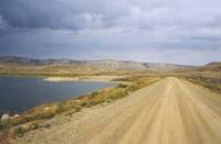
We ended up following the road straight south instead of the much longer official route over Bridger Pass. The CDT is better watered and probably more scenic, but its about 17 miles longer. Were both ready to end this desert walk and get back to trees and mountains. This stretch is long enough. Ray told me on the phone that if it rained we would do better to follow the gravel road, since the Bridger Pass road can get really muddy. That influenced our choice this morning. Weve been lucky with rain -- mostly it has passed us by -- but today it is coming down in earnest. Oh well, were overdue.
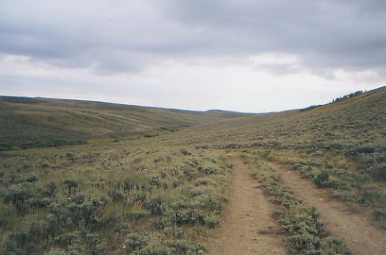
At lunch, Jim rigged the rain fly as a tarp to keep out wind and rain so we could eat in the dry. Four deer wandered past while we were eating. I would have thought the flapping nylon would have scared them, but they completely ignored us. Thats the only wildlife weve seen so far today. The walk was pretty monotonous: rolling brown hills with occasional ravines, mostly dry. The big interest is looking for water, or where water could be, and watching the trucks go by. It seems that about 99% of the traffic on the road is pickups.
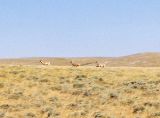
LATER: We sat a while under our tarp, reading while we waited for the rain to ease up. Just as we were in danger of being flooded, the rain stopped. We spent much of the afternoon climbing up to the Divide via Middlewood Hill. We started seeing cows and antelope again. At the Divide, we left the gravel road and went up and down through the hills on jeep track, finally rejoining the CDT a couple of miles later. In the draws up there we saw a LOT of antelope; one draw had at least 25. Total count for the afternoon was over 60. It rained off and on all afternoon, and started again as soon as we arrived at Mill Creek. Dinner will be late tonight. The mountains to the south were totally socked in. Mill Creek is a good water source, but the area is grazed. We chased away several cows when we found a place to put our tent, and we have to be careful where we step. Im glad we have a new water filter. There is a small badger across the creek, searching for food. Ive never seen one in the wild before, though we see their holes often.
Jim: We talked to Ray Hanson on the phone while we were in Rawlins. He told us that if it was raining, the official trail would be a mud pit and that wed probably want to stick to the gravel road that goes straight south. It was (raining) so we did (go straight south on the road). We set up the tent rain fly so we could be dry during lunch havent done that before, but it worked well so we may try it again.
September 2 - 16 miles

Kind of a mixed day. Sunshine and showers, cool breezes, dark clouds and blue skies alternated every ten minutes. Montana weather, in Wyoming. The hills were pretty, more lush than weve been used to seeing. The grass is taller, as is the sage. Weve also started walking in forest, mixed aspen and spruce. Its nice to see trees again. We followed the BLM route through Smiley Meadow (love the name) to the National Forest boundary. Then we were left high and dry. The BLM route ends on the west side of the Divide, while the old Medicine Bow Forest route ends on the eastern side. They havent yet built trail to connect the two. So we looked at the maps and followed jeep tracks toward the Divide. The problem is that the jeep tracks go right through private property--past a hunting camp, a nice house by a pond, and a ranch, posted against trespassers. Yet that was the obvious route, seemingly the one recommended by Ray and Jim. The only alternative would be a bushwhack. (NB: We were told later that there are roads through the NF that dont show on the map that would have led to the trail without needing to trespass. Once again, the maps lied - big surprise!) So we ended up feeling lost, even though we were always exactly where we thought we were. Not knowing about the water sources ahead doesnt help.
LATER: The afternoon was much like the morning. We took one major wrong turn and ended up dead-ended at a very nice campsite. There are a lot of roads that arent on the maps. (They number them: 237 A, 237B, 237Q, etc.) We sat under a tree at the campsite, waiting out a storm. That cost us about an hour, between the rain, looking for the trail, and finally backtracking to the turn we missed. About 3:00 p.m., we finally met up with the National Forest route. What joy to see the CDT sign! The terrain changed too: big grassy hills and green tree-covered mountains. We followed jeep track in the open for a while, then foot trail through the woods. It felt so odd to be in the deep damp woods again. There are lots of mushrooms. We met a bow hunter who told us there was water a short way ahead, so we decided to stop and cook dinner at the stream, then move on for another hour or two to a campsite. One of the maps shows no water along the Divide; the other showed this spring and a couple of other possible sources. We wont know until we get there. Cooking now is easier than carrying water for miles, plus it gives us a needed break. Besides, the sun is shining. It will be nice to sit still for a few minutes to enjoy it.
Friday, September 3 -- 18 miles
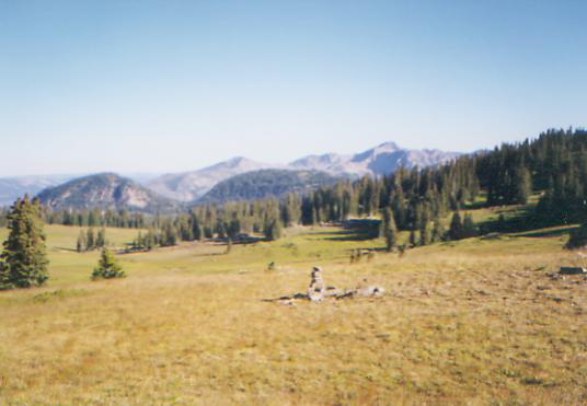
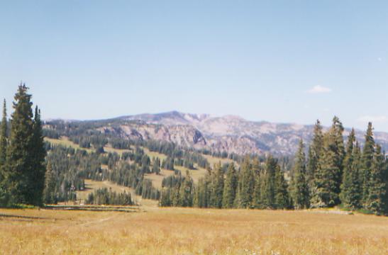
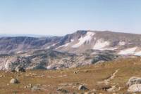
It rained off and on all night, but was clear when we got up. The clouds moved in once we started walking, and it felt more like the AT with its fogs than the dry west. We skipped the side trip up Bridger Peak as a result of the fog, though we did get occasional nice views off the Divide below the clouds. It was a very nice walk, though the climbing got to me a time or two. At 11,000', I feel the altitude.
We are now in the Red Mountain Wilderness, and it is red. Its the start of a holiday weekend, I can tell. We ran into a bunch of horse vans and horse people setting up camp near the trailhead. Its raining, but Jim and I are eating lunch tucked in under a grove of trees and so are fairly dry. It is cold though. We walked in hats, gloves and rain jackets for the first two hours this morning, until the sun came out. We saw one deer. Last night we heard what might have been a screech owl, plus the usual coyotes.
The country is mixed conifer forest and meadows. There are still a few wildflowers: purple asters or daisies, yellow sunflower types, occasional paintbrush and lupine. We saw dozens of mushrooms in the forest, huge but ugly. They look like fungus. (I know, they are!) Evidently Colorado had a VERY wet summer this year.
LATER: A thunderstorm chased us into the tent while we were eating dinner. Actually, we were chased by thunderstorms all day. Twice we waited under trees while hail fell. The third hailstorm turned to snow! It only lasted for about 10 minutes though.
We passed through some pretty country, following the Divide. There were lots of wet meadows, which were later replaced by pink rocks and boulders. There were occasional views east and west. They moved the trail so the maps arent accurate. Jim and I were concerned about water, so we bushwhacked ½ mile to a stream below the Divide, only to discover they had brought the trail down to it after all. We havent had many thunderstorms until this week. We seem to be making up for lost time with several a day. It does slow us down a bit.
Jim: The trail today was the best marked trail weve seen out here a post every 20 or 30 yards through the Wilderness. We ended up putting the tent down right in the middle of the trail and barely got set up before the deluge hit. It was a wet night.
Saturday, September 4 18 miles
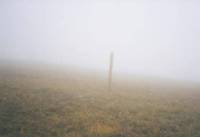
It rained and hailed hard last night for a couple of hours, starting when we were eating dinner. We woke to snail -- snow/hail/sleet -- and dense fog. The snail stopped as I began to cook breakfast, but the fog lasted until about 11:00 a.m. It was cold and windy and wet. Altogether, a nasty morning. We followed the Divide through forest and meadow, but saw little as we bushwhacked from cairn to cairn. The trail doesnt get much use around here, I guess. We did get a good view of the Hog Park Reservoir below us. We met two pairs of bow hunters, one in a truck, the other at their campsite. The campers had shot a deer that had the misfortune of wandering past their trailer while they were cooking dinner last night. We also ran into one backpacker late this afternoon at the meadow where we intended to camp. He is starting an eight day section hike of the Colorado CDT. We talked to him for a few minutes, then moved on.
The sun came out in time for lunch and it warmed up a little. It was 43° when we met the men in the truck at 11:00. We picked up the Fireline Trail, an old stock driveway, still in use, which we followed across the border. We passed a herd of sheep, but only heard (and smelled) them as they had already moved off trail when we passed.
Finally, we entered Colorado, though we didnt know it at the time. There was no sign until we were about a mile beyond the border, where we ran into a sign heading the other direction that said, Wyoming and someone had penciled in 2 mi. Reaching Colorado at last feels really good. Were truly half way now. Sometimes it felt like wed never reach here. Colorado is kind of like the White Mountains on the AT or the Sierras on the PCT anticipated with both fear and excitement. Fall is here, and our cold fingers remind us that we arent really ready for extreme cold. I look forward to the beauty of the high country, but I am also aware that we will be doing a lot of climbing at high elevation on exposed ridges in uncertain weather. And I hate being cold!
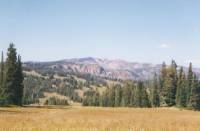
The afternoon was a roller coaster walk along the Divide. There were occasional views of green tree-covered mountains and some clear-cuts. We are on the edge of the Mt. Zirkel Wilderness, following jeep tracks on a stock driveway though the Routt National Forest.
Jim: We finally crossed the Wyoming/Colorado border. After we left Rawlins, I became unbearable about getting across the border. I didnt care about anything else - anything that got between me and the border was gonna get run over. I have no explanation no excuse thats just the way it was for me. And then we crossed the border and didnt even know it. We were two miles into Colorado before we saw the sign that told us it was two miles to the Wyoming border. Now I can relax again.
Or maybe not. Were camped just off the trail and the trail is probably 20 yards wide at this point its a motorbike trail through here and theyve torn it up even worse than the horses did in the Teton Wilderness. It would be hard to describe the devastation even pictures wouldnt do it justice. I thought for a while that a group of motorbikes were gonna catch up to us, but they must have taken the side trail that we passed a couple miles back.
Sunday, September 5 -- 19 mi. to campsite beyond Three Island Lake
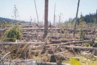
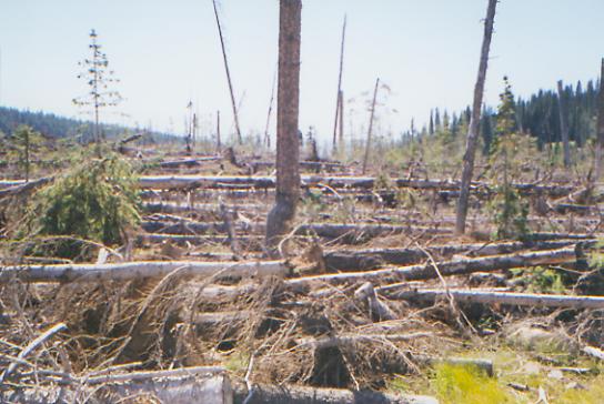
We woke up to sunshine and frost. It was 43° inside the tent, just above freezing outside. By noon we were wearing t-shirts. The morning hike was an easy walk along the ridge, then a steep descent to Trail Creek and our first meeting with the Routt Blowdown. Two years ago a big windstorm took out thousands of acres of trees. Total, but scattered, devastation. We could see the hill across the valley looking like a clear-cut was in progress and walked through some of the destruction. We had heard that the CDT was affected, so were following a jeep road that parallels the trail instead. We could hear chainsaws, and were told later that they were logging the trail with its massive blowdowns. Weve seen a lot of traffic on the jeep road: ATVs, trucks, motorbikes, bicycles. No hikers though. Our lunch spot wasnt in a damaged area, so we had a river on one side and aspen-covered hillside on the other. Very pretty.
LATER: We ended up changing our route again. Following the CDT to North Lake would have meant a 21 or 22 mile day with a five mile, 2000' climb just at the end of it. Instead, we are following a trail past Three Island Lake, which will make tomorrows hike longer, but today a bit more bearable. It meant less roadwalking, in any case, and I had had it with roadwalking by the time we reached the trailhead. There were a lot of trucks on that gravel road so we ate a lot of dust. It felt strange to be walking on real foot trail after so long following jeep tracks and roads or just open trailless country. A two-foot-wide path felt a bit odd, but nice. It was a pretty walk up to the lake along a cascading stream.
Were camped at about 10,000' and its cold. There is no camping allowed near Three Island Lake, so we went past it to an open spot above a stream. The view across the valley is pretty. This trail will connect with the CDT in three or four miles, up in the high country. It was a good choice. A lot of dayhikers evidently think so too. We passed 20 or 30 heading out on our way up, including two rangers. One had llamas and tools for trail maintenance. He said he had just put up the signs along the CDT this summer.
Jim: Once again weve stopped to make camp just before dark at the last water source for many miles. We seem to have a talent for this. Thats cool its better than some of the alternatives. At least this place is really pretty were on a bench overlooking the stream and a large meadow. The sun went down behind the hill almost as soon as we got here, but it lingered on the far side of the meadow for a while.
Monday, September 6 - 19 miles to Steamboat Springs
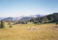
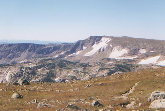
We woke to heavy frost and a frozen water filter. Still we got a decent start (8:00 a.m.), though we started the climb wearing jackets, hats and gloves. The morning hike was really beautiful, but very windy. On the climb over Lost Ranger Peak, 40+ m.p.h. gusts knocked us off our feet. For the rest, we just walked like drunken sailors. This high alpine country is spectacular. We passed treeline at about 11,000' and had views of wide grassy meadows, snow-spotted peaks, bright blue lakes, dark green firs and krummholz, and pink and grey rock. Weve done a lot of climbing. If it werent for the wind stealing our breath and making our eyes water, this would be perfect hiking.
Were taking lunch in a small valley, sheltered behind a tree. Were hoping to make Buffalo Pass in time to get a ride down to town today, but it will make another long day. The southern Mt. Zirkel Wilderness is really beautiful. I wish we had more time to enjoy it. We finally met some other backpackers, part of the Labor Day weekend crowds. They were surprised at how quickly we climbed the ridge, but then, they dont know how long weve been doing this. We saw some flowers: blue gentian, white and purple daisies, yellow paintbrush and cinquefoil, and various yellow sunflower types. At the same time, the leaves are frostbitten and turning red.
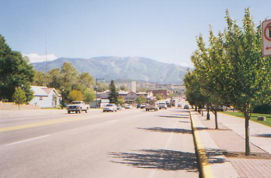
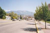
LATER: We did make it to Steamboat Springs. Its quite different from most of the trail towns weve seen - rather like Manchester Center in Vermont in some ways, very neat and clean and touristy, with shops, art galleries and restaurants. The manager of the first motel we stopped at said, $85.00," so we said, Goodbye and found a better price down the road. The afternoon was nice easy hiking with good views, easy climbs, and lots of meadows. We met several groups on their way up, including a group of llama packers. (5 llamas for 4 people. Each llama carries 70 lbs. Thats a lot of food!) We also kept leapfrogging a couple of rangers on horseback. They had to stop each incoming group and explain about Leave No Trace camping. We got the talk yesterday, briefly, and a little handout on LNT. We got a ride down the mountain with the first car (jeep actually) that passed. Today was a beautiful day all around, the kind that reminds us why were out here.
Jim: The rangers seemed to be impressed by the fact that we kept catching up to their horses. Its one of those ego things that makes you feel good even when you know theres no substance to it. Strange thing we caught up to one kid who was in a hurry he was carrying a dead fish that someone had caught and left by one of the lakes. He said he wanted to dump it in town so it wouldnt litter the backcountry and/or draw the bears. I think Ill shut up and enjoy the view.
Tuesday, September 7 - Rest Day in Steamboat Springs
Free bus service took us to Safeway, then we walked to the library to check our e-mail (finally) and eventually we did our laundry. That, plus eating, took all day. I dont know where the time goes. We look forward to town, but the truth is, town visits are never restful, and not all that much fun. We dont sleep. We eat too much. We end up walking from one end to the other and back again, and we spend too much money. The best part is the hot shower and clean clothes. The rest is just doing chores.
Weve done some talking about how to keep your enthusiasm for a long hike. We know people who quit hiking the AT because they got bored with the long green tunnel. One guy on the Internet said he could never do a long distance hike because there are too many boring parts; he only wanted to hike the highlights. One friend worries about getting burned out on another long hike with the relentless push for miles. Another got so burned out after several AT and PCT hikes, he joined the Army, hoping for a real challenge. (He said he didnt find it!)
It made me think about why I can keep doing long hikes without losing my enthusiasm. I think it has a lot to do with why I go out in the first place. I love being outdoors, surrounded by beauty. I love walking and stretching my body. I love camping out, watching sunsets and stars and chipmunks and cows with Phantom of the Opera faces. I love rounding every bend with the hope of seeing a deer, a bear or a hawk. Admittedly, I dont like road walks, hiking until dark, or going out to start the stove on a wet or frosty morning, but I do like sipping coffee and watching the sun rise, or the high I feel on a crisp, cool, sunny morning when we top a rise and get a whole new view, or snuggling inside a warm sleeping bag with Jim, ignoring the cold outside.
The physical challenge is only a small part of why I go; the emotional challenge is a bigger part. There is a saying, Nothing can go into the presence of God and emerge unchanged. Thruhiking is a long walk in the presence of God. Change is part of the journey. For some hikers, the physical challenge is all, and once that is surmounted, the motivation is gone. One thing Jim and I agreed on a long time ago was that if the hike became merely a physical grind, we would change the rules. Were out here until were done or until winter stops us. Yes, we want to finish the trail, but more than that, we want to enjoy our six months in the mountains, living fully and freely. Keeping in mind why we are here is part of that. Exploring new worlds, seeing incomparable views, experiencing moments of peaceful beauty, thats why were here. The serenity, the joy, the feeling of wholeness that comes from time to time, thats why we hike. Pushing too hard makes it easy to lose sight of our real purpose. Jim and I are trying to keep that from happening.
I know that short-cuts, for me, have been a mistake. The wrong priorities are being followed. Instead of enjoying whatever the trail brings, the fear of getting caught by winter or worry about delays caused by outside factors have caused us to choose some shorter quicker road-walks (Anaconda and Macks Inn) instead of doing the longer roundabout routes on the trail. Normal practice for CDT hikers, but for me, a mistake. Yet I know well do it again, either because of time or weather.
Fiddlehead told me before we started, You have to be able to compromise on the CDT. In order to finish in one year, hard choices have to be made. Either you push yourself to do consistent high mileage days (the physical grind) or you find alternate routes that will shorten the journey, or you do the longer, more interesting routes with the understanding that winter can, and probably will, cut short the journey. Weve ended up combining the three.
Jim: Were in Steamboat Springs, Colorado. Over the last couple weeks weve gone from the stark harshness and extreme beauty of the Wind River Range and the Popo Agie Wilderness to the 90 degree heat of the relatively waterless Great Basin (Red Desert) of Wyoming and then to the thunderstorms and nine days of rain in southern Wyoming (the Huston Park, Red Mountain and Mt Zirkel Wilderness areas). We went from summer to dehydration to hypothermia weather kinda like the PCT? Now were in high alpine country again and we woke to a heavily frosted tent and a frozen water filter this morning. Hopefully itll warm up again for at least a couple weeks. A few stray thoughts from the last couple weeks:
- Water is always a concern. When miles of the trail are on the Divide, water sources are few to non-existent. So were always looking and planning ahead for water sources. Thats not just a desert problem.
- Desert water sources a few of them were piped springs really good. A couple of them were reservoirs in fenced BLM Recreation Areas but one of those was infested by amphibian livestock that required either a filter or boiling (in which case it became some extra protein in the meal). Some of the other water sources (few) were streams that hadnt been totally fouled by cows, antelope, wild horses, etc. And some were open stock ponds which means that if you find the nastiest, muddiest pothole on your local dirt road, add a quart of motor oil, 15 pounds of cow manure, 10 ponds of fresh duck shit and stir vigorously youll begin to get a vague notion of how appetizing stock ponds are. One of the best sources was a brand-new solar well 38 miles north of Rawlins, Wyoming good work on the part of the BLM (or the rancher who grazed that area.) And I didnt even mention the dead cow in Bull Springs.
- Weather we were spoiled by long stretches of clear skies and high temperatures. Nine days of thunderstorms became really depressing. Waiting out a couple thunderstorms each day also has a depressing effect on mileage between that and our re-entry to the mountains (and big climbs) we only did 17 miles a couple days.
- Food -- is a different problem we cant get enough. We left Rawlins, Wyoming with 8+ days of food and we got to Steamboat Springs, Colorado with 2 dinners, 1 breakfast, no lunch and 1 Pop Tart. After 6 ½ days. Ginny isnt as bad as I am, but we both amazed people at the restaurant tonight. Ive lost 35 40 pounds and have the appetite of a starving rat. We cant carry enough food to keep from starving.
Home | Links| Trail Journals |
The Thruhiking Papers | Bun-bunMontana | Wyoming | Colorado | New Mexico
Created: Fri, 16 Jan 2004
Revised: 30 Sept 2016Copyright © 1999-2017 Spirit Eagle