|
 |
 |
 |
 |
|
|
|
|
|
|
Thursday, August 12 - 12 miles to Beauty Park
We ate a big breakfast, went to the Post Office to mail a few things, waited an hour for a ride out of town, which we got with the owner of a new Italian restaurant in Jackson, reached Togwottee Lodge at 11:00 am, decided to have lunch, and finally hit the trail at 12:30. So much for an early start.
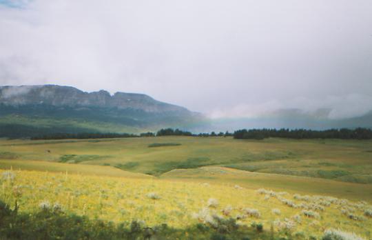
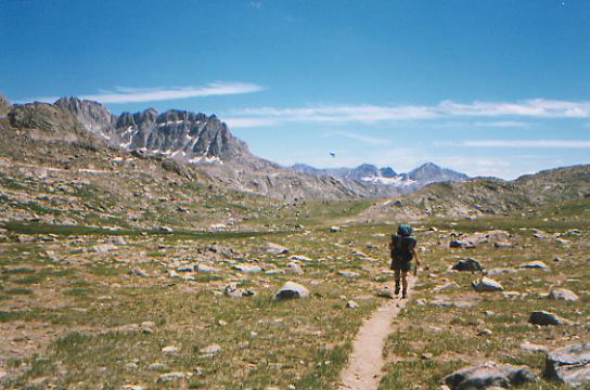
We were doing a route we had figured out from the maps, not the official or recommended routes through here. There was a lot of uncertainty as to whether the trail shown on the map actually existed. Jim Wolfs route has some cross-country, so we figured we had little to lose if we got lost on our route as we could always head cross-country to join his. I dont think the new official route from Brooks Lake to Pelham Lake has been built yet, though we could have followed dirt roads back to the Divide. It turned out we were able to follow trails most of the way. The problem was too many trails. Cow trails and pack trails are hard to tell apart, and this area has a lot of cows. We just kept taking whichever trail headed south. It worked, and occasionally we were even on the trail shown on the map, I think. It all took longer than expected. It was 7:00 PM before we stopped to set up camp, just before sunset. It was a treat to see 12 elk out on the meadow while we ate. We had seen where they had bedded down in the tall grass, so we knew there were some around, but it was fun to see them. The afternoon was mostly pretty walking through grassy meadows. The cliffs and peaks were really beautiful when the clouds finally lifted enough to see them. It rained for a couple of hours and has cooled off a lot. Someone in town said, Summers over. I hope not!

Jim: Hitchhiking is funny - its usually the working class people wholl pick you up (farmers, welders, truck drivers). Usually those with money (the new cars or big motor homes) wont even look at you - but sometimes they fool you - they stop anyway. This one surprised me hes building a brand new high-dollar restaurant in Jackson Hole. And then we surprised him by wanting to go back to where wed stopped hiking - even though it would mean walking 4 miles back along that same highway. He didnt understand that. But for us it would have left a four-mile gap in our hike. We dont need any more gaps like that. He told us that the owner of the Cowboy Cafe had thruhiked the AT a couple years ago with his son. Wish wed known that while we were still in town. It was a wet drizzly day when we started but eventually it cleared.
Friday, August 13 - 18 ½ miles
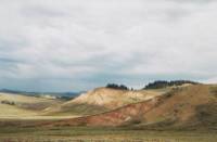
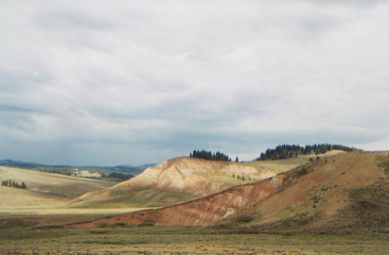
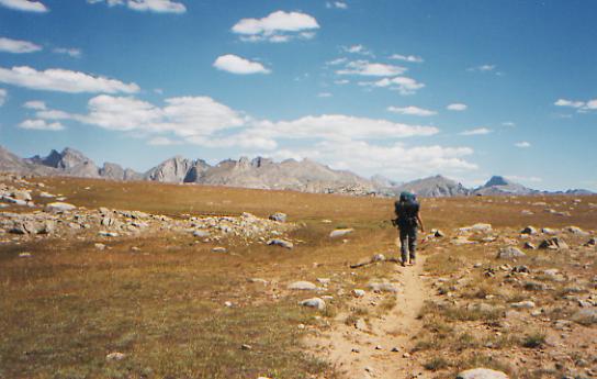
It poured in the night, just after we went to bed, but we awoke to sunshine. The trail was obscure for a while, then we picked up an old logging road and then a good jeep road which we followed down the valley of Fish Creek to Squaw Creek. We continued on roundabout jeep track since we couldnt find the trail up the creek and didnt want to bushwhack for six miles. We saw five more elk and a couple of hawks. Clouds have come and gone, black and threatening, but so far, no rain has fallen. We passed some pretty red and white bluffs, like the Badlands near Dubois. It is pretty walking through sage and grass.
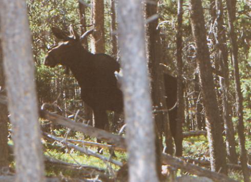
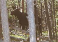
LATER: The jeep track ended and we ended up bushwhacking a long way back to the trail. For a while we were really lost, then we finally reached the Divide again. I got really upset because we kept running into crosswise ridges covered with blowdowns. The easier game paths all went in the wrong direction. Then we followed an old jeep track along the Divide. We lost it several times in dry meadows, but always found it again. Now, at the end of the day, there is some uncertainty as to where we are. There was a good cross trail, with lots of horse tracks, that may have been the route we wanted to take, but it wasnt in the trail description, so we kept going. Fortunately, we eventually found a spring and an old horsepackers camp with benches and firewood and a lot of trash (old stove pieces, tables, a corral, a decrepit outhouse, etc.) Theres a pretty view across the meadow, so well go look for wildlife after dinner. We saw a moose pair earlier -- a bull and a cow-- plus two bull elks with nice antlers. It was a long day that would have been really long if we hadnt found the spring. I hate not knowing where we are when water is tight.
Jim: Typical of this trail (only more so) - were not sure where we are. But were headed south so it doesnt matter.
Saturday, August 14 - 17 miles to Fish Creek Park
The confusion continued for the first two hours this morning. We followed faint jeep tracks and snowmobile markers for two hours, then finally realized we had somehow gone off on the wrong ridge, one paralleling the Divide. It wasnt until we rejoined the CDT that we realized where we had been. It added some distance, but wasnt all that bad since there was water. It was just confusing since we couldnt place ourselves definitively in the trail description. We knew we were heading in the right direction; we just had the wrong snowmobile trail.
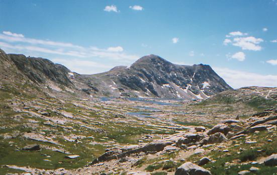
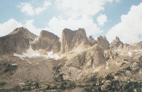
When we got ourselves back on track, the jeep trail improved and we rose to a vast plateau with views in all directions: the Tetons and Gros Ventre Range to the east, the Wind River Range to the south, and the steep cliffs of the Dunoir Buttes to the north. There is still snow on many of the peaks.
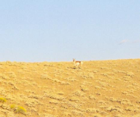
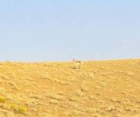
This was a really good morning for seeing wildlife. There was a moose in the meadow where we were camped, then we saw five elk (three females, two calves), then 14 antelope (a herd of 12 plus two solitary animals.) We also saw two men on ATVs who werent at all friendly.
It is cool and windy, but mostly sunny. We slept badly last night because of the wind. Must be a change in fronts or something. The clouds are a mix of cirrus and cumulus. Walking along the plateau was a real pleasure. I love the far ranging vistas.
LATER: We decided on an early night, stopping at 5:15. It makes a nice change after the last two nights. We had time to wash up in a good stream and air out our sleeping bags and dry the tent. We dont know how far we actually went, since they relocated the trail through here, shortening it quite a bit and taking it off the jeep roads. The afternoon was spent wandering from valley to valley, herd of cows to herd of cows. It was mostly open sagebrush, though there was a stretch through trees past popular Lake of the Woods and again past a pretty lily-covered pond. We saw a pair of whooping cranes or trumpeter swans flying past. (Noisy - they sounded like something between a loon and a turkey). We also passed a great blue heron, a kestrel and another antelope, trying to hide in the middle of a cow herd. It was a pretty day with mostly easy walking along old jeep tracks. Its nice not to be lost. It was nice also that the cooler weather has cut down on most of the flies and mosquitos. We have views over Fish Creek Park to the west and Ryan Park to the southeast, with Gunsight Peak a few miles ahead. Its a good campsite. We saw a couple of ATVss on the road nearby, but they didnt see us.
Jim: The early stop was good - its one of the few times its been warm enough (and that weve had enough water) to actually get somewhat clean at the end of the day. It was a good place to stop - the next water is a long way down the trail.
Sunday, August 15 - 20 miles to Trail Creek in the Jim Bridger Wilderness

Last night I marveled at all the stars. An hour later it began to sprinkle. It was gray and gloomy as we climbed on trail and jeep road to Gunsight Pass this morning, and very cold and windy at the pass, but after that we had more and more sunshine.
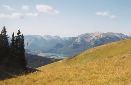
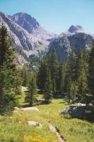
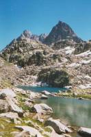
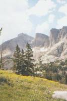
Lunch is at an incredible viewpoint above the Green River Valley. We can see massive mountains ahead -- Squaretop, Sheep Mountain, etc.-- as well as part of one of the Green Lakes. It is cloudy, so the lake is more blue-grey than green. Below are aspen and spruce groves, a wide green valley with cows, and a cabin. It is beautiful. Im happy and excited to finally be here in the Winds. Ive heard so many raves about this area. I can see why. There are big mountains, touched by snow, nice trails, and no regulation like Glacier or Yellowstone. Ive heard it can get pretty crowded in August though. Well see.

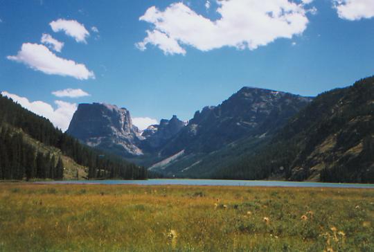
LATER: Well, they were right. We passed six groups out backpacking, plus dayhikers, fishermen, and one lady on a horse leading another pack horse. Still, it is incredibly beautiful. We walked above Upper and Lower Green Lakes, then up the Green River valley. The water varied from aqua to turquoise to a pale milky blue. Above were towering granite cliffs on one side and peaks on the other, Big Sheep and Squaretop among others. Farther upstream, the river becomes turbulent as the gorge narrows. The trail is narrow sidehill above the waters, sometimes in trees and sometimes in the open. Despite the crowds, we saw two young moose a couple of miles apart. One was walking up the trail ahead of us.
I was in one of my high-flying moods most of the day. Yesterday evening, as I looked out over the sage, I thought about how peaceful I become out here at times, totally serene. I can just lean back and relax as I look out at the beauty that surrounds us. Today was a different kind of happiness: bubbling with excitement and joy. Both moods inspire a feeling of real gratitude: that the beauty is here, that we are here, and that we have hearts open to wonder at the beauty. The sunshine this afternoon definitely helped.
We are camped near the river. We passed up two other campsites, knowing that the groups we passed needed them more than we did. Those kids looked tired! We can look up at sun-touched peaks and marvel at the beauty. However, we can barely hear each other talk above the roar of the river. Theres a small cascade just below - pretty but noisy. The valley is too narrow and rocky to climb far above the water.
Jim: Last night we camped in sagebrush - tonight were back in the mountains, camped beside a mountain stream (the Green River). Lots of weather changes during the day, but thats expected. Whats really memorable is the sheer variety - the different kinds of country, the transitions.
Monday, August 16 - 15 ½ miles to small lake below Lester Pass
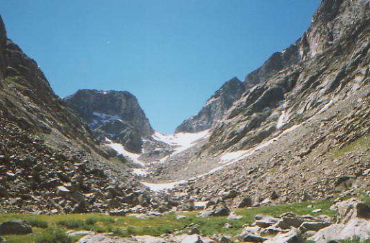
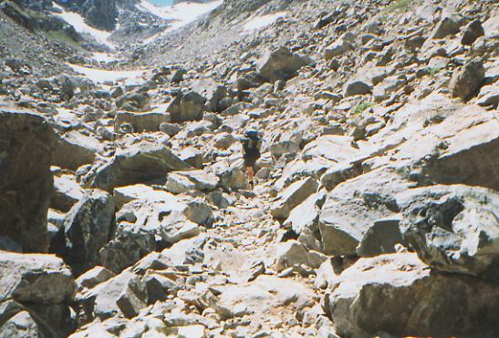
This morning was an exercise in feel the fear and do it anyway. We knew there was a steep climb up to Cube Rock Pass; what we didnt know was that it included half a mile of talus, with three snow chutes we had to cross. Where was my ice axe? It is beautiful with the steep snowy peaks and flowery meadows, but I was scared. Earlier I had refused to cross a wet pole bridge, preferring to wade the stream in my sandals. This time I couldnt refuse. After the first snow chute, I wasnt going back. Lunch was at lovely Dale Lake below Cube Rock Pass.
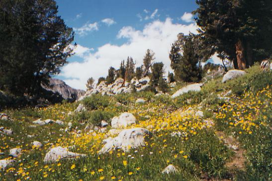
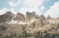
We had a couple more snow patches after lunch, but nothing difficult. The trail was rough in spots, rocky and eroded, but mostly we just did a lot of little ups and downs from basin to basin. There were dozens of lakes and ponds everywhere. Some were quite large, like sapphire blue Upper and Lower Jean Lakes; some were tiny clusters of alpine tarns. There were lots of flowers: purple daisies, yellow butterweed, buckwheat, some heather, paintbrush, and some pretty blue and hot pink alpine flowers I didnt know. Theres even a little columbine hiding in the rocks.
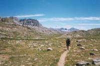
Anyhow, we decided to stop early today. The morning climb past Vista Pass, Cube Rock Pass and Shannon Pass wore us out and we never got any real energy back. We werent up for the climb over Lester Pass at the end of the day, so we stopped at a little pond a mile and a half before the pass. It may be partly a question of altitude. We were above 10,000' all day, with two passes at 11,100. We feel it a bit on the climbs. Well, it makes a good excuse for being slow and out of breath. Bottom line is that even after two and a half months, a climb is still a climb. We saw a fair number of people: five groups before we started for the pass, then none for the next four hours as we climbed over the passes (there is a less strenuous alternate route through here), then five more groups after we rejoined the Highline Trail, including an outfitter heading for one of the lakes and several people just fishing. Two guys this morning looked like long distance hikers, but they sped past before we could ask. The mosquitoes are back. I liked it much better when it was cold and silent. Today was warm and sunny and crystal clear. The open vistas were so beautiful, with the blue lakes, green meadows and white rocks. Below 10,500' there are even some trees in the sheltered rocks.


Jim: We started the day with a 3000' climb - and then we were into the Wind River Range for real - lots of rock, lots of lakes, lots of passes. Unbelievably beautiful, stark, rugged, colorful. Probably not a lot of fun in bad weather, but weve had really good weather - warm and sunny with light breezes. Ill take it. Ginny didnt like Cube Rock Pass much though - its not easy to find the trail in there and it still has a fair amount of snow. The trail is granite on granite and its marked by what I call ducklings one small rock on top of another (a baby duck) not easy to spot in the middle of a rock field.
Tuesday, August 17 - 17 miles to Pipestone Lakes

We spent a beautiful morning winding among the lakes and ponds, basin to basin, pass to pass. There have been a lot of fantastic views. It is warm and sunny and breezy. We only met one hiker, Jeff Stewart, who thruhiked the AT and PCT in the mid-eighties and is section hiking the CDT with a friend. He has spent the past two months exploring the Winds. We had a nice chat with him. Lunch was at a flowery meadow, looking down at Baldy Lake, under Baldy Mountain, next to the Bald Mountain Basin. It is all so beautiful, though the ups and downs on rocky trail get very wearing as you have to watch every step. We saw no animals except occasional birds, and, of course, the ubiquitous flies and mosquitoes.
I feel very lazy. I would like to just sit and eat and read for a few hours. But were down to counting the cookies at this point. Whatever we eat doesnt feel like enough, and town is still a long way away.
LATER: Just after I wrote that, a man passed by with his two sons. He stopped to chat and soon said, Are you folks hungry? We have too much food and would be glad to give you some crackers. They had four full boxes of Armenian flatbread and were leaving tomorrow. Needless to say, we accepted two boxes of crackers and proceeded to eat half a box on the spot. His kindness made me feel good for a while, but the endless little ridges sapped my energy for most of the afternoon. Late in the afternoon we had a knee-deep ford, the second today, which pepped me up a bit -- enough to get to Pipestone Lakes, three miles farther.
This is a pretty little lake, though there was a fire nearby that burned some of the forest. Today there were a lot of beautiful lakes and flowery meadows. After passing so much water today, my first order of business was to get clean. I thought about a swim, but at 7:00 p.m. it had already cooled off a bit, so I contented myself with a sponge bath from the water bag.
Jim: Our mileage is off a bit from what I would have expected. Partly because the trails are really rough. Lots of rock, lots of erosion, lots of elevation gain. But beautiful.
August 18 - 16 miles to Dads Lake
More trail magic. Jim and I were sitting next to a creek this morning, eating a pop tart and taping a blister, when a group on horseback passed by. They stopped to water their horses and asked us where we were heading. Jim made a comment about being almost out of food after seven days in the backcountry. That triggered the motherly instinct in several of the women. We had offers right and left, and ended up with three apples, an orange, some baby carrots and half a Cadbury bar. Amazing. It is fun to be munching on yogied crackers and chocolate. The fruit is already gone. They were very nice people, despite the horses.
We woke to frozen socks and ice in the water bag, but the sun soon warmed us up and it feels about 80 in the sun, though in the shade we need jackets. The morning hike was easy, with rolling ups and downs as we traveled from lake to lake, stream to stream. Dream Lake had the best name, though it didnt look at all dreamy. The country is dry and rocky except near the streams. Mt. Bonneville, looking like a miniature Mt. Whitney, was the most impressive peak. Since were headed for Big Sandy Lodge tomorrow, we dont need to make big miles today. Well aim for a midday arrival so there is some flexibility, depending on circumstances. We may be able to stay, or we may only get a shower and our food box. Jims hip (sciatic nerve) is bothering him again, after two days pain free, but otherwise our mood is better than it was yesterday.

LATER: We ended up perched above lovely Dads Lake on a tiny ledge. Nearer the lake is soft deep grass - wet and lumpy. Several other groups are camped nearby. Theyre out of eyesight, though I smelled something good coming from one of them, onions or meat I think. When we were ready to stop, we couldnt find a campsite. We got into desperation mode, determined to stop NOW, so when the first good site was too close to another tent, and the next was lumpy, and the third was occupied, we settled for a tiny ledge above the lake. Its a good climb over the next ridge to another part of the lake, and chances are that would be occupied too. This is the first time we have had a problem finding a place to camp because of crowds, but we are less than 10 miles from the trailhead at Big Sandy Opening, and it is a pretty lake.

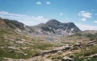
We had the morning to ourselves, but by mid-afternoon we met a bunch of people, including a pack outfit with 22 horses (about 14 people), a professor from Utah out with his family on their annual vacation in the Winds, a Spanish sheepherder (heard the sheep but never saw them) and a couple basecamped at Raid Lake who come out here every year. There were others camped at Marms Lake we just waved to. I understand why they all come, but it isnt exactly a wilderness. The country continues to be beautiful. The dry rocky desolation (beautiful in its own way) gave way to a high plateau with terrific views of the Cirque of the Towers and other nearby high peaks, followed by a descent to several small creeks and rivers, with one real ford, then a succession of lakes again. The best part of the afternoon was seeing a bald eagle flying past us. We watched it for a while and the white head and tail were unmistakable. Thats only the second one Ive ever seen.
Jim: Ginny accused me of yogiing the horse group this morning. Moi !??! Just because Im hungry?? Well maybe a little. The country is stark, raw, unbelievably beautiful. And we can see the back side of the Cirque of the Towers well be there in a couple days.
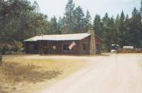
August 19 - 8 miles to Big Sandy Lodge
This morning was fast and easy, past Mirror Lake and through dense pine woods. We passed several groups heading into the wilderness. They looked so clean! And their packs looked so big.
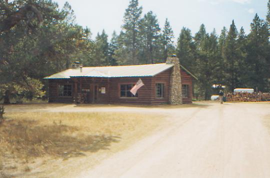
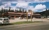
We decided to stay at Big Sandy, though they had no cabins available. They let CDT hikers camp nearby and take meals at the lodge, so thats what were doing. We had a scare first. When Tim, the manager, went to look for our maildrop, he came back with a tiny box of goodies from Linda Patton. Sorry, there are no other boxes for you. Since its three days to Atlantic City, I got upset, though not outwardly. Daves box is still here, so we decided to take that one. He wouldnt mind. When Tim went back to get it, he found our box, hiding in a corner. This seems to happen to me a lot! So we sat and ate lunch and lots of goodies that we had put in our maildrop. We talked for a while with Tim, the manager, then took a wonderful, though expensive, ($7.50!) hot shower. We looked at a Wind Rivers hiking guide to get some idea of the mileage for this next stretch since we are creating our own route again. Now we have all afternoon to do nothing.
Jim: Doing nothing isnt all its cracked up to be but sometimes its a necessity. We spent the afternoon reading, writing, and resting out by the lake. Tim told us we could camp someplace around the lake (free) so we found a spot about ¼ mile away from the lodge, not too close to the horse trails. We could have resupplied, packed up and left this afternoon, but then wed have missed dinner AYCE and GOOD. I think we impressed the cook. We certainly didnt leave a lot of leftovers. And we slept well clean (relatively), dry and well-fed.
Weve been on the CDT for 2 ½ months now over 900 miles. I havent kept a real journal and probably wont but its time to write down some thoughts about what weve seen and done and experienced. So Ill start with a sort of late introduction to what this is all about:
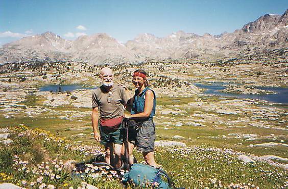
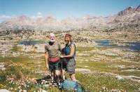
Spirit Eagle originally consisted of Jim & Ginny Owen and Dave Fleischman. Weve all thruhiked the AT at least once, Ginny hiked the John Muir Trail, Dave thru-hiked the PCT in a high-snow year, and Jim and Ginny have logged over 4500 trail miles during the last 6 years most of those on Pennsylvania trails (the significance of which will become apparent later). Dave taught us a lot about snow travel and ice axe use. I wont comment on what we taught him. Dave is a faster hiker than we are and in better physical condition. Hed planned to hike with us for the first month so we could all get through bear country as a group. Then the plan was to separate so he could do higher-mileage days. As planned, we separated at Chief Joseph Pass that way we could each go our own way and Hike our own hike without the compromises necessary to hike as a group. Dave is more than a friend Brother would be a better word. We miss him and wish him safe and happy trails. Unfortunately, we recently learned that Dave had to leave the CDT because of stress fractures in his foot. But Spirit Eagle flies on.
The plan was to start at Warm Springs, Montana and walk north to the Canadian border, then to return to Warm Springs (site of the Montana State Mental Hospital) and walk south to the Mexican border. The purpose of this flip-flop was to hike the lower elevation (6,000-8,000 foot) mountains of northern Montana before trying the 7,000-10,000 foot mountains of southern Montana. The hope was that the snow levels would be better at the lower elevations. In a normal snow year it would have been a good plan. But this was a 135 200+ % snow year with a 3 to 4-week late snow-melt. So our first 6 weeks consisted of 5 to 10 foot snowpack on many of the trails and ALL of the passes. Lots of ice axe practice. Glacier National Park, the Bob Marshall and Scapegoat wilderness areas, the Anaconda-Pintlar range were beautiful, but WHITE. The snow didnt disappear until Goldstone Pass. We finally sent the ice axes home from Leadore, Idaho in mid-July.
The trail yesterday someone said The CDT thats like the AT, isnt it? How do you answer that kind of ignorance? Comparing the two would be like comparing a house cat to a mountain lion. Not that the AT is easy, but the CDT is an entirely different world. The trail itself varies from easy, brand new sidehill like Elk Mt in the Bitterroots to rocky scree slopes to apparently unmaintained sections of old trail to jeep tracks which havent been used for 20 years to sections which have never had trail and are your basic bushwhacks. We recently spent 2 days bushwhacking through the Bridger-Teton National Forest. Bushwhacking is a good way to spend twice the time and four times the energy to cover half the distance.
August 20 - 17 miles to Lower Baer Lake
This was definitely an interesting (in the good sense) day. We started with a good breakfast at the lodge: bacon, pancakes, cinnamon rolls, bananas and oranges, juice, and coffee. Yumm! Last night was ham, potatoes, wonderful home-baked rolls, vegetables and three desserts. All you can eat, and did we ever eat! Hiker hog heaven!
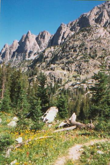
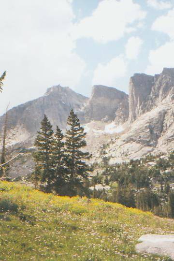
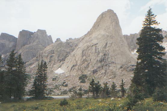
Then we followed the river to Big Sandy Lake, walking easily through forest and meadows. Its a beautiful place surrounded by towering peaks. We climbed steeply for a couple miles over Jackass Pass to the Cirque of the Towers, an utterly awesome place of huge granite spires. The hike there was rocky and steep, and reminded me a bit of New Hampshire hiking, though not quite as steep. We ate lunch on the far side of the pass, looking out at the immense peaks. There were climbers on one of them, but they were so tiny against the rock we couldnt see them. It sprinkled off and on all day, but never seriously, just enough to keep it cool. We met a day hiker, Mollie, who knows Bryan Schuman, a 1997 CDT thru-hiker we met last year at the ALDHA Gathering. She said she had watched his slide show only last week.
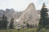
The afternoon hike east from the Cirque was also interesting as the narrow valley was lined with more smooth granite peaks and cliffs. It was beautiful. We had a knee keep ford that was colder and faster than usual, but otherwise it was mostly just an easy walk in the woods until the last mile or so, when we switchbacked steeply up to some lakes. We saw five deer in the trees there. We were ready to stop when we did. After we set up camp, a hiker came by who claimed to be hiking the CDT, but he only started three days ago and has never been out for more than a week, so Im not sure how far hell get. We talked a while, then he headed on. Dusk fell before we were finished cooking, much less eating. We really took our time today, taking lots of pictures and admiring the views. It was really wonderful to see the Cirque of the Towers and have it be as beautiful as expected. Id seen photos, but its like Yosemite or the Grand Canyon: it may look just like the pictures, but you need to see it in person to really appreciate the beauty and understand how awesome it is. Im glad we made this detour. It was worth the extra miles.
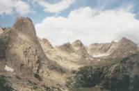
Jim: The Cirque of the Towers is awesome. One of the towers rises about 3000 out of the lake there were a number of climbers up there (we were told there were 17) but while we could hear them we couldnt see any of them. We ate lunch in a light drizzle about half-way down from Jackass Pass. I think I shot at least a full roll of film there.
Saturday, August 21 - 17.5 miles to campsite near Sweetwater Guard Station road
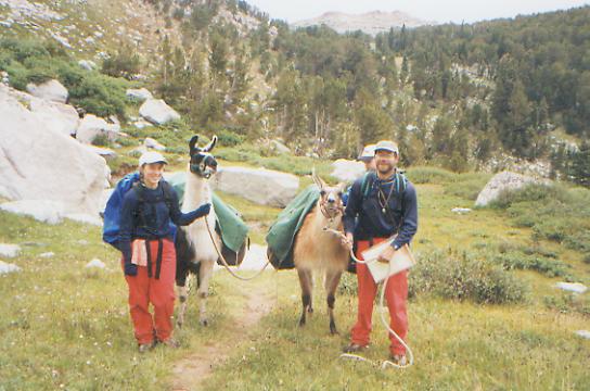
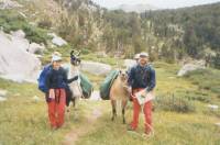
It was a gloomy drizzly day after a dark and drizzly night. We climbed up to a huge alpine zone in the Popo Agie Wilderness above 10,800' with lots of lakes and granite cliffs. Given the day, it was a study of grey on grey. Desolate, but oddly beautiful. We met a couple from Pennsylvania, known as the Bobbsey Bums, with their young son and two llamas. They are members of ALDHA and friends of Cindy Ross and her husband Todd, whom we also know, who section-hiked the CDT with their children and several llamas over a period of five years. More than that, the couple we met hiked the Appalachian Trail in 1988, the year I did my first long hike. It was fun to meet them.
Im sorry our last day in the Winds is so wet. What we could see was spectacular and Im sure it looks less stark under blue skies. The Ice Lakes and Deep Lakes were pretty--no ice, but still some snow, despite being late August.
LATER: Well, we finally left the Winds behind us. Im a bit sorry, as the Bridger and Popo Agie Wilderness areas were really beautiful, but it is also exciting to reach the Great Basin.
This morning was slow with lots of ups and downs between basins, while the afternoon was an easy climb to Sweetwater Gap, a wide grassy pass next to Mt. Nysstrom, followed by a very long descent along the nascent Sweetwater River to the base of the mountains. We saw lovely water and one deer. Several miles of the trail were burned in 1988, so there were some blowdowns, but the trail was mostly pretty easy. We met a couple of dayhiking geologists on their way up, but no other backpackers. It wasnt like yesterday with its 15 groups. We got spoiled by the solitude in Montana. We arent used to crowded trails.
We are camped at the base of the mountains, looking up at Mt. Nysstrom and Sweetwater Needles from a pine grove. Theyre the last of the big mountains for a while, though the trail follows the edge of the basin through several small ranges.
Jim and I are both impatient to begin this next stretch. It is one of the most uncertain, with new marked route through the desert. Some people said they loved the Basin, that it was easy and had lots of wildlife; others just push through as fast as they can and complain about lack of water, especially if they take the alternate route through Wamsutter. Andy crossed the desert in three days from Wamsutter.
Jim: It was a grey, drizzly, generally cold day. The Winds showed us another face but we still enjoyed it immensely. Im glad we made the side trip youve gotta wonder why this isnt the official trail rather than the roadwalk out of Big Sandy.
Sunday, August 22 - 21 miles to meadow above South Pass City
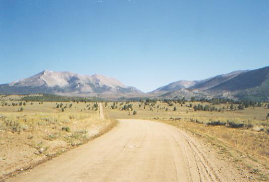
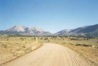
The sun is back - hooray! It makes for warm walking, but nicer views. Weve been walking on the southern edge of the mountains, through hills and valleys and past a few small streams. Its mostly sage country, with a few pines. There are interesting knobby rock formations all around. The only wildlife we saw this morning was hawks, cows, and one grey snake. Its pretty country, especially with the green mountains behind us. Were following jeep roads, so the walking is easy, for the most part. Grasshoppers leap at every step.
The afternoon was a bit more adventurous, with one wrong turn, a misadventure at Pine Creek with a beaver dam, two herds of antelope plus one loner, dinner at the Rock Shop Inn, and a search for a cross-country route to South Pass, blocked by more beaver dams and steep canyons We had planned to reach South Pass City late this afternoon, since we were walking about three mph along the jeep roads. Then the maze of roads, as shown on the map, confused us and we turned too early. A ranch house and a feeling of heading the wrong direction (south instead of east) gave us the hint to look at our map again and we quickly figured out where we actually were, so we backtracked. Wrong move. By following the right road, we ended up in the swamp created by a very busy beaver. I saw four dams. We crossed one, very slowly, sinking in mud and willows and mint with every step. Finally across, we discovered another swamp. We couldnt find a dry way across. Jim wanted to go back across the dam, head downstream about ½ mile to an easier crossing, then climb a big hill back up to the road. There was no way I was going back over that dam, so I just took off my boots, put on Tevas, and waded through the muck and the mire. It was pretty nasty. Unwillingly, Jim followed me. We were neither of us in a very good mood until we saw the first herd of antelope - 12-14 of them. We also saw our first CDT markers in about 100 miles. The last were when we entered the Bridger Wilderness at Green River Lake.

To cheer ourselves up, we decided to walk two miles up the highway to the Rock Shop, an inn where we ate hamburgers, salad, fries, coke, beer, pie and ice cream. They were just what we needed. Happily sated, we finally continued toward the historic mining town of South Pass City, after consulting with the bartender, who told us we could bushwhack there easily by just heading up the creek across the road. What he didnt tell us was that the creek was another beaver construction project. The whole area was flooded and there was no way across. So we went up the highway beyond the flood zone, then climbed over some hills, paralleling the creek. We could see the ravine, but it was hard to follow through the steep rocky canyons. We found a campsite in a grassy spot in one of the side canyons. Tomorrow well figure out how to get to South Pass. I hope the cows dont come back - this is obviously one of their grazing sites. As we were looking for a spot to set up the tent, we saw another herd of antelope on a hill across the way. Then when we went scouting, we saw a lone antelope about 100 yards away. Jim tried for a photo, but it moved too fast.
Jim: We had a good start for the day and a good ending. But once we got over the pass, it took us forever to make the descent to the desert. I think it may have been a head problem cause we were walking through another burn area. One section had a LOT of blowdowns. We had some minor problems in the desert, mostly a disagreement about how to get around the beaver ponds. But the Rock Shop cured us. My writing is sporadic to say the least but Ive been busy. Back to the trail and some more observations:
Trail marking/blazing Were just outside of South Pass City, Wyoming and we saw 2 CDT markers today. Theyre the first weve seen since Green River Lake on the other side of the Wind River Range over 100 miles ago. The type of trail marking also varies it may be wooden CDT signs or carsonite posts with paste-on stickers or axe-cut blazes or International orange metal tabs in the trees or rock cairns (or ducks) or any combination of the above. Or none of the above. For several sections in the last two weeks there have been what we call ducklings rock cairns that are 2 to 6 inches high. Today was a 24 mile day along jeep tracks with no indication whatever that we were on trail or what road we were on or where we were. It was strictly dead-reckoning navigation by map and compass with a few hints from Jim Wolfs guidebook. The 2 CDT markers we saw showed up in the last mile and we have no idea what relationship they actually have to the trail.
Injury lets dispose of this one so we dont have to dwell on it again. Weve had the usual blisters, sore muscles, aching backs, etc. On the second day we were post-holing in waist-deep snow and I twisted my left knee and tore tendons in my right leg. That took over a month to heal and slowed me down considerably. Then there was the phlebitis that developed in my right ankle. That slowed us down to 12 to 14 mile days and didnt get better until we stopped in Salmon, Idaho due to Ginnys accident. Both Ginny and I have had problems with boots Ginny with old boots that dried out after all the stream crossings in northern Montana me with new boots straight out of the box. In both cases, they tried to cut off our feet at the ankles. The only other problem for my part is the 2 compressed discs that I acquired on the AT the pack sometimes hits them wrong and provides my daily ration of agony in the form of extreme pain running down my right leg. Ive talked about Ginnys accident someplace else.
August 23 - 5 miles to Atlantic City
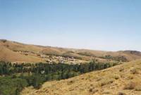
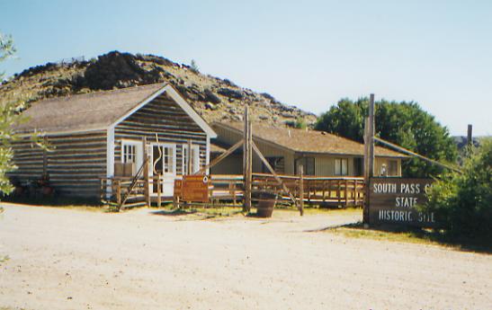
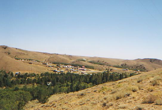
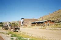
South Pass City turned out to be more interesting than expected, while Atlantic City was a disappointment. South Pass is a state park with several old cabins, hotels and historic markers explaining life in a gold rush boom town from 1867-72 and afterwards. There were about 25 preserved buildings, plus several houses outside the state park that are currently inhabited. (Summer population 14, winter population 7.) We met a nice couple from Ann Arbor, Carol and Dieter, who are following the bicycle route along the Divide for the second time. We had a long chat with them and the woman who runs the general store. (It acts as a post office, but doesnt sell anything but coffee.) We walked past some mines to Atlantic City, where we had lunch at the Mercantile with the bicyclists, and got a cabin for the night. Then came the disappointment. In packing our box, we assumed there would be some sort of store here. There wasnt. It turns out the mercantile is a bar, not a store. No gas for the stove, no bread, no cheese, no ice cream. We have no lunch for the next week. Oops! Its still 150 miles to Rawlins. The nearest town is Lander, which is 36 miles away.
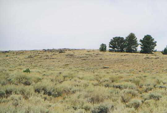
This next stretch across the Great Basin really intrigues me. Many hikers simply try to get it over with as quickly as possible, while others really enjoy it, saying it is beautiful with lots of wildlife. It is high desert, where water is scarce and even known springs may be hard to locate or fouled by the cattle we must share them with. I am scared of the unrelenting sun and heat. This is sage country, with no trees for miles. Im also excited at stories of antelope and wild horses and skies that go on forever. I look at the maps and see in the scattered red lines so many possible routes. There is a freedom there, with so many choices: the BLM route, Jim Wolfs route, or alternate ones we have either heard about or can create for ourselves. Tomorrow we cross the Oregon Trail and at times we will walk in the tracks of the emigrants. But we also will have the risks that accompany having choices - of running out of water, or food, or pushing too hard in the heat. This could be one of the hardest sections, or one of the easiest. Many hikers do 25-30 miles a day in the desert. I am excited and scared, but I think Im ready.
Jim: The campsite last night was definitely a cow hangout. They showed up just after dusk and made a nuisance of themselves all night. Nothing drastic, but they kept moving in and out of the trees around the meadow. Probably hoping we were just a mirage and that wed be gone next time they came back.
Today is a different town stop good hamburgers, lots of beer, a shower and a bed but no laundry, no gas station (no fuel), no store (no ice cream or lunch for the next week), and only one phone in town a pay phone out with the traffic, mosquitoes and dust.
Home | Links| Trail Journals |
The Thruhiking Papers | Bun-bunMontana | Wyoming | Colorado | New Mexico
Created: Fri, 16 Jan 2004
Revised: 30 Sept 2016Copyright © 1999-2017 Spirit Eagle