|
 |
 |
 |
 |
|
|
|
|
|
|
November 26-27 - rest days in Deming
Were prolonging our trek, deliberately, by staying in Deming for a couple of days. Deming is a good hiker town since all the amenities are so close together. We have a nice large room; there are stores and restaurants close by; we found a good used bookstore; now we can rest up for the final push. I dont expect it to be difficult, though we are taking the roundabout route through the mountains instead of the more direct highway route.
On Friday, we met Margaret and Dave, CDT thruhikers who started south in July and have been chasing us ever since. I saw her standing outside the post office with her pack, and knew she had to be a long distance hiker. She had the look. Theyre in a hurry to finish, partly an effect of the holidays I think, and have just road-walked the highways for the past week. Theyll finish today, after walking the highway straight south from Deming to Palomas. I understand the sentiment, but dont really share it. A small part of me says, Were so close, lets just get it done. But the rest says, Im not ready for this to end. I dont want to go back. Lets stretch this out as long as possible. Hearing on the news that there is a warm spell expected for the next week helps a lot. It was a lot of fun meeting David and Margaret. We talked for a couple of hours over pizza, before they headed off for a quick beer for the road. Odd to think that we were the first to start southbound, and well be the last to finish. I dont mind. We dont know what happened to Jason and Julian. I doubt theyll do the scenic route though. A quick dash down the highway is more their style. I know they were in a hurry to finish. Or they could be off visiting some local family that has taken them in. Julian was big on getting as much local color as possible. The final tally seems to be five northbound thruhikers (Andy, Willis, Dick, Laura and Leslie) and eight southbound (Jim and I, Dave, Margaret, Jason, Julian, Jeff and William) will finish this year. Thats actually a lot on the CDT. Most years there are only five or six who finish. We only met six other thruhikers though, the rest managed to miss us. William Emerson was an ultra-light speed hiker. He passed us when we were at Grand Lake. Willis we barely missed in Wisdom. Dick we missed in Yellowstone. There were also several who completed large sections of the trail, but we only met the two section hikers near Yellowstone--Dean and Maryanne-- and Rob, who hiked from Mexico to Wyoming. It is interesting hearing about other peoples experiences on the trail, and their different styles and approaches to the hike. Hike your own hike is more than just words. Out here, anything goes.
Jim: Were now less than three days from the Mexican border and Im gonna do something I hadnt intended to do - talk about our contract. Before we started our hike, we did some serious thinking about what we wanted the hike to be and why. And we (Ginny and I) decided (and agreed) what our contract would be. Those who dont know about contracts can find more information on the subject in The Thruhiking Papers
This is OUR contract and OUR reasoning, based on OUR priorities, experiences, preferences, etc. It has no relation to anything that anyone else is doing, has done or will do. And its NOT a comment on, criticism of or comparison to anyone elses hike we dont have the time, energy or inclination to judge what others are doing were too busy living our own lives our way.
The Spirit Eagle contract isnt complicated - it only has 5 points. And it reads like this:
- Well walk from the Canadian border to the Mexican border along or near the Continental Divide Trail.
- Were out here for 6 months.
- Were here to see the country, to meet the people and to learn whatever lessons God has to teach us.
- Were here to walk the mountains and the wilderness as much as possible - not to roadwalk the Trail.
- Finishing the Trail is important, but not as important as enjoying the Trail. If the push to finish gets in the way, well re-examine what were doing and why. If necessary, well take 2 years to finish rather than compromise on points 1, 3, and 4.
Now - isnt that simple?
But then comes the hard part - the underlying assumptions, implications and explanations that go with that contract. For some people the first point of that contract will raise the question - Why didnt we just follow the CDT? Why didnt we do or even attempt to do a pure hike (ala purity of the AT variety which basically means following the official trail all the way). And the answer has several parts, some of which concern the nature of the trail and some of which concern the nature of thruhiking.
The first part is that there is no such thing as what some would think of as a pure CDT. There are official routes for much of the trail, there are Jim Wolfs guidebook routes (and alternatives), there are routes that have been used by other hikers and there are a gaggle of undocumented or possible routes. The fact is that much of the Trail is not only unmarked, but undesignated and arbitrary. For example, of the northern 350 miles of the CDT in New Mexico - only 25 miles is marked. And much of the trail has no treadway - only axe-cut blazes through untrodden forest or cairns across rough desert and grasslands. And some of the official trail is so waterless as to be unfeasible and useless for either hiker or horse travel.
The second part is that, in keeping with contract points 3, 4, and 5, were out here to see what WE want to see not someone elses idea of what we should see. If wed followed the official route through the Black Range in New Mexico, wed have missed the West Fork of the Gila and the Gila Cliff Dwellings. Worse yet, wed have been walking trail that passes through miles of burnt forest - with the accompanying massive blowdowns that other hikers have reported rather than through beauty. Some of the official trail has been deliberately designed to avoid places like the Gila to prevent overuse by CDT hikers. We did hike some of official trail in the Black Range - and we CAN confirm just how bad some of that trail is. We had enough of burned out forest along the rest of the trail.
The third part is that thruhiking is about learning, and personal growth and freedom - the freedom to make your own choices and to live with the consequences of those choices. We made our choices - it was our choice to do the Anaconda and Creede cutoffs. It was also our choice to go through the Cirque of the Towers and the Indian Peaks Wilderness - each of which was longer, harder and more time-consuming than the CDT routes. But it was our choice, our time, our sweat --- our hike.
The fourth part is that time, weather, injury, safety, water availability and a host of other considerations can sometimes make following the Trail impractical or even downright dangerous.
The last part is that I doubt that anyone has hiked the CDT as a pure hike in the sense that the term is used on the AT (and sometimes on the PCT). Undesignated trail sections, mazes of unmarked dirt roads, snow-covered trail, etc. make route-finding a constant challenge such that few hikers manage to stay on THE TRAIL. Is there anyone whos hiked the CDT without getting lost or off-track or misplaced at some point with respect to the Trail? If so, Id like to meet them.
The bottom line here is that on a trail thats partly undesignated, largely unmarked, generally unmaintained and often a non-existent bushwhack or a cross-country route, the AT concept of purity is an alien and invalid concept. So our hike was never designed or intended to be pure it was designed to be what we wanted it to be. And it has been.
The second point of the contract carries implications in terms of daily mileage. To spend 6 months (~180 days) on the CDT implies a 16 to 17 mile per day average. Getting into male-macho-mileage mode and increasing our average to 20 mpd would have us finishing in about 5 months. Higher mpd averages would mean even less time on the trail, an increased probability of injury or burnout, and less time to see the country, meet the people and learn what were here to learn. It might also necessitate skipping some of the mountains and road-walking more of the trail. That would violate points 2, 3, 4 and 5 of our contract. Its not what were here for.
There are those who come out here to do the Trail in minimum time. They either do big miles (20 - 30 - 40 miles per day) or they take no time off in town or they road-walk or they skip sections or some combination of the above. God bless them its their hike. But thats not why were here this is a Spirit-walk for us. It was meant to take 6 months - and it has. And thats the way we wanted it to be. Weve seen a lot of wild and beautiful country and met a lot of wonderful people along the way. And I believe weve learned more than a few lessons. Well find out about the lessons over the next couple years.
With respect to point 4 of the contract, weve done a couple short cuts along the way - the Anaconda cutoff, for example. And weve talked about them. The conclusion is that, with only one exception, we wont do those road-walks when we walk the CDT again. Well take the other routes instead. Theres no regret about what we did - simply curiosity about what the other routes are like and an increasing preference for choosing routes as wild and natural as possible. Of course, large parts of the official trail and the alternate routes New Mexico and Wyoming follow roads either paved or dirt. Our reaction to those sections was mixed, from real anger at the busy highway near Rawlins to complete acceptance of following dirt roads through the desert. We saw so few people out there, the only difference between a dirt road and a trail was that the road was easier to navigate as it was more likely to be on the maps and you werent getting whacked by the brush with every step. Given how few people walk these trails, and the lack of maintenance, road walks are a lot more practical than cross-country routes that cant be followed. Even so, we still followed trail whenever it was practical.
The last point was sometimes the most difficult to keep in mind. With both of us being thruhikers, there was always the desire to finish in one year. There was also a high probability, given our deliberate decisions about time, speed, distance and routes, that we could have been stopped in Colorado or northern New Mexico by snow or cold and have to come back next year to finish. Resolving that conflict was an exercise in mental discipline. It required a decision about what we wanted - and then a second decision to adopt, internalize and accept the attitude that would achieve that goal. It also meant accepting the possibility of NOT finishing this year - and accepting that as one of the lessons we were here to learn.
One of the hardest parts of thruhiking is the way the push for miles can take over a hike. When it becomes an endurance test - a death march - then the purpose of the hike changes from exploring and enjoying the land and the wildlife and the people to a joyless quest for more and more miles in order to get to the end of the trail. On the CDT, that translates to the race for the border and the destination becomes more important than the journey. Theres also the consideration that constant exhaustion can easily lead to burnout, both physical and emotional. For us, there were many days (too many) when water or weather concerns forced us to push harder than we liked. There were other times when we stretched the miles just for the fun of it, but we always tried to remember why we were there.
We were lucky. We had snow and cold and injury and long days with little water, but nothing that we would allow to end our hike. More than that, we never lost our enjoyment of the trail. Well end the hike being sorry only that it wasnt longer. Our contract was a good one for us.
November 28 - 12 miles to Rock Hound State Park (Elev gain/loss: +600/-310)

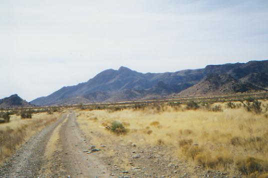
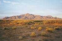
We decided to take a short day today, hiking only as far as the campground at Rock Hound State Park. The park is one where they encourage visitors to take rock samples home. There are jaspers, agates and geodes all around here. We saw a fantastic geode collection in the Deming Museum and another at a rock shop a couple of miles down the road. We had a long chat with one of the owners of the rock shop. He was a real character. Otherwise, it was an easy undistinguished day on paved roads through town, out past several RV parks, and across the desert toward the Florida Mountains. Theyre a small range, but interesting, with a ridge that really does resemble a dragons back. The park is in the gap between the Florida and Little Florida Mountains, a pretty desert setting with potential for good sunsets behind the mountains. It was a warm day - felt like 70s. Nice for hiking. There was no point in hurrying, so we didnt. We knew there was water at the campground here, even showers, and the next few miles cross private land, so this seemed like a good place to stop. Its a pretty setting and very quiet, despite the dozen or so RVs scattered around. We passed several cotton fields, still with cotton on the plant. One farmer was out on a big machine, a mechanized cotton picker I suppose. There was cotton floating in the breeze for miles. We also passed a winery and pecan groves. We were ready to leave town, but we want to take our time, as much as water allows. I dont want this trek to end.
Jim: This was a road-walk day - and a short one at that. But then were in no real hurry neither of us is anxious to finish this trip. We could have picked up water at the State Park and moved on, but we just stopped early, took a shower, had a leisurely dinner and watched the sunset.
Monday, November 29 - 19 miles (Elev gain/loss: +1570/-1940)

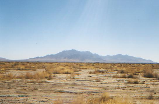
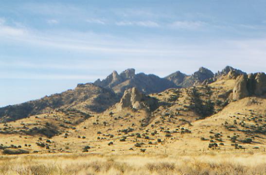
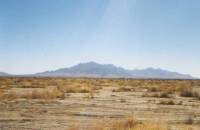
It was a warm night, the first one above freezing in a long time. The wind picked up though, making breakfast a bit more exciting than usual as we chased stray items all over the place. Lighting the stove took forever. Weve had a leisurely walk around the back/east side of the Florida Mountains. They are a rugged range with some good rock formations. I especially liked the Needles Eye. So far, there has been lots of water, but we didnt need it. The eastern side has a view across a wide flat plain to a couple of short mountain ranges. We passed some houses and ranches, but have seen no people. Last night we had a nice city lights view of Deming. It spreads out a long way. Tonight we may see the lights of Columbus. I think this roundabout route south is worth it. It gives us a chance to see some nice desert mountains and is much prettier than the highway, I think.

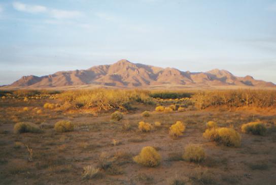
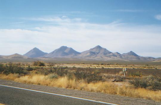
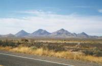
LATER: We never made it to water this afternoon. We got water at noon, but the next two windmills we passed were deliberately disabled and the wells near the highway were just a bit too far. We can see them, I think, but theyre on private property and the sun is starting to set, so we decided to stop in a sandy arroyo, dry camp, and get water in the morning. We missed a junction and ended the day with a long bushwhack back to the right dirt road. We went too far south and were in danger of missing the wells, so weve had to backtrack northwest after heading southwest all afternoon. It was easy walking across a lot of small dry washes. Near the mountains we were in lush mixed desert. In the washes the vegetation is mostly mesquite while elsewhere it was mostly creosote. We have good views of the Floridas to the north, the Tres Hermanas to the southwest, and some unknown ranges farther south in Mexico. We never got a lot of energy today, though the walking was fairly flat and our packs were light. The views were nice, the dry windmills a bit frustrating, and the bushwhacking easy, but also frustrating because we are heading in the wrong direction. No animals today but rabbits, cows and quail. There werent even many tracks except the omnipresent coyotes.
Jim: Typical of the trail I had a brain cramp, we missed a turn and a half-hour walk put us in a position to be unable to recover until tomorrow. I was upset enough that I got careless in crossing a barbed wire fence and managed to drive a thorn all the way into the palm of my hand right to the bone. It hurts, but its also funny.
The water situation is interesting we picked up water at a cattle tank at noon. The next water source was a solar well in the midst of several large (50,000 gallon) storage tanks. But it was disabled not broken, but deliberately disabled by someone who simply pulled the connection from the solar array. The next water source was a windmill again, deliberately disabled. The Border Patrol strikes again.
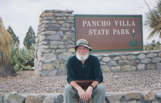
November 30 - 15 miles to Columbus and Palomas (Elev gain/loss: +190/-170)
Six months ago today we started this journey. Today we walked across the border into Mexico, and this chapter in our life ends. Our feelings are mixed. Disbelief dominates, I think. There isnt a lot of excitement or joy, though we did the last three miles from Columbus to the border in record time. Theres a sense of let down, a feeling of Now what? but mostly it hasnt really sunk in that this is over.
We werent supposed to finish today, but water concerns forced a change in plans. We were camped last night about a mile from the highway between Deming and Columbus. We intended to get water at one of the wells along the highway before heading back into the hills and doing a circuit of the Tres Hermanas. The first windmill filled a big muddy stock pond that was pretty nasty looking, so we kept going. The next well was dry. The next turned out to contain something other than water. After we had filtered a bottleful, we noticed that it was odd--thick and oily--so Jim tested it. I dont know what it was, probably fertilizer, but it wasnt water. We ruined our filter and almost our health. We only had one quart of water between us left from the well we passed at noon yesterday, no filter, no wells in the immediate vicinity, and no certainty that the few wells on the map were working any better than the others we had passed, so we decided to hoof it to Columbus, 11 miles down the highway. Without water, it wasnt safe to continue with our plan to hike through the Tres Hermanas. There were a couple of ranches a couple of miles back that were possible water sources, but we decided to just head south. The walking was fast and easy; the land was dry and empty. We passed a few homes and a derelict shopping plaza. Someone had left a trail of pennies and dimes every half mile or so, so I amused myself by picking them up as we walked. I ended up with $2.27. It was odd, but fun. I wonder what game was being played, and by whom. There were still a few wildflowers, even this late in the year. That was a pleasant surprise.
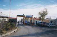
We had lunch in Columbus, got a room at the motel, then headed down the highway the last three miles to the border. We left our packs at the U.S. Customs Office and wandered down the main street of Palomas, then stopped at the very touristy Pink House for a celebratory beer. To be honest, we felt more like crying. But looking around, it was obvious that, yes, we were in Mexico and could go no farther.
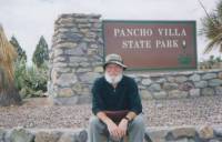
Palomas is different: the main street is lined with bars, pharmacies and a few tourist shops. It isnt the same kind of shopping haven that Nogales (the only Mexican town Ive spent much time visiting) used to be. Columbus is much as I imagined, a very small town. There are lots of people living in trailers, but the town itself has only one motel, two Bed & Breakfasts, 2 restaurants, and a few public buildings: a post office, police station, library and Chamber of Commerce. The State Park is the highlight: the site of Pancho Villas raid, with a nice botanic garden and campground.
Now it is time to let our bodies heal while we plan the next phase of our lives. Physically, we are ready for a rest, even though emotionally we really didnt want this trek to end. This has been such a good experience, despite the difficulty. If we could, if it werent winter, I think wed head north again. Already we are talking about what we will do differently, the next time we hike the CDT. But first, there are other trails that call us - the PCT, the Arizona Trail, the Canadian Divide. So much world to explore, so little time.
Jim: Its finished six months of wandering through the high country of the Rockies. I should maybe be philosophical here, but somehow thats not what Im feeling. Later maybe Ill come up with some Earth-shaking observations but I wouldnt bet the farm on that. Im tired, Im happy that weve finished, Im not happy that weve finished, Im afraid of the future, and yet I look forward to it. Ginnys brother, Jeff will pick us up tomorrow and Ill be happy to see him, but if the money, the weather and our bodies were up to it, Id rest here for a couple days and then head north for Canada. Someday well be back this stage of our journey is finished, but the journey itself continues. Spirit Eagle flies on.
Home | Links| Trail Journals |
The Thruhiking Papers | Bun-bunMontana | Wyoming | Colorado | New Mexico
Created: Fri, 16 Jan 2004
Revised: 30 Sept 2016Copyright © 1999-2017 Spirit Eagle