|
 |
 |
 |
 |
|
|
|
|
|
|
Wednesday, October 27 - 18 miles to Piedra Lumbre Road (Elev gain/loss: +1380/-1380)
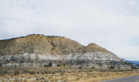
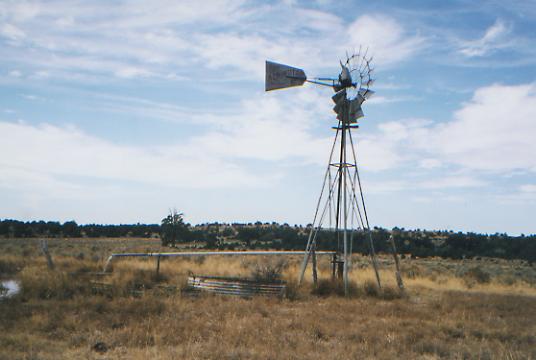
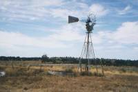
We managed to leave town about 10:00 a.m. after breakfast and a visit to the Post Office. The first five miles were along a highway--not too busy, fortunately. We passed houses and trailers and a gray and white section of badlands. We detoured to check out a windmill since we wanted to learn how they work. We got it started, but couldnt figure out how to stop it, even after Jim climbed to the top. That scared me. Evidently they stop themselves, eventually.
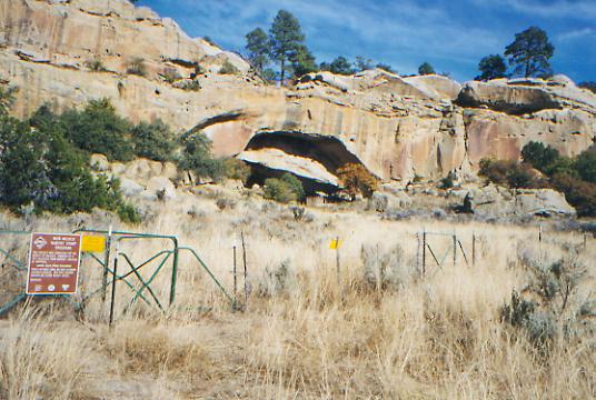
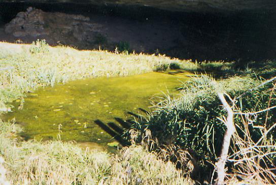
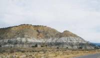
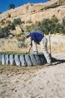
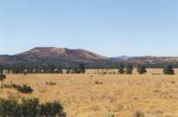
We ate lunch in a section of pretty yellow sandstone sculpted boulders. I thought they were pretty with their strange shapes. We did a bit of bushwhacking out of the canyon, then followed a maze of jeep roads across the flat top of the mesa. The drop down to Canyon Jarido was a steep boulder scramble, short but scary for me since the rock crumbles so easily. The canyon was orange sandstone, with lots of little caves. One large one had the Ojo Jarido, a good fenced spring. It turned out to be covered with a thick blanket of algae, so we got water from the slightly better tire tank out in front of the cave. Jim carried a gallon from there to our campsite six miles away. This area is mostly sage with a few scattered pinyon pines and junipers. It is very dry. The prickly pears are withered. Its not just the time of year; two years of drought are showing. However, normally dry Zambarno Lake had water and most of the stock ponds weve seen were full, if not very appealing.


Jim: I dont like carrying water, but its better than the alternative - I dont like being thirsty either. The water sources dont look any better here than in the Wyoming desert, but at least there is water - even if its a long way between good sources.
Thursday, October 28 - 23 ½ miles to Cabezon (Elev gain/loss: +850/-1350)
It was a quiet and peaceful morning, following jeep roads along the Arroyo Piedra Lumbre. Only one truck passed us. He stopped to ask where we were going and just shook his head when we told him. We got the same reaction yesterday. They were probably thinking, What crazy people!
Were making pretty good progress, passing by cliffs, a few small peaks such as Deadman Peaks and Cerro Colorado, some dry lakes and broken windmills, a few small cabins and a lot of cows. Fortunately, theyre not as nervous as the Montana cattle. Mostly they dont run, they just watch us pass by, then go back to eating. The road is sandy so we can see lots of animal tracks: deer, coyotes, mice, birds, etc. Yesterday evening a parade of cars passed our campsite at about 7:00 p.m., but otherwise the jeep roads have been very quiet.
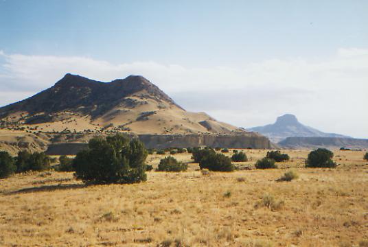
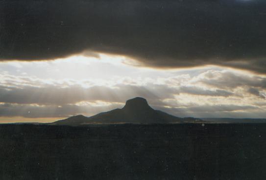
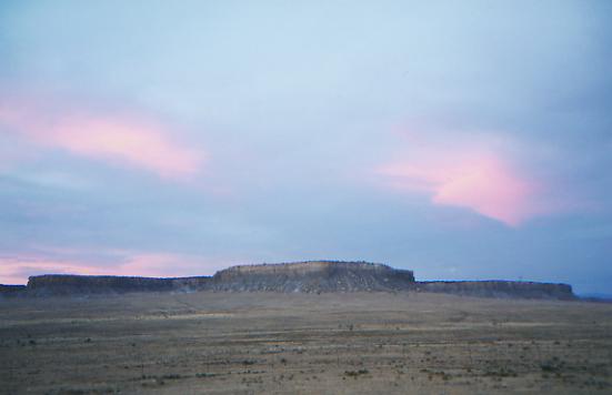
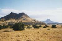
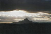
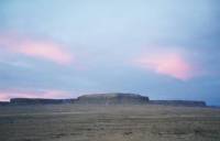
Lunch was on a rocky ledge looking south toward Cabezon Peak, a big round volcanic plug that dominates the horizon. There are other smaller peaks and mesas to liven the journey and give us a sense of progress as we draw nearer and then pass them.
This will be a long day because the best water is 22 miles from where we camped last night. There are small stock ponds from time to time, but theyre usually very shallow and muddy (if not worse!)
LATER: We stopped to cook dinner at the water faucets at the Cabezon well, part of an artesian system that waters the whole valley. Soon a car pulled up and Charlie McCarthy got out, saying, You must be CDT hikers. He is with the Mountain Club of New Mexico and has been working on relocating the trail in this section off the roads. They have completed about 25 miles of new trailway. There is no tread, just cairns to mark a route through the desert, so the walking is fairly rough, especially on the climb up to the plateau. Charlie said there is sufficient water, so it may be all right, when enough people have used it to create a path. We may cut across to pick up the new trail tomorrow, or we may just stick to the roads. Well see how were feeling in the morning. We had a nice chat anyway. Charlie had been following our adventures via the Internet. Small world.
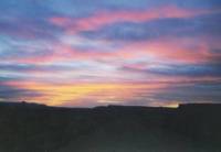
Finally we packed up our gear and moved a mile or so away, off the road. The sunset and sunrise were beautiful. We saw a deer and a covey of quail. This area has several small volcanic plugs and mesas with steep eroded cliffs in a sandy yellow color. Its much prettier than I expected.
Jim: Charlie gave us some good information about the water sources ahead. Sounds like some of them could be hard to find. And at least one potential water source (Arroyo Chico) isnt really good - its salt.
Friday, October 29 - 23 miles to Los Indios Canyon (Elev gain/loss: +3900/-1400)
We followed the road route instead of Charlies cross-country cairn route since we have so many miles to go to water. Its 23 miles to the Ojo de los Indios, and thats a long way when youre bushwhacking from cairn to cairn. This is interesting country. It is hard to imagine trying to make a living off this land. It isnt barren, but it is really dry. Cerro Cuarte was an interesting pyramid-shaped peak that we passed this morning, with deep canyons carved into its sides. We crossed huge Chico Arroyo, lined with yellow-leaved cottonwoods and willows. Charlie had warned us that the water in the creek wasnt good to drink, so we passed it by. Only one pickup truck passed us. He asked the usual question, and shook his head at the answer.
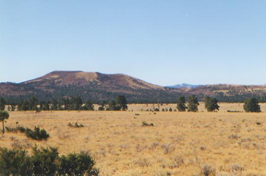
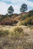
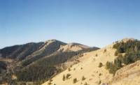
It has been very windy, and sometimes very cloudy, with big black thunderheads. We were sprinkled on twice, very briefly, as we climbed up to the plateau that rises 2000' above the valley. Were back to pinyon pines and junipers, with occasional ponderosa pines and scrub oak. The temperature has dropped at least 15°, between the climb and the cold front passing by. The plateau is mostly flat, with open grasslands surrounded by trees. It is easy walking, but not as interesting as the canyons and mesas below. I keep looking for deer, but havent seen any so far. We can do the long miles since the road walking is so easy, but it takes its toll on feet, backs and legs.
Jim: The spring was interesting - it was really good - and would have been really hard to find if we didnt know where to look. (Jim Wolf has been really good at directing us to the water sources. The guidebooks are well worth the weight.)
Saturday, October 30 -23 ½ miles to American Canyon (Elev gain/loss: +4120/-2910)
We had an unexpected pleasure last night at our campsite on the plateau. As we were sipping our cocoa, Jim spied a herd of elk grazing on the meadow nearby. We were tucked into the trees out of the wind, so they didnt notice us. It was too dark to see much, but there were at least 20 in the group. Soon after, a pack of coyotes began serenading us. At dawn, a bull elk wandered by and began barking at us as we slept in the tent. The coyotes joined in after a while, as did the crows. Our meadow was empty when we passed through it, but a mile later, in another larger meadow, we spotted a huge herd of elk, at least 50-60. The bull elk bugled a warning, but several ignored him and stayed put until we got closer, then they ran off to the other side of the meadow. That was exciting. A turkey gobbled in the pine trees next to us, but we never saw it.
The morning was spent wandering on the plateau. The hills have some red from the oaks, plus brown and green and yellow trees. I think its pretty. It was very cold when we awoke (20° inside the tent) so the filter, our boots and the tent were all frozen, as well as fingers and toes. We passed one cabin, but no cars or hunters were on the road today. Given the condition of the road, I can guess why.
Jim: Once again - finding the spring was a small problem. The spring was exactly where it was supposed to be - but the road had moved so the description didnt fit. It didnt help that we were really tired and it was getting dark. Once again - bushwhacking is a good way to spend twice the time and four times the energy to make half the distance. Our campsite was a hunting camp beside the road in a saddle - not exactly a backcountry area. But thats not the first time weve camped like that.
Sunday, October 31 - 16 miles to Tom Bombacis (Elev gain/loss: +6550/-8150)
Happy Halloween! Last night I was too cold and tired to write, and besides, it was dark when we stopped. We tried a shortcut, hoping to follow the pink flags of the future CDT. It didnt work. We followed a mix of cow paths, bushwhacking, fence following, logging roads, etc. for about five miles. Miraculously, we came back to the road only a mile from our planned campsite. Then we discovered they had moved the road away from the springs. Fortunately, we were able to find water and get set up before dark. By then it was so cold, we simply wolfed down dinner and went to bed. Thats very bad for the digestion. We slept little, though we soon warmed up. We listened to an owl for a while, then a coyote or deer came by to check us out. It was a long night.
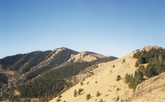
Today was a bit warmer. We ate lunch, sitting in the sun atop 11,301' Mt. Taylor, an extinct volcano. It is very beautiful, with far-ranging views in all directions. As we passed La Mosca Peak with its radio towers, we could see north to Cabezon and the Mesa Portales, and maybe as far as San Pedro Parks. From Mt. Taylor we could see the meadows and forests along the ridges to the south (looking like Montana), the city of Grants, and the mountains and ridges to the south. The Malpais doesnt look much different from the country weve just passed through, when seen from this height. There are more trees than I expected.
We were joined at lunch by a couple of ATVs, several dayhikers and a runner. Mt. Taylor is considered a sacred mountain, and there is a lot of official unwillingness to route the trail through here for fear of offending the local Indians, so it is ironic that the riders of the ATV were Navajo. Riding an ATV over the peak is not respectful! However, since there is a dirt road only 1/4 mile away, it was easy for them to do it. Since this is already a popular hiking and motorized destination for local people, I dont see that it would make any difference to have the CDT routed over the mountain, and it really does have a superb view.
LATER: A nice end to a frustrating afternoon. We ended up talking to the runner, Van Keele, who has had many interesting adventures of his own, including a Continental Divide bike trip. He took us on a steep bushwhack down the mountain to the trailhead. (The trail would have been better, if longer.) From there we looked for Tom Bombacis pink flagged trail down the plateau. It was hard to find, then rather rough going once we did find it. But eventually we made it down to Tom and Donnas house outside Grants. They open their home to hikers and have made us most welcome, sharing their steak dinner with us and offering us a bed upstairs. They are really nice people.
I got upset for no reason this afternoon. I was overtired, thirsty, tired of being lost, unsure whether we would make it to the Bombacis today, my stomach was hurting again, (maybe dehydration, maybe giardia), and I felt so pushed I couldnt stand it. Doing the long miles, racing darkness with too little water, gets to me after a few days. (Only 2 ½ quarts apiece yesterday for a 23 mile day, no wonder my stomach hurt!) I hope we dont end up with a lot more days like yesterday.
Home | Links| Trail Journals |
The Thruhiking Papers | Bun-bunMontana | Wyoming | Colorado | New Mexico
Created: Fri, 16 Jan 2004
Revised: 30 Sept 2016Copyright © 1999-2017 Spirit Eagle