|
|
|
 |
 |
 |
 |
|
|
|
|
|
|
|
|
The Pacific Crest Trail
Campo to Idyllwild
Thursday, April 20: Hauser Creek - 15.3 miles
We're on our way, at last. As usual, last minute hitches threatened to delay our departure, but we fought through the tangle of details and difficulties to fly to San Diego on schedule. Brick, a friend from the Internet, picked us up at the airport on Wednesday afternoon, drove us around town, took us for a short walk in Balboa Park, then out to dinner at an Indian restaurant, and let us sleep in his living room. It was fun to finally meet him, after "knowing" him via e-mail for so long.
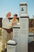
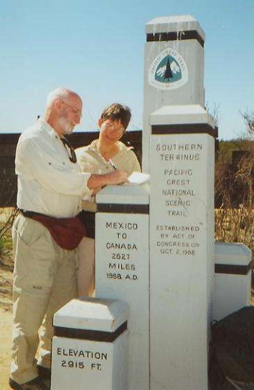
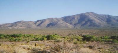
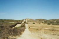
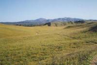
This morning we had a big breakfast, then headed toward the border near Campo. It only takes a couple of hours to drive from San Diego to the PCT monument at the border, but what a difference! San Diego is pretty, with a very tropical feel to it (lots of trees and flowers), but Campo is inland in high desert. We stopped at the Post Office in town to see who had signed in at the trail register there, then signed in again at the border monument a mile away. At least 20 have started the PCT already, though it is a bit hard to tell since many who sign in are section hikers, not thruhikers who intend to go all the way this year. Several signed in this week, and the earliest likely long distance hiker began about a month ago. The Mexican border has a wide cleared swath next to a metal fence — not chicken wire as in Arizona, but solid steel. A border patrol car pulled up while we were there. It is quite ugly, with the bulldozed and burned desert all around.
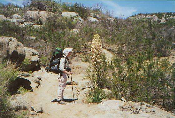
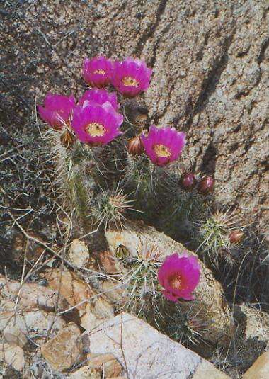
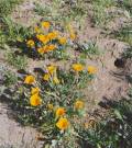
In contrast, the desert is filled with flowers. There was a heavy rain a few days ago, so the seasonal creeks are running and the flowers are blooming. Desert lilac and another white bush are in full flower, smelling very sweet. There are lots of small desert flowers hidden in the brush. Not masses, but enough to be interesting.
After saying farewell to Brick, at about 10:00 we headed north toward Campo, a small town about a mile from the border. About 15 minutes along, I twisted my ankle, badly. We sat for about 10 minutes waiting for the throbbing to subside, then started off again, slowly. We had to decide whether or not to let it stop us, but decided to keep going, since we had already seen Brick drive off and didn't really want to camp out at Campo unless it became absolutely necessary. Two miles later we stopped next to a stream to rest, cool off, and eat lunch in the shade of some tall cottonwoods. Bird song surrounded us. The day is warm and sunny — hot in the sun, but cool in the shade, with a breeze blowing lightly.
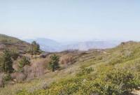
I'm happy and excited to be on our way. Yesterday it didn't seem real, but now I’m ready. Brick, who has thruhiked the trail and done a lot of trail running along it as well, warned us about the PCT reality: problems like poison oak, ticks, snakes, overgrown brush and endless switchbacks. But reality is also birds and flowers, blue skies, lizards, hawks, ground squirrels, sunsets, and starry nights.
We didn't make it as far as we hoped. I was limping along slowly because of my ankle and we took a lot of long breaks. We're camped near a trickle of water at Hauser Creek. It's next to a dirt road and too near the trail, but neither seems to get a lot of use. The trail itself has been good — wide and recently cleared. It does a lot of winding, but the grade is gentle — too gentle sometimes. We saw some poison oak, but mostly it was well cut back. I don't know whether the trail tomorrow will be as well cleared, but today was nice.
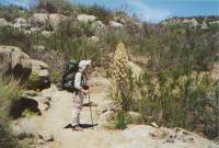
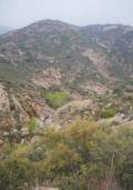
Jim has a sore knee and I was stung by something nasty — a bee or wasp — but otherwise we're okay, just tired. My ankle was painful. I think it will be okay, but now it still hurts. It looks swollen, but not bruised. In common with the majority of PCT hikers, I decided to wear low-topped trail shoes instead of heavy boots in the desert sections. That may have been a mistake. The heat was getting to me for a while, but it cooled off as the shadows grew longer. Usually there was a gentle breeze. The country was rocky chaparral, densely grown brush on both sides of the trail. We saw a pretty ranch below us, but after that the country was very remote and wild. We'll head into the Hauser Wilderness tomorrow, briefly. We saw few critters: just lizards, ground squirrels and birds.
We did see a large group of illegals creeping up a draw. They hid when they saw me. Later we saw a couple more people down near where we're camped. I had hoped they were PCT hikers, but they disappeared too. They might be headed up the ridge to Lake Morena where there's a campground and store, or they may be more immigrants. It was interesting to see the signs in Spanish warning about the danger of being in the area without water. This little creek will be dry in a few weeks, if not sooner. If we weren't so tired, we wouldn’t camp here, but it is too late in the day to do a steep climb and five more miles. Mentally I'm fine; physically, I'm a wreck. Tomorrow will probably be the opposite. I like the land, the trail and the flowers. My body will heal, sooner or later.
Friday, April 21: Fred Creek -- 17.5 miles + .6 (officially 32.2, not including side trips)
Last night, about 3:00 a.m., we heard a group of illegals, walking down the road past our campsite. A few got separated from the main group and were confused by the trail junction there. For 15 minutes, they ran around calling, "Mito, Mito" (presumably the name of their leader). Finally, they headed up the road again. I wasn't sure whether to call out and give directions or just stay silent and not call attention to our presence. While problems with illegals are rare, we didn't want to risk it, so we stayed silent.
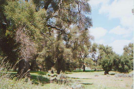
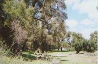
We started the day with a big climb up to Lake Morena. It wasn't as bad as we expected since it was early in the morning, which was cool and foggy, and we were fresh. About 9:30 we reached the campground by the lake and decided to walk 1/3 of a mile to a little store/café. After getting soaked by mist all morning, a cup of hot coffee or chocolate sounded very welcome. We decided that breakfast was in order too, so we relaxed and enjoyed some delicious French toast before heading back to the trail. As we walked, the fog lifted and we could see Lake Morena far below us. The chaparral included a lot of manzanita, more lilacs and other wildflowers. Then we descended to Cottonwood Creek and ranch country. The oaks were huge, but so were the cows, who were more curious than frightened of us. They must be used to seeing hikers.
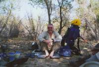
We had lunch at Boulder Oaks Campground in the shade of a big oak tree. It is actually a bit cold. We had heavy fog all morning, and now there are big black cumulus clouds surrounding us. It's better than yesterday's heat, but unexpected. A nice fisherman told us that thunderstorms are predicted for this afternoon. Some PCT hikers don't bother with a tent in the desert. I'm glad we have ours.
The campground is interesting because every site has a horse corral. It also has water, so made a good place to cook dinner. My ankle hurts, but not excruciatingly. I think Jim's knee hurts him more.
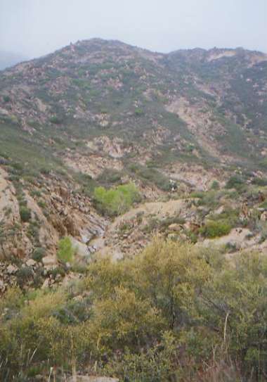
Later: The afternoon hike was interesting: winding up canyons high above flowing Kitchen Creek, then high above the desert. There were interesting rocks and what would have been good views except that the clouds rolled in again and turned the world grey and foggy. Parts of the trail reminded me of hiking in Tucson's Upper Sabino Canyon, with green cottonwood trees lining the rocky creek. We kept going and going as there weren't any flat spots along the trail and I wouldn't dare camp near the creek with thunderstorms about. Flash floods are not something to mess with, and Kitchen Canyon is quite narrow. We're camped in a grove of trees near a dry creek. It's six miles to the next water, but my feet wouldn't stand many more miles today. It's surprisingly cold. We're bundled up in long underwear and jackets. Odd, when yesterday was so warm. We never had any real rain today, just a foggy mist that managed to get us pretty wet.
Saturday, April 22: Laguna Campground — 15.5 + 0.4 miles (47.7)
We woke to the steady pitter patter of rain on the tent, so we rolled over and went back to sleep for a little while. The rain eased as we were packing up, but the clouds and fog remained for another hour and a half. Even after that burned off, there was a cold wind. We climbed up into the pines atop the Laguna Mountains, after a brief stop to get water at Long Creek. We dropped off the trail to come into “town” for food. Mt. Laguna is a tiny resort, with a lodge, restaurant, small store and post office. There was a trail that took us straight from the PCT to the lodge, passing a couple of cabins. The post office was closed, so we were unable to read the register to see which hikers had passed this way recently, but the store manager said there had been quite a few in the past week. We had lunch at the Blue Jay Lodge. Hamburgers on the grill, beer on the table — life is good!
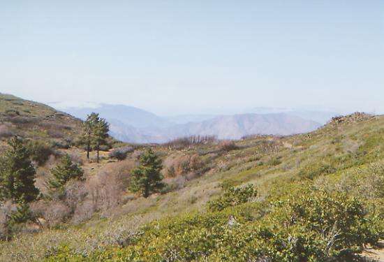
After lunch we ended up only walking five more miles to the Laguna Campground. I hate paying to camp, but they have a hot shower, which felt wonderful. Another PCT hiker, Emily, aka Bugbite, is camped with us. We had met her at a long distance hiker Gathering a couple of years ago and she also knows a friend of ours whom she met on a southbound AT hike in 1998. The campground is noisy, but we are sore and tired, ready for an early stop. The views were nice this afternoon. The tall trees atop Mt. Laguna didn’t last nearly as long as I had expected. We returned to chaparral country pretty quickly.
Easter Sunday, April 23: Chariot Canyon — 16.3 + 0.4 (64.0)
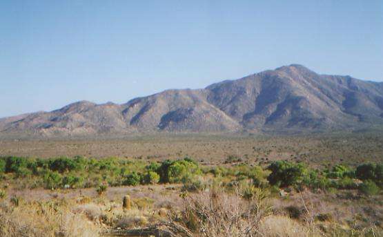
It was a sunny day with a cool wind. We met another PCT hiker named Peter Haskell. He is from Houston and has Parkinsons. It makes trail life very difficult for him since everything takes such a long time with his limited mobility. Just packing up in the morning takes him hours. He's hiking seven or eight miles a day, right now. I admire his grit, though I doubt he’ll finish the trail. Still, he started it, and that’s what counts. Most people would just say, "I can't."
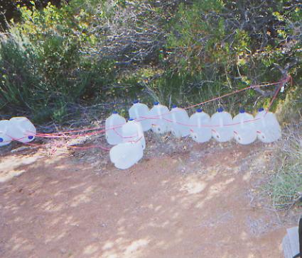
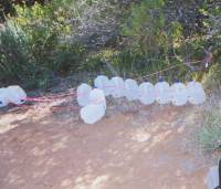
As we walk, we have a nice view northward toward snowy San Jacinto and San Gorgonio peaks. We can see where we’ll be hiking for the next two weeks, more or less. We saw a black and white striped snake this morning. I'm a bit paranoid about rattlesnakes in the brush. Peter saw one on his first day. We passed a water cache with about 40 plastic jugs. In many parts of the trail in southern California where water is a problem, concerned trail angels put out water for the hikers. Most people welcome the water, though a few prefer the challenge of carrying large amounts of water through the dry sections. I dislike carrying water for 20 or 30 miles, (it’s heavy!) so we welcome the caches when we find them. Unfortunately, you never know for sure where they'll be, or if the water jugs will be full or empty when you get there. They're a bonus, but can't be counted on. We're hoping for one tomorrow in the infamous Scissors Crossing to Barrel Spring section. It's a hot and dry 24 miles between water sources. That's a long way, this early in the trail. Walking in the sun is getting to me. It's fairly cool in the shade, but there isn’t much shade.

The trail winds around the canyons through dense brush. There are lots of flowers: yuccas, Spanish bayonet, blue spring beauty, a red flowering tree, lilac and many more. I know only a few of the flowers, mostly those I saw in the Sonora Desert near Tucson. It's frustrating knowing so little.
We took a long lunch break in a shady grassy spot, which helped my mood a lot. I get hypnotized by the sun and the endless contours around the ridges. We're making progress, but slowly. I don't like walking on automatic pilot. Half an hour of food, water, and rest helped us keep going.
We stopped early for the night since there is a small stream about ¼ mile up the canyon and the next few miles will be more contouring around a mountain, so campsites are likely to be scarce for a while. The next water is 14 miles away, and that is sort of iffy — the infamous Scissors Crossing. The guidebook says it’s "contaminated by cattle", but considering what we drank on the CDT, I'm not worried. That's why we carry a filter.
We saw a lot of people today, but then, it was a Sunday. There was a lady on a horse, two others at a trailhead saddling up their horses, three on motorcycles at an overlook, and two men hiking together, one with a backpack and one without. Emily and Peter joined us at the campsite. We had a nice visit. She hiked the AT southbound two years ago. This year she only plans to hike for a couple of months before heading to Colorado to start a doctoral program in chemistry. Peter consults on organizational development. He said his wife totally opposes his desire to thruhike, though an article in the Houston Chronicle calling him "an inspiration" helped a little to reconcile her to his absence. He had done two and three week hikes in the past, but never anything this ambitious. I can't imagine trying to do a hike like this without the wholehearted support of my partner. It is hard enough as it is, with support.
Monday, April 24: @ 18.5 miles (82.5)
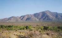
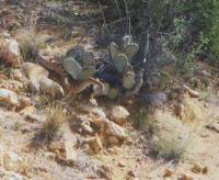
It has been a hot day, winding through desert and chaparral. There are lots and lots of wildflowers. One burned hillside was covered with purple phacelia and other flowers. Prickly pear and hedgehog cactus sport bright pink blooms. Agaves raise white candle-like spires. Brittlebush and globemallow, paintbrush and lupine, thistles and white poppies create a rainbow trail. Because of the heat, we took a long two-hour lunch break, then went on to Scissors Crossing. San Felipe Creek flows through the valley and is lined with tall willows and cottonwood trees. It is nice in the shade.
We met some more thru-hikers there: Steve from Lexington, Kentucky, and Garey (aka Terminal Man) from Santa Rosa, who has terminal cancer. He was told in 1997 that he had one year to live. In 1999 his wife told him to go do the PCT, since it was a long-time dream of his. He still has the cancer, but would rather be out here than undergoing more chemo that can only slow, but not stop, the spread. He really seems to be enjoying himself anyway. His nephew and a friend (Jonathan and Ryan) are hiking with him. They walked several miles down the road to a little store to pick up beer and water, then collapsed in the shade. Like us, they were all waiting for the day to cool off before continuing up into the hills.
The trail crosses the shallow creek, then switchbacks up a mountain, contouring for several miles along the canyons of the San Felipe Hills. It is very hot and exposed, so we decided to cook dinner in the shade of the cottonwoods, then head up the hill in the "cool" of the evening. We hiked until 7:30, then found a tiny ledge below the trail to lay out our sleeping bags. On the climb, we saw more blooming cactus: barrel cactus and ocotillo. It was nice walking, but slow. There was little sense of making any real progress.
Tuesday, April 25: Barrel Spring -- @ 19.5 miles (101.9)
We had another long lunch in the shade, stopping early since we were totally beat. Walking in the sun gets really debilitating. I end up feeling a little dizzy after a while. Either that or I get in zombie mode. I'm not sure whether we count as mad dogs or Englishmen out in the noonday sun. We woke early, but not early enough to escape the heat for more than a couple of hours. By 10:00 it was at least in the mid-eighties. We found a water cache put out by the Sierra Club that gave us a chance to take a break and drink up. It was still 11 miles from there to the next spring, but we had enough water, especially with our long midday break. We've climbed above the cactus, for the most part. I enjoyed seeing all the blossoms. Chaparral is different. We napped in the meager shade of a bush and read for about two hours, then walked an hour, then rested another hour, then finished the last five miles to a nice campsite near Barrel Spring. It’s a piped spring in a grove of oak trees, very peaceful. There are a couple of turkeys rustling in the brush, not afraid of us at all. A hummingbird hovers over us, checking us out.
Another PCT hiker, Greg, showed up with a wild tale of being stalked in the dark last night at Chariot Canyon. He abandoned some gear when he ran through the brush to a line cabin nearby. He said that the bad guys tried all night to get into the cabin. At dawn he was able to escape and find a sheriff, who went looking for the people who stalked him, then drove Greg up the road to this campsite. The odd part (to me) was that there were no obvious scratches on him, despite playing cat and mouse in heavy chaparral in the dark. He’s an ex-marine; maybe he’s just tougher skinned than I am
As we hiked today, we saw a naked man walking up the trail. (He did carry a sarong over his shoulders, which he put on when he saw us.) Earlier we met two day-hikers who were doing a 20 mile round trip to add water to the water cache. Trail angels! In some ways the San Felipe Hills weren't as bad as expected. Definitely hot and dry, but doable, even if the water cache hadn’t been there. I’m glad it was though.
Wednesday, April 26: Lost Valley Spring — 19.6 + 1.5 miles (120.5)
We had a nice walk into the village of Warner Springs across open grassy meadows, covered in golden poppies and cows, then along the Canada Verde, a small stream lined with huge oak trees. Warner Springs is a small resort town, where we picked up our mail (first food drop), made a couple of phone calls, ate lunch at the Golf Club Grill, and drank a gallon of Gatorade We finally walked out of town two hours and $40 later. We met two more thruhikers, Guy and Kerstan, as well as Emily again. They were all missing their food drops, though their drift boxes, containing essential but non-edible resupply items, were there. The mini-mart at the gas station was pretty limited for resupply, and the hiker box was empty, so they had to make do with rice and cookies. The woman at the post office said there had been several other boxes missing already, and it is still early in the season.
We walked along the highway through town, then climbed up a pretty creek for a couple of miles, with nice views of a mountain (Hot Springs Mountain?) above the cottonwoods. There is a big fire burning to the north. It was weird. We were sitting eating lunch when I looked out the window over Jim’s shoulder and saw a huge black cloud of smoke, just north of town. Oh oh. At the gas station we were told that it is a "controlled" burn of 500 acres. It looks bigger than that.
We had a good climb from town to our campsite ten miles away. We stopped for a brief dip in Aqua Caliente Creek. We kept crossing it, and finally it was just too inviting to pass up. There were some nice campsites down near the water, but this next section has water located at odd distances, so we wanted to cover more miles today to set the section up right. It was an enjoyable walk all day, through meadows, over streams, with lots of new flowers, ribbonwood (like a hairy manzanita), and good trail. Nicest was discovering that the spring at Lost Valley Spring was flowing, though the guidebook says that it may be dry. Smoke from the fire created a lovely orange sunset. Life is good.
Thursday, April 27: Tule Spring — 17.8 + .85 (138.3)
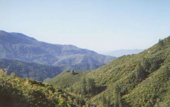
Watching the fires burning only a mile or two away was a bit eerie last night. Fortunately, they didn’t come our way, though we were prepared to run for it if necessary. Our trail this morning climbed gently through manzanita, chaparral and occasional pines. We met one hiker with two dogs who was camped on Bucksnort Mountain for a couple of days. He was a farmer from Anza whose son hiked the PCT in 1998. We had lunch with him in the shade of a pine tree atop a gap, looking out at the hills below. There are beautiful mountains in several directions, looking green or purple depending on how far away they are. It was hot and breezy. I got water at a ranch about 1/3 of a mile off trail. The present owners are friendly to hikers, but since the place is for sale, I wonder if the next owners will still allow hikers to get water from the water tank?
I miss the wildlife we saw on the CDT. We hear owls and coyotes, see squirrels, lizards and snakes, plus an occasional hawk or woodpecker, but that’s about it. The brush is so dense, everything else remains hidden. We have seen a few red velvet ants. I wonder why they are always alone? You don’t see a line of them, just one soft red fuzzy creature at a time. Occasionally there is a white velvet ant — also alone. Odd.
We were more than ready to stop early tonight. A long rocky descent made our feet and knees scream. The best part of the day was washing up out of the water bag. The campsite at Tule Spring is a bit of a disappointment. I had expected a nice site amidst cool cottonwoods and sycamores, but the creek is narrow and the area was badly burned. There is water though, from a big concrete tank used by the fire crews. It’ll do. Jim and I are both really dehydrated. We’re carrying enough water, but not drinking it. It shows in our pace and our attitude, especially at the end of the day.
Friday, April 28: Penrod Canyon — 19.1 + 2.25=21.3 (157.4 total)
It was a windy, cool day, winding through the hills above the Terwiliger Valley amid desert flowers and cactus. We saw our first rattlesnake. It was perched on a ledge beside the trail. We scared it off its ledge, but then couldn’t get it off the trail, so we had to detour around it. The snake was nervous, with its head up and rattles shaking, but not mad enough to coil or strike. Last night a couple of bats played with us for about 20 minutes, darting in and around and between the two of us. It was a strange game.
Clouds are moving in, but, according to a printed-out forecast left on the trail next to a water stash, no rain is expected for the next week. I enjoyed all the flowers: yellow poppies, bushes covered with a yellow sunflower-type flower, agave, prickly pear, lupine, manzanita, paintbrush, etc. We passed through some huge reddish boulders — interesting.
Later: Our water source this afternoon was a café a mile off the trail, on the Palms to Pines Highway. Since the next water is either 8 or 18 miles ahead, and the last water was 15 miles back, it was no hardship to make the detour, especially since the Paradise Café treated us extremely well, with huge burgers, as much coke as we could swallow, and pie fresh out of the oven. Walking out of there with a gallon of water in our packs was not nearly as much fun, especially since we climbed from the highway up into pines amid big rounded colorful boulders. The granite rocks of the San Jacinto Mountains are a foretaste of the Sierras. It is pretty though.
Saturday, April 29: Gap on San Jacinto Crest - 14 or 15 miles (@172.4)
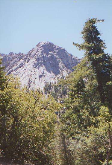
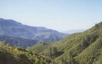
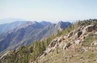
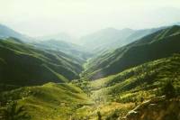
We woke up to frost inside the tent, and had a cool couple of miles to start the day. The wind was really whipping! We climbed most of the morning, passing over and around several small rocky peaks. The trail followed the ridgeline for a couple of miles, which was a nice change. We rarely get up on the crest, usually we contour along the side of the ridges instead. We dropped down to a pass, then climbed all afternoon into the mountains above the town of Idyllwild. The San Jacintos are a rugged range, burned in places, with fir, oak and pine in others, and some really steep sections of trail. It feels like real hiking, not wheelchair trail. I like it!
We woke to the sound of a hummingbird, checking us out. We have seen several over the past few days, not just your usual ruby-throated varieties. I’ve also enjoyed the variations among the horned toads. Some are only an inch long; others are 4 or 5 inches. Some are sandy or red or red and black. The lizards are less colorful, but more frequent. We see them constantly.
We met another PCT thruhiker, Mark Bingham from England. We met another Marc yesterday on our way to the café. He told us he had managed to eat both breakfast and lunch there. Marc is a musician from New Hampshire who hiked the AT over three years, using the trail name HairBear. He doesn’t plan to do the whole PCT this year as he has to be home in August, but he hopes to finish California. Meeting so many other long distance hikers is odd, after seeing so few last year. In the past nine days, we’ve met 11. In six months on the CDT last year we only met a total of 9 long distance hikers on the trail, including section hikers. This isn’t exactly a wilderness experience. I miss having the trail to ourselves, but then, we didn’t expect it out here. So far we’ve only met hikers in passing, so there is no sense of community. Maybe in a few hundred miles it will develop, when we actually get to talk to people for more than just a few minutes. We’ll see. On the Appalachian Trail, the shelter system and frequent hostels in towns along the trail kept people together. On the CDT, we felt the sense of community, though we never saw anyone for more than a few hours, simply because there were so few of us. Out here it is different. We may meet people in town or briefly on the trail, but our paces are all so different, we never manage to hike with anyone for long.
Later: So saying, we ended up camped with both Mark and Marc a couple of miles past Apache Spring. While Jim went for water, I watched our gear, visiting with a dayhiker and then both Marks while they rested after fetching water at Apache Spring. That was a long steep descent to water! After climbing back up to the trail with two gallons of water, Jim had had it. We kept going another mile or so, but stopped at a little gap that is likely to be the last campsite for a long way. The trail is rocky and narrow, dynamited into a steep cliff face. We saw our first snow, on the shady side of Eagle Peak. Stopping early gave us a chance to dry out our gear after the dewy evening last night. Unfortunately, our campsite was at a junction with a side trail, much used by dayhikers. A group of kids came up and then turned around while we were cooking dinner.
Sunday, April 30: Idyllwild — 7.6 + 2.5 miles (180)
We made it into town fairly easily. The morning hike had some surprises though. There was a long climb back and forth across the ridge with beautiful views of the peaks all around, then a gentle descent, with a fair amount of snow on the trail. Patches only, but a few were pretty steep and icy. We lost the trail for a while, following the wrong set of footprints, but found it again ¼ mile later. I spotted a couple of day-hikers on a ridge high above us, and sure enough, they were climbing Taquiz Peak. The trail ran just below it. We took a side trail to town that was long and steep but packed with day hikers, runners, and weekend backpackers. We got a ride the last two miles into town, headed for the nearest pizza place, and called Bob at the Taquiz Motel. He came to pick us up after a short stop at the grocery. The motel rooms have full kitchens, so I bought some hamburger to cook later, as well as beer, coke, juice, and fruit. Idyllwild is pretty touristy and looks expensive, but should be a nice day and a half stop.

I feel utterly exhausted, though it wasn’t that long or hard a hike today. There is a beautiful rock cliff above town — very Yosemiteish. I dread the climb back up though. The motel owner, Bob, has offered to drive us back to the trailhead. He is extremely nice, offering hiker discounts, shampoo, laundry soap, use of his computer, etc.
This morning was the first day I felt my usual hiker high. There have been a lot of things I’ve enjoyed — particularly the flowers — but mostly my pleasure has been very low key. I get a little aggravated at the roundabout nature of the trail, the endless gentle switchbacks and sidehill winding in and out of dry gullies, but not enough to matter. Yet somehow I haven’t really caught fire yet. I try not to make constant comparisons to the CDT, but today was one of the first days I didn’t think, "The CDT is better." As hard as the past two days have been (and they were), they were real hiking, not a gentle stroll along a wheelchair path. I really enjoyed it.
Monday, May 1: Rest Day in Idyllwild
For once, our rest day really has been a rest day. After a leisurely breakfast, we visited the outdoor store, hardware store, post office and grocery, then came back to our room to check e-mail on the motel’s computer, ate lunch, took a bath and read the afternoon away. I keep wondering what we have forgotten; usually town visits are much more hurried and harried. I’ll cook dinner in a while. In the meantime, my book awaits.
There are lots of thruhikers in town, though the only ones we know are Guy and Kerstan, Garey and the two Marks. Garey is getting off the trail. He passed out twice, and decided that it was time to go home. He is happy with what he did, though he didn’t go as far as he hoped. He told me, “You don’t know how lucky you are.” He’s right. We’re here, in this wonderful trail world. There are so many other realities we could be dealing with. Instead, we have the health, the money, the time, and the desire to be thruhiking. It’s not all luck — we made the choices that brought us here—but luck is a factor. My sprained ankle could have been worse and forced us off the trail. If not for the healthy stock market the past two years, we wouldn’t have had the money to be out there again. We could have family or health issues that keep us from hiking. Yes, we know we’re lucky, though we forget it sometimes.
We said hello to Adam, another PCT hiker, at the restaurant this morning, and met two guys with dogs. Most of the hikers are camped at the State Park across from the motel. This has been a nice stop. The town is small enough to navigate easily. At the same time, the motel is far enough out that we go out only when necessary. We’re saving a bit of money by cooking in the kitchen of the motel room, spending only for breakfast, our favorite meal. I’ll be ready to go back out on the trail tomorrow, but it has been a nice stop.
Home | Links| Trail Journals |
The Thruhiking Papers | Bun-bunSouthern California | Central California
Northern California | Oregon | Washington
Created: Fri, 16 Jan 2004
Revised: 30 Sept 2016Copyright © 2004-2017 Spirit Eagle