|
|
|
 |
 |
 |
 |
|
|
|
|
|
|
|
|
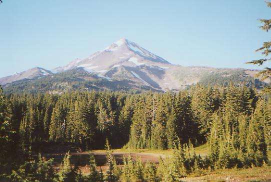
The Pacific Crest Trail
Ashland to Olallie Lake
Friday, August 4: Ashland and Callahans — Day off @ 4 miles in town
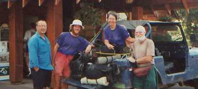
We didn’t sleep much Wednesday night—it was just too hot. Thursday morning, after breakfast, we got a ride into town with the restaurant manager. We decided to stay in town on Thursday, instead of at Callahans, because we had a lot of errands to do, from picking up our mail, to grocery shopping for the next three weeks, to packing up the boxes for Oregon, to getting e-mail at the library, visiting a couple of outdoor stores, getting Jim a haircut, and checking out a used bookstore. At the grocery, we ran into our friend Greg--known as Weathercarrot (or WC)--and his hiking partner, Laura. They started a week after we did, and have been trying to catch us for a while. They’re staying at the hostel, which is a lot cheaper than the motel. We decided to stay at a motel instead since you can’t be at the hostel during the day, and we need to be able to sort and pack our boxes this afternoon.
We won’t be stopping in any other real towns in Oregon. The trail passes near some small camping resorts, but we have heard that supplies there are limited and very expensive, so we’re doing most of our shopping here, and shipping boxes ahead. We’ll do the same in Washington. Shopping for three weeks is not easy, especially since you have to guess so much at serving sizes. A box of cereal that “serves 11” may last the two of us two days, or even three, but never five. We decided to do a lot of small boxes, instead of fewer but bigger maildrops. There are places that accept mail every 50 to 100 miles. We would rather stop more often and carry a lighter load. We spent half an hour in the Safeway parking lot stripping the packaging off our purchases; we would never have gotten it all back to the motel otherwise. Packing it up took most of the afternoon, then we had a late dinner with Greg and Laura. We took off early this morning, hiring a taxi to take us and all our boxes to the Post Office. Unfortunately, they weren’t open, so Jim guarded our goodies while I searched out breakfast. Coffee and donuts to the rescue. One of the boxes had to be sent UPS, which turned out to be more of a problem than expected. We hoped to find a business in town that would ship our box with their stuff, but the outdoor and book stores were either still closed, or unable to help. We found a shipper a couple of miles away, so we went back to the motel to pick up our heavy packs, then took a bus out to the university to get rid of the last box. We had an expensive Mexican lunch there and finally called Callahans to ask if anyone could pick us up and take us back out to the hotel. There was a bit of a wait, but eventually Donna found us and took us back to the inn. We barely made it, as the car overheated on the freeway, but we finally limped home.
Ashland wasn’t really a good stop for us. It was hot (95 degrees), crowded, expensive, and too busy. We thought about going to one of the plays — Ashland is known for its annual Shakespeare Festival — but tickets were expensive, so we didn’t even try. Best was taking Friday afternoon off at Callahans, followed by dinner with WC and Jim, a southbound section hiker who has done the CDT and part of the Canadian Divide. He was interesting.
Saturday, August 5: Hyatt Lake — 23.6 (1745.1)
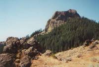
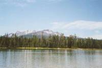
We slept better last night. It was still hot, but the noise from the air conditioner outside bothered us less. I was exhausted. We had a good breakfast, then Ron loaded us all in his jeep to take us out to the trail. It was hot, but breezy. There is a big fire south of here, sending up a tall plume of brown smoke. The highlight of the day was passing by Pilot Knob, a big lava plug once used as a major landmark for pioneers on the Oregon Trail. The rest was a nice woods walk with occasional views. The trees are covered with three or four kinds of moss. We saw two deer at the trailhead (one a young buck) and a couple of groups of grouse, including two that were almost tame. It is nice country, fairly open with small oak trees and dry yellow grass. It feels like summer’s end. We ate some good thimbleberries along the way.
Weathercarrot hiked with us today, and we all met up with Laura a little way before Hyatt Lake. She wanted another day off, so stayed at the hostel in town while he camped at Callahans last night. On the road near Little Hyatt Reservoir, we ran into a mother and two kids on ATVs and another on a motorized go-cart.
We stopped at the campground at Hyatt Lake. There is supposed to be a PCT hiker site, but we never found it. Instead we just took one of the walk-in sites near the lake. It’s a nice place. There are only two families camped nearby. It is a very civilized campground, with hot water in the bathrooms, a shower nearby, a playground, volleyball and basketball nets. My legs have a rash from the grasses, but it doesn’t itch. The lake is warm and swimmable, with a sandy bottom, but it is too public to swim naked, and I don’t really want to get my clothes wet as it’s not really hot enough for them to dry before morning. There are times it would be nice to have a swim suit. I just waded in and washed up a bit. It sprinkled for a few minutes as we cooked dinner, but not enough to get wet. Just at dark, it began to rain again, but gently. I love the pitter patter of rain on the tent.

Sunday, August 6 — Brown Mountain -- 23.4 miles (1768.5)
It was a quiet day, for the most part. Last night’s rain didn’t last long, so the tent was dry when we got up. The climbs were gentle, mostly in forest, with occasional open yellow grassy meadows. A lot of the forest had been cut--some areas very recently--but there were also long cool stretches of shady woods. In the afternoon, we ran into patches of huckleberries. Only a few were ripe, but there were enough to be interesting. There were few views, though we did see Shasta off in the distance and a few glimpses of Hyatt and Howard Prairie Lakes. The day was mostly dry. We crossed a canal and small creek that the guidebook said weren’t reliable, so we carried enough water to walk the 20 miles to Brown Mountain Shelter. It’s a real shelter, almost AT style, though with no floor and a big stove in the center. It was built for cross-country skiers, but they also put in a pump outside with good cold water, so summer hikers stop there too. I was hot and filthy, so the water felt wonderful when I washed up. The day was hot and sunny, so we took our time, with lots of breaks to eat, drink, and rest Jim’s foot. Greg and Laura met us at the shelter. They left before we did this morning, so we never saw them all day. We cooked dinner and visited with them for a couple of hours, then walked another hour or so until we found a brush-free lava-free spot to set up our tent.
Just before we did, we met our first true southbound PCT hikers, known as the Puppy Chow Crew. They started in Canada on June 18. When we met them, they had just seen three big owls, one of which swooped down on their dog. We talked for a while, then moved on as darkness was descending.
Monday, August 7 — 24 miles (1792.5)
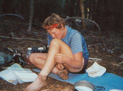
As we ate breakfast, one of the owls perched on a nearby tree to check us out. We watched each other for a while, then it flew away. The morning hike around Brown Mountain crossed numerous lava flows. The trailwork there was incredible. They took the rocks and made walls, then filled in the walls with dirt and small red rocks to make a smooth trail. It was a huge project. Greg and Laura joined us while I was fixing a blister. Our new boots were a disaster. Both sets started to fall apart within a week. Jim sent his back and got a new pair of Lowas, but I kept mine until Kahley sends me the Raichles I left with her.
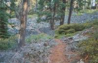
Generally the day was very easy and totally uninspiring. We are in the Sky Lakes Wilderness, but the trail goes nowhere near any lakes. There are alternate routes that we considered trying, but it is simpler to stick with the PCT. The Sky Lakes Alternate Trail would have been a good one if we could have reached the lakes in the afternoon or evening, but our timing is off so we wouldn’t reach them until morning. We rarely swim in the morning, or take time to sit beside a lake and watch the fish jump and sunlight sparkle on the water except at noon or at the end of the day, so it’s not worth the extra time. We got one very brief glimpse of a lake far below us at one point. It was frustrating. Instead of visiting pretty lakes, we just wind through hemlock and lodgepole forest on nearly flat trail. It’s quick, but boring.
Tuesday, August 8: Stuart Falls — 25.5 miles (@1818.0)
We had a nice morning walk, with occasional views back toward Mt. McLaughlin and Shasta and north toward Mt. Thielson and Crater Lake. You can’t see the lake, but you can see the ridges around it. I had a nice chat with Laura as we walked, learning a little about her life. She has had an interesting one, for someone so young.
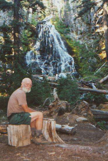
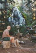
The rest of the day’s hike was in the woods with no views, but we ended up on a side trail near a very nice waterfall. The water was very cold, but we were able to get cleaned up before starting dinner. Halleluia! This side route is the only good water for a long way, plus the waterfall is worth a visit, so it is crowded. That hasn’t happened to us much. There is another group camped here, a Boy Scout Explorer Post from Corvallis, Oregon and one lone PCT section hiker, plus WC and Laura. Downstream we met a three-person trail crew, out to repair a bridge. We also met two more southbound PCT hikers, Bob and Christy. They started at Manning Park the same day as the Puppy Chow Crew.
Wednesday, August 9: Crater Lake —13.8+.6 miles (1831.8)
The Scouts settled down early, fortunately, so we slept well, despite the crowd. We set off about 7:15 and reached Mazama Campground, part of Crater Lake National Park, about 10:30. We took wonderful hot showers, did laundry, picked up our mail drop at the store, and bought a few things to fill in the cracks, then started out for the lake.
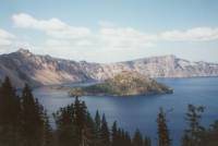
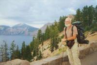
It was a good climb up to the rim, but a pretty one, with open forest, flowery meadows, and several springs and streams along the five-mile climb. The lake was beautiful, big, and blue, surrounded by steep jagged cliffs, with Wizard Island--a small volcano--off to one side in the water. We walked along the rim as far as the lodge, then came back to eat at the AYCE buffet. The salad bar was wonderful, but we ate too much, of course. We took off about 7:00 p.m., walking along the rim, admiring the water, the clouds, the rain (just sprinkles) and, eventually, the sunset (not over the water, unfortunately, but it was still pretty.) Jim and I sat on the edge of the ridge and watched the rich red and purple glow behind distant Mt. Thielson. A small hawk flew below us. Earlier we saw two does with their fawns in a grassy meadow. It was very peaceful and beautiful, quite a contrast to the crowds along the rim.
We were part of the tourist attraction at the lake: a lot of people asked us questions and were excited about our trek, especially a group of kids from a camp, though, as usual, it was the leaders who were most interested. As experienced hikers, they had a better idea of what is involved in a six month hike. One of the kids said, “I could never leave my computer that long!” We laughed and answered, “You’d be surprised how easy that was for us.” We also met a few new thruhikers at the buffet: Woog, Bullfrog, and Kubiak.
Thursday, August 10: Thielson Creek — 23.9 miles (1855.7)
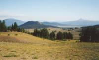
We got an early start today, while the dawn was still painting the sky. The sunlight on the lake was blinding, until some clouds dropped down and covered us in a cool fog. Yesterday was much cooler too. We circled the Watchman, a peak with a firetower high above the trail, and Hillman, a jagged volcanic peak, before passing pretty Red Cone. Then we left Crater Lake and entered the forest again. It is very dry and open, with mostly lodgepole and hemlock. Talking to Laura made the day pass quickly. There were clouds all around, threatening rain most of the afternoon. It sprinkled a couple of times, and hailed on us once. Mt. Thielson was very beautiful and dramatic, pointing up to the sky. It is known as the “Lightning Rod of the Cascades”—not a good place to be during a thunderstorm. We crossed its ridge just before it began to rain again. For once, I was glad the PCT didn’t go near the summit. We camped near the base of the peak, at a stream that is the first water source since the lodge at Crater Lake, 25 miles back. There’s a reason they call parts of this area “the Oregon Desert.” There may be trees, but it is dry.
Friday, August 11: Oldenburg Lake Trailhead — 23.1 miles (1878.8)
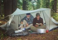
It rained for about an hour just as we finished cooking dinner, so we threw everything into the tent and followed with the pot of pasta. We had planned to keep going, but decided that with the uncertain weather, we would do better to stop early. Instead, we enjoyed a long quiet evening, reading in the tent.
This morning was clear and cold. We kept our jackets on for the first hour or so, and saw frosty patches on the grass. Most of the morning hike was easy walking through hemlock forest. We saw one deer.
Greg is sick, with a high fever, no appetite or energy, and has to make constant stops to dig a hole. He doesn’t filter his water, so it isn’t surprising that eventually something got him. We’re selective on what we filter, and a lot looser about it than we were on the CDT, but we’ve been lucky so far. Of course, it could have been the AYCE buffet at Crater Lake. It wouldn’t be so bad except he’s meeting a friend from Eugene tomorrow afternoon and is worried about not making it to the highway in time. We decided to slow down and wait to make sure he’s all right. We took a long mid-afternoon break at Tolo Spring, waiting for him and Laura to show up, then picked up enough water to dry camp somewhere before Nip and Tuck Lakes. Greg’s fever returned, so we stopped near the trailhead to Oldenburg Lake. There’s nothing we can do for him, but we didn’t want to leave him behind, even though Laura was with him.
Otherwise the day was rather unexciting. We met two women on horseback, heading for Maidu Lake, and a section hiker doing all of Oregon. There was a brief view of big sparkling Miller Lake, and a couple of glimpses of tree-covered peaks nearby. The best view was this morning, near Tipsoo Peak. There were grey and black ridges to our right and a big red one to our left. Although I was also feeling a bit off color, it was a nice easy stroll through pretty woods along a long ridge — very pleasant and relaxed. It stayed cool all day, but never rained. I had been looking forward to a dip in Nip and Tuck Lake, but the cool weather made it easier to not feel bad about not making it that far.
Saturday, August 12: Lower Rosary Lake — 25.4 miles (1910.9)
It was a cool and cloudy day, mostly light cirrus. Greg felt a little better, but was still having problems with his stomach bug. Fortunately, the walking was fast and easy to Crescent Lake, where we stopped for an early (11:00) lunch at the horse campground. We took an alternate route that takes us directly to Shelter Cove Resort where we have our next maildrop.
We passed several small lakes, but only actually saw three of them since the others were off trail a bit. We’re back in dry lodgepole forest, flat and easy. The horse campground is evidently quite popular; there are a lot of full sites. I still find it strange to see a campground with individual corrals at each site, but horseback riding seems to be very popular in Oregon.
We wandered through green mossy hemlock forest along a cascading stream for a couple of miles. It was cool and pretty. We split off from Greg and Laura, who are heading for the town of Eugene for a couple of days with friends. Jim and I headed for the campground and marina at Shelter Cove. They had our UPSed mail-drop and a limited selection of junk food, so we munched on a hot dog, muffin, beer, coke and ice cream bar before heading back to the trail.
As we climbed the hill on the other side of the highway, an owl flew into a tree beside us. It had a downy head and was curious, but not scared of us. In the small things we feel the greatest joy. That makes two owls this week; how odd. It’s like our bears: we’ve only seen two the entire trip, and they were both in the same week. Because we were slow today, between waiting for Greg and the long break at Shelter Cove, it was almost dark when we arrived at Rosary Lake. We hurried to set up the tent and wash up. I was really happy to get clean again. It’s been three days since our shower at Crater Lake, and with the dry-camping we’ve done, there has been no chance to get clean at night. Dinner will be eaten in the dark — unusual for us. I don’t like to set up in the dark, so we rarely do.
This is a medium-sized lake, which we seem to have to ourselves. Odell Lake, where Shelter Cove is located, is a really big one, with motorboats, houses, and a couple of campgrounds. Earlier this afternoon we spent a few minutes at Diamond View Lake, a small one with a good view of still snowy Diamond Peak. It was pretty. We saw several hikers, backpackers, and horsepeople, plus Dave, the section hiker we first saw at Stuart Falls. There were no other thruhikers though. We must be back in a hole. The guys we met at Crater Lake haven’t caught up yet, though I’m sure they will. The trail is so easy in Oregon, a lot of hikers regularly churn out 30 mile days. We don’t see any need to, since we’re in no hurry to finish. We like it out here, so why rush? Besides, there’s a Long-Distance Hiker Gathering in Government Camp, Oregon at the end of September that we plan to attend. If we finish too early, what do we do with ourselves while waiting for the Gathering?
Sunday, August 13: Brahma Lake — 22.6 miles (1933.5)

We slept well and long on our ridge above the lake. We didn’t get up until 7:00, feeling no need to hurry the day. It is cool and breezy, an autumnal day, like Pennsylvania in mid-September. We passed the three Rosary Lakes and Rosary Peak (looking somewhat like a fist), then had only one other view all day, looking back at all the lakes of the past few days. The rest of the day we were in hemlock and lodgepole forest. Mid-afternoon we began passing the first of a series of lakes and ponds. Some are large blue and green lakes, most are small shallow brown ones. Lots of mosquitos come along with the water, but it makes a nice change. The guidebook describes this section, saying,“the first third is flat, viewless and dry, the second third is viewless with lakes, the last third is scenic.” About four miles along the PCT was burned — dry, dusty and depressing. There were lots of pink fireweed flowers and some tiny berries (wild cranberries) which were tasty, but I hate burned forest.
We stopped early (5:30) at Brahma Lake to cook dinner, swim, and rest. I really enjoyed the swim, especially with the sun still shining to warm me up afterwards. The water was fairly shallow, but deep enough to stand shoulder deep, at least. We had planned to move on after dinner, but we spent so much time reading in the sun, we decided it wasn’t worth the effort.
Monday, August 14: Koosah Mountain — 22.1 + 1.3 (1954.6)
We had another late start, thanks to a cool damp morning that made us prefer to snuggle deep into our sleeping bags. Mist rose from the lake, where warm water met cold air. The day’s hike wove in and out of gentle hills, winding from lake to pond to lake. In the sun, the waters sparkled. Lunch was eaten beside rocky Cliff Lake, next to a very decrepit wooden shelter — not one I’d care to use.
Late in the afternoon we dropped off trail to visit Elk Lake Resort, where we picked up food for the next 100 miles. They had a small café, where we ate a hamburger, salad, and ice cream. There was no shower, laundry or phone, and the camp store was outrageously expensive ($1 for a candy bar!) but it was worth the stop. We met Britt there, a southbound section hiker, as well as Slick 60, a northbound PCT thruhiker. We saw several groups again today--scouts, horseback riders, backpackers—it’s a busy little wilderness.
Oregon is interesting. It’s a wilderness experience in the sense that there are so few real amenities for hikers, just remote campground resorts with tiny stores, rather than real towns with laundries, motels and Internet access as we usually had in California, but at the same time, there are so many people out here, there is no sense of wilderness at all. The frequency of the resorts, and their willingness to accept mail-drops, means that our packs can be lighter, so they are worth a visit even without amenities. And given that the trail passes so close to them, it would be silly to just pass them by completely. After so many miles, any junk food looks good. I just wish there were more showers. Despite all the backpacking I’ve done, I still hate being so dirty and smelly. An occasional lake clean up isn’t the same as a hot shower. Knowing that it will be 11 days or so until our next shower doesn’t help, especially when we’re being drilled by hundreds of mosquitos every day. They’re iniquitous and ubiquitous and seemingly invincible. As many as we kill, there are always more.
It turns out Greg’s case of “Mazama’s revenge” wasn’t an isolated one. At least four other hikers got sick soon after Crater Lake. I wonder if it was the all you can eat buffet or the water at Thielson Creek? I'm glad Jim insisted we filter there.
Tuesday, August 15: Minnie Scott Spring — 22.2 miles (1976.8)
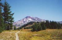
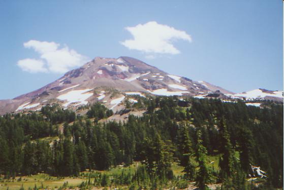
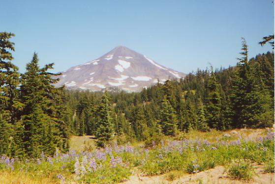
We have finally begun the scenic third of the Three Sisters Wilderness — the part with the Three Sisters. They are three big volcanoes surrounded by several smaller ones, and quite beautiful with their glaciers and snowfields. We started the day with a 1200’ climb to a viewpoint on Koosah Mountain with a nice view of Broken Top and South Sister, then dropped to disappointing Sister Mirror Lake. It was windy, so there was no mirror, and no Sister. Then we wound around to open dry meadows with a good view of South Sister and its huge moraine. A falcon flew past us, probably looking for some of the marmots that live in the rocks there. Then we passed through a series of green flowery meadows. Some had streams and lots of yellow cinquefoil and pink monkey flowers; others were dryer and covered with blue lupine and yellow or orange paintbrush. While we spent a lot of time in the trees, there was also a lot more open country than usual—very pretty! We passed five horses grazing unattended in one of the meadows. Only the stallion was hobbled. We saw a group of eleven backpackers come up a side trail, and two small groups heading the other direction, then more and more hikers. The day’s total was 36 hikers and three dogs. One hiker was barefoot; another wore only Teva sandals. On the lava, that must have been really painful.
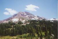
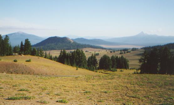
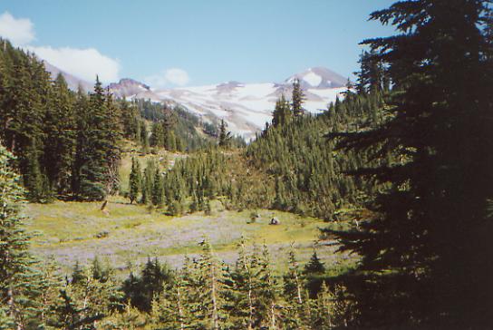
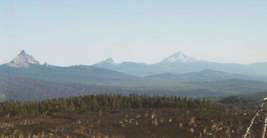
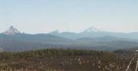
The afternoon hike went around Middle Sister and North Sister, past Little Brother and Collier Cone. The last part was through loose lava, basically scree sliding. Much of the lava was dark red and black. I love the colors of the volcanic rock, with the red, purple and grey ridges all around. Of course, walking on it can be a pain, as it’s often loose, sharp-edged and lumpy. We walked through an obsidian field with lots of shiny black rock and a pretty little waterfall. There were beautiful views up to the Sisters, over toward Husband Mountain, and north toward pointed Mt. Washington, Three-Fingered Jack and snow-covered hazy Mt. Jefferson and Mt. Hood. We’ll pass those in the next few days. There were also lots of wildflowers. It is a beautiful area.
Our campsite is on a ridge near the lava flows, above a small creek fed by snow-melt. The creek is too cold for a bath, though I’m hoping the water will warm up enough in the waterbag to allow a brief shower. We can glimpse Mt. Jefferson through the trees. We stopped early, tired from the heavy packs and lava walking. It may make tomorrow more difficult, but we had had enough. Three other PCT hikers set up not far away, just as it was getting dark: Slick 60, Bullfrog and Kubiak.
Wednesday, August 16: Pond past Big Lake — 22.8 miles (1999.6)


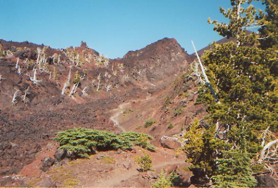
We started out early this morning, before the others had broken camp. Kubiak and Bullfrog passed us a few miles up the trail. It was cold and frosty, and they had been camped in the open next to the spring without a tent. I imagine they were pretty wet this morning. We saw five very cautious deer this morning as we ate breakfast. They tried to tiptoe past our campsite, but we spotted them in the draw below us. A large part of the morning hike was on rough lava—yech! It makes for slow painful walking. The views were terrific though, back to North and Middle Sister, and ahead to Belnap Crater, which we climbed partway, and farther ahead to Mount Washington and Jefferson. A few trees grow in the lava, but very few. I did find some ripe blueberries before we went out into the lava flow. Jim was sulking, angry at the way they routed the trail through the lava instead of around it and nowhere near the observatory, and walked right past the berry bushes, but I picked a couple of good handfuls.

After lunch we had a bit more lava, then climbed up and around jagged Mt. Washington. For a while it seemed that the ancient volcano was giving us the finger, but then we passed around to the friendlier west side. The spring at 18 miles, the first water of the day, was dry, so we took an unplanned side trip to a Seventh Day Adventist Youth Camp on Big Lake that is friendly to PCT hikers. Sure enough, they were very nice to us. We were able to take a quick shower before dinner, which we were invited to share. We had tofu stroganoff (better than it sounds), with salad and some ice cream that a nice counselor brought out especially for skinny Jim. They asked us to stay the night, but it was very noisy and hectic, with teenagers running all over the place, so we went on our way after filling up our water bottles. We camped near a small pond with a nice view of Mt. Washington, glowing pink in the evening sun.
The day was very mixed, emotionally. I started out happy and singing, grumbled a bit on the winding lava fields, cried a bit during a mid-afternoon break, and ended up happy again after the hot shower. Even though we’re doing relatively short days, I’m just plain tired. Mostly I was tired of being filthy, but I was also tired of endless miles with a too-heavy pack without a break. Ashland seems very far back, and that wasn’t a very restful stop. I hope Cascade Locks will be better. But that’s still 150 miles away. We may stop at Government Camp in 100 miles. I don’t like to spend the money, but we have the time. We’re a couple of days ahead of schedule right now. To be honest, I’m sick of hiking right now. It is a major effort to move on after a break. We’re doing a lot of late starts, because it is hard to get up in the morning and face another 23 miles. This section is pretty dry too, which doesn’t help. We carry a lot of water, but are always thirsty, afraid to use up our reserve. I want to see the land ahead of us — Washington is supposed to be beautiful — but oh, I am so tired of this trail! We won’t quit--we’re too close to finishing--but I think I’ll be very happy when it’s over. It’s still better than the “normal” world, but I am so tired of being tired all the time. I think Jim is ready to go back to hot showers and cold sodas too. I am scared of facing our very uncertain future, and generally a few hours in town have me anxious to return to the peace and beauty of the woods, but the long distance lifestyle is getting old right now. I would like to do something different, at least for a day or two.
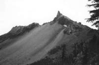
Thursday, August 17: Shale Lake — 24.6 miles (2024.2)
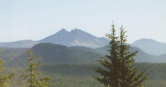
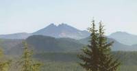
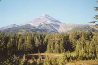
We woke up to a dew-soaked world: grass, tent, sleeping bags, socks, and of course, the clothes we rinsed out in the shower last night and spread out to dry. That’s the trouble with camping in the open near water. It was cold enough to be frosty, which really didn’t help when it came time to put on our half-frozen socks. The sun soon warmed us up, and a mile of ripe huckleberries lining the trail soon put the twinkle back in our eyes. We spent the morning climbing up and around Three Fingered Jack. It’s a dramatic volcanic peak, with multiple pinnacles thrusting up to the sky (not just three!) We crossed a couple of small snow patches, frozen hard despite the August sun. Early on we saw a buck and later on some horses being saddled. So far they haven’t caught up to us. The trail is too narrow and the mountain too steep for me to look forward to meeting them along the trail.
Lunch was by a pond, where we spread our gear out to dry in the sun. It was a busy place. A couple of women were there dipping out water samples; they said something about collecting invertebrates to see how introducing fish stocks into the pond has affected them. As we ate, a couple of groups passed by. We had fun watching some kids try to create a bridge to a rock out in the middle of the pond. They got quite wet. As we were leaving, our friend Sly showed up. He was way ahead of us for a while, but had taken a few days off along the way. We walked and talked with him all afternoon. Views were great all day. Though most of the hike was in the woods, we got frequent glimpses of snowy Mt. Jefferson to the north and all the peaks to the south, as well as several lakes well below the trail. We’re camped near a couple of ponds at the foot of Mt. Jefferson. It is quite cold and windy, but very pretty.
Friday, August 18: Olallie Campground — 23.6 miles (2047.8)
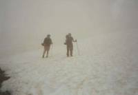
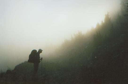
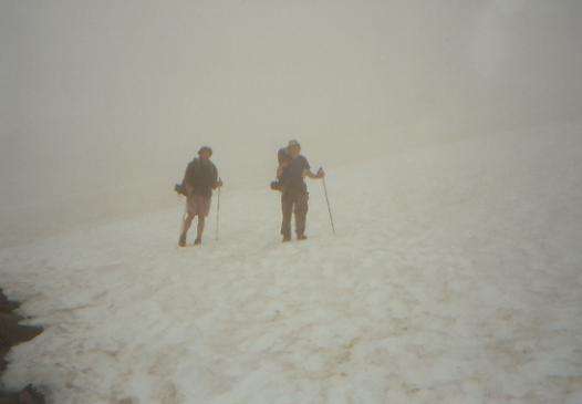
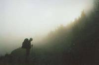
Morning mist rose from the lakes, veiling Mt. Jefferson. Off in the distance, a half dozen lenticular clouds piqued my interest. What did they signify? In our case, rain, though not until after lunch. Before that we did a lot of up and down around the mountain, crossing fast but shallow glacier-fed streams, passing though popular Jefferson Park with its many lakes and flowery meadows. We saw 29 people and six dogs today, most of them totally unprepared for wet weather. It was weird. You would think Oregon backpackers would be used to rain, but we saw hikers with no raingear or packcovers. Several had their sleeping bags totally unprotected on top of their packs. There will be a lot of unhappy campers tonight! We had dried our gear out at lunch, but as we climbed up into the clouds, it began to mist and then rain gently. We could see nothing but “the great white sheet”-- a wall of white cloud. We had to cross several large snow patches. There were times when we had no idea where we were supposed to go, because we couldn’t see the trail on the far side thanks to the mist and cloud. Still, the snowfields were mostly flat and not all that icy, so we crossed them safely, glissading occasionally. Then the rain began to get serious, and the day became a slog. We passed several side lakes, barely visible in the gloom. Five tents clustered at one large lake, but no people were visible.
Around 5:00 p.m., we reached the “resort” at Olallie Lake. There are a few decrepit cabins, a tiny store and a boat dock. The store was expensive, but we drank a very welcome cup of hot chocolate, picked up our latest mail drop, and left part of it behind in the hiker box since it’s only 2 ½ days until our next one and we’ve still got food left over from the last drop. It was cold and wet and miserable outside, so it was a bit reluctantly that we left the warm store and drove with Cheryl to the campground nearby where we set up the tent in the rain. There was a semi-dry spot under some trees where I could cook, and Cheryl collected wood for a fire, which kept us warm and dried out our pants a bit. It was our first fire in over two years. The fire made it possible to stay up a little longer than usual. Usually, we prefer to just go to bed when it’s cold, but I think after being alone all week, waiting for Sly to meet her, Cheryl was happy to have some company. The life of trail supporter can be pretty lonely.
Home | Links| Trail Journals |
The Thruhiking Papers | Bun-bunSouthern California | Central California
Northern California | Oregon | Washington
Created: 16 Jan 2004
Revised: 30 Sept 2016Copyright © 2000-2017 Spirit Eagle