|
|
|
 |
 |
 |
 |
|
|
|
|
|
|
|
|
The Pacific Crest Trail
Tuolumne Meadows to Tahoe
Wednesday, June 21 — near Miller Lake --17.2 miles (954.0)
We stayed with Guy at the campground last night. A couple of old friends, Sly and Cheryl, were up at the backpackers’ campground, but we saw Guy first, and he was alone, so we decided to keep him company. Sly and Cheryl were hiking the Appalachian Trail this spring, but got tired of the crowds and constant rain, and decided to come west. Sly hiked half the PCT last year, and hopes to finish it this year, if his money holds out. It was a fairly quiet night, despite the RV generators. The bear that has been running around the campground was quiet, so we had a peaceful night’s sleep. Cheryl told us about the wild night they had the night before, with rangers chasing the bear through the campground. We woke up early, then went for a quick breakfast at the grill, and got on the trail again a little after 9:00. Cheryl offered to pick us up at Sonora Pass in four days and drive us to town, so we will have to hurry through this section. Hopefully, snow won’t be the problem it was south of here.
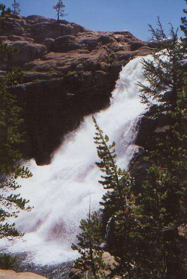
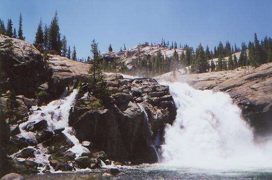
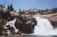
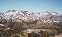
The morning hike was beautiful, with lots of views across the meadows and up to the smooth domes and peaks all around. Some were grey, some multi-colored. Cathedral Peak was snow-covered. We saw a couple of beautiful big waterfalls on the Tuolemne River, as well as placid sections of smooth blue water. This would be a nice area to explore in more depth, climbing some of the domes and investigating the downstream waterfalls. We had lunch at Glen Aulin Camp, not yet open for the season. There were lots of hikers and backpackers on the trail, including some new PCT hikers. Sly plans to hike this section and the next, then jump north to continue where he left off last year. Cheryl wants to hike off and on with him, but not here in Yosemite. An old AT friend of Sly’s, Dude, joined him for a couple of days, by accident I think. We met a couple of new ultra-light, super-fast PCT hikers — JB and Kimmo -- at the post office. They did 30+ mile days through the Sierras. Once they pass us, we’ll never see them again. They plan to do the next 75 miles in two days — definitely not my style. I wouldn’t if I could, couldn’t if I would.

Later: It was a quiet and peaceful afternoon. Once we left Glen Aulin, the only hikers we saw were Sly and Dude. We were in trees most of the time, with occasional small meadows and views up at polished rock cliffs or across toward the snowy peaks. There were only a few small snow patches on the trail, just enough to put water in the streamlets. There were big black clouds to the south of us, rumbling occasionally, but so far, we’ve stayed dry. As badly as I need a shower, I think I’m glad. We had a couple of interesting fords. One was high-thigh, the other was hip-deep. The guidebook warned that one could be dangerous, but I think we’re past the worst of the snowmelt. Thank God. One Bear Creek is enough — more than enough.
Thursday, June 22: Kerrick Canyon — 19 miles (-0.8) (@973.0)
We slept well on our rocky perch above Miller Lake, though paranoia about bears made for frequent brief wakings. This morning’s hike was very slow, with four fords and a lot more snow than we expected. It wasn’t deep, and it wasn’t enough to make route-finding difficult, but it was frequent and soft enough that we were post-holing a lot. We met a ranger who stopped us to ask for our permits and whether we were bear-bagging. We just told him we had rope to bear bag and knew how to counter-balance; we didn’t mention that most of the time we didn’t bother, especially when we were up in the snow at high elevation. Although there is always a risk, this early in the season there aren’t many bears up high. They’re more likely to be found in the valleys and meadows where there is more to eat. Later in the season is another matter. A lot of the other PCT hikers admitted that they sleep with their food instead of hanging it. I imagine it won’t be long before they require thruhikers to carry bear cannisters, despite their impracticality for a long hike. (They’re bulky, heavy, and only hold a few days’ food.) We tried asking about conditions ahead, but he only had general knowledge, not current. In fact, there were a lot of blow-downs just past the place where we met him.
It is a pretty area, quiet and remote—a nice change from crowded Tuolumne Meadows, Lyall Canyon and Glen Aulin. The trails are steep, rough, and rocky — not your usual National Park tourist paths. Because of the horses, there are places where they cobblestone the trail. It makes for very hard walking for humans, though it probably does keep the trail from eroding as fast. The afternoon was pretty rough. There was a steep descent to Benson Lake, followed by several complicated fords (one stream had five branches, including one that took 10 minutes of bushwhacking to reach a relatively shallow spot), a steep climb up to Seavy Pass, with its multiple gaps, then finally a very snowy descent to our campsite by the river. We have a waterfall opposite our campsite. It’s noisy, but pretty. We have to ford Kerrick Creek in the morning and it has a LOT of water. We met a woman out by herself who said she didn’t even try the crossing, she was so worried about getting swept away. We hiked until 7:30 and finally stopped, utterly exhausted, a mile or two before the creek crossing. It’s hard to tell how far we came. The snowy stretches slowed us down a lot. At one point, we were right above the river, traversing the steep narrow snow-covered trail. I was afraid that we would slide right into the water. Then I got worried that we would end up hiking through the snow in the dark.
Both of us got frustrated today at the slow difficult travel. The rocks and peaks and ponds are lovely, but we’re pushing to meet Cheryl at Sonora Pass, and we’re not sure we can make it in time, given the long steep climbs and snowy conditions. If we don’t meet her in time, we’ll go hungry. Also, while there’s water everywhere, there’s no time to swim in the icy waters, inviting as they are, and cleaning up at the end of the day becomes really difficult when the swarms of mosquitoes hover. DEET only lasts a few hours, then sweat and river crossings wash it out. I’m so tired of being filthy!
Friday, June 23: Cascade Creek — 21.8 (994.8)
It was a strenuous morning, with stiff climbs over two ridges and four stream crossings, including one that was a waterfall. Our first stream, in Kerrick Canyon, was about what we expected: waist deep, fast current, and bone-chillingly cold. That was painful! The other two were just shallow sandy wades, knee-high and thigh-high. The trail for the past two days has been heading west, cutting across the grain of the mountains, so we’ve had a lot of climbing from ridge to ridge, with deep valleys between. From here we finally head north again, for a while.
It has been pretty, with all the glacially polished granite, but it has been hard work. Fortunately, there was very little snow this morning, so that wasn’t a problem. That changed later in the day. After a fairly relaxed gradual climb through woods, meadows and bog, we reached Lake Dorothy and began the short climb over Dorothy Pass and out of Yosemite. The whole area was covered with snow, for about three miles. We ended up playing hide and seek with the trail, and usually the trail won. It twists and turns among the rocks so that even when it wasn’t covered with snow, the route wasn’t obvious. Eventually we would always find it, but then we’d lose it again. It was very frustrating. It didn’t help that it was raining at the time. All afternoon we watched the clouds build up to the north. Although they were black and menacing, there was only a little thunder and a couple of short icy showers where we were. Enough to get us wet, but not enough to get us clean. Right now, I’m sore, tired, and cold. My feet haven’t been dry all day, between river crossings, boggy meadows, wet trail, and snow. It was a long day.
We met several people today: two new fast PCT hikers (known as Huck and Gruven), a section hiking couple, chipping away at the PCT, one guy hiking the Tahoe-Yosemite Trail, and another couple doing a loop out of Hetch Hechy. We had met the PCT hikers before, at an outdoor store in Virginia before we went on the trail. We never expected to see them out here though, since they started three weeks after we did. But they walk fast — at least 4 mph! We tried to visit, but I couldn’t match their pace, and they wouldn’t slow down just to be sociable.
Saturday, June 24: Sonora Pass/Kennedy Meadows C.G. — 18.4 miles (1013.2)

Today the PCT actually lived up to its name--we’re walking along (or close to) the crest. That’s rare. The morning hike was easy, gentle up and down in the woods, past several small meadows, and over several small streams. Three were bridged, but two of the bridges were mostly broken. It was an interesting experience to cross them, especially the one that was lying on its side.
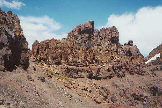
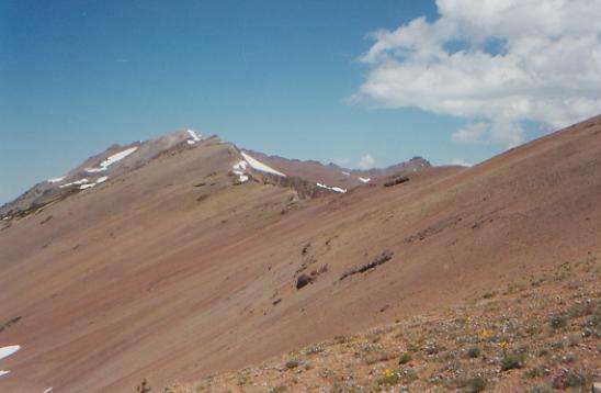
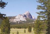
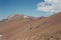
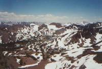
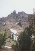
Finally we began to climb--about 2000’, up to 10,500’. There was still a fair amount of snow on the trail up to the ridge, but then the narrow trail follows the western, mostly snow-free side of the crest for quite a while. It is very beautiful, with views back toward the snowy peaks to the south and west, a turquoise lake nestled in an emerald green valley below, wildflowers, fluorescent orange and yellow lichen on the dark reddish-brown rocks, and blue sky with a scattering of black thunderclouds. The mountains here are different from the ones in Yosemite—volcanic, not granite—so the rock colors are also different: less white, more red, black and grey. The trail is narrow and on scree, but at least it’s not covered with snow. That comes this afternoon. The descent to Sonora Pass is notorious.
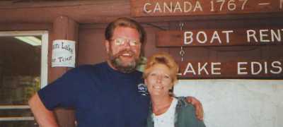
Later: the afternoon proved to be a bit more strenuous than this morning’s hike, with long stretches of snow on both sides of the crest. The snow was fairly soft though, so we could easily kick in steps. We made pretty good time to the pass, but the descent was hard. It started off easily, with two long switchbacks that ended up in a steep bowl where the only option was to go straight down in the snow, just as we had managed to avoid when we first crossed over the ridge. The way was narrow and lined with rocks, making a slide pretty dangerous, so we slowly plunge-stepped down the mountain. At the bottom, we met Cheryl. The amazing thing was that we were actually on time, despite four long days and lots of snow. She drove us to Kennedy Meadows, a campground resort about 17 miles from the trail. We had planned to go to the town of Bridgeport, on the eastern side of the Sierras, but this is the weekend of their annual Biker Festival and there are no rooms to be found for 50 miles. Cheryl found a nice campground on the Stanislaus River, with a restaurant, store, saloon, and laundry about a mile away. We ate, took wonderful hot showers and talked. Sly is due in tomorrow. We never saw him after the first day.
Sunday, June 25: Kennedy Meadows CG @ 1 mile
Although we could have gotten back to the trail today, since Cheryl had to go back to the pass anyway to pick up Sly, we decided that a relaxing day off at the campground was more appealing. Aside from the frequent roar of motorcycles on their way home from the Bridgeport Festival, it is very quiet and peaceful at the campground. It’s cheaper than a town stay, and more relaxing since there’s no place to go and little to do but rest and read the paper. Our hard push to get here in four days had its usual effect: exhaustion, sore feet, and strained knees. Our next stretch is the same distance, but this time we won’t be pushing to meet Cheryl, so it should be less stressful. While it was really nice not to have to worry about getting a ride to town, and it was a lot of fun to see Cheryl again, I hated not being able to take the time for a swim in the clear pools because we were pushing so hard. Then we didn’t end up setting up camp until it was almost dark, so it was too cold or mosquito-infested for a good swim on the occasions that we camped near anything swimmable. I like having more flexibility. I know that in order to finish the trail we have to push the miles, but it does get in the way of enjoying the experience, especially when snow and stream crossings conspire to slow us down.
Later: The afternoon didn’t quite turn out as expected. We hung our food in a tree and walked to the resort for lunch. As we were leaving, Sly and Cheryl and Dude drove up, so we visited with them while they ate. Then a big thunderstorm hit. It rained and hailed for the next three hours. Sly and Cheryl went back to camp to get their laundry and our jackets while we waited outside the store, then we all went to the saloon for a beer and some juke box country music, then we returned to the campsite to wait until it was time for dinner. The restaurant is quite popular, so we had to make reservations for dinner, but the prime rib was prime, and the prices were reasonable. We visited with a group of soaked weekend hikers while waiting for Sly and Cheryl to come back. I was glad we weren’t hiking as we watched the rain and hail come down. I was especially glad we weren’t back up on the ridge we were on yesterday. I was even happier that the rain stopped before bedtime.
Monday, June 26: Above Golden Lake —16.3 miles (1029.5)
After a good “cowboy breakfast” at the resort, we finished packing up and Sly drove us back to the trail. He and Cheryl are headed to South Tahoe for a couple of days, then they’ll go north to the point where he left the trail last year and hike together for a while. It’s a pretty--though winding—drive from Kennedy Meadows to the trail at Sonora Pass. We met Guy up at the pass, settling in for an all-day wait for Kerstan. He was camped at Kennedy Meadows about four sites down from ours, but we never saw him since he spent little time up at the resort, and we spent a lot. The life of trail support is wearing on him, I think. His knee still won’t allow him to hike, so he spends a lot of time waiting. He must love her a lot.
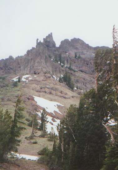
The climb up from Sonora Pass was interesting, past volcanic spires and hoodoos, caves and rock windows. The ground was very slippery with mud from yesterday’s storm. The backside had a good amount of snow, softened by the rain, and was therefore a bit more treacherous than usual. We post-holed a lot--usually only a foot or two deep, but it made for slow walking. Another storm was building, so it was cool and cloudy. Rain helps melt the snow, but creates its own problems. The afternoon had a lot of up and down on fairly obscure trail. We descended the valley of the Carson River, then climbed north and west, with a lot of up, down, and around rocks and ridges, with occasional views. The storm circled around, never reaching us. I was just as glad. We saw one deer and one southbound hiker, headed toward Whitney.
While I was glad to be back on the trail, neither of us had much energy today. We were tired and sore and wondering what we were doing out here. The first day back on the trail after a break is always difficult. It wasn’t particularly hard going--the many stream crossings were mostly just rock hops and we didn’t get any more significant snow--but even the views, when we had them, didn’t make us much more enthusiastic. We just counted the hours until we could stop. When we did, it was in a little cow-flop-covered campsite on a ridge, partway between where we planned to stop (Golden Lake) and where we hoped to stop (the stream a mile farther.) Near the lake the ground was wet, muddy, and buggy, so we kept going, but each ridge wore us down, so finally we stopped in a nearby grove of trees, much loved by cows.
Tuesday, June 27: Pennsylvania Creek — 22.3 miles (1051.8)
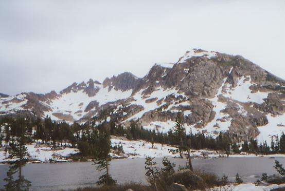
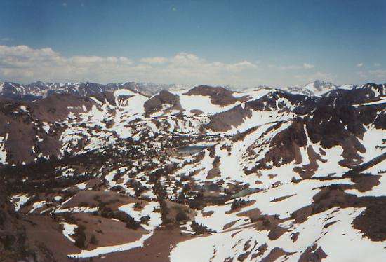
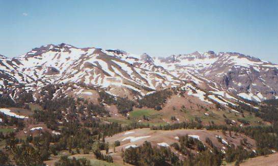
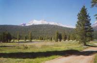
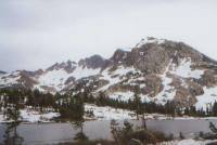
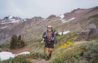
We slept deeply and late, which helped both our moods. The views have been terrific, with lots of interesting peaks, colorful lakes, rich green meadows, and a wide variety of wildflowers. There has been a lot of up and down, but with only intermittent snow patches. The ground seems to be drying out from yesterday’s rain, so the walking has been pleasant. This area reminds me of Montana, with lots of sage, wide views, and green meadows. Our lunch spot was atop a ridge, with incredible views of snow-streaked mountains and blue Highland Lake. Once again, the clouds are gathering. The accompanying winds are cool and are keeping the mosquitoes temporarily at bay. It is lovely.
Later: An interesting afternoon, with an exciting, though unwelcome, ending. The trail winds from stream to stream, around all sorts of interesting peaks and rock formations. There are spires and pinnacles, red and orange rock, huge conglomerate boulders, etc. It reminded me of parts of the San Juans in Colorado. It was interesting walking, especially since we were mostly in sage and could actually see the ridges beside us.
Then, around 6:00, the thunderstorm we had managed to avoid all afternoon finally reached us. Boom!!! Lightning, thunder, hail and pouring rain. We tried waiting it out in a grove of trees, but we still got soaked and soon started shivering, so we moved on over hail-whitened ground to the first likely campsite we could find. The water in the creek is a raging muddy torrent. We won’t cook tonight with that mess! At least we were able to dry off and get warm again fairly quickly.
Wednesday, June 28: Frog Lake — 20.7 miles (1072.5)
It was a wet night, though the rain stopped around 8:00. We reluctantly packed our wet sleeping bags and tent, hung yesterday’s wet clothes off the back of the packs, and began the day’s hike. The first part was a continuation of the circle around jagged Reynolds Peak. Parts of the area were very barren, parts were low sage and wildflowers, and part was in trees. Then we reached an area with many ponds and lakes. We stopped for an early lunch to dry out our gear before the next storm hits. The clouds are gathering already. It wasn’t a difficult morning, just lots of little ups and downs. There was only one bad snow patch. We saw no people or animals, though we saw smoke and heard voices at two different camp areas, so we know we’re not entirely alone out here.
The rain began just as we were finishing lunch, so we hurriedly repacked and started out again. It never rained very hard, but we had sprinkles off and on all afternoon. Worse was the thunder. As we approached treeline, the storm moved right overhead. We sat in a grove of trees and waited for it to pass, then started up the ridge again. Thunder grumbled all afternoon, close, but not quite on top of us. Much of the time we were exposed, either on or near open ridges. We didn’t feel very safe, but we weren’t willing to lose the day waiting for the storm to pass completely. It was pretty though, with black clouds all around and grey lakes below. We had intermittent snow patches, with the worst at the end of the day when we climbed steeply up and over the crest for the last time. For that one we got out our ice axes. Most of the rest were flat or short enough that we didn’t bother, but the last two were more difficult. We never saw any people, though we did see two deer early in the afternoon and heard yells coming from one of the lakes. We were both tired, so we stopped fairly early (6:15). The grey skies make it seem much later than it is, and I wanted to cook dinner before the rains begin again. We’re nicely tucked into a grove of trees near a small lake. There were many wildflowers: paintbrush in orange, yellow, and pink, blue and white lupine, dark blue larkspur, hot pink and blue penstemon, pink candytuft, etc. The views were really nice from the rock outcroppings. All in all, it was a good day.
Thursday, June 29: S. Lake Tahoe -- 15.4 miles (1087.9)
The morning hike was mostly pleasant as we dropped down to the road at Carson Pass then climbed back up into the Truckee River basin. There were wide, wet, green meadows, a couple of ponds, and one lake. Snow patches were sporadic and easily crossed, except one that trapped me when I plunged knee deep into a hollow drift. Trying to get out just trapped the other foot. It was funny. There I stood, feet buried in soft snow, unable to move. Jim couldn’t help me because he would have gotten trapped too. We laughed.
We had to hurry in order to reach South Lake Tahoe. With the holiday weekend coming, we were worried about rooms being hard to get, or more expensive. We know nothing about the town, since the Town Guide doesn’t include it in the listings. We do know that a lot of hikers visit there, so it must be at least somewhat hiker friendly. We found a motel on the edge of town, near a shopping center. A huge thunderstorm hit just as we were leaving the grocery, so we sat under the overhang, ate our ice cream, and watched the rain and hail. I was so glad not to be hiking in it!
Friday, June 30 — S. Lake Tahoe -- Day off (@ 2 miles)
Home | Links| Trail Journals |
The Thruhiking Papers | Bun-bunSouthern California | Central California
Northern California | Oregon | Washington
Created: Fri, 16 Jan 2004
Revised: 30 Sept 2016Copyright © 2004-2017 Spirit Eagle