|

|
|
||
 |
 |
 |
 |
|
|
|
|
||
|
|
|
|
The Pacific Crest Trail
Olallie Lake to Cascade Locks
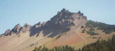
Saturday, August 19: Near Red Wolf Pass — 26.2 miles
When we woke, the trees were dripping, but the rain had stopped. It remained cool and cloudy all day. We tried to dry our gear out at lunch, but the sun didn’t cooperate. The trail was very easy, just cruising through forest with no views. There were a couple of lakes and streams though. The trees were big and mossy. Jim got into rocket mode, talking to Sly, so I lagged behind, browsing on fat juicy huckleberries and taking my time. I decided that I didn’t even want to try to keep up. Let ‘em wait!
Sunday, August 20: Wemme on Hwy. 26 — 18 miles (2092.0)
We had a change in plans, sort of. Cheryl met us this morning at a highway crossing and drove our packs 15 miles up the trail to another road crossing. I really enjoyed cruising along with no weight on my back. Instead of ‘slack-packing,’ Sly said the preferred expression is now ‘freedom packing.’ We passed an interesting artesian spring, about 50 feet across, sapphire blue, cold, and deep. There were about a dozen tourists who passed by as we ate our lunch there. One couple went swimming in the spring. After we got water, fortunately. It was quick easy walking. The other highlights were seeing a deer and eating more huckleberries. We met Cheryl again at 3:00 and decided on the spur of the moment to go back to her motel. Unfortunately, there were no vacancies, so we ended up on the floor of their room. Still, the shower was hot, we got a good dinner and did laundry, so we’re happy.
Monday, August 21: Sandy River bench — 19 miles (2111.0)
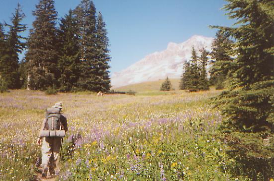
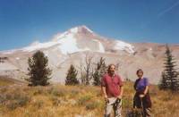
We didn’t sleep well in town, but we still got up early and went out to breakfast before heading back to the trail around 9:00. Cheryl drove our packs up to Timberline Lodge, on the slopes of Mt. Hood, so we had an easy 10-mile packless climb before lunch. There were a few views of Mt. Hood and the area around it. The land is very dry and sandy, with xeric wildflowers (lupine, Shasta daisies, paintbrush, and mariposa) and huge eroded sandy gullies. We could see people skiing way above us. The lodge was a zoo, full of skiers, snowboarders, and tourists. We ate lunch at the lodge with two PCT hikers — our old friend Steve and Chad, who hiked half the trail in 1977, and came back this year to finish it. The main lodge and Wy’East Annex were both huge and absolutely filled with people. There were also a lot of dayhikers in the mile or two after the lodge.
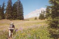
Above the lodge, the trail was very beautiful, with lots of wildflowers, awesome views of Mt. Hood, strange eroded canyons, waterfalls, etc. It was tough climbing, but really nice. We ended up camped on a bench above the Sandy River, which is really flowing fast. We had to cross it on a log, not my favorite way of crossing water. The woods were very green, full of hemlocks, rhododendron, junipers, ferns and mosses. It was lovely.
Tuesday, August 22: 21.1 miles to Indian Spring Campground (2132.1)
We slept well and long, not hitting the trail until almost 8:30. Chad, Steve, and a new thruhiker named Greg stopped by as we were eating breakfast. Up the trail, we passed a bunch of hikers as we headed toward Ramona Falls. That was a pretty waterfall, big and lacy. There were a couple of awesome views of Mt. Hood, but most of the day was in the woods. At the end of the day there were hazy views of Mt. St. Helens, Mt. Rainier and Mt. Adams, all big snow-covered volcanic mountains to the north. The hills around here were badly clear-cut, in stretches. Much of the trail was overgrown, making it hard to walk since we couldn’t see the obstacles underfoot. There were lots of huckleberries, plus some sour blueberries, and a tasteless yellow berry that must be salmonberry. We ended up at a primitive campground area with picnic tables and even an outhouse. The road to it has long been abandoned, by the look of it. We’re tired, despite our late start and relatively short day. An early night will be most welcome. A father and son are camped nearby, as is Chad.
Wednesday, August 23: @ 13 miles to Cascade Locks (2150.2)
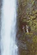
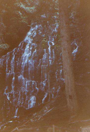
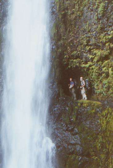
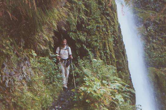
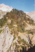
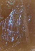
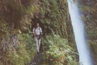
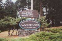
We got an early start down the Indian Springs Trail to Eagle Creek. We took a highly recommended alternate route that passes several waterfalls. A friend who has hiked the trail three times told us, “you’d have to be stupid to take the PCT instead of Eagle Creek!” Sure enough, it was a beautiful walk, with steep narrow rocky walls covered with ferns and moss and several beautiful waterfalls. I can see why they didn’t want horses along that trail though, which is why the PCT was routed elsewhere. Parts of the trail are quite narrow and wet. The most interesting one was Tunnel Falls, where the trail passes through a tunnel behind a huge waterfall. The force of the water was powerful, spraying hundreds of feet high. The trail was about halfway up the rocky cliff. Another good one sprayed two streams that crossed each other in mid-air, forming a big X. Another was known as the Punchbowl, where the water carved a dip in the side of the cliff and a big round bowl below. It was beautiful. We had the upper canyon to ourselves, but met 66 hikers on the trail in the lower canyon, plus four dogs. Most of the hike was along the cascading stream, which had carved a very deep narrow canyon for itself. We had a bit of trouble finding the connecting trail into town, but ended up following an old highway, (now a bike path) into Cascade Locks.
We found a motel, bought a few groceries, ate dinner, and then called it a day. There are lots of hikers here: Sly and Cheryl, Steve, Kubiak, Firefly and Gepetto (section hikers) and probably others we haven’t seen yet. Town is quite small, with just one main street along the Columbia River and a couple of residential side streets. It’s a good place for hikers, since it is so compact. We watched barges on the river as we ate our dinner. We plan to take a couple of days here, to resupply and rest. Since Ashland was so long ago, almost three weeks and 500 miles, a few days’ rest sounds very appealing. We need to prepare boxes for the rest of the trek through Washington.
It's odd to think we are about to enter our last state. Only 500 miles to go! Oregon has been good, for the most part. Nice easy walking, lots of pretty forest, some really nice views, swimmable lakes, plus lots of tasty berries and only a few days of wet weather. I hope Washington turns out as well. There’s lots of beautiful country ahead, we hear, though weather is always unpredictable there and could put a damper on things. I’m not ready for another month on the trail, though I’m sure I will be by the time we leave town.
Home | Links| Trail Journals |
The Thruhiking Papers | Bun-bunSouthern California | Central California
Northern California | Oregon | Washington
Created: 16 Jan 2004
Revised: 30 Sept 2016Copyright © 2000-2017 Spirit Eagle