|
|
|
 |
 |
 |
 |
|
|
|
|
|
|
|
|
The Pacific Crest Trail
Kennedy Meadows to Tuolumne Meadows
Sunday, June 2: Cow Creek — 18 miles (716)
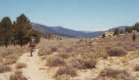
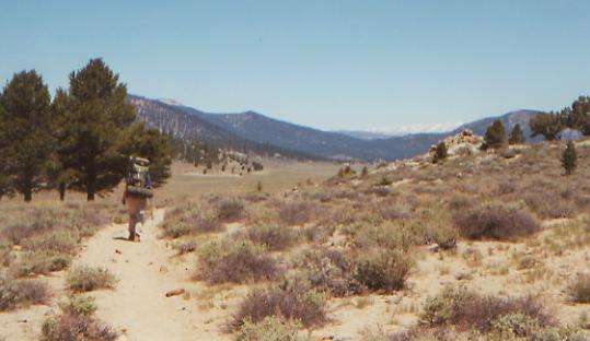
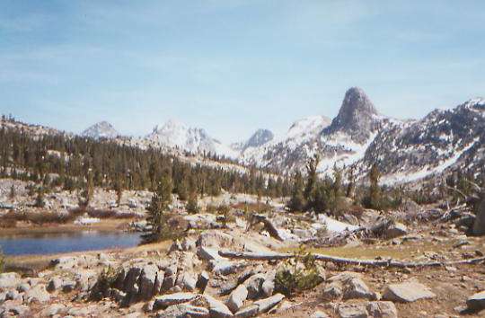
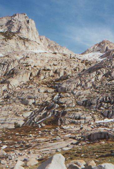
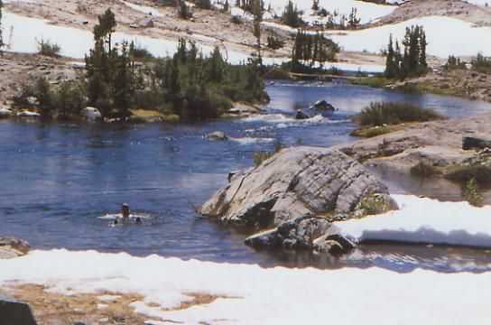
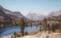
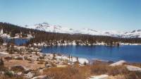
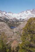
We were interrupted in the night by an RV that drove up to our camping area, looking for a site. It took a while for him to get settled, but when he did we went back to sleep after retrieving the food from the outhouse where we had hidden it to protect it from bears. I trusted the bears more than strangers who appear in the middle of the night. We weren’t far from the regular campground, so we passed through there before any of the campers had started the day, then we had the trail to ourselves. We climbed up along the river for a while, then through an old burn area that is now a sage and other brush meadow. There were white and yellow flowering bushes everywhere. After a while, we climbed up to Beck Meadow, a real grassy meadow that reminded me vividly of the CDT — open and grand. There are snowy mountains visible to the north above tree-clad hills. It is very beautiful. There’s not that much snow on the peaks right now. That’s good in terms of safer, easier travel, but I’m a little disappointed that I won’t be able to improve my snow skills. [NB: Watch what you wish for!] It is warm and sunny while walking, though it got very chilly last night, and it feels cool in the shade. We’re entering the wilderness, at last.
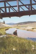
It wasn’t a bad afternoon, though we climbed for most of it. Best part was stopping for water at the South Fork of the Kern River and watching dozens of swallows in their mud nests under the bridge, flying in and out. We tried to make sense of their activities, but never did. It was a pretty place, with tall green grass and nice views across the Monache Meadow. Then we began climbing up tiny Cow Creek. We criss-crossed it several times, but it was never more than a hop across. Near the top, we met Notch, another PCT hiker, as we all filtered water for the night. He didn’t offer to share his campsite, so we went on to find a flat spot near the trail. We still have another 1000’ or so to climb, but we’ll do that in the morning. Besides, it’s likely to be chilly at 10,000’. Our packs are too heavy, with all the stuff we sent in anticipation of the snowy Sierras. Good thing it’s a short hop to Lone Pine, where we can get rid of some of the excess weight.
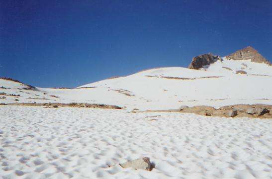
Saturday, June 3: Dutch Meadow —20.7 miles (736.7)
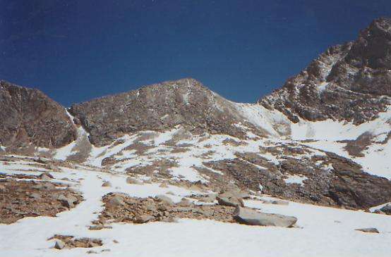
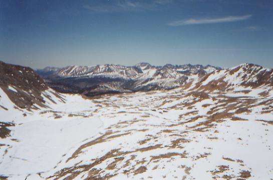
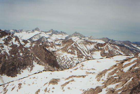
It was an up and down morning. Up to 10,250’ on the side of Olancha Peak, then down to a couple of creeks at 8900’ then back up above 10,000’ again. We’re aiming for a high point at about 10,700’. There’s no snow on the trail, though we saw a couple of tiny patches in shady spots. Looking north, I’m amazed at how little snow there is. Even the 13-14,000’ peaks aren’t solid white, but striped. We’ve had nice views of green meadows, white granite and serrated peaks. We walked through some sage above 10,000’ — now that’s a HIGH desert. We met a hiker, Hawkeye, taking a nap under a tree. Now that’s the way to hike!
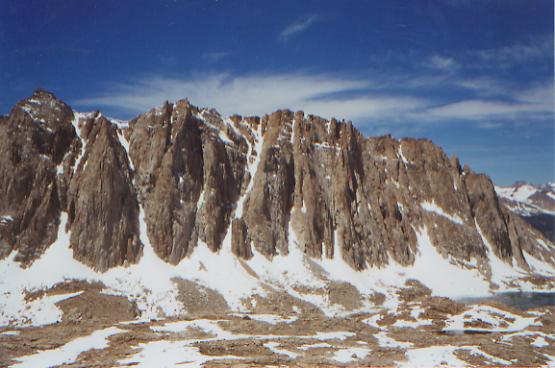
Later: I’m tired, sore, in pain, and under siege from mosquitoes; it’s time for bed! Dinner first, then we’ll collapse. The climbs weren’t that bad, but the altitude started to get to me, so every step was a major effort. Then my “new” boots were really hurting. I wanted to have leather boots for the snow, so switched out of my running shoes. Only one obvious blister, but both heels feel raw. I wore those boots for 1000 miles last year, so they should be broken in, but unfortunately, my feet aren’t yet. Once my ankles got used to the lack of support, the running/trail shoes worked well. It took a while for my ankles to stop turning, but once they did, the New Balance shoes were great. Carrying the old shoes out of Kennedy Meadows proved a good idea. I finally switched and did much better for the last mile of the day. There were occasional nice views of Whitney, Olanche, Kern, Trail Peak etc. We were in forest all afternoon, with some really interesting rock formations and cliffs. We ended up at a campsite with a corral near a meadow. Nice little spring, but lots of mosquitos. DEET helps, but they’re good at finding the spots I missed. Getting washed up was agony, as they chewed on me the whole time.
Sunday, June 4: Lone Pine 2.3 + 2.5 (739.0)
We made it out to the road by 9:00, but then had an almost two hour wait for a ride. We made the mistake of taking the wrong fork in the trail out, so we ended up a mile or two from the parking lot at the trailhead. It might have been easier to get a ride from the trailhead, since there were people leaving. We watched a group of 5 jeeps pass us, then a couple of single SUVs, but no one would stop. We got pretty upset, since there is so little traffic and it is such a long way from town that walking just isn’t an option. I found it hard to imagine that hikers could leave other hikers stranded 22 miles from town, but they did. Finally two guys on their way home from a week-long fishing trip picked us up and dropped us in town. We’re at the Dow Villa, an old hotel/motel. It is overpriced for what it offers, but this is prime tourist season, so I’m not surprised. We weren’t in the mood to go to all the other motels to look for a better deal. Looking up at Mt. Whitney from the main street of town is a pleasure. The town is small enough to walk around easily, with several motels and restaurants. Getting out of town could be difficult, but that’s Tuesday’s problem. Today we rest. We need it.
Monday, June 5: Lone Pine — Day off
Tuesday, June 6: Guyot Creek @ 16.2 miles (756.0)
Our town visit to Lone Pine went well, but we were ready to leave — tired of noise, greasy food and spending money. We never saw any other PCT hikers, just hordes of tourists. Getting out of town took a while. There weren’t many people heading up to the trailhead on a Tuesday morning. A local woman drove us a mile or two out of town so at least we would be past the junction to Whitney Portal. It meant fewer cars, but less disappointment watching cars pass us that weren’t going all the way up to Cottonwood Pass. We only saw one car an hour. The first passed us, but then, it was one of the SUV’s that also left us in the dust on Sunday. The second was a tow truck, stopping just a few miles up the road. Finally a dayhiker from Los Angeles, out to see whether there was too much snow for his planned backpack trip at the end of the month, picked us up. He’s 70, and planning to climb Whitney as a day hike on Labor Day, on the 50th anniversary of his first climb up Whitney. He was nice. I love seeing older hikers out here. I do hope that when I’m 70, I’ll still be climbing big mountains! He has been chipping away at the PCT for about 10 years and has completed 700 or 800 miles of it.
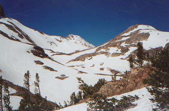
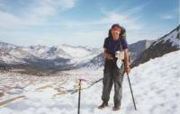
We decided, since we were starting so late (10:00) to go directly up to Cottonwood Pass instead of Trail Pass where we came out. They both start at the same trailhead, but the trails form a triangle and reach the PCT about 5 miles apart. The Cottonwood Pass trail is longer and has more elevation gain, but saves about 3 miles for the day since it reaches the PCT farther north. There was a snow cornice at the top of the ridge, but we were able to go around it on old (bad!) trail. We had hoped to go all the way to Crabtree Meadows today, but it didn’t work out for us. A late start, very heavy packs, sore feet, and altitude problems made us very slow. We got rid of some pack-weight in town, but with 10 days food, our packs are still too heavy. I was nauseous, out of breath, and lethargic from the altitude. I started taking Diamox, which is supposed to help with altitude sickness, but all it did was make my ears ring. I had had some problems when we were above 10,000’ the other day — nothing major, but it is frustrating to feel so slow and out of shape when I know I’m not. It’s like being a newbie hiker after years as a couch potato--very painful. I had much the same trouble on the CDT, though not quite as bad. Jim seems to be fine with the altitude. With luck, I’ll get used to it, since we’ll be at altitude off and on for the next two weeks. In Colorado we went high and stayed high, but in the Sierras you climb up to high passes, then drop to much lower valleys, so there is a respite from the altitude and all that goes with it, like snow, cold, etc.
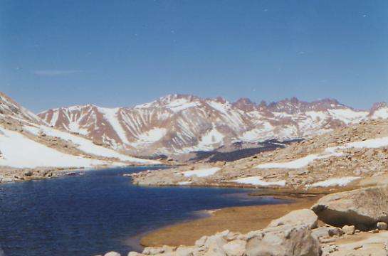
However, the hiking was nice, with some good views. We saw two deer and our first marmot. No other hikers, though we saw lots of footsteps in the sand indicating that we were passed while we were in town. Some avoid the long hitch to town by carrying 12 days of food (or more) out of Kennedy Meadows, or they get off the trail at Kearsarge Pass, a week or so up the trail. That one has a long hitch plus an 18-mile round-trip hike on a side-trail to get out, but is better situated than Trail Pass for resupply since it is halfway through the section. This worked for us, but there were several options we considered before we started. I was glad to go to town when we did so we could send back some of the cold weather gear we had sent ourselves in Kennedy Meadows. It is cool up here, but not nearly as wintry cold as I expected. We saw patches of snow above 11,000’, but it isn’t the continuous snow-cover many PCT hikers experience. We packed for winter, and it feels more like late spring. Tomorrow we’ll climb Mt. Whitney, the highest point in the lower 48. There will be snow up there.
Wednesday, June 7: Crabtree Meadows -- @ 14.7 miles
It was an interesting and beautiful day, though we didn’t succeed in our attempt to climb Mt. Whitney. We gave it a good try, but it wasn’t worth risking our lives for. The morning was cold, so we dawdled in bed until 6:00, then hiked 5½ miles to Crabtree Meadows. We left our gear at a campsite there with a bear-box, taking only the essentials with us. There were two tents at the campsite, but we assumed that they were PCT hikers, since so few others are out here now. If not, we figured we could always move on later. One turned out to be an acquaintance — Joe, known as Motherbird -- and the other was a PCT hiker named Mike.
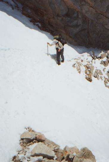
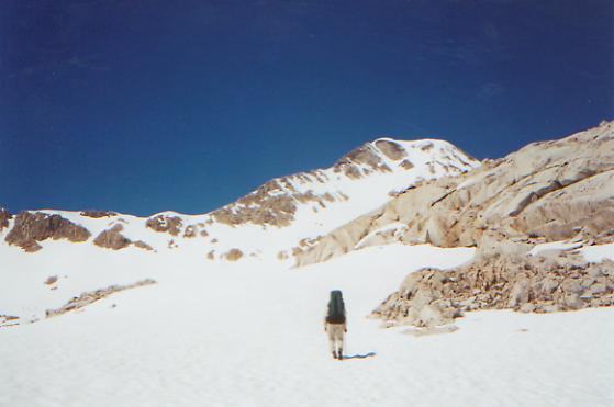
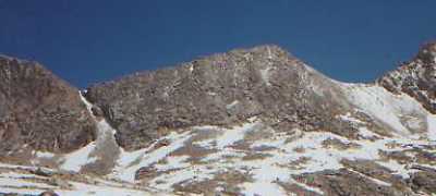
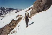
We left about 9:30 to start the 7½-mile climb up Whitney. We met Brad on his way down. He had spent a very chilly night alone on top. He told us, “It sounds better than it was.” A little while later we met Joe, who had turned around partway, and visited with him for a while too. Finally, we began climbing. There was a fair amount of snow on the trail above Guitar Lake. Not continuous, but enough to make it hard to find the trail sometimes. Both Brad and Joe warned us that they had lost the trail, so we were careful. Brad ended up doing a big slide and had to self-arrest. Scary, especially when you’re alone. Then the way got steeper and we got out our ice axes. On flat snow, the ski pole I usually hike with works better because it is longer, but isn’t much good if you have to self-arrest. We crossed a couple of steep snowfields, then the trail was clear for a long way, so we were able to climb, then we hit a steep snowfield, followed by one you could bypass on loose scree (not fun!) I was really nervous on the unstable earth. We met Mike on his way down from the top and asked about the trail ahead. He said there were five more bad snowfields. A few minutes later we came to one that was steeper than I was willing to try. There were no visible steps across it as it was too icy to kick good steps. I looked at it and said, “No, I can’t do that.” Jim said, “Fine, let’s go back.” So we did. Trouble is, I might be able to cross once, but you have to come back, at the end of the day, when you’re tired. I didn’t think it was worth the risk. Whitney was a side trip, for fun, and not part of the PCT. It was ceasing to be fun. The climb was really beautiful and worth the time spent, even though we didn’t get to the top. We’ll do that another day. We made it to 13,000’ anyway. My altitude sickness made me very slow and there was a possibility we would have had to turn around before reaching the top in any case. We brought sleeping bags, so in a pinch, we were prepared to camp, but we really didn’t want to do that. As slow as I am over icy snow, it would have been difficult to get to the top and back before dark.
We also have a storm front moving through. We heard about it in town: “rain possible on Wednesday, Thursday and Sunday; drop in temperature of 15 to 20 degrees.” The wind picked up and clouds started to build as we climbed. It was mostly cirrus, so thunderstorms were unlikely, but that can change. I was disappointed not to make it to the top, but it was smarter to turn back while we could. Jim was very accepting. He said he didn’t really have his heart set on climbing Whitney. In town they said the other side has waist-deep snow, so we knew that it was possible we’d get snowed out. That’s what we get for being early in the season. This may be a low snow year, but it isn’t a no snow year.
Along the way we saw four deer and a lot of marmots. They’re redder than the marmots in the Rockies. I think they’re cute, though I know they can be a hazard to hiker food bags.
Thursday, June 8: Tyndall Creek — 9 + 6 (769.5)
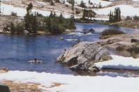
The clouds yesterday brought no rain, but the temperature did drop. It was well below freezing overnight, making for a late start since I still don’t like cold mornings. At noon, snow and puddles in the shade were still frozen, though the ones in the sun were melting around the edges. It wouldn’t be so bad except for two things: 1) we have a formidable pass to cross this afternoon — Forester Pass is 13,000’ and notoriously difficult when there is snow, and 2) we had four knee-deep stream crossings this morning, and that water was icy! None were particularly difficult or dangerous, just cold. We used our sandals for each since it takes such a long time to thaw out frozen boots, and ours were still damp from yesterday’s snow and stream crossings.
On the positive side (easy, since we’re sitting in the sun bundled up nice and warm) the mountains were gorgeous this morning. There were lots of open vistas to view the splendor of snowy peaks and green meadows. We saw two deer and a couple of marmots and several chipmunks.
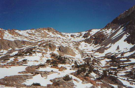
Joe decided to turn back and go out Cottonwood Pass to Lone Pine. He has to go back to work next week and decided he didn’t need to risk Forester Pass. Like me, he gets nervous when the footing isn’t stable and there’s a long way to fall. Mike moved on last night. We decided against it since we want to be at the pass when the snow is softer, preferably late afternoon, since the temperature dropped so drastically last night. When the snow is icy, you can’t kick steps. I’ll be very glad to be done with Forester Pass. It’s the highest point on the PCT. (Whitney doesn’t count since it’s 8 ½ miles off trail.) I don’t know if Forester is the most difficult pass, but we know it will have snow, while the lower later passes might not. We shall see. Yesterday’s failure didn’t help my confidence any, though I know it was right to turn back when we did.
Later: Another disappointing day. We’re sitting in our tent on the wrong side of the pass, listening to the sleet snarl. Soon after lunch, it began to snow. The higher we climbed, the harder it was snowing, and the worse the visibility became. I started to get really cold, between the wet snow and the strong wind. We lost the trail frequently under heavy intermittent snow patches, but finally we reached a large open basin where we could see no sign of the trail. Since we couldn’t even see the north wall toward which we were heading, and 20 minutes of wandering in circles didn’t raise any cairns to mark the way, we very reluctantly decided to turn back. Of course, that was no picnic either, as the trail was even more obscure on the way down. Our footprints had filled with snow and the trail, when we did find it, was a running stream. We headed to a campsite below treeline with water and a bearbox, right next to where we ate lunch. Grrr. We are not happy campers. This puts us a day behind schedule, with a real possibility of running out of food before we reach our next resupply at Vermilion Valley Resort.
Friday, June 9: Vidette Meadows — 12 miles (781.5)

Well, we survived Forester Pass, but as Emily put it, "There was no margin for error up there." We slept in as late as we could stand, then dried our tent and sleeping bags in the sun for a while, giving time for the snow to soften. We were passed by Emily, Silver, John, Doug and Christa (with dogs of course,) and another hiker, Blue, whom we never saw. About 9:30 we finally left and retraced yesterday’s path. Amazing what a difference it made not having a snowstorm to obscure things. It helped that we had eight sets of fresh tracks to follow. We went right back to the upper basin where we lost the trail yesterday. Besides the fresh tracks, we could see the other hikers ahead of us on a ridge, so we were able to make our way easily through the snow to the switchbacks up the wall. The switchbacks were visible from below, but covered in snow, so we did a combination of trail and bushwhack up the talus to the clearer switchbacks above. The group ahead just went straight up the rocks. Scary! Finally we reached clear trail, but there was one more obstacle at the very top: an icy snow chute, about 15 yards wide. Doug had cut steps into the ice with his axe, which Jim widened for me. They got Monty across using ropes, but the other dog, Cyclone, just charged across. The group roped themselves up, though we didn’t even think about trying that. It was a straight drop to rocks below, and pretty scary, but we made it.
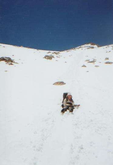
Finally, we reached the top of the pass and looked down the north side. What did we see? Solid snow. We followed the group’s example and did a butt slide down a couple of hundred yards. It was open and easy sliding. Then we plunge-stepped across a little bit, past some rocks, found a steeper slope which we walked partway down, then we glissaded on our fannies the rest of the way, using our ice axes and feet as brakes to slow ourselves down. That was fun, but very cold. It was better than slowly kicking steps 700’ down in hip deep snow!
There were half-melted lakes to avoid, but eventually we made our way more or less down below snowline, where we had a very late lunch with the others. Then we descended easily through forest along rushing Bubbs Creek to a campsite with a bear-box, which we are sharing with Emily and Silver. I even got cleaned up in the creek. It was a little cold, but very welcome. We saw lots of waterfalls and snowdrifts on the trail.
I feel good about the day. We didn’t make many miles, but we all made it safely across some pretty scary stuff. I was very glad we didn’t keep going last night. Between the falling snow, the cold, and the lack of visibility, plus the extra miles, we would have been in serious trouble. Having the footsteps to follow today and the steps cut across the ice chute helped enormously. Doug and John have both done the trail here in similar conditions, so presumably they know the way. Having sunshine this morning meant we could appreciate the beautiful views along the way. We weren’t freezing, as we were last night, which helped my mood a lot. I love sunshine in the mountains!
Saturday, June 10: Upper Woods Creek — 16 miles (797.5)
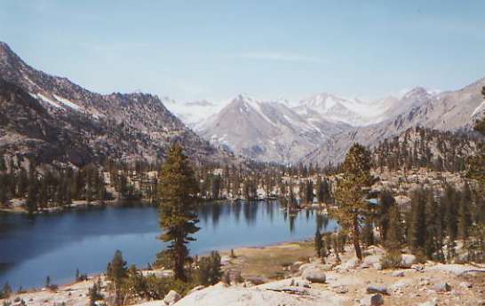
It was a long day, to make up for yesterday’s short one. Glen Pass proved to be rather more formidable than expected, with lots of bushwhacking over talus looking for trail hidden under the snow. The north side was solid snow, so we slowly plunged our way down to beautiful Rae Lakes below. I thought it was too steep to slide, though Emily had a good time doing that. One of the other hikers had to self-arrest when he slipped, unexpectedly. We didn’t see it, just heard about it afterwards. We ate another late lunch beside the lake. We met four new hikers there: Skid, who has hiked the PCT and CDT before, Jason, Jeff, and Jeremiah (known as the Three J’s). Emily and Silver were also there. Doug, Christa, and John went to the town of Independence, so we won’t see them for a few days. The Three J’s had fishing line, which they used quite successfully to catch us all some lunch in the lake. Those trout were tasty!
We then began the long and painful, but beautiful, descent to Woods Creek, followed by the climb back up toward Pinchot Pass. It was a beautiful day, with gorgeous peaks, lakes, and waterfalls. We met three sets of backpackers, heading toward Glen Pass. I tried to warn one very heavily laden couple about Glen Pass. They didn’t have an ice axe and were obviously pretty inexperienced, so I suggested they go up to the lakes and then turn around, instead of trying to go up and over in the deep snow. I don’t know if they listened. There is a popular loop trip past the lakes and over the pass. Great for summer, but dangerous with so much snow. We had lots of stream crossings this afternoon that are usually easy rock hops, but today required us to ford knee deep. Many crossings weren’t even mentioned in the guidebook. The waterfalls were really something: long thin ribbons or short fat thundering cascades. I enjoyed climbing above the river late in the afternoon. It was a fairly gentle climb and quite beautiful.
Sunday, June 11: Campsite above Upper Palisade Lake — 16.6 (814.4)
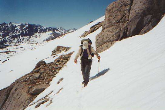
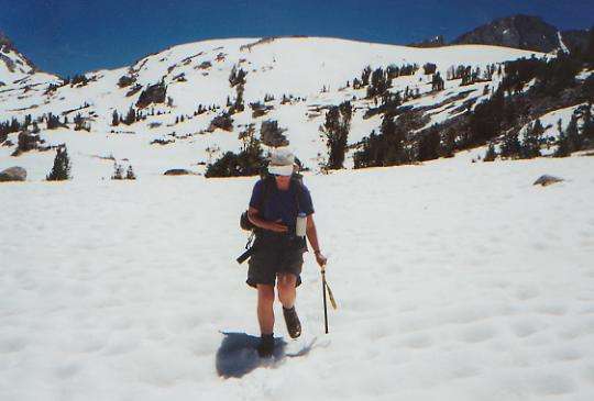
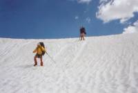
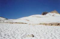
We made it over one pass—Pinchot—in the morning and hope to do the same this afternoon. The morning wasn’t particularly difficult, but we kept losing the trail in the snow. We’d have clear trail for 10 yards, then snow for 50. Once or twice we just used the map to figure out where the trail ought to be and made a beeline. Makes for slow going. The very top of the pass was a huge snow bank/cornice we had to go straight up and over. That was the only really scary part, though it may just be I’m getting used to the long traverses. The snow was just soft enough to be easy to cross, without being post-holing soft. The north side was icier, but fortunately the grade was gentle, and it soon softened up too. A lot of our snow travel is across sun cups: dimples and ridges in the snow, something like an egg carton. The trick is to walk on the lips, creating a flat spot. It helps to be the second or third person to cross a snowfield. The good part about sun cups is they are fairly safe. If you slip (and you do) you won’t slide far. Usually you just sit down. The bad part is that the balancing act requires time and concentration. A flat expanse of snow isn’t necessarily an easy walk across. The ice axes are too short to help much with balance, especially if the sun cups are deep.
The country is really beautiful. The streams are icy cold. I have a cold too. I’m sneezing constantly. I must have caught it in town, and the cold nights and constant immersion in cold water probably don’t help. We haven’t seen anyone this morning. The others are all a bit ahead or half a day behind.
Later: Mather Pass turned out to be a really nasty one. I’m not sure how we made it, but I’m glad it’s over. We were lulled by the first three miles climbing gently from the Kings River. We went easily up the canyon above a stream, crossing several side streams with no snow. Then we reached the upper basin, which had just enough snow to completely hide the trail. No problem. We could see the pass ahead, and there was a mostly dry ridge we could follow to get there. Then came the last two miles. We looked up at the pass and said to ourselves, "You’ve got to be kidding!" The trail consists of switchbacks dynamited into the rock and across huge talus fields. Except for a few very short stretches, we didn’t follow the trail. It was completely buried under the snow. First we climbed straight up the snow about 300 vertical feet to a stretch of trail we could see above us. When that vanished, we climbed up the rocks, hand over hand, hoping to find the next switchback. No such luck. They had built the trail off to the side in a deep shadowed snow/ice chute. We didn’t find the trail again until we reached the snow cornice at the top, where we had about 15’ of clear trail. That was over 300 vertical feet of talus and rock climbing — often very loose rock that crumbled in our hands and under our feet. I was really scared, but all I could do was focus on the ten feet in front of me.
Once at the top, we were surprised to find clear trail, for about 100 feet. That soon vanished, so we followed footprints down the mountain through the snow. The trouble with following footprints is you assume the person you’re following knows what they’re doing. Sometimes they don’t. At one point, the prints ended at a rock cliff. It was a short scramble down, but I did wonder at the sanity of the person ahead of us. A little while later, we heard the rumble of an avalanche across the valley. Not a reassuring sound.
We planned to go farther down the valley today, below snowline if possible, but we found a sheltered dry nest in some trees that we couldn’t pass up. Just before that we had crossed a tumbling stream on a bunch of logs. There was a waterfall above and another below. Fortunately, it wasn’t far across the stream. I used up all my nerve going over Mather Pass. I seriously considered backing out when I saw what it was going to be like. As sore as I am now, I’m not sure we made the right choice. Why do we risk our lives like this? It would have been a long way out, probably at least a two-day hike, but it was pride more than practicality that kept us going.
Monday, June 12: to campsite at 10,400’ @ 14.9 miles (829.0)

We slept well, tired and sore as we were, and woke up late. The morning was a bit warmer than usual lately (above freezing!) so we took off down the trail about 7:45. It’s cloudy, with high thin clouds and cool. It was a steep, rocky, switchbacking descent with many beautiful and massive waterfalls. We followed Palisade Creek for miles. Sometimes it was a roaring cataract, sometimes a beautiful aqua bathtub. Below treeline, the grade was gentle as we slowly descended through conifers, aspens, and green meadows. What a contrast to the grey and white world above! I saw one deer, taking a nap in a grove of trees. Except for the rocky switchbacks, half-covered with snow, of the early morning, it was a very pleasant morning, downhill most of the way. Now we get to start the long climb up to Muir Pass. We had planned to do a long 21-mile day today over the pass, but I doubt we’ll even try it. How far we get depends on how much snow there is near the pass. The guidebook says that the pass is sometimes snowbound all summer. We were very slow this morning, stiff and sore from yesterday, and cautious on the hard snow and wet rocks.
Later: We were slow but steady, climbing along the turbulent Middle Fork of the Kings River. The river was a roaring cascade most of the way. To the right of us were sheer black and white granite cliffs, rising thousands of feet above us. To the left were snow-covered cliffs. Waterfalls thundered down from all sides. Occasionally we would go around a green flower-filled meadow (mostly purple shooting stars.) There were only occasional drifts of snow to cross, soft and slushy. The streams were icy cold, but only one was knee-deep; most were easy hops across. At one of the stream crossings, Jim looked at the bottom of my sandals and saw shining specks. Was it gold?
We stopped early since we were concerned about not finding a campsite if we kept climbing. We might have gone over the pass today, but as soft as the snow is, that would be a slogging soggy trudge. Besides, it’s a long way down to treeline on the other side, though the grade is gentle. As it is, we’re surrounded by snowdrifts again, and the ground is still wet from just melted snow. We joined Steve, whom we haven’t seen since Scissors Crossing, at his campsite. He was way ahead of us, since he’s a strong hiker, but when his girlfriend joined him for 10 days, he slowed down.
Tuesday, June 13: San Joaquin River — 16.6 miles (845.6)

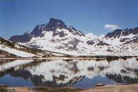
It was a long and eventful day, though we didn’t manage many miles. We had gotten the last dry campsite last night; the trail was completely snow-covered from our little flat spot to an area several miles on the other side of Muir Pass. It wasn’t a difficult pass, just continuous snow. First we climbed about 1500’ to the pass, with numerous false summits and some interesting route creating (not finding – I have no idea where the real trail was) around streams and lakes, then slowly, slowly we wound down the other side. The snow was fairly to very soft. A marmot at the hut at Muir Pass tried to get into Jim’s pack while we were taking a break there. We didn’t see clear trail again until about 2:00, and it was another hour before we had continuous clear trail. We had lunch with a teacher from Fresno who thruhiked the PCT in 1996. The lakes were beautiful, in many shades of blue depending on how thawed they were. A barely thawed lake is robins’ egg blue. A completely thawed lake is deep sapphire. Lovely.

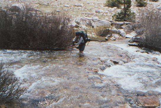
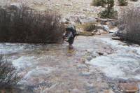
The descent was maddeningly gradual, but finally we dropped down to the Evolution Valley. It was different from my memories of the John Muir Trail. They moved the trail into the woods and away from the meadows, so we got glimpses of green grassy meadows and broad Evolution Creek, but mostly we just walked quickly through the woods, crossing dozens of small streams. Many were easy jumps, a couple we crossed on logs, and one we crossed by scooting across on a log straddling it. Some we were able to cross on rocks without getting too wet. Then came the biggy: all afternoon we had watched Evolution Creek get bigger and bigger. In places it was a roaring cataract, in others it was a broad placid river that filled the whole valley. Where we crossed it was something in between. When I did the John Muir Trail in 1990, the water was knee deep. Today it was waist-high, 40 yards wide, and fast — not to mention COLD! About three-quarters of the way across, Jim slipped and couldn’t get back up. He and I were holding hands, with him upstream next to me, breaking the fast current. I held tight to his hand, braced against the current, and he regained his footing. Then he slipped again. Finally we made it across, soaked but safe.
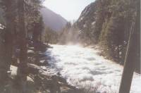
Berkeley Bill, whom we had been leapfrogging all day, had worse luck. As we watched, he got swept off his feet completely. He kept flailing his arms and legs (I wouldn’t exactly call it swimming, it was too desperate) and made it to shallow waters. Good thing, since not far downstream the creek drops steeply in a series of misty waterfalls. All in all, it was scary and exciting. All Jim’s gear is wet. Bill looked at the creek and expected to end up swimming, so he wrapped everything well in plastic bags. We were a bit more arrogant, and so end up with wet gear. We walked another hour or so, to dry off a little, before setting up camp in a mosquito-filled hollow by another river. We ended up hiking more than 12 hours today, no wonder we’re tired.
Wednesday, June 14: Bear Ridge — 21.1 miles (866.7)
No bears disturbed our rest last night, despite the fact that we were sleeping with our food since we could find no appropriate trees to hang it. The grove consisted of young trees with short branches, so we decided our food was safer with us. The fact that we’d seen no recent bear sign in the area contributed to the decision, but still we slept poorly, awakening at every sound. Fortunately, the morning hike was fairly easy: a couple of miles downhill along the roaring, rushing San Joaquin River, followed by a long, mostly gentle climb to 10,900’ Selden Pass. Snow was only a problem for the last mile or so, and that only because we kept playing hide and seek with the trail. The way was pretty obvious, and the valley narrowed the higher we climbed.

We saw Bill briefly just before the pass, but then we stopped for lunch at a dry spot atop the pass, while he went on ahead. Since we were on the wrong side of the lake at the time, we were glad to watch him to see where the trail went. Jim made snow lemonade while I stretched out in the sun and watched three marmots gallivant around. I feel good about the climb and about making 13 miles before lunch. Yesterday we did six! Since we’re headed for a resupply tomorrow, we’ll push today to go as far as we can. How far we go will depend on the amount of snow on the other side of the pass and the difficulty of a couple of stream crossings. It is very, very beautiful and surprisingly hot, considering the snow all around.
Later: The heat had other consequences besides sunburn: the streams are at flood stage since the snow is melting so fast. Tiny feeder creeks are full waterfalls, and the big ones are rushing torrents. Our descent from Selden Pass was slow because the trail was buried in soft snow for the first two or three miles and we had a hard time finding it. At one point I spotted a rock cairn below us. Eureka! Nope, not the trail. I don’t know what it marked, but it wasn’t the PCT. So we headed downstream, hoping to find the trail before it crossed the creek. Eventually we chanced across the trail and headed for the first of a series of fords that were all trickier than expected. The first was placid, but deep. We finally found a spot that was only high-thigh-deep and not too fast. Then came Bear Creek. It was worse than Evolution Creek yesterday--both faster and deeper. We couldn’t cross at the trail crossing, so we went downstream to a slightly shallower spot. It wasn’t much better. The water was still waist deep. Even with Jim upstream breaking the flow of the current, I was barely able to move. About five feet from the far shore, we lost it. Both of us went down in the water, but managed to surge to shore. It was crazy. We laughed, but I felt like crying. That was just too scary. We couldn’t even take a few minutes to recover as the mosquitoes were ferocious and swarmed the moment we reached shore. A mile downstream was a creek described in the guidebook as "gentle". It was five separate waterfalls, each requiring a different crossing technique. Again the water was thigh high. We heard later that Emily fell off a log there and got trapped on the wrong side. A short while later we met four southbound John Muir Trail hikers, sitting at a riverside campsite. I felt like saying, "Turn back!" but settled for, "The water is really high." But they could see that. The trail followed the creek for several miles, and it was obviously at full flood stage. Yipes! And this is fun? We climbed to the top of Bear Ridge for the night, hoping to escape the mosquitoes. Vain hope. We ate dinner inside the tent, but since it was almost dark, that was for the best anyway.
Saturday, June 15: Vermilion Valley Resort — 4.6 + 1.5 miles
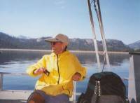
We were up early and on the trail by 5:30, despite another nearly sleepless night. We quickly descended the innumerable switchbacks, despite some massive blowdowns on the trail, and crossed Mono Creek on a lovely bridge. The side trail to the ferry is a bit over a mile from the PCT to where the boat docks, but we missed the turn (it was covered by a downed tree) and ended up having to backtrack, then discovered that there was no dock. Evidently ferry service only started yesterday. We weren’t sure whether the ferry was running at all. We didn’t really want to walk the five miles to Vermilion Valley Resort, but since our food drop is there, we would have if we had missed the ferry or it hadn’t been running. Just in case, we sat out on the rocks beside the lake and decided to wait a bit. Soon we heard the motor of the boat coming toward us. We shouted and waved and finally it pulled up next to us. We were the only passengers heading toward the resort, though a couple of hikers, Greg and Blue, got off at our rock.
VVR has an interesting setup. It is a small resort beside Edison Lake. There are four motel rooms, some large tent cabins, a restaurant and store. The owners are very friendly toward PCT hikers, offering one night free in the tent cabin, mail service (for a fee), laundry and showers, etc. The problem is, since the place is very remote, everything is very expensive. (Beer for $3.50! Cell phone at $2/minute!) It is easy for hikers to spend $100 a day. Many hikers stay for several days, perhaps partly because they are unwilling to face the snow and river fords again, but mostly because they enjoy Butch and Peggy’s hospitality.

We took a motel room so we could rest, but it turned out they are remodeling the room next door, so a nap was out of the question. I burned my eyes on the snow a couple of days ago, so I just lay on the bed with a cool cloth over my eyes, listening to the hammering. My eyes are very red and sore. Butch gave us some eye drops, which help a little, but rest is the best medicine, I think. We have eaten a lot and talked with several other thruhikers: Brad (a boat captain from North Carolina who is heading for the Peace Corps in September,) Bill from Berkeley, Skid (who hiked the PCT and CDT before and is dating someone we know who is hiking the AT this year), the Three J’s, and a father and son from Northern California, Bruce and Gordon, who are very fast hikers. Emily showed up with Ed and Kathy from Washington state. It was fun to compare Sierra stories with everyone. Just about everyone had trouble with the river crossings. Some were planning to leave today, but there will undoubtedly be others coming in this afternoon.
As I lay in bed this afternoon, I wondered whether this is really worth the pain and the risk. Jim has lost 27 lbs. so far. His right foot has hurt since San Gorgonio (broken toe) and he banged up both knees on the river crossings, one fairly seriously. I’m only a little bruised, but with blood-red eyes, and I’m utterly exhausted from too many nights lying in my bag unable to sleep because my feet ache, jump and twitch. Yes, we get a chance to see some really beautiful country. Yes, out here we are fully alive, happy with ourselves and life in general. Yes, I get a chance to face and overcome my fears on an almost daily basis — at least those dealing with falling in all its myriad forms (stream crossings, rock climbing, snow traverses, etc.) Now, if it was only as easy to face and overcome my other fears! Yes, we are challenged at a lot of levels every day. I love this life out here. I love the closeness and comradery Jim and I share. I love being surrounded by the natural world instead of cars, computers, and television sets. But is it worth risking our lives? I know that in a week or two, most of the risk will vanish. We’ll be back to the more normal trail problems of how many miles to water and how far to the next town, and do we really have to keep on doing 20 mile days? We’ll probably miss the excitement of dealing with snowy passes and raging rivers. Better fear than boredom? I don’t think so. I’m not an adrenaline junky. I like just walking the mountains, in peace and beauty, without fear.
June 16: Day off in VVR
Thanks to Butch’s generosity and a lingering reluctance to face the snow and river crossings, we decided to take an extra day off at Vermilion Valley. We didn’t do much but eat, read, and rest my eyes and Jim’s knee. It was expensive, but worth it since we ended up eager to get back to the trail. We convinced Emily and Steve to continue to hike as far as Yosemite, as they had planned. (Emily is getting off the trail there, heading to graduate school. Steve is going home to decide whether or not to continue his hike.) Both got a bit unsettled by the difficulties of the Sierras. Emily had a couple of very close calls, including a couple of self-arrests on Muir Pass. This is Steve’s first long hike, and not what he expected, I think. (i.e. It isn’t always “fun”.) We decided to hike together for the next few days. They didn’t want to be alone with the snow and streams, and we’re glad to have the company. A couple of John Muir Trail hikers came in to VVR, as well as H, another PCT hiker, and Guy, awaiting the arrival of Kerstan and company. Guy meets Kerstan as often as he can, but in the Sierras, that’s not often.
Saturday, June 17: Tully Hole — 12.0 + 1.5 (883.1)
We enjoyed a beautiful return trip across Edison Lake on the boat. It was very peaceful floating across the calm water surrounded by mountains and trees. It was much more crowded than when we came in on Thursday. We got back to the trail about 10:30. We only had one pass to cross today — Silver Pass — and it wasn’t too bad. There was solid snow for about a mile on either side of the pass, but generally route-finding was easy, just a matter of following footprints, and the climb was gentle. We got to do one sitting slide, then dropped fairly easily down to where we could find the trail again. It was, as usual, time consuming, but easier than expected.
The fords today were also easier. Our feet were constantly wet, and we had a couple of knee-deep fords and one hip-deep crossing, but the water wasn’t all that fast or cold. The scariest was across a waterfall that was described as dangerous in the guidebook. We got soaked with spray, and one part looked fast, but the water wasn’t very deep so we got across all right. The four of us stayed together all day, making sure everyone got across the streams and over the pass. We stopped early since the trail climbs above 10,000’ from here, and we weren’t sure whether snow would be a problem. Tully Hole is a pretty spot, with a meandering stream below, a grassy meadow, trees to camp in, and glimpses of snowy peaks. The Silver Pass area was quite beautiful, with dramatic grey, black and white granite, and lots of jagged snowy peaks.
It got cooler again. After four very hot days, the cooler weather feels odd, but nice. It also keeps the streams from flooding as badly. There was more snow down in the trees than we expected, long after we had descended from the pass. This morning we saw several beautiful waterfalls, including the one we crossed. We hope to take our time for the next few days, both because of the snow and streams, and just because it doesn’t make much sense to push right now. Emily is being picked up Tuesday evening at Tuolemne. I’m not sure when Steve flies home. Jim and I are just not in a hurry at the moment. We are hoping the snow will be gone before we get into the northern Sierras, so why hurry?
Sunday, June 18: Soda Springs -- @ 21.9 (905.0)
The cooler weather lingers. As we climbed, we found more snow, ice in the puddles, and frost on the ground. Even so, the stream crossings weren’t too bad — wet but not icy. It is very hazy again, and cumulus clouds are building. Our morning hike had a lot of up and down as we climbed from Tully Hole to Lake Virginia to Purple Lake to a long ridge with views southward to the snow-covered Silver Divide. There were intermittent patches of hard snow—enough to slow us down, but not enough to make navigation difficult. We met still more JMT hikers — a father and teenaged daughter team this time. She didn’t look very happy. Yesterday we met a man from Spain, dressed in cotton sweats, heading up toward snowy Silver Pass. He was hiking the John Muir Trail and really wasn’t prepared for the snow. I’ve been surprised at how many people there are out here so early. Is it because of the low snow, or just that they didn’t have a clue that there could be snow this time of year? Of course, this is a weekend, so there are a few weekend backpackers as well. We passed some people this morning by Lake Virginia, and then another eight or so during the day.
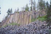
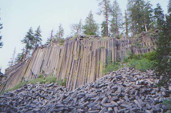
We reached Reds Meadow about 4:00. It’s a small resort, with a campground, store, and café. We ate an early dinner, bought some bread, and talked to Christa, whom we have been following for a couple of days. She said Monty, the dog, did fine on the river crossings, but Christa was swept away at Evolution Creek and had to swim for it. She’s quite small. That must have been scary for her. I’m glad Jim and I cross bad water together. We managed to hike a lot of miles today fairly easily. There wasn’t much snow this morning, and the afternoon was completely snow-free with easy stream crossings. At the store, we heard that one of the stream crossings ahead was quite bad (the teller ended up swimming), so we decided to avoid it. We took a side trail to Devils Postpile to get a close-up view of the huge volcanic columns, then followed the park road for a few miles to Soda Springs Campground, where we got water and rejoined the trail, well beyond the dicey crossing. No one was in the mood for an evening swim. We passed up the hot shower at Reds Meadow; we didn’t want to replace it with a cold bath. There was a big burned section just before Reds Meadow. It was fairly recent, I think. I hate burned forests; they’re so depressing.
Monday, June 19: Marie Lakes Trail Junction — 15.5 miles (920.5)
The morning hike was nice, gently climbing most of the way. First we climbed along and above a river, then we climbed along a ridge with some nice views of Banner and Ritter Peaks as well as Shadow Lake across the valley, with a waterfall descending hundreds of feet. There were a lot of small springs, making for boggy ground and lots of mosquitoes, but we thought it would be less snowy following the PCT instead of the alternate JMT route. The two trails coincide for most of the Sierras, but in a couple of places they diverge. This was one.
It is a gorgeous day, cool and clear.
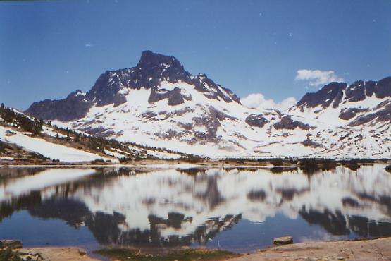
We ate lunch beside the outlet to beautiful Thousand Island Lake. We were too low to see much of the lake from the rocky bench on which we sat, but the snow-covered peaks around it are a beautiful contrast to the deep blue water that we could see. I love the views of Banner and Ritter; someday I would like to climb them. Steve jumped in the icy lake. He’s nuts! (But he’s clean.) There’s a lot of snow up here at 9800’. We climb from here. As we climbed, we had beautiful views of half-frozen Thousand Island Lake and beautiful Banner Peak beyond it, then later of other snow-covered mountains. We had a mix of clear trail and long sections that were snow-covered. We followed footprints and the map and only got really confused once, when we ended up on a section of very old PCT. We met a JMT hiker at one stream crossing who had gotten completely turned around and was heading north instead of south. Oops!
Finding a dry spot to camp wasn’t easy, but we finally found a tiny grove of conifers surrounded by snow and streams. This area isn’t at all as I remember it. It’s still beautiful, but without the green meadows and dancing waters that I remember. We did a short day because we know the next three miles will be slow slogging in snow, but it will be a bit easier when we’re fresh and the snow is firmer.
We met a lot of hikers again today, 20 or so. We also saw three deer when we were looking for the trail earlier. We’re still camped with Steve and Emily. Group travel is a bit slower, but it is fun making sure no one gets lost or has to face a difficult ford alone, and they are good companions, easy to get along with. Emily did the early part of the Sierras with a very hard-driving couple from Washington. They’re nice people, but they really pushed hard, all day, every day. We’re a bit more laid back. At least we’re slower.
Tuesday, June 20: Tuolumne Meadows — 16.3 (936.8)
Donahue Pass was a snowy one, not technically difficult, but with a bad descent. The worst part was trying to figure out which one was the actual pass. Looking up at the ridge, we could see three possibilities, so the debate was endless. After much discussion, we ended up following footprints over the pass to the left. It worked.
We crossed Lyall Creek on a snow bridge, then followed it downstream to the campground at Tuolumne Meadows. The water in Lyall Creek was beautiful — clear, waist-deep, blue and green. It looked very swimmable, but we know where it comes from: pure snowmelt. There were masses of hikers on the trail. It was an interesting experience seeing the variations: from tiny day-packs to massive expedition packs. One couple looked ready to tackle Everest with their plastic glacier boots and huge packs, and they were only out for the weekend. Tuolumne Meadows felt really strange, with so many people, running all over the place. We stopped to pick up our mail, ate a hamburger, and bought groceries for the next few days. Emily’s father came to pick her up, and took Doug and Christa on to town for an anniversary celebration. We had hoped to buy enough food at the store to get to Echo Lake, but the prices and selection weren’t very good, so we decided to break up this next section by exiting at Sonora Pass. By then, we’ll be more than ready for a shower and laundry. VVR seems a long way back, already.
For some reason, I spent most of the day in a really bad mood—very emotional and weepy. Partly I was just tired and upset about a two-day headache (altitude?) that was plaguing me. Partly I was irritated at the group dynamics at Donahue Pass. Partly I was unhappy because the trail wasn’t as I remembered it. (i.e. the beautiful green Rush Creek area was grey and snowy; easy Lyall Canyon had a long steep rocky snowy descent before we reached the flat meadows, and then the trail was so boggy, it wasn’t quite the cruise trail I remembered.) Partly it was the rush to get to Tuolumne Meadows before the post office closed at 4:00, which made it impossible to relax and enjoy the day. We rather enjoyed the brief sprinkle that fell around 6:00. It was enough to get the tent wet, but we stayed dry under the trees. There were big black thunderclouds all afternoon, but no real storm.
Home | Links| Trail Journals |
The Thruhiking Papers | Bun-bunSouthern California | Central California
Northern California | Oregon | Washington
Created: Fri, 16 Jan 2004
Revised: 30 Sept 2016Copyright © 2004-2017 Spirit Eagle