
|
 |
 |
 |
 |
Monday, August 13 – 16-17 km up Owen Creek
After breakfast and a quick stop at the post office to get rid of some excess weight (maps and journal), we walked out to the highway to solicit a ride back to The Crossing. It was cold, cloudy and wet from last night’s rain, but even so, we had a hard time getting a ride. A lot of people drove in to Nordegg to get gas, but none would stop for us. There was a road just beyond the turnoff that parallels the parkway all the way to Hinton. Evidently a lot of people drive that one instead of going up to the Parkway. People waved, but then turned. There is supposed to be a nice hostel 3 km up the road that would be an alternative to the motel, but then you’d be far from the restaurant. I’d rather pay the extra for the motel and not have to walk back and forth two miles each way to get a good meal. After about an hour and a half, a car finally stopped, with a very nice young woman who works for the Park at one of the entry stations. The hour-long drive passed very quickly and easily in conversation.
By the time we reached The Crossing, it was time for lunch so we braved the hordes (they get a lot of buses stopping there to use the bathroom) and got an overpriced meal in the cafeteria. The chili was good, but the place was a madhouse. I was very happy to leave it and head back to the trail.
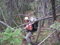
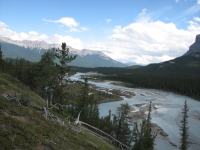
There was some confusion starting out. We were supposed to pick up a trail on an old road near the motel. We did, but it was the wrong old road. Eventually we bushwhacked to the right one and enjoyed some nice views of the North Saskatchewan River below us as we hiked. We paralleled the highway, but far enough away that it felt like a hiking trail, not a roadwalk. In six kilometers or so we passed an old Warden Station at Owen Creek where we ran into a family trying to get up the nerve to cross the creek. We splashed across, said hello, then bushwhacked a short distance out to the highway, where we picked up a trail of sorts along Owen Creek that we followed all afternoon.
Owen Creek was an interesting trail in that it was so variable. Generally there was tread to follow, but it varied from nice foot trail through the forest to narrow mountain goat trail going straight up the fall line to making our own way along the edge of the river on rocks. You really had to pay attention.

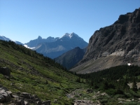
Though the guidebook warned against following the “new cut trail”, late in the afternoon we decided to give it a chance since it was obviously constructed trail, as opposed to another nasty bushwhack back down to the creek. I was curious to see where the side trail went as there is no obvious destination in the area, no lakes, waterfalls or passes that show on the map. Unfortunately, it kept heading northeast and we wanted to be following the creek northwest. I got stubborn and kept going long after we should have turned back. After a long climb on the ‘new’ trail, we decided it was too late in the day to be exploring, and since the trail wasn’t heading back the way we needed to go we finally turned around. Dropping 500’ back down to the creek was not fun, but it was necessary. Then we had to climb back up almost to treeline. The guidebook said that there was a flat area near a side stream. Sure enough, we reached a pretty little meadow just before sunset that had been used as a campsite previously. Jim froze his feet looking for the camping spot, crossing the icy stream several times. He was not a happy camper.
Owen Creek was an interesting stream, aside from the trail. It started at the lower end with a narrow twisting slot canyon much like Mistaya that was narrow enough you could step across, but at least 25’ deep. Then there were several waterfalls. We had a view of the Wilson Icefield for a while. The creek roars. It has a lot of water, even this far up. In the slots it really sounded ferocious. The view from the campsite is beautiful, looking out at the peaks and icefields to the south.
Tuesday, August 14 – 16 ½ km to Pinto Lake
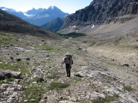
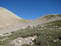
We slept late this morning, making up for our usual town insomnia. Still, we found our shoes covered with ice and our socks frozen stiff. We took our time, letting our shoes thaw and the tent dry out a little, then continued our climb up Owen Creek. Tread was intermittent, but the way was obvious. The first pass wasn’t difficult and the views from the top were terrific. The top was funny because the left side of the pass was all orange rock, while the right side was all gray rock. There was a clear line between the two. We descended a couple of hundred feet, easily, to the Michele Lakes Basin. The upper lake is very shallow, but later we could see another beautiful aqua lake below us. Then we climbed about 1200’ to a pass on the other side, the highest point on the GDT (2590 meters). Since this isn’t a real trail, just a route, the passes aren’t named. From below, the pass looked quite difficult, especially with the snow cornice across the ridge, but it turned out to be straightforward, just steep. The descent to Waterfall Creek was a long steep bushwhack. We ate lunch in a meadow below the waterfalls. It was a beautiful spot, with lots of flowers and sunshine. It has been a good day.
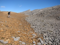
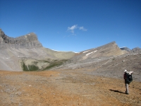
After lunch we wandered around looking for the trail up to the next pass. First we picked up a bear trail that went through numerous diggings. He had rototilled huge patches of meadow. Finally we picked up some decent pack trail that led us up above treeline. The trail vanished when we reached the alpine zone, but we spotted some hikers ahead, so we just headed toward them. We talked to the group for a while, five men out on a four day trip, then they went down and we continued up to the pass, over a snowbank (in August!) then down the steep north side.
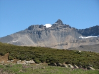
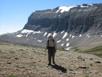
Finding the trail down was a problem. We found it, lost it in the scree, thought we saw it below but discovered that what we were seeing was just a watercourse, bushwhacked north for a while and finally ran into good pack trail again. After that it was just a matter of dropping down, down, down to Pinto Lake, a pretty lake 7 km from the Pass. There are a couple of camping areas by the lake. The hikers we met warned us that a group of Outward Bound teens had taken over the main campground, so we decided to stop at a horse campground a kilometer before. We were ready to stop anyway. Today was a strenuous one, with three major climbs and three big descents. Finding the trail down the valley was a big help, but it had also been damaged by horse traffic, especially in the many wet areas, so that wasn’t entirely a blessing.
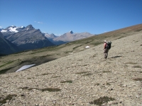
Today was a beautiful clear sunny day, but quite cool, especially when the wind blew, as it did at the passes. It was a really spectacular day, with some incredible views. It was fun, in a lot of ways, though really exhausting. I’m glad we added the half day in this stretch. Between the steep climbs, the rough trail and the stretches of no trail, we just can’t go fast. We normally hike about 2 miles per hour; today we only managed 2 kilometers per hour. It’s not a problem, since we have the time to take our time. Having the extra half day will keep us from turning tomorrow into a super long day. The climb up Cataract Creek is supposed to be even rougher than what we’ve already done this week.
August 15 – 22 km up Cataract Creek
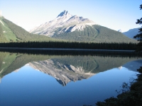
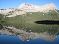
It was a lovely campsite, despite all the horse manure scattered about. We listened to the laughter of a loon last night and again this morning. When we woke the lake was still and reflected a perfect mirror image of the peaks surrounding it. We walked the kilometer to the main campground and learned that the kids were all off in the brush, doing solo campouts for two days. All the tents were left behind, so there wouldn’t have been room for us if we had continued, even though their owners were not there. We spoke with a woman instructor at the campground and two men at a helicopter landing site nearby. Evidently the group resupplied by helicopter so they didn’t have to carry all their food with them. The group is out for 21 days in the backcountry. I was a bit shocked to hear that they don’t hang their food from the bears – I suppose because it’s so heavy. They just put it up high enough to keep it away from rodents. So far they’ve been lucky, but they aren’t doing their job of teaching the kids how to survive in the backcountry if they don’t teach them proper bear country behavior.
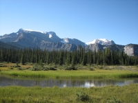
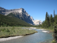
The men directed us down the wrong trail, but we soon figured out the error and turned back. We followed the Cline River for a couple of miles, then turned up Cataract Creek. For the most part the trail was easier to follow than expected. It’s in the White Goat Wilderness and not maintained, so there are lots of blowdowns (though not nearly as bad as the Howse River Trail), but there is good tread. The Outward Bound group told us they missed the first ford and ended up bushwhacking for several kilometers on the wrong side of the creek before finally crossing and finding the trail. We ended up inadvertently shortcutting to Cataract Creek on a game trail instead of the foot trail. We only realized where we were when we noticed the creek was flowing in the wrong direction. Soon we found the ford and all was well again. Our only disappointment was somehow missing Pictograph Rock, a large boulder with some faint painted stick figures. We knew what to look for, a big boulder between the trail and the creek, but there were more large boulders than expected, and we couldn’t check them all out. Oh well.
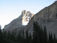
We follow Cataract Creek upstream for the next 21 km. It’s a pretty area in the White Goat Wilderness. We ate lunch down by the stream, looking up at rocky cliffs towering overhead. We don’t plan to go far today. We need to camp inside the Wilderness and as we get closer to the pass, the trail is supposed to get steeper, so campsites may be hard to find. I won’t mind vegging out for a while. It is warm and sunny and very peaceful.
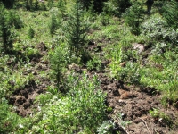
After saying how easy to follow the trail was, of course we lost it. In wet areas the trail vanishes. We went the wrong way after lunch and spent half an hour searching. We eventually found the trail again, and the next couple of hours were uneventful, just climbing gently in the trees. There were few views, though we passed a couple of glaciers/icefields and a big waterfall. We just got half glimpses of those through the trees. At the end of the day, things got confusing. The guidebook warned of an obscure junction. Either we passed it or we never reached it. We didn't bring a GPS on this hike, so we rely on the guidebook descriptions instead of the coordinates that are also in the book. Sometimes the description just isn't good enough, especially at obscure junctions. We were supposed to cross a major tributary, but there were lots of side streams, some quite large. Which was the tributary? I was really worried about finding a campsite below treeline, so when a sort of flat spot appeared on a bench next to a tributary with signs of previous occupation, we grabbed it. There were others a few miles farther back, but we wanted to get as close to the pass as possible, without actually climbing up to it.
We’ll worry about finding the pass tomorrow. Trouble is, the pass doesn’t show on the topo map we have and the next map is on a larger scale so lacks a lot of the detail we need. I don’t really want to climb 1200’ tomorrow and discover we’re at the wrong pass. Today we got concerned because we were heading away from the creek and heading toward Cline Pass, which is definitely wrong, so we bushwhacked back down to Cataract Creek and just followed it upstream. We got a glimpse of what might be the pass off to the left. Out here the passes are not always obvious.
The flies have been driving me crazy this afternoon, which doesn’t help my attitude much. The big biting horse flies have been swarming us. DEET doesn’t stop them, though it discourages the mosquitoes and smaller flies. Losing the trail was just icing on the cake.
We’ve seen lots of bear sign this afternoon: fresh scat, tracks and recently dug up meadows. There is at least one big grizzly in the neighborhood.
August 16 – 18 km to Four Points Campground in Jasper NP
It was another freezing night, cold enough to keep us awake. Jim’s shoes were frozen again. Mine were under the tent flap, so were just cold and wet, not stiff, when we got up.
It turned out we were exactly where we thought we were last night, about 4 km from Cataract Pass. There was no sign of trail though, so we bushwhacked along the creek for a while, and then began climbing straight up the scree. After a while we reached a fairly level bench where we spotted a rock cairn. From then on the climb was straightforward and not too difficult. There was a lot of snow, but mostly we could avoid it. We could see where some hikers skied down one big snow bank.
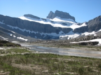
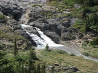
The far side looked down on some blue gray lakes with lots of snow around the edges. It was a steep descent, but on trail all the way. That vanished in the broad river plain that is the head of the Brazeau River, so we just crossed wet gravel bars for a bit until Jim spotted more cairns. We followed the Brazeau River for the rest of the day. It’s a beautiful open valley with orange and gray rock, glaciers, and deep blue glacial water in the river. The map shows the trail as merely a ‘route’ but in fact there was decent foot trail most of the way. We had one short section of large boulders to scramble through, but the rest was a fairly easy path beside the water. We were surprised at how quickly we reached the trail junction with the good “Glacier Trail”. From there it was an easy hike past a waterfall and campground down the valley of the Brazeau. It is pretty country.
There are several people at Four Points Campground. We spoke with one guy for a while about the GDT, since he knew a lot about the trail. He was doing the Brazeau Loop, a 70+ km trek that sounds like an interesting hike. There were only three other tents at the campground: a couple and three women who had dayhiked to Jonas Pass today, and the Brazeau Loop hiker. I was able to wash up in the river before the others showed up. It felt wonderful.
August 17 – Jonas Cutoff Campground – 22 km (or 19?)
A thunderstorm blew in just at dark but when we woke the sky was blue again, though everything was soaked. Clouds built up again soon after we started out and it was hazy with humidity, but it was cool enough for good hiking and we were able to dry the tent in the sun at lunchtime. Today was another short day thanks to the location of the campground. We had a choice of 22 or 33 km to the next one. We chose the more relaxed option. Tomorrow will be about 30 km, though without any major climbs, I think.
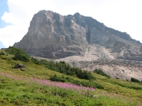
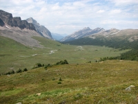
Our morning hike today was a really nice one up to Jonas Pass. After an initial steep climb through trees, the trail breaks out into an open alpine valley which it follows gently uphill for several miles. It was easy hiking – cruise trail – with views of ice fields, pink and gray mountains, and green hills. There were several wet foot stream crossings but nothing deep. We had the trail to ourselves all morning, met a solo woman at lunch and one other couple an hour later. Not bad for a busy trail like the Brazeau Loop. Scurrying ground squirrels and whistling marmots were our only wildlife.
The climb up Jonas shoulder, a ridge between Jonas Creek and Poboktan Creek, wasn’t as bad as I expected, largely because we didn’t descend much from Jonas Pass before beginning the climb. It was steep but only for a short distance, then the climb became more moderate. The views were spectacular, despite the haze. We could see at least four glaciers on one side of the ridge, and others to the north. Clouds came and went all afternoon, but we took advantage of our early stop to rinse out our t-shirts and socks, in the hope that the rain would continue to hold off for a few more hours. I’m glad we didn’t opt for the big day today.
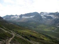
It was nice to be able to take our time, enjoy the views, and take lots of pictures. It made today an especially enjoyable day, with easy hiking, lots of views and no push for miles. We haven’t pushed very hard on this trail. We’ve done more short days than long ones, all in all. I’ve enjoyed that. We took a few flower pictures, but they’re getting sparser as summer winds down. Yellow paintbrush, blue gentians and pink fireweed dominated, but they’re all starting to fade. We’ve had a few freezing nights, so I’m not surprised, but I am glad we started when we did so we could enjoy a month of beautiful flower displays before the frost killed them. A few plants are starting to turn red already.
Two men share our campground – Germans or Eastern Europeans I think. They were here when we arrived but napped most of the afternoon so we didn’t get to talk to them much. The trail hasn’t been as crowded as we expected – hurray! After the crowds on the Rockwall Trail, I expected Jasper to be as busy, if not worse. This section, at least, hasn’t been. We’ll see how the super popular Skyline Trail compares.
August 18 – 30 km (or 26?) to Mary Vaux Campground
We only got about three drops of rain last night, but we awoke to a cool damp morning, with clouds wreathing the peaks. By noon, thunderclouds filled the sky. The morning walk was a nice one, descending the valley above Poboktan Creek. There were a couple of interesting peaks and a beautiful waterfall at Waterfalls campground, but mostly we walked through woods and meadows gently up and down on good trail. There were lots of side streams, mostly bridged, so wet trail was sometimes an issue, but mostly it was an easy hike.
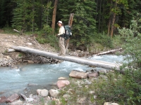
We ate lunch at one of the campgrounds with a Russian (?) couple who were cooking scrambled eggs over a fire. At the trail junction a kilometer later we met our first backcountry warden, talking with a family group. The mother asked if they could take a picture of the kids riding his horse and he said yes, though a bit reluctantly I thought. He asked for our permit, which I was happy to hand over, since we were exactly on schedule. I'd wondered if we would meet a ranger. As he said, it’s nice to know that the money we paid for the permit was in fact quite necessary. Some hikers don’t bother with a permit, because it is a bit of a hassle and because it is more work to create a schedule and stick to it, but it gives thruhikers a bad reputation when they are caught without one, especially American thruhikers who think that the rules just don’t apply to them. Generally, if you have a permit, the wardens will give you some slack if you are off by a day or two, but if you have none, they will give you a hard time. I don’t blame them. Thruhikers are not above it all, exempt from the rules that apply to all other backpackers on the trail. We got spoiled on the PCT where a single permit covered the entire trail, and reservations were not required at campsites anywhere along the way, but Canada is different and we should respect that difference. We don’t have to like the reservation system, but I accept that there are valid reasons for it, just as there are in Glacier, Yellowstone and Denali.
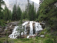
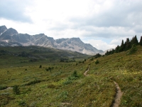
We spent the afternoon climbing up and over Maligne Pass. The trail deteriorated, becoming very eroded and rocky. The Pass was a long valley with a small lake, quite scenic. The clouds and haziness stayed with us all afternoon, but the rain held off while we hiked. We passed two women at the pass who joined us later at the campground. Evidently it gets little use. There appear to be four tent sites, but only one showed signs of wear. The others are overgrown with weeds and flowers. There are two tables and an outhouse, but only two cables to hang food. I’m not sure how far we hiked today. The guidebook says 30.6, the trail signs said 26, the map said 28 ½. In any case, we were tired and ready to stop. We had the same uncertainty yesterday. Did we hike 22 km or 19 yesterday as the map stated? Who do we believe: the guidebook, the map or the national park signs? Fortunately, it really doesn’t matter.
August 19 – 26 km to Trapper Creek CG (or 19? or 22?)
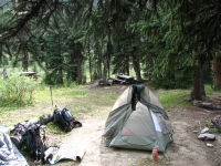
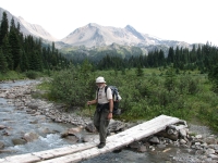
It was a cold wet drizzly dreary day. The rain started last night about 6:30, continued for three hours or so, stopped for the night, then started up again soon after we left camp this morning and continued all day. It never rained hard, just continually. In any case, the bushes were soaked and so were we within five minutes of leaving camp. I suppose we were lucky; it snowed on the ridges above us again last night. We might have been dealing with snow today instead of rain, just as wet but twice as cold.
The trail wasn’t very exciting in any case – mostly a walk in the woods with occasional sorties into the meadows by Maligne Creek. The clouds were so low we could barely see the nearby ridges, much less anything farther away. It was just wet walking through willows and huckleberry bushes. The highlight was spotting a moose grazing near the trail not far from our camp.
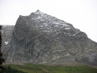
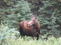
We have one co-camper, a man who intended to hike the Skyline Trail but he started at the wrong trailhead and went in the wrong direction but didn’t realize it until he reached our campground. Ouch! That would hurt. He’s not a strong enough hiker to get back on track so he plans to bail in the morning. We built a fire in an attempt to dry out, but the wood was so wet it produced more smoke than heat. Then it started to rain again so by the time we got the food hung we were soaked. I was really unhappy with that after being so wet all day. Knowing that we’ll start out wet tomorrow is not happiness. I have been looking forward to the next stretch – the Skyline Trail – for years. Doing it in the rain was not how I pictured it.
August 20 – 27 km to Curator CG
It rained most of the night but we woke to only clouds with a few patches of blue overhead. It was a great improvement. Most of the day remained the same: clouds, intermittent sunshine and occasional brief showers. It was much cooler than yesterday, so we stayed bundled up even when the sun was shining.
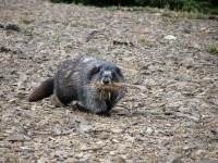
It was also a much more interesting hike today than we had yesterday. We climbed the ridge near the campground and wound our way through the woods to the trailhead near Maligne Lake. Hordes of dayhikers passed us heading up the Bald Hills Trail. We dumped our garbage in a bin at the trailhead, then headed into the woods on the Skyline Trail. It’s a real tourist trail, especially the first 4 kilometers -- wide, smooth, gently graded -- it was great, especially after yesterday’s wet overgrown trail with its many blowdowns. All trails are not equal out here, that’s obvious. We passed a couple of small lakes as we climbed gently through the trees.
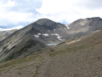
We ate lunch at the second campground we passed, just below treeline, after spreading all our wet gear out in the sun to dry. Then the views started to get good as we looked back to the Bald Hills and the Opal Hills. There was fresh snow on the steep jagged peaks near Maligne Peak with its big glacier. Little Shovel Pass was an easy climb through green hills with a drop to wide flowery meadows on the far side. The peaks nearby were gray and rocky, with snowfields still hugging the sides of the cirque.
The climb to the next pass was steeper and the far side had barren scree slopes, not green meadows. The icy wind howled and we got a rain/snow shower, which hurried our pace a bit. We dropped off the main trail to Curator Campground beneath a tall braided waterfall. It will be a stiff climb up – about 2000’ – but at the campground we’re in the protection of the trees. There are several people here already and we passed at least one more group that will be sharing the site.
I was really happy to get the beautiful views today, even though our pictures aren’t likely to be very inspiring. Gray days rarely photograph well.
August 21 – 28 km to Jasper
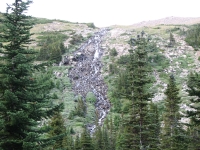
Plans have changed, all around. It rained all night and when we woke it was still pitter-pattering against the tent. We waited about an hour, but there was no change, so finally we got up, ate breakfast and packed up our gear. All around us hikers were trying to decide: go up or go down? From Curator, the trail rises 2000’ to the Notch, then follows an open ridge. Several miles are above treeline. From below, we could see occasional glimpses of fresh snow above us, but mostly just white cloud. Yesterday, the wind was fierce and cold. Today would likely be worse. On the other side of the campground there is a horse trail heading down that passes an outfitter’s lodge and descends to a bike trail that goes directly to Jasper. Since it was cold and still raining when we left, we decided to go down. I was really disappointed to miss the second half of the Skyline Trail, but given conditions as far as we knew them, it seemed wiser to go down. Of course, half an hour later the rain stopped, but when we looked back, clouds still covered the ridge, so we continued our descent. Walking in a whiteout can be dangerous, especially above treeline. It was 11 km down on fairly good trail. There was some horse damage in places, but all in all it was better than expected. It was hard on the knees though, since we dropped at least 3000’. Then we switched to a bike track that was a very nice trail. It reminded me of the Valley Trail in Grand Teton NP. We had views of the mountains near Jasper and of creeks and meadows below the trail. The sun appeared for a while. The last three kilometers were a bit rougher, but when we dropped to the milky blue Athabasca River, I really enjoyed the last half mile. We watched a raft float by as we approached the trailhead; that must have been really cold!
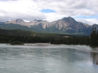
We crossed the river on a bridge and headed to the Visitors’ Center in the middle of town. Our first order of business was lodging. We had a reservation at the Maligne Canyon Hostel near the trail, but since we didn’t end up anywhere near there, I wanted to switch to the main hostel so we could take advantage of the $5 shuttle (vs. $24 to go to Maligne). I also wanted to take a shower today. The Maligne hostel is a primitive one that doesn’t have showers. I couldn’t get through to the hostel; the line stayed busy for the 15 minutes I spent redialing. I had a hard time getting through when I made the reservation so I wasn’t surprised. That time it took two hours to get a live human being. In the meantime, a woman came up to the accommodations board to add her room to the list. It seems a lot of Jasper residents rent out a room or two. If they have space, hosts come to the Visitors Center and put their names on a list. A free phone is provided. I talked to her, then to Jim, and we ended up at Sandra’s Place, a private house with a basement room and bath, right in town. That’s much better than a hostel 7 km from town. I left a message on the hostel answering machine to cancel all reservations and hoped that they wouldn’t charge us anyway. I wish I’d been able to get through to a human being.
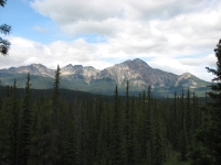
While I was on the phone, Jim talked to the backcountry ranger. The guidebook says that the trail north of here was damaged by a fire in 1998 and is impassible. The guidebook recommends an alternative, the North Boundary Trail. Unfortunately, that trail is closed this year. They’re putting in a pipeline, so all access is closed from Celestine Road while construction continues. We could access the trail from a trailhead 100 km away, but I’m not sure we could even get to the trailhead from here. There’s another ranger who knows more about the GDT route, but right now it doesn’t look like we can continue our hike. All along we’ve told people we were “hiking from Waterton to Jasper”, but I really thought we’d be able to continue as far as Mt. Robson. The main uncertainty was Jim’s knee. It hurts, but he was willing to continue if the weather was favorable. Now – we’ll decide tomorrow.
August 22 – Rest Day in Jasper
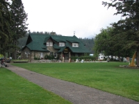
It was a disjointed drifting sort of day, seen through a haze of exhaustion and disorientation. We slept very little last night – our usual town claustrophobia and caffeine overload, I think. The past eight days were tiring and the unexpected detour yesterday was really dispiriting. I had been looking forward to the Skyline Trail as one of the highlights of the GDT and to have it get snowed out was a major disappointment.
We left our lodging fairly late in search of a big breakfast, after several cups of coffee and a chat with Sandra, our hostess. Over pancakes and eggs, we visited with three local men, talking about our hike, Jasper, and the space industry. Laundry took a long time, but we ran into the family we met at Curator Campground and talked with them for a bit. They followed our example and descended out of the bad weather yesterday. Only one group hiked the ridge route.
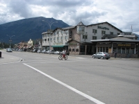
We stopped at the train/bus station to inquire about transportation options out of Jasper. There are lots of possibilities, but most are too expensive or time consuming. We went to the pub for lunch, then returned to the Visitors Center to discuss the GDT north of Jasper with a warden who knows the area well. We learned that one thruhiker, the man from Lethbridge, did hike the Miette River route last week. He said it was obscure, boggy and he lost the trail frequently, but it is doable. The ranger we spoke with was very enthusiastic about the remoteness of the region and the wildlife, but admitted that they don’t have the resources to maintain the trail any longer. It’s not completely abandoned, but it doesn’t get cleared unless someone on horseback brings an axe. She said the North Boundary Trail is in better shape, but is your basic long green tunnel and not nearly as interesting as the Miette River route.
Unfortunately, by the time we talked with her, Jim and I were feeling very tired and discouraged about continuing the trail this year. The weather forecast calls for clouds and cool temperatures for the next two days with more rain over the weekend. Right now, the thought of a long roadwalk followed by 100 km of wet, muddy, overgrown, burned and blowdown-covered trail just doesn’t appeal. There are highlights to look forward to—Mt. Robson, Miette Lake and Moose Pass—but the price is more than either of us is willing to pay at the moment. So we thanked the warden, Vicky, for her time and went to the bus station to buy tickets for tomorrow’s bus. If we weren’t so tired, the decision might have been different, but for now I’m okay with it. All along we’ve said, “We’re walking to Jasper.” I guess we got it into our heads that that was all we had to do. I don’t feel celebratory, but I don’t feel sad either about ending this trek. I believe we’ll be back to hike more of this beautiful country. We may hike from Jasper to Robson, or even up to Lake Kakwa, just not this year.
August 23 Postscript:
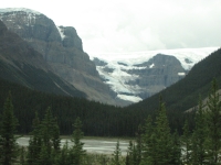
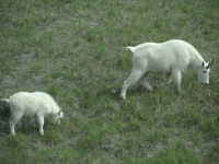
We took a Brewster Bus from Jasper to Calgary, enjoying the beautiful views along the Icefields Parkway. It rained off and on, but it was still a nice ride. Greyhound is a little cheaper, but it heads north to Edmonton then south through the flatlands, so isn’t nearly as scenic a ride, plus it’s longer. We saw some mountain goats and deer from the bus, as well as the various glaciers, icefields, waterfalls and lakes that make the drive such a pleasure.
From Calgary, we caught a bus to Pincher Creek, which is the closest town to Waterton National Park that Greyhound visits. They no longer drive to Great Falls, so the only alternative routes that cross the border would be via Vancouver or Winnepeg. It seemed easier (and quicker) to get as close to the border as possible, then just hitchhike the last stretch. Arriving at 1:30 a.m., we were lucky to find one motel in town that was still open, with a room available. It was expensive, but we were so tired we didn’t even care. Twelve hours on buses is exhausting!
The next morning we hitched a ride 50 km to the edge of Waterton with a very interesting man who worked with Canadian Fish and Game. He revived our interest in the Willmore and points north. A man from Utah, now living in New York as an aspiring poet/novelist, drove us across the border and almost all the way to East Glacier. Life got interesting for a few minutes because he'd lost his passport last week. Crossing the border was an adventure.
Finally, a woman who works at East Glacier Lodge drove us the last few miles. She was full of questions about how to ovecome her fear of bears - and where to go in Baltimore when she was there for a wedding in a couple weeks.
All in all, it wasn’t a bad hitch and there were some interesting conversations along the way. We were happily settled in at the Whistling Swan by 3:00. Now we can relax and figure out our next moves. This part of the journey is over, but we still get to drive home. Where shall we go along the way?
To follow the winding path we took through the North-Central States on the way home, you'll find our journal here.
Update:
In 2008 we hiked the section of the GDT (Great Divide Trail) from Jasper, AB to Mt Robson Provincial Park, BC. Our journal for that section of the trail can be found on the next page as well as in our 2008 Alaska Journal(Aug 3-10, 2008).
Home | Links| Trail Journals |
The Thruhiking Papers | Bun-bun
Created: Fri, 16 Jan 2008
Revised: 30 Sept 2016Copyright © 2007-2017 Spirit Eagle