|
 |
 |
 |
 |
|
|
|
|
|
|
August 7 about 8 miles on the Amiskwi Trail
Jim decided to buy another tent, rather than live with the broken zipper. Its heavier and bulkier than our Tarptent, which is not happiness, but given that rain is forecast for the next four days, its probably a smart move. We left Wilsons and saw a Greyhound bus pulling up to the curb. On a whim, I asked the driver, Do you go to Field? He said yes, so I asked, When do you leave? As soon as I get loaded up. So we dashed into the depot/post office, bought tickets and were soon on our way. Its only 30 km, but it saved us a somewhat complicated two part hitch.
On the way, I spotted a coyote eating by the road as we drove westward. The bus dropped us off on the highway, so we walked across the bridge and the railroad tracks into town to pick up our maildrop at the post office. The postmistress said only one GDT hiker had been through this year. He was a man from Lethbridge, Alberta, probably the same one we heard about in Castle Mountain. She didnt have any boxes for any other hikers. I wonder what happened to the two who had sent boxes to Coleman? They must either be way behind, or they were section hiking. Or perhaps they intend to go to Lake Louise?
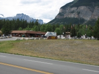
We ate an expensive lunch at the Truffle Pig, then headed back to the trail. We were supposed to have a rest day today, but given the high prices for food and lodging, we decided instead to take a half day where we eat as much as possible in town, then do a short half day on the trail. I would have enjoyed a complete do nothing zero mileage day where I did nothing but read, watch TV and rest, but the hostel at Lake Louise isnt particularly restful and Field is too expensive and too limited in amenities. Only one restaurant serves breakfast and lunch and I think paying $13 for a hamburger is ridiculous, even if it is bison.
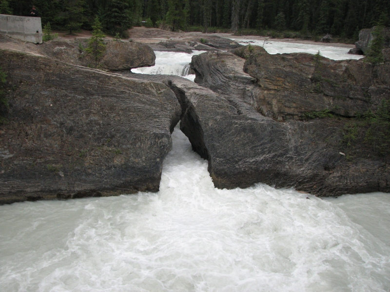
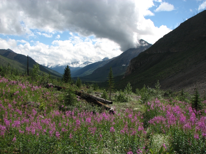
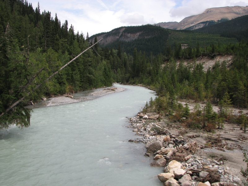
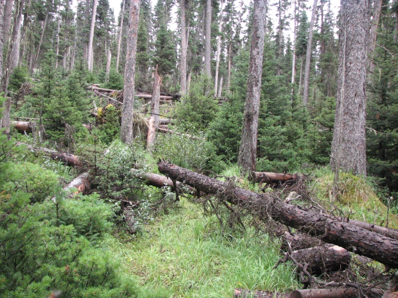
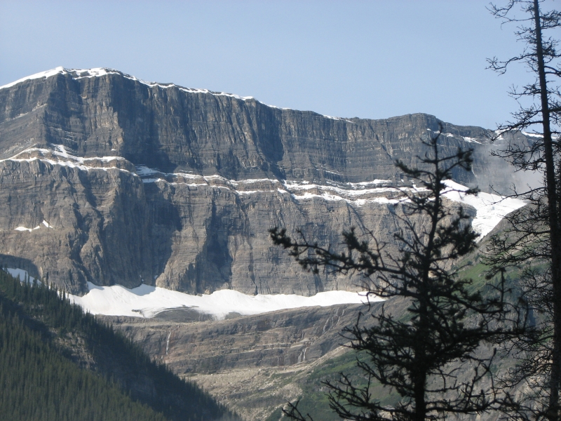
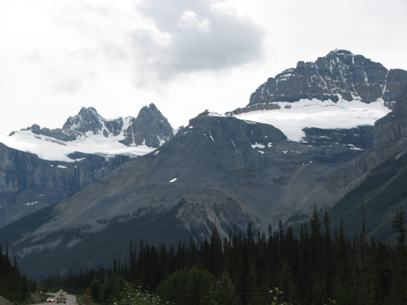
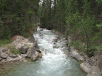
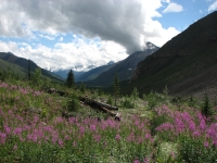
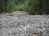
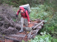
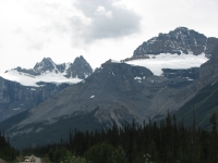
The trail followed old woods roads today: first the Tally Ho Trail from Field to Natural Bridge, a spot where the Kicking Horse River had worn a hole in the rock that it entered and emerged from shortly afterwards. Then we followed an old abandoned logging road above the Amiskwi River. We cant see or hear the river, but its down in the valley below us. The trail gets little use and no maintenance, as evidenced by the number of downed trees on the road. It was still easy hiking. The guidebook warns that it can be wet underfoot and overgrown in places and there are a couple of fords up ahead, but all in all this section should be fairly easy. Its also likely to be remote, with few if any other hikers, quite different from the last one.
Its only 70 miles from Field to Saskatchewan Crossing, and though we travel through two National Parks and one Forest District, we are allowed to do random camping all the way as there are no formal campsites en route. We still have reservations so they know where we are, but the permit only lists approximate locations (i.e. Amiskwi, Howse River, etc.) and we can camp wherever we find an appropriate spot. Thats good because our daily mileage isnt predetermined, but sometimes good campsites are hard to find in areas that get little use. The ridge the road is following is very steep, so we ended up camping in a wide spot by the side of the road. It started to rain and we decided we didnt want to go any farther. The big problem with that is the road gets a lot of bear traffic. We found scat every 50 or so.

Most of the scat was old, but still, the risk of an encounter is high. We spent an hour looking for a better spot and didnt find one. There was a good possibility way back, but we arent supposed to camp within 5 km of the trailhead and that one was only an hour out. There are other possible campsites ahead, but farther than we want to go on this half day.
The guidebook mileage was off again it took an hour and fifteen minutes to hike from town to the trailhead at the picnic area, which was supposed to be 6 ½-7 km. It only took 12 minutes to walk "2.5 km" (?) from Natural Bridge to the picnic area. I dont think so! The guidebook mileage seems to be off whenever there is a road walk, which is nice for us, as invariably it seems to be shorter than expected. Walking into Field yesterday was much shorter than expected, and since it was a highway, we were quite happy with that.
August 8 29 km to Amiskwi Pass
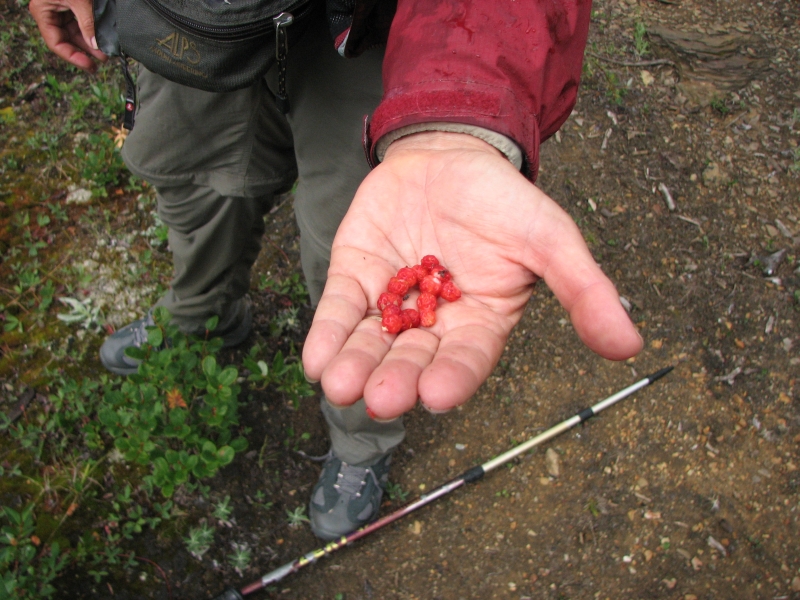
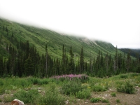
It rained off and on all night and again this morning. We slept late, putting off the inevitable, but eventually we packed up our wet gear and headed up the jeep track. It didnt rain hard, just occasional light sprinkles, but we got soaked anyway from the brush lining the road. The trail was in better shape than expected, with bridges over the side creeks, plus someone had brush-whacked a couple miles of the road a year or two ago, so the saplings havent yet filled in the tread. They left lots of stubs, but at least the road was easy to follow for a while. There were lots of wild strawberries again, very tempting and very tasty.
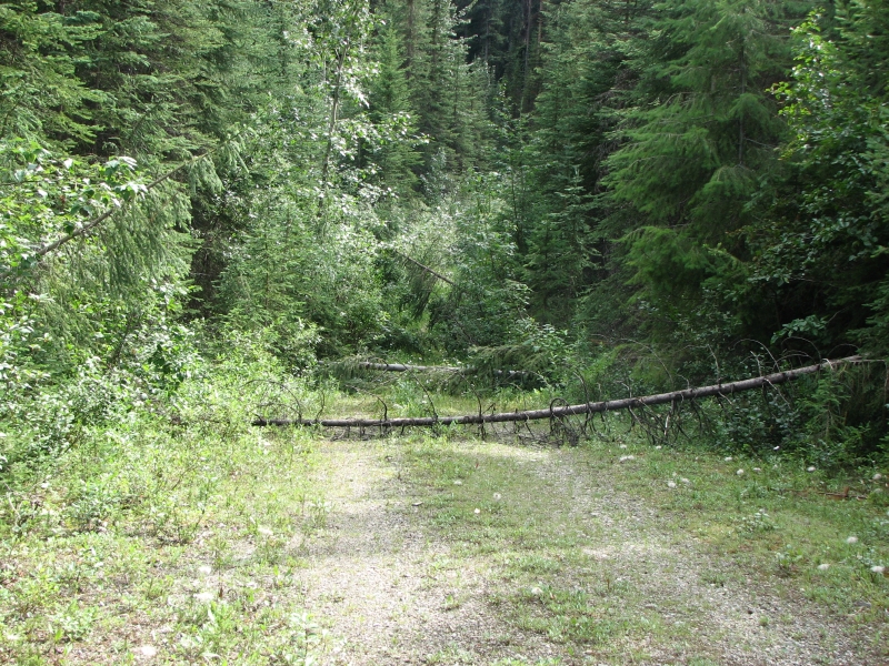
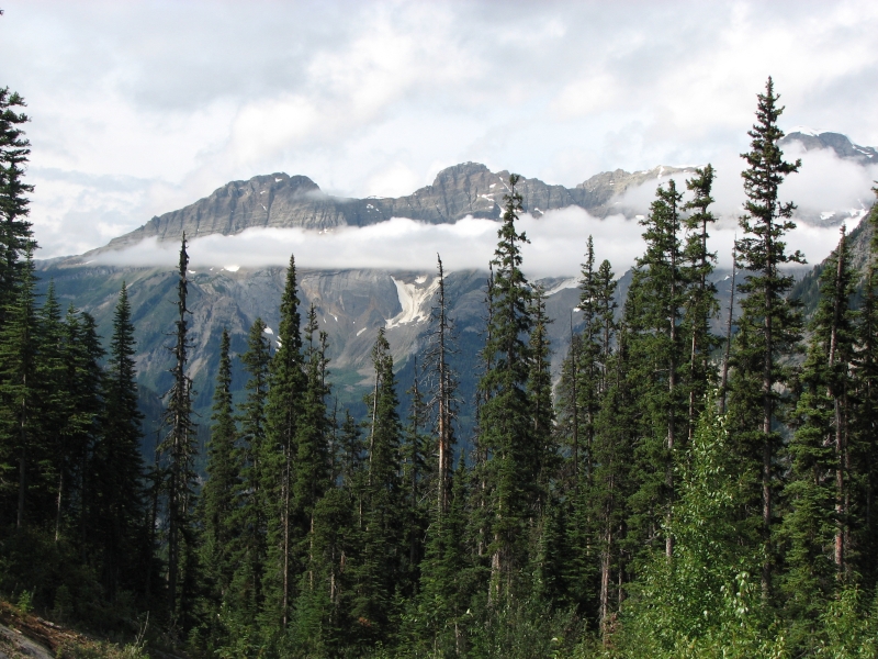
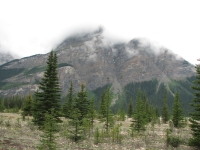
Because the mountains were covered by clouds, we had few views, but it was fun to watch the clouds come and go. We had brief periods of sunshine, followed by showers and even some hail. We passed Amiskwi Falls in the middle of a rain shower. Our three fords of the river turned out to be easier than expected; the water was knee deep and not fast. The trail was sometimes clear and easy to follow, sometimes completely buried by brush and sometimes washed out. There were stretches that felt more like bushwhacking than trail, even though this is in a national park. Even so, the miles passed fairly quickly.
We stopped for the day at 5:00 at Amiskwi Pass, the boundary between Golden Forest District and Yoho National Park. There is a wide flat meadow there, good for camping. Since we have a permit, it was even legal to camp on the Yoho side, which is much flatter. Mosquitoes are horrendous, but we had a few minutes of sunshine, which gave us a chance to dry out a little. We saw no wildlife today, but the fireweed was abundant and there were tracks: deer, elk, bear and even some people a few hours ahead of us. We never saw them, just their footprints. There was a lot of bear sign, scat and diggings, but no fur. Dinner was interrupted by a shower, but then the sun came out again to dry the tent. Weird changeable weather.
August 9 27 km to Cairnes Campground
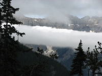

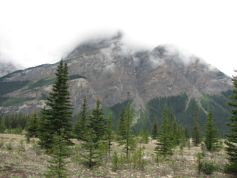
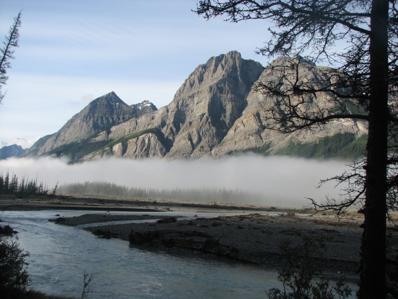
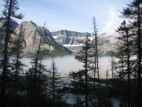
We had several more short rain showers before we fell asleep last night. We woke to clouds/fog covering the mountain tops, including our campsite at the pass. The cold dampness stayed with us all morning and hid most of the ridges and peaks, but occasionally we would get glimpses of steep cliffs, ice fields and waterfalls. Except for the first 1.6 km of pack trail north of the Pass, we followed a gravel road all day down into the Blaeberry River Valley. The road gets little use, though there is supposed to be a lodge at the end, near the Pass. Perhaps people helicopter to it rather than drive the dirt road? It was easy walking, but with limited views, thanks to the low hanging clouds.
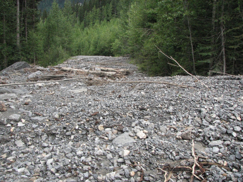
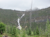
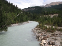
We crossed the rushing glacial Blaeberry River on a bridge and discovered why the road looked unused: theyve closed the access road. As we climbed along the river we discovered why it was closed: sometime in the recent past (possibly last November when Washington and Montana were hit by torrential rains), this area was seriously damaged by flooding. There were several massive washouts and mudslides burying the road in debris. The road is now impassible to vehicles, though walking across the mudslides wasnt a problem.
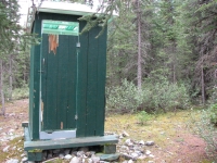
The good part of that for us was that Cairns Campground is no longer a car campground, since only people on foot/horse/bike can reach it. We stopped early because the campground is quite nice, with an outhouse (damaged by a bear, but still useable) and picnic tables. The water source is the glacial river, but we had stocked up on drinking water earlier, so we only need to use it for cooking; we wont have to filter it. Besides, the guidebook warns that the trail well be following tomorrow, the David Thompson Heritage Trail, is in really bad shape, so campsites may be hard to find.
We hiked about 16 miles today, which is reasonable, though since it was roadwalking it was quite quick and easy, albeit hard on the feet. We had sunshine at noon, rain at 2:00 and more rain is coming. Our feet got soaked crossing one of the mudflows. I enjoyed looking at all the tracks in the mud bears, coyotes, deer, etc The hikers weve been following the past two days are still ahead.
Im feeling frustrated with these gray gloomy days. We see little of the beautiful scenery around us. We jump into the tent at 5:00 or 6:00 to avoid the daily showers and sleep in a wet tent and damp sleeping bags. Yech. I knew this kind of weather is normal in the Canadian Rockies, but three weeks of sunshine spoiled me. I miss sitting outside after dinner, reading in the sunlight until the sun drops behind the ridge, drying and warming our sleeping bags in the last heat of the afternoon, watching the squirrels and chipmunks play.
August 10 25 km to the Howse River

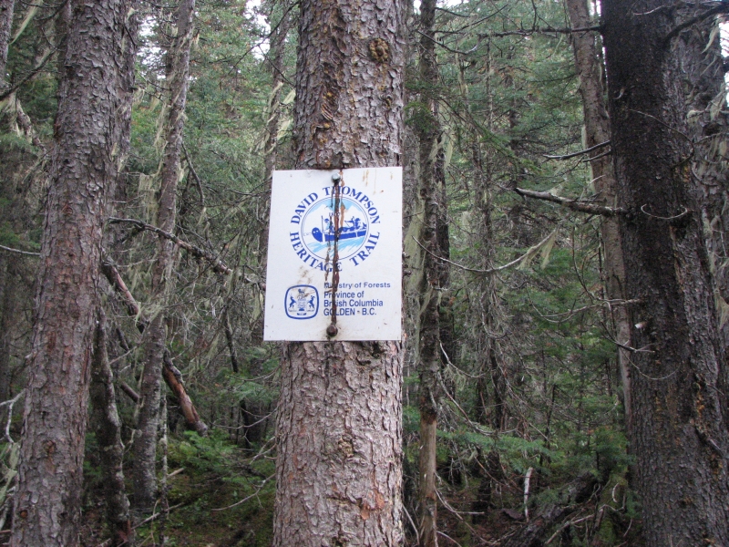
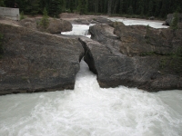
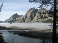
Today was an extremely rough day, especially in contrast to the recent road walks. It rained most of the night, but eased off just in time for us to pack up this morning. We began the David Thompson Heritage Trail and a poor tribute to him it is. David Thompson is the Canadian equivalent of Lewis & Clark or John Colter, a very early explorer who pioneered routes through the Rockies 200 years ago, including the one over Howse Pass. The trail was once quite a good one, but years of neglect have left their mark and now it is barely passable in places. We started the day with a difficult ford of Cairnes Creek. There used to be bridges, but the log bridge broke and its replacement, a metal bridge, was washed downstream and now resides on a sand bar about 100 yards downstream from the campground in the middle of the Blaeberry River. The water was icy cold, knee deep and fast. It was a bit scary because the water was strong enough I was almost knocked over.
At first the trail didnt seem too bad some blowdowns and a lot of brush, but it was easy enough to follow except where the river had washed the banks away and we had to bushwhack through the dense forest to a spot where we could pick up the trail again. We passed a beautiful waterfall, but it was raining so we took no pictures. We thought we had reached Howse Pass a couple of miles before we were actually there, since the trail goes through a long level stretch with meadows and ponds before the pass is crossed. We lost the trail in a big meadow and had to circle the pond twice before we found the trail again. We followed a game trail (bear tracks) for a while before it petered out and we turned back to the pond. We ate lunch near the pass during a short respite between rain showers. By that time we were both hypothermic, shivering badly and losing coordination, so the food was a real life saver.
Two miles later, the trail split. The guidebook was buried in my pack, so we took the obvious trail. Wrong move. Half a mile later we reached a large creek which the trail seemed to cross. I didn't remember any major river crossings, so we dug out the guidebook and sure enough, we were on the wrong path. The correct one looked like a game trail, a very faint one, especially near the junction. Then things really got bad for the next 5 ½ miles we had constant blowdowns. We went over, under and around hundreds of downed trees. It was a mess and very slow going. Finally, around 6:30, we reached the Howse River flood plain and called it a day.
It rained off and on all day. Between that, frequent stream crossings and the very wet brush that crowded the trail, we got beyond soaked, more like saturated. Everything we were wearing, including our packs and the inside of the packs, got drenched, despite rain jackets and pack covers. As we ate dinner, we saw patches of blue sky, but no real sunshine. We jumped into bed as soon as we could to warm up, since we had been cold to the bone all day. Jim especially was affected, probably because he has less body fat to keep him warm.
August 11 23 km to The Crossing
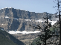
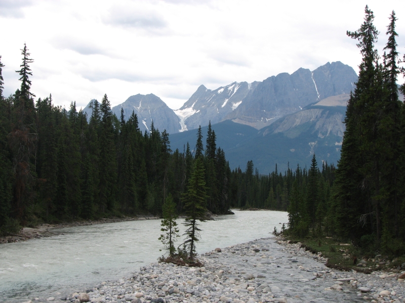
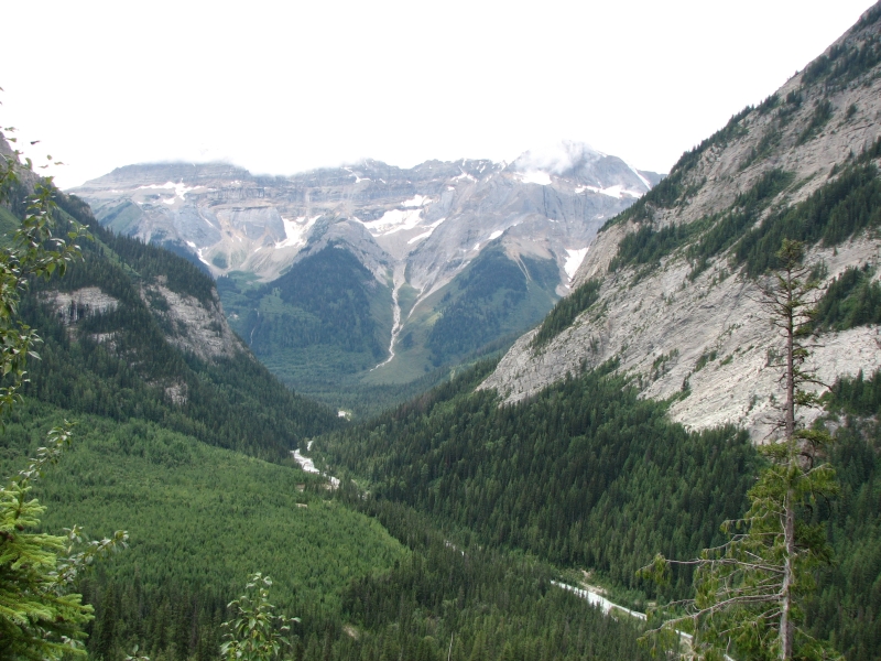
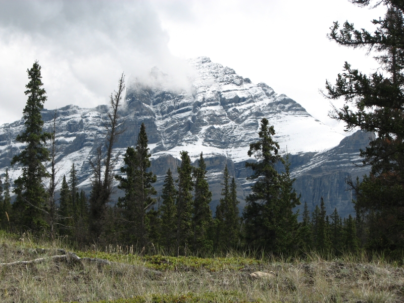
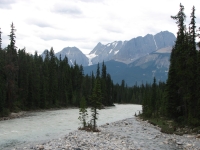
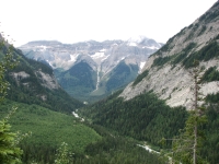
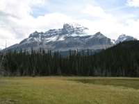
The rain stopped overnight, but we woke to thick white fog. It was hard to put on our wet clothes and go out in it, but eventually we forced ourselves to get moving. The trail followed the flood plain only a short distance before the river covered the path, so we went back into the woods for three more miles of blowdowns. Then the trail got much better. It was still brushy, but there were fewer downed trees. When the fog lifted, we began to get occasional views of the beautiful ridges and glaciers that line the river very nice. We ate lunch on an open ledge above the Howse River with awesome views north and south. The mountains to the north were dusted with fresh snow. I didnt realize it was that cold! We stayed bundled up all day because the brush was so wet we were soaked from head to toe. Though the sun emerged, it didnt have a lot of warmth to it.

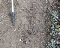
Were heading out today for our next resupply, with the intention of having a real rest day tomorrow. The slow going over the blowdowns means we wont reach The Crossing until late afternoon, but at least well sleep warm and dry tonight. I need that. The rain has been hard to deal with, mostly because the brush gets so wet and because all the wet wood were crossing is extra slippery. Jim got scraped and cut fairly badly. I avoided that by being super-cautious so slow. Jim was stung by a wasp the other day and his arm is still swollen. He is ready for a day off. The last two days have been rough ones. We havent seen any other people since we left the picnic area five days ago. We only saw one deer. We did see fresh wolf tracks this morning. He must have passed our tent while we slept. This afternoon we followed the tracks of several wolves; the prints were clear in the soft mud.
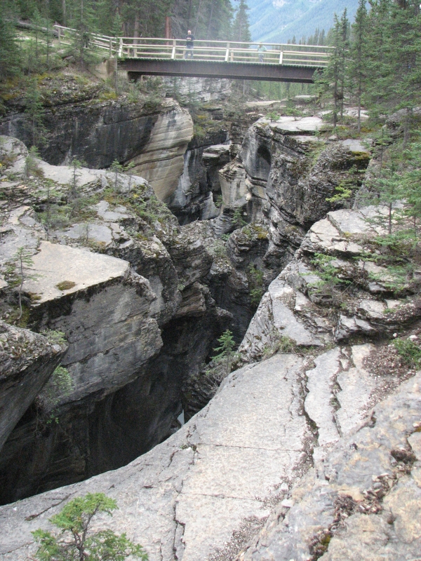
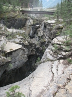
We left the Howse River valley and climbed through woods toward the highway. Near the trailhead, we crossed the Mistaya River on a bridge. There was a fascinating narrow twisted chasm carved by rushing waters, a slot canyon. It was quite cool. Since its near the highway, there were a lot of tourists taking pictures there. The sign at the trailhead noted that the Howse River Trail is not maintained past four km from the highway. No kidding!
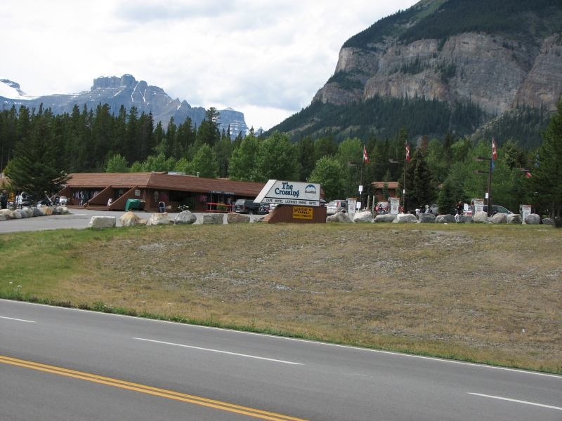
From there we followed the highway 5 km. to The Crossing, a motel complex located where the highway crosses the North Saskatchewan River. The mountains were beautiful, with at least three glaciers visible, all newly dusted with snow. We had a maildrop at the motel. There is a small store at The Crossing, but its too limited for a long resupply. We asked about a room when we picked up our box, but, not surprising on a Saturday night, they were full.
The clerk did give us phone numbers for a couple of other motels and let us use their phone. We decided to go to Nordegg, a former mining town about 50 miles away, off the Parkway. We knew it would be cheaper than anything on the parkway, and there was very little that was closer, unless we went back to Lake Louise. We got a ride in about 10 minutes with a man who was heading to Nordegg to meet a friend for dinner. The drive was gorgeous, past a huge icefield, through the mountains past beautiful turquoise Abraham Lake/Reservoir. There were several primitive campgrounds, but only one lodge and a gas station in the 50 miles to Nordegg. Nordegg is very small, but the motel has a good restaurant and laundromat and theres a mini-mart so we can buy soda and ice cream. Were taking a long overdue rest day tomorrow. Its time to get clean and rest our sore feet and knees. The next stretch will be demanding, even if the weather is good. Besides, to stay on schedule we need to take at least one day off. We could take two, but that would be more expensive, and its not really necessary. Im tired, but not that tired.
August 12 Rest day in Nordegg
Ive got mixed feelings right now. The next 65 km are described as rough bushwhacking with steep climbs. The way is more of a route than a real trail until we reach Jasper National Park. The forecast is for more rain for the next three days. Then the sun should (?) return and well be in Jasper on good trail, so things will get better. We just have to get through the next four days.
We decided to do a half day tomorrow instead of taking another rest day. That way if the hiking is really hard, we can do very short days without getting off schedule. If its easier than expected, we may have a problem because we have reserved campsites in Jasper National Park. We may end up hanging around Pinto Lake for a day, which wouldnt be all bad. We intended to stretch out the last section for an extra half day, but a shortage of campsites forced the mileage a bit so we finished early.
Our only chore today was laundry. We talked to a couple of long distance bicyclists for most of the time we were waiting. They were very nice people, quite interesting. Other than that we just relaxed and ate as much as we could.
When I was searching the bottom of my pack for stray socks I discovered that the garbage bag liner I was using along with the pack cover didnt work: the inside of my pack got soaked, which meant that my journal for the past month was drenched. I dont know how much of it I can salvage. The paper is shredding and the ink bled through the paper. Deciphering it will be a challenge. We put it in the microwave for a few seconds to evaporate some of the water, then spread it out as carefully as we could. Ive got my fingers crossed.
Home | Links| Trail Journals |
The Thruhiking Papers | Bun-bun
Created: Fri, 16 Jan 2008
Revised: 30 Sept 2016Copyright © 2007-2017 Spirit Eagle