|
 |
 |
 |
 |
|
|
|
|
|
|
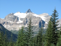
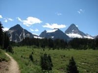
Friday, July 27 – 17 km to The Forks CG (plus 5 extra for Jim)
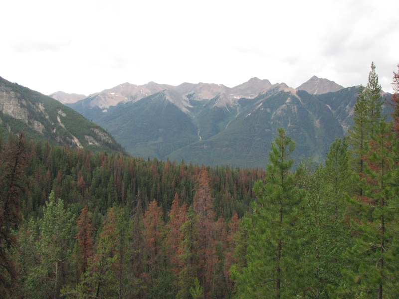
Today was supposed to be a rest day, so mostly we took it easy. Last night we spent a relaxing hour or so watching the sun set over the mountains from a bench near our campsite. Watching the colors change and the alpenglow reflected on one of the distant peaks was a real treat. The sun sets so late up here, we rarely stay awake until sunset, much less get to enjoy the transition to night. The next several hours were much more frustrating as we listened to our neighbors at the campground chop wood every ten minutes until well after midnight. They chopped one piece, burned it, then chopped another. It would be quiet for a bit and I’d start to drift off, then the axe would begin again. Grrr!
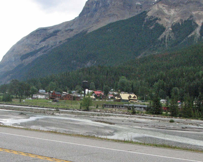
Fortunately we were able to sleep in a bit this morning. We ate breakfast, then went down to the café for a second egg sandwich breakfast, bought some bread and cookies for the next 10 days, then went back to the campsite to pack our overloaded packs and to read for a couple of hours. We went back to the café for lunch and a final ice cream cone – big time calorie loading! The only way to carry 11 days’ food is to go a bit light on the food. We’ll ration as best we can, but I’ll be surprised if we don’t start running out of some of the extras like dried fruit and jerky. We’ll have the basics -- breakfast, lunch and dinner – but not much more. We’ll survive, but I’m sure we’ll be getting hungry before the end of this stretch. So today we loaded up on calories and carbs. Eat, drink and be merry, for in an hour we’ll be hauling our heavy loads up hill and down dale.
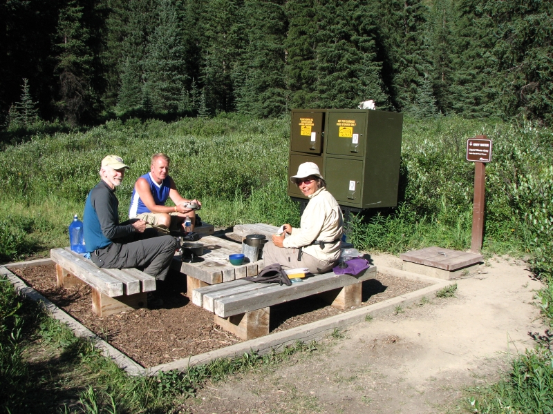
We started out a little after 1:00 and immediately ran into someone in the parking lot who asked, “Are you Jim and Ginny?” It was Gail, a woman we know from CDT-L who hiked the Continental Divide Trail last year. She and her husband Alistair live in Calgary and had come to hike with us for a couple of days. We explained our change of plans, so she drove off to find Alistair, who was looking for us at the trailhead, and they took off to get a permit for the campsite where we were staying.
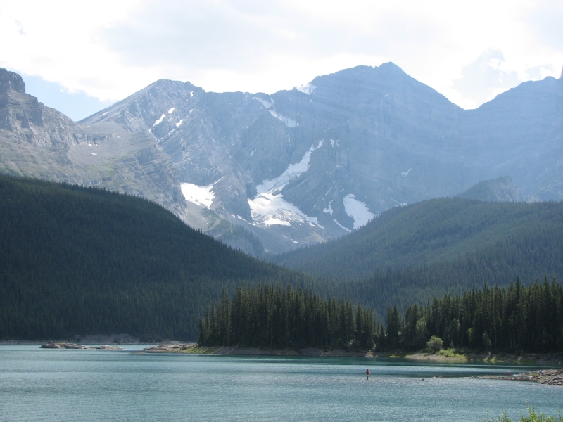
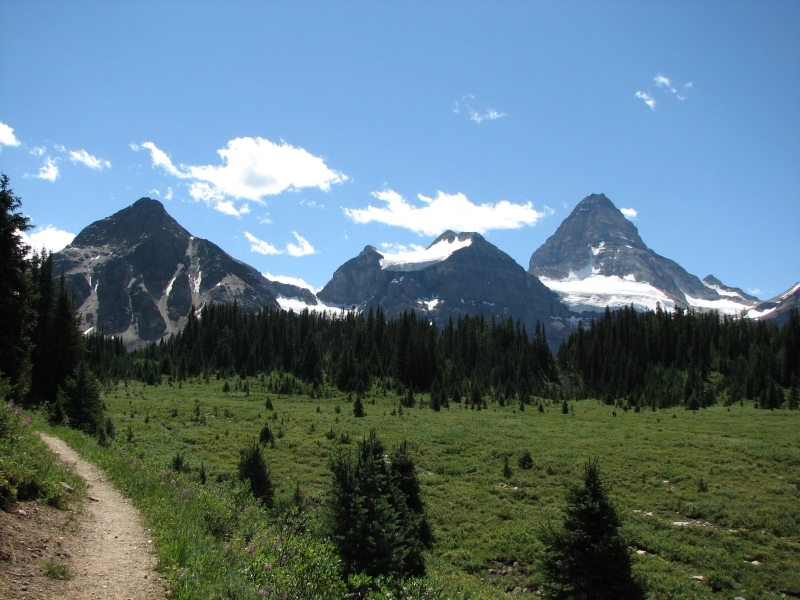
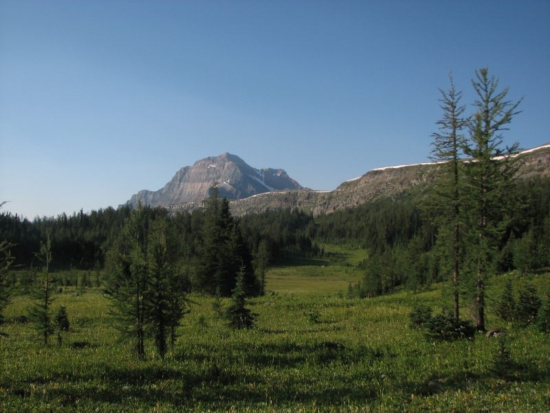
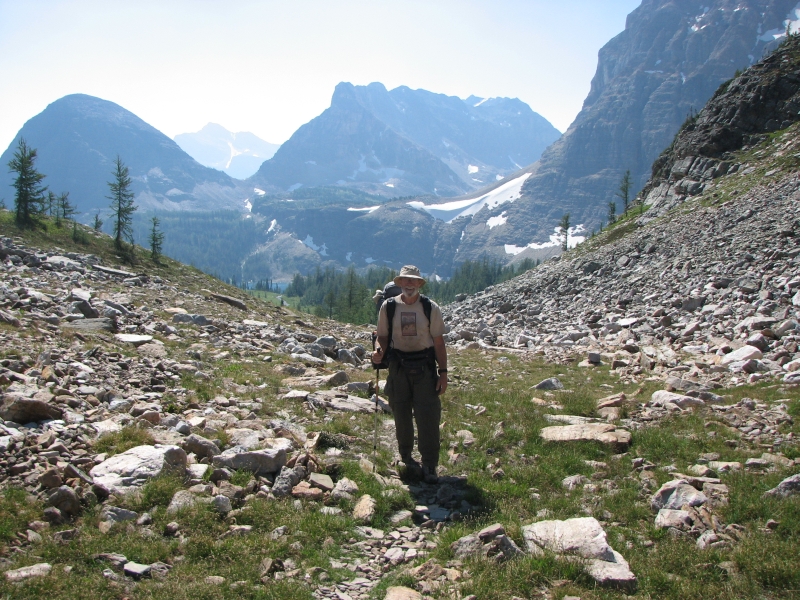
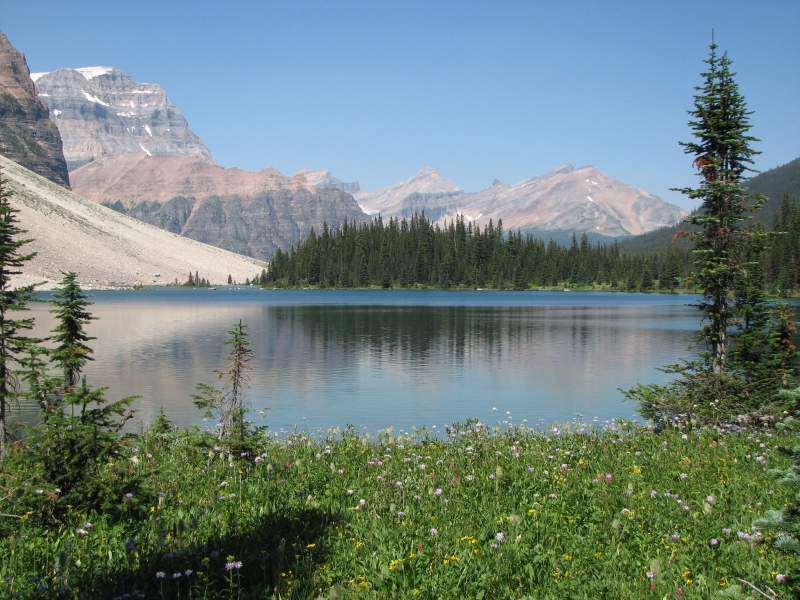
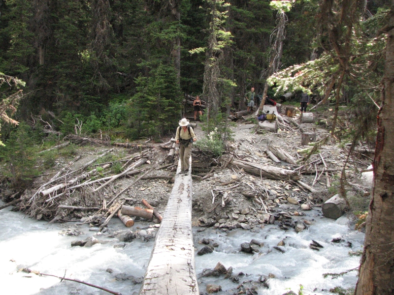
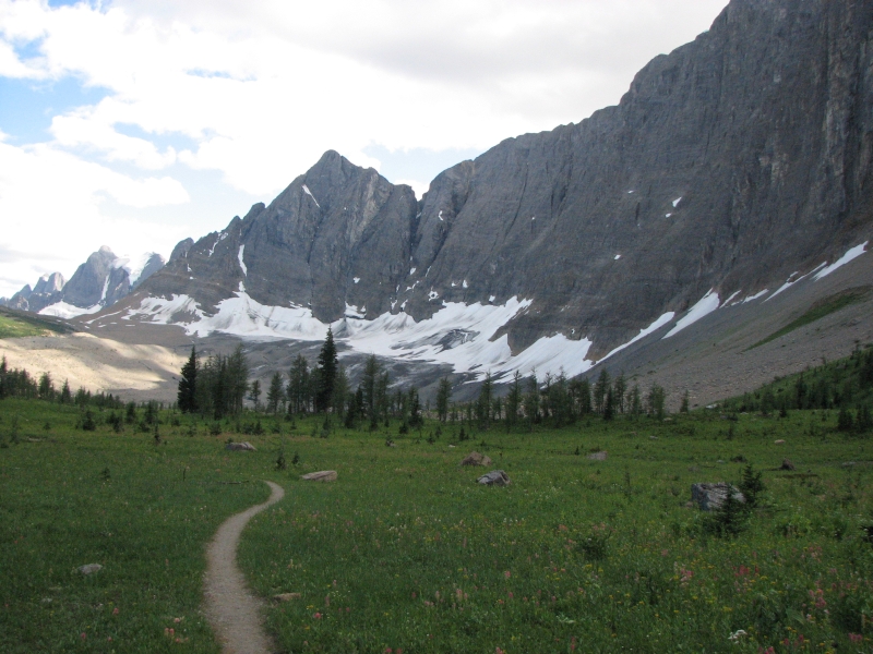
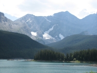
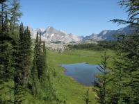
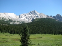
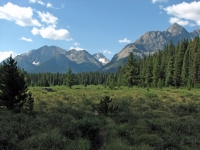
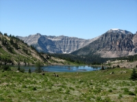
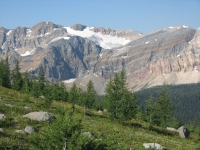
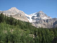
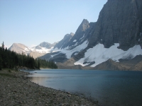
We headed out on bike paths through the campground complex to Upper Kananaskis Lake, which is a beautiful aquamarine color and reflects the blue glacier-covered peaks above it. I suggested taking a photo, which is when Jim realized he had left the camera behind, either at an outhouse two miles back or at the store three miles back. I sat on some rocks admiring the views and guarding the packs while he ran back to see if he could find it. A marauding chipmunk challenged me several times, sneaking around behind me and attempting to dive into the packs, but I held him off until Jim got back. That chipmunk was a bold one, with no fear at all.
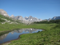
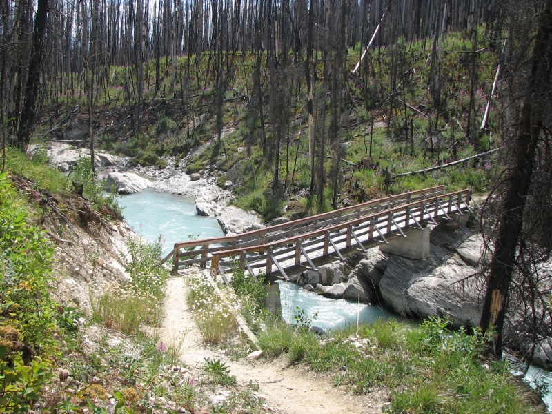
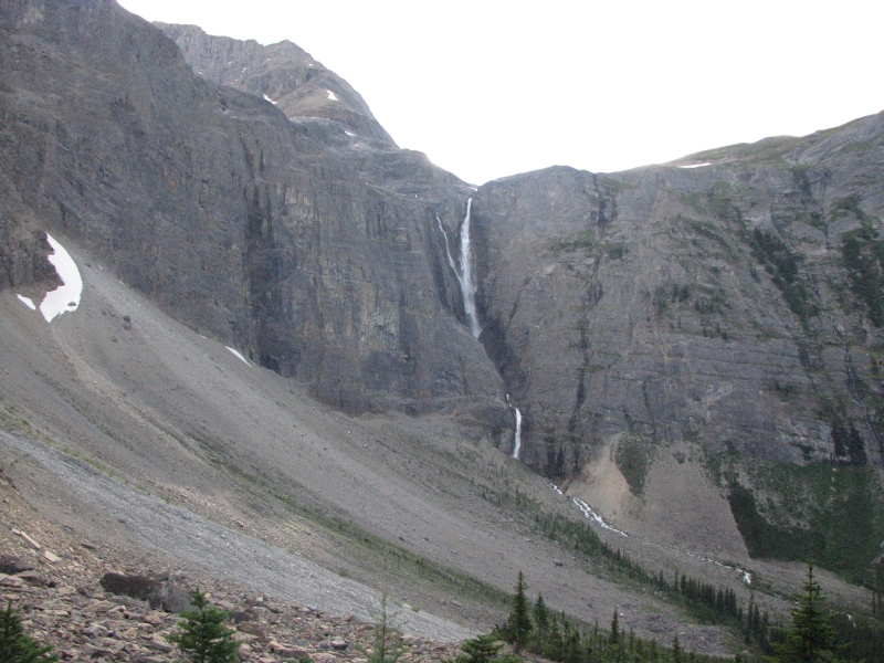
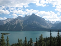
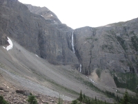
Jim returned after about an hour, breathless but happy that no one had picked up the camera after all; it was right where he left it. We enjoyed the hike around Kananaskis Lake, with many views of the water and peaks beyond. Halfway up, we passed some day hikers heading out. One was sick with heat exhaustion. We offered water, but they refused, saying that there was none ahead of us, while we had just passed a stream that they would reach in a few minutes. Actually, while the river is silty and undrinkable, there were several side streams that had good water so we filled up our water bottles at one of them and continued to Forks Campground. Gail and Alistair had arrived long before since they didn’t hike around the lake from Boulton Creek, but started at another trailhead just a few miles from the campground. We talked with them for a couple of hours, then went to set up our tent. There is another small group here, but it’s a huge campground with a dozen sites, and tables and food lockers in abundance. We set up near the river and enjoyed the alpenglow on the peaks above. There was a big waterfall tumbling from a glacier nearby. All in all, the Forks was a nice site. Since it cost us $24 to camp there, it ought to be! Our front country site, with shower and nearby camp store, only cost us $20. Odd that the backcountry site was more expensive, but they charged a reservation fee on top of the per night fee. I thought they weren’t supposed to do that for same day reservations, but evidently I was misinformed.
July 28 – 16 km to the Palliser River
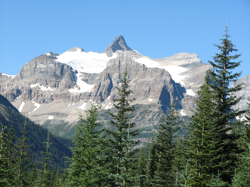
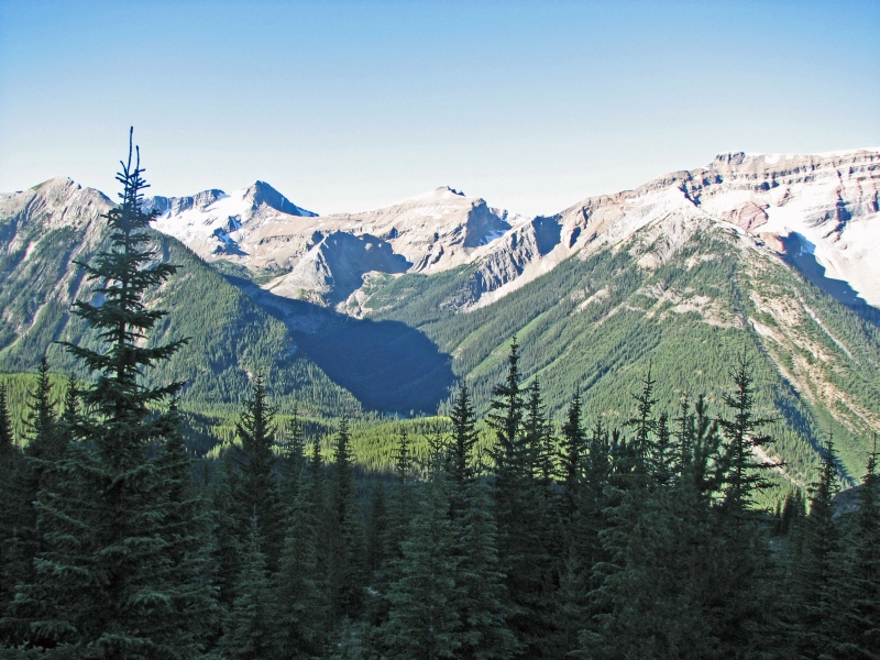
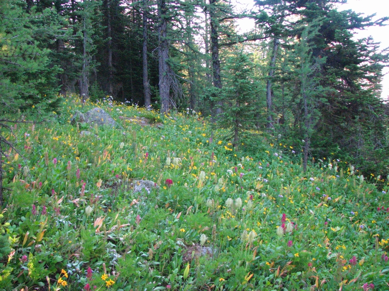
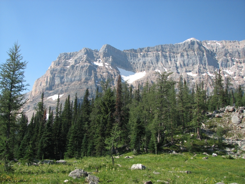
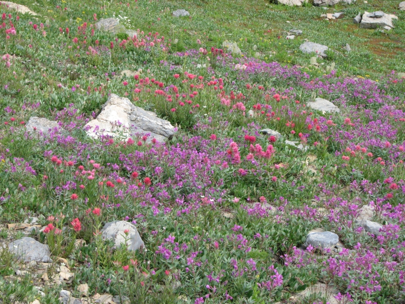
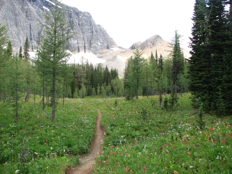
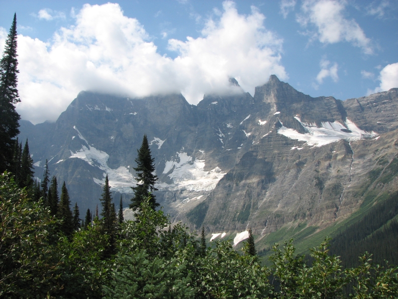
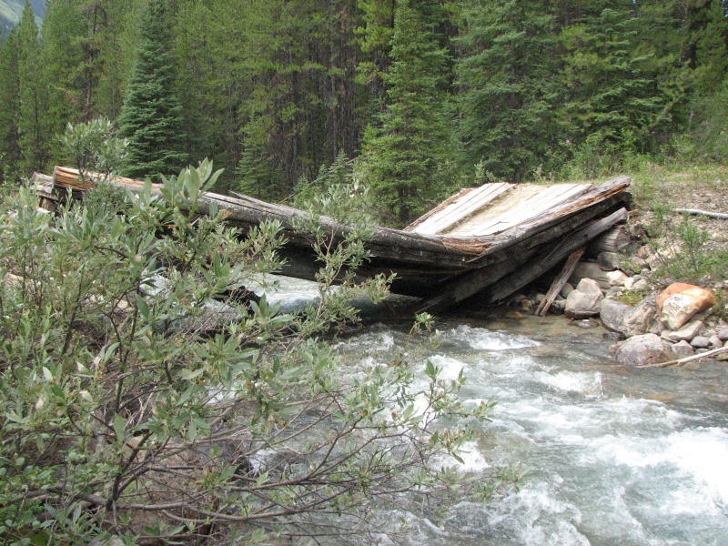
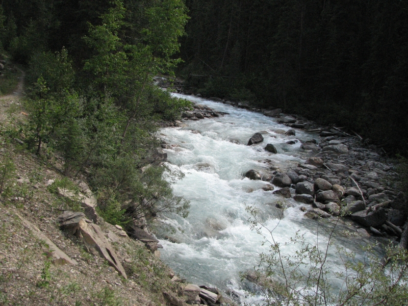
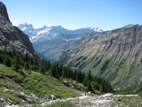
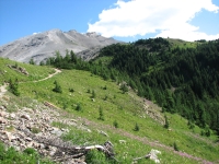
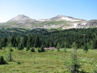
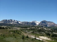
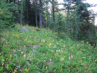
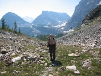
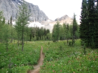
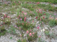
Because our planned mileage was low, we had a very low key hike today with lots of long breaks and an early stop. The trail up to North Kananaskis Pass was a good one, with some very nice views, a couple of pretty lakes, two glaciers and a moderate climb. The Pass was beautiful, with lots of wildflowers and views of a deep blue lake and a nearby glacier. We spent a long time there, eating lunch and talking. Short days can be restful that way. The descent was another story! As we entered Height of the Rockies Provincial Park, there were spectacular views, but the trail was very steep and overgrown--the kind of trail where you grab the bushes to keep from sliding down, and if the person in front gets more than 10 feet ahead, you can’t tell where the trail is located. We crossed Leroi Creek, which is glacial runoff, silty and very fast (but not deep this year, fortunately), and descended through dense bushes to the Palliser River, which was an easy crossing with clear water. That was a relief, since we knew we’d be drinking it. There is a grassy meadow on the far side, so we decided to stop for the day there rather than begin the seven kilometer climb up to Palliser Pass. If the climb is anything like the descent, there will be few if any places to camp along the way. The meadow is lumpy, but there were a couple of reasonable places to set up our tents. It was better than anything else we saw after the pass.
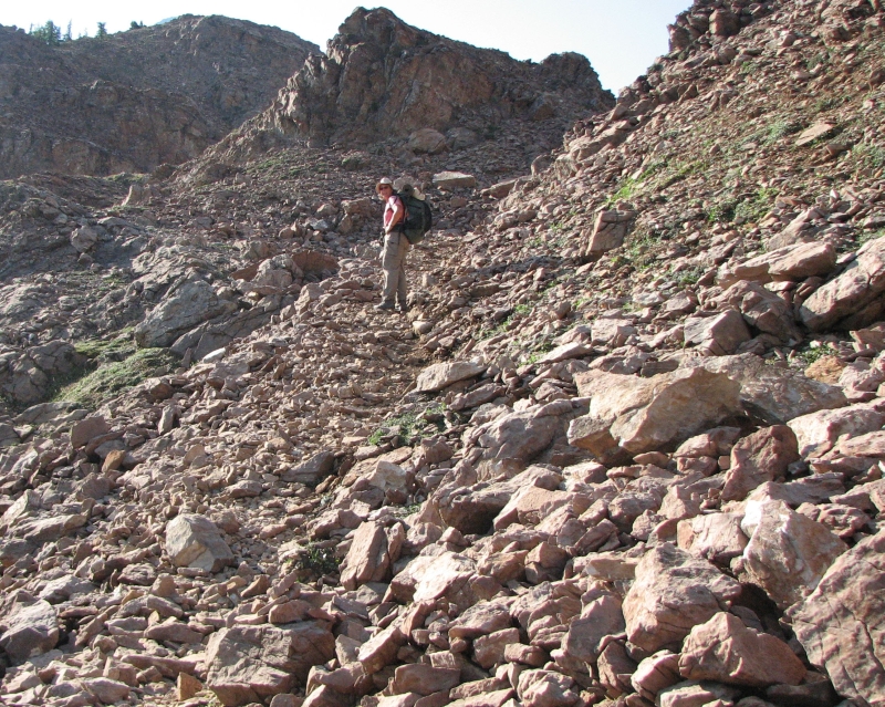
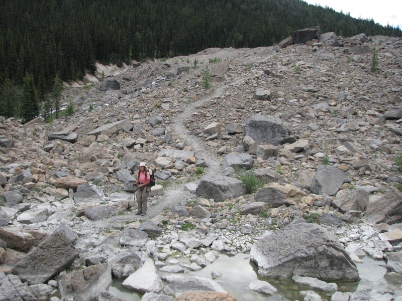
Gail and Alistair stayed with us today, but tomorrow they’ll begin a bushwhack up to South Kanaskis Pass and then back to Peter Lougheed Prov. Park. They have spent 20 years exploring these mountains, climbing peaks and glaciers, doing a lot of cross-country wandering. They also run marathons. They make us look like pikers. They were very good company on what turned out to be some fairly wretched trail, especially after the easy hike in the Park yesterday and the moderate climb this morning. The guidebook warned us the trail gets little use. We had no trouble finding the trail, it was just a difficult 2500’ descent. Three miles took us almost three hours. I’m glad we decided to break this stretch into two days. Our original plan had us going all the way from Boulton Creek to the Palliser River in one day. We’d have been exhausted. Instead, we were able to take it easy and enjoy both days as much as possible. Having good company made it even more enjoyable.
July 29 – 17 km to Birdwood Campground

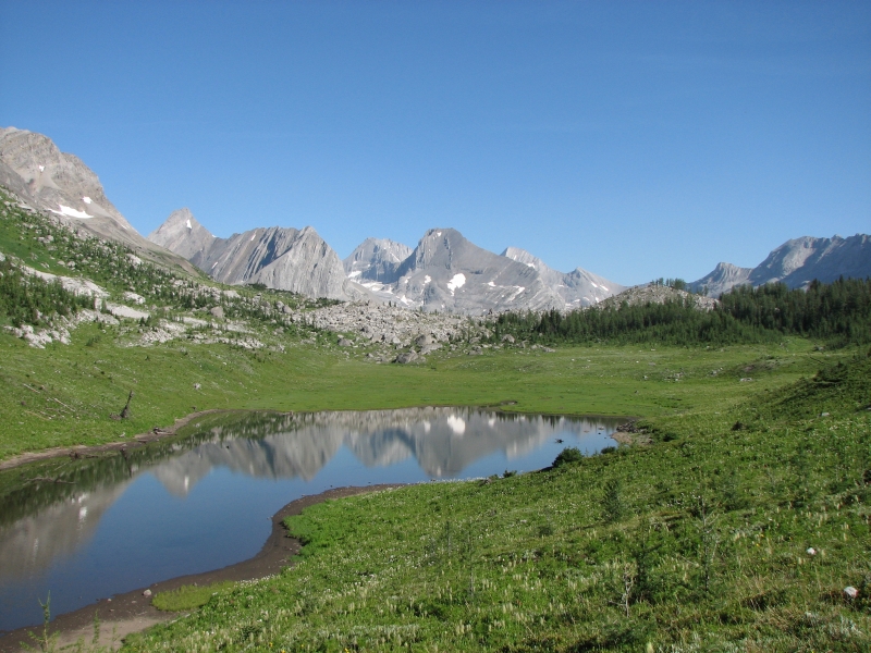
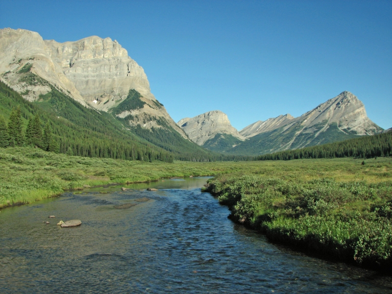
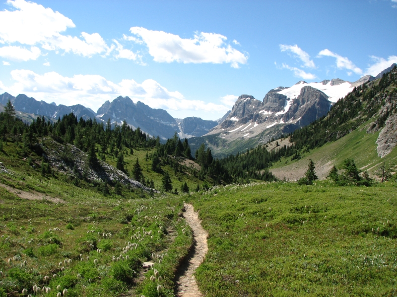
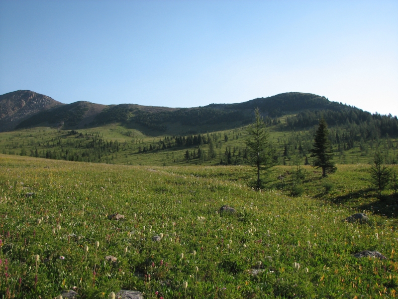
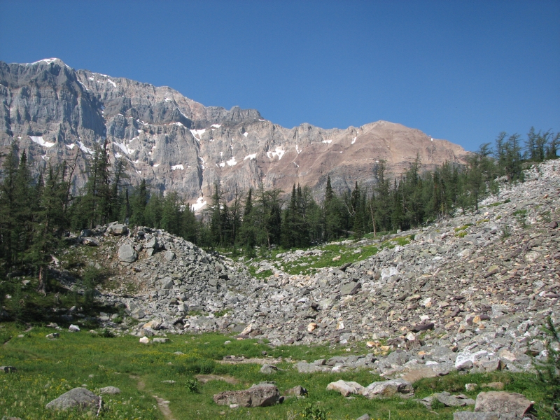
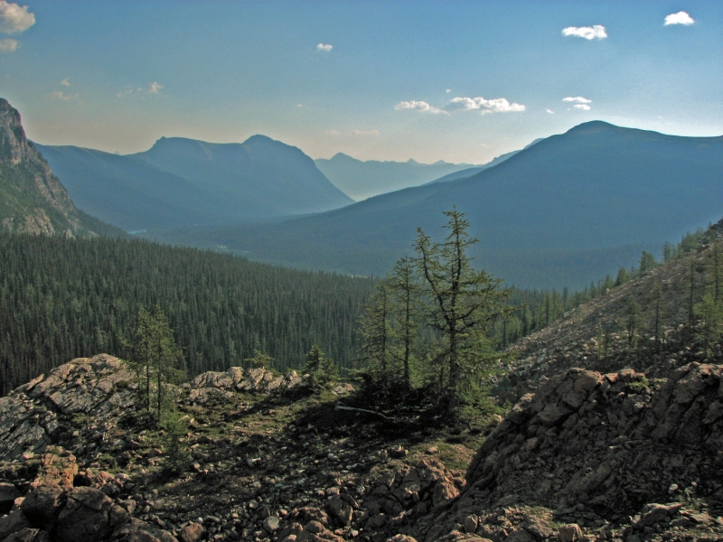
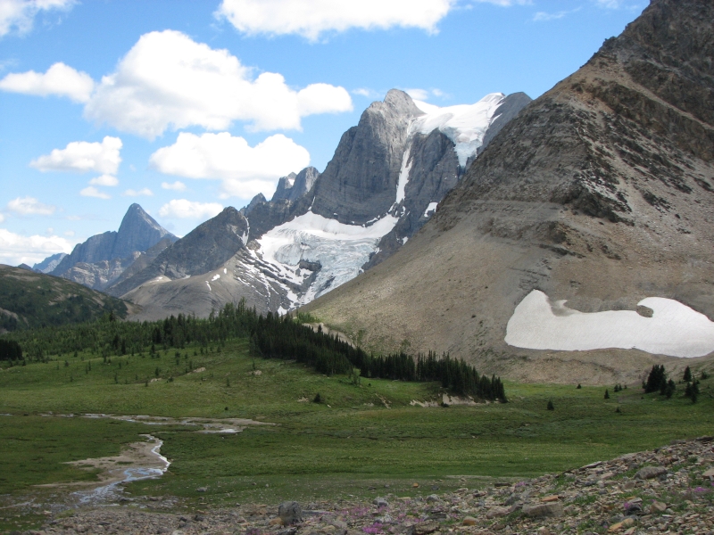
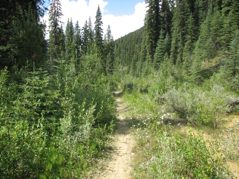
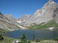
It took four hours to climb five miles this morning, because we didn’t find the right trail starting out. The guidebook says to look for horse trail on the far side of the meadow. We found one, but it headed downriver, not up. So instead we took the obvious well worn trail heading upstream. It was good for about ˝ mile, then it vanished on the far side of the river. We bushwhacked and found a game trail, which soon vanished. Then we found another faint path, then another. The bushwhacking was hard because there were a lot of dense willows and alder to wallow through. After 2 ˝ hours, we ran out of trails, so we descended to the creek and finally found the good pack trail we had been searching for. Hurray! At that point we began to climb, steeply. We gained over 1000’ in the next mile, which took us to an upper basin with a nice campsite. We continued to climb, but more gently, past ponds and a beautiful blue lake. We were heading west, which was worrisome since the map shows a side trail that leads to a small lake to the west, but since we saw no other trails heading north, we kept going on the obvious one. It finally turned north and left us at the green wide meadow at Palliser Pass where we enjoyed a long lunch in the sunshine.
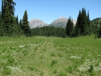
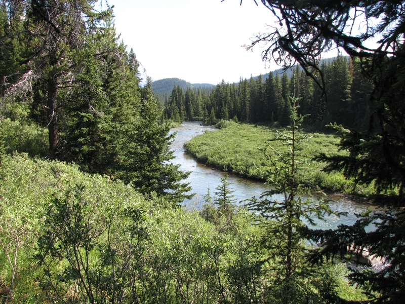
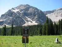
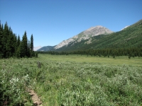
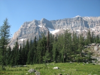
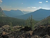
Now we enter Banff National Park. Alistair warned us that the trail doesn’t get good until Leman Lake, but it had to be better than the wilderness trails we’ve been following the past two days. In fact, the trail was fine all the way to our campsite at Birdwood Creek. We had an easy afternoon, following the Spray River ever so gently downhill. The river is in a wide green valley, with interesting dramatic mountains on both sides. It was really a beautiful hike. The trail was mostly along the edge of the valley, near or in the trees, so mostly dry. We crossed the Spray River twice. Though the map shows the trail staying on the east side of the river, half the hike was on the west side, but at least there was good trail all the way.

The guidebook mileage was off again. We reached the Birdwood Campground about two miles earlier than expected. Despite the short day, we were both tired and ready to stop. The bushwhacking this morning took a lot out of us. We had the campground to ourselves, which surprised me since it is National Park and the area is quite pretty. It is a more primitive site than some, with grassy open areas to camp in instead of formal tent pads, but there is an outhouse and hanging wire, which is all we really need.
I’m feeling more relaxed and happy with our hike. The packs are getting lighter and the scenery more spectacular. No ATV’s or motorbikes break the silence. No smoke spoils the views. We saw a couple of deer drinking at the river, but no people since we left Gail and Alistair this morning. It feels very peaceful. Only the constant whine of the mosquitoes disturbs my tranquility.
July 30 – 18 km to McBride’s Camp

It was an easy day, continuing the descent of the Spray River Valley, then commencing a climb on the Bryant Creek Trail toward Mt. Assiniboine Provincial Park. Most of the hiking was in forest, with occasional views of the rivers and mountains, mostly as we crossed side creeks on bridges. It’s a different face to the GDT. In slide shows, you generally only see the wide open views, not the parts that are a long green tunnel. But the long woods walks are also part of the trail.
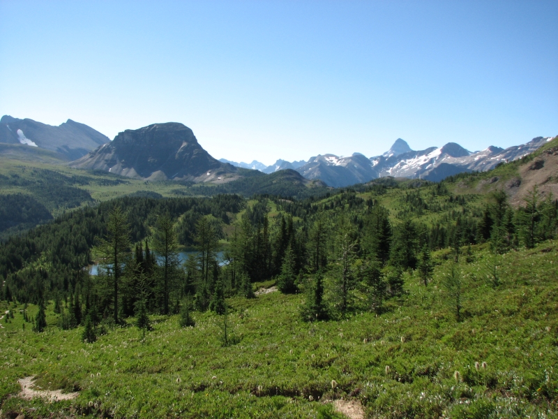
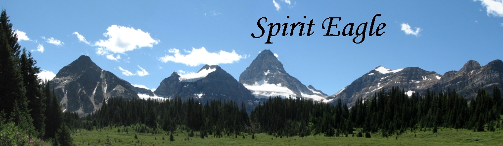
Today was a short day, thanks to the location of the campgrounds, and easier than expected since our climb was on an old woods road with a very gentle grade. Mount Assiniboine is a very popular destination. Some fly in on helicopters, some walk in from Sunshine Meadows near Banff and some hike from the Mt. Shark trailhead near our route. We’ve heard helicopters all day. I think that they are only allowed to fly on certain days though, so that there is some respite from their din. I remember hearing a lot of helicopters dropping hikers off near Berg Lake near Mount Robson when we hiked there in 2003. There’s a lodge in Mount Assiniboine Prov. Park, a couple of campgrounds and some closed shelters as well. I’ve been looking forward to seeing the very distinctive peak, which I remember from the slideshows I’ve seen.
We reached our campsite early – about 2:30. We debated continuing over the pass to the Park, but decided against it. Several people recommended hiking in on the alternate route over Wonder Pass, though it is a bit longer and more strenuous. Mt. Assiniboine doesn’t require reservations; the campgrounds are “first come first served”. On the Wonder Pass Trail, it’s about 14 km from here to Lake Magog, the nearest campground. That is the most popular campground, so chances are it would be full when we arrived and we’d have to continue to Og Lake, another 6 km. I’d really rather not do that kind of mileage, especially since we don’t know how steep the climb is to Wonder Pass. While we might make it to Magog in time to get a spot, that would still make a 33 km day, a long one. And then what? Tomorrow would be a short one instead. We might as well enjoy a leisurely day today, have the campground to ourselves, climb the pass in the morning, and continue to Porcupine Campground tomorrow night as planned. The following day we’ll be back in Banff, stuck with the reservations we hold. There are a few changes we should have made to our schedule, but all in all I don’t think we did too badly. We planned it so that when our packs were heaviest, we’d do shorter days. Later on we’ll have some long mileage days, but by then our packs will be light, with the food half gone, so it will be manageable. Because of the reservation system, it is hard to create an ideal schedule. Some days will always be either too long or too short because we have to go where the campgrounds are, and they don’t plan them with long distance hikers in mind. If I’d known how easy the Spray River section was, I’d have planned a longer day today – but I didn’t, so we have a very short day instead. No big deal.

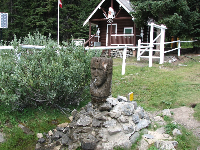
Tonight’s campground is next to a Warden’s Cabin, like the one last night. No one was home when we went to get our water, which emerged from a large carved wooden head in spurts. It was an odd spring, but fun. Yesterday the water source was a stream ˝ mile before our campsite, again next to a warden’s cabin. The Canadian wardens (rangers) have cabins in some absolutely gorgeous locations. I wouldn’t mind living in one for a while. Out of curiosity, after dinner we walked behind the campground to where we could hear water falling down the mountain and found the source of the spring, a small waterfall that falls in bursts, just like the fountain.
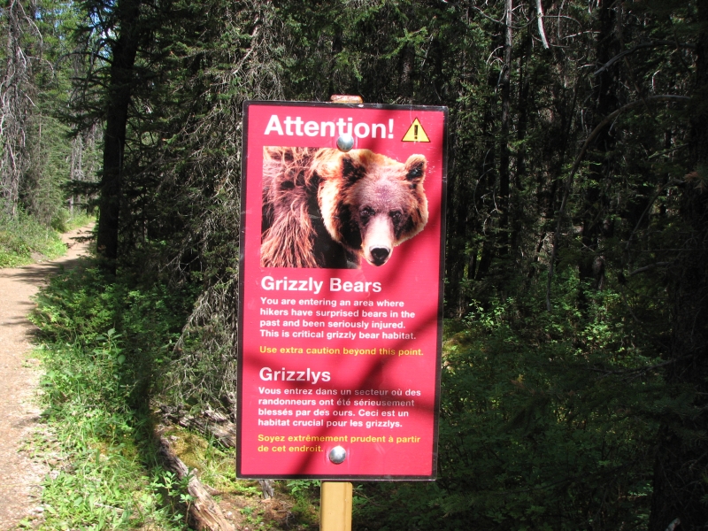
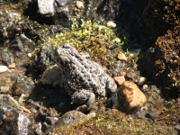
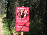
We ran into 10 backpackers on our way up the trail, heading out. We have seen several all women groups out here. One group of six were all older women – 50’s and 60’s at least. A couple of days ago there was a group of girls in their teens. We met another couple today rattling their bear bells loudly with every step. Usually bear bells are almost too soft to hear. These were very noticeable. Surprisingly, we haven’t seen a lot of bells or bear spray out here. Some carry either or both, but most don’t. Gail said that a lot of backpackers don't take the bears all that seriously, which can be a real problem for the hikers who camp near them or after them. In a way I understand. We've seen only one bear on this hike, and that was from the safety of the Information Center balcony. On the other hand, we've seen a lot of tracks and scat, so we are very aware that they are out here.
July 31 – 26 km to Porcupine Campground

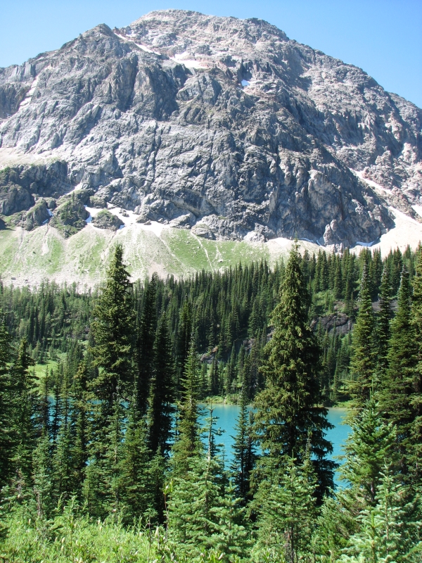
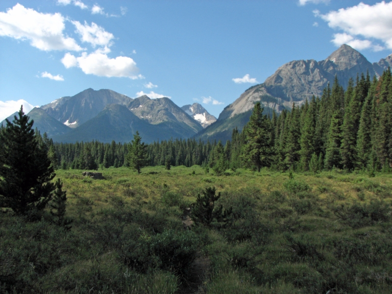
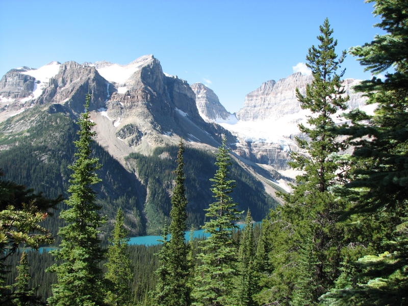
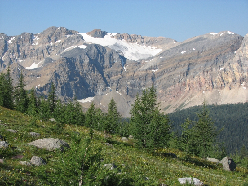
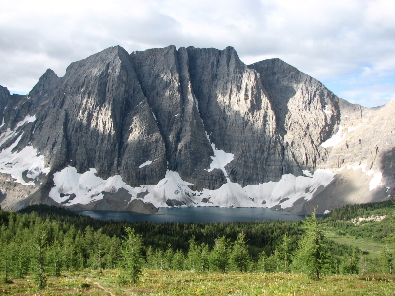
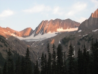
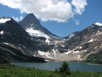
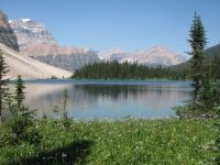
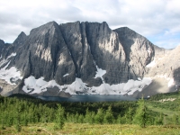
We made the right decision in waiting to climb the Pass. We had a quiet restful afternoon, then, for no good reason, didn’t sleep well. We got a late start as a result, but it was a cool morning after a cold night so the climb was easier than it would have been yesterday afternoon. The first three miles, above aquamarine Lake Marvel, were gentle, then we began some steep climbing up switchbacks. The views were spectacular of Mt. Gloria with its glacier and turquoise-colored Lake Gloria below. The last mile over the pass was less spectacular, but easier climbing.
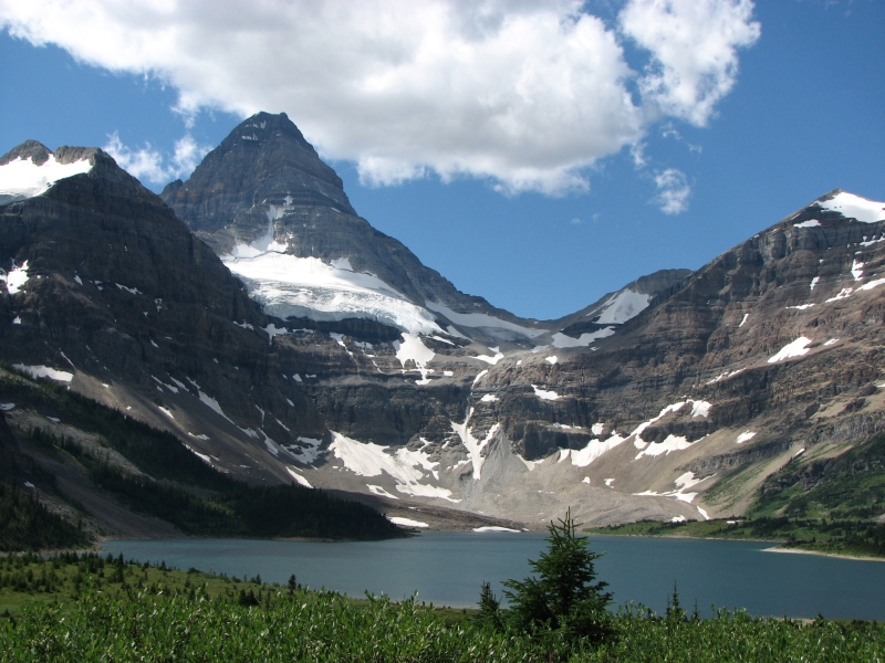
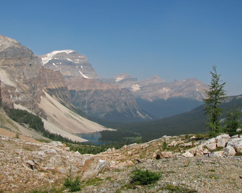
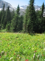
Then we dropped into Mt. Assiniboine Provincial Park. It is a beautiful place. We ate lunch on a bench near the Lodge with a spectacular view of Lake Magog and Mt. Assiniboine rising above. There are thick glaciers and thinner snow patches on some of the peaks, with waterfalls tumbling off the glaciers. The meadows are green and covered with colorful flowers. We’ve seen lots of people, as expected – both backpackers leaving the Park this morning and dayhikers exploring the area. The lodge looks nice, though expensive. We have friends who stayed there a few years ago and had a good time. There were lots of ground squirrels squeaking at us as we passed. We had a rabbit come visit last night while we were eating dinner. It had big feet, so may have been a snowshoe rabbit.
We also ran into a trail crew building boardwalk across a wet meadow. It concentrates the impact, but I don’t much like walking on wood instead of earth. Too civilized. Later we ran into another trail crew near Lake Og, completely redoing the campground with new tent pads, a brand new outhouse and a new cooking area with metal food storage lockers as well as hanging wire. Banff is changing their campgrounds so the cooking area is at least 100 meters from the sleeping area. I guess Mt. Assiniboine decided to follow suit. Porcupine Campground hasn’t been changed yet, so we are within sight of the cooking area and storage lockers – 50 feet at best.
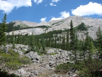
The afternoon was a mixed one – gentle hiking in green alpine meadows to Og Lake, then rough roundabout hiking in the aptly named Valley of the Rocks. It is a different kind of geology there, with big crumbling gray boulders. The trail twists and turns, up and down and around to pass through the rock jumble. Finally we descended steeply to another valley where Porcupine Campground is located. We pulled in around 5:45 and there were only two men here. Over the next hour several groups dropped down the hill. Most had hiked in from Sunshine Meadows on their way to Mount Assiniboine. We got lucky, I think. There are seven tent sites and four food lockers. All will be full tonight. Evidently there’s some ignorance about the purpose of the cooking area since half the groups cooked by their tents. Let’s hope there are no bears around tonight. We met some people who camped here last night who warned us about porcupines and said that there’s a black bear that lingers in the area. We’ll see what happens. At least we managed to get our food locked up in the metal locker. It was quite cold so we went to bed early. At the lodge the thermometer read 15 degrees C. at noon (around 60 F). It felt warmer than that in the sun, but the shade was cool. Since we’re in a valley, the sun went down early.


August 1 – 21 km to Healy Creek Campground
It was a cold night so we woke to frost on the meadow and a very wet tent – as usual. It would be nice to have a small lightweight tent that didn’t have condensation issues, but so far, we’ve never managed to find one.
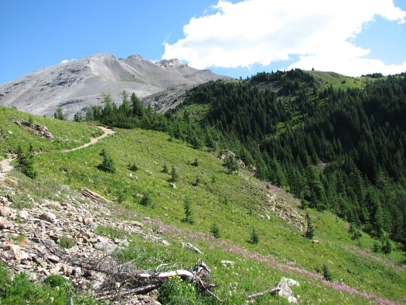
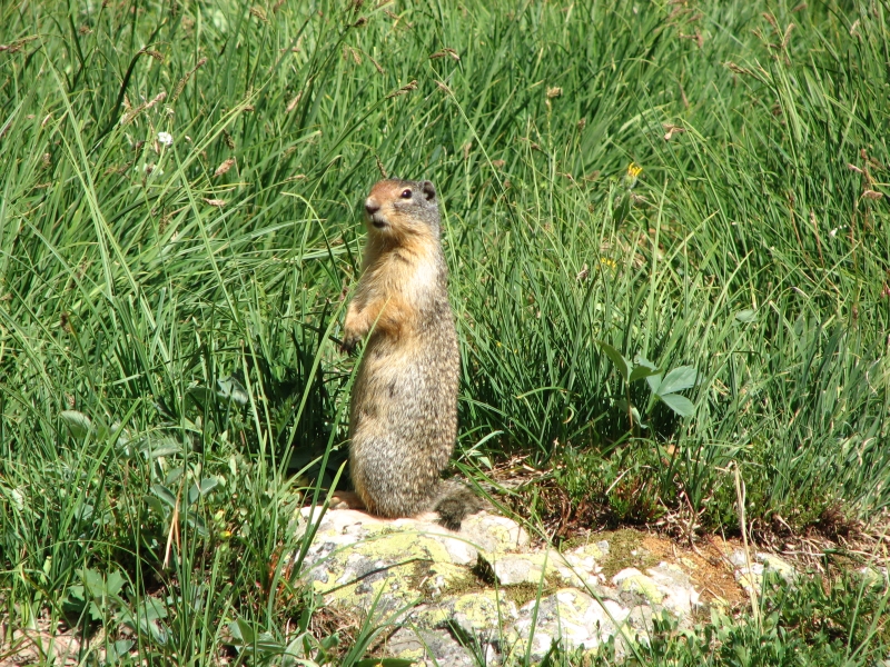
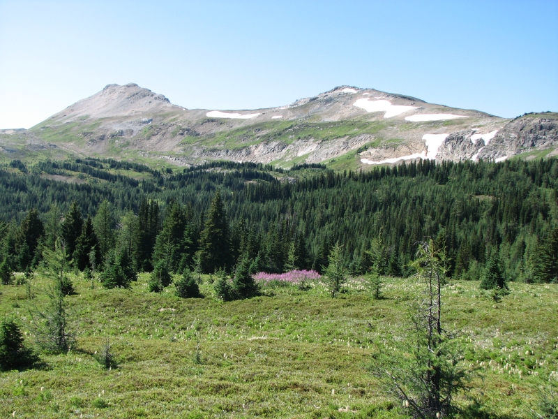
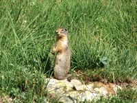
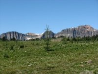
We started the day with a 2000’ climb; 700’ was just the half mile from the campground back to the trail. It was steep for three out of four kilometers, but the last kilometer to the pass was practically flat. There were nice views back south and at the pass we had good views north to the Sunshine Meadows area ahead. There were dark pleated ridges and green rounded ridges. We saw a bighorn sheep on the way up, but no other wildlife except the ubiquitous Columbian ground squirrels. They are cute.


Around 10:30 we began seeing hordes of tourists. There is a shuttle bus that takes hikers up to the ski area at Sunshine Meadows every hour. It costs $49 to go from Banff, or $24 to ride the 5 km from the parking area to the trailhead. Every hour we met a new group of hikers, mostly just out for the day, though we also met a group of backpackers headed to Mt. Assiniboine.
We decided to detour slightly to the ski area day lodge where there is a tiny café. It wasn’t really worth it. We had been hoping for a hamburger, but all they had were cold sandwiches, like Boulton Creek. It was very expensive – resort prices. Beer cost $6 each, so we didn’t even get that. From the ski area we climbed again a short distance, then dropped down to our campground near Healy Creek. It was a short day. We should have gone on to Egypt Lake instead, but I used the chapter summary for the location of our campsite instead of reading the text, so I thought the campground was closer to Healy Pass than it actually is. The turnoff is actually 4 km before the pass, then 1.6 km off trail. Of course, if we’d gone on to Egypt Lake that would have made tomorrow either way too short (9 km) or too long (35 km) – which is why we’re here. We took advantage of the short day to bathe and rinse out our filthy clothes. Without soap it isn’t very effective, but at least some of the salt and dust come out, and a little of the smell.
The hike today was beautiful. There were gorgeous mountains in all directions, shallow tarns and a couple of glaciers. Flowers were less abundant than I expected, probably because it’s so dry, but there were some lovely patches with red and yellow paintbrush, pink and purple fireweed, asters and anemones and several others. Mt. Assiniboine remained visible until we were past Sunshine. When we were at Lake Magog, it didn’t look that much taller than its neighbors, but the farther we got the more distinctive it became. Assiniboine is 2000’ feet higher than the other peaks (over 11,000’) so it is visible for a very long way.
So far we have the campground to ourselves, but we set up in the only sunny site, which is right next to the trail, so we have seen numerous day hikers pass by on their way to their cars at the lot five km away. We could have detoured to Banff from here, it’s only about 18 km from the parking area below, but it’s a big tourist town that I don’t remember fondly. It really doesn’t appeal. I’d rather enjoy our solitude here than deal with hordes of people in an expensive tourist town.
August 2 – 16 km to Ball Pass Campground


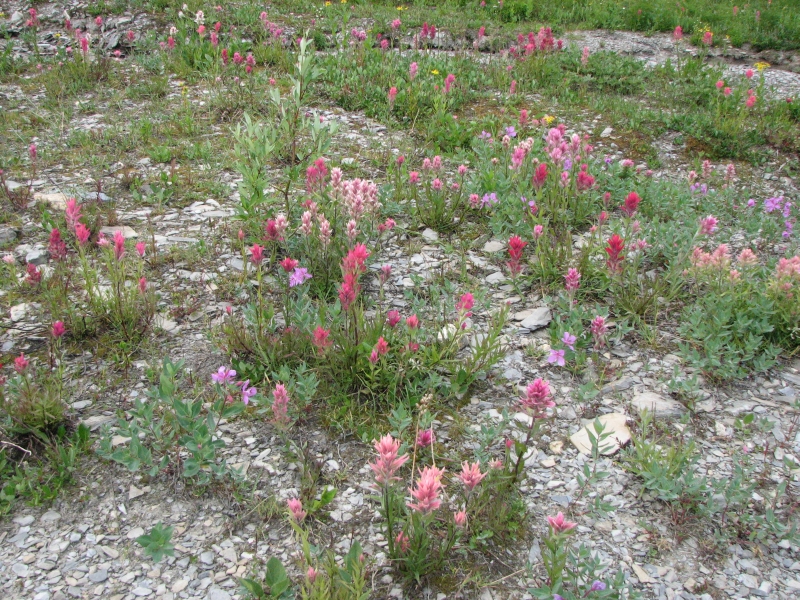
Another couple did join us last night, but they cooked dinner late and breakfast early, so we had no real conversation with them. We got an early start, for us, because we knew there were a couple of passes we'd have to climb this morning. They turned out to be easier than expected. Healy Pass was a beautiful open area, with wide flower-filled meadows, green round ridges on one side and a steep cliff with a snow cornice on the other. It is very smoky today, so the distant views were disappointing, but we could see enough to know there are beautiful mountains all around. There’s a lot of red and orange in the rock, which contrasts nicely with the gray layers. We dropped through the trees to Egypt Lake warden station, campground and shelter. A helicopter dropped some people off as we approached. The campground still had several tents when we arrived late morning. Egypt Lake is a popular place to base camp for a day or two. The shelter was a closed cabin with bunks, tables and a wood stove. You can reserve it like a campsite. It would be nice when the weather turns cold or wet.
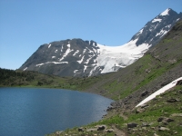
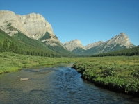
The climb over Whistling Pass was steep, but not as bad as I expected. I’d hate to go down it, but the climb was just steep and rocky, not difficult. I must be getting in better shape – two weeks ago I’d have had a much harder time. It’s nice when you can say, “That was easier than I expected,” instead of, “Oh my God!” We skirted most of the talus and there were flat sections to give a respite between the climbs, which helped. We ate an early lunch, looking out at royal blue Haiduk Lake and glacier-covered Ball Peak to the north. It is beautiful country: a narrow green valley with steep colorful mountains on all sides.


The descent from the pass wasn’t too bad, though we crossed some talus/scree and had some very eroded sections of trail. They rarely use water bars or check dams on the trails, so steep sections become rain gutters, eroding badly. We hiked along the edge of shallow Haiduk Lake. The water was so clear I wanted to jump in, but we could see the source: two waterfalls tumbling from snowfields above. I waited until we got to camp and washed in that cold stream instead. We reached camp early and were set up with the food hung by 3:00. A solo woman soon joined us. It’s a small campground, with only five spaces along the bank of a creek, with a steep talus slope on the other side. The food preparation and storage areas are across the creek, about 150 yards away. The outhouse was also across the creek, but upstream. We got our drinking water upstream from the outhouse, fortunately, though we didn’t know where it was at the time. Another couple came in after we were in the tent, hiding from the mosquitoes, so we never saw them, just heard them pass by looking for a tent site.
August 3 – 25 km to Floe Lake

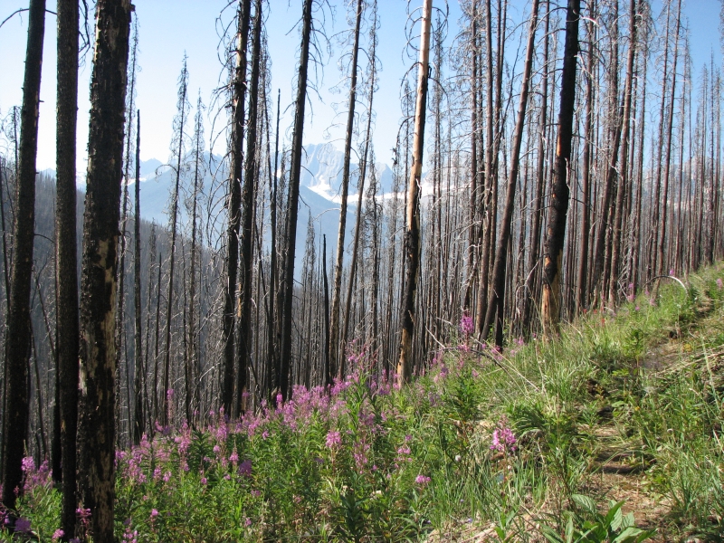
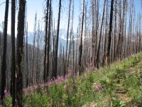
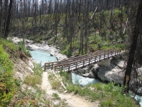
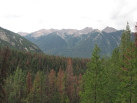
We started the day – again – with a 1000’ climb up to Ball Pass. Part of it was very steep, but some was quite gentle. There was a really good view of Ball Glacier from the top of the climb. It’s hazy/smoky again so distant mountains are just a fuzzy gray. The descent to Highway 93 was long (11 km) but mostly quite gentle except in a few spots. Kootenay National Park, which we entered at the pass, was devastated by forest fires in 2003. Much of the Hawk Creek and Floe Lake Trails were burned. The trail was rebuilt and few trees have fallen yet, but it is sad to see so much dead forest. Fireweed was abundant and there were other flowers – asters, blanket flower, roses, etc. I found our first ripe raspberries of the trip. They have reseeded the lower stretch of trail near the road-- little pine saplings were abundant – but I still hate hiking in a burn zone.
This afternoon we climbed up more of the same for 10 km. The lower part was very gentle, but then it got steep for a couple of miles near the top. The burn continued until the last mile or so. The fireweed was taller than we are in places and there were raspberries and thimbleberries just starting to get ripe. We crossed a robins-egg blue glacial river in the first half mile – on a bridge, fortunately since the river was big and fast. We stopped for water at a creek about halfway up and met a group of about a dozen backpackers resting and filling up their bottles.
We are beginning a very popular trail in Kootenay National Park known as the Rockwall Trail. There are several ways you can come up to the Rockwall, or leave it, and there are campgrounds every 10 km or so, so you can hike for a weekend or four or five days if you choose.
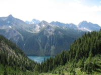
There is a lot of up and down over the passes, but it is very beautiful. With the smoke, a lot of the visual impact was lost for us, but I still thought Floe Lake was beautiful, with deep blue water and lots of snow and ice on the rock wall opposite the camping area. There are lots of wildflowers, especially red paintbrush, to add color. After so much burned forest, the green trees and grasses were very welcome. There are a couple of campsites with good views of the lake, but they were taken before we arrived. We ended up in a group of tent sites in the trees high above the lake. There are 18 sites here and two cooking areas (with views) so hopefully there will be room for everybody we passed on the way up, plus those coming in from the north.
August 4 – 29 km to Helmet Falls Campground
A lot of people set up in our campground last night. We were soon surrounded. I enjoyed one man who sat in a small backpacker chair drinking wine out of a wine glass, looking out over the lake while his wife cooked dinner. That’s the good life! Just after dinner, it began to rain, so we were in the tent early again. It only lasted half an hour, but then it sprinkled a few more times later. The temperature dropped and gray clouds accompanied us as we hiked today, but it also cleared up the smoke, which was a welcome development.
Our climb first thing in the morning up to Numa Pass was beautiful, with views back to Floe Lake and the snowy cliffs above it. We dropped 700 meters through the trees to Numa Campground (not a particularly appealing place) then began a grueling climb up to Tumbling Pass. The views up high were good, though. We passed several waterfalls and a couple of milky glacial streams. One crossing was really scary: the log bridge was 10-12 feet above the rushing water. It had broken, but was propped up by logs underneath. The bridge shook with every step. Not fun!
We met several groups heading the other way. A lot of people just hike from one campground to the next, then stop for the night. It makes for a short day, about six miles, but is less difficult than our plan of three passes in one day, plus a 600’ ridge. There is an option to leave Kootenay at Wolverine Pass and camp outside the park legally, which would shorten the stretch, but when we got there it was so beautiful I wanted to keep on hiking. Aside from the difficulty of 4600’ elevation gain, today was a beautiful hike and really a great day, one of the best so far.

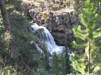
At Tumbling Pass we had good views of Tumbling Glacier. At Rockwall Pass we had easy trail that paralleled the gray limestone cliffs of the Rockwall, with minor ups and downs around snow-filled ravines. Everywhere there were beautiful flowers: red, pink and yellow paintbrush, purple primroses, asters, yellow flowers of various kinds – it was gorgeous. Much better than Sunshine Meadows. We even got to eat some almost ripe huckleberries. There were lots of people on the trail and the campground tonight is almost full. Coming down the last few miles we could hear the thunder of Helmet Falls. It’s a big waterfall, tumbling down the end of the valley. We saw the largest tamarack/larch tree I’ve ever seen in a grove of tamarack trees. Usually they’re pretty spindly, but this one was huge, for a tamarack.
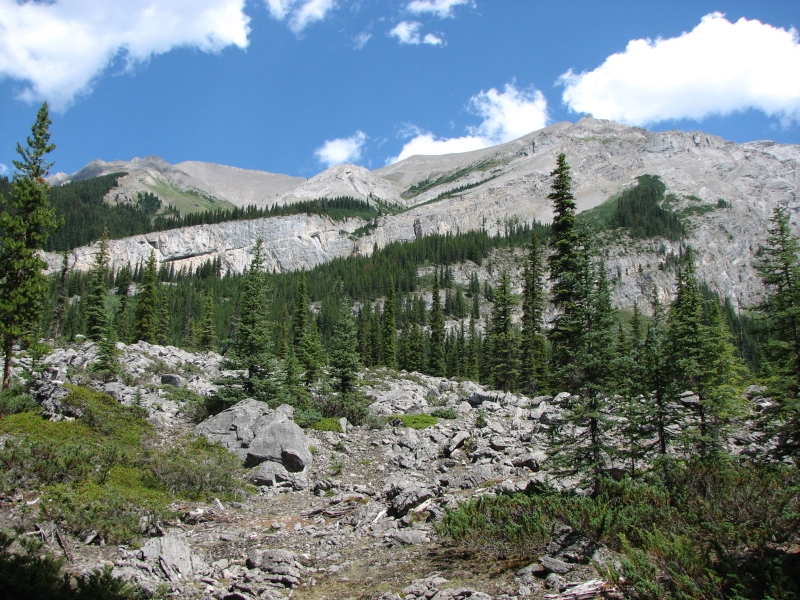
We walked along the moraine of an old glacier for a while. It was a big one, judging by the size of the rocks it moved around and the area it covered, now just bare rock. There is still snow and ice along the edges, but I don’t think it counts as a glacier any more since it doesn’t move. There was a gray lake and a silty stream, all that remained of a once mighty ice field. There were plenty of other glaciers to admire. The thickness of the ice is incredible in some places. Now it’s covered with ash and soot and dirt, which makes the ice melt faster, but they’re still pretty amazing to see.
August 5 – 28 ˝ km to random camp


We woke to the sound of our neighbor chasing a porcupine away from his tent. We checked our boots to make sure they were unchewed, then rolled over again. We had a hard time getting up. It was cold and my feet still hurt from yesterday’s long miles, but we were on the trail by 8:45. As usual, we started with a 1400’ climb up to Goodsir Pass. The top consisted of a long flowery meadow that we climbed gently for about a kilometer. There were some good views of glaciers ahead of us and peaks fore and aft, shrouded in clouds, but then we dropped down into the trees again and lost the views until we stopped for lunch at the Warden’s Cabin at McArthur Creek. Neither the climb nor the descent was particularly steep, just long. This section of trail doesn’t get as much use or maintenance as the Rockwell Trail, which we left at the campground. Most of the Rockwell Trail was in really good shape, except for a few badly overgrown stretches, mostly in avalanche chutes. Today we had blowdowns, washed out trail and overgrown avalanche chutes to deal with, but the majority of the morning hike was just good sidehill walking through trees. We ate lunch at a picnic table next to the Warden Cabin above the Ottertail River, drying out our tent and sleeping bags in the sun. Black clouds are massing to the south. We were supposed to camp at MacArthur Creek--it’s the last campground before the highway now that Float Creek Campground is closed--but it was too early to stop for the day so we decided to keep going. We left Kootenay National Park and entered Yoho NP, where we’ll be hiking for the next few days.


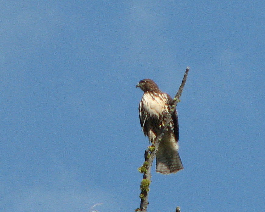
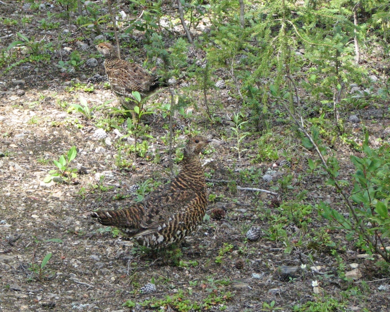
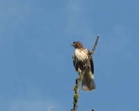
The afternoon hike consisted of gentle walking up and down on an old abandoned fire road, now an occasional bike trail. It’s easy walking, though overgrown in spots. A bridge near the campground was broken in two. We crossed it, but very carefully. There were limited views, mostly of the turbulent Otterail River below us. We saw no people all day and only a hawk and several ptarmigan for wildlife. There were delicious tiny sweet strawberries along the road. I stooped several times to pick them – wonderful!
Tomorrow we’ll walk either the highway or the railroad tracks to Field, where we have our resupply. We need a rest day, but I’m not sure we’ll be able to get one there. I remember it as a very small and expensive town. There is a hostel, but it was booked when I called before we started our hike.
We’ll have to look for a guest house or camp at the campground five miles north of town. I desperately need a shower and laundry. Jim needs calories. He’s losing too much weight too quickly. We also have some gear issues. Jim's boots were new when we started but are already falling apart. Of course, it doesn't help that they haven't been dry since we left Coleman. Mine aren’t much better, but they at least have more miles on them. There is an outdoor store in Lake Louise – we may end up there instead.
A little before 6:00, the thunderstorm that had been threatening all afternoon finally hit. We had set up the tent shortly before, in anticipation of a deluge, so dinner was eaten inside the tent while it rained and thundered outside. So much for good bear country behavior!
August 6 – 9 km to Field
The thunderstorm last night was a doozie, with lots of rain and hail pounding on the tent and through the tent seams. It didn’t last long, only a couple of hours, but it was intense while it lasted. I was very happy to be inside rather than trying to hike in the torrential downpour.
We woke early and walked along the highway to Field, where we had sent our resupply box. Unfortunately, we didn’t know that today is a national holiday so the post office was closed. We also found that the Lodge and the less expensive guest houses were all full. We could get a room for $170, but nothing cheaper. The problem is, most of the guest houses only rent out one room, so they are booked months in advance. We ate breakfast at the only restaurant in town that serves breakfast, then stopped at the hostel and paid $10 for two showers, which felt wonderful. The hotel where we had been told we could do laundry said we should come back in three hours. They need to finish washing sheets and towels before the public can use the machines. Makes sense, but now what?
We had planned to hitchhike to Lake Louise tomorrow, to see if we could find new boots at the outdoor store there, but rather than hang out in Field all day waiting for a washing machine, we decided to go on to Lake Louise today. After an interminable wait for a freight train that blocked access to the highway, we headed out of town. Before we even reached the highway, a local woman who works in Lake Louise picked us up. She showed us where to find the hostel there, told us we could do laundry at the hotel across the street, and dropped us off at the strip mall where the outdoor store and grocery are located. The outdoor store is a pretty good one and very friendly to hikers. We both ended up buying new boots to replace the worn out ones we were wearing. I considered waiting to see if mine would last another 200 miles, but I don’t dare, since there is no place between here and Jasper to replace them. My cracked pack belt buckle was also replaced, though again I wondered if the duct tape would last long enough to keep it functional.
Chances are, it would break for good at an awkward time, so I took advantage of the opportunity to replace it while I could. Our tent has a broken zipper and we debated replacing it too. We’ve only used it for about five months total (we bought it last year when we were in Colorado), so it’s frustrating to have it break so soon. I don’t want to buy a new tent out of desperation -- they don’t really have anything we want--but at the same time, the mosquitoes are bad enough that living without a zipper is a real problem.
After our expensive interlude at Wilson’s Outdoor Store, we checked out the grocery store, then headed to the hostel. They had only four beds left, so we reserved ours, then went to the hostel café for burgers, beer, pie and ice cream – hiker heaven! Finally we headed to the basement to start laundry. We hadn’t intended to come to Lake Louise, but it turns out to be quite handy for a thruhiker needing to take care of town chores, since it is so compact. It’s only a couple of hundred yards from the hostel to the shops, and everything else a hiker needs is at the hostel, including internet. It’s expensive -- $41 each – but that’s still better than what we would have paid in Field for a room without the amenities we get here.
Home | Links| Trail Journals |
The Thruhiking Papers | Bun-bun
Created: Fri, 16 Jan 2008
Revised: 30 Sept 2016Copyright © 2007-2017 Spirit Eagle