|
 |
 |
 |
 |
|
|
|
|
|
|
August 19 32 km to Alexander Creek Bridge
We really enjoyed our stay at A Safe Haven, but after a day of running around in town, we were ready to leave and get back on the trail again.
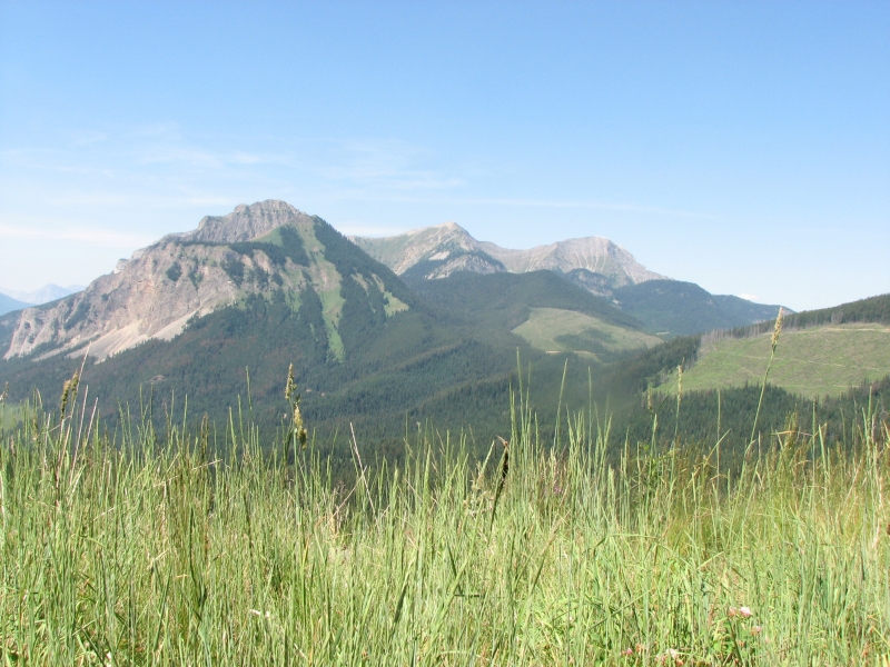
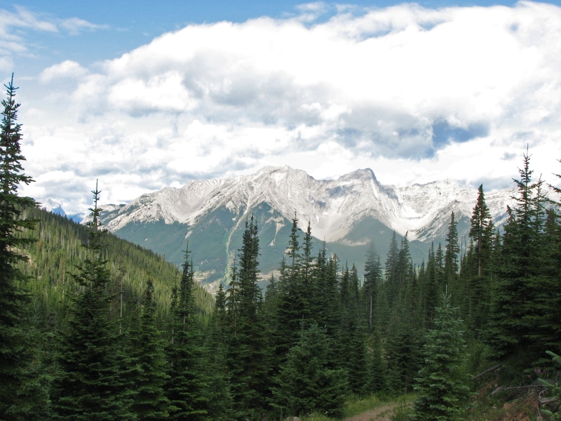
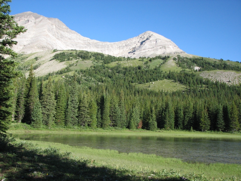
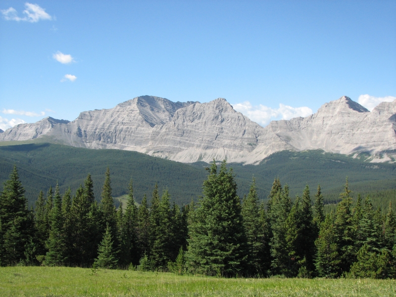
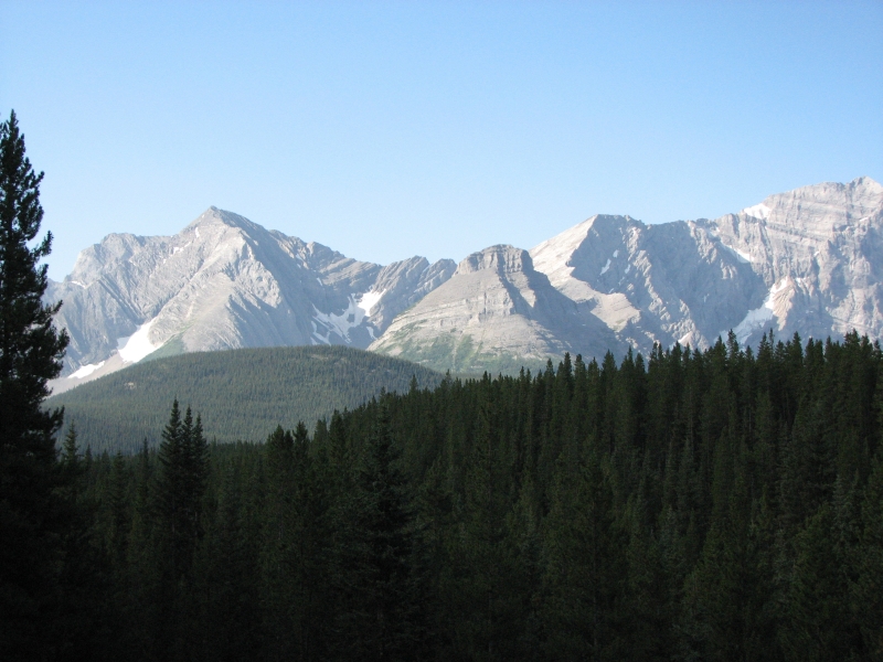
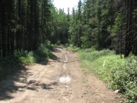
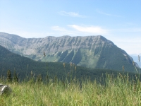
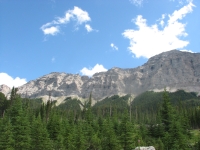
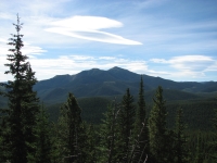
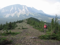
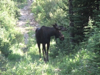
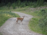
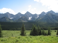
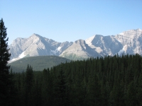
It rained hard last night, which cleared the air remarkably. We had good views of the nearby mountains, especially Crowsfoot Peak a few miles north of town, which we passed quite closely. Its a very distinctive mountain. We followed the highway for a few miles, then turned up graded Allison Creek Road, which leads to a lake and a lot of camping areas. There were RVs parked all over. One man on foot told us he had just seen a grizzly a couple hundred yards up a side road to the lake. Once again, we just missed seeing a bear. That happened to us twice at Teton NP.
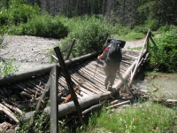
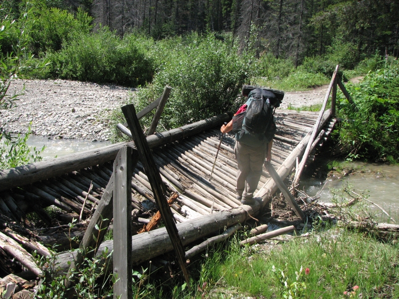
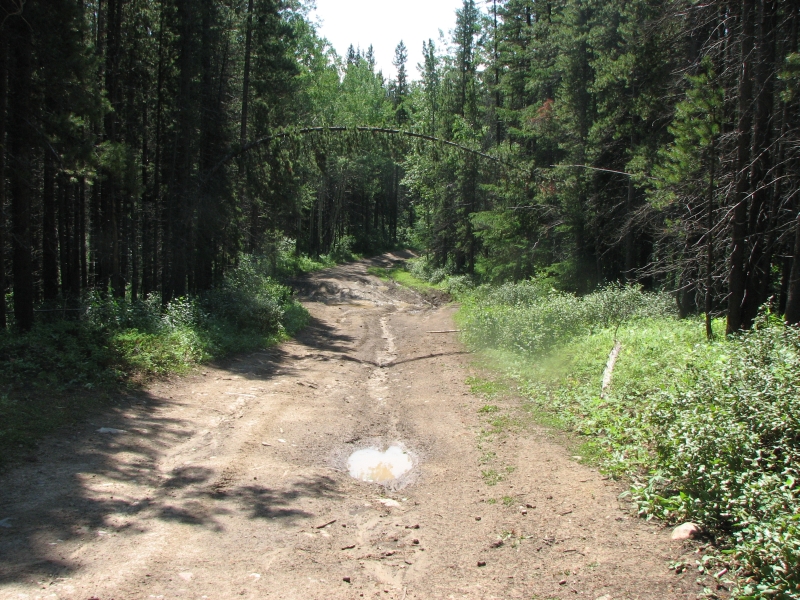
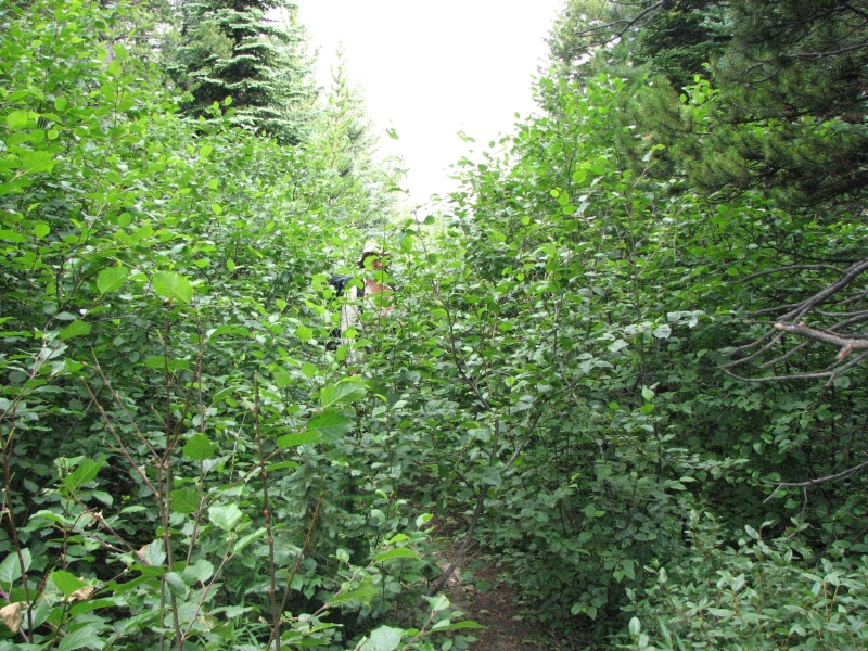
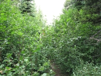
The dirt road was fairly busy, but eventually we turned off it to head over Deadman Pass on an ATV track. The bridge over Allison Creek was badly damaged but we used it to cross anyway since last nights rain meant the water was high. We passed a sign indicating that they have instituted a fire ban, effective today. It doesnt seem to have affected the number of people camping in the forest, but then, they might not know about the ban. Its ironic to start a fire ban the day after it finally rained. The dirt road was full of puddles that completely filled the road, forcing us into the bushes to avoid getting swallowed. Still, Im glad it rained. This area is overdue.
We climbed gently over Deadman Pass, then got confused when we missed a turn, had to backtrack, and somehow ended up at Alexander Campground where we were headed even though we werent following the guidebook route at all. There are a lot of old roads in this forest. Some have been closed (including the one to the campground), but many are in frequent use by ATVs, judging by the tracks. The guidebook can be hard to follow sometimes and reality doesnt necessarily match the description. The campground hasnt been in use for a long time (thanks to the closed road probably). If not for the sign saying Alexander Creek Recreational Area, we never would have known we were there. There were no tables, bear poles or outhouse, just a flat spot by the creek. It was really buggy, so we decided to keep going a couple of miles up the road. This is a Forest District area, so we can camp freely. We ended up next to the creek near a bridge in an area that has obviously been used before for camping. There werent any good trees, so we had to hang our food off the bridge, which worked. The site wasnt as buggy as the other campsite. There were mosquitoes, but no flies or bees. Today was cooler thanks to some dark thunderclouds that came and went all afternoon. We ran into one large family group on the ATV trail, but otherwise the afternoon was quiet. This side of the Divide doesnt get the use Atlas Creek does, evidently.
Were both tired and sore from our heavy packs, but still happy to be on the trail again. The guidebook is frustrating me, but well live with it. In tomorrows description, it says, Leave the road just before the bridge, cross the bridge, stay on the road. Say what? I figure the new edition kept the words of the old edition and just added the contradictory information on top of the old route. But which is old and which is new?
Friday, July 20 26 km to Line Creek area
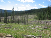
We decided to ignore the guidebook and just use the map to navigate. It shows a road heading north which we were able to follow all morning. The confusion came at junctions. Since the map is old (1973), most of the intersecting roads arent on the map. Theyve logged this area recently, so there are many new logging roads. Some of the old roads dont exist any more. Its a guessing game. Its not so bad when were heading due north, but at times the road winds, so you really cant tell if youre where youre supposed to be. We attempted a shortcut on a new logging road, but it dead-ended in half a mile. The forest here is very dense, so bushwhacking was out, though the guidebook recommends doing some, I think. Its hard to tell what Dustin intended. We finally figured out at lunch that the route I marked on the map isnt the same as the one in the book. The map route seems to lead directly to (through?) a mine that were supposed to avoid. One hiker a few years ago went to the mine to ask for directions and was escorted out to the highway, 20 miles away, on the wrong side of the Divide. We could hear the mining equipment ahead of us, so we turned around and climbed back up to the ridge and took a different dirt road that we had noted earlier. It still wasnt the one in the guidebook, but it headed north and eventually joined the guidebook route, without any need for bushwhacking. We did see a bull elk as he went crashing through the trees below the road.
We followed the logging road down to the edge of a big mine, then things got complicated again. The maps and reality didnt quite gibe. They showed a logging road coming in from the right, which we finally figured out probably disappeared in a clear-cut next to our road. We were looking for that road because we needed to turn right at the following road. We missed the turn. We continued straight for a while, but the road we were on headed directly toward the mine, so we backed out and tried another road. It ended at a locked gate, so we turned off on a side road and crossed our fingers. It could dead-end at one of the clear-cuts we could see ahead, or it might head over the pass. We didnt know. We found a place to camp for the night and hoped for the best.
We decided to stop early because we really werent up for a long slog over the pass then down to water on the other side. The guidebook said it was a steep climb with several dry miles. The campsite we found was on an old logging road not far from a stream, with room to spread out our wet tent and sleeping bags. We had a lot of condensation last night, so Jim got drenched and woke up cold. We didnt see any people at all today. We kept hoping for an ATV we could stop to ask about the route, but we saw no one.
July 21 26.5km to Hidden Creek Campground
It started to rain about 8:00 last night, so we jumped into the tent early. It didnt last long, but clouds and wind remained in the area. It has been cool hiking today as a result.
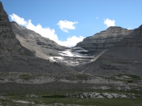
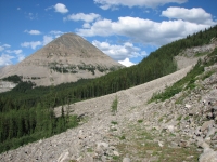
It turned out that we guessed right yesterday and we were on the trail to North Pass after all. Hurrah! The trail vanished for a while, completely washed out by the creek, but eventually we found ATV tracks to follow around the wash-out and soon picked up the old road again, climbing to the pass. We had three passes to cross today. North Pass was easy, Tornado Pass not too bad, but Tornado Saddle was really hard, with scree and obscure trail.
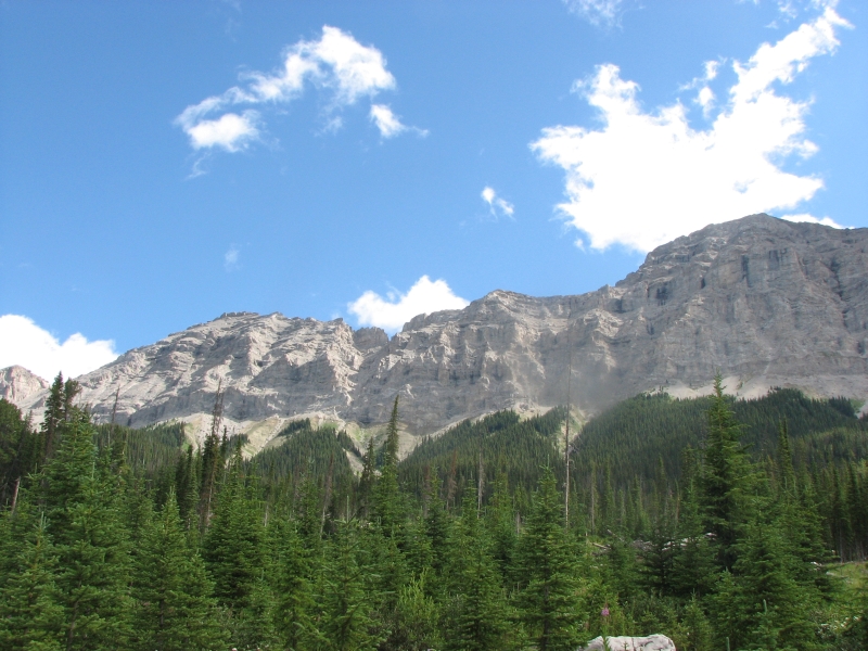
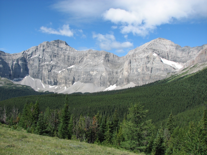
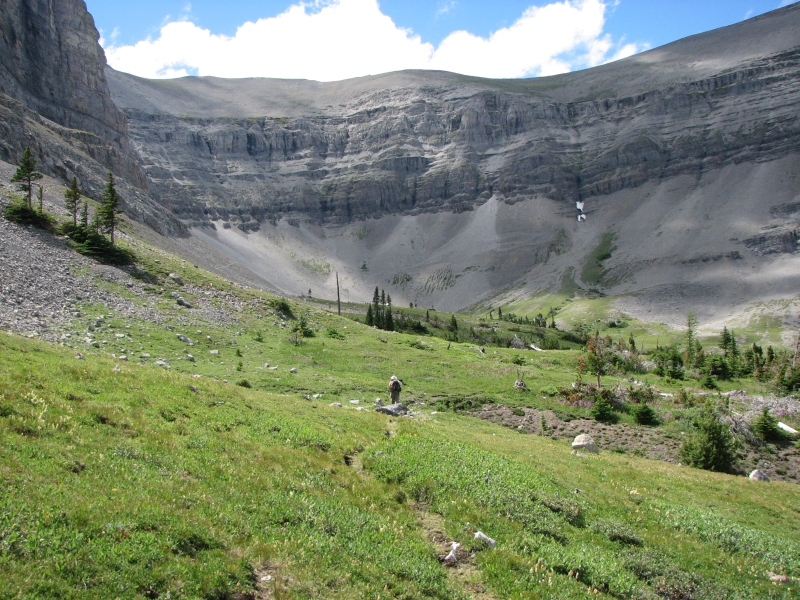
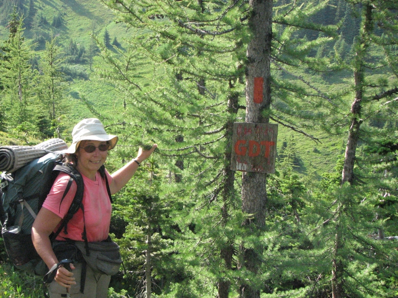
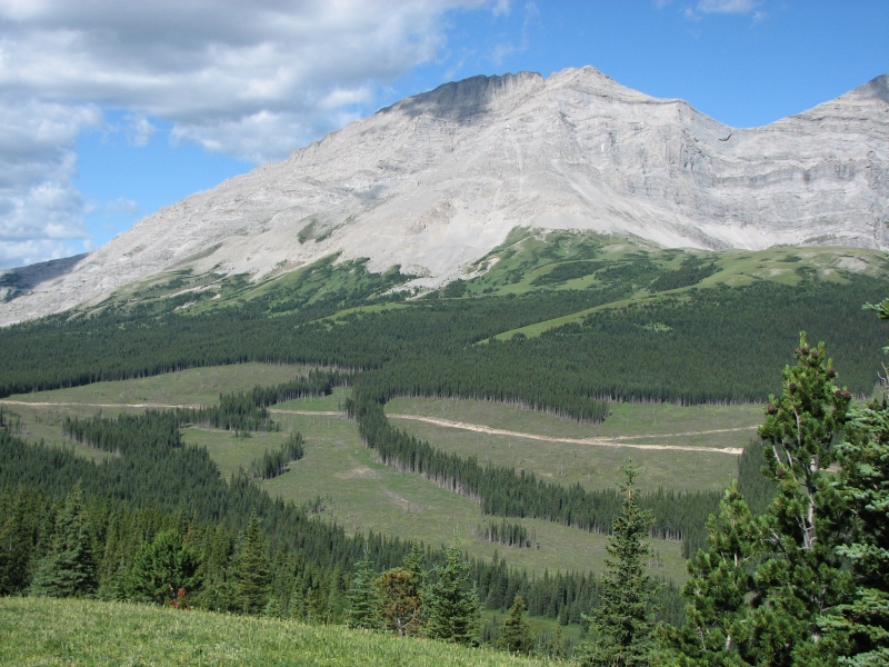
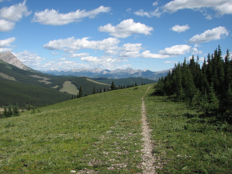
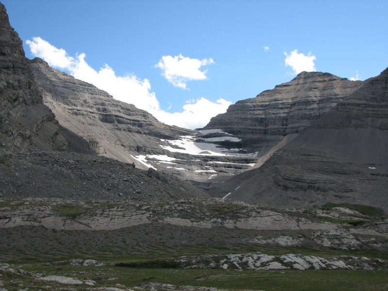
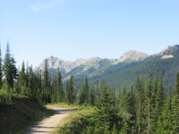
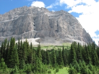
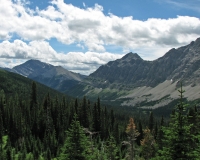
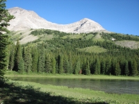
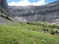
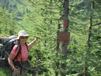
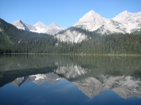
At North Pass we picked up the actual Great Divide Trail that was constructed in the 1970s. They built 95 km (a little less than 60 miles) and then were stopped by a lack of funding and government support. Supposedly it still gets a little maintenance. The orange blazes are intermittent and the foot trail is more used by ATVs than hikers, but it is an actual trail. The scenery along Dutch Creek was beautiful, with dense forest and rugged gray cliffs on both sides. We ate lunch at Dutch Creek Campground. In the Forest Districts, the campgrounds are actually just campsites a stone fire ring with a few logs to sit on, a flat spot for a couple of tents, sometimes a bear pole and/or outhouse and generally a water source. Dutch Creek CG is in a pretty location, with cliffs and big boulders nearby and a very green meadow below. It would be a nice place to stay the night, if our timing allowed.
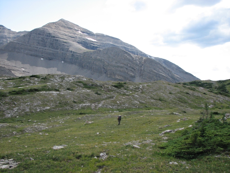
The climb to Tornado Pass was steady, but not steep. The guidebook says its a foot trail, but ATVs have obviously been using it regularly. From there we contoured around 10,000 Tornado Peak and began a really steep climb to Tornado Saddle. Trail was intermittent, so we ended up climbing too soon, but it didnt make much difference. The final push was over loose scree, sliding back every other step. There was faint trail and switchbacks near the top, but it was still very steep. It was even worse than La Coulotte, if thats possible.
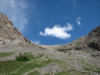
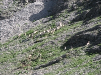
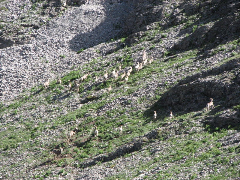
The other side wasnt as bad because there was more vegetation. There was one section of constructed trail at the top for about 25 yards, then it vanished and we ended up descending straight down the hill, dropping from cairn to cairn. At the bottom we scared up a herd of bighorns, about 40 of them. They climbed the scree on one of the side ridges, then waited at the top to see what we would do. We descended a lot more slowly and painfully than they climbed. Im sure they were laughing at our feeble efforts. We picked up foot trail with orange blazes (reminded me of Pennsylvania) and continued descending through dense forest fairly steeply (1800 in two miles). Finally we joined an ATV track that we followed for the last few miles, dodging puddles and swampy areas. We set up camp in an outfitters campsite, which had tables and shelves and lots of manure, but there are a couple of flat spots, so it will do. A hawk and baby hawk flew off as we approached I dont think Ive ever seen a baby hawk before. The steep up and down was very painful on knees and feet. We were both ready to stop.
Sunday, July 22 23 km to Oldman River Road/Memory Lake
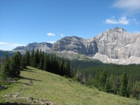
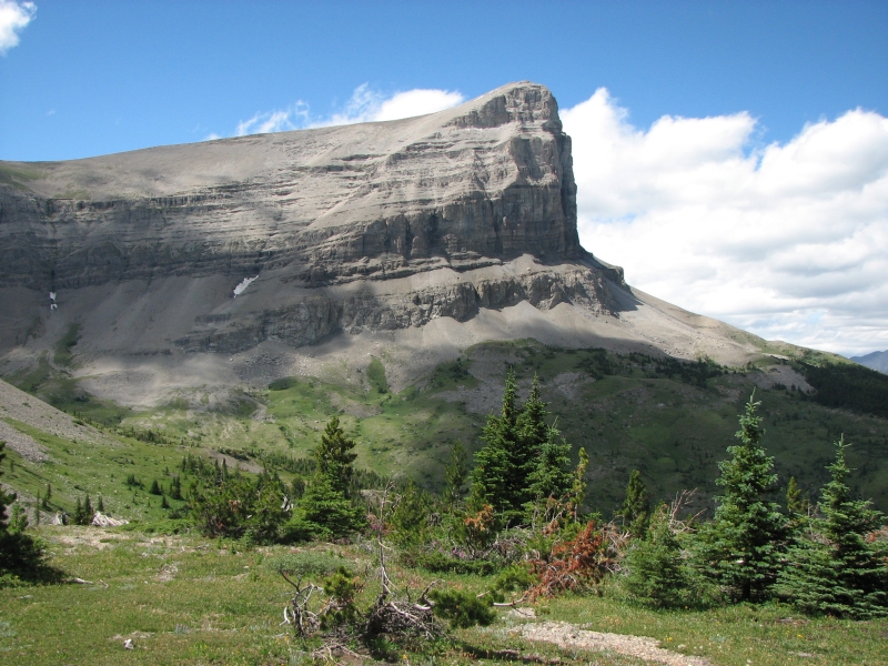
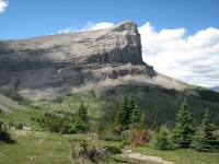
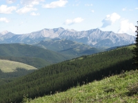
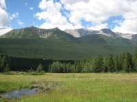
The wind kept us awake last night, roaring through the campsite and shaking the tent. It continued most of the morning, buffeting us as we walked along an open ridge. The views this morning were spectacular as we climbed out of the Hidden Creek Valley. There were stark gray cliffs to one side, green forested mountains to the other. It was beautiful.
We started the day with some confusion. The book said to turn left at a junction we did. Then it said to hug the north bank of the creek. What creek? We stepped across a tributary, but never saw Hidden Creek. So we turned back after 15 minutes or so and tried the other fork, thinking maybe there was a second junction that wasnt in the guidebook. Weve run into that before. That road went straight up a hill. So we turned around again, and about 50 past where we turned around the first time, we found a cairn and an orange blazed trail heading into the forest. Evidently they mark the foot trail segments of the GDT, but not the ATV sections. That was frustrating. It was a long climb up, but beautiful along the ridge.
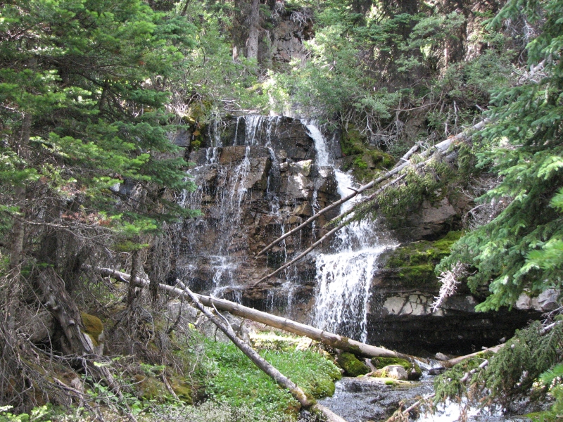
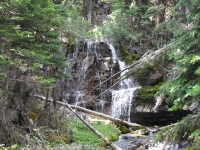
As I was filling water bottles after lunch, I was quite surprised to see four dayhikers and a dog pass by. Evidently theres a road about 2 km away. They were exploring the Cache Creek Trail, which has a small waterfall
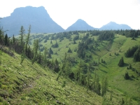
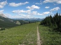
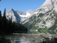
Our afternoon was similar to the morning: a long climb switchbacking through trees, terrific views on top, roller coaster up and down for a few miles, then a drop to the valley again. I spotted two more bighorns far below, but no other wildlife. It was a nice hike, albeit steep in spots, with over 3000 climbing today. It all took much longer than expected. I think the guidebook distance is off. Dustin changed the mileage in this section, shortening it, and I think its wrong now. The map was certainly wrong. We climbed much closer to the ridge than shown on the guidebook map. We hiked through a beautiful big cirque with grassy meadows and tarns. Later we had a nice view of the cliffs with a line of emerald velvet colored hills in front. The Beehive is one of many huge peaks in this area. Its really beautiful. Were camped by a pond beneath Mount Goss, a pretty site. We had good trail most of the day. There were some badly eroded spots, but it was easy to follow through the woods and there were cairns to lead us across the meadows where the tread tends to vanish. Flowers were abundant: pink fireweed, yellow columbine, purple daisies, dark red and light pink paintbrush, and white Queen Annes Lace, among many others. The wind accompanied us all day. Breaks were short because my sweaty body got cold quickly when we stopped. We still took a lot of breaks to drink and rest from the climbs.

July 23 25 km to Cataract Creek
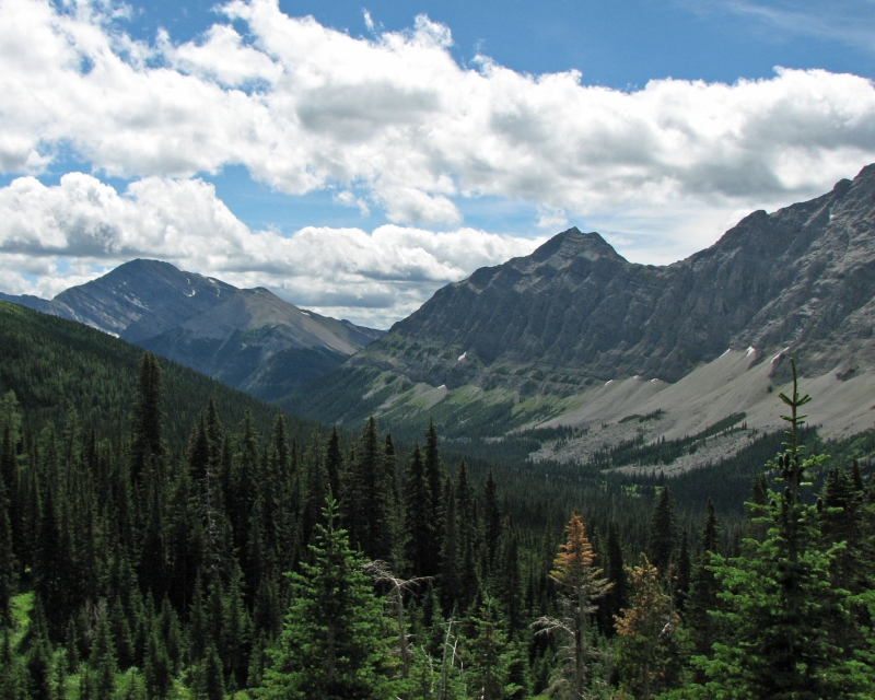
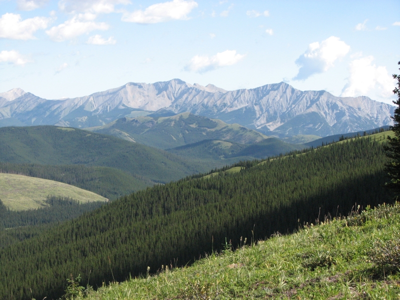
It was a mixed morning. The smoke is back, so views were limited, though nice when we could see the cliffs of the High Rock Range. Navigation was interesting: we started out from the pond on a jeep road, spotted orange blazes heading into the woods, followed them for 200 m. and ended up back at our starting point on the jeep road by the lake. We turned around and went back up the road for a half mile or so, ignoring the trail through the woods. Why did they go to all that work to create such a short off road segment?
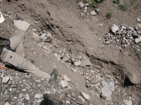
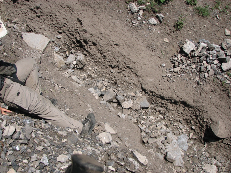
After that, we did all right for the first hour or so, following faded blazes and occasional orange ribbons. Then we lost the trail completely at a creek. We scouted around, found a couple of game trails, but no blazes. Each trail dead-ended -- once in a very wet meadow, once in a bears day bed. Jim climbed back up a steep eroded section of trail to find our last blaze, then came back looking for a side trail, but found nothing heading off. Reluctantly, we decided to bushwhack. The book said, Descend to a creek, then climb the broad ridge beyond. The hope was that we would meet the trail as it switch-backed up the ridge. Fortunately, it worked. We were able to follow game trails past the bears bed through the woods, and eventually we found the trail again. That was an enormous relief. The actual trail was probably through the boggy meadow. Our topo map predates the trail and is missing most of the logging roads, so it wouldnt be much help on a long bushwhack.
After that the trail was mostly quite good, following ridges and contouring around knobs. There were a lot of blowdowns and some eroded sections where the trail was gone, and one really nasty washout that we had to slide down and across, but mostly we followed good sidehill trail through the trees. Were slow because of the steep ups and downs and the occasional navigational uncertainty. Jim has an infected toe (a blister gone bad) so every step is painful. I have to be careful to stop often to wait for him because were seeing a lot of bear sign fresh scat, tracks and digging. I dont want to come around a corner and meet a bear alone if I can help it.
After lunch we continued descending the ridge to Lost Creek, where we picked up some most welcome and overdue water. Then we climbed again moderately through the trees, then dipped down into a narrow valley and up the other side. The next mile or so felt like the CDT, with open ridge walking down the crest of a ridge. It was really hazy, so the spectacular views were hidden in the smoke, but it was still a good hike. The trail was really well blazed, which was good since tread was faint. Evidently the motorbikes havent discovered that stretch of trail yet. All in all, it was a good day. We only lost the trail this afternoon for a couple of minutes, when we followed a cow path downhill in a clear-cut area. Blazes were scarce because tall trees were few and far between. Still, none of it was as bad as the guidebook described, except our little adventure this morning. The guidebook warned about impassible trail due to blowdowns and confusion around Lost Creek, but neither was an issue for us.
At the end of the day, we couldnt find Cataract Campground, which is supposed to be 100 meters off on a side trail. We found the side trail, followed it for about 400 meters and didnt see anything that looked like a campsite, so we turned back. It was really wet and boggy back there and the trail felt more like a game trail than a hiker trail. We set up on an old logging road or seismic line. Its a bit sloped, but we were more than ready to stop.
Tuesday, July 24 -23 km


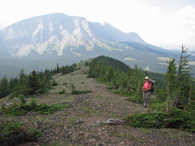
It was another mixed morning, with some terrific hiking along green and grassy Rye Ridge, followed by a nightmare stretch through a clear-cut, picking our way through downed trees and slash.
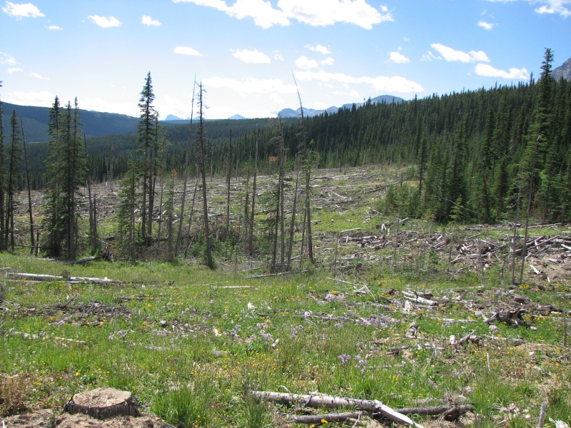
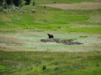
It rained last night, so we had clear skies and views again. We stopped atop our first grassy ridge for a long break to admire the scenery. I spotted a moose in a distant clear-cut. Theyve done a lot of logging in this area, so the forest is a patchwork. From a distance, I dont mind clear-cuts all that much - this is a national forest after all and you have to expect logging in forest districts -- but when the trail vanishes under a pile of dead wood, I get upset. Late morning, the trail completely vanished in a large cleared area. In places you could see trail under the deadfall and an occasional orange blaze on a downed tree, but for the most part we were bushwhacking through a mess of tree litter for about a mile. It was a great relief to finally leave the clear cut and climb through forest on foot trail to a grassy knoll where we ate lunch, looking north at green uncut forests and mountains. It was beautiful.
Navigation was mostly good, though the blazing was erratic. There were some good sections, some where the blazes were sparse or very old. The guidebook steered us wrong at cow-infested Etherington Creek Campground. The guidebook said to go north through the meadows. Instead the trail headed through the woods behind the campsite. We wasted some time there, following game trails through the meadows heading in the wrong direction through the willows. They have probably built new trail in the years since the author hiked the trail, but it was one of many frustrations Ive had with the new guidebook. It seems to me he should have rehiked the trail before putting out a new edition - or at the least, hiked the sections that are not part of the National Parks since those are the most difficult to navigate.

Our afternoon hike up and over Fording River Pass was on good trail. It was steep in places, of course, but the trail was a good one. The pass is a big one, at least a mile long and half a mile wide, in a high valley. We criss-crossed an eroded old road a half dozen times. Near the top, The guidebook says the trail is the road, but we werent sure where to switch, so we kept going on the foot trail. The actual pass was hard to discern, so we just kept going down the other side on the foot trail. The guidebook says to follow seismic lines steeply down the far side of the pass. We stayed on the foot trail and missed the first seismic line, and when we met the second one he mentions, we followed it for a short while, but it was a rocky eroded mess, so we went back to the foot trail again. We passed the Fording Pass campsite by a pond and kept going until our path ended at a logging road. So far, so good. If wed gone left, wed have been fine, but we headed right, downhill. After about 20 minutes, we knew we were obviously heading in the wrong direction, off to a side valley. So we turned around and headed the other direction on the road. Sure enough, about 10 minutes past the cairn marking the foot trail, we intersected the guidebook route again.
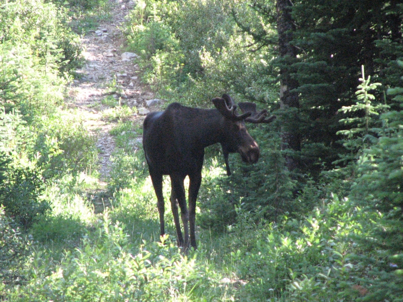
On the way, we met a young bull moose who was in no hurry to leave the trail. He stared at us, we stared at him. Nobody moved. I think he just couldnt figure out what we were or what he should do about us. He finally turned off into the brush, never to be seen again. We ended up camping right next to the logging road at a flat parking spot. The road gets no use (except wildlife) and the views are terrific, so it was a good campsite for us.
We finished the 95 km. section of constructed GDT today. Our last blaze was on the other side of Fording River Pass. Ill miss the blazes. You learn to rely on them, even when theyre erratic. The book can be awfully vague sometimes with descriptions for long sections summed up in a few sentences. Jim Wolfs detailed CDT books spoiled me on guidebooks. We only saw two GDT signs in the entire 95 km section, one yesterday and one today, but those familiar orange blazes gave us a sense of security that is rare out here.

Wednesday, July 25 35 km to Lower Elk Creek Camp Ground
We woke to black clouds shrouding the mountains. They lingered all morning, keeping us cool and damp. We descended the mountain on an old closed logging road. About a mile was badly overgrown with dense alder, similar to the closed road south of Castle Mountain, but mostly it wasnt too bad. We crossed Aldridge Creek four times. Twice the water was above our knees, but the way was easy for the most part. There were stretches of pack trail in the woods where the road was washed out that were very helpful. After about 5 km we reached a power line which had a road that we followed for the next 7 km. No cars, but we passed a trailer and tent at a really nice clearing with a view. After that we picked up another gravel road that we followed for the next 23 km. It was easy walking through the woods with occasional views of nearby ridges.
We ended up going much farther than intended, partly because it was so easy, and partly because the guidebook mileage was really off. There are three nice car campgrounds along the Elk River Road. The guidebook lists them as two km apart. It was way off. The first was 10 km up the road, as described in the text, but the next was 6 km beyond, and the third was ½ km beyond that on a side road. The guidebook then says that the hiker campground at Elk Lakes Provincial Park is only 3 km farther, but it was actually six. We had planned to stop at the third campground, but decided to keep going -- and going -- and going. We ended up at a nice campground in Elk Lakes, a real one with tent platforms, a fire ring, a new outhouse and bear pole. We get to pay for all these amenities - $5 each which wasnt the case for the campsites along the road, but it is a nice spot next to a pretty lake. There is a family camped at the next site. Theyve been here a couple of days.
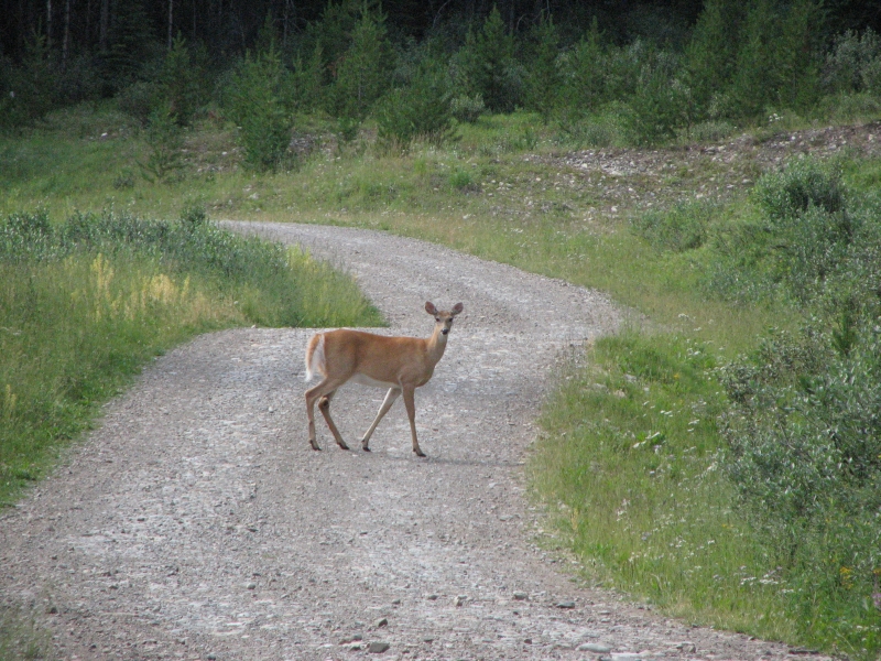
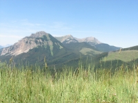
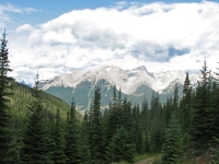
It was a nice walk this afternoon along the Elk River. The mountains in this area are just gorgeous, huge dramatic ridges with glaciers and snowfields. We saw a deer on the road and only four cars all day. Some recent logging activity spoiled about a mile of it, but the rest was beautiful with occasional views of the river and the mountains through and above the trees. Still, 21 miles is a long day for us. Were tuckered out. Were almost a day head of schedule, heading for a resupply stop at a place with absolutely no amenities. What will we do with two rest days at a campground?
Thursday, July 26 12 km to Boulton Creek CG/Peter Lougheed Provincial Park
The problem with our schedule resolved itself. In making our reservations on the phone, Jim accidentally eliminated the rest day I had planned at Peter Lougheed Provincial Park. That took care of one of the extra days. As to the second, we decided to divide our planned long first day into two short days. We decided that doing 16 miles on the first day leaving our resupply stop with 10 days food wasnt a good idea. Instead well do two short days, getting used to the extra weight a little at a time.
We are heading to Banff National Park, where we have to stay at reserved campsites. We have some really long days planned and some really short ones, due to the location of the available legal campsites. Its a different kind of hiking for us. We had reservations at Glacier and Yellowstone on the CDT, but that was all. The Appalachian Trail and Pacific Crest Trail don't require reserved campsites for thruhikers, even in the National Parks. Since the GDT goes through five national parks and two provincial parks that require campground reservations, well have to live with a schedule and reserved campsites for a lot of the trail. It can be nice to know that there will be a decent campsite at the end of the day, with an outhouse and bear pole, but it means sticking to a schedule. It also means well have neighbors almost every night. Some of the backcountry campgrounds get pretty crowded. Sometimes we meet nice interesting people, sometimes noisy inconsiderate ones. Well live with it, but Ill miss our solitude.
Today worked out well for us. We found a shorter route to Boulton Creek Trading Post than the one in the guidebook. The guidebook is vague, talking about the maze of snowmobile trails in the area. It said to follow the powerline, but we never saw a powerline. Instead we followed the trail closest to the creek and got to the Trading Post much quicker and more directly. We saw a deer on the trail, and several dayhikers.
At the store we met Randy, aka Sierra, who hiked the PCT in 1977. He was eating lunch with his wife when he noticed our appearance -- dirty, worn out and carrying packs obviously long distance hikers. They live in Colorado and are up here hiking and biking. We talked to them for a while and ate lunch, and then they drove us to the Peter Lougheed Information Center where we had mailed our resupply box. A nice bit of trail magic! They dropped us off back at the store where we paid for a campsite, then walked up the hill to a very nice spot in the campground.
Boulton Creek is a nice campground, except that its very spread out. The shower is half a mile away, and the outhouse a couple of hundred yards from our campsite. There are no bear boxes or bear poles and our food load is heavy. The trees are lodgepole pines, skinny trees with short branches, so Jim will have quite a job hanging our food. There was a big grizzly behind the Information Center, which is only 7 km from the campground, so we arent going to risk sleeping with the food. He was a nice one, digging up silverweed in the meadow, and utterly oblivious to the people watching him from the balcony. There are several campgrounds in the vicinity, but Boulton Creek has a shower and café/store, so it was the obvious choice. I practically skipped down the hill this morning, I was so happy to be heading to a hot shower. Since theres no place to do laundry, we threw our clothes into the shower and washed them as we showered. It was a long, double shower. Weve rinsed out our clothes a couple of times along the way, but they still reeked so did we! Now theyre not clean, but its better. We used our bear rope for a clothes line to dry them before dark.
Home | Links| Trail Journals |
The Thruhiking Papers | Bun-bun
Created: Fri, 16 Jan 2008
Revised: 30 Sept 2016Copyright © 2007-2017 Spirit Eagle