|
 |
 |
 |
 |
|
|
|
|
|
|
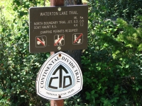
July 6 6.3 km in Waterton Lakes National Park
We unofficially began the Great Divide Trail (GDT) today. Well start it for real next week; today was just a prelude. But a nice one.

After breakfast with a group of Continental Divide Trail (CDT) hikers in East Glacier, we drove north to Canada to mail our resupply boxes. There have been hikers whose resupply boxes have gotten stuck in Canadian Customs for days or even weeks, and we really dont have time for that, so we drove to the Post Office in Waterton Township and dropped off four boxes of food and maps for our journey on the GDT.
Along the way, we picked up another CDT hiker, Nick, who was on his way to St. Marys grocery store. We dropped him off at the Park Café, then continued up the highway. There is a huge fire in the Bob Marshall Wilderness that continues to burn (on the CDT, unfortunately) so smoke left a light haze over the mountains. Still, it was a pretty drive up past Chief Mountain to Waterton.
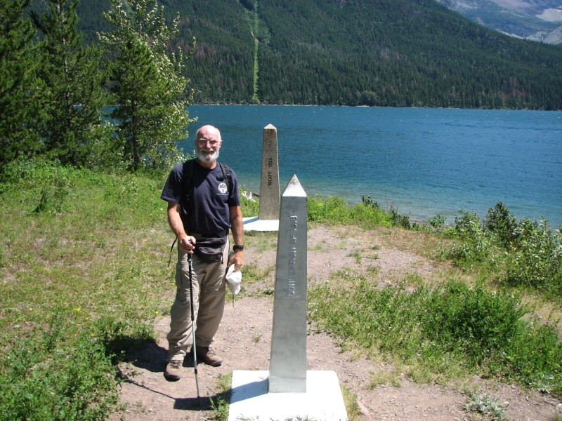
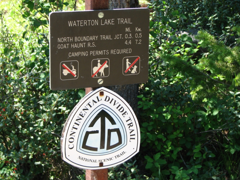
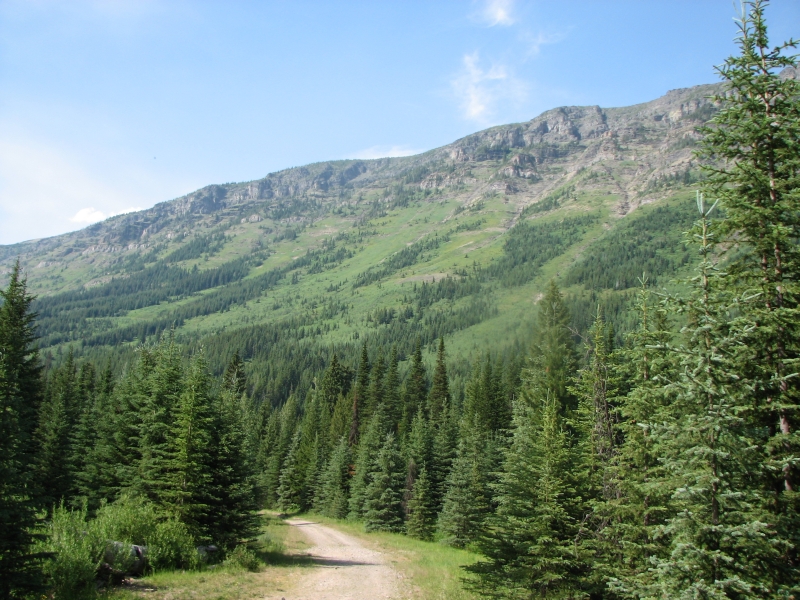
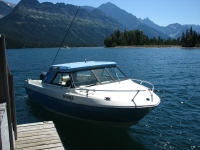
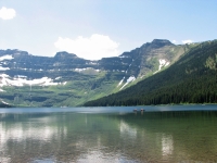
As long as we were in Waterton, we decided to hike the first 3 ½ miles of the trail from the US/Canada border to Waterton Township. We have done it before, on our first hike through Glacier in 1998, but agreed to hike it again for the GDT hike. We didnt especially want to do it both ways, so we asked the tour boat office if they would drop us off at the border. They said the big tour boat couldnt dock there, but they would be willing to drop us off in a small motorboat. That was fine with us. It was a really hot day in the low 90s so it felt really nice to be out on the water.
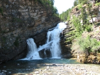
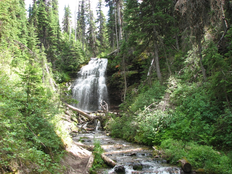
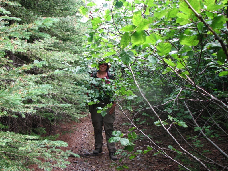
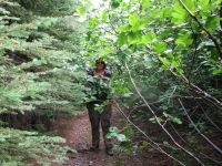
We took the obligatory border photos, then headed back to town. We had been warned about a problem bear in the area. The Park closed a couple of the campsites because of the bear, but we saw no sign of him. We did make a lot of noise as we hiked though, since there is a lot of vegetation along the way. The trail has some short steep ups and downs, but mostly it was a nice woods walk with occasional views of the lake. Despite the haze, the views were beautiful. We stopped hiking at beautiful Cameron Falls, where the trail leaves town and heads into the mountains. Our only wildlife were several very tame deer in the middle of town. There were signs warning that deer will attack dogs in defense of their young. Its the first time Ive seen that sign.
It felt good to be hiking, especially on the GDT. Mailing our resupply boxes made it feel real; we really are going to hike this trail. Ive wanted to do this ever since my first ALDHA workshop on the Great Divide Trail ten years or more ago. Happiness is starting a long-awaited long distance hike!
July 11: Alderson Lake 7.4 km
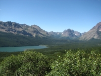
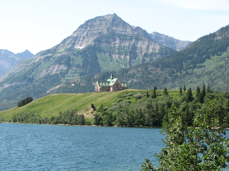
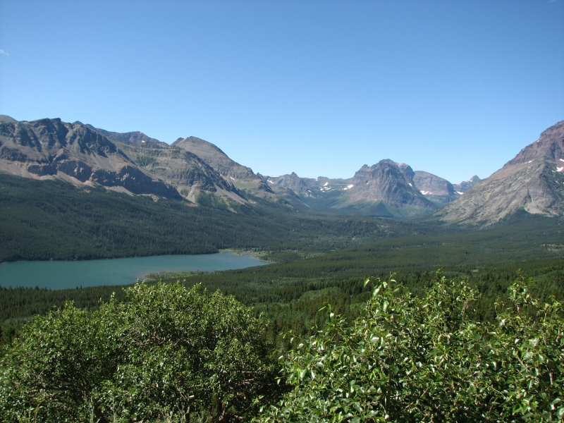
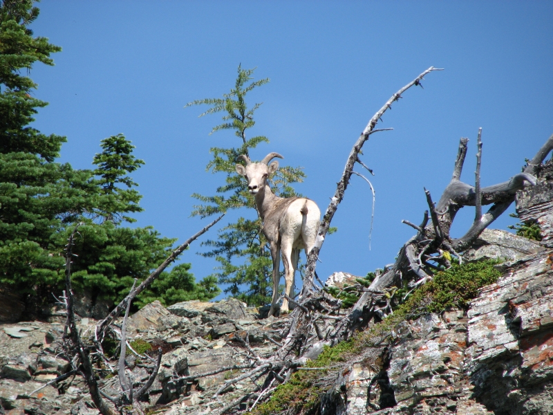
We finally officially started our hike on the Great Divide Trail this afternoon. Hurray! The shuttle bus from East Glacier to Waterton doesnt leave until 11:00 and doesnt reach Waterton until 2:30, so we set up our campsite reservations so we could do a short day today. Given how heavy our packs are with seven days food, that is a very good thing. The van was full from East Glacier to Many Glacier, but after that there were only two other hikers: two border patrol agents from New Mexico starting a three day backpacking trip. They were a bit in awe at the thought of a two month hike. The drive was a nice one. We saw a bighorn at Many Glacier and a golden eagle on the highway, as well as three deer wandering through Waterton. We bought an ice cream at the Prince of Wales hotel and watched the chaos as a large group of women bicyclists arrived, one by one, at the hotel.
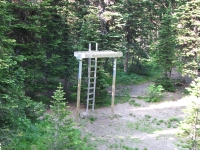
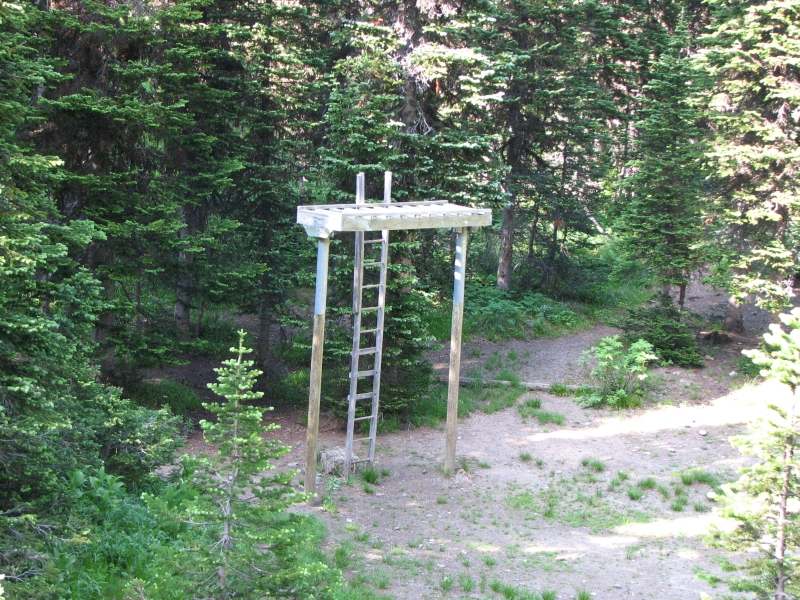
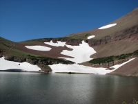
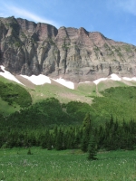
We started our hike at the waterfall on the edge of town where we ended last week, then climbed 1500 on shady lush green trail above the creek. It was hot, so the shade was welcome. We met seven day hikers and a trail crew, putting in a bridge with the help of a helicopter that ferried in the logs. We reached Alderson Lake at 5:30. It is a small one, very blue, with steep cliffs beyond and some dirty snow patches around the edge. There are hordes of flies and mosquitoes. We have the whole campground to ourselves, which is surprising. I took advantage of our solitude to wash up in the lake. There is an unusual bear platform that requires a ladder to access. Getting food up there with our heavy food bags will be interesting.
All the national parks and some of the provincial parks require reserved campsites. One of the biggest concerns before we started was setting up a schedule and getting the permit. In some ways, it was easier than expected, since random camping is allowed over about half the trail, including some of the more remote sections of the national parks, but we still needed to figure out how far we wanted to go each night, and attempt to fit our desires with what was available. Usually it meant setting up either very short days or very long ones. Because we arent in a hurry, we tried not to be too ambitious. I want to enjoy this hike without feeling pushed to do big miles. At the same time, we dont want to carry too much food weight. There are some long sections between resupply points. The guidebook author recommends a two month hike, but that means carrying very heavy packs. We plan to take six weeks to get to Jasper and another week or so to go to Mount Robson, depending on which route we take.
Waterton NP was a mixture in terms of campgrounds. There were four options in the first ten miles, then nothing for about 20 so we will camp off trail tomorrow in a Provincial Park and then head back to the park for our third day.
July 12 Akamina Creek Campground 17.5 km
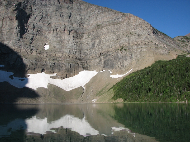
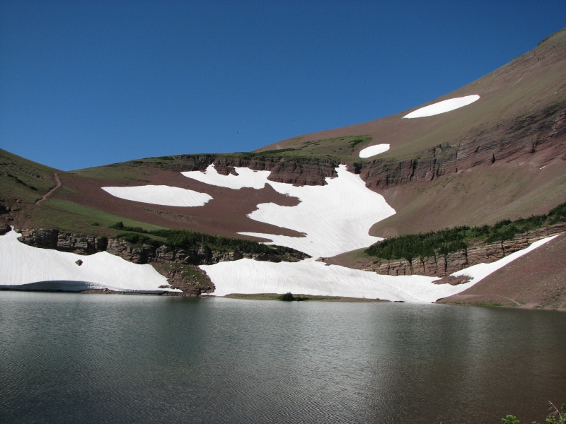
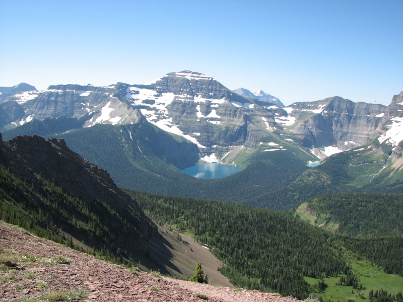
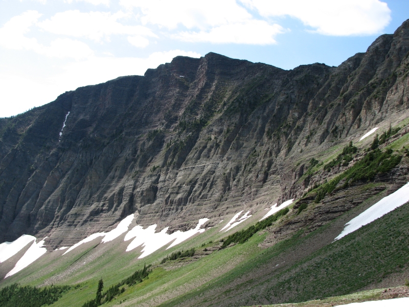
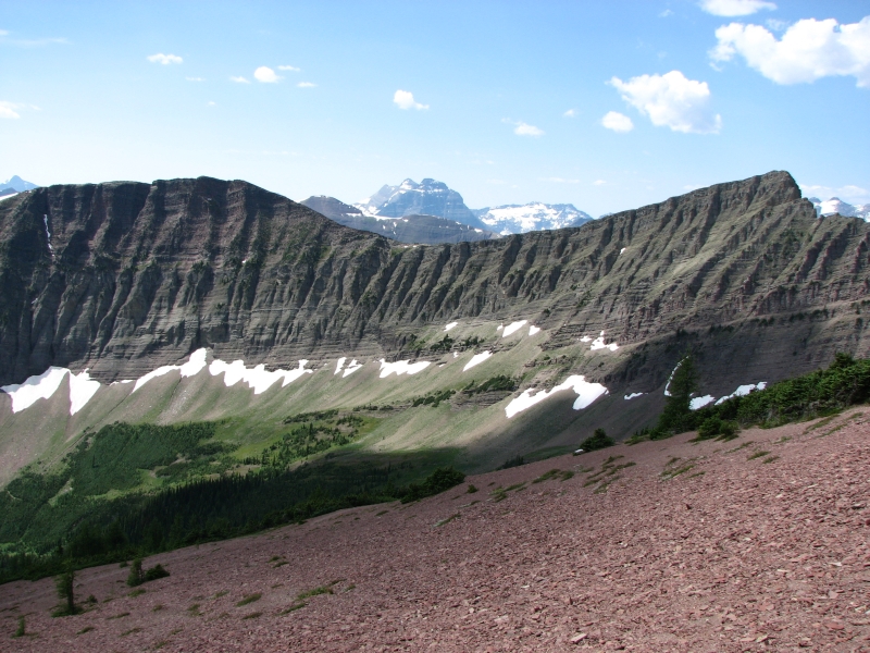
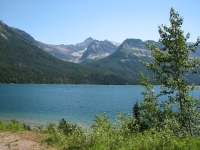
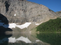
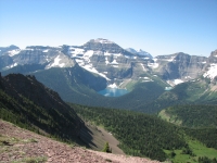
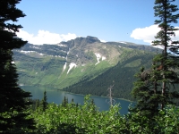
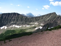
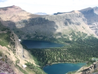
We had a peaceful night, once the buzzing flies quieted down. Our tent was drenched with dew this morning, so we took our time packing up. The trail climbed and climbed past Carthew Lakes to Carthew Summit, with gorgeous views of snow-streaked mountains and beautiful glacial lakes. The lakes are incredible shades of brilliant blue and green: royal blue, emerald, peacock blue, turquoise, aquamarine. There were a lot of fish in one of the lakes we passed. The water was clear enough to see them swimming past us.
This trail is very popular with dayhikers I counted 31 people before we stopped for lunch near Summit Lake. The trail was pretty good, though there are multiple paths in some places to confuse things. We hadnt intended to climb to the summit, but that was the obvious trail. The junction where we were supposed to turn wasnt marked or at all obvious from the south. Descending was a bit tricky because we had to cross a huge scree slope with multiple small rock slides not my favorite kind of hiking. But it was really gorgeous.
After lunch we continued descending on switchbacks through dense forest to large Cameron Lake. It was a busy place. They rent out canoes and also have a small concession stand where we bought cold drinks and ice cream. It isnt quite as hot as it was last week, but it is hot probably high 80s--so the sodas were very welcome.

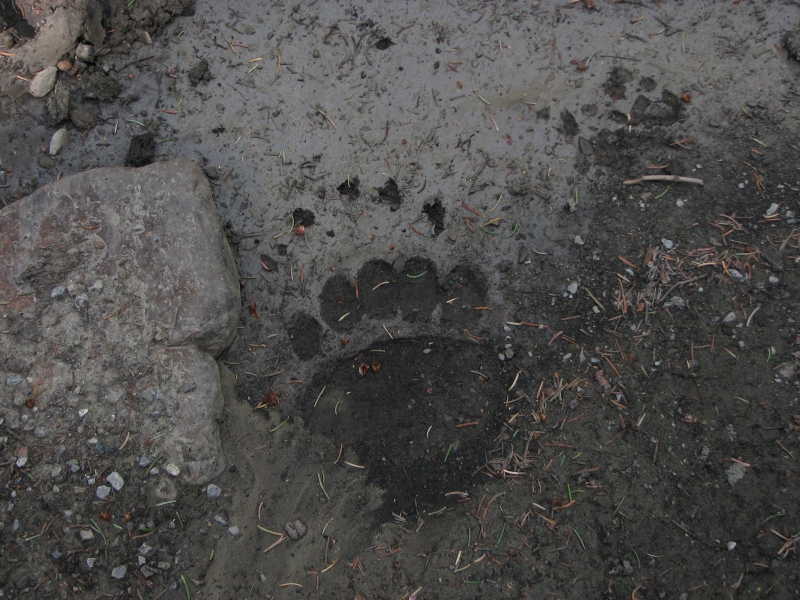
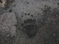
One and a half kilometers up the road we found the Akamina Pass trailhead into Akmanina-Kishinena Provincial Park where the campground for tonight is located. That was also a busy trail. The trail is an old road, so fairly easy, and leads to a couple of lakes and waterfalls in just a few miles. We ran into a large group of dayhikers on their way out and a Mennonite family heading in. We ended up visiting with the family for quite a while later on as we cooked dinner. They were from nearby Pincher Creek, out hiking for a couple of hours with some family visiting from Texas. The dayhikers all mentioned a grizzly sow with a cub seen at a lake about 3 km. from our campsite. I hope she stays there.
We detoured to check out Forum Falls, but didnt continue past the campground to any of the nearby lakes. Today is a short day, but we were tired with the climb, the heat and our heavy packs. The campground is 3 km off route, but we didnt have a lot of choice; it is the only legal option in this section. Because bears are abundant in Waterton and Akamina-Kishinena, they restrict camping to a few scattered spots. This campground didnt require a reservation, but there is a fee board, so we registered and paid when we arrived. Were sharing it tonight with two climbers from Kalispell,a group of six Boy Scouts who rode up on bicycles and a lone backpacker who arrived just about dark. The boys were a bit noisy but eventually they settled down.

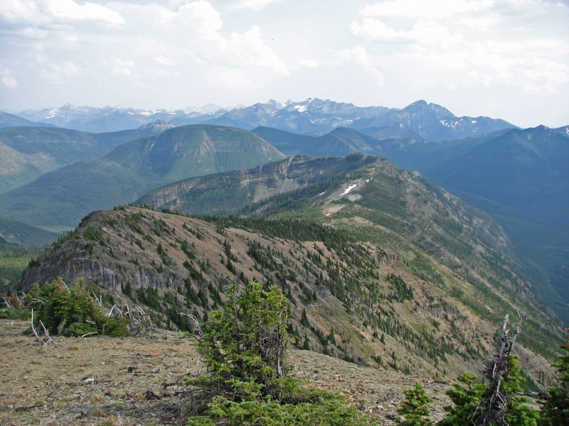
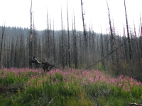
July 13, 2007 - 30 km to Twin Lakes
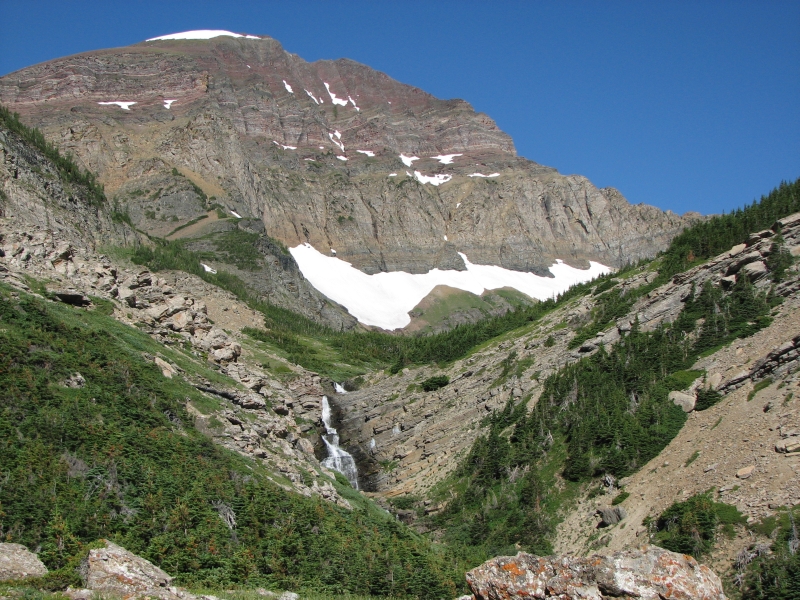
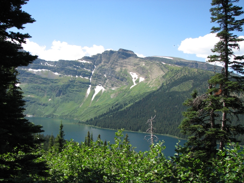
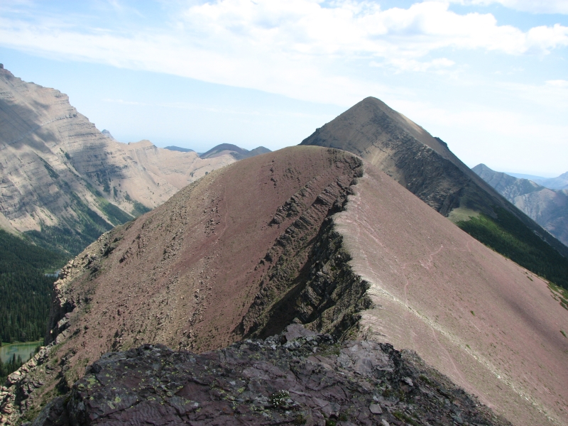
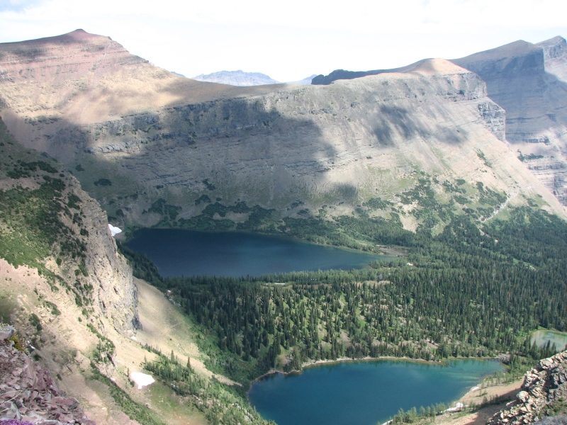
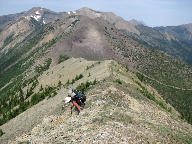
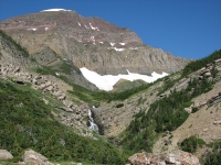
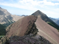
Today was a strenuous day, but beautiful. After a short hike along the paved road, (shorter than the guidebook stated), we started up the Tamarack Trail in Waterton NP, which climbs 3000 to Lineham Ridge. The first half was in the trees, so relatively cool, but then we reached the cirque at upper Rowe Creek and began climbing up the wall of the valley, 1500 in two miles. The views from the top were great: back to Rowe Creek and Rowe Lakes, south to Akamina Ridge and the snowy peaks of Glacier National Park beyond, and north to the Lineham Lakes. There are several long ridges along here. Wildflowers are abundant. The views are hazy because of fires down south, but still beautiful. We could see ridge after ridge, stretching out before us. It was worth the effort. The descent was on good trail, but over scree. We slipped and slid all the way down, then climbed back up over another ridge 1100 in a mile to the campground at Lone Lake. Thats steep trail. We were ready to quit then for the night, but our reserved campsite was still 4 ½ miles farther so onward we trudged. There was some nice trail descending gently then climbing not too steeply another 600 over another ridge to Twin Lakes. We didnt arrive until 7:00, utterly exhausted, but 18 miles and 5000 of elevation gain will do that to me.
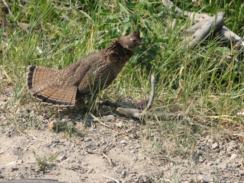
There was a group at the campground, but lots of scattered campsites so we were able to get away from the noise. Unfortunately, the men were fishing in the lake, so my long-awaited swim turned into a sponge bath back at the campsite. They were the only people we saw all afternoon. This morning we ran into a trail crew who had just scared a black bear off the trail, and two dayhikers from Iowa. The trail crew this morning were funny. I said something about the sow and cub seen by the dayhikers yesterday and their response was a bored, There are lots of bears here. In Glacier theyd do a report on it and probably close the trail. Our hike this afternoon was on trail that had a sign warning about a male grizzly near Lone Lake. The trail crew told us the bear had probably moved on, since the sign was dated June 29. They were pretty blasé about it all, though they did make a lot of noise as they hiked to warn off any other bears in the vicinity.

July 14 10 miles to La Coulotte Ridge
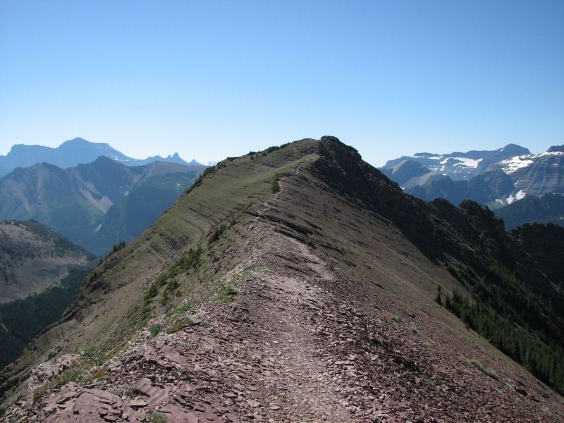
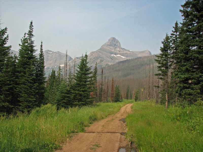
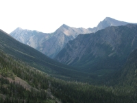
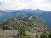
We left Waterton National Park, for good this time, to begin a less developed section of trail. We climbed above Twin Lakes to Sage Pass on good trail, which we then lost in a wet meadow. We picked it up again fairly quickly and followed faint trail along the Divide. It was smoky so we took few pictures, but the ridges were beautiful, spreading out as far as the eye could see. I always enjoy ridge walking, though the climb up to the ridge was a slow steep one. We spotted a deer and a bighorn this morning, our first large animals since leaving the town of Waterton.
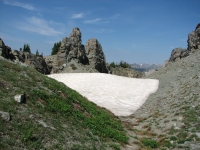
One section was different: a narrow rocky gully, filled with snow. Weve seen patches, but this snow covered the trail for 100 yards or more. We had an early lunch at an outfitters camp in a sunny, flowery meadow by Font Creek. Water is scarce in this section, so were tanking up every chance we get. Today is supposed to be about 90 degrees, which means we really have to be careful.

The trail went up and down from valley to ridge to valley. It was a steep roller coaster, but not too bad. At Scarpe Creek that changed. We began a section of some of the most strenuous hiking Ive ever done. The trail vanished, so we headed straight up to Coulotte Ridge. Then we followed the ridge steeply up and even more steeply down. The scree was bad enough; getting around and down some of the rocky knobs was worse. We didnt make it as far as we hoped. What the guidebook lists as 4 km took us four hours. We were both exhausted and not up to another 1000 climb straight up La Coulotte Peak and down the other side, so we stopped at the col just before that climb. We barely made it that far before dark. Fortunately, in addition to the water that we carried from Scarpe Creek, there was a snow bank that we used to supplement our supply. Our campsite is small and lumpy, but it will do. Theres no way to hang food--the trees are too small--but no bear would be likely to come up here. Its too steep and rocky, with nothing for bears to eat (except us or our dinner).
July 15 14 miles to Castle Mountain

We continued our traverse of La Coulotte Ridge this morning. We decided against climbing the peak 1000 straight up and down the other side, all on scree, just didnt appeal. Our knees screamed just thinking about it. Instead we contoured around the mountain. Given the steepness of the slope, it wasnt easy, but it was better than going up and down that steep ridge. We had two more climbs afterwards, about 400 up and down each one. Those were bad enough, between scree and trees that we had to bushwhack through. All in all, we were moving about ½ mile an hour, if that. I was on the edge of a panic attack several times. With my fear of falling, walking on loose rock really scares me.
Finally we reached an ATV road leading off the ridge. I was so relieved, I was practically dancing, until I realized that it was also steep and rocky, and not much better than the bushwhacking we had done before. The grade eased up after a while, though the trail became heavily overgrown another form of bushwhacking. We ran into four motorbikes in the bushes, which really surprised me. The trail is officially closed, and as overgrown as it was, they had little joy of it. Eventually the way opened up past a gate, other roads joined ours and the walking became quite easy. We saw a couple of ATVs but that was all. The walk up Castle River was mostly tree-lined, but we had occasional good views of cliffs and meadows above the road. After the difficulty of La Coulotte Ridge it was nice to have an easy walk for a while. That was some of the hardest hiking Ive ever done, it was so steep and rough. Navigation wasnt a problem, but the straight up and straight down climbing was difficult, especially with no trail to follow. I got badly dehydrated, even though we were lucky enough to find snow banks to supplement our water.

We looked for the campground that is supposed to be next to the Castle Mountain Ski Resort and didnt find it. There were some people car-camping near the river, but we didnt see a formal campground. When we reached the resort, we asked for directions to the campground and were told, You can camp anywhere around here. We headed to the pub for beer and pizza, then decided to stop at the hostel to see if they had a room. Sure enough, there was a double bed available. The shower was most welcome, especially after the heat of the past few days. We cleaned up at a creek this afternoon, but that coolness didnt last long. Last nights dry camp meant I was really sticky today so I couldnt resist the thought of a shower. The hostel is half full with a fire crew, but there were plenty of empty beds, so the managers were quite happy to see us stay.
Our main highlight today was watching two animals playing in a pond below the jeep track. We couldnt tell what they were since we were quite far away. The color said moose, but the play said bears. I didnt think that moose would dive into deep water that way, frolicking and splashing. Turned out I was wrong. The photos later showed that they were really moose playing in the water on a very hot day.
July 16 16 miles to Lynx Creek Road

We ended up not sleeping much simply because it was so hot. Funny how it always feels hotter inside a room than when camping outside. We left about 8:30, heading up a good gravel road for a few miles past some swampy areas and wildlife refuges. Then we turned up Poison Creek on the first of a series of ATV tracks. Confusion was the story of the day. There are a lot of trails in here; none are on the map and the directions arent always clear. (i.e. the guidebook said, go straight but the road forked right and left.) We started with a wrong turn which cost us about a mile. We turned left at the first junction but right at the second the guidebook only mentioned one junction. Part of the hike was straight up, about 400 vertical, then we climbed more moderately for the next 600. The ATV roads on top werent bad, just very overgrown. It has been years since the roads were cleared and alders grow fast. It got confusing at times because of the many jeep tracks and we made another wrong choice by heading north on a seismic line instead of turning left on the road. But that was easily fixed since we reached a gravel road soon after that we intended to follow for a while. It just added another ½ mile to the day.
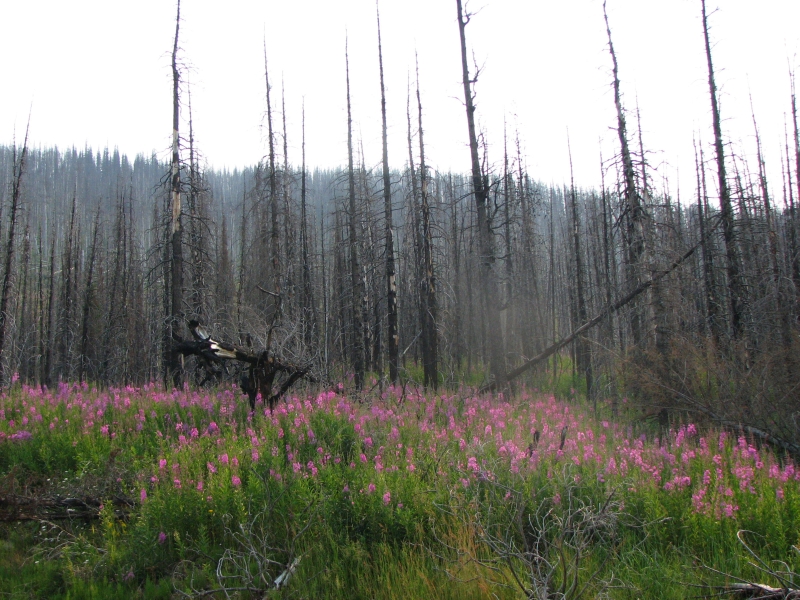
We reached Lynx Creek Campground, where we had planned to stop for the day, in the middle of the afternoon. It was very busy with ATVs, motorbikes and a herd of cows, so we decided to take a long break, then move on a few miles. We ended up altering our route as well. The guidebook route heads up Willoughby Ridge, which was burned in a big fire three years ago. The guidebook author says that the end of his route no longer exists (buried in deadfall) and suggests looking for an ATV trail to descend back to Lynx Road. Since the section starts and ends on Lynx Road, we decided to simplify matters and just stay on the road. There is water along the road, which is not the case for the trail, and it has a gentler climb than the ridge, which is a good thing at the end of the day. Jim and I were both tired and footsore and not up to an 1800 climb to a dry camp in the middle of a burn. If there were views, it might be worth the effort, but visibility is awful due to smoke in the air. We can barely see across the valley today.
We eventually found a small car-camping site next to Lynx Creek. We decided to stop early, once we found a decent spot. Because a lot of the forest is burned and this is a fairly narrow valley, we werent sure what wed find ahead. The road follows the creek, sometimes high above it and sometimes within easy reach of the water. There are several people camped along the creek, and several more just out fishing. Our campsite seems to be next to the best fishing hole several people have tried their luck here. I was surprised in my bath by a woman fishing with her little dog. We spotted one deer this afternoon, but no other wildlife. The road had some traffic, but not a lot, so though we ate a lot of dust, it was still better than dodging burned trees up on the ridge.
July 17 13 miles to Coleman

There were a lot of people camped along the river this morning; most were still sleeping as we passed by on the road. We continued on Lynx Road another 7-8 km to an ATV track that headed up past the head of Lynx Creek. There were views of a dramatic peak and Lynx Basin, barely visible in the smoke. We saw one deer and followed fresh bear tracks up the road. There were lots of tracks: deer, elk, a small cat, and one clear wolverine track.
Beyond the pass we returned to lush unburned forest as we descended along York Creek toward Coleman. The ATV trails have mostly been marked, so confusion was minimal. A friend gave us a recreational use map that shows all the ATV roads in the Castle Mountain area. It has been helpful. We saw only one jeep on the trail and only two cars this morning on the main road, so it has been pretty quiet and mostly easy hiking. We are anxious to reach the town of Coleman, where we are doing our first resupply stop. We have a room reserved at a Bed & Breakfast there, and I am really looking forward to getting cleaned up. The shower the other day was wonderful, but that was two days ago and besides, our clothes are filthy. Im ready for a rest day too.
On the way to town, we met an interesting man on an ATV, obviously a professor, who talked to us for a while about edible plants like glacier lily stalks and making fireweed jelly. The descent into town was shorter than described (the book said 4 km from the snowmobile staging area, but it took only 20 minutes). That was a welcome development. We reached town at 2:30 and were made welcome by our hosts at A Safe Haven B&B, Alannah and Dan. Jim had called from Castle Mountain to confirm our arrival, and got good directions, which helped. The town is small, but it was nice to have some idea of where to find our room instead of wandering in circles looking for it.
July 18 Rest Day in Coleman
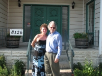
The Bed and Breakfast is really nice. A Safe Haven is a 3 ½ star B&B, a cozy welcoming home with friendly hosts and delicious food. Dan and Alannah are also trail angels, who have developed a special relationship with GDT hikers. They took very good care of us, feeding us well, letting us do laundry and use the internet, and helping us with our errands. The house is perfume (and chemical) free which I appreciate. Im not chemically sensitive, but strong perfumes can be as obnoxious as smoke, especially to those of us who spend a lot of time outdoors. There was another couple staying there the first night and we enjoyed a long conversation with them over breakfast. Dinner and lunch, prepared by Alannah, gave us the chance to get acquainted with our hosts. Alannah and Dan are really nice people, and very interesting to talk to. We ate really well. She takes a real effort to provide delicious and healthy food with lots of fresh fruit and veggies. Later, Alannah drove us to the nearby town of Blairmore to the grocery, bank, post office and hardware store. As I said, shes a real trail angel. I appreciate the fact that such busy people are willing to take the time to help out strangers. Money is easy time is more difficult to come by for people in the hospitality business. Their busiest weekend of the year starts tomorrow, so I know time was in short supply.
Home | Links| Trail Journals |
The Thruhiking Papers | Bun-bun
Created: Fri, 16 Jan 2008
Revised: 30 Sept 2016Copyright © 2007-2017 Spirit Eagle