
|
 |
 |
 |
 |
Saturday, August 2: Hinton
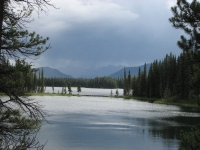
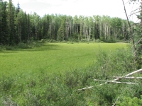
Heading south on a mixed sunshine and cloudy day. Some sprinkles, but so far nothing serious. The landscape has been interesting. We started with farmland: big rolls of hay everywhere, some horses, cows and an elk farm. Then we passed by the large town/city of Grand Prairie. Cheap gas and lots of big box stores on the highway, but we didn’t linger. We drove into the mountains. There were some very distinctive folded ridges, beautiful azure rivers and lakes, patchwork forests on rounded hills. We hit Grande Cache in the middle of Deathfest 2008, evidently a long 24-hour ultra run. Again, we didn’t linger, though we may have missed an interesting festival. It was a popular one at any rate, based on the number of people we saw there. We had planned to spend the night at Grande Cache, but the crowds put us off, and besides it was still early, so we continued driving south. We saw three deer and a couple of hawks along the road.
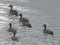
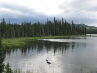
Because of the holiday weekend, most of the campgrounds were packed. We stopped at Kelly’s Bathtub in William Switzer Provincial Park to do a short hike around the lake between rain showers. The ranger there told us that every campground in the area was full and even the WalMart parking lot in Hinton was getting crowded. Fortunately, it turned out she was wrong. In the middle of the town of Hinton, next to the pulp mill and recreation center, there is a municipal campground with wooded sites. No electricity but it has a real bathroom and picnic tables. Most important, it had vacancies. We took one of the empty sites. We found out later why it was half empty: trains run beside the campground every half hour or so, but we’ve run into that before and we’re pretty good at ignoring the noise. We slept fine.
Sunday, August 3: Jasper
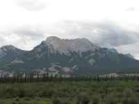
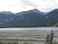
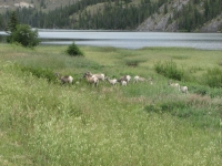
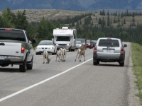
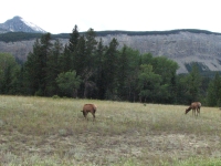
We enjoyed a big breakfast at Smittys, then headed to the grocery to pick up some milk, bread and ice. Eventually we headed to Jasper. It was a good drive. We ran into two groups of bighorn sheep next to the road and some elk on the way out of town. It was cloudy all day but never really rained.
Our first stop was the Visitors Center where we learned that because of the holiday weekend, all the park campgrounds were full, as well as the private accommodations in town. However, there is an overflow area near Snaring River that should have space. We can’t reserve a space there, just show up at the end of the day and take our chances.
We had hoped to make a backcountry camping reservation on the Skyline Trail so we could rehike the section of the Great Divide Trail that was snowed/rained out last year. We were told the trail is booked until September. Plan B was to see if we could get backcountry reservations for the GDT route from Jasper National Park to Mt. Robson Provincial Park. Jasper was easy, but we couldn’t reach the park office at Mt. Robson. No worry, we were told. Go anyway. We were told that if we met a warden, we should just say that we tried to call but couldn’t get anyone on the line. Evidently it is a common problem. We tried three times with the direct number at the backcountry reservations desk, then I tried the 800 number a final time from a pay phone and then called directly to the park a few hours later. The 800 reservations number said that we didn’t need a permit for the trail along the Moose River and they only reserve 27% of the Berg Lake Trail campsites--which were all booked--so I needed to call the Park directly. Oh well. We tried.
The folks at Jasper were very friendly and helpful, but couldn’t help with the Mt. Robson issue except to acknowledge that, yes, they are impossible to reach by telephone. Since it’s a 170 km round trip to talk to the wardens there in person, we didn’t try, though we considered it. Driving over 100 miles just to make a reservation for one night of camping is not reasonable. I am not happy about the situation, but don’t see much we can do about it. We’ll just have to deal with the wardens when we get there. Or maybe we’ll camp outside Mt. Robson Provincial Park and skip the issue entirely. It means not having a reservation in Jasper that last night, but that is less of a problem since there are so few people in that part of the park.
Then we were told that they are working on an oil or gas pipeline near the trailhead (the same one that closed the Celestine Road last year and again this year) so hikers need an official escort past the construction zone. Nobody was sure whether that would apply for the holiday. The wardens tried to call a supervisor, but couldn’t reach anyone who knew for sure, so they said stop by tomorrow and we’ll have an answer. I was feeling really frustrated by that time.
Laundry and dinner took up the rest of the afternoon, so it was early evening when we drove out to the huge overflow camping area at Snaring River where we parked in the middle of a meadow and began packing our backpacks.
The forecast for the next few days is a good one, which encouraged our decision to go for the long hike now. We plan to take our time over the next six days. It’s about 120 km. to the trailhead at Mt. Robson. We’re doing it in six days, which should be doable despite Jim’s knee and foot and the notoriously bad trail. A southbound GDT hiker just did that section and told the wardens that the trail was hard to find in places, boggy, buggy with some waist and chest deep creek crossings. Should be interesting. I’m excited about this trip, but also scared. I’d like to go all the way to Kakwa Lake, the guidebook’s GDT terminus, but Jim wants to see how we do on a short stretch before we commit to the longer one. I wasn’t really mentally prepared for the trip to start so soon. I had figured on doing the two day Skyline Trail and a couple of dayhikes, then go do the GDT. Most of our hiking this year has not gone to plan, so it will be interesting to see how this works out.
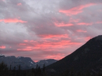
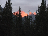
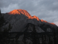
The Snaring River Overflow was a huge open area but it managed to fill up with hundreds of tents and RVs. It looked like a music festival. Not enough outhouses for all the people, though. Since fires aren’t allowed, it was pretty quiet. There was a beautiful sunset with pink alpenglow on the peaks.
Monday, August 4: Miette Creek, Jasper NP (16 miles)
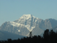
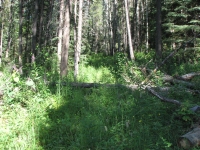
A gorgeous day, cold but clear. The forecast was for 70 degrees – nice. We drove to town early since Jim was worried about a traffic jam when everyone leaves the camping area this morning. There were a LOT of people out there. We had breakfast at Smittys then met Elliot, the park employee who was supposed to escort us past the pipeline construction. Someone had locked the gate with the wrong lock so his key didn’t work. Rather than wait for him to go to town to get another one, we decided to just walk in. It’s what we had planned to do before we heard about the construction, and since it’s a holiday there was no work being done. He thought we’d want to avoid the 2 ½ miles of gravel road, but we didn’t care. The road is narrow in spots, so I can see why they don’t want hikers mixing with bulldozers.
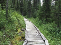
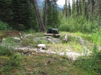
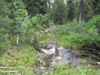
We almost missed the turn off up the Miette River Trail though, since the junction had been buried by a bulldozer. Only an arrow up in a tree warned us to pick our way through the debris and over the big pile of dirt and branches. The trail was a rough one with a lot of bushes growing over it, but not hard to follow most of the time. We’ll see how we do in the open meadows tomorrow. After climbing a while, the brush became less of a problem, but wet, boggy, rocky, rooty trail became an issue. It was slick, so we had to be really careful. It reminded me of the worst of the AT in New England.
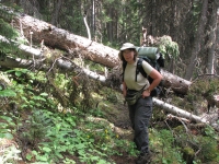
The trail was much harder than we expected, though we had been warned about a lot of it. What I didn’t expect was to go as far as we did. The plan was to go about 10 miles to the site of a former warden cabin. We got there before 3:00. The bugs were ferocious and there was no good flat spot to put up the tent. The only proof that it was used as a campsite was the fire ring in the middle of the old cabin foundation. We kept going and there was no good place to stop for six more miles. We arrived close to exhaustion, stumbling and slow. We haven’t done this long a day in a long time and the trail itself really didn’t help. The Miette River Trail gets very little use and less maintenance. It’s overgrown, eroded, very wet and boggy. We played stepping stone all day long. Someone had been through recently with a saw, but he still left dozens of blowdowns to go over or under. We were in trees all day and had only a few partial views of the mountains above us. Too bad, as the peaks above looked interesting. Tomorrow should be better in that regard.
Our campsite is near treeline. As we were looking for a place to cook, I could see farther through the trees and the views were good. We didn’t see any wildlife except squirrels on the trail and an elk near the highway this morning down by the river. We did see frequent piles of fresh bear scat, the tracks of at least three bears, plus deer, moose and elk or caribou. It rained a couple of days ago, so the tracks were clear and fresh. Some hikers are a day ahead of us and others a day or two ahead of them. I doubt we’ll see anyone though until we reach Berg Lake. This is close to real wilderness.
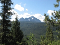
Physically we’re worn out, but our spirits are good, I think. We knew what to expect: lots of wet, overgrown trail. It’s a large part of why we didn’t hike this section last year, especially in the wet conditions we experienced last August. The bog here is notorious. One account we read told of a horse sinking belly deep in the mud. This week the forecast is for mostly sunshine. We had some storm clouds all afternoon but no rain. It was warm when we were climbing, in the high 60’s or low 70s. The climb wasn’t much, only about 2000’, but it was still uphill, so we warmed up. We contoured along a ridge with lots of little ups and downs but overall a gain in altitude.
With the good weather come the mosquitoes. They’re worse than anything we had in Alaska, but it was colder there. While cooking dinner, I was killing them four or five at a blow. Biting flies, especially horse flies, were also a problem. We were happy to duck into the tent so we wouldn’t have to deal with them.
Tuesday, August 5: 13 miles to Colonel Pass Campground
We slept well on our lumpy stretch of tundra. We stayed in bed late waiting for the sun to dry out the tent a little. Condensation soaked everything. Fortunately it was a beautiful sunny day. We started getting views soon after we started and they just got better and better. The trail climbs gently to beautiful Miette Lake, where we were supposed to camp. It was way too early to stop, so we climbed up to Centre Pass where we ate lunch in a huge flower filled meadow with 360 degree views of mountains and ridges. There were lots of snowfields all around. Lots and lots (hordes in fact) of mosquitoes. While we were eating lunch, we were surprised to see a family of four on a day hike. They were staying at the warden’s cabin at Miette Lake. Miette Pass is a gorgeous spot – incredibly beautiful. It was worth the hard hike to get there.
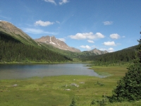
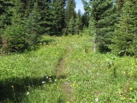
The trail up in the meadows is very obscure, sometimes non-existent. We found occasional orange ribbons or axe blazes when entering the woods after a patch of wet meadow. The big open meadow at Centre Pass was pure bushwhack, but easy. So far the trail had been as advertised, obscure but not too hard to find and follow. The meadows were full of flowers: white, pink and yellow paintbrush, columbine, monkey flower, asters, and many many more. One talus slope was covered with hot pink primroses. The trouble with flower-filled meadows is no trail. It took an hour and a half to find the trail again after Centre Pass. We didn’t waste a lot of time looking for tread, we just headed north until we stumbled upon it again. The trail was good for a while as we contoured around Salient Mountain, then we lost it again at another meadow and didn’t find it until Grant Pass. We knew in what direction we were supposed to head, so we weren’t lost, just trailless. The views were great. Salient has steep cliffs and we saw a couple of hanging glaciers and waterfalls. No wildlife except a golden eagle and the ever present, ever hungry mosquitoes.
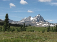
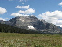
We decided to cook dinner at Grant Pass since we didn’t know when or where we would end up camping. Does the campground at Colonel Pass still exist? We were told that there was a big fire in the area, but not exactly where and how much was burned. Is the trail really impassible? Obviously not, since some GDT hikers do manage to hike from Jasper to Robson. While I was cooking, Jim sat swatting mosquitoes, over and over, usually several at a time. When we stood up to continue our hike, the rock we were sitting on was black with dead bodies, hundreds of them. It was a veritable mosquito graveyard.
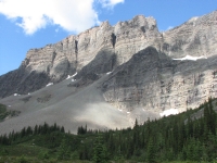
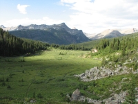
It turned out that the trail from Grant Pass to Colonel Pass was a good one, a bit faint at times, but totally passable. The fire damage was on the north side of the pass. The campsite at Colonel Pass is the best we’ve seen this trip: next to a small shallow lakelet with a good flat tent site, a hitching rail and a bear pole that’s very high but too close to the trees on either side. Evidently black bears haven’t discovered this place yet. I washed up before jumping into the tent. It felt good, but the bugs did get my back several times. It was worth it to get a little cleaner. All in all, it was a good day. The weather held – warm and sunny. The mountains and meadows were beautiful. Losing the trail was a bit aggravating, but not that big a deal since we mostly had open meadows to walk in. They were lumpy underfoot, but keeping straight isn’t a problem. We just followed the valley upstream, more or less.
Wednesday, August 6: Moose River (10 miles)
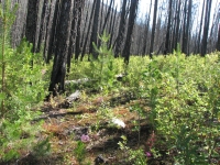
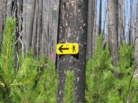
It was very slow going as we picked our way through the fire zone. Evidently the area burned several years ago. Saplings are knee high and there’s lots of brush and fireweed. The burn started about two miles from our campsite last night and continued until we reached the Moose River, then intermittently for a few more miles.
There were bad blowdowns from Colonel Pass north. I don’t think a trail crew has been up that far since the fire. We did see signs of trail work in the fire zone, especially as we neared Moose Creek. There were axe blazes, some cut trees and an occasional faded pink ribbon. Because of all the blowdowns we crawled over, under and around, we’re both black with soot. The hiker who is a day ahead of us helped by stepping on wildflowers, so we followed his trail sometimes and just hoped he was going in the right direction. I did my best to trample vegetation so anyone coming after us will have an easier time. It was really exhausting walking. The first 7.2 km took four hours. We lost the trail at Moose River. Our last pink ribbon seemed to flag a route downstream, not up, so we went back to bushwhacking, following moose tracks along the riverbank. For a while we seemed to be back on trail (yellow ribbons this time) but we lost it again in another burn area.
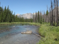
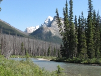
The guidebook says the trail crosses the river waist deep nine times. We decided to try to stay on the east bank as long as possible to avoid some of the crossings. We did well for a while, then we began running into branches of the river that we had to cross, but only knee deep. We were both tired so we decided to eat an early dinner on a gravel bar (no bugs!) before moving on to look for a campsite. We’ve little hope of making Steppe Creek Campground as it has been very slow slogging through willows, bogs and blowdowns. The view through the trees is a good one, with jagged peaks and icefields and snow, but it’s intermittent. I have no idea how far we’ve come. The route is too rough to maintain a normal pace and the guidebook’s mileage for this section is screwy; the numbers don’t add up.
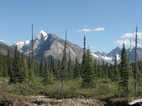
After dinner we ended up deciding to just stay put. The lack of mosquitoes was a factor, plus we’re really tired and still a long way from Steppe Creek. We never did see Trio/Colonel Creek campsite. Either it burned or we passed it when we were off trail. Our campsite on the gravel bar is a nice one with a view, water and few bugs. No sign of bears in the vicinity. We only saw one pile of scat all day. But moose tracks are plentiful.
Jim: Moose River was supposed to require some large number of knee to chest-deep fords. We blew that off and stayed on the east side of the creek. We'll have to ford at least once, probably more, tomorrow. but they won't be chest deep unless we walk into a hole. The river just isn't that deep.
Thursday, August 7: Calumet Creek (12 miles)
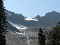
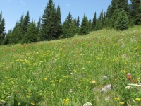
We lost our sunshine. We woke to hazy gray skies that turned to sprinkles around noon. Oh well, three days of sunshine is excellent up here.
We ended up crossing the Moose River four times instead of the guidebook’s nine or ten, but sometimes the bushwhacking we did along the shore was worse than the fords would have been. We did pick up the trail, lost it when it crossed the river, then we picked it up again when the trail returned to the western bank. We should have forded that time. We had some really dense brush to whack. A couple of times we just walked in the river because the route along the shore was impassible. When we crossed Steppe Creek, I thought it was still the Moose. There were markers on both sides of the crossing. Same for the next two crossings. We reached Steppe Creek Campsite--a big horse campground with hitching rails, barrels to store food and a privy—around 11:30. We didn’t stop long but climbed up to our final (4th) crossing of Moose River. None of our fords was over knee deep. I had been really worried about them since the hiker who was here last week spoke about waist and chest deep crossings. Either a week makes a real difference in water depth, or he just doesn’t know how to pick good places to ford.
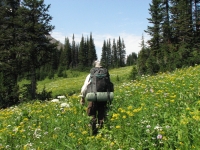
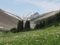
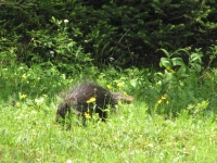
After the one brief shower, the clouds lifted and we ended up with a bright sunny day. The character of the trail changed too: from very obscure to easy to follow as it climbed above treeline. The views were glorious. For several miles we hiked through flower-filled meadows as we climbed up to Moose Pass and down the other side. We saw numerous glaciers, waterfalls, beautiful peaks and ridges that were gray, orange or both. There was a first pass in a glacial moraine with beautiful views south, then we continued climbing over green hills with incredible views of the glacial peaks to the north. Moose Pass was an utterly awe-inspiring area. We descended two miles from the pass to a horse camp next to Calumet Creek. It doesn’t seem to get much use though: no ‘horse apples’. It does have a hitching rail and a bear pole. The only animal we saw today was a porcupine, but there are tracks and signs of fresh digging so we know there are bears and moose nearby. Our campsite tonight has a bear tree, one where bears like to rub, either to scratch or mark territory. Numerous tufts of hair decorate the slender spruce.
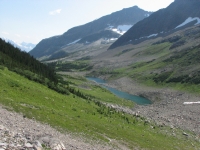
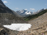
Anyhow, today’s spectacular views and wildflower meadows more than made up for the difficulty of the trail. Actually, it wasn’t as bad as I expected, but then I was told that it was impassible, and obviously it isn’t. Some of the bushwhacking was difficult, (the bushes whacked back so Jim’s shirt got shredded), and the numerous blowdowns were definitely a pain, but it is doable. We were on trail more often than off it, even in Moose Valley. The burn wasn’t as bad as it could have been because a trail crew has been through to mark the way, some of the time at least. And we’re good at looking for signs of old trail work (cut logs or old blazes) so we never got seriously off track there.
Friday, August 8: Adolphus Campground (6 miles)
A most frustrating morning: three miles took us three hours. We lost the trail soon after we left camp and spent the next few hours bushwhacking through dense woods. We weren’t lost, since we knew where we were and where we were going, we just weren’t on anything resembling a hiking trail.
The guidebook talks about obscure and faint trail so we weren’t surprised when we lost the trail in the woods, but the question was, were we ever even on the trail? The river had washed out the bank where we were walking, so it was hard to be sure where the trail was supposed to enter the woods. The guidebook said to enter the woods and climb. We followed moose tracks into the forest on decent tread and climbed and climbed until they vanished. We weren’t sure whether the pack trail was above or below, so we tried both. Eventually we picked up an old faint trail that led us out of the woods and back to the river plain. In the middle was a couple of hours of very frustrating bushwhacking through the worst kind of dense brush, blowdowns and soft tundra.
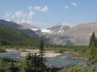
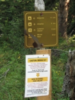
We found bits of trail from time to time, but they must have been game trails or very old pack trails. We didn’t reach the actual trail again until we reached Yates Torrent at the Coleman Glacier outflow. That was a scary ford. Not deep--only a little over knee high at the worst--but it was very very strong. A sign on the far side warned against attempting the crossing, but we weren’t likely to turn around at that point. Jim and I crossed arm in arm and we both came close to getting swept away. Definitely an adrenaline moment. It wasn’t the worst we’ve ever done, since we didn’t actually go for a swim, but it was a bad one. Evidently the bridge was removed in June. A note at the Warden's cabin stated that they didn't expect the bridge to be replaced, but we heard later that the bridge was actually put in about a week after we crossed the water. Good thing, as that could be really dangerous if the water were any higher.
We had considered doing a long day today and heading out to the trailhead at Mt. Robson, but with our very slow and physically demanding start this morning, it’s better to do a very short day instead. Jim’s knees are killing him as it is. I can’t do another 26 km today on top of the three hours of rough off-trail hiking we did this morning. Tomorrow will be a long one as we head over Robson Pass and out the Berg Lake Trail. Since we never did manage to get a reservation in the Park, we decided to not even try for a campsite, though supposedly you can track down a ranger up at the warden’s station at Berg Lake and ask about availability. We’ll just walk out tomorrow.
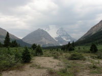
The last 2½ km to Adolphus Campground was easy pack trail up a wide valley that reminded me of the trail along the Spray River. We had hazy views of snow-covered Mount Robson ahead. Adolphus has two campgrounds, according to a trail register we saw later. We ended up at the horse site instead of the hiker site, but that worked out since I think it is nicer, despite the fact that it does get used by horse parties. It has a nice open area (for horses to graze), a bear pole and a privy, one of the green plastic ‘thrones’ we saw when we were in Jasper five years ago. We saw another one yesterday near Moose Pass. The campsite is a bit lumpy, but it will do.
Soon after we arrived in camp, it began to rain. We jumped in the tent and finished our books while waiting for it to ease off. It may be just as well that we don’t have a reservation at Berg Lake. Crossing an open pass in a thunderstorm is not the best idea. The rain stopped around 4:30 so we were able to cook dinner in the dry and go for a walk to the empty warden’s cabin a short distance away.
We ended up with unexpected company tonight. After our walk, a woman on horseback appeared. We thought at first she was the warden, but no, she and her dog and two horses were out on a ten day trip to the Wilmore Wilderness area. She had some problems with routefinding and got delayed, so now she’s two days overdue. She decided to exit at Mount Robson, though no horses are allowed on the trails there. She’s worried that Search and Rescue efforts are supposed to start tomorrow and wants to get out before they get organized. We sat around a fire talking until dark. It was fun. Joyce knows these mountains well, though she lives several hours away. Watching the different style of camping (horse vs. hike) was also interesting. Fortunately she had packed a lot of extra food, so had enough for herself and her dog despite the extra time out. No dog food, but he seemed to like Ramen noodles.
Saturday, August 9: Jasper (28 km )
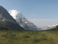
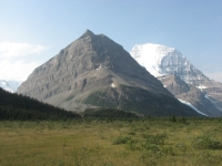
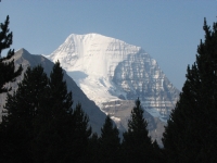
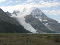
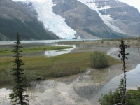
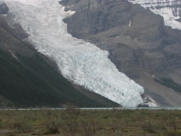
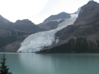
Today was another really good day, but a very long one. We woke to sunshine and hazy blue skies. Mt. Robson was a shiny white beacon as we neared Robson Pass, three km. from our camp. We passed emerald green Adolphus Lake, then soon reached the wide rocky alpine pass. There were towering mountains with glaciers on both sides. Robson has several glaciers. One reaches down to Berg Lake, another has its own little lake behind a high terminal moraine beside Berg Lake. It’s beautiful.
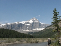
There are several campgrounds on the Berg Lake Trail, so there were many many hikers going up and down or doing day hikes from a campsite. The first time we were in Canada we spent two nights up at the lake and it was a highlight of our trip. The most beautiful part of the trail, to me, was the spectacular beauty of Mount Robson itself, but there are other wonders: the many waterfalls emerging from the snow and ice above, (especially powerful Emperor Falls), the azure rivers (one place where a blue river met a brown stream from a different valley reminded me of the turquoise Little Colorado meeting the muddy Colorado in the Grand Canyon), the place where the river had carved a 200’ deep channel, then changed course and is now carving a parallel channel up above, the rich green rainforest down low, with its huge cedars and lush mosses and ferns. It was a beautiful hike. Clouds moved in mid-afternoon, so we didn’t get views of the high country later in the day, but the green woods and roaring river provided interest.
We reached the trailhead at 4:00, then learned that it was still two kilometers to the highway. Drat! We had told Joyce that if we got out first we would contact her friend to call off any search and rescue efforts, since she is now three days overdue. We left camp before she did, but hoped she’d soon catch up. She had to make booties out of socks for her dog, who injured his pads with the long mileage they did the previous day. Instead, we only saw her at a distance on the horse bypass when we were still four miles from the trailhead. (Wardens can and do ride in the park, though no one else is allowed to any more.) She never did catch up. We called and left a message on her friend’s answering machine but had no assurance that he would get it soon. We didn’t want to send the Mt. Robson wardens after her, so we decided to talk to the people in Jasper when we got there to see if a search had been started, since the area where she went astray was closer to Jasper than Robson. (She started on the North Boundary Trail and got into trouble at Jackpine Pass in the Wilmore Wilderness.) Sure enough, the search started at 8:30 this morning and was still on when we got to town. We told the wardens in Jasper that she was fine and to call the search off.
We got lucky getting back to our car. After making the phone call, we got a cold soda and ice cream at the store near the Mount Robson Visitors Center, then headed out to the highway to hitchhike. Dark clouds were massing, hiding Mount Robson from view, but the rain held off except for a few sprinkles. After only half an hour of watching cars race by, a German couple who had just dropped their daughter off at the trailhead stopped and drove us the 50 or so kilometers to Jasper. Nice.
We got to the Jasper Visitors Center just before closing. Jim talked to the backcountry folks about our trip and the S&R for Joyce while I asked at the Accommodations Desk about a room. (In Jasper a lot of private homes offer rooms for the night at a decent price.) A very nice man at the desk called the Seldom Inn for me and I was able to get a room for the night. Cheryl and Doug rent out four or five rooms in their house at a reasonable price – for Canada. No breakfast, but the shower was hot. The only campgrounds in the vicinity with showers were already booked by the time we got to town, so I was quite willing to pay $80 for a room. We went out for an expensive dinner at Earl’s: tasty, but not worth $13 for a cheeseburger and fries.
I’m really glad we came out to do this hike. It was rough, but very beautiful. We’re exhausted and very sore, but happy. We both feel good about finishing this next to last section of the Great Divide Trail. The high points made up for the low points. Out of six days hiking, we had three days of spectacular views (Miette Pass, Moose Pass and Mount Robson) and three really difficult days. The good points definitely outweigh the bad ones. I feel like a real hiker again. After so many months of mostly short dayhikes, it felt good to do a challenging backpacking trip again.
However, Jim pays a big price when we do. His knees are giving him fits after some of the steep rocky trail today and yesterday’s steep bushwhack. I know I’m selfish to continue to ask for these hikes when it hurts his knee so much, but he loves it almost as much as I do, and he knows how much I need the hikes to be happy. We try to compromise by doing mostly short hikes, but they don’t really satisfy my need to spend time in the wilderness or his need to avoid more pain. So weeks like this one are great, but the cost is high.
Jim: What's this "almost as much as I do" stuff??? I volunteered for this - and it wasn't because I hate it.
Sunday, August 10: Rest day in Jasper
We slept very badly, through our room was very comfortable. Somehow we never sleep well in town after being in the woods for a while. Clean sheets and a soft bed feel wonderful, but I just can’t sleep. Jim was in too much pain to sleep well either. We tossed and turned and finally fell asleep around dawn, then woke up at 8:30. We visited with our host Doug, who works for Parks Canada, while I sipped a cup of coffee, then we left in search of breakfast. We had a tasty, but expensive, meal at Papa Georges, then headed out to Whistler Campground. It’s the nicest of the nearby campgrounds. We got a tent site and settled in for a rest and clean up day. We emptied the packs and the cooler (sour milk, yech!), cleared out the back of the truck, sweeping out dust and pine needles, and dried out the tent, packs and sleeping bags. Of course, before we were finished, a brief hailstorm blew through and undid a lot of our efforts. The afternoon was spent with other chores: laundry and grocery store. I bought a new pair of hiking shoes. The Merrill Mesa’s that I used last year have been discontinued, but for some odd reason the store had a pair in my size in the back. Hurray! We had an early dinner at the Whistlestop, catching the last song of their Sunday afternoon jam session. I wish we had been there earlier to hear more. All in all, it was a relaxing day.
Monday, August 11: Wilcox Creek Campground (3 ½ miles)
It rained all night but stopped soon after we got up except for the occasional sprinkle. Still we decided to enjoy a hot breakfast in town, then spent a couple of hours at the library preparing an e-mail update on our travels. It was after noon by the time we gassed up and left town. Many of the mountains were hidden in clouds. The ones we could see were dusted with fresh snow. We decided to play tourist: although we’ve driven the Icefields Parkway before, on our trip to Canada in 2003, we agreed to stop at all the overlooks and tourist spots as if it were the first time.
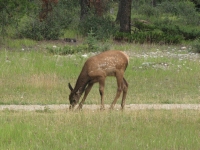
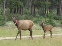
It is a spectacular drive, regardless of the weather, and places like Athabasca Falls and Sunwapta Falls don’t need sunshine to be impressive. By late afternoon, we were treated to a few glints of sunlight shining on the glaciers. A few miles south of town we were stopped by a herd of elk grazing beside the road. The young ones still had spots and the adults were just starting to get antlers again. Several miles later, more stopped vehicles alerted us to the presence of a black bear sow and cub grazing beside the road. The goat licks, alas, were empty though.
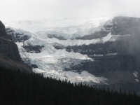
We stopped a few times for pictures, especially of the waterfalls and the Columbia Icefield. Around 4:00 we turned in to the Wilcox Creek Campground. Jim wasn’t feeling well, so he took a short nap while I climbed up to Wilcox Pass. It’s a steep climb on good trail with beautiful views of the Icefield, the valley below, and rocky alpine meadows up above. Today it was all in shades of gray: the rocks, the sky, the snow. It felt good to stretch my legs after two quiet days. It was cold and windy, but the rain held off while I was hiking, and since it was so late, the usually busy trail was pretty quiet.
When I got back, we discovered that the car keys had disappeared. Maybe they were dropped on the way to the outhouse and someone picked them up, maybe someone took them out of the door while Jim slept. We don’t know, but we couldn’t find them, despite tearing the car apart several times and walking from the car to the outhouse looking for them. Aargghh! We have a spare set, but the electronic keys are expensive; I hate to lose them! (Note: we found them two months later, buried in a bag that we looked through a dozen times.)
Tuesday, August 12: Lake Louise (3 ½ miles)
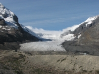
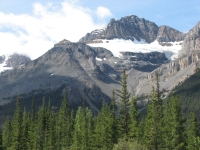
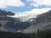
A beautiful sunny day. The snow and the ice on the ridges brew up their own clouds, which is interesting on a clear day. The glacier looked like a smoking volcano. We noticed that at Goat Rocks in Washington, years ago. We drove back to Athabasca Glacier to see what it looks like in sunlight and it still had a small white cloud cap.
Because the sun was shining, the colors of the rivers and lakes were incandescent blues and greens, turquoise, sapphire and emerald. The first time we drove the road, the entire area was covered in smoke so the mountains were barely visible and even Peyto Lake looked gray. The mountains were still beautiful, but not as spectacular as they were today. The Icefields Parkway is arguably the most beautiful long scenic drive anywhere. The area is horribly crowded, but its popularity is deserved. Between the mountains, the glaciers, the waterfalls, the rivers and lakes . . . it is one scenic highlight after another.
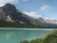
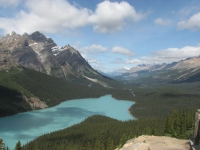
We stopped often to take pictures of snow and ice-capped mountains, waterfalls, blue rivers and bluer lakes. We did the short and very popular walk to Peyto Lake Overlook; today the lake really did look turquoise. Bow Lake was more of an aquamarine. We decided to stop early at the campground at Lake Louise. Jim needed to copy photographs onto a disk so he could erase the camera’s memory cards. We’re almost out of memory. Jim downloads the photos onto the computer, then makes a backup disk, just in case. We haven’t had a campsite with electricity in a while, so he hasn’t been able to do it. Copying the photos takes a long time – too long for the laptop’s battery. So we got a site at the big RV campground at Lake Louise. The tent campground is more interesting: it has an electric fence around it to keep out the bears. The RV campground doesn’t have the fence, so it doesn’t allow tents or pop-ups, but our hard capped truck counts as an RV, though it doesn’t have a camper.
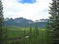
Last time we were in Lake Louise we braved the hordes up at the lake. Beautiful as it is up there, I was not in the mood for more crowds, so while Jim downloaded photos, I did a three mile hike on the Bow River loop trail. It was a nice gentle walk along the beautiful blue river, mostly in the trees. There were occasional informational boards about the wildlife along the river. I saw a group on bicycles, but otherwise I had the trail to myself. Nice. It was a warm sunny day, so it felt good to enjoy some relaxing exercise. After a most welcome hot shower, I sat in the sun reading until dinner.
Wednesday, August 13: Peter Lougheed Provincial Park
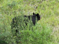
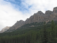
It was a cloudy gray day as we headed south on the Bow Valley Parkway. There were occasional views through the trees of the beautiful mountains across the valley. We saw a nice buck with its antlers still in velvet, then a black bear through the trees. That caused a huge traffic jam. Then we made the mistake of heading into the city of Canmore to pick up a few groceries. Canmore has a beautiful setting, (gateway to the Canadian Rockies), and is surrounded by tall silver mountains, so has become an expensive, crowded tourist town. What a zoo! I’m sure Banff would have been worse, but not by much.
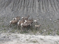
A short distance south of town, we were surprised by a herd of Rocky Mountain bighorns that slid down an embankment right next to the highway. Jim slammed on the brakes, thinking they intended to cross the road in front of us, but the sheep just wanted some salt from the rocks. They scared us both, but I managed a couple of photos before we started up again.
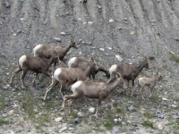
We’re following the two lane paved Kananaskis Trail southward. We both enjoyed the incredible beauty of the Kananaskis last year on our Great Divide Trail hike, so we wanted to see more of this corner of Alberta. There are several provincial parks and wilderness areas almost unknown outside Canada. Exploring the area certainly sounded more interesting than revisiting Calgary.
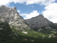
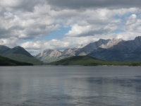
After turning off the main highway, we ran into another herd of mountain sheep licking salt off the road. One of the lambs climbed the rocks to escape the cars, but the others seemed oblivious to the passing traffic. We checked out the gas station grocery at Fortress Junction to see if it was a feasible GDT resupply stop (yes, but barely - and it's a long, long way from the trail) then ran into a third herd of sheep on the road nearby, and a fourth herd at the junction to Peter Lougheed Provincial Park. Amazing! The country was as spectacular as we hoped. It was fun looking up at some of the places we hiked last year and we saw some other trails that looked equally intriguing.
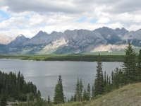
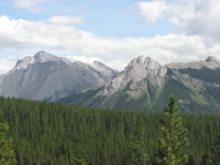
We got a campsite at Boulton Creek in Peter Lougheed Provincial Park, where we stayed last year. It is a nice big wooded campground, largely vacant on a weekday. We drove around to look at the beautiful blue lakes, ate a generous ice cream cone at the store, then I did a short (2 ½ or 3 miles) walk on the Boulton Creek loop. I was a bit nervous because we had run into some rangers a mile or so away with a radio antenna keeping tabs on a grizzly in the woods nearby. Evidently there is some concern that the bears are coming too close to the campgrounds. It’s berry season, but the crop is light this year so they may be looking to supplement their diet. In any case, all I saw were squirrels and a rabbit, but it was a nice hike in the woods.
Thursday, August 14: Campground near Fort MacLeod
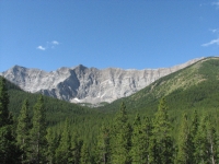
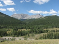
Another beautiful sunny day; what a change from Alaska! We had a very quiet night at our forested campsite. No one was parked within sight, much less sound, of us. The drive south was beautiful with sheer gray cliffs high above, a lot like the beautiful High Rocks area we hiked last year. We stopped at Highwood House to see whether it is feasible for GDT resupply – it’s not. There is no mail service so you would have to drop off a package there personally (we were told some people do that) and they had very little to buy, plus it’s 42 miles from Peter Lougheed PP on a sparsely traveled road. The Peter Lougheed Visitors Center is a much better option, but they have limited storage so can only take a few packages at a time. The ranger said he’d turned away packages for lack of space.
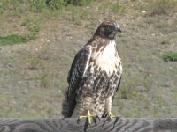
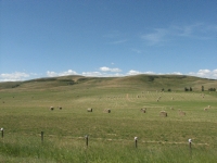
We left the mountains and began driving through the foothills -- pretty rolling green and brown hills and ranches with grazing cows and horses. It’s a lot like Montana. I really enjoy this kind of country. I love the mountains best, of course, but rolling hills are more hospitable. I can imagine living in this kind of country. We saw lots of hawks today – beautiful.
We drove all afternoon through ranch country to Fort MacLeod. Jim wanted to visit Head Smashed In Buffalo Jump and the Mounties Museum, so we made the detour. The RCMP Museum was fun. It had some exhibits, the old fort, a movie on the march west when the first Mounties headed to Fort Whoop Up to oust the American whiskey traders, and then a live musical horse drill. That was fun, though one of the riders screwed up a bit. Maybe she’s new?
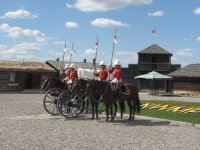
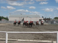
We came out to a flat tire, another slow leak that suddenly wasn’t so slow. We filled the tire with our portable air compressor, then found a tire shop nearby. Fortunately the flat happened while we were in town. Jim knew about a slow leak in one of the tires, but this was a different one, the one we got repaired a couple of weeks ago. The mechanic couldn’t find any new holes, but thought that either the patch we got in Whitehorse was separating or some local kids opened the valve while we were watching the horse show. We’ve got our fingers crossed, hoping it was that simple and not a more serious problem.
We took care of a few errands, then looked for a campground. It’s hot – 80 degrees – warmer weather than we’ve seen since Utah. We found a campground a couple of miles from Head Smashed In with shade and a nice hot shower. A donkey brayed frequently during the night and either wolves or coyotes yipped and howled. The country looks like Montana, Wyoming and South Dakota – yellow hills with lots of cows and wildflowers. There are also a lot of windfarms up here. Good open country for it.
Friday, August 15: Waterton Springs Campground
Head Smashed In Buffalo Jump turned out to be more interesting than I expected. There is a museum and walks along the cliffs, both on top and along the bottom, and an excellent film that explains how the natives used the cliffs to hunt bison. We ran into a similar site near Monarch Pass in Colorado, but since it’s in the middle of nowhere, it isn’t developed. There were just signs explaining how the Indians drove the bison between stone cairns to the edge of the cliff. The video was more explicit and dramatic, very well done, I thought.
We then headed to Waterton Lakes. When we got there, we discovered that all the campgrounds in the park were full. There is always that risk when you travel without a schedule. No plans means no reservations. Oh well, something always turns up.
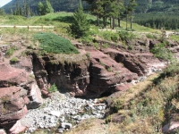
We drove up Red Rock Canyon on a narrow paved road. It’s a beautiful 15 km. drive and the rocks in the gorge really are dark red. On the way into the Park, we saw a big badger beside the road, and then a small herd of bison hidden in the hills at the Bison Pastures. On the Red Rock Road we stopped the car when we saw people looking up the ridge with binoculars.
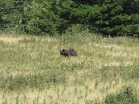
Sure enough, there was a young reddish brown black bear grazing on the hill. A mile or two later, we stopped again and spotted a young blond bear. Once again it was a black bear, but with light coloring. It looked a bit mangy, really. Until this year I had never seen a black bear that wasn’t black, though I knew it was possible. Seeing the bears was fun, though both were quite far away. We did a short walk along the creek then drove to the huge Prince of Wales Hotel to admire the view over Waterton Lake. It is gorgeous. A few miles up the road outside the Park we found a private campground. It was nearly full, but it was a large campground so they still had a few spaces up in the trees. It’s a long walk to the bathroom, but it will do.
Saturday, August 16: Waterton (11 miles on Crypt Lake Trail)
We woke early, for us, and drove into Waterton to catch a boat across the lake. There’s a hike to Crypt Lake that I’d read about that sounded interesting, but the only access to the trailhead is by boat. They only have two boats dropping hikers off in the morning (9 and 10:00) and two that pick them up later in the day (4 and 5:30). I hate hiking to a schedule – and with a crowd – but the hike sounded so intriguing we decided to go for it anyway. We arrived at the marina about 3 minutes before the first boat left, too late to buy tickets and board, so we waited an hour for the second one while I fixed lunch and we changed our shoes.
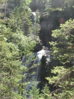
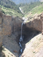
It was another beautiful sunny day – a hot sunny day as it turned out. The hike to Crypt Lake is a very popular one: there were 40-50 people on each of the two boats. Fortunately, the groups spread out quickly. I had been warned about the crowds, so we stayed in the back of the boat – first off, so first up the trail. Three people from our boat raced past us, and then an hour or so later we started passing hikers from the earlier boat, but we weren’t walking surrounded by people so I was okay with the crowds.
We started out walking in the woods above Waterton Lake, with some beautiful views across the lake as we climbed on switchbacks. Soon we turned up a side valley and began a more serious climb: 2200’ in 5 ½ miles. We passed three big waterfalls on the way up, plus a long beautiful cascade on an alternate trail on the way down. About halfway up we left the trees, so the views of the canyon and the upper waterfall were good, but it was very very hot. Jim and I weren’t used to the hot sunshine, so we were really feeling the climb. The last ½ mile got really interesting as we climbed a metal ladder and passed through a short narrow tunnel.
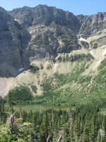
It wasn’t like the Ptarmigan Tunnel in Glacier. That one was 6’ high and smooth easy walking. This was only about 5’ high, with rough rocks on the side, so you ended up almost crawling in places. Then we climbed the narrow rocky trail holding onto a metal cable that had been bolted into the rock – like the one at Angels Landing in Zion. Going up wasn’t bad, but going down was a bit scary, especially the ladder. It was also a problem because of the number of hikers. We went up and down a few at a time, but it meant having to wait for the way to be clear. Once past these obstacles, we reached a beautiful cirque with an emerald green lake. There we caught up with the hikers from the first boat. There was room to spread out but it was still crowded as we sat eating lunch and enjoying the view. A few kids jumped into the lake, despite the snow patches around the edge of the water. After a short lunch break, we turned around and began the long descent. Heat wasn’t as much of an issue on the downhill hike, so we hurried in hopes of catching the 4:00 boat. The side trip to Hell Roaring Canyon was very steep and rocky and a little longer than the main trail, so we weren’t sure we’d make it, but we got to the dock with five minutes to spare. I did envy the folks who got down to the dock in time for a swim in the cool water.
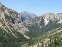
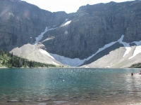
It was a good hike, but because of the heat more arduous than I expected. There were lots of wildflowers (blanket flowers, paintbrush, asters, etc.) and berries along the trail. I really enjoyed the ripe thimbleberries. Some people from the early boat saw a couple of bears, but they were long gone by the time we got there. We did see several deer in town, as usual. The deer in Waterton are amazingly tame. Jim also spotted a deer this morning at the campground, grazing on a grassy hill, silhouetted against the sunrise.
Home | Links| Trail Journals |
The Thruhiking Papers | Bun-bun
Created: 1 Jan 2009
Revised: 30 Sept 2016Copyright 2009-2017 Spirit Eagle