|
 |
 |
 |
 |
|
|
|
|
|
|
Friday, July 25: BLM Campground north of Chicken
We started the day with blue skies, but by 9:00 the clouds were gathering and by noon we were getting sprinkled upon. We got a fairly early start, for us, but took our time heading south, with stops at the Knotty Pine Shop, North Pole and Rikas Roadhouse, where we enjoyed a really good bear claw and cinnamon roll. Road construction stopped or slowed us down a couple of times. We saw a huge caravan of RVs heading the other way, at least 30-40 in a group that was traveling together. We ran into another large group at the RV park on our first night. All the RVs had a sticker, showing that they were part of the tour group. Its a different way to go. Someone else does the planning and makes the reservations, you just try to keep up with the group. They seemed to be from all over.
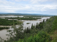
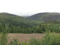
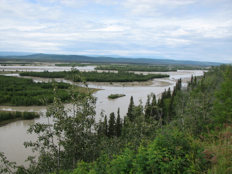
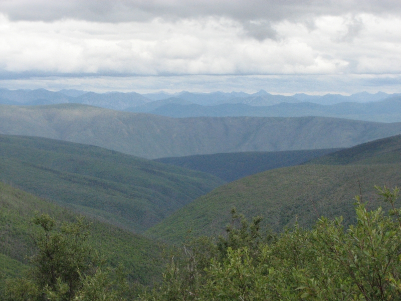
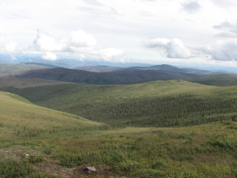
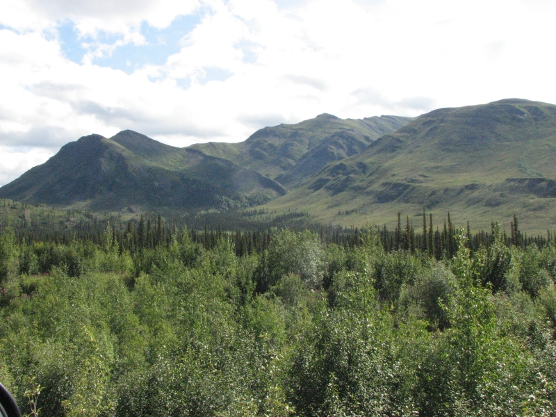
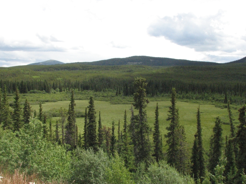
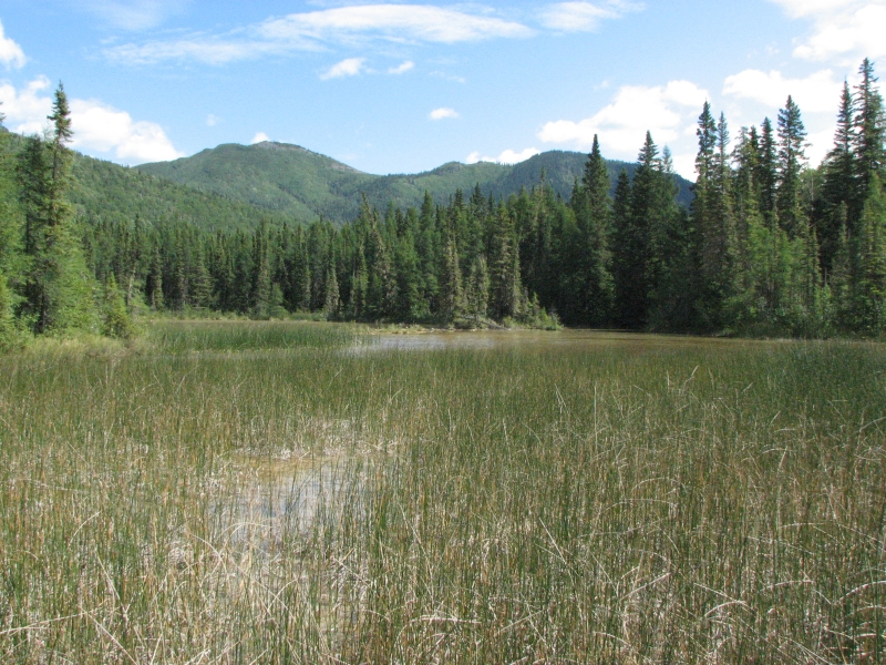
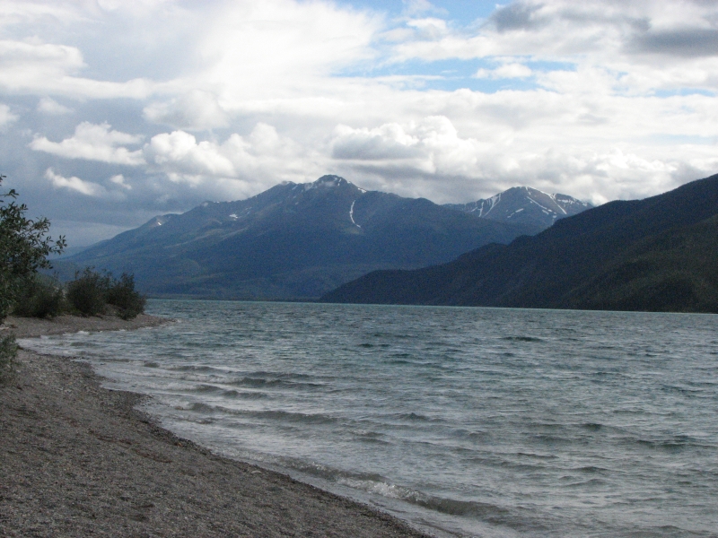
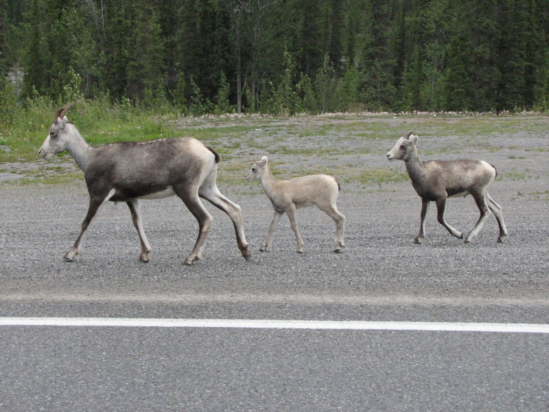
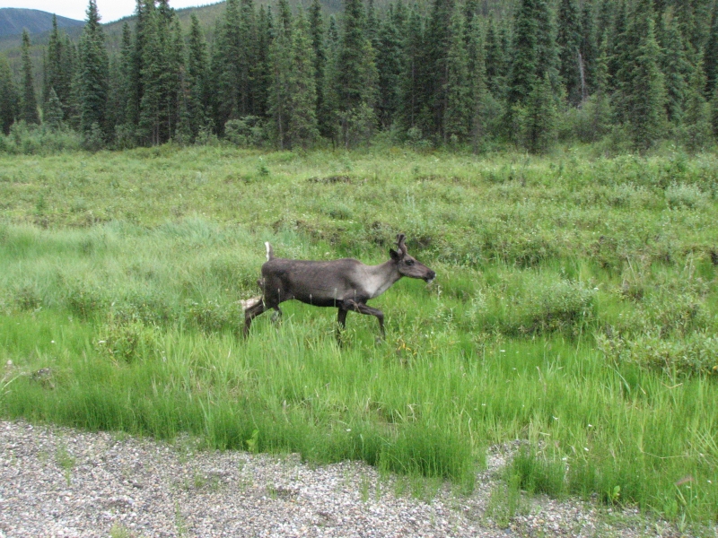
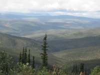
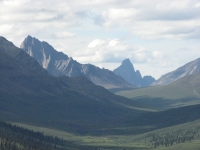
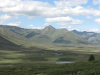
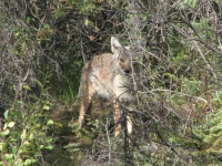
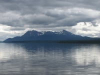
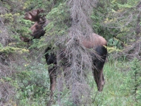
We had good views of the wide braided Tanana River but the mountains of the Alaska Range were hidden in the clouds. At Delta Junction we got back on the Alaska Highway, for the first time since we left Tok, and started heading east. We followed it to Teslin Junction, where we switched to the Taylor Highway, another alternate route. Seems were blue blazing again! The Taylor leads to the Top of the World Highway, which is the shortest and most scenic route to Dawson City but it is also more remote and primitive than the Alaska Highway. There are no services for the first 65 miles, up to Chicken. About 60% of the road is paved though even the paved stretches have breaks. The road goes through rounded green hills. Much of the area was burned in the huge fires of 2004 (1.3 million acres!) There is some new growth, and lots of pink fireweed. At one point the road gets very close to treeline, so we could look up at the alpine meadows that are home to the Forty Mile caribou herd. Its the wrong time of year to see them now. Its pretty country, but not as spectacular as the glaciated Alaska and Brooks Ranges--round green and black ridges with lots of streams. We saw a moose with calf at a pond just before Chicken but they vanished quickly in the willows.
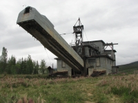
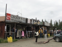
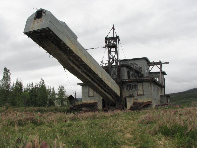
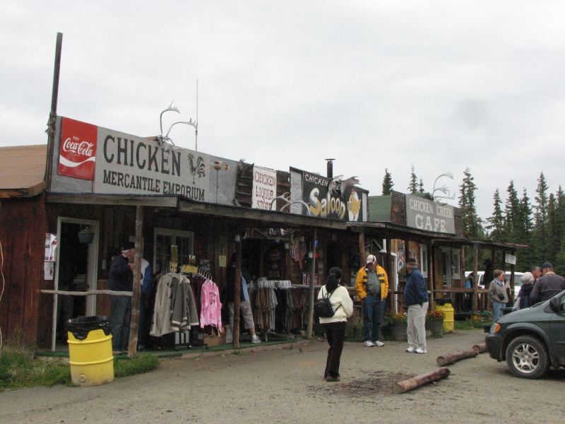
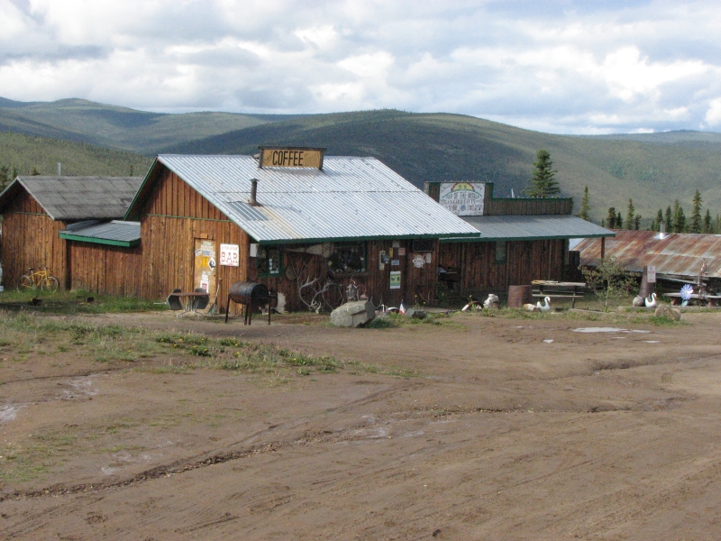
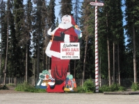
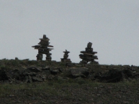
We took a break in Chicken to top up the gas tank (last chance before Canada) and stretch our legs. There is a huge gold dredge there that we circled on foot. Weve passed a few, but this was the first we could really look at close up. Chicken is very small, with a few shops and cafés and a large parking area for RVs. We decided to stop at a BLM campground a few miles up the highway. The dirt road was wet from intermittent rain all day so we drove slowly. Between the multitude of potholes and the slick mud surface and steep drop off, we were in no hurry. Fortunately the buses had already passed through. We met two Holland America buses in Chicken, a long way from their cruise ships. One of the young men on the bus was absolutely green from the rough ride. We spotted another moose cow in the Forty Mile River below the road.
It was raining when we reached the campground so we were very happy to see a couple of covered cooking pavilions in the tenting area. We ate dinner in the dry shelter, then drove back to a spot near the outhouse where we read in the back of the truck until sundown, listening to the rain on the roof. Weve actually been lucky this year. Despite all the rain this year, weve rarely had to deal with it at dinner time.
Saturday, July 26: Dawson City
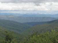

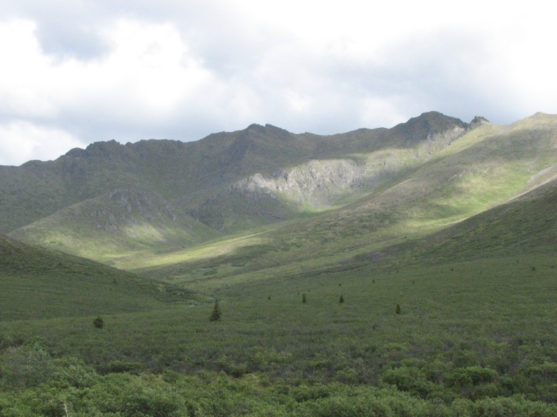
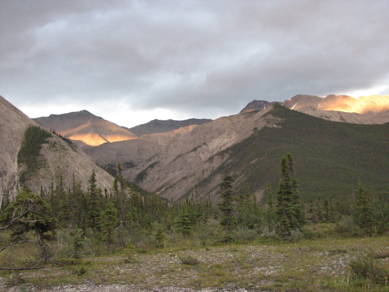
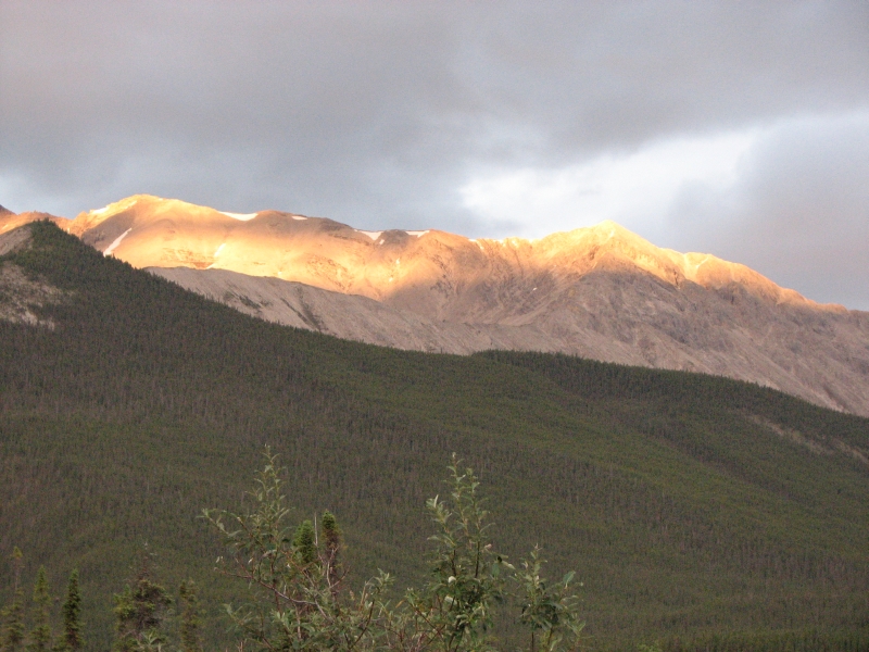
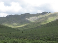
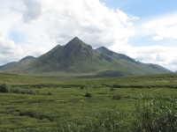
We left Alaska today, for the last time (this year anyway). It feels weird to know weve finished that phase of our journey. We woke to clouds and fog, but the fog burned off by the time we got on the road. The Top of the World Highway is a beautiful alpine drive with far reaching ridge-top views, so we were really happy to have decent weather. We stopped often to look out on the mountains and valleys. I was hoping for a glimpse of the caribou herd, but our timing is off again. We stopped at the Roadhouse in Boundary to get some expensive ($6) gas. Its still cheaper than in Canada. The land is really lovely open, wild country. It is always amazing to go for miles and see no sign of human habitation. I love it.
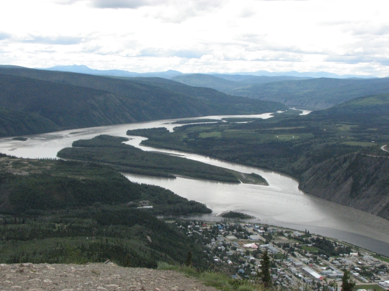
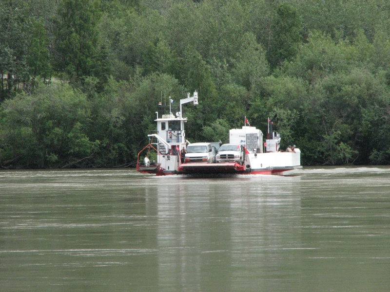
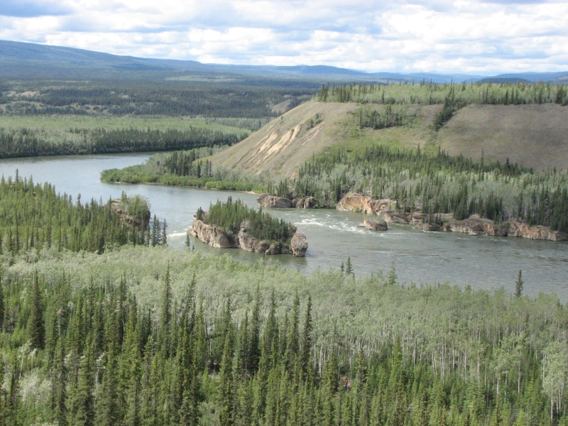
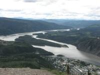
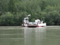
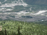
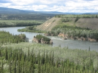
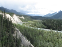
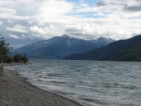
Jim was in major photographic mode, stopping at every curve to take pictures. It probably helps break up the stress of weaving through the potholes. The Canadian side was better than the Alaskan road, with more pavement, but it was still rough in spots. We drove about 30 mph, less if you include stops. We were camped only 92 miles from Dawson City, but we didnt get there until 2:30. We waited ten minutes for the small ferry across the Yukon River. Two cars and two RVs filled it. Once on the other side, we first headed out to the RV parks on the edge of town to get a campsite, then headed up to Midnight Dome, five miles from town. There are fantastic 365 degree views of the Yukon River, the Klondike River, Bonanza Creek where gold was first discovered, the worm trails left by the gold dredges along the river, the mountains all around, and, of course, the town of Dawson City at the junction of the two rivers.

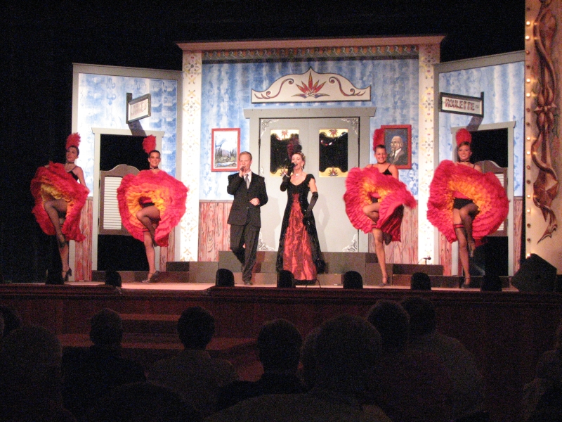
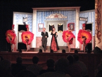
Finally we headed back to town to explore. We stopped at the Jack London and Robert Service cabins, wandered the shopping district, then stopped for dinner and ice cream before heading back to the Robert Service cabin for a presentation on his life and poetry. It was fun. Later we went to Diamond Tooth Gerties Casino to watch the show: singing and can-can dancers. It was okay, but I enjoyed the poetry more. The show was a bit hokie, and the casino part really didnt appeal.
It turned into a beautiful warm sunny day. I wish wed had the sunshine this morning while we were taking pictures, but at least it didnt rain.
Dawson is a nice town with dirt roads and old buildings, eight blocks wide by 18 blocks long, with a little development (campgrounds and houses) outside of town a mile or so away. I could almost see myself living there, if I could handle the winters.
Jim: Yup - there's a reason why Jack London and Robert Service liked it here. And it wasn't the sled dogs.
Sunday, July 27: Dempster Highway to Moose Creek Campground


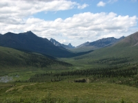
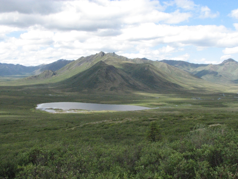
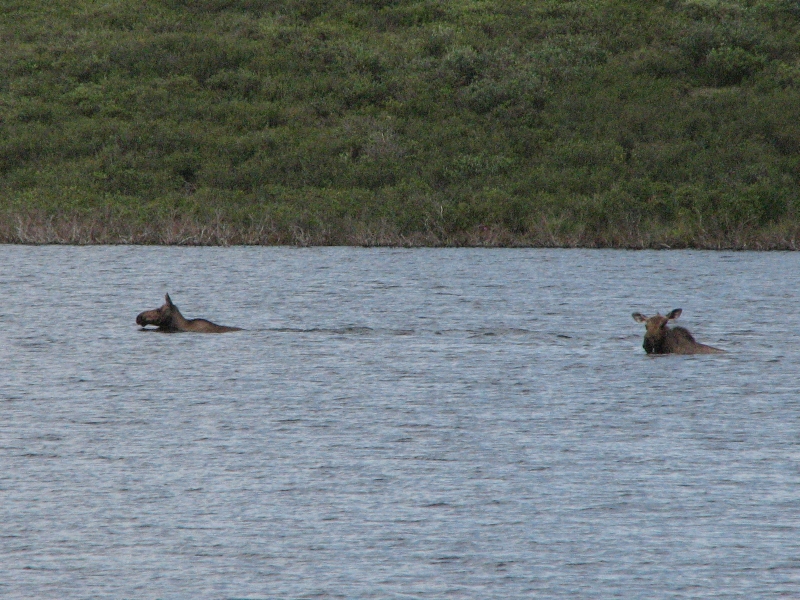
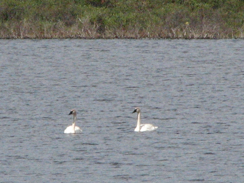
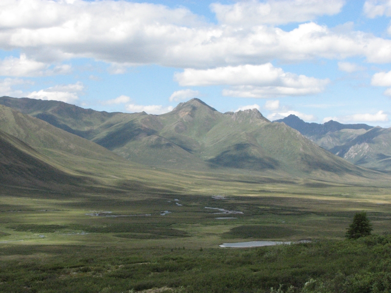
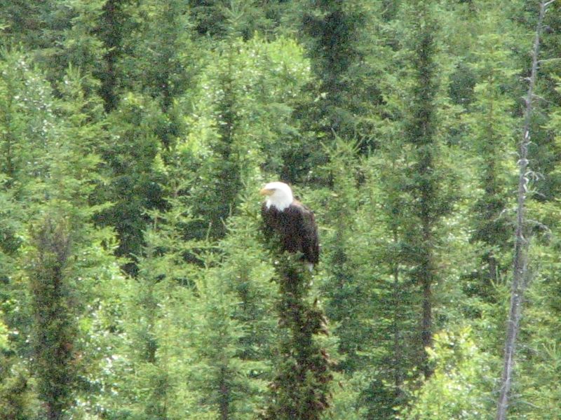
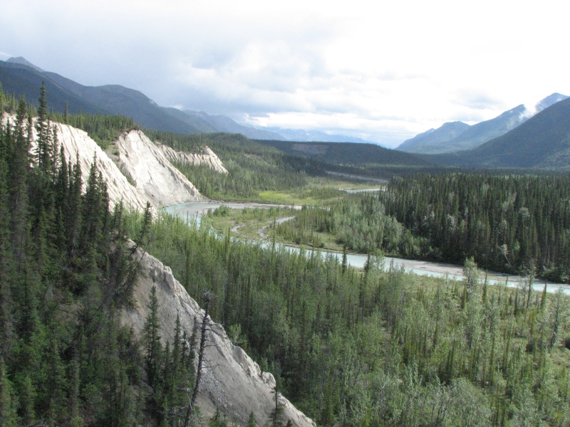
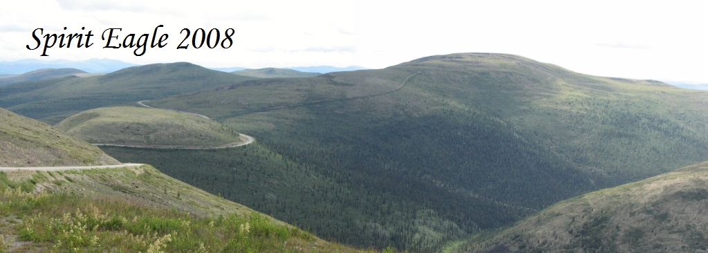
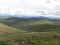
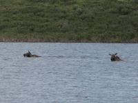
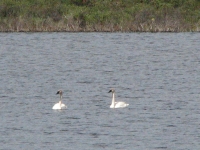
It was such a beautiful day, warm and sunny, we decided to detour up the Dempster Highway to Tombstone Territorial Park. The Dempster is a 460 mile gravel road that leads to the town of Inuvik, NWT. Its a lot like the Dalton Highway, but without the pipeline and the pipeline traffic. Tombstone Territorial Park begins about 46 miles up the highway where the road enters the mountains and rises above treeline. The road goes through the park for another 26 miles or so. It is beautiful country, with jagged peaks off in the distance. We saw snow down along one of the rivers, though the high country seems to be mostly clear of snow. Clouds began building up mid-morning, so there were dark shadows over the mountains, but it was beautiful. A fox crossed the road in front of us, early in the day. At Two Moose Lake we saw two moose, both cows, swimming across the water past a couple of swans and a flock of ducks. Weird. A bald eagle flew past us very low over the Blackstone River.

It was one of those days, (one of several weve had this trip), when we were utterly awestruck, excited and overjoyed by the beauty surrounding us. Sunshine, mountains and open vistas filled my heart with such joy I felt like crying for happiness. Id really like to come back and do some exploring on foot. It was so beautiful.
We turned around at Chapman Lake at the north end of the park. We were tempted to keep on going, but its a long slow trip to Inuvik. We couldnt really justify spending money for gas for another 800 miles (round trip) of bad road. The Dempster varies a lot, with some smooth easy sections and some really bumpy worn sections full of potholes. Seventy two miles 144 miles round tripwas a good day trip.
It took a lot less time going out since we didnt stop as often to take pictures. A few miles from the end we spotted a car in the bushes that had slid off the road. I dont think it was there earlier. Written in the dust on the side of the vehicle was A-okay, so evidently the driver got out all right. Getting the car towed from the ditch wont be easy though.
We have a slow leak in one tire so we stopped at the gas station at Dempster Corner to see if we could get it fixed, but they didnt have anyone who could help so we added some air and kept going.
A sign at Gravel Lake intrigued me. That is the northernmost location of lodgepole pines and evidently their number is increasing rapidly from a handful 50 years ago to large widespread groves today. Evidently the seeds have lain dormant since the last ice age, either buried under glaciers or carried north by receding glaciers. Evidently pinecones can remain viable for 10,000 years. Our warming climate and melting permafrost has allowed them to grow where they havent grown for thousands of years. Amazing.
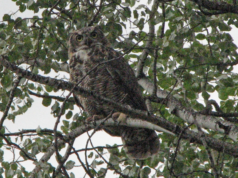
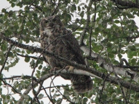
We headed south to the campground at Moose Creek for the night. There were several gravel stretches on the highway so our progress south was slower than I expected. We were tired and very ready to stop. A Great Horned Owl greeted us from a tree beside the road, then flew to another tree nearby to hoot at us. It was sprinkling, so we waited a bit before starting the charcoal for dinner. It was after 8:00 before we ate, but I still wanted to hike a trail out of the campground. Ive never started a hike at 9:00 pm, but since dark isnt until much later, we knew we had time. We wandered through spruce and aspen to the Stewart River and along Moose Creek. The Stewart is deep, wide and fast, not one you could ford without swimming.
On Moose Creek we ran into a very fat beaver. We watched each other for a minute, then he dove into the creek, slapping the water with his tail as he dove under. Of course, we didnt have the camera with us. A red squirrel scolded us as we walked under its tree. Somehow, I dont think they were happy to see us. It was a nice loop hike 1 ½ - 2 miles. It sprinkled a little from time to time, but not enough to get us wet, just a bit damp around the edges.
The campground has few people; maybe six out of the 40 or so sites in this section are occupied. Its very quiet. Ive been surprised at how empty most of the campgrounds have been. Obviously, July 4th was different and the city campgrounds tend to be busy, but many of the state and forest service campgrounds have been nearly empty. Nice for us, but not what I expected. Of course, most of the RV crowd like electricity and water and have the money to pay for them, so the more primitive campgrounds that I like best get less use.
Monday, July 28: Whitehorse
Jim: Started the day by using our little 12vdc air compressor to blow up the tire that had gone flat during the night. There's a good reason for carrying that puppy all this way. At this point, the tire had been leaking for at least 150 miles that we knew about. But, again, a lot of small businesses have gone bust because of the price of fuel. So we haven't found anyone yet to fix it.
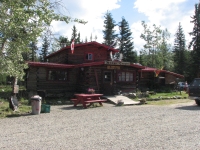
It was a straightforward driving day as we continued south on the Klondike Loop to reconnect with the Alaska Highway at Whitehorse. We were almost out of milk, so we ate a hot breakfast at Moose Creek Lodge near the campground. It was a nice change.
We stopped several times along the highway, looking for a place to get our tires slow leak fixed. No luck. The Milepost lists several garages, but none of the places that advertise repair services actually had a mechanic. In one case, the garage had burned down. So we ended up driving all the way to Whitehorse on the bad tire.
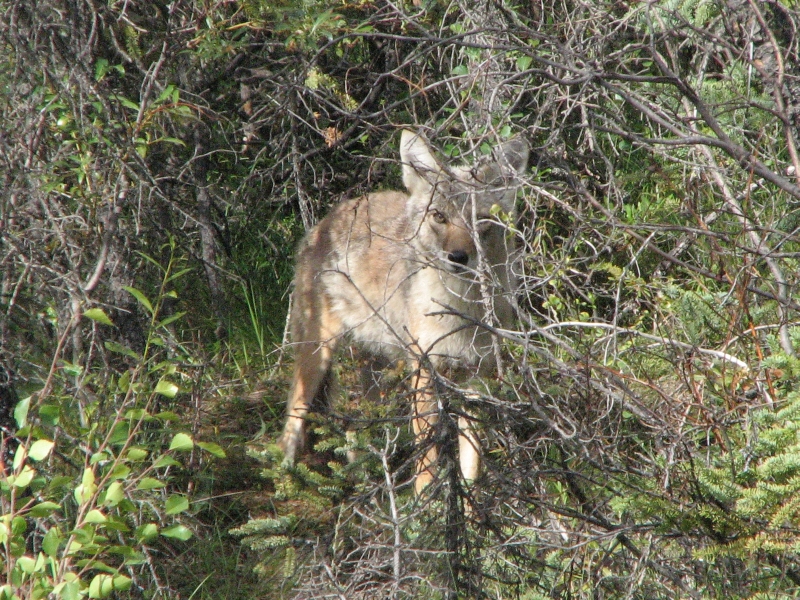
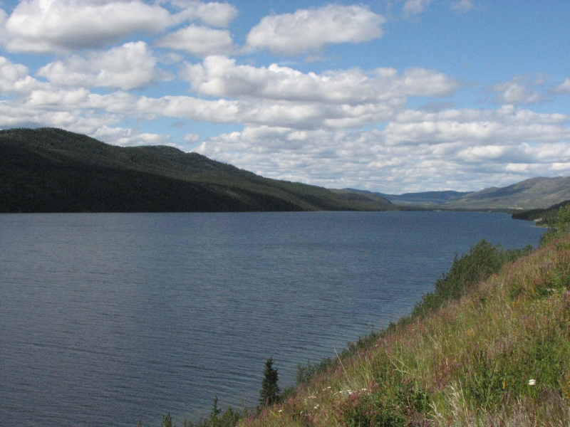
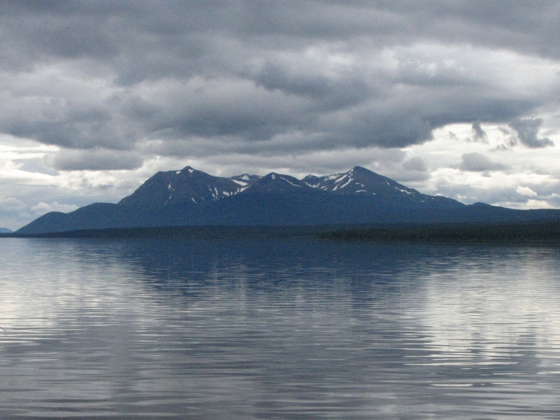
It was a nice drive, but not a spectacular one. The hills and mountains are low round ones covered with spruce and aspen and poplar. We crossed large rivers several times (the Yukon and Stewart Rivers), and passed a couple of large lakes and a multitude of smaller ponds and creeks. We spotted two coyotes playing in the bushes and later I saw either a large fox or small coyote in the grass beside the road. We had a mixture of sunshine and black clouds. It was a nice day.
We finally reached Whitehorse at 4:30. Its a big town, much larger than anything since Fairbanks. The first two tire shops we visited said they couldnt fix the tire today. The third was willing to take care of it before they closed, so we were finally able to get it done. (Unfortunately, they didnt do a good job and we ended up having to fix it a second time a few weeks later.)
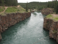
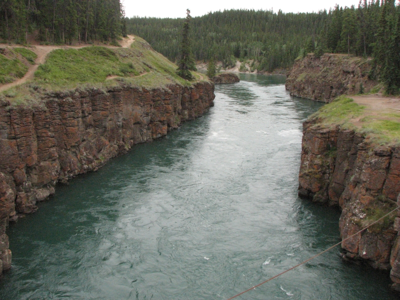
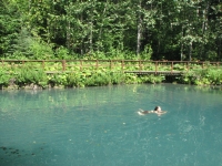
Finding a campground was also something of an ordeal. Our original choice was covered with smoke and the smell of road tar from nearby construction filled the air. We drove to another one down the highway, but that campground felt really claustrophobic, despite having wooded sites, and the bathrooms were way far away, so we turned around. We ended up back at the first campground, since the smoke had cleared. After dinner we drove a couple of miles to Miles Canyon to admire the steep narrow rocky canyon and emerald water. In the gold rush days, Miles Canyon was a major obstacle. Now its a pretty hike or boat trip.
Tuesday, July 29: Watson Lake
It rained all night and into the morning, halting only after we headed out around 10:00. We had a couple more showers around noon, but by late afternoon it was warm and sunny again. The drive east along the Alaska Highway was a pretty one, through domelike mountains, past Teslin Lake and several rivers. We did most of the route on our way to Alaska, but it is pretty enough to be enjoyable on second view as well. We spotted a hitchhiker sound asleep by the side of the road with a sign Edmonton. Must be very slow getting a ride through here. We have so much junk in the truck, we didn't stop. The only hitchhikers weve picked up were the backpackers in the Kenai, though we see them fairly often.

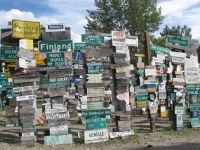
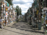
We drove as far as Watson Lake, where we stopped early because I wanted to visit the Northern Lights Center and their show times were 1, 2, 3, 6:30, 7:30 and 8:30. We arrived at 3:30, of course, so had to wait. We watched a video on the Alaska Highway at the Visitors Center, then wandered through the huge signboard forest, which has over 60,000 signs now: street signs, town signs, license plates and peoples names and addresses painted on boards. It was fun looking for towns we know, though we didnt add one of our own.
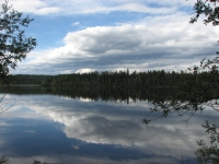
We did a short 1½ mile loop hike around Wye Lake, got a site at the nearly empty RV park on the edge of town, cooked dinner and then went back for the show. It was in two parts, one on How big is the universe? using many Hubble images, and the other showing many images of the aurora borealis. They were both pretty. I would love to see the aurora some day as Ive never seen the northern lights. Summertime isnt the right time though, you need dark nights for that. Our only wildlife today was a bald eagle posing in a tree near a view point. The campground is nearly empty. So odd. Last night in Whitehorse we were packed like sardines, today there are only 6-10 campers in the 100 space campground.
Jim: I thought it was strange that we'd see a Hubble Space Telescope video on the Alaska Highway in Canada. Just seems like an odd place for it to show up. And then that was followed by the aurora video from another of the spacecraft that I worked on some years ago. Strange connections...
Wednesday, July 30: Liard Hot Springs to MacDonald Campground at Muncho Lake
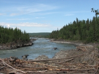


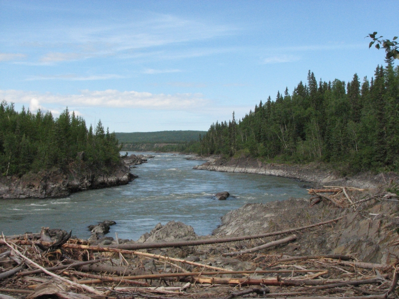
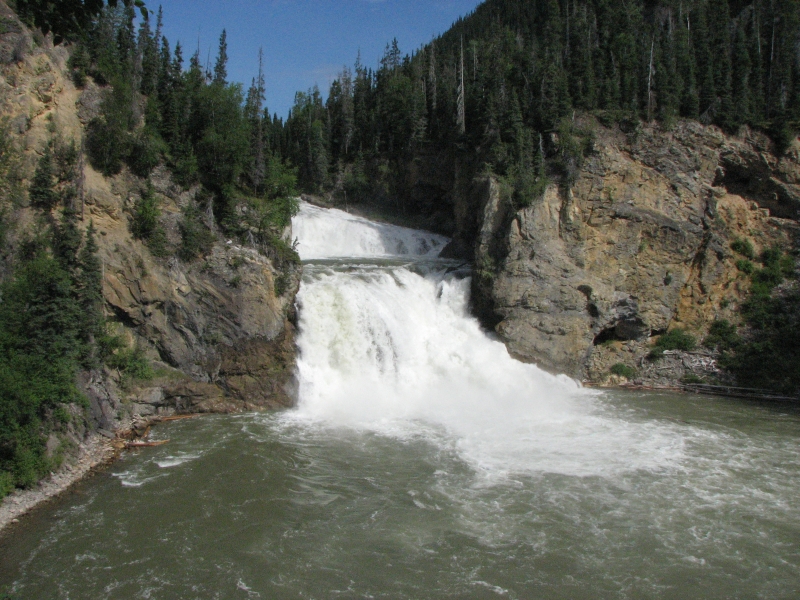
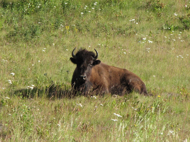
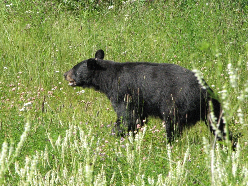
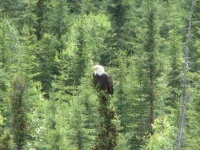
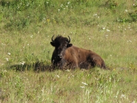
It was a beautiful sunny day. We continued east to Liard Hot Springs, one of the most highly recommended stops on the Alaska Highway. We spotted a couple of bison sleeping by the side of the road near Contact Creek. A short while later, a grazing black bear appeared. Jim slammed on the brakes and backed up so we could watch as it wandered though the tall grass and wildflowers. We stopped a couple of times to look at a couple of rapids on the Liard River, then detoured to Smith River Falls, a very nice powerful two-tiered waterfall. There was a short hike to a viewpoint there.

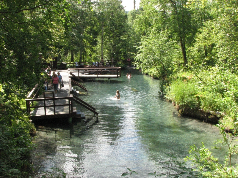
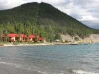
Liard Hot Springs was, surprisingly, as good as its reputation. You walk about half a mile on boardwalk across wetlands and through fern-filled forest to two large pools. The first is shallow with benches in the middle and a small waterfall. The temperature was cool at one end and very hot at the other (108-126 degrees). The water was crystal clear with gravel underfoot. That was the more popular pool. There were 10-25 people in the water while we were there. The upper pool is about 0.2 mi farther, not as clear, but 9 deep and much wider. You could swim across it or float and just let go completely. It was hot, but not too hot. We had the upper pool to ourselves for about ten minutes. When we felt sufficiently relaxed, almost drained, we left. There is a campground there, but I wanted to go on to Muncho Provincial Park 30 miles away. Many people camp at Liard so they can enjoy the springs at night, but since it doesnt get dark until midnight, I wasnt all that interested.

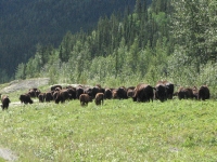
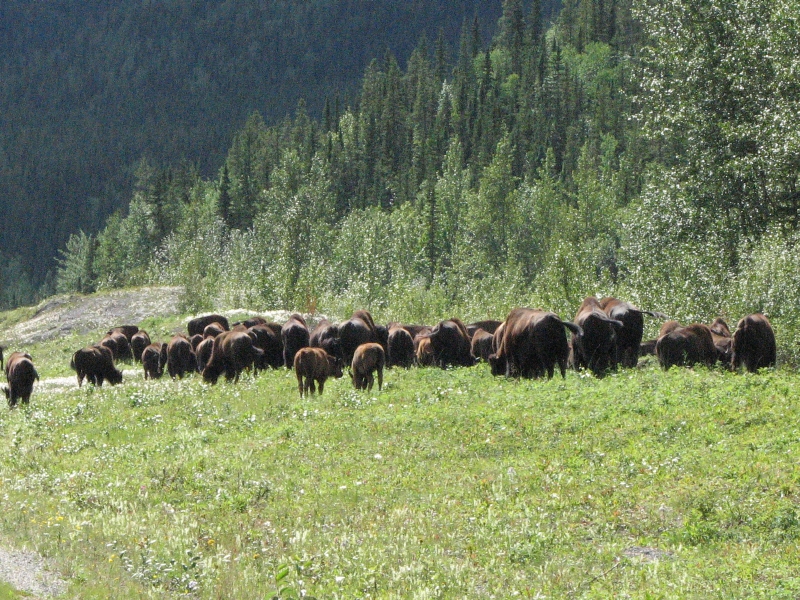
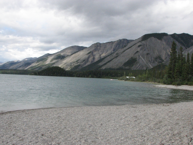
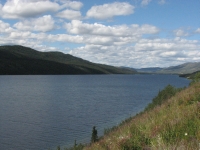
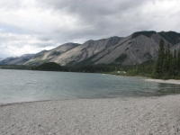
The views of the Liard Valley were beautiful with steep green mountains on both sides. There are still a few patches of snow in the mountains. About 5 miles east of Liard we ran into a large herd of bison. They were on both sides of the road and crossed in front of the cars, utterly oblivious to the vehicles and the tourists taking their picture. We stopped at Trout Creek salt lick to look for wildlife. Theres a short hiking trail that leads to mineral licks. We didnt see any animals there, but I enjoyed the walk and the view from the overlook there. A few miles farther is a small (15 space) campground on Muncho Lake. It was nearly full, so we grabbed a site overlooking the lake and waited for a rain shower to stop before heading out for another short walk. The mountains are steep, gray and rocky with huge gravel outwashes. Either there used to be glaciers or they get some serious snowmelt flooding. The storm didnt bring much rain, but it did drop the temperature drastically. In Liard Hot Springs it was 73, as we drove, it dropped to 60. When we finished our salt lick hike it was 55 degrees.
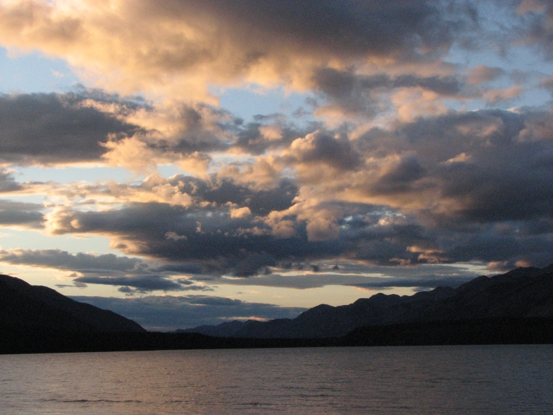
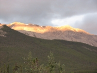
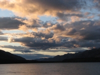
We ate an early dinner, then I decided to go for a walk along the lake shore. Jim had a sore leg so didnt want to stress it by hiking any more. A gull became irate and started hovering above me, squawking loudly. I was trying to keep an eye on the bird in case it started diving at my head and ended up twisting an ankle on the round river rocks. I fell and for a few minutes couldnt move. I sat there wondering how long it would take Jim to get worried and come after me. Too long, I decided, so I stood up and hobbled to the lodge up the lake. Its huge with numerous cabins and a large central building. It looked really nice. I was moving okay, just stiff and sore, so instead of asking for help I turned around and walked the short distance back to the campground. Resting for the next few hours helped my ankle but I did get up to admire the alpenglow on the peaks and a beautiful sunset over the lake. Its a beautiful campsite.
Very few bugs too, which is a welcome relief. The past few nights weve spent significant time chasing down mosquitoes in the back of the truck when we go to bed. Not hordes, fortunately, but even 5 or 6 can prove irritating when you hear the whine but cant spot them. Jim and I had a good laugh last night at one that would go silent as soon as the flashlight was turned on, but would begin buzzing as soon as it was dark again.
Last night we saw stars for the first time in two months. Sundown is back to 10:00 or so, and we needed headlamps by 10:30. Quite different from a month ago, or even a week ago, but were well past solstice and a lot farther south than Fairbanks or Deadhorse. I enjoy seeing sunsets again Alaska has had some really nice ones but I miss being able to read past midnight without a light.

Thursday, July 31: Fort Nelson
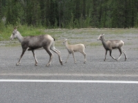
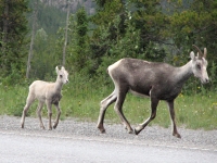
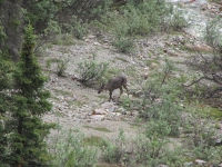
We woke to a cold, gray, blustery day. Soon after we took off, it began to rain. The green lake was gray and white-capped. Gulls fought the strong winds. The mountains were hidden in thick white clouds. I had hoped to do some hiking in Stone Mountain Provincial Park but by the time we got there it was 46 degrees and pouring. Not a fit day for man nor beast. We did, however, see some wildlife beside the road: three Stone sheep (a grayish bighorn sheep that lives in the northern Rockies), a bull moose hiding in the trees, a caribou along a rocky stream and two young caribou grazing beside the road.
After we left the mountains, we entered farm and ranch country with hay fields, horses and, occasionally, cows. We saw some deer hiding in the trees, the first weve seen since we left BC two months ago. We bought a cinnamon roll at a lodge. (Everybody advertises their great cinnamon rolls; most arent as good as they claim, but they do tend to be very large.) Then we drove on to Ft. Nelson in continuous rain. We decided to call it a day when we got there. Its a long way to the next campground and driving in a downpour isnt a lot of fun.
We decided to splurge on a motel, the first in three weeks, so we could enjoy a relaxing afternoon out of the weather. We visited a small used bookstore then read the afternoon away. The motel had internet so we were able to get a little bit caught up on the news of the world.

Dinner at Dans Pub was followed by a quick trip to the grocery. Canada has some products in their stores we dont have in the States, like Liptons carbonara, spaghetti marinara and curried noodles or my favorite Coffee Crisp candy bars. We stocked up. I watched TV for the first time in months while Jim downloaded pictures and put together several panoramas on the computer. Hes really good at splicing images together to make beautiful big photos.
Friday, August 1: Sudetan Heritage Park
Another day of sunshine and shadow, blue skies and black clouds. Heading east, the mountains are not as tall or dramatic as those we left behind. There are round green ridges with dense spruce forest on both sides of the highway. They cut a wide verge along the road, making a wide open corridor so we can see any wildlife and they can see us. This time of year, the verge is full of flowers: paintbrush, fireweed and goldenrod, among others. At one point, the roadside garden was so tall we could barely see the head of a buck leaping through the grass. I wonder what other wildlife we passed hidden in the wildflowers?
It began to rain around noon and continued steadily until we reached sprawling Fort St. John mid-afternoon. We lost both the wide open spaces and dense forest as we went east. Instead we saw farms, ranches, big towns and businesses. I liked the southern route better than the official Alaska Highway, all in all.
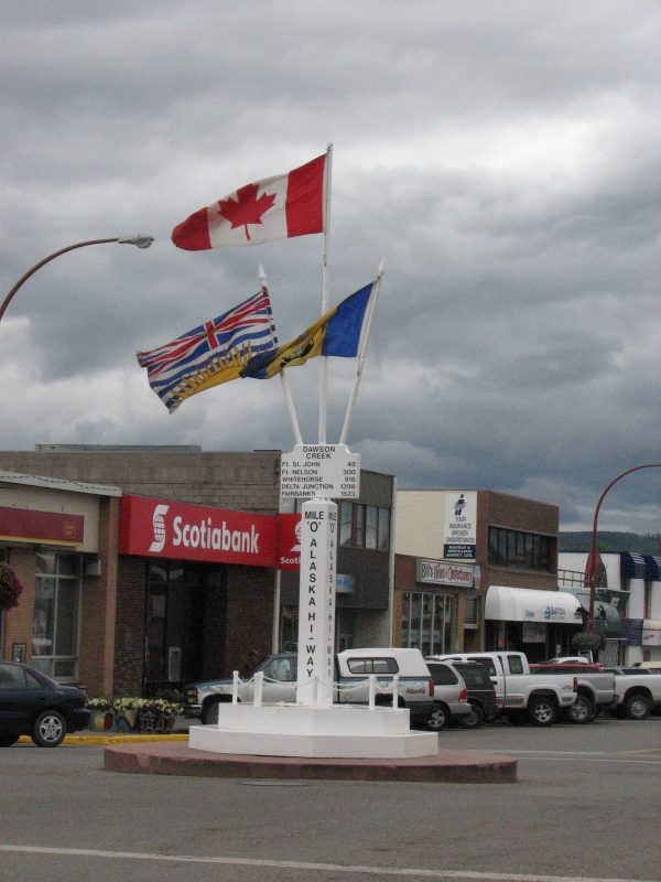
At Dawson Creek we officially finished the Alaska Highway when we passed Mile Zero. Theres a big marker in the center of town. After talking with a girl at the Visitors Center there, we decided to take the east side route to Jasper. Theres a big rock music festival at Tumbler Ridge this weekend. I had hoped to visit a waterfall near there, but it will have to wait.
Its a holiday weekend in Canada, so finding campgrounds may prove difficult, even on our eastern route. The one at Pouce Coupe was nearly full, so we continued to Swan Lake Provincial Park. We drove right into the rain, passing green hay/alfalfa fields and low wooded hills that reminded me of Pennsylvania. Swan Lake Campground was completely full. Fortunately, there was a small 14 unit primitive campground nearby--Sudetan Heritage Park--that still had a few empty spaces. It was right next to the highway, so a bit noisy, but the sites were spread out in the trees so we had privacy and didnt hear the other campers. It rained off and on all evening, so we just tucked ourselves into the back of the truck with our books. The campground host didnt realize we were there. He drove by several times, but didnt see us in the back. He finally knocked on the window after I had turned out my light and gone to bed. Jim was still reading though, so he paid the man.
Home | Links| Trail Journals |
The Thruhiking Papers | Bun-bun
Created: 1 Jan 2009
Revised: 30 Sept 2016Copyright 2009-2017 Spirit Eagle