|
 |
 |
 |
 |
|
|
|
|
|
|
Wednesday, July 16: Fairbanks
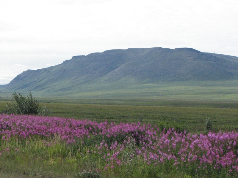
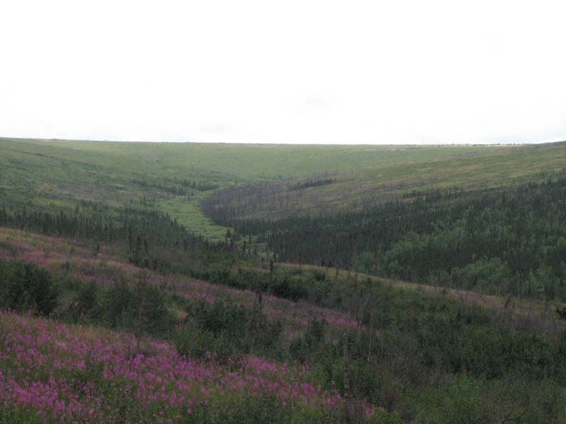
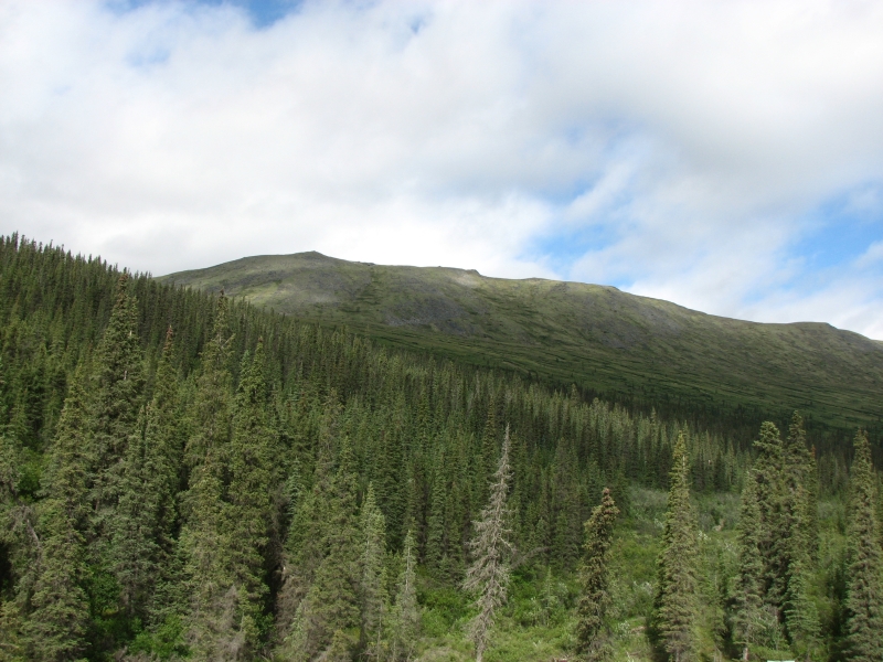
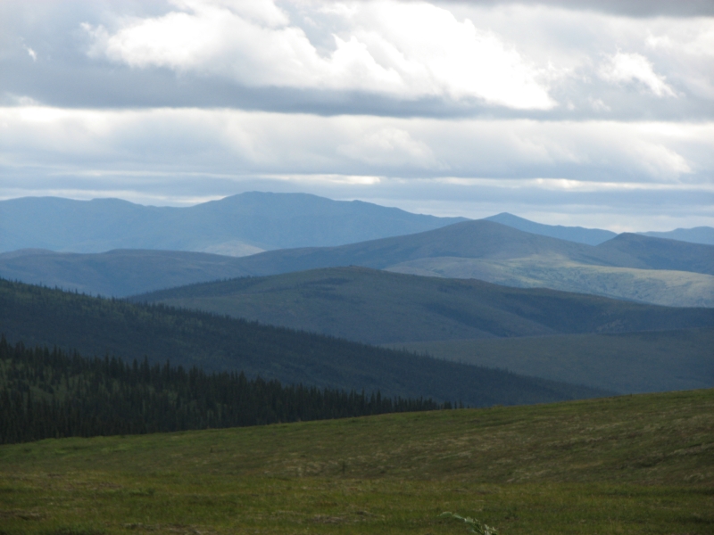
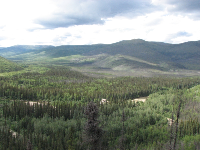
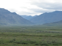
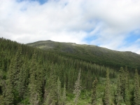
It was a fairly short drive from Healy to Fairbanks. The landscape north of the Park is quite different from the land to the south. Between Anchorage and Denali there are big mountains on both sides of the highway. The mountains to the north are more like hills, green rounded ridges with dense forest. There are rivers and lakes shining silver in the distance. The roadside flowers are mostly pink fireweed; the lupine are past their season. The views were pretty but not especially photogenic; big snowy mountains are much more dramatic than spruce-covered hills.
We got a site at an RV park next to the Chena River, bought groceries and wandered around town visiting bookstores, getting the oil changed in the car and looking (in vain) for an outdoor store that could sell us butane for our stove. Eventually we went to Pioneer Park, a free tourist site with an old paddlewheeler, President Hardings private railroad car, and a couple of dozen old buildings converted into shops or museums. We wandered a while then went to Pizza Hut for dinner. It was a low key day, sunny and warm. I rather like Fairbanks. The people are nice and driving around isnt too bad. We visited the excellent Museum of the North last time we were here and the other tourist activities all cost money (i.e. the Dredge tour or the paddlewheeler ride up the river) so Pioneer Park was a good alternative. Jim wasnt feeling well, so he took no pictures, but I had fun. We spent a while talking to one of the artists he was good, but too expensive for our budget.
Thursday, July 17: Marion Creek Campground near Coldfoot
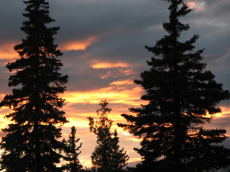
A gray day with scattered showers, still warm though. Yesterday got up to 74 degrees, t-shirt weather at last! We stayed up until sunset again last night very late but it was a pretty one. We still havent seen real darkness here in Alaska. When we get up in the middle of the night, it always looks like dawn, light enough to walk to the bathroom without needing a flashlight. It gets confusing in a way, but we try to ignore the light and just sleep when were ready. I have put my jacket over my eyes a time or two when I wanted to sleep before sundown but mostly I dont bother. Its not that hard to deal with the constant twilight. I sleep well regardless. The problem is that we lose awareness of the time, so end up going to bed really late.
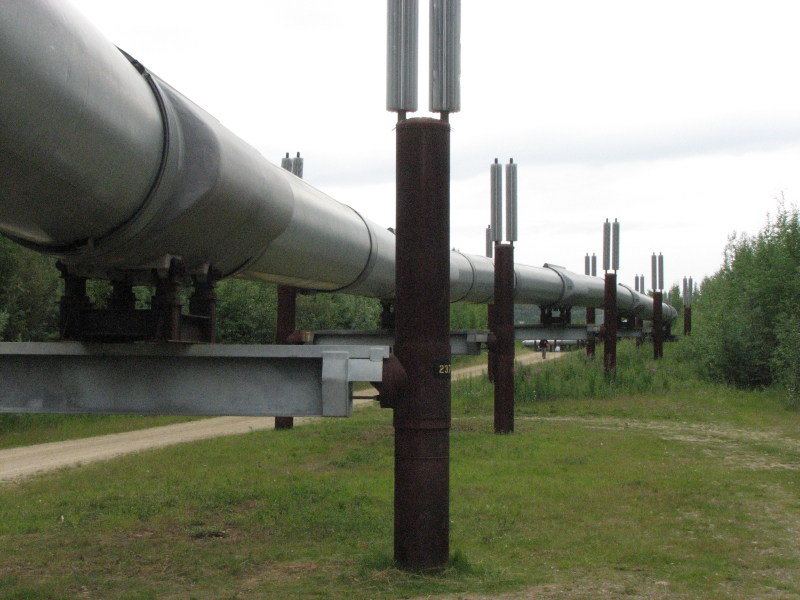
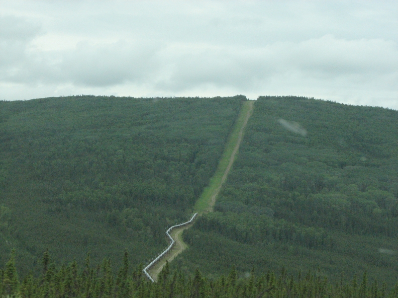
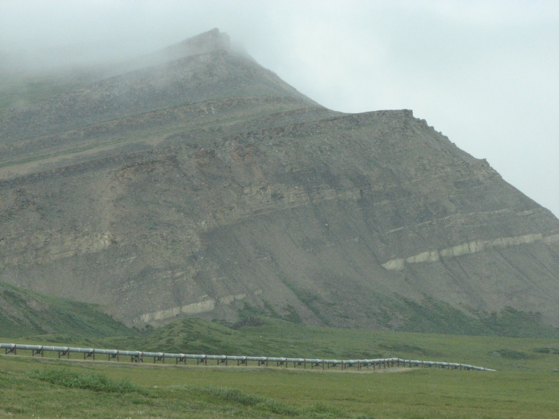
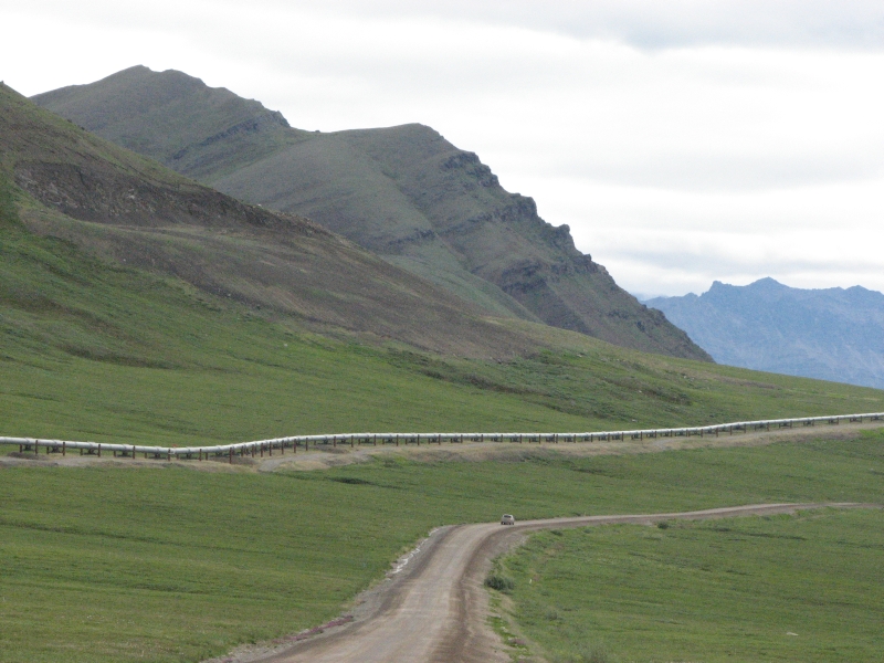
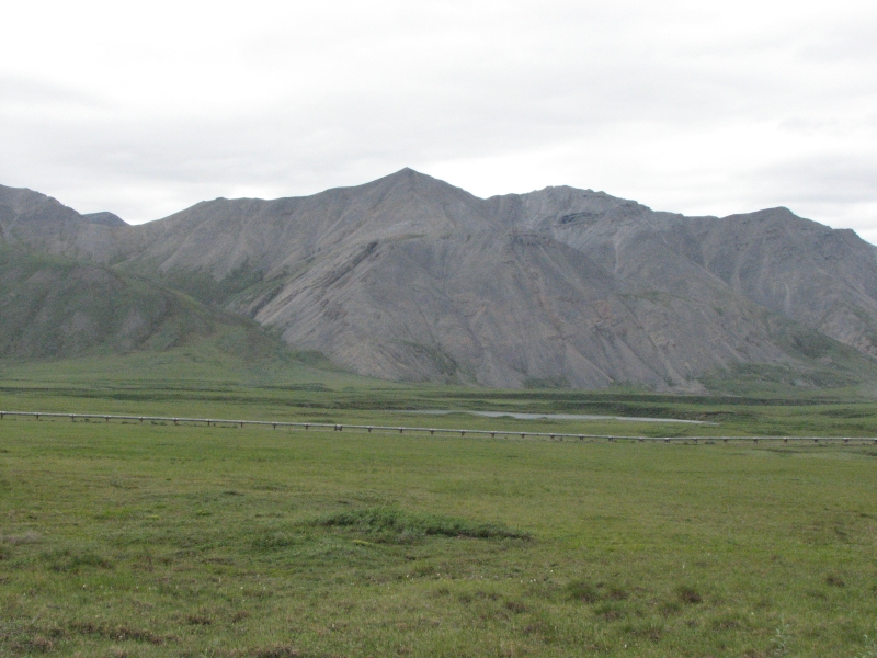
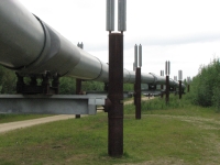
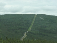
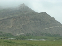
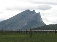
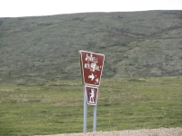
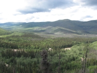
Were heading north today, following the Steese, Elliott and Dalton Highways. We started out driving through low tree-covered hills. There are occasional dirt roads heading out, but for mile after mile, no other sign of development. The Dalton Highway is not one recommended by the tourist offices and its forbidden by most of the car rental agencies. Its a mostly gravel haul road for big trucks driving to Prudhoe Bay. There are few places with services of any kind, just a couple of truck stops. Its 500 miles from Fairbanks to Deadhorse at Prudhoe Bay. The first 100 miles are mostly paved but very uneven due to frost heave. The rest is graded dirt and gravel. The road parallels the Alyeska Pipeline the whole way. At times the pipeline dives underground, but mostly it snakes across the landscape.
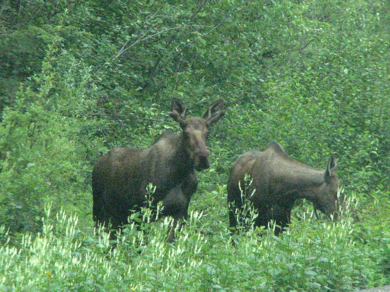
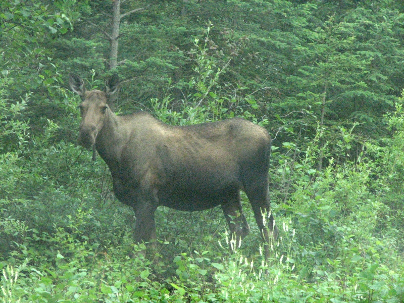
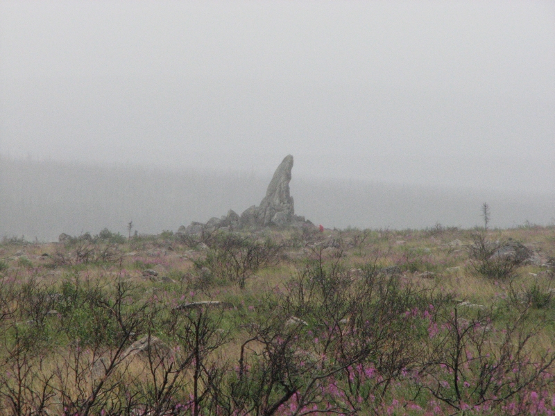
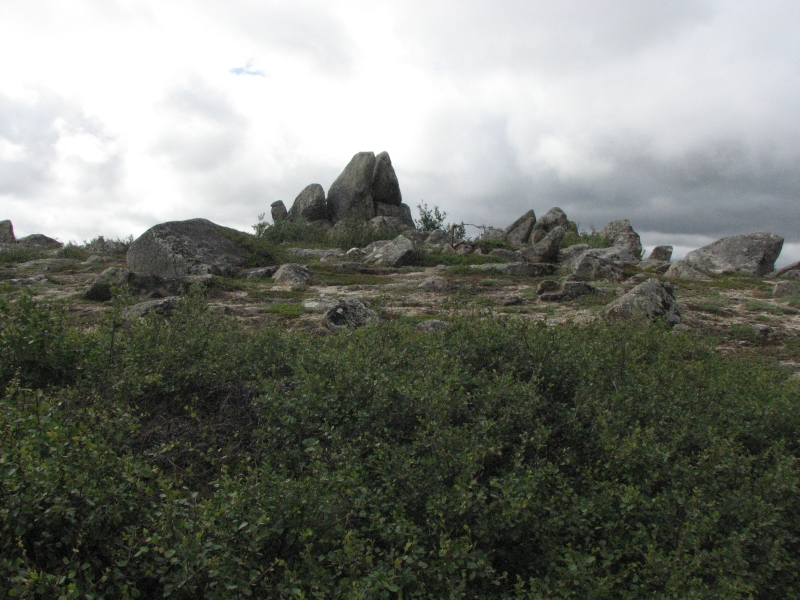
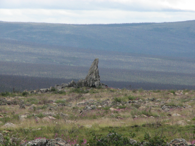
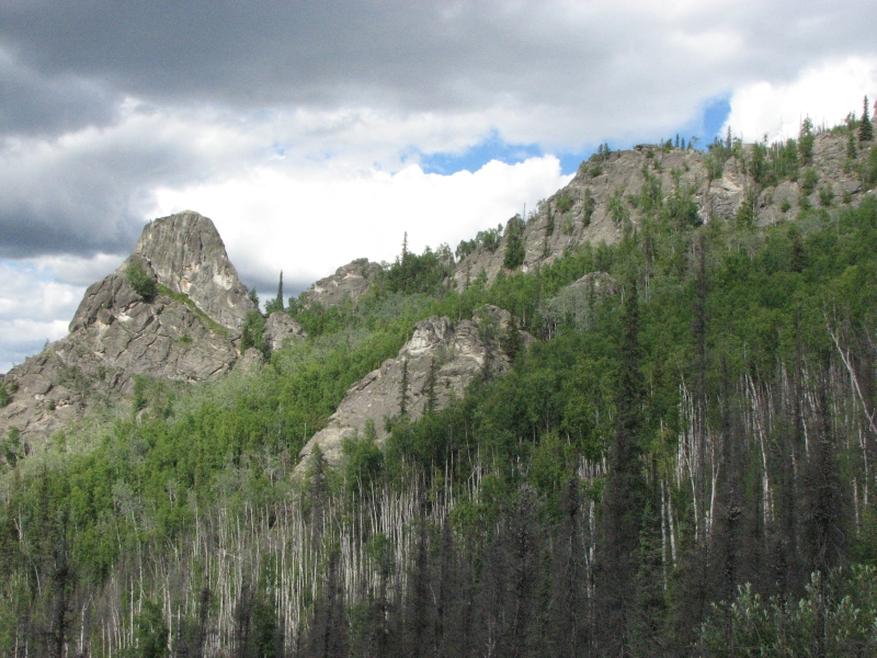
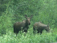
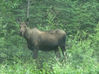
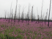
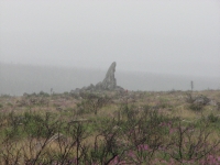
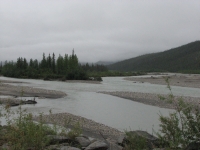
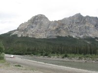
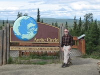
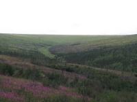
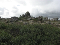
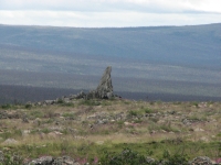
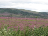
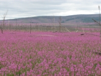
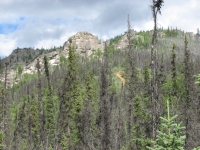
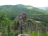
The first few miles of the Dalton goes through rounded green mountains that reminded me of Pennsylvania. Mixed into the spruce is a lot of aspen; it must be striking in the fall. Then the hills got lower and we wound our way through skinny black spruce forests taiga. There were areas that were burned in a fire 15 years ago and other areas of dense forest. We saw two female moose grazing by the side of the road. The rain got more serious while we ate our lunch in a pullout beside the road. We drove in clouds for a while and the road turned slick and muddy. We could barely see the river when we crossed the Yukon. (Is that like crossing the Rubicon? A point of no return?) We stopped at the BLM Visitors Center at the Yukon nice people and got covered with mud. The road became a roller coaster with steep ups and downs. There was more traffic than we expected, given the conditions. A lot of people visiting Fairbanks drive or take a bus as far as the Arctic Circle. Lots of fireweed in the burned forest made a carpet of pink. Around mile 100 of the Dalton Highway the trees thinned out and we had glimpses of open tundra with several rocky tors (i.e. Finger Rock). A few miles later we crossed the Arctic Circle. We got to the sign just as a cruise ship bus disgorged its load. We waited in the car while the group took pictures and drank champagne in the pouring rain.

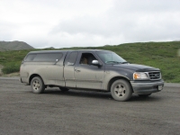
The road alternates between gravel and pavement. The pavement was usually in worse shape than the gravel with bigger and more unavoidable potholes. Evidently we hit one too many: 140 miles up the Dalton we got a flat tire. I put out a flare and cleared the mud off our flashers while Jim changed the tire in the rain. Several cars stopped to ask if we needed help, but Jim soon had it under control. They recommend carrying two spare tires on this road, but we only have the one. We were glad it was only 35 miles to the gas station at Coldfoot. We dropped the tire off at the garage and walked to the restaurant to stuff ourselves at the buffet. When we were finished, so was the tire. The mechanic wasnt very hopeful about the repair he did, since the damage was to the sidewall. He didnt think it would last, so we kept the spare on the truck and left the repaired tire to use in an emergency.
Theres a nice BLM campground with large wooded sites and few people at Marion Creek about five miles north of Coldfoot, so we headed there for the night. It was a good one, not even a third full.
Friday, July 18: Deadhorse
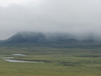
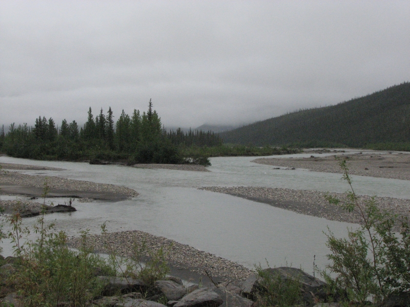
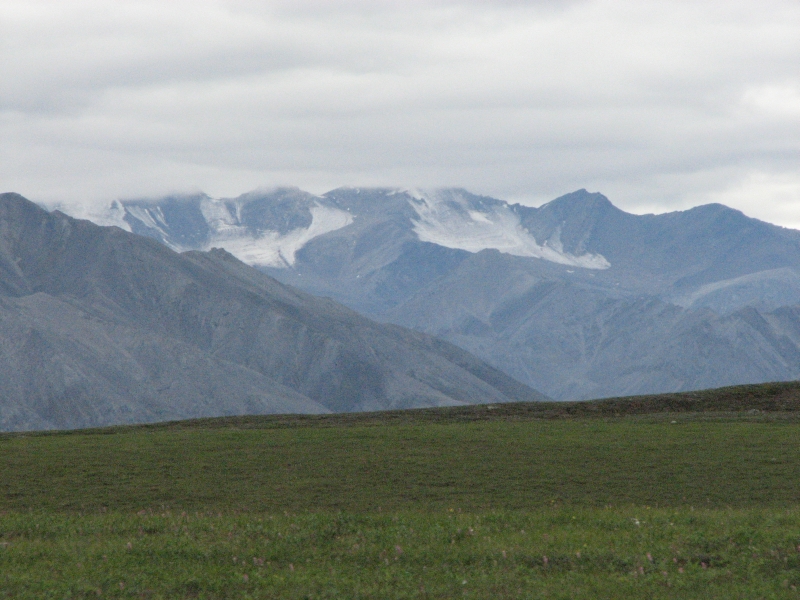
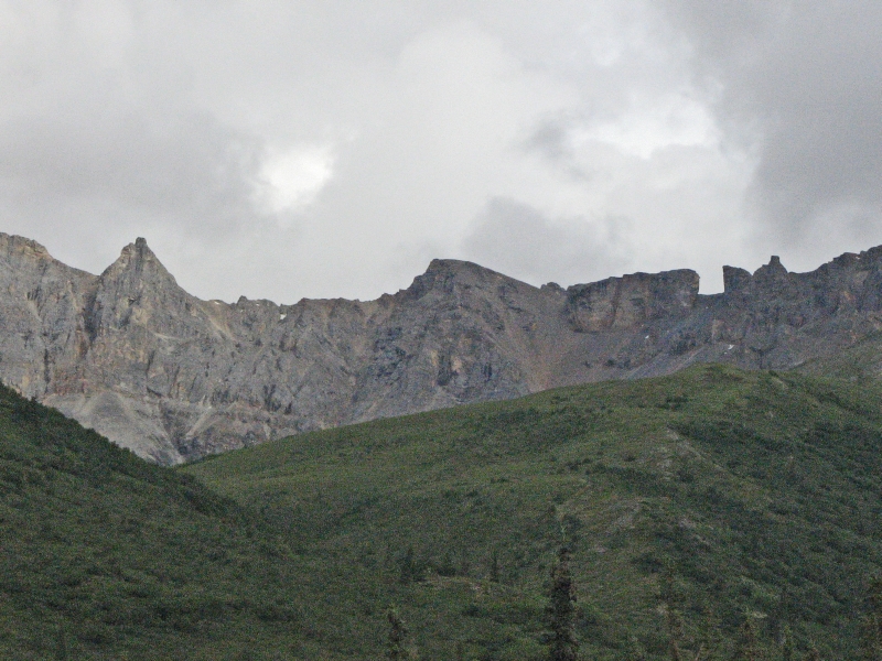
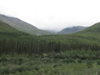
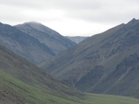
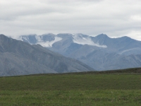
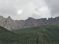
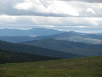
The rain continues. Its frustrating. Were driving through the edge of the Brooks Range, a place Ive long dreamed of hiking, and we cant even see the mountains since theyre hidden in clouds. I can tell theyre big and steep, but thats all. We crossed some large blue rivers and streams nice after all the gray and silty rivers in Denali. The rain added an extra dimension of excitement to the journey: the road became much more slippery. As we dodged potholes, Jim also had to avoid sliding off the edge of the road when we slipped in the mud. One half mile section reminded me of the deep mud bog we ran into in Wyoming.
We talked about turning back, but we both really wanted to keep going. We had called from Coldfoot to reserve a spot on the tour bus from Deadhorse to the Arctic Ocean. You cant travel through the oilfields at Prudhoe Bay except on a tour and they require you to give passport or drivers license information 24 hours in advance so they can do a security check before you arrive. I wasnt sure I wanted to spend the money for the bus, but after driving 500 miles, why stop eight miles from the Arctic Ocean? Were also hoping the weather will improve so we can get better views on the return journey.
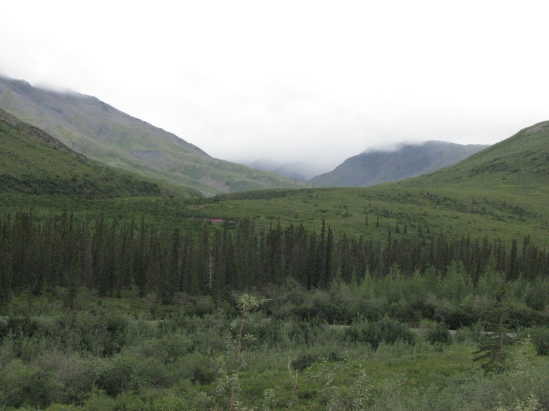
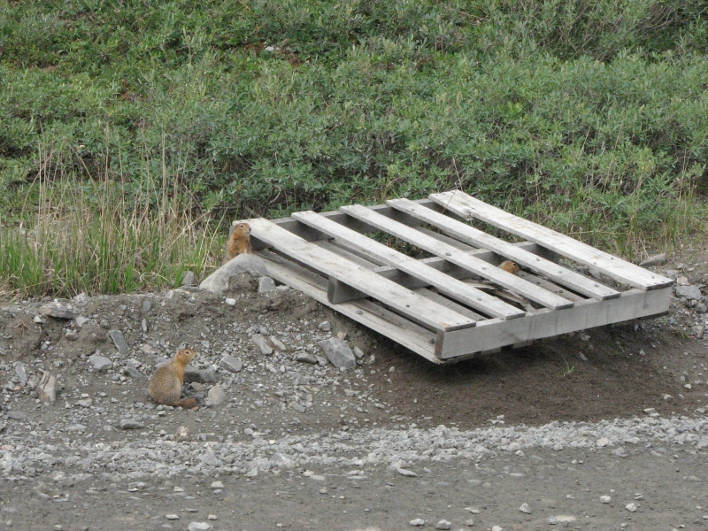
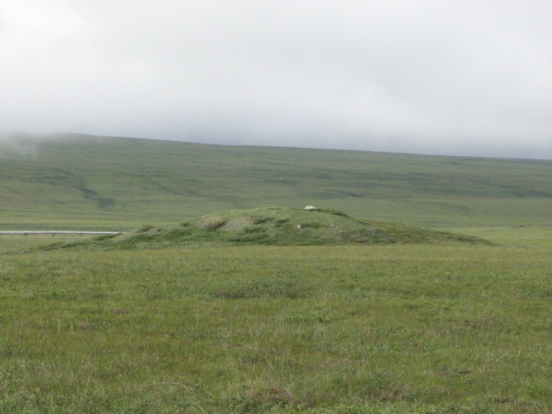
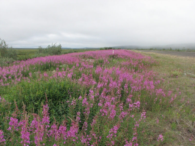
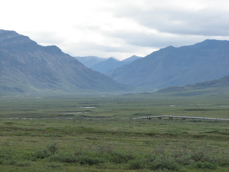
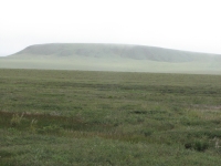
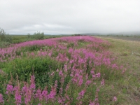
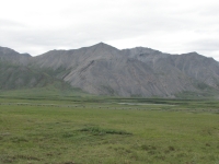
Around noon we passed through some spectacular mountains with alpine meadows. We ate lunch there, at the Chandalar Shelf, looking out over the broad green valley. Rocky Atigun Pass was completely socked in. Its a steep climb into the clouds and down the other side. The pipeline was buried there to protect it from rockslides and avalanches. In places the clouds lifted and we had fantastic views of mountains, lakes and later open tundra. As we drove north we lost the trees and then the larger shrubs. It became alpine. In some areas there were flowers, especially Alaska cotton and fireweed. Ground squirrels were abundant. Jim stopped to take a picture at one point so I scanned the open meadows with binoculars and spotted three grizzlies: a mama with two large (yearling?) cubs. All were blond with brown markings. North of Galbraith Lake, fog hugged the ground. If there were caribou there, we missed them. Fortunately, traffic was light. We could see lots of small ponds and an occasional pingo or palsa. The pipeline was usually visible not far from the road. It crosses under the road from time to time. There are numerous pump station complexes and construction camps, now mostly used by the Dept. of Transportation. We ran into occasional road graders. Supposedly ¼ of the Dalton Highway is paved, but its intermittent and mostly at the ends. One section where the pipeline was buried was covered in a dense blanket of fireweed, ten feet wide. It was so odd: the left side of the road was pink, the right side was willows, beyond were low hills covered in green grass and small shrubs. Its beautiful if you like expansive views and alpine meadows and tundra. I do. We watched an owl dive for a squirrel about 20 away and a couple of peregrine falcons winging low over the meadow.
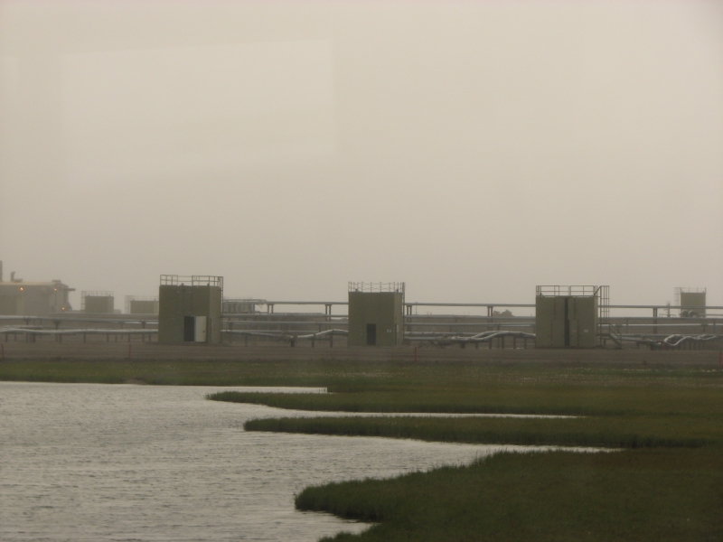
There are no services in the 239 miles between Coldfoot and Deadhorse, except a couple of B&Bs in Wiseman, a few miles north of Coldfoot on a side road. Coldfoot has a gas station/garage, a motel, and a café of sorts. It has a dinner and breakfast buffet but no a la carte menu during those hours. Deadhorse is larger, with three motels and two gas stations, but weve been warned that it is a busy industrial complex that doesnt really cater to tourists. It has housing and food for all the pipeline workers, but tourists dont get special treatment. We eat the same as the oil workers. Actually, we share their cafeteria. The motels are expensive, though very basic, but they allow people to camp overnight in the parking lots for a small fee.
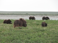
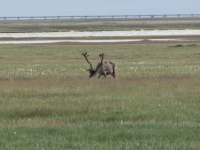
While looking for musk oxen, I spotted a large dark shape that vanished behind a bush before I got a good look at it. Since musk oxen arent solitary, it was more likely a bear, but it was hard to tell. Later, we spotted a herd of musk oxen on the flat coastal plain. The herd had about 20 feeding in the meadow beside the river. We got out of the car and walked closer, keeping a row of willows between us and the herd. They didnt seem alarmed; they just kept on feeding. They arent as big as bison and have very long dark hair and curly horns. There were a few calves. It was a real treat to see wild musk oxen so close to the road.
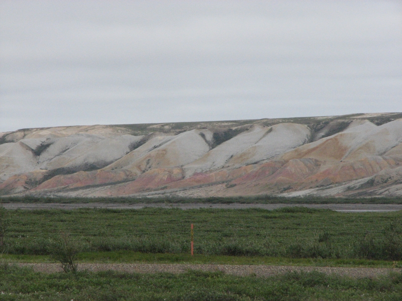
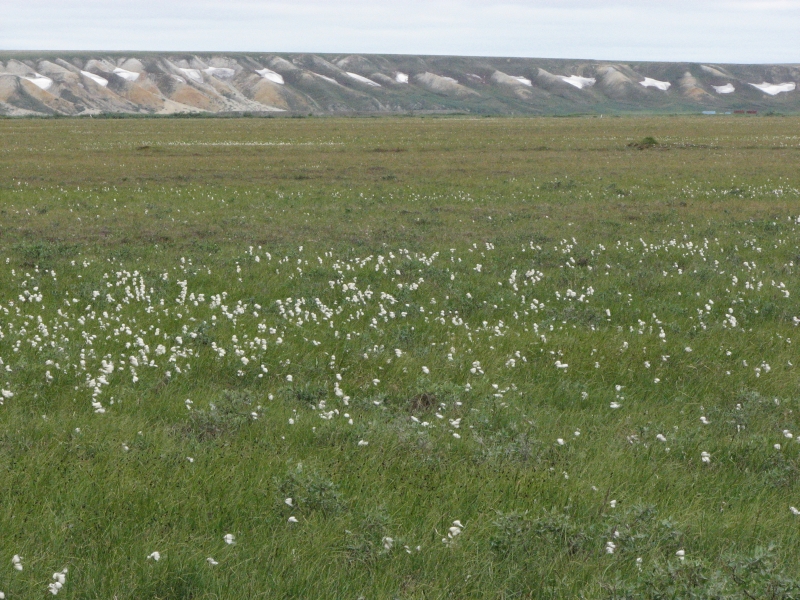
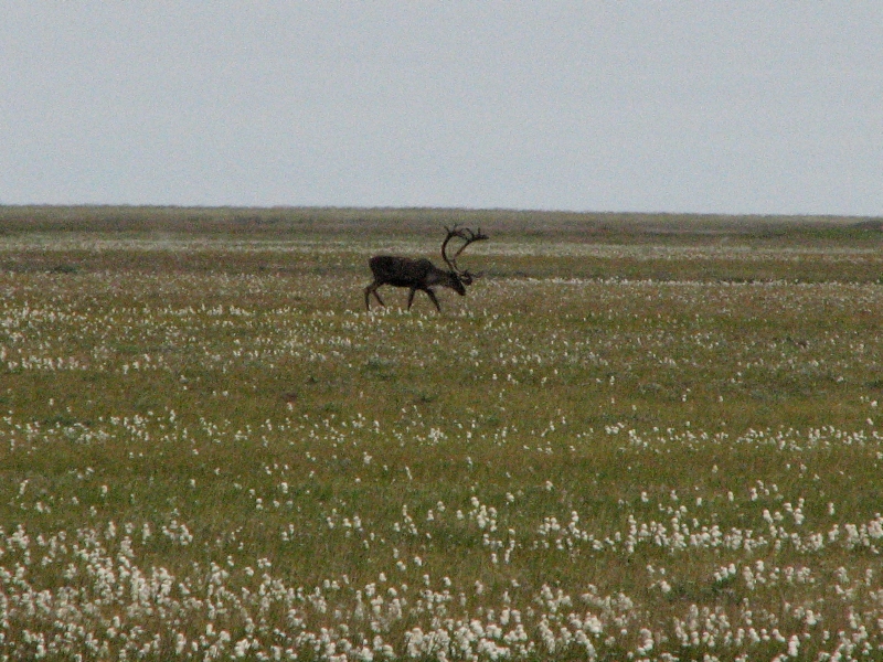
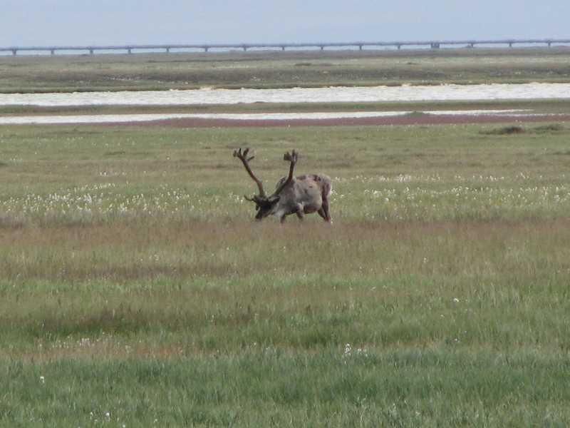
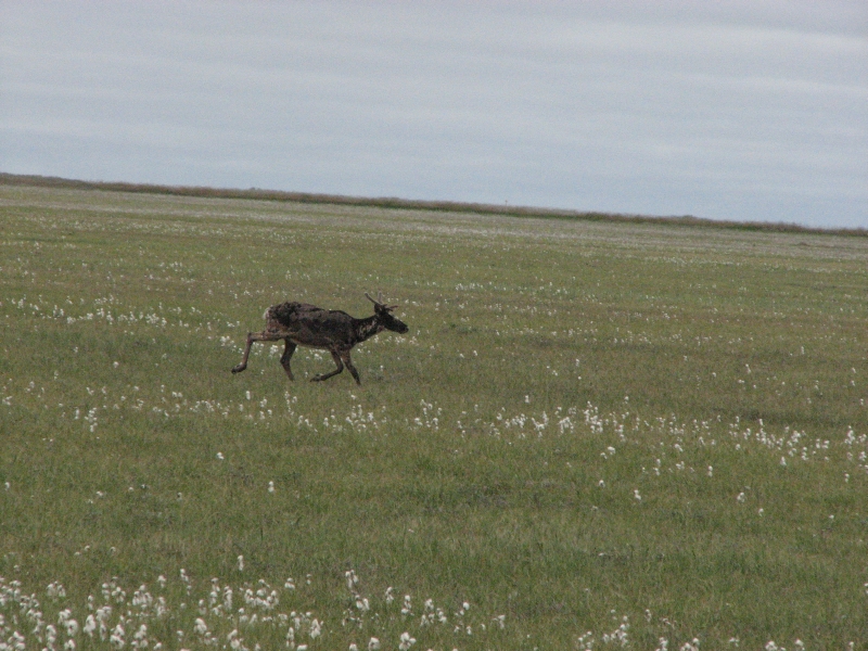
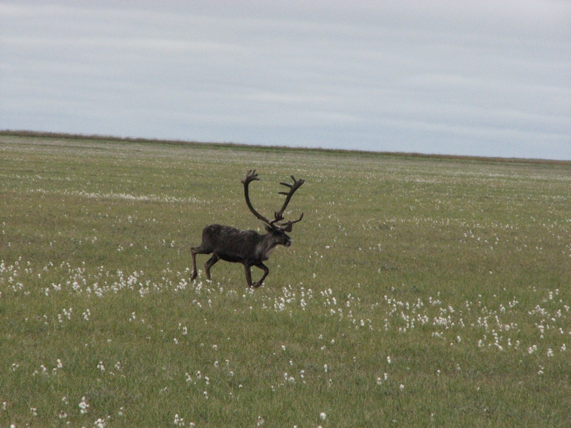
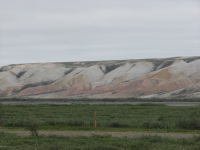
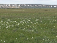
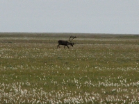
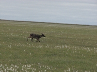
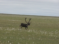
The Franklin Bluffs 25 miles from Deadhorse were interesting. Its a low long cliff colored red, yellow and white, with patches of snow in the hollows, that parallels the road for several miles. It was beautiful! Lots of cotton grass (Alaska cotton). The white tufts contrast nicely against the green meadows. About 12 miles from Deadhorse, I spotted a lone caribou out on the river gravel. The Sagavanirktok River is shallow but wide and a beautiful shade of blue. Later we spotted a couple more caribou as we approached the industrial complex. It was cold (46) and windy but the clouds lifted and there were patches of blue sky to the north.

We ate dinner at the cafeteria at the Arctic Caribou Inn with a family from New Mexico on a bus tour that was part of their Holland America cruise, and a very talkative oilfield worker. He has only been working there a month or so, but likes it. He had some stories about his life that were very dramatic; Im just not sure how true they were. But it was interesting.
After supper we drove around looking for gas. Its a remarkable ugly town but since it is a working industrial complex, I shouldnt be surprised. The workers stay for two weeks, go home for a week, then come back for another stint, though some stay up to six weeks at a time. It isnt intended to be a home for them, just a workplace. We parked in the lot behind the hotel for the night, then spent some time watching birds in the stream and a caribou on the meadow 100 yards away. It was really cold though, so we closed up the truck and went to bed early.
Saturday, July 19: Back to Coldfoot
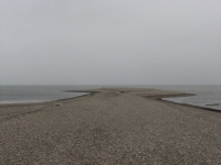
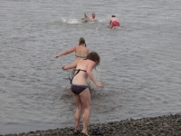
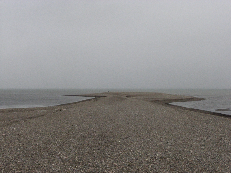
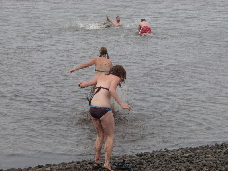
We ate breakfast at the Caribou Inn, then joined the 8:00 tour. There was a short film about the oil fields, then we got on a bus to tour the complex and drive out to the Arctic Ocean. Our guide, Chris, explained about the complex, the buildings, the attempts to minimize environmental impact and ensure safety, what its like to work there, etc. Then we drove out to the Beaufort Sea in the Arctic Ocean. A half dozen people stripped down to bathing suits and jumped into the cold mucky water. I waded ankle deep but Jim just stuck his hand into the icy sea. The water temperature was 38, the air 43, but the wind made it feel much colder. All would have been well except the bus couldnt back up. Evidently there was a rock stuck in the transmission linkage. We had to wait until a van and driver could be located to come pick us up. One of the girls who went swimming got really chilled waiting.
We got back to the hotel at 11:00, then drove to the General Store to check it out. It had a little bit of everything, from hardware items, to snacks, to gift items. We bought a couple of bumper stickers, including one about surviving the Deadhorse 500 aka the Dalton Highway. A thermometer made me laugh: If you dont believe that Hell freezes over, youve never visited Deadhorse, Alaska. As we left Deadhorse, I noticed the check engine light on. Not what you want to see when youre 500 miles from the nearest town. It didnt go off for another 170 miles. (We figured out later that it was probably mud on the sensor but it was a bit nerve wracking!)

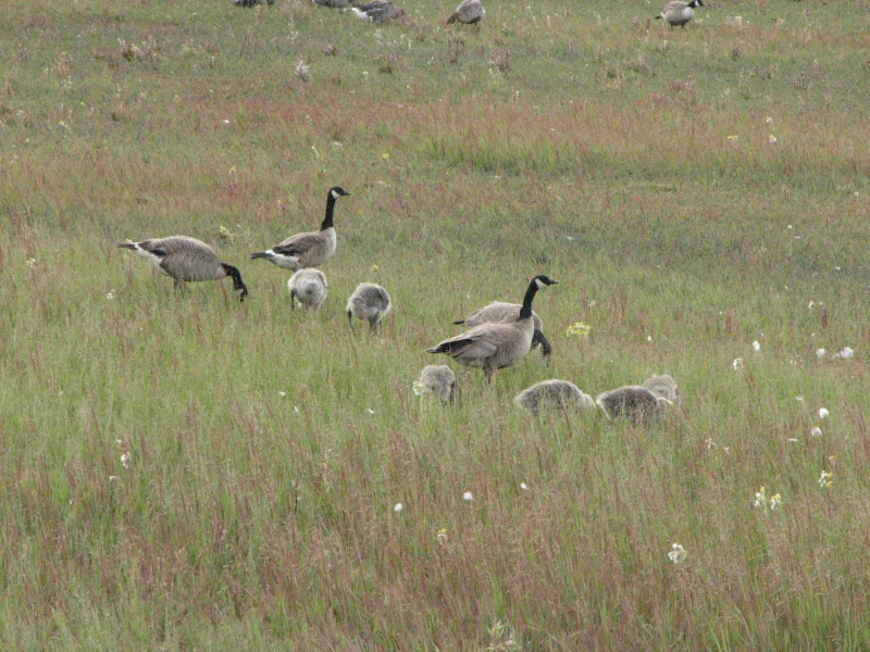
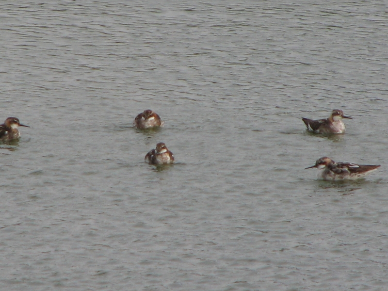
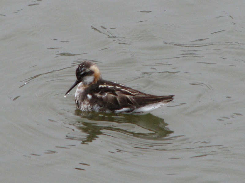
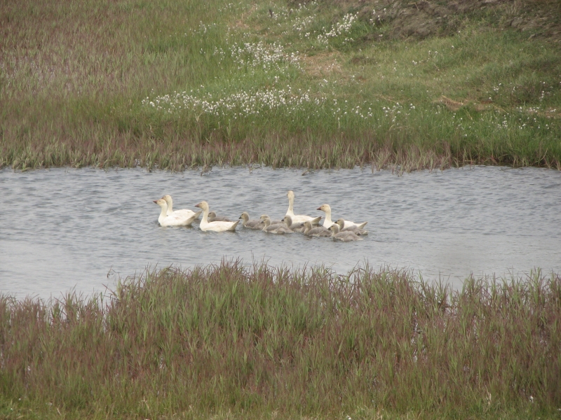
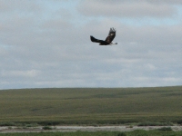
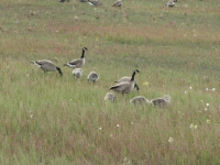
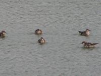
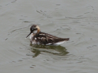
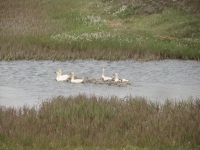
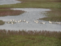
It was foggy all morning but the sun came out after noon as we began our journey south. Clouds remained, but it was warmer and brighter and the views were good. A couple of caribou crossed the road in front of us and the herd of muskox was still grazing by the river. We saw lots of birds: a golden eagle about 20 away, falcons, snow geese, snow buntings, gulls, terns, Canada geese, cackling geese, greater white fronted geese, and maybe red necked phalaropes. We have a bird book, but Im terrible at identifying birds, most of the time. A few are certain (i.e the buntings) and some are just guesses (the phalaropes). Its a really rich area for the arctic birds; I know some birders who would be really happy to visit up here. I enjoyed it, and Im just a beginner.

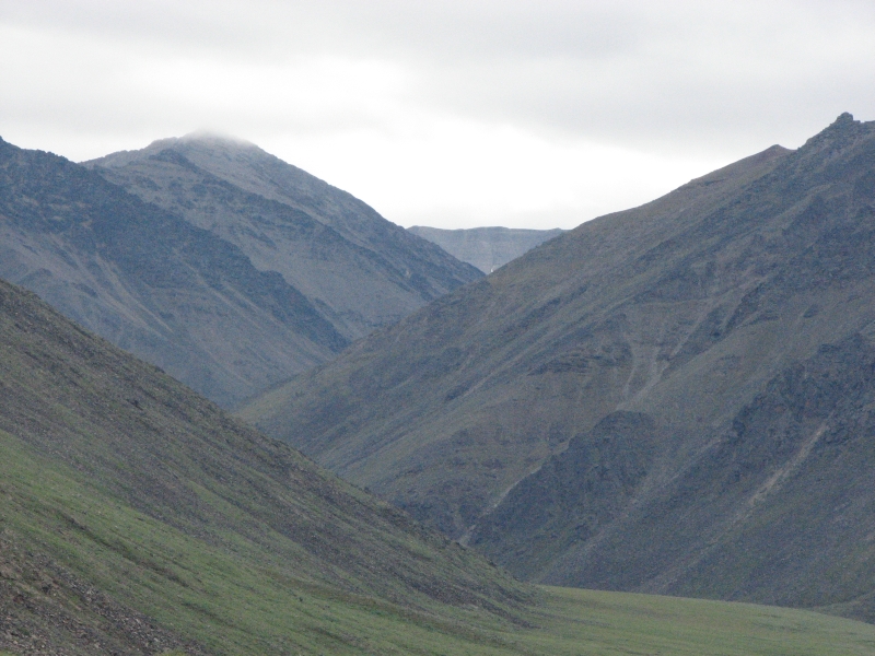
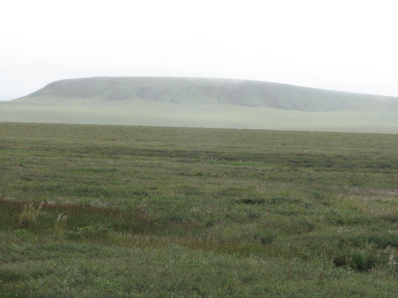
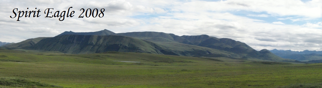
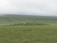
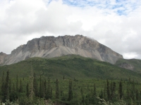
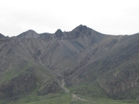
The rolling green hills of the north slope remind me of Wyoming or Montana, much wetter and greener, of course, but similar. Today we got to see all the beautiful country we missed yesterday because of the clouds. It was a gorgeous drive, especially in the mountains. The peaks were dark and jagged, looking volcanic in their coloration of black, gray and red with green and yellow lichen. There were many alpine flowers, a river of pink in some rocky streambeds. We ran into a brief shower at Atigun Pass, but the rugged mountains continued to impress. As a hiker, I itched to explore beyond the road. There are a lot of streams with intriguing valleys and rounded ridges of dry tundra that teased us. If it werent for Jims knees . . .
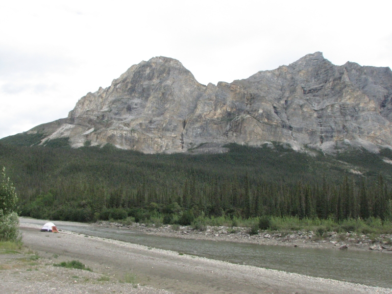
It rained on us as we approached Sukakpak Mountain, but when we passed it, the view was spectacular. One ridge had a pyramid and window that looked very like the ones in Colorados San Juan Mountains. They made us laugh.
We ended up back at Marion Creek Campground, in the same site we had two nights ago. It is a much better place to stay than the hotel parking lot in Deadhorse! It started to rain again while we were cooking dinner, so I ended up standing over the fire with an umbrella, fending off a gray Canada jay that kept diving down to steal bites of hamburger off the grill. He was very persistent and very bold. We did manage to get dinner before the rain put the fire out.
Sunday, July 20 Back to Fairbanks on the Dalton Highway
Dark clouds threatened, but we had much better weather than on the drive north. We stopped frequently to take photos of the massive mountains, the rocky alpine tors, the lake dotted valleys, etc. We even got out at the Arctic Circle this time to read the interpretive signs. We passed through a large burned area that was covered for miles in pink fireweed. It was gorgeous.
Im very glad we drove the Dalton Highway. It was really beautiful, all the way up and back. The driving was a mixture of very good and very bad. We were slow, but a lot of that was the fact that we stopped so often to look around and take pictures or scan the hills for wildlife. The many different kinds of birds --merlins, falcons, eagles, songbirds and water birdsadded to my enjoyment. The morning was filled with birdsong. There were a lot of oh wow, isnt this beautiful! moments over the past four days that more than compensated for worries about the car and the rough road.
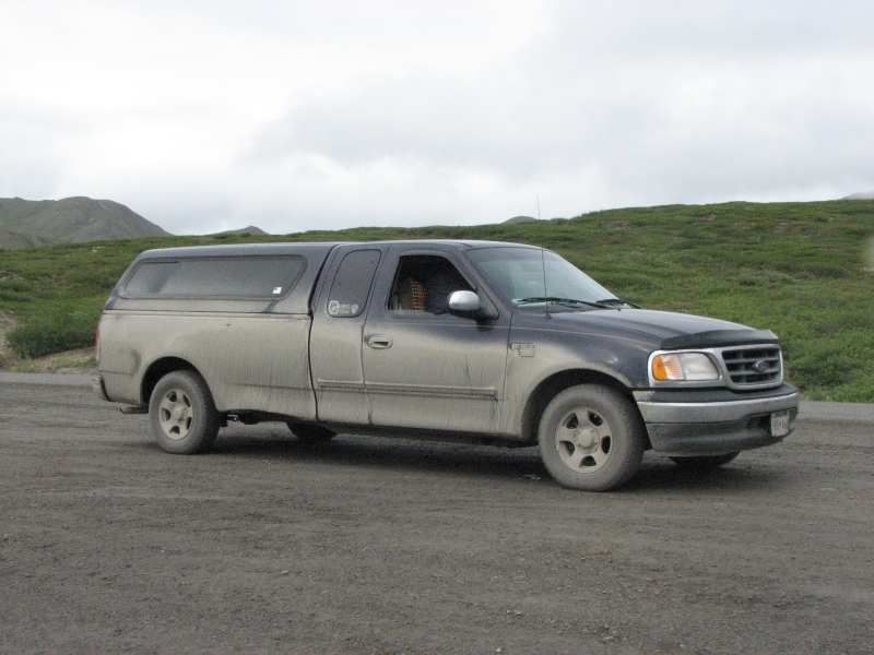
We could tell at a glance which cars were headed north and which south: the ones who had driven to Deadhorse were thickly coated with brown mud. We cant see out of the back windows any more. Our truck is now two-toned: brown on the bottom, blue on top. As far as I can tell, we only got one new window ding from gravel thrown up by passing trucks. We had been warned that it can be a real problem sometimes. I didnt actually think the truck traffic was that bad, and they seemed to be very courteous, for the most part.
We stopped for a huge and tasty burger at the Hot Spot, a small nondescript café a few miles north of the Yukon River, then continued south to Fairbanks. We needed a shower, badly, so decided to wait on our planned side trip to the Pinnell Mountain Trail. We ended up back at the Rivers Edge RV Park. Dinner was salad from the grocery store, then we washed some of the mud off the truck. It needed it. You couldnt get in or out without getting mud all over hands, legs, etc. We were carrying a lot of extra weight. The RV park has a hose which gets a lot of use as tourists try to rid their vehicles of mud and road salts. We did a quick and basic job since we are heading out again soon to other dirt roads that will just mess it up again. Plus there was a line of people waiting to use the hose, which made us hurry. But at least you can read the license plate again and see out the windows were legal.
Monday, July 21: Fairbanks
A low key day as were both exhausted from the long drive north. The Deadhorse 500 is a long drive. I cant imagine being a trucker, doing the drive two or three times a week. What took us two days takes them one but then, they dont stop for pictures.
I slept late so we went to Dennys for brunch followed by a two hour visit to WalMart to replace the tire that was damaged on the Dalton road. The puncture was on the sidewall so we were warned the patch probably wouldnt hold very long. We still have a long way to go this summer, so we decided not to risk it. We need a reliable spare, so we did a complicated rotation to get all the tires in the right places. A stop at the Post Office to mail home another box of books followed. We do read a lot out here. Since daylight continues at least until midnight, we have been reading much later than usual. Thank heavens for used book stores. Some RV parks have book exchanges, which is a much better deal, but it is harder to find books we actually want to read.

We spent an hour or two on the phone today. Jims ex-wife is very ill, as we found out via an email message from his daughter. Since were friendly, we wanted to know what was happening and how everybody is handling it. By that time it was mid-afternoon and we were still tired, so we decided to go back to the RV park and call it a day. I had planned to revisit the Museum of the North, but that would take more energy than we have right now. So would driving to the trailhead for the Pinnell Mountain Trail, so we decided to wait on that too. I went for a short walk near the campground and stumbled on several bushes covered with ripe raspberries. I ate some and brought a hatful back for Jim. Serendipity!
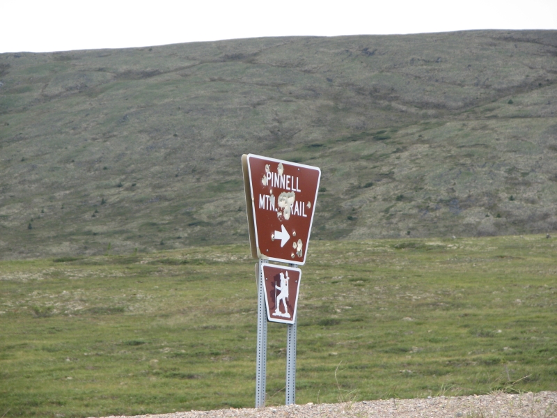
Tuesday, July 22: Pinnell Mountain Trail (9 ½ miles)
It sprinkled off and on last evening, but we woke to blue skies and sunshine. Time to go hiking. Pinnell Mountain Trail is a 27 mile linear alpine hike with a lot of elevation gain and loss as it follows the ridges. Its northeast of Fairbanks on another graded dirt highway. By the time we packed our packs, ate breakfast, bought ice and gas and set off up the Steese Highway, black cumulous clouds filled the sky. Oh well, we headed north anyway. The Steese passes through miles of rounded mountains that were largely burned in the big fires of 2004. It was (and still is in places) a huge gold mining district. Piles of rock tailings attest to past activities. There are several public gold panning areas as well as the more common fishing ponds, creeks and campgrounds. Traffic was very light, which could be a problem when we try to hitch back to our car after hiking the trail.
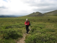

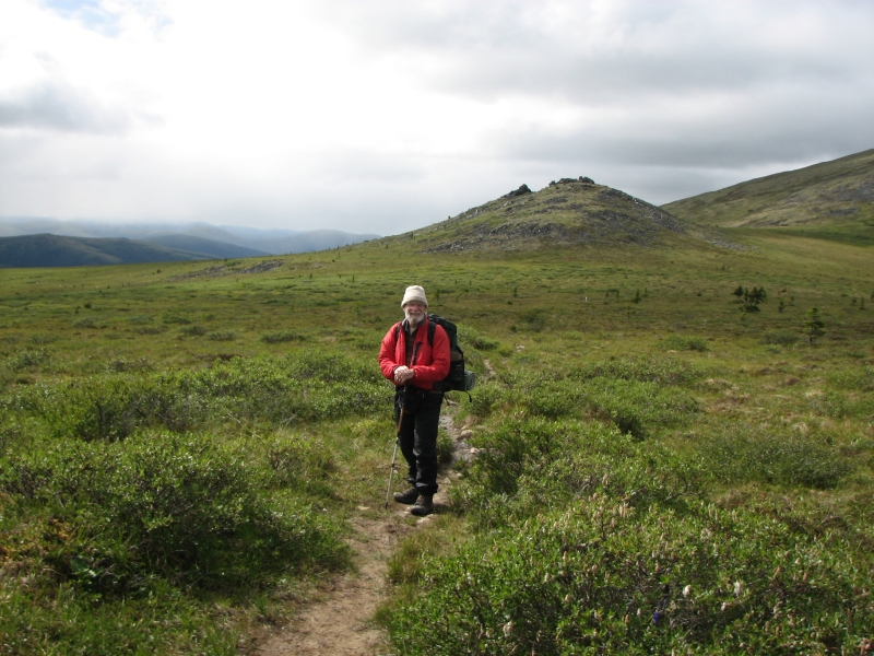
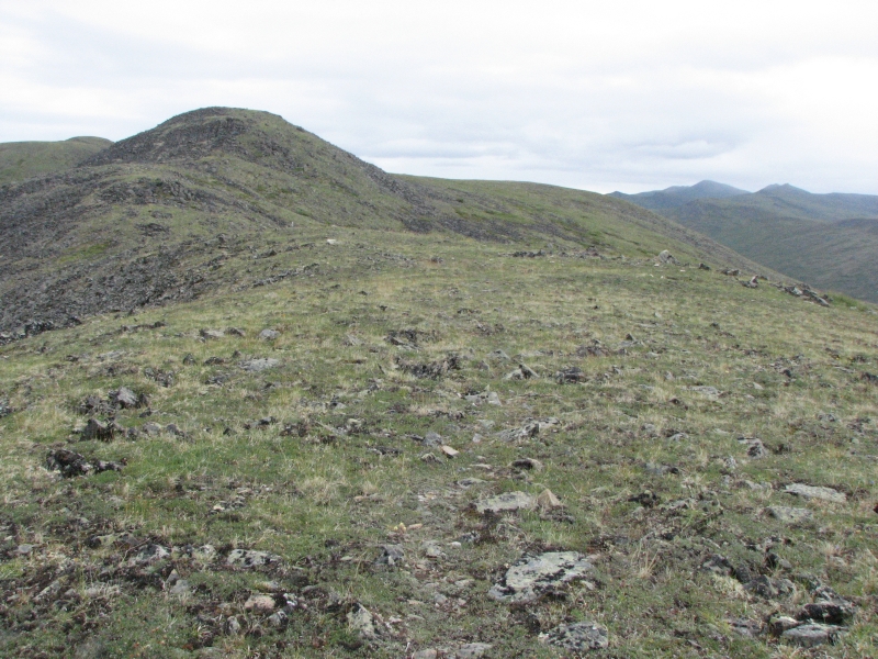
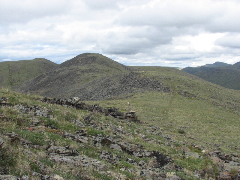
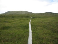
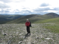
When we set off at 1:00 it was cold (44 degrees), gray and very windy. There are no trees to break the wind. We ate lunch in the warmth of the car and added some extra warm clothes to our packs. The trail starts out on boardwalk, crossing wet bog and climbing up to the ridge. The ridges reminded me of parts of the CDT, especially in northern Colorado: lots of rocks and talus slopes, some very faint trail, some easy trail, and open green ridges with views that extend for miles.
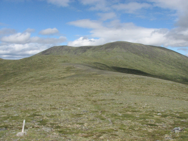
We walked almost 10 miles to a small closed shelter. The trail was in very good shape with lots of cairns, mileposts and well graded switchbacks. Even so it was hard walking, very rocky underfoot. Toward the end of the day we crossed a lot of talus and some wet bog. Alpine hiking isnt all green hills and wildflowers. We did see a wide variety of alpine flowers. Some I knew; some were unfamiliar.
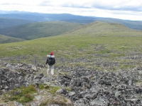
There was monkshood, lupine, two kinds of gentians (a purple one and a blue green one), yellow paintbrush, harebells, etc. We saw no wildlife except a few birds. The wind was constant but the sun came and went. We would warm up on the climbs then cool off on the descents, so our gloves were put on and off frequently. The jackets and hats stayed on all day, but our rain pants came off as soon as the sun came out. They were a necessity when we started out, not for the rain, but for the wind. It was cold! The trail was above treeline all day, out in the open. Views were good of green rolling hills and mountains all alpine.
Wednesday, July 23: Back to Fairbanks (9 ½ miles on the Pinnell Mountain Trail)
We hadnt planned to stay at the shelter last night, just cook out of the wind, but we were so cold that once we went inside, we really didnt want to leave the protection of the four walls. As it was, we changed into dry clothes and crawled into the sleeping bags to read and were still freezing. My fingers were white and numb. About 8:30 we shut the door and snuggled into our down bags and enjoyed the darkness. We havent seen much of that lately.
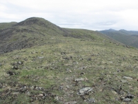
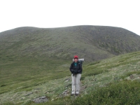
Despite a pretty sunset at midnight, by morning the skies were gray and leaden. (Whoever said, Red skies at night, sailors delight never visited Alaska.) The forecast was for rain. We decided wed rather walk the 10 miles back to the car than 17 miles out to the other end with a problematic hitchhike at the end of the day, especially if the weather turned nasty. Alpine hiking is fun and beautiful on a sunny day, but it can be dangerous on a wet or foggy one. It was the right decision. As we were climbing Table Mountain, it began to rain lightly but steadily. That lasted a couple of hours. About two miles from the car it stopped and the sun came out for a few minutes, but the respite didnt last. When we reached the car it began to pour.
We were both happy to be finished. The rough walking on the rocky trail was really painful and the up and down was killing Jims knees. Because of the clouds, we didnt have views to compensate, though we did enjoy the flowers and birds. A marmot was our largest animal. The shelter register was full of tales of the resident marmot that was trying to eat the shelter (and succeeding by the looks of it) but we never saw it. We did hear several marmots whistling from the talus and the occasional meep of a pica.
We went back to the RV park in Fairbanks for a shower and laundry, then to Brewsters for a good hamburger and beer. It rained off and on all evening. I was very happy we had shortened the hike. If wed gone halfway yesterday, it would have been different, but wed have had to either go 17 miles today in rotten weather or spend another night out on the ridge. Two nights in the cold and rain really didnt appeal.
Thursday, July 24: Fairbanks (3 ½ miles at Angel Rocks)
It was a beautiful warm sunny day, with an occasional sprinkle from towering black cumulous clouds. We started out with a visit to WalMart to get the tires balanced. We switched them around when we bought the new tire, but only the new one was rebalanced, so we figured the wobble when driving fast was the result of the switch. Turns out it was mud there were still mud clumps on the wheel, legacy of the Dalton and possibly the Steese, which was also a dirt road for much of the way.
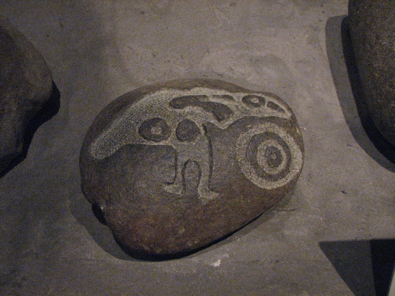
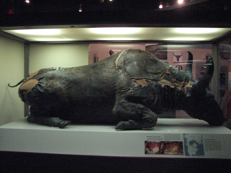
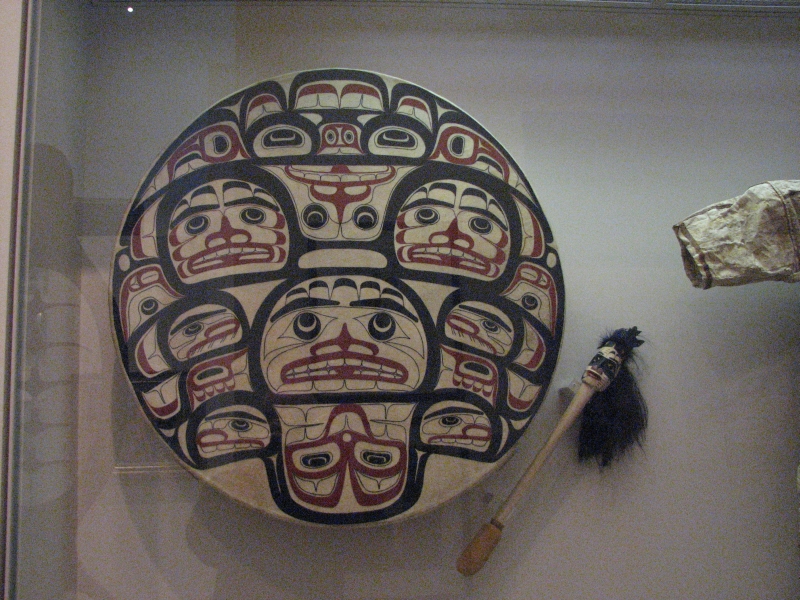
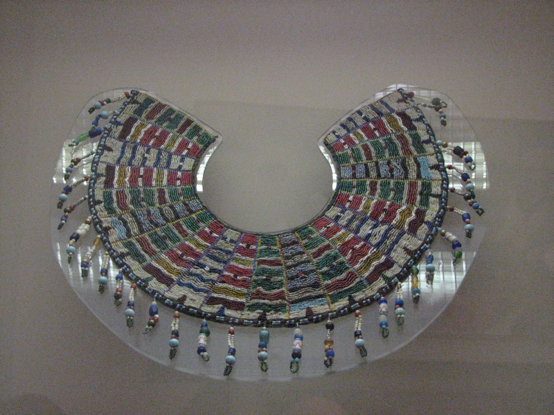
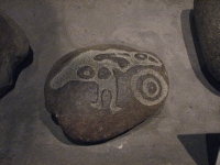
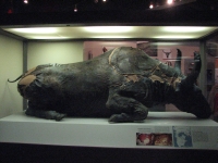
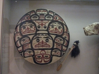
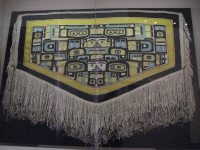
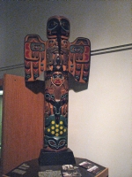
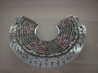
Finally we were able to revisit the Museum of the North at the University. We toured it last time we were in Alaska, but it is worth a second look. They combine modern and historic Alaskan art with historic and cultural artifacts as well as prehistoric animals (the Blue Ox) and wildlife. Its an interesting mixture.

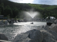
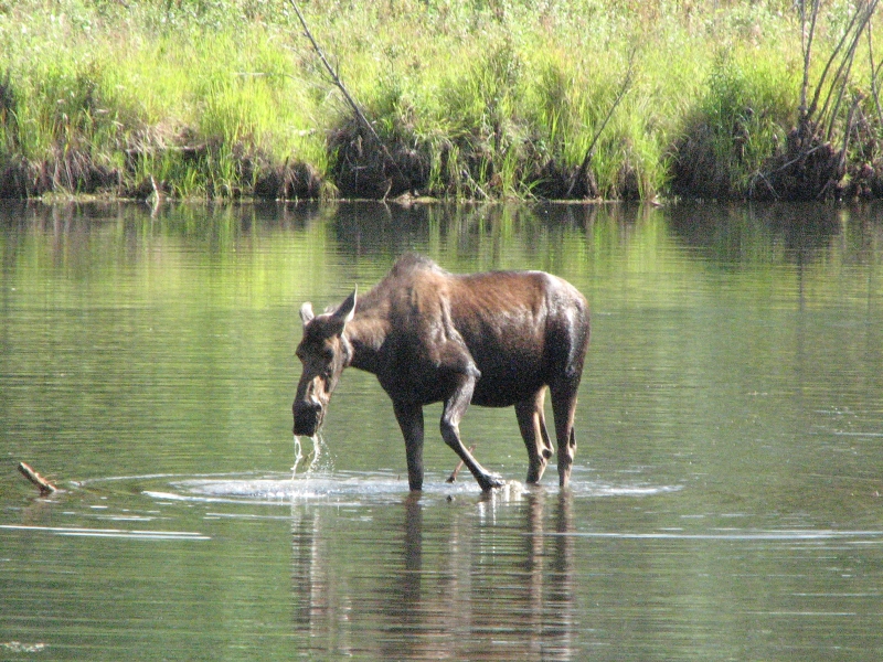
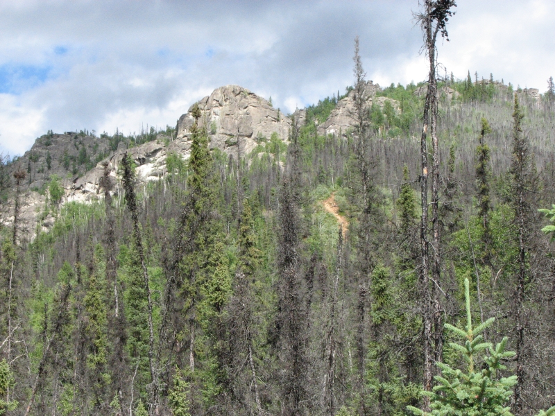
We thought we were leaving today, but I wanted to do one of the many hikes on Chena Hot Springs Road, a few miles from Fairbanks. There are several options, but we chose the easiest. It was a good choice: a short hike up to Angel Rocks, a set of granite tors with beautiful views. Its a steep climb, but a good (and popular) hike. On the way we stopped to photograph a moose cow in a pond beside the road. Finally we drove out to Chena Hot Springs to look around. It costs $10 to swim in the hot pool and we werent really in the mood so we just looked around at the resort then headed back up the road. Chena is a popular place, especially in winter. Only an hour from Fairbanks, you can sit in the pool and watch the aurora, if youre lucky. That would be very cool. The lodge is an expensive place to stay, though it does have camping too. We expected to camp at one of the state campgrounds along the road but it was very shady, wet and dark not very appealing today -- so we drove back to Fairbanks, ate lasagna at Pazzo Gs, a local pizza place, then headed to the RV park to see if we could get a site there one last time. Tomorrow we really are leaving, for sure.

Home | Links| Trail Journals |
The Thruhiking Papers | Bun-bun
Created: 1 Jan 2009
Revised: 30 Sept 2016Copyright 2009-2017 Spirit Eagle