|
 |
 |
 |
|
|
|
|
|
July 11-August 23 Great Divide Trail hike from Waterton to Jasper
From Glacier National Park, We turned North in order to hike the Canadian Great Divide Trail. Our journal for that six week hike can be found here:
Great Divide Trail Journal on the Spiriteaglehome.com website.
August 24 East Glacier
Back to East Glacier and a happy reunion with Charlie, our pick-up truck, after six weeks on the Great Divide Trail. Feels like coming home. (When you're on the road as much as we are, home IS the back of the pickup truck. It's a fairly comfortable home, all in all.)
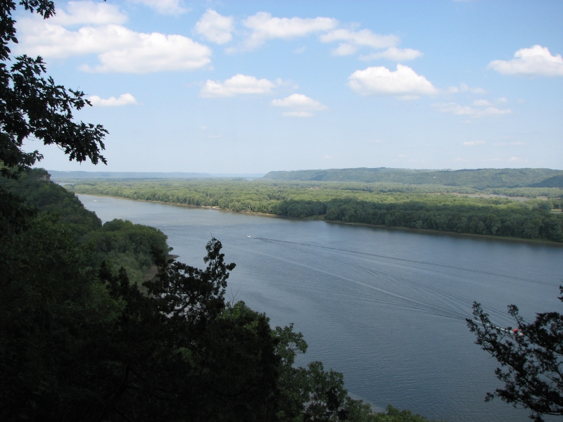
Were still (again?) exhausted. Yesterday was a tiring day. We left Jasper after lunch at 1:30 on a Brewster shuttle to Calgary. There is a Greyhound bus that is a bit cheaper, but it is longer and more boring since it heads north to Edmonton, then drops south to Calgary via the flatlands. Brewster follows the Icefields Parkway to Banff, then heads east to Calgary. It was a beautiful drive, though it rained off and on. I enjoyed the glaciers and ice fields, as well as some mountain goats and deer beside the road. We ate a very quick dinner in Banff during a 45 minute break - at the same pub that we visited when were here in 2003.

We had an hour-long wait at the Greyhound station in Calgary, then at 10:30 pm we started south to Pincher Creek on the bus. I was stiff and sore from the previous 8 ½ hours, so the 3 ½ hour ride felt like torture. At 1:30 a.m. we were dropped off in the sleeping town. Pincher Creek is the closest town to Waterton that the bus visits about 50 km north. We checked out five motels before we found one that had both a night clerk and a vacant room. They were actually in the middle of training a new employee, so we had lots of assistance. I gulped at the price, but beggars cant be choosers. It was either take the room or sleep in an alley, so we paid the ladies, staggered up to our room and crashed. Jim woke up early, so we didnt get to take full advantage of the room, but we enjoyed enough sleep to be functional, especially after a wonderful high pressure shower and a good breakfast at the hotel restaurant. Then we headed out to the highway to begin hitching across the border to East Glacier.
It was a cool sunny day, perfect for our needs. It took three rides, but all in all it wasnt a bad hitch and the people we met were very interesting. After only a 15 minute wait, a Canadian Fish and Game person drove us to the turnoff to Waterton. He was really fascinating, with stories of Kakwa, the Willmore, fire suppression problems and the abundance of bears near Waterton. It took an hour to get our next ride with a young Mormon who left Utah to work in New York in the hope of making a career as a creative writer. He brought us all the way to Kiowa Junction, where he headed east and we headed south to East Glacier. We stopped on the way in St. Marys at the Park Café for lunch and a terrific piece of pie. His family owns a cabin in Waterton, so he knows this area very well. Finally we stuck out our thumbs again and the first car along stopped and drove us the final 12 miles. She was a Glacier National Park employee. That was easy.
We spoke to Mark, got a room at the Whistling Swan, and were happily settled in before 3:00 pm. Now we can relax and figure out our next moves. More important, we can sleep in a familiar environment, which should eliminate our usual town insomnia. I hope.
August 26 1 ½ miles Camp near Little Bighorn
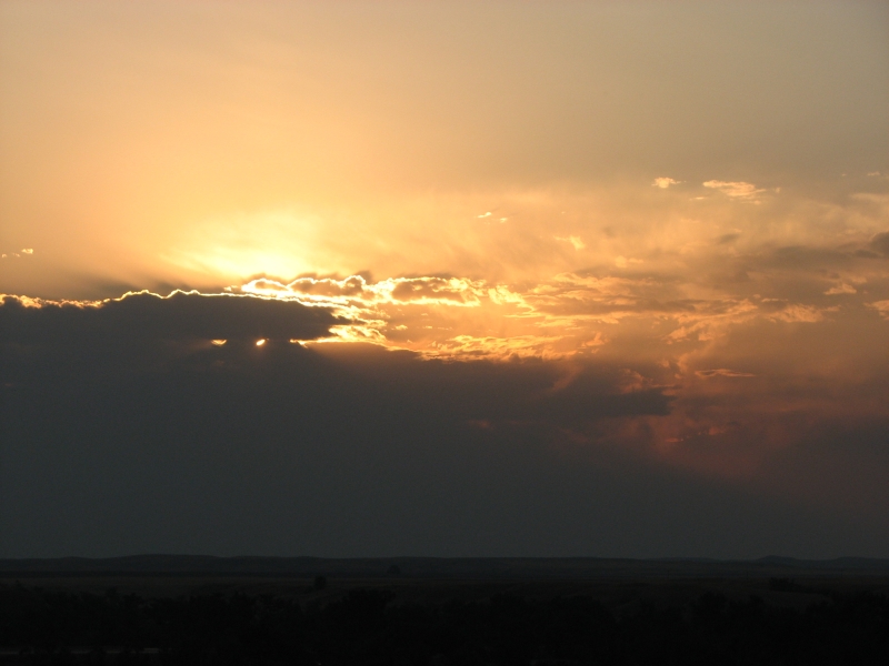
Two days of driving have brought us to the southern edge of Montana. We didnt leave East Glacier until noon on the 25th, then we stopped for a late lunch and some last minute groceries we forgot to pick up in East Glacier. Then we just followed Highway 89 south through the extremely dry grasslands, hills and flatlands to the Big Belt Mountains, where we set up for the night at a Forest Service campground. Montana is incredibly dry right now and in fact there is currently a Stage 2 fire ban making it illegal to cook our hamburgers in the fire pit. What do we do with the bag of charcoal we just bought? Oh well.
Yesterdays most interesting sighting was a ranch with buffalo, elk and camels. Say what? A farm for exotic meats perhaps?
There was a waterfall hike about a mile from our campground, so we started today with a short hike to two 20 falls. It was easy and surprisingly popular, given its location miles from the nearest town.
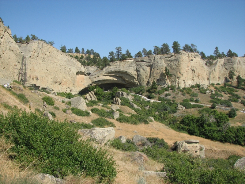
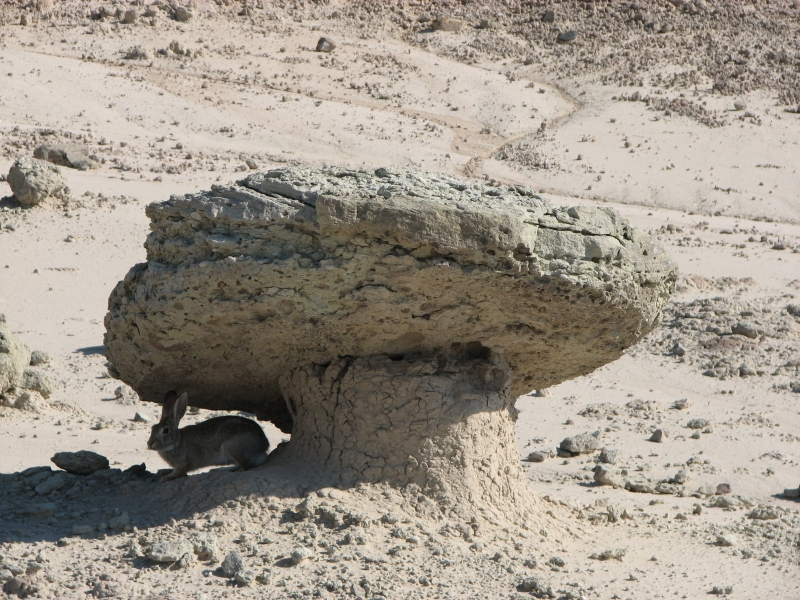
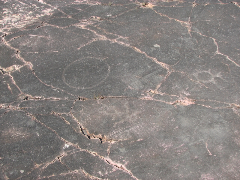
We reached Billings in time for another late lunch, then headed out to Pictograph Cave. The state roadmap wasnt clear about the location, (it was shown between two roads, not directly on either of the two) so we ended up doing about 20 extra miles wandering through the hills in search of the state park. It was a massive disappointment. We had visited the park before, when we hiked the Beartooths in 2002. I hoped that this years experience at pictograph viewing would help us see the faint images better than we did last time. Weve gotten pretty good at seeing faint traces of carving on rocks. No such luck. Faded paint is even harder to see than worn rock. Only the modern images showed at all (guns and a horse). None of the older paintings was even remotely visible. When they excavated 80 years ago they must have taken photos, so they know what used to be there, but none of the black images is visible now.
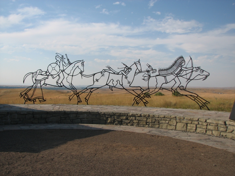
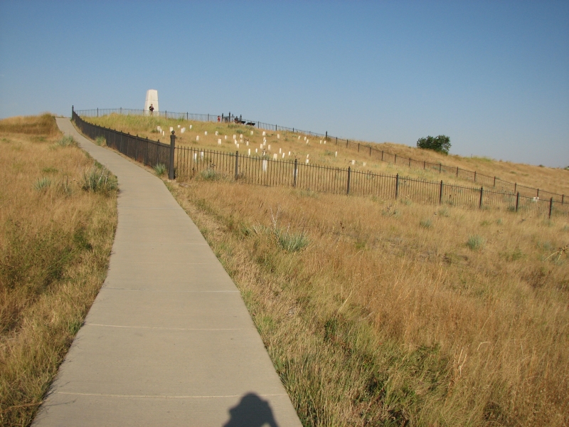
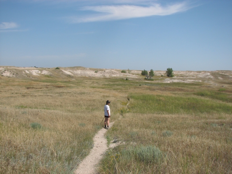
From there we drove an hour east to Little Bighorn National Monument. That was interesting. I had read books and seen movies about Custers Last Stand, but it was more interesting to see it in person and read the signs to get an idea of what happened there. They used quotes from both the cavalry and Indian eye-witnesses, which made it come alive. Its a beautiful area, if you like rolling grassy hills (and I do.)
We ended up at a campground a few miles away that has hot showers and WIFI. Weve had no telephone access since Canada, but email we can get. Odd.
I enjoyed the drive down the back roads. Montana is such a beautiful state, even in drought conditions.
August 27-28 Rapid City and Custer- 2 ½ miles

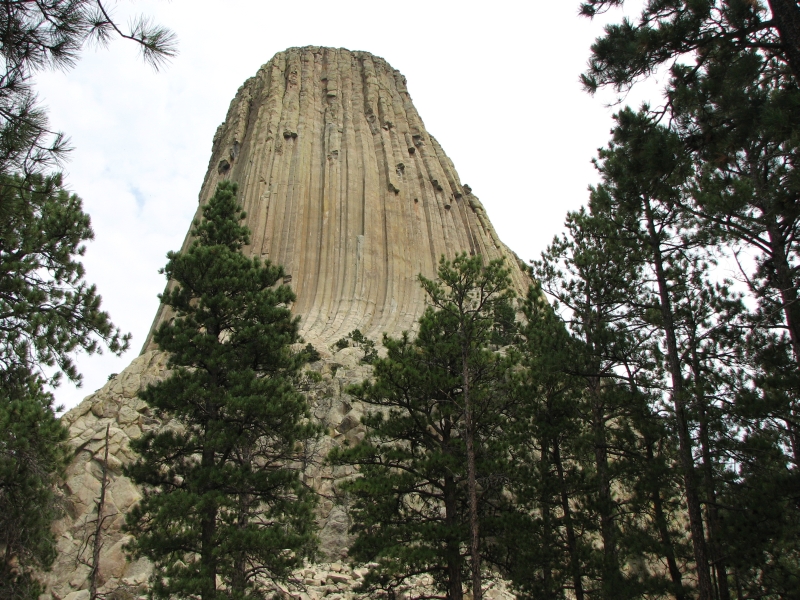
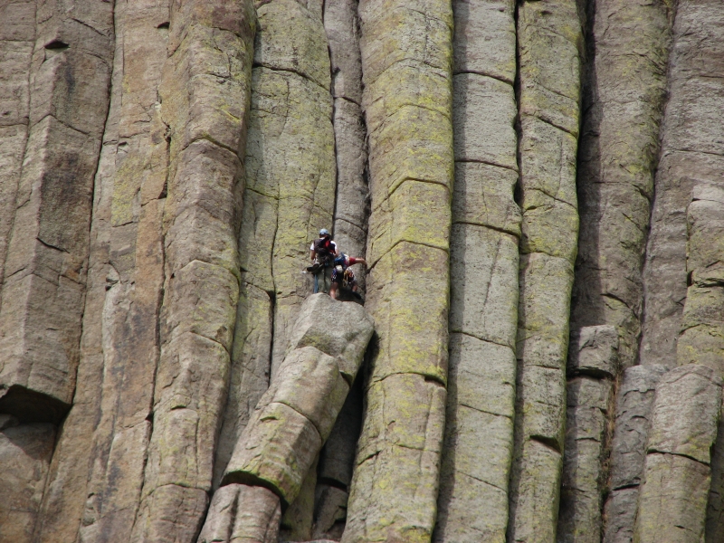
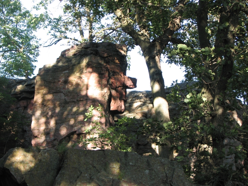
It has been an interesting couple of days as we began a brief exploration of the Black Hills region. I wanted to see Devils Tower, so yesterday we drove out of our way to visit it. It was worth the detour. We walked the 1 ½ mile trail around the base and spotted several climbers on the mountain.
It is a sacred site to the native people, and I can certainly understand why. The columns look like those at the Devils Postpile on the John Muir Trail, but are igneous intrusions of porphyry, not basalt. It was much bigger than Devil's Postpile.
Out of curiosity we drove through Sturgis, home of the worlds largest motorcycle rally. Fifty weeks of the year, its just another small ranch town, but for two weeks or so things get very lively. I'm glad we're too late for the rally though I think it's probably a lot of fun if you're into bikes and don't mind crowds.
Deadwood was a disappointment, just one casino after another, an expensive tourist trap. We drove through without stopping. I dont know what I expected, something a bit more mellow, I guess, like Tombstone or Bisbee in Arizona. We ate dinner in Rapid City and camped at a nearby RV Park. It was quiet.
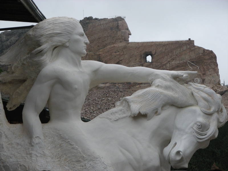
This morning we woke to a light drizzle. We had intended to see Jewel Cave, so we decided to skip Mount Rushmore this morning and head west. It doesnt matter what the weather is outside when youre underground. We did stop on the way to see the Crazy Horse Monument. When we arrived it was buried in clouds, but they lifted while we were watching the orientation film. It is an immense project, carving the huge image into the mountain. I wonder if it will be completed in my lifetime. I doubt it. Progress seems very very slow.
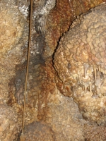
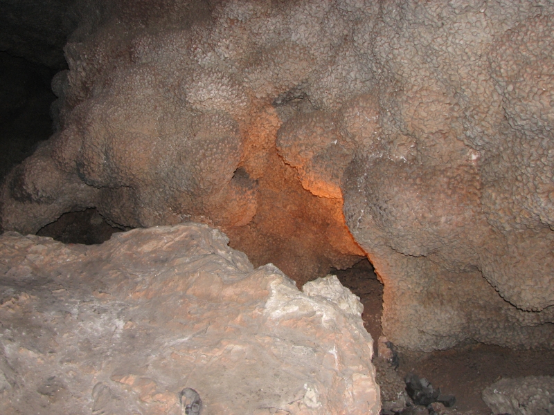
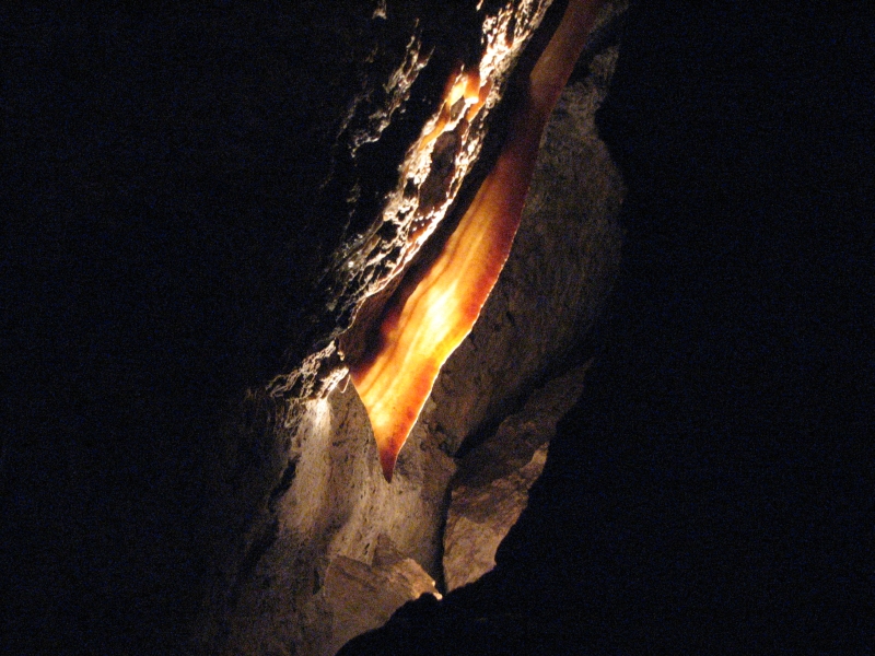
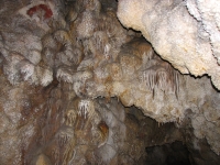
Jewel Cave was really good. Its not as spectacular as Carlsbad or Lehman, but it still had some really nice cave decoration, especially the calcite crystals that line the walls. It was like being in a giant geode. One area has standard cave decorations: stalactites, stalagmites, soda straws (one was 3 long!), draperies, etc. It was beautiful. Most amazing of all, as we were waiting to go in I was tapped on the shoulder. When I turned around, I saw Mark Hudson, an old friend from the AT and ALDHA, who was in South Dakota hiking the Centennial Trail. We spent the rest of the afternoon with him, talking about hiking, etc. That was a wonderful surprise.
Jim and I ended up in a motel in Custer for the night. The pizza we ate for dinner was not great, but the pie at the purple pie shop was quite good. (Just not as good as the Park Café.)
This area is very touristy. There are lots of motels, campgrounds and family activities, aside from the State and National Parks and Monuments. The towns are surrounded by National Forest so there is a break from all the tourist traps grassy hills, trees and wildlife.
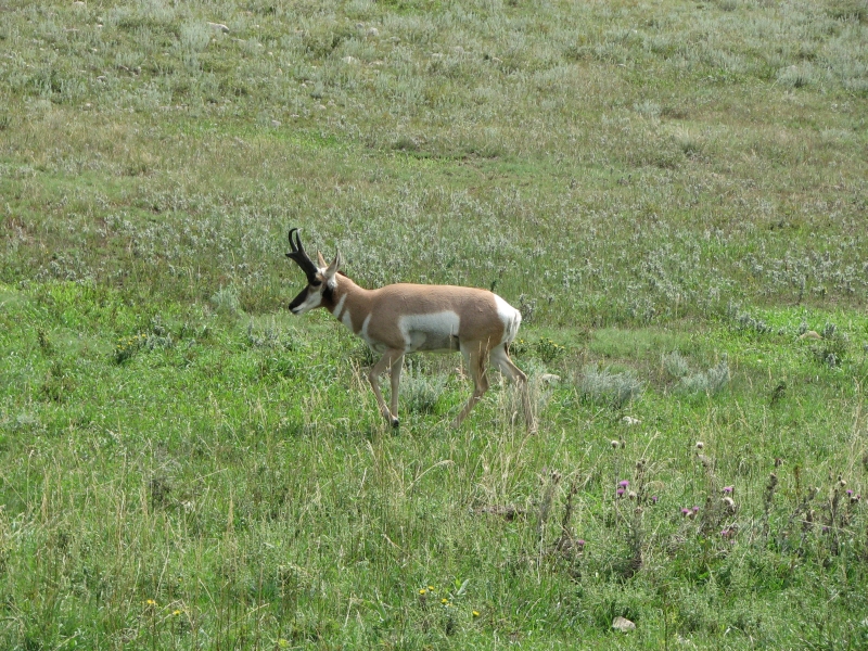
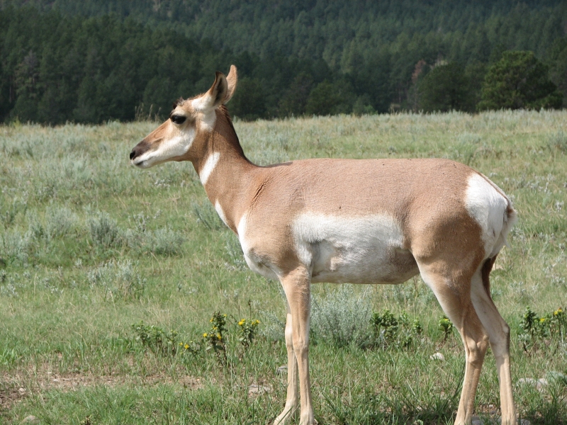
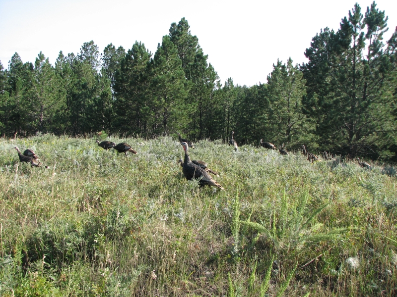
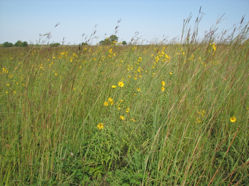
Weve seen several deer, dozens of antelope, turkeys and hawks in the past two days. There were also prairie dogs and deer at Devils Tower. It is good to be seeing wildlife again. That was my biggest disappointment with the GDT: we saw few large animals, especially compared to the CDT. We saw more animals in 30 miles of the CDT this summer than we did in 560 miles of the GDT.
August 29 1 mile Motel in Rapid City
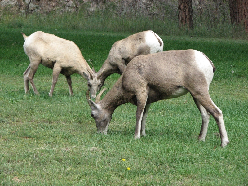
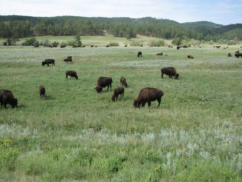
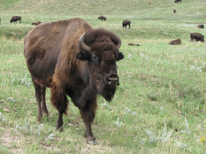
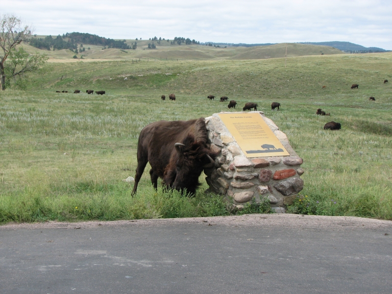
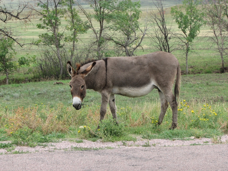
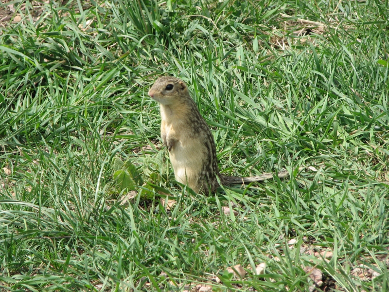
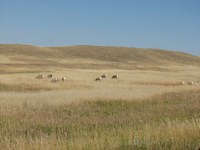
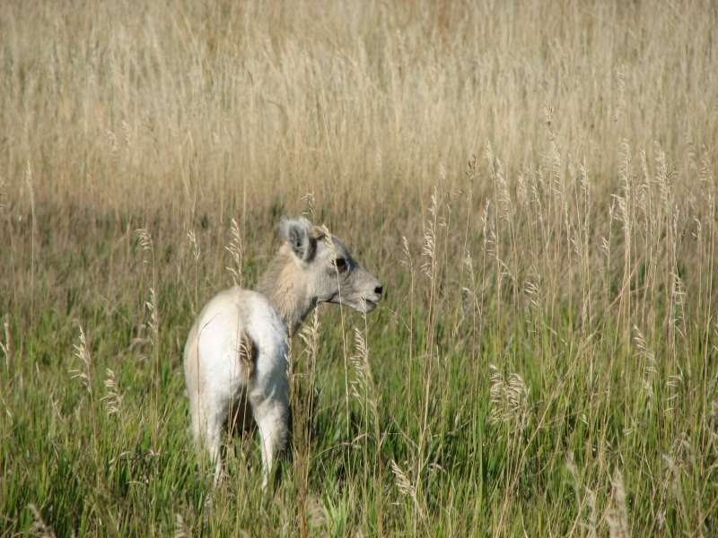
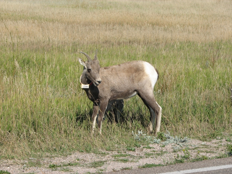
We had a really good day wandering around the Black Hills again today. We started by doing the Wildlife Loop, a scenic drive in Custer State Park. The road twisted and turned, but was fun to drive. There was a lot of wildlife today. We spotted two herds of bighorns, four flocks of turkeys, two herds of wild burros, hundreds of antelope and even more bison. The land is rolling hills and grasslands, ideal country for the buffalo. There were also lots of prairie dogs, a couple of Thirteen Stripe Ground Squirrels and a few deer hiding in the woods.
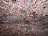

From Custer we drove a few more miles to Wind Cave, which has an interesting and unique formation known as Boxwork a lattice web of calcite. There was a little crystal and some popcorn, but on the whole it was a less interesting cave than Jewel. However, the guide was good and made the on-going exploration of the cave come alive.
The cave is an incredible maze, with five to eight exits from some of the large rooms. So far theyve mapped 125 miles of cave, about 5% of the probable total. By contrast, Jewel Cave has 140 miles of explored cave corridor so far. Again, only a small portion has been explored. Park employees are not the ones who explore the caves, except on their days off. It is all done by volunteers. The cave systems are very different though. Jewel Cave has only one entrance and few connections between the chambers. To explore, spelunkers must do overnight trips after passing through a really tiny opening. Wind Cave doesnt require overnight trips, not yet. But it is such a maze that it is easy to go in circles. I have no real desire to become a caver, but Ive enjoyed the caves weve visited and I like learning about the differences between them. Jewel and Wind Cave arent that far apart, but they are very different.
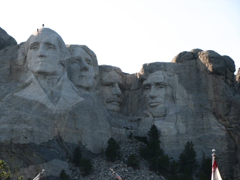
Late afternoon we headed for Mount Rushmore. The light wasnt optimum, but the faces were still impressive. We watched a video explaining how it was carved and why, then did a short walk to the base of the cliff where we could look directly up at the four faces. There were two park employees inspecting the sculpture. It was very odd to see people walking over George. Eventually, we ended up back in Rapid City, got dinner at Outback, and retired to a motel next to the freeway. It was a good day.
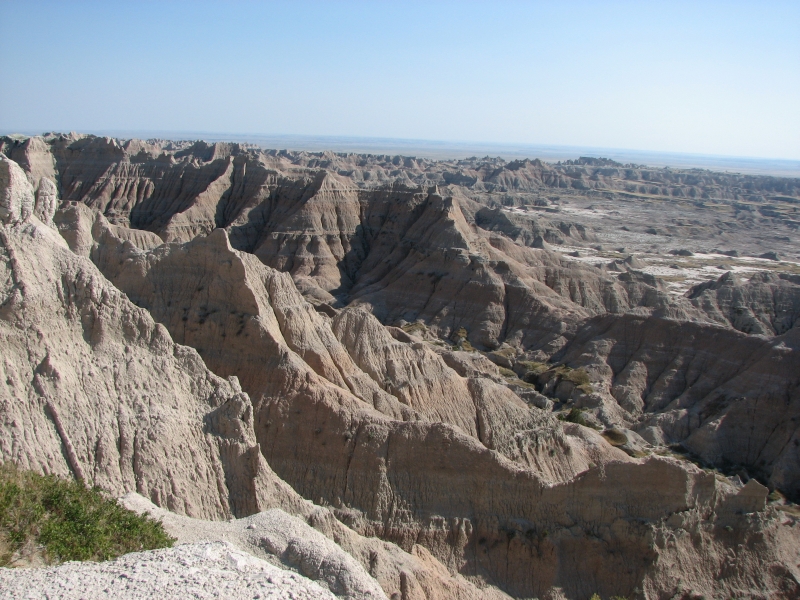
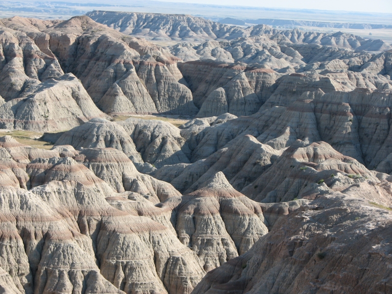
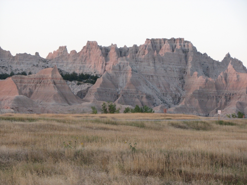
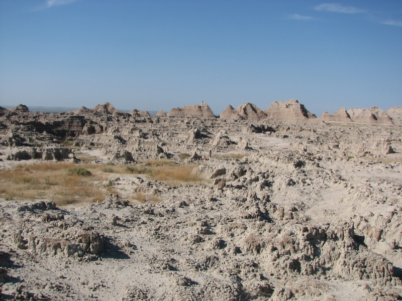
August 30-31 10 miles in Badlands National Park
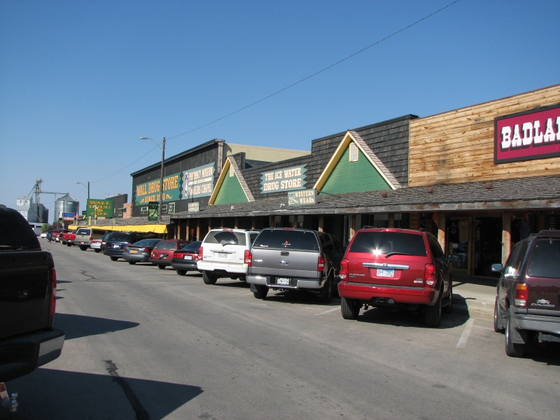
The past two days have been spent doing chores, driving and visiting the Badlands. We also stopped at Wall Drug, an overgrown drugstore/tourist trap along the freeway. After seeing all the signs for 100 miles, we had to stop, but it was even worse (more crowded) than I expected, so we visited the book store, ate an ice cream and then left.
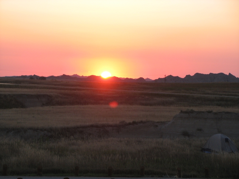
I really enjoyed the Badlands. We started driving through the park late in the afternoon, stopping at overlooks and admiring the colorful eroded hills. We passed a large herd of bighorns, but didnt see any bison since theyre in a different section of the large park. We settled into the campground and watched the sun set and the shifting shadows on the mountains. It was beautiful.
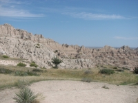
This morning we hiked the Castle and Medicine Root Trails, 10 miles through the eroded landscape. It is beautiful country, with red and white striped ridges in weird shapes, rolling grassland with cactus and wildflowers. What surprised me was seeing small pools of water in the washes and cottonwood trees. I didnt expect to see water in the Badlands.
There were meadowlarks singing, rabbits hiding in the rocks, a couple of chipmunks and seven other hikers exploring Badlands longest day-hike. It was hot, about 90 degrees, but there was a little breeze that made it bearable. After being chilled the last few days in Canada, the heat was a bit of a shock. The trail goes out to a short fossil trail that gives examples of some of the many mammal fossils from 28-35 million years ago that have been found at Badlands. Evidently it is a very rich area for paleontological discovery. Theyve found ancient horses, turtles, rhinos, cats, hyena-like animals, etc. No dinosaurs though, since the area was under water when dinosaurs roamed the earth.
Afterwards we headed east on the freeway past grassland prairies, farms and ranches to the Missouri River where we stopped for the night. It was really hot (95 degrees) and after the hike this morning we needed a shower, so we got a motel instead of camping. Last night the weather was perfect. Today camping didnt appeal, especially the idea of cooking dinner in the heat.
September 1 1 mile at Pipestone NM
We continued to drive east along I-90. It was actually a rather pretty drive as it passes through green well-watered country. I like driving through farm country, with its lush green pastures and grazing livestock. Our goal was Pipestone National Monument in Minnesota, a place where Indian tribes have quarried a red rock called Catlinite for the past 300-400 years to make ceremonial pipes. The rock was named for the artist George Catlin, who described it when he visited the area in the 1830s.


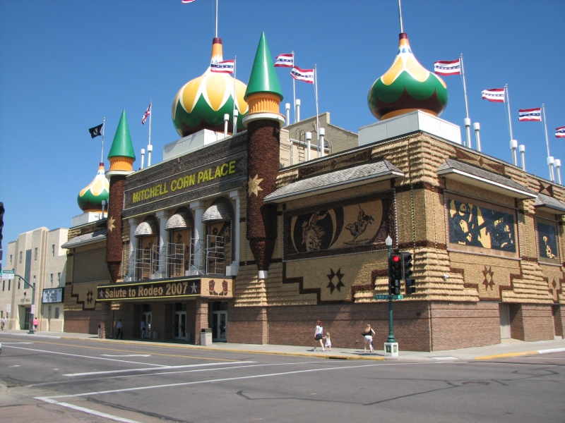
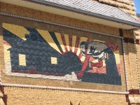
On the way to Pipestone, we stopped at Mitchell, South Dakota, home of the famed Corn Palace, a large building that gets redecorated every year with murals and designs made out of corn cobs in eight different colors. It was quite cool. They havent finished putting up this years murals so we could see how it is done: a paint-by-numbers drawing is done first, with notes red, tan, black, blue, etc. Then the corn is attached in the right spots. The inside of the building is rented out for basketball games and shows. There were photos inside of all the past versions since 1892, when it all began. I enjoyed seeing the changes in the building itself and the many different themes used along the way. The theme this year was rodeo.
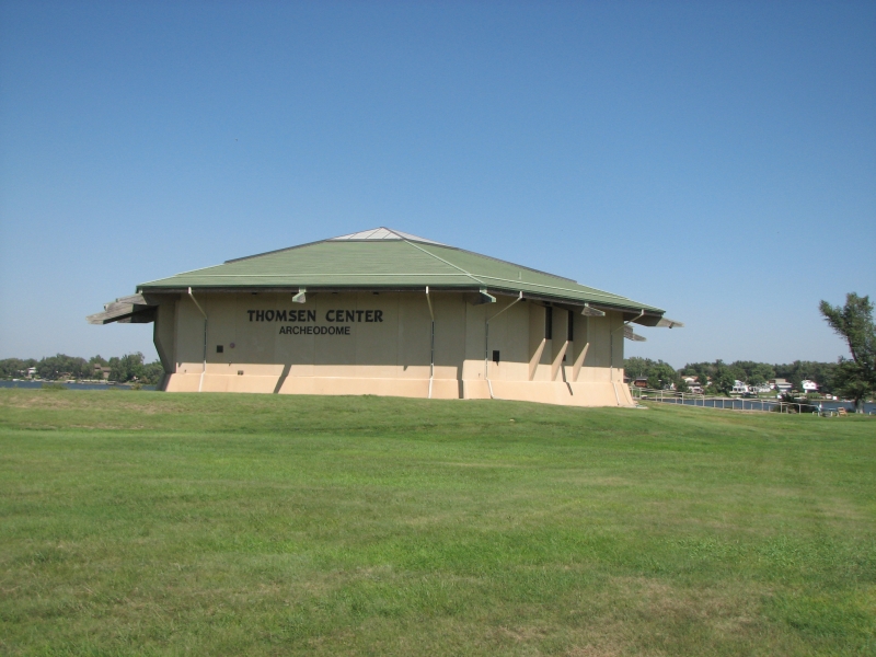
Mitchell also has a very interesting prehistoric (1000 AD) Indian village that contained about 80 lodges. Inside an archaeodome you can see the excavation in progress. They work on it for a few weeks every summer, so it is a long term project. They have found millions of artifacts so far at the site. The guide was a good one who obviously loves his job.
Sunday, September 2 1 mile
It was a good day, made better by the fact that it could have gone quite badly, but we got lucky. As we were heading to Jeffers, Minnesota Jim noticed that the battery light was on. He tried to fix it by cleaning corrosion off the terminals and adding water, but it didnt help, so we stopped at the next big town to look for a garage. Sunday afternoon, on a holiday weekend (Labor Day), is not a good time to look for a garage. Everything was closed. We tried the next town, with the same result. Eventually we reached Austin, MN. We drove through town, passing closed garage after closed garage. However, there was an auto parts store that was open. We stopped and they hooked the car up to a machine that tested the alternator, which evidently wasnt working at full power and needed to be replaced. Then the clerk went inside and started calling around, looking for a garage that would install it. Jim knows how, but doesnt have all his tools with him. One of the clerks found a friend (cousin?), a certified mechanic in a nearby town, who was willing to install the new alternator. So at 6:00 pm on Sunday night we drove 15 miles to his home garage, sat and read while he fixed the car, and drove back to Austin.
We were in a motel by 7:15. Whew. As we drove today, I was really scared we would end up stranded on the side of the road with a dead car. Been there, dont like it. We got lucky. Given the holiday weekend, I thought it would be Tuesday before we got the car repaired. Austin is a nice town, but not one Id want to spend two days visiting. (I wonder if the Spam museum is open on holidays?)
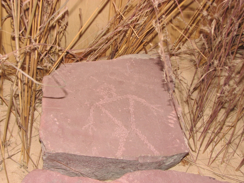
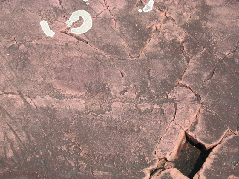
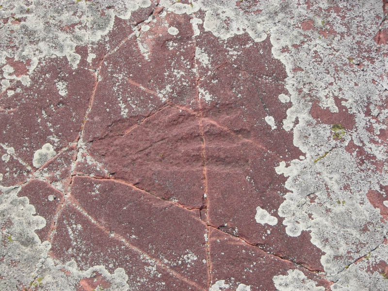
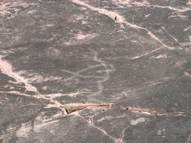
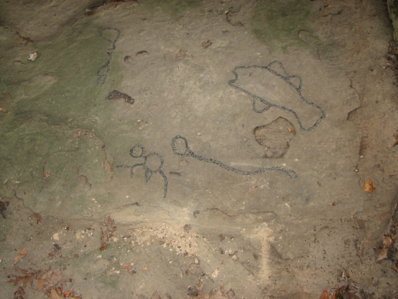
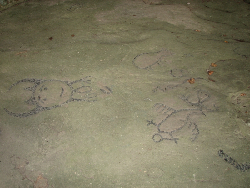
This morning was much better. We drove to Jeffers Petroglyphs site, where a 100 yard reef of red Sioux quartz has been inscribed with 2000 petroglyphs. We couldnt see that many, as they are very faint and the light was wrong, (best time to see them is at sunset), but we did see turtles, human figures, atlatls, thunderbirds, snakes, bison, etc. It is also a park that preserves native grasslands, which were very lush with many wildflowers. We spent three hours wandering around, looking for carvings and admiring the flowers and tall grasslands. It was fun, though a bit frustrating trying to figure out what we were seeing. Some petroglyph sites are very easy and obvious. Sandstone covered with black desert varnish is easy. Those with hard rocks are much harder to decipher. You see faint scratches that could be deliberate, or could be the movement of glaciers over the rock. Since you cant touch the rocks, you can only use your eyes, not your sense of feel to tell where the carvings are located. My eyes arent that good any more.
September 3-5 Dubuque, IA and Decatur, IL 3 miles at Effigy Mounds
Yesterdays highlight was an overnight visit with an old AT friend from 1992, Dick a.k.a. Magpie. It was really fun to spend time with him and his wife, Dorothy. We hadnt seen him since 1994.
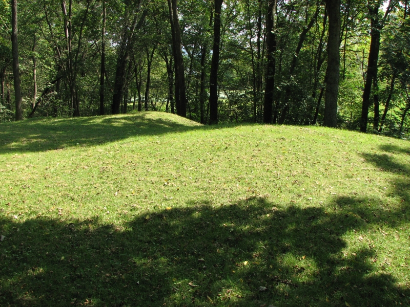
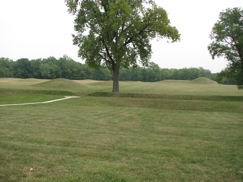
Traveling across Iowa and Illinois, we made two tourist stops: Effigy Mounds and Dickson Mounds. Both were ancient Indian mound sites.
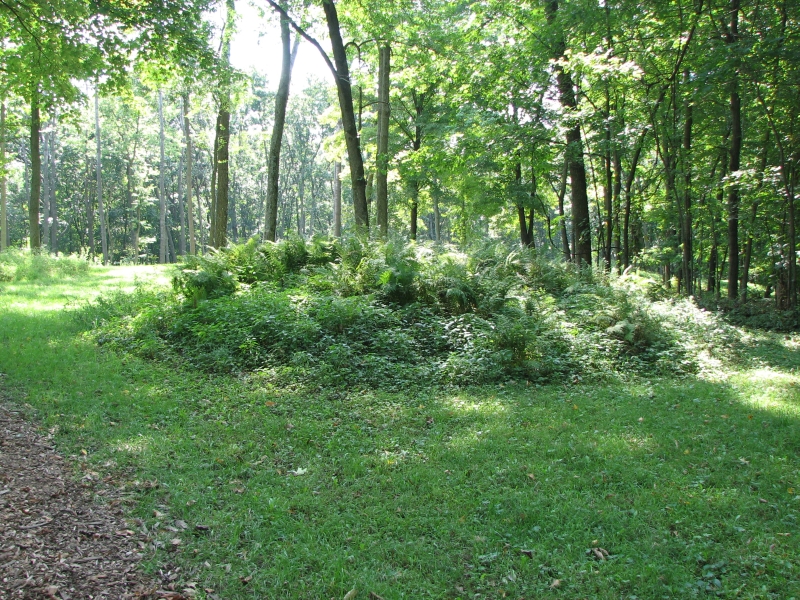
Effigy Mounds was a good stop, since we could walk among dozens of the mounds, some round or rectangular, some in the shape of bears. Evidently they also built some in bird shapes possibly totems or clan animals? It was a nice hike, but very hot. We hiked the northern section and would have liked to visit the southern section as well, but we didnt have time to walk another 4-8 miles.
Today we headed south to Dickson Mound Museum, Dickson had a decent museum, explaining the history of the area and the people who built the mounds 1000 years ago. Most of the mounds are long gone.
Then we headed east on back roads to Maroa, IL, where my mothers grandparents lived. We stopped at the library and found out where the Crocker house was located and where the cemeteries are. We took a quick look around, didnt find what we were looking for, and decided to get a room in Decatur and try again in the morning. We tried one motel, but left because it was just too weird. We watched the interactions of the clerk with two people ahead of us and decided it was not a good place to stay.
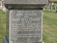
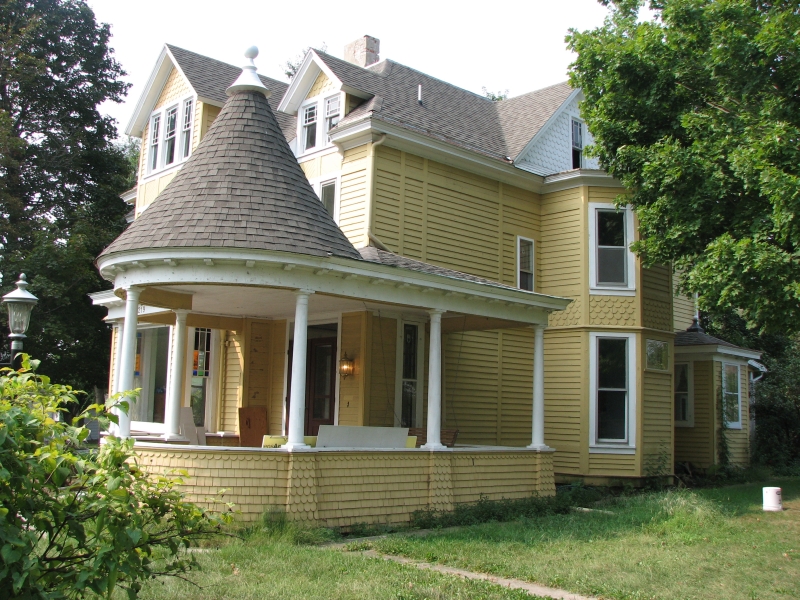
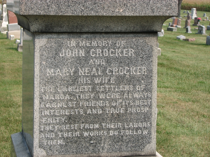
The next morning we returned to Maroa, bought a book on their 150th anniversary celebration that had some photos of various ancestors of mine, as well as a couple of houses where they lived, found the person responsible for the cemeteries who was able to tell us where the Crockers lie buried, and visited the graves of some of them. I thought my grandparents might be there, but didnt find them, just the great-grandparents and great-great-grandparents. It was interesting though, learning a little about the family history that I didnt know. My mother used to tell me stories about her family. In visiting Maroa, I felt close to her. I do miss her. I wish I could have told her about the visit.
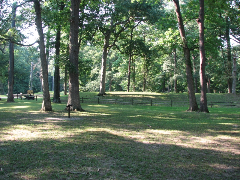
Our next stop was at Mounds State Park in Indiana where we did a short 2 mile hike past several small scattered mounds. We had to pay for that one, but it was worth it, just to get out and walk for a while in the cool shady woods on a hot and humid day. The mounds look something like a donut with a central platform surrounded by a ditch, surrounded by a low earthen wall.
September 6 - Ohio to West Virginia


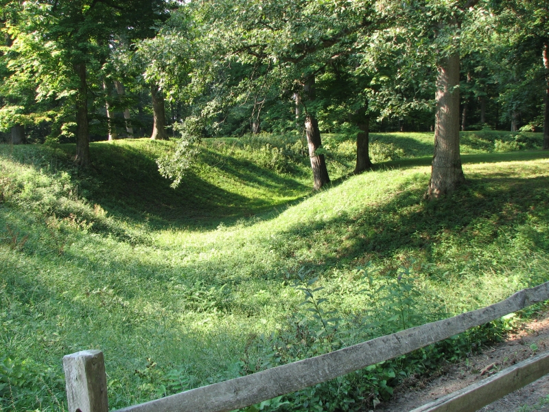
More prehistoric pilgrimages today, this time in Ohio. There are a lot of mounds in the area of Chilicothe, some of which were protected as a National Monument. Hopewell National Monument has several separate units, but we stopped at only one, Mound City.
One of the things I find interesting about the mounds is that each of the sites weve visited is different from the others. This one had several mounds of various sizes and shapes within a large earthenwork wall. Yesterdays mounds had a single large mound inside a wall, with a ditch between the two. Effigy Mounds had some in the shape of bears and birds. The ones on the Natchez Parkway were a huge platform. They vary in age from 2000 years old to 1000 or so and the people who built them were from very different societies: Adena, Hopewell, and Mississippian. They were complex societies much more than I had realized. There is a huge complex near St. Louis Id like to visit called Cahokia Mounds, but it was too far to drive this year. I wonder if there was a South American influence? After all they traded as far as the Gulf of Mexico, a few refugees from the big pyramid building civilizations might have come north and suggested the idea of building mounds as ceremonial platforms. Some mounds were ceremonial, some were burial sites. Some were both. Supposedly there used to be about 200,000 mounds in the Eastern U.S. Most were destroyed by farms, roads and town development, but hundreds of the mounds remain visible. They just arent all that obvious. In hilly country, a green manmade mound is practically indistinguishable from a natural rock mound.


Afterwards we drove 30 miles south to Leo, which has several petroglyphs carved on a slab of sandstone. They protect them by fencing them off and putting them under a roof, but they also used paint to highlight the carvings. Not good. There were several large pictures: a fish, a bird, a mask, person, etc. Afterwards we walked a short nature trail into the nearby gorge that was undoubtedly the reason the Indians came to this spot in the first place. We drove on to West Virginia for the night. Its pretty country.
Only one more day and well be back in Maryland. It is hard to believe this journey is almost over. I really hate to see it end. But winter is coming, so we will stop wandering for a while.
Afterword:
We made it safely home to Crofton. I dont know what comes next. Well spend the next few weeks getting a couple of slideshow presentations ready for the Gathering, but then we have to decide where we want to spend the winter and what we want to do next year. We may go back and fill in some of the gaps from this year. As busy as we were, there are a lot of areas we missed or that we visited too briefly. We may go back to Alaska. We may end up buying a house and settling down for a little while. Well decide later.
This year has been unexpected in a lot of ways. We didnt hike as much as I hoped, though we have managed to accumulate about 1400 miles, between a few long hikes and a multitude of short ones. Our growing interest in archaeology was an unexpected development. We had had some previous exposure, but this year it became an obsession, and a game, as we tried to visit every place we learned about that might have interesting ruins or rock art. There are hundreds of thousands of sites in the United States. We couldnt come close to visiting them all, but we did visit a lot of the main ones that are open to the public. (Though, from wandering in Arizona with my brother, it seems that many of the best sites are not public ones at all, but ones that have been more or less ignored and left untouched. They seem to have less vandalism than the protected sites.)
We also managed to visit a large number of National Parks and National Monuments. This countrys National Park system is a wonder. Jim counted 61 Parks, Monuments or Historic Sites that we visited this year. We tried to hike in each one that we visited, if possible, so that we would get a feel for the land, and not just see the visitors centers. I know we will return to several of them, especially some of the parks and monuments in Utah. I loved that country.
It has been an incredibly rich and enjoyable spring and summer. We spent six months wandering, and it has been a blast. We learned a lot. We had fun. Even the traveling time was enjoyable, since we took it leisurely. This country has so much beauty, in the deserts, the mountains, the prairies, the forests and the farm/ranchlands. I really enjoy exploring its variety. I wish only that we had had more time theres so much still to see -- but theres always next year.
Home | Links| Trail Journals |
The Thruhiking Papers | Bun-bun
Created: 10 November 2007
Revised: 30 Sept 2016Copyright © 2007-2017 Spirit Eagle