|
 |
 |
 |
 |
|
|
|
|
|
|
Friday, May 26 16 miles to San Pedro Parks

We left town early after a good breakfast at Del Prado. In keeping with the theme of this hike, were exploring an alternate route in the San Pedro Parks Wilderness a small high country Wilderness Area north of Cuba.
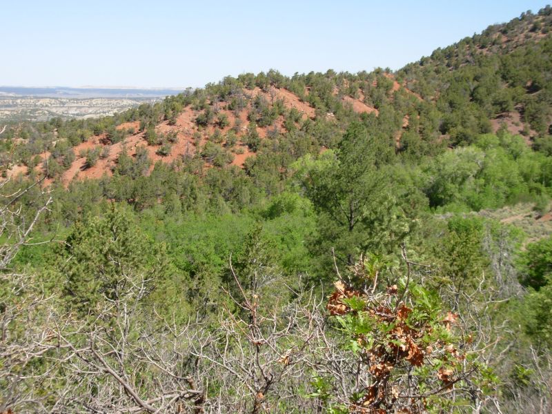
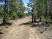
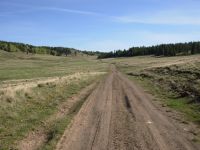
Instead of going north out of town, then east, we went east and then north. This should give us a few more miles in the Wilderness, which is a real plus. First we walked Highway 126 for three miles, which wasn't busy that early in the day, though we noted a few vehicles packed for camping that were evidently leaving early for the holiday weekend. Then we took off on a side paved road (Eureka Mesa) past some ranches for a couple of miles. Soon we entered the National Forest and the road became a very worn and rutted dirt track.
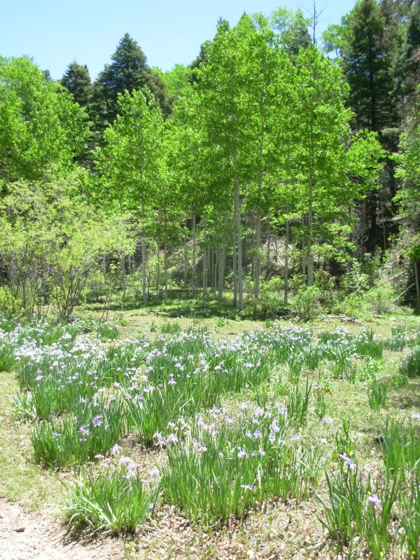
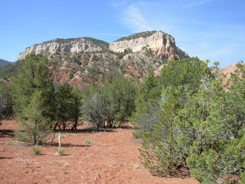
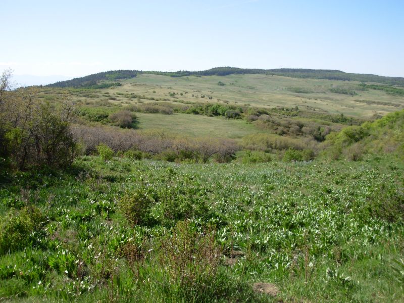
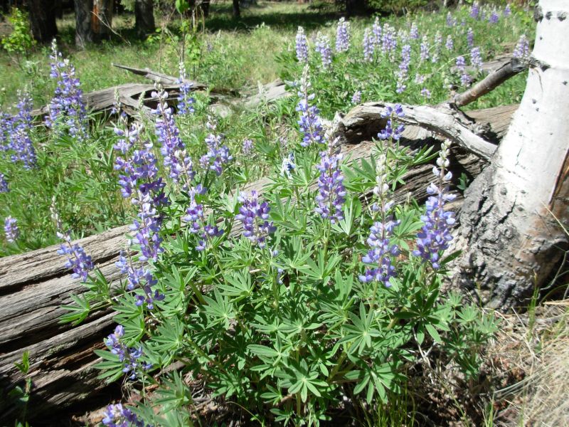
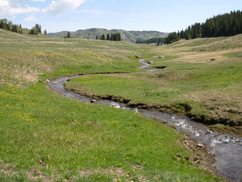
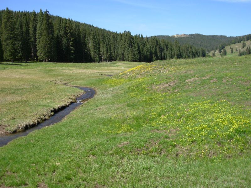
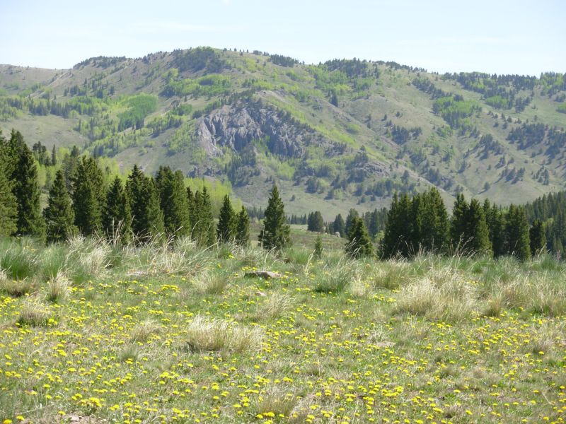
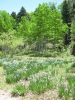
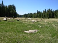
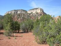
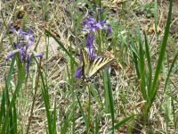
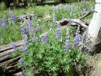
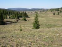
A sign said the road was closed, but we saw fresh tire tracks. We followed the winding road as it switchbacked up with good views of Cuba and vicinity, then we climbed up into the mountains about 2200 just to get to the trailhead. It was a really nice walk. The oak at lower elevations and the aspen up high were minty green. The pines and aspens emit a beautiful rich scent. Green grassy meadows were covered in wild iris and golden pea. Ive never seen so many iris in one place. Down low we saw a bush covered with pink flowers that lined the road. There are ferns and mosses, blue lupine and many other flowers. Pine and spruce trees provide a cool contrast to the sunny meadows. All in all beautiful!

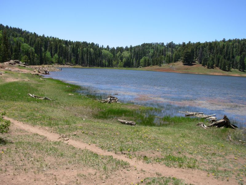
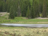
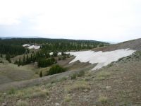
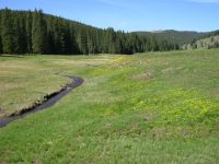
We ate lunch near the trailhead into the Wilderness. How strange it was to see dayhikers; they are rare on the CDT in New Mexico. We enjoyed our hike this afternoon, but were happy to stop early. The altitude (10,000) was getting to us both. It was pretty walking along the green meadows and streams. There was a pretty little lake, Cienega Gregorio, where we saw a couple of groups out fishing. Part of the trail went through dark mossy spruce/fir forest. There were still several patches of snow in the shady spots. Flowers were abundant: violets both white and purple, dandelions, corn lilies, even one little patch of red columbine.
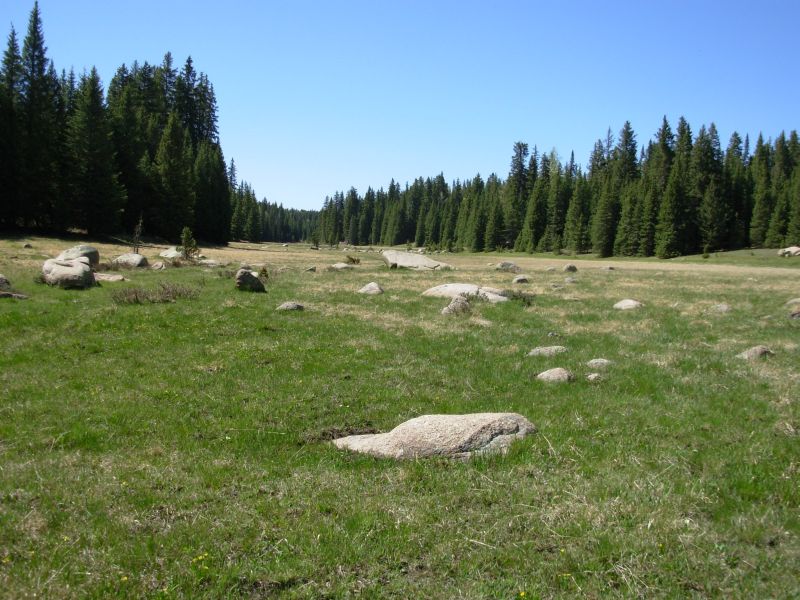
We didnt see any people after we passed the lake. Neither did we see any elk or deer, though their tracks were abundant. The wind was intermittent but mostly high above our heads. This green oasis feels so far removed from the dry desert we crossed on the other side of Cuba. Its our first taste of Colorados high country meadows. I think northbound hikers probably appreciate San Pedro Parks more than southbound hikers. For us, it is the contrast to the desert that is appealing. For southbounders, it is merely the last of many similar meadows. Not quite as exciting.
Jim: Typically, we chose a different route through San Pedro Parks than the one we used previously. It was prettier, a little longer and not as steep. The only disappointment was that we saw no elk, moose or deer. We know they're there - they were probably hiding in the trees watching us.
Saturday, May 27 24 ½ miles to Ojitos Canyon


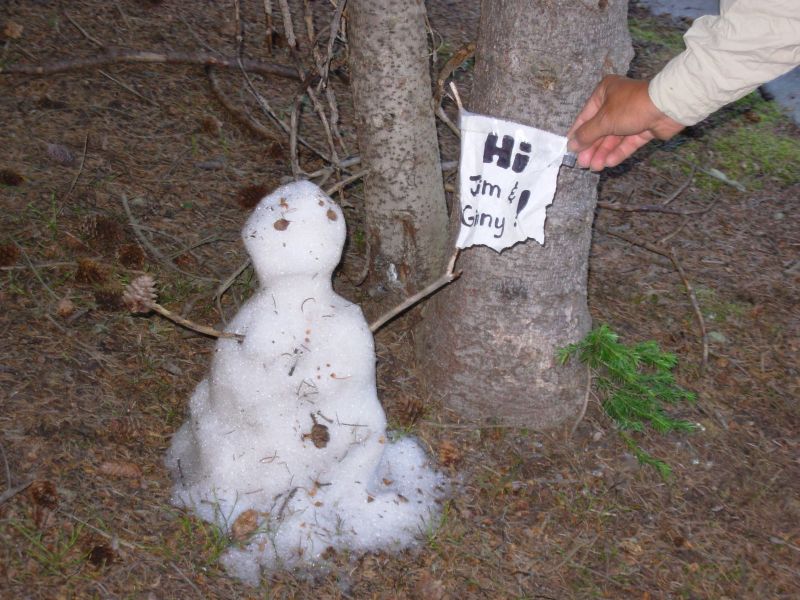
It was a cold night at 10,200. We woke to frost on the flowers. The first half mile we wore our warm jackets as we passed through the beautiful meadows near San Pedro Peaks (which werent obviously taller than the rest of the plateau.) Our high point was 10,550. Then we entered the forest and began a five-mile descent to the edge of the wilderness, all in spruce and aspen forest. Ready left us a small snowman that brought a smile. We wasted some time looking for a spring in a fenced wet meadow and it turned out that there was a stream beyond the meadow that the trail crosses. We saw a mule deer down by Cecilia Spring and our first horse-people on the trail. They were just out for a short ride, they said. We also saw lots of flowers: lupine, wild roses, white violets, etc. This morning as an airplane flew low overhead I heard a pack of coyotes howling in protest. When it left, they stopped. That was funny.
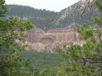
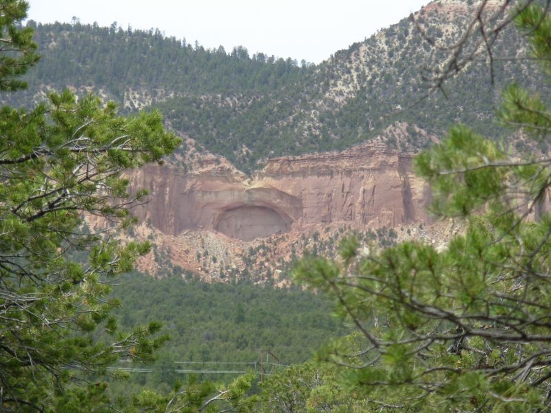
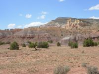
It turned out to be a more adventurous and strenuous day than expected. We followed new trail from the edge of the wilderness that was much nicer than the former route on jeep roads, though occasionally a bit more obscure. We were warned that the new route was not completed yet, but the plan was to follow it as far as we could and describe it for Jim Wolf. The last couple of miles were very rough bushwhacking, following pink ribbons through the brush. There was a nice view of an arch across the highway. At Highway 96 the trail ended completely and there was no sign of a continuation on the other side. JW had told us that we would come out one mile east of the old route, so we headed west. After one mile nothing. After two miles, still no sign of the jeep road we were seeking. Jim noticed that we were gradually climbing, but according to the guidebook, the road we wanted was lower at 7300, not 8000 - so we figured out we had gone in the wrong direction. Very unhappily we turned around and headed back. We saw another deer, running across the road. A mile later a truck stopped and asked if we needed a ride. This time we said yes, and rode back down the highway to the trail. Grrr. The driver was a bit drunk and wanted to give us something to help us on our way. Unfortunately, he had no water, just Bud Lite, which we wont drink. So we said, Thanks, but no thanks. As we climbed back up from the highway, we regretted that refusal. The climb was about 1300, past some brightly colored sandstone cliffs. We were slow because we were tired and thirsty.
On the other side of the ridge we followed some nice forest roads past a long green meadow. Unfortunately, the stream that fed the meadow didnt appear to be running. Theyve done a lot of very recent logging along the road branches and logs were everywhere so it didnt look at all as I remembered. More important, we were counting on a stream that we couldnt find as our evening water source. So we kept going to Ojitos Canyon where we were fairly sure we would find water. It was a long steep descent to the stream there, as the sun was going down. Luckily we were able to find a nice flat campsite near the stream, so we set up just as it was getting dark and I was even able to wash up a little. Dessert was eaten by starlight. We are both tired and sore but not unhappy. Jim tripped this morning and hurt his shoulder landing, but otherwise hes okay aside from the usual soreness that comes with doing 25-mile days.
Jim: Today was some more new trail. The trail to Cecilia Spring is new, but the spring is really good. Most of the relo to the highway hasn't even been built yet, and the trail cuts off the forest road onto brand new trail a mile or more before the place indicated in the guidebook.
We got to camp right at dark - but with a good water source. We'll be at Ghost Ranch tomorrow - pretty country.
Sunday, May 28 15 miles to Ghost Ranch
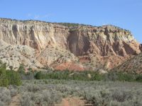
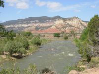
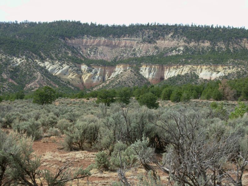
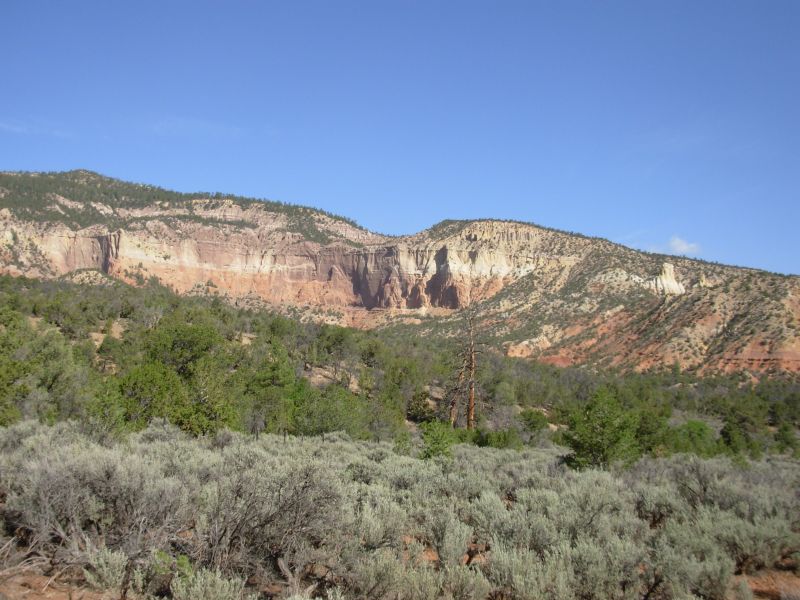
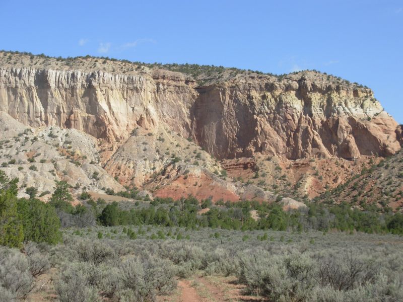
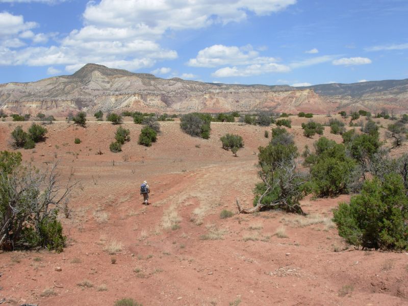
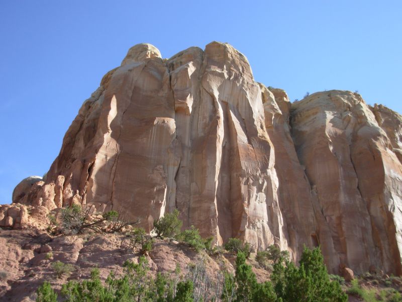
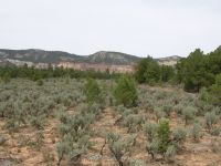
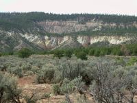
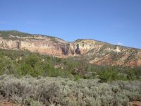
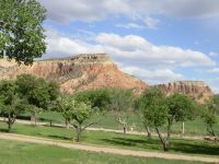
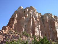
Our hike was a beautiful one, first criss-crossing tiny Ojitos Creek, then down the canyon, then along the Chama River. The cliffs rose tall above us, layers of red, yellow, orange, pink, and even some purple. The river was flowing swiftly a boon to all the holiday rafters and boaters. We had a long six-mile walk along the busy dirt road with lots of boaters, bikers and campers. No other hikers though. We were quite happy to turn off the road and head across the desert toward Ghost Ranch.
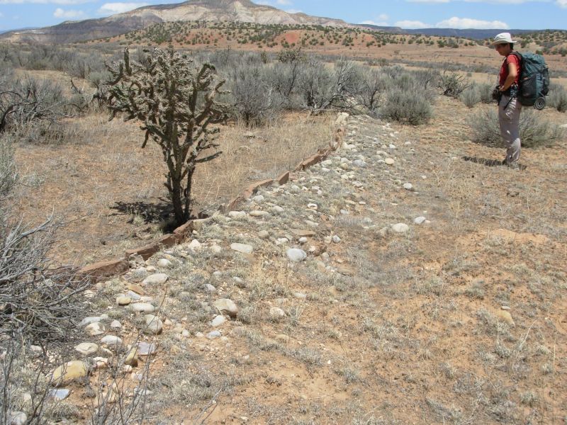
Once again we noted the ancient stone walls -- only a few inches high that outline -- what? An ancient village? Tribal lands? A house? The walls are long and curve around, but the purpose isnt obvious.
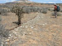
This land is so beautiful, I can imagine it was occupied long ago. We saw an old adobe ruin in the canyon but not as old as the stone walls. Imagine living with that view every day!
We stopped to visit the Ghost Ranch Museum and Visitors Center. It is still being developed. It is only one year old in its current incarnation, and gives information on a little history, a little geology plus a nice nature trail that we followed to Ghost Ranch. We reached Ghost Ranch itself about 4:00. They allow CDT hikers to camp for free at the campground or you can get a room inside for $63 per person. We can eat meals in the dining room ($8.50 dinner), do laundry, and, best of all, theres a shower. We just had time to set up the tent and jump in the shower before hurrying off to eat.

It is very windy. We have a maildrop here with food for the next four days. We also washed our dusty clothes and hung them up on the line to dry overnight. Late evening a group of about 30 geology students from UT Austin arrived in five or six vans on a six week geological tour of the west. Sounds like fun. Spur and Ready were here too, as Spur wasnt feeling well and they didnt want to leave until he felt better. This next stretch is a fairly rough one with obscure trail and some bushwhacking, not a good place to hike sick.
Jim: Getting to Ghost Ranch made a short day. But we had fun speculating about the Anasazi ruins again, and then we spent some time at the Visitor Center, which had been closed the last time we were here.
Last time we were at Ghost Ranch, they had no accommodations for us because they had a major conference in progress. This time was much better - camping (free), meals, phone, internet, shower - the whole banana.
Monday, May 29 16 miles to Harris Bear Spring
We slept badly with all the noise in the campground plus the sound of our tent flapping in the wind. We woke up, ordered a new tent on the Internet as the old one is falling apart (zippers and seams but it is six years old and has seen a lot of use), walked the labyrinth, and finally got on the trail around 9:00.
There was some confusion at the beginning as Ghost Ranch has several hiking trails and the directions didnt tell us, Take Box Canyon Trail to Upper Camp Trail which would have helped. We backtracked ¼ mile when the directions no longer matched reality. We kept crossing a creek, but the guidebook directions only crossed it twice. Oops.
Later we deliberately went off route. The guidebook tells us to bushwhack from an old jeep road up to another road on the ridge above. We did that last time, and it wasnt an easy bushwhack. We decided instead to see where the old track went, just for fun. It continued up the canyon, then switchbacked up the ridge and finally met the guidebook route a short way before Yeso Tank. Most of the way the route was clear. It was just at the end that we started to worry that we had come out in the wrong place, but the map didnt steer us wrong this time.
A while later we did a little bushwhacking from another jeep road to one above it, but fortunately we remembered it from last time so it was easy to know where to begin the climb and where we were supposed to come out. The trail isn't marked well and there is little tread, so the way feels pretty obscure. Later we werent as lucky. At Puertecita de las Ranas, a large meadow with many cows, we were supposed to make a turn from one jeep road to another fainter track. Because the cows were really upset, bellowing their hearts out, we got distracted with laughing at the cows and forgot that we were supposed to turn there. Instead we continued straight, following the ridge. After about a mile, when we could no longer hear the unhappy cows, we spotted a side road labeled 677-I. Oops, we werent supposed to be on FR 677 any longer. We looked at a map and saw that if we continued, another side road would eventually reconnect us with the trail. Trouble was, it added quite a bit of distance because of the climbing and winding. Still, it was pretty walking this afternoon, with lots of mature woods and meadows. We were at 9000. With the various detours, plus the late start and a 3200 climb, we stopped early near Harris Bear Spring. Were both exhausted. It was grey most of the day, cold and damp. We had no rain, just clouds.

Jim: Getting "lost" is always "interesting", but it's never something to get upset about. After all, a very high percentage of our trip so far has been either on alternate routes or relocated trail, so getting "lost" is nothing more than an "unplanned alternate route" that requires a little closer attention to the map - and sometimes a few extra miles.
We've warned people about the myriad ways they can get "lost" by not paying attention, but this is the first time we've been caught "NOT paying attention" because we were laughing at cows.
Last time we were at Harris Bear Spring, we had to dispute our right to water with the longhorns. This time there were no cows at all in the immediate area.
Tuesday, May 30 19 miles
It was an interesting day, with a bit of off-trail wandering, both planned and unplanned. This morning we were following a jeep road through the woods, following CDT trail markers. Another road came in at an angle. We continued straight. Evidently we were supposed to turn there. Oh well. The guidebook recommends a bushwhack to the top of Mogote Peak, which we didnt want to do, so it was no help. Our road ended and we ended up bushwhacking across some meadows to another jeep road which took us to FR 559 which took us back to the guidebook route. Evidently its not the official route as there were no markers. I remember this section as basically a two mile cross-country adventure. Just what we need right now. The morning was nice anyhow, with lots of green flowering meadows studded with scattered aspen groves Sound of Music country. We werent worried about losing the trail we knew where we were and how to get back on track it was just a question of how long it would take.
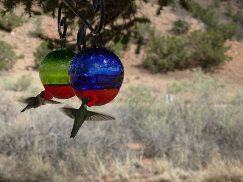
One oddity: in the aspens were thousands of caterpillars. We stopped to get water at a spring (which we dumped as it turned very cloudy after sitting for a while) and our packs were soon covered with caterpillars. Savant had the same experience last year, I think. We also saw a hawk with a white underwing and a dark band along the edge. Pretty. This area has lots of hummingbirds. They are attracted to my orange jacket, so I see them often in the morning. At the campground at Ghost Ranch our hostess had feeders up so we could watch 5 or 6 at a time drinking from the feeders. That was fun.

The afternoon bushwhack, as described in the guidebook, turned to be easier than expected. We followed jeep tracks part of the way, then turned straight north for ½ mile and stumbled on a trail that looked like a game track but had signs of people (bottles and carved names on aspen trees) that took us out to FR 274, right where we were supposed to come out. It was an easy two miles, except for the 500 climb. The altitude has been affecting me ever since San Pedro Parks not badly, but Im having a hard time getting enough oxygen. I gasp. I yawn. I pant. Uphills are very slow. Jim has no energy so is slow too. But we keep on trucking 16 miles yesterday and 19 or so today. Weve been stopping early because of water or energy levels, but thats good because we get time to relax in the sun, listening to the birds and the wind. The only concern is food. For once I underpacked. The distance from Ghost Ranch to Chama is 90 miles or so. I only packed four days food. Say what? We may be out for six at this rate, especially since tomorrow is another obscure bushwhacking day.
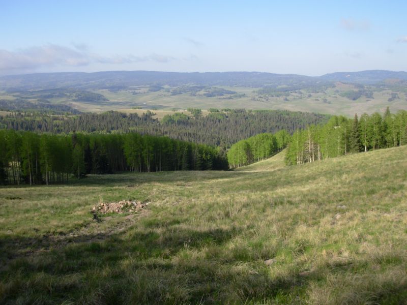
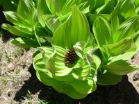
This afternoon was spent walking at 10,000 through high meadows with spruce and fir. We went down one creek, up the 15 Springs Valley, then down Jarosito Creek. The jeep tracks were barely discernable for the last four miles. An ATV illegally followed them very recently, but this area is supposed to be closed except for FR 274. I enjoyed walking through all the green and flowers. There were a couple of new ones: yellow glacier lilies and bluebells. Spring is about a week behind San Pedro Parks at a similar altitude. We saw a few patches of snow in the trees, but less than in the Wilderness. We saw snow-covered peaks to the north Colorado? Fifty miles makes a difference. There were some pretty mountains to the east. I love all the open meadows up here. I look for wildlife, but we rarely see any. I did see a turkey in the woods today.
One mishap: Jim fell going over a downed tree. We stopped for a break about 10 minutes later and discovered he had lost his glasses, which he puts on the front of his shirt. I went back and tried to recreate the fall. It took a while but I finally found them where they flew when he tripped. Happiness!
Wednesday, May 31 -21 miles
It was a noisy night, so sleep was scarce. First came an odd yelping, from about 50 feet away. No bark or growl, just yelps. They came every 5-10 minutes for about 45 minutes. Probably elk, but whatever it was it was very unhappy. Later, much later, we heard a coyote pack yipping and yapping. I was a bit worried that they might come looking for our food, but they stayed away.
At breakfast we heard one lone mournful howl. Since we were on the edge of a meadow near a stream, we ended up drenched with dew, frosty dew. I was freezing. We were on the wrong side of the valley to get morning sunlight, so we packed up our wet gear with the intention of drying it out at lunch. Of course, it was cold and cloudy at noon,so things dried a little more, but not completely. We did a planned bushwhack that cut off about 1 ½ miles of roundabout road walking, then tried to skip the next section of cross-country travel by following new CDT blazes along the road. A mile later, the road ended and so did the blazes. We dropped down to the Rio Vallecito below the ridge, hoping to pick up the guidebook route. Instead we found pink ribbons, marking the proposed new route. We climbed away from the creek, but lost the ribbons after about ½ mile. So we continued east, bushwhacking around and above a ranch. We never did find ourselves back on the guidebook route. We did pick up a jeep road that was in the guidebook, but missed the turn off it. Missing the turn was half deliberate since we remembered the route from our last hike. The trail follows a fenceline around private property, parallel to but not on a jeep road, up and down along rough rocky hills. We didnt want to do that again. Instead we decided to follow jeep roads on a roundabout route to Hopewell Lake near the highway. This route is longer, but less frustrating, and besides, its new to us.

The country in the Carson National Forest is really pretty with lots of meadows, spruce and aspen, but the trail is really obscure and hard to follow with a lot of cross country. The Forest Service is relocating most of the trail in this section. The new route will be a lot longer, but easier to follow. Reading cross-country directions in reverse (JWs guidebooks are written north to south) requires you to pay total attention to where you are at all times. No mental wandering is allowed. Unfortunately, my mind wanders. Some days, I can pay total attention; today isnt one of them.
I did see a flock of turkeys, a couple of elk on a hill and something big (deer or elk) crashed through the brush below the trail, so it was a good morning. Im always happiest when I see wildlife.
The afternoon continued with more wildlife sightings. Just after we passed Hopewell Lake on the highway, I spied two elk running across a meadow. They werent running from us, but from a herd of cows being driven by five cowboys on horseback. Later, as we approached a stock pond north of the highway, I saw a couple of brown specks by the water. Turned out they were four elk lying by the pond. They ran off, but we watched them head up the hill through the trees. Later, as we were setting up the tent in a grove of trees, I saw movement behind Jim: three antelope were approaching, about 50 away. They couldnt figure us out at first, but they vanished soon enough once they figured out we didnt belong there. What fun. Finally, after dinner as we sat reading, an elk appeared behind the tent, about 40 away. He was totally oblivious of us watching him, and grazed next to us for about half an hour.
Our afternoon detour along the graded road past Hopewell Lake worked out well. Only two cars passed us in three hours. Our route was longer, but without the obscure cross-country bits. We had two miles along the highway, but we saw the lake, the cows and the elk, so that passed quickly. We ended up doing 21 miles or so, and still stopped at 5:15. Theres a big climb coming up in the next mile or so and we were too tired to face that at the end of the day. Besides, here we have a nice clump of trees surrounded by meadows a nice site. We got sprinkled on twice today and some of the clouds are lingering, so we decided a tent would be a good idea. Plus, at 10,000 the extra warmth is nice. After last nights dewfall, it sounds like a good idea anyhow.
Jim: It was one of those days when you make a lot of navigation mistakes because your mind is someplace else - and somehow none of it matters. My mind wandered at least as far as Ginny's did today. Usually, if one of us is wandering, the other is awake. But it didn't happen that way today.
So we walked a few extra miles - big deal. We're not in a hurry anyway - somehow no matter what's happened, we're still ahead of "schedule". Meaning we're still going to get to Colorado too early and have to plow (or rather posthole) through the snow in the South San Juans. I'm not up for a lot of that. My knees don't like it - and it's not necessary.
Thursday, June 1 22 miles
This morning two more elk stopped by to feed, oblivious to us hikers, 100 yards away. We didnt have any more night visitors to our meadow, at least none that we were aware of. We woke to thick clouds/fog but it burned off by about 8:00. Other clouds came and went, but none lingered. Still, its cool and hazy and feels damp.
Our morning hike was nice through rolling hills and meadows. We followed the Land Grant fence-line off and on and pink ribbons designating the new CDT when we could find them. They tended to vanish in meadows or in groves of trees. The official trail is more or less following Jim Wolfs route, but there are variations. When in doubt, we headed back to the fence.
Lunch was eaten perched high above the Rio San Antonio. The trail down was steep, but it was an interesting hike along the river. That is a pretty narrow valley between steep straight walls with green meadows along the small creek. We were supposed to follow pack trail for about three miles, but we kept losing it. Finally I picked up what I thought was pack trail; instead it was a game trail that led us up to the plateau above, about 1 ½ miles early. No big deal except that the river had several fingerlike canyons, and it was a long way around them. We headed northwest to the Land Grant fence again and followed it up and down the fingers. One was a very steep nasty gully. Eventually we found the CDT again. Then we hit Lagunitas Creek another very very steep descent and climb. There I misread the directions so we followed jeep tracks in the wrong direction downhill. Rather than backtrack, we again headed northwest until we picked up the jeep road we will follow for the next 13 miles. Our miscues were minor ones, but frustrating. We knew where we were and how to get back on track; the question was how much extra mileage would be involved. Officially, we did 21 miles today and about 3000 elevation gain. In reality, like yesterday, we did at least one or two extra miles.

On the plus side, today was a terrific day for wildlife: we saw 11 more elk this afternoon (plus the two this morning) in six separate encounters, plus a porcupine. The porcupine waddled, amazingly fast, to a tree once he saw us following him up the road. Another good encounter was a small hawk, maybe a falcon, and what looked like a nighthawk.
After we camped, Jim also saw a fox peering at us, then we heard growls, yips and whimpers. The foxs den must have been very close to our campsite. Later that night we heard a pack of coyotes very nearby. Our yelper also came back while we were eating dinner, but it didnt last as long as last night.
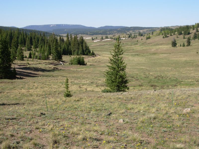
It was also a good day for views, especially off Brazos Ridge, which we climbed late in the afternoon, despite a cold wind and threatening thunderclouds all around. The winds were fierce, but the views were worth the exposure. There was a lot of snow up at 11,000. The road was completely blocked in a couple of places, so we got our first experience of snow walking on this hike. Clouds threatened and there were occasional rumbles of thunder, but only a few drops fell on us. The Las Cruces Basin Wilderness was also beautiful seen from above.
Jim: A lot of dirt road walking today, but no cars because the roads are still mostly blocked by snow. I wasn't really excited about Brazos Ridge because of the really nasty thunder clouds that hung over it. But once we got up there, the view was "to die for." Fortunately, we didn't.
Some of the road north of the Cruces Basin has deteriorated badly. I remember the road as being a good quality dirt road that could be driven by passenger car. But now it's been eroded and is largely loose rock in some places so you'd need a 4x4 to get in there.
We camped at one of the sites that Jim Wolf recommends - the fox den was just on the other side of the small stream, about 50 ft away. Didn't get any good pictures because mama fox had chosen her den well - under the roots of large pine where there were lots of shadows.
Friday June 2 11 miles to Cumbres Pass and Chama

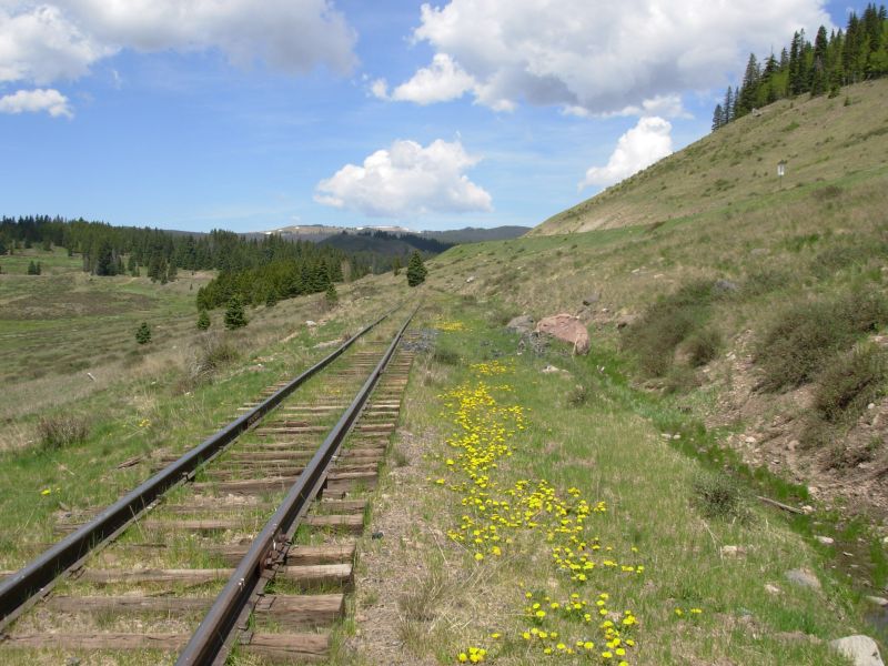
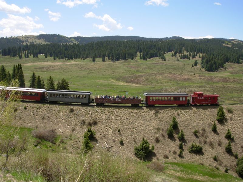
Well, we made it to Colorado. It was beautiful hike along Osier Mesa, with clear views of the mountains ahead as well as the green valleys around us. It was a quick 11 miles, mostly on jeep roads, to Cumbres Pass, where we hitched to Chama. The last mile or so was along the railroad tracks. I was a bit nervous because we could hear the train whistle and see puffs of black smoke in the distance, but the train didnt come. The railroad grade is fairly narrow in places and we wanted to be well away if the train showed up. As it turns out, the train makes a long stop at the pass some passengers get off and get on a train going the other direction so we had time to get off the tracks and then watch the trains heading out in both directions.
The hitch to town wasnt too bad an hour and 20 minutes to get a ride. Traffic is very light at the pass. Getting back could be slow too. We know hikers who gave up after four hours or so.
We were dropped off at an expensive hotel, which we took because we were afraid there wouldnt be much available on a weekend. Wandering around later, we found a better rate for tomorrow night at the Cumbres Suites where we stayed last time. We checked in, ate a late lunch, checked email and did our post office business: two drift boxes, my repaired pack, boots for the two of us for the snow ahead, etc. We had extra stuff that got shipped here from Cuba and Grants. Finally everything got sorted out, but it took a while. We thought we had sent some warmer clothes here, but evidently they were with the ice axes that we decided not to ship after all.
Most of the internet accounts weve seen from hikers ahead of us have been complaints of postholing in soft snow. One today said he was happy he carried his ice axe, but hes two weeks ahead of us. By the time we get to the San Juans, conditions will have changed, I hope. Im definitely nervous about the snow. We are early, even for a low snow year. Im not great on snow my phobia about falling kicks in too easily. Im not crazy about the mud and muck that comes with recent snowmelt either. At least river crossings wont be an issue in Colorado. Were too high. I remember stepping across the source of the Rio Grande. It wasnt a big step.

We have the four and a half day section in the South San Juans to gauge current conditions. Our last report is over a week old. Most of the hikers ahead ended up roadwalking part or all of it, or hitching around. We really want to avoid that if possible. This is a really nice section of the trail, one I have been looking forward to seeing again.
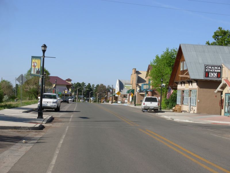
We had a beer at Fosters, an ice cream cone, and finally a most welcome shower, then headed to the grocery and laundry on the other end of town. Chama isnt large, but it is very spread out. Tomorrow will be a pure rest day. Spur and Ready have already left town. The section hikers we met south of here, Nona and Del, passed us as we walked through town and stopped to chat. They followed the new CDT route the last seven miles or so to Cumbres Pass and got totally lost. We didnt even see where the new route left the road we were following. Besides, weve had enough of following incomplete trail, chasing pink ribbons through the woods. When they complete the reroute, we may come back. Dinner was a special treat filet mignon at a restaurant with live music. Good food and entertainment too. It was worth the cost.
Jim: The last couple miles to Cumbres Pass were partly on the right-of-way for the Cumbres and Toltec railroad which is Chama's main claim to fame. The "season" opens when the railroad starts running and ends when the railroad stops running. The "season" is when prices for motels, meals, etc. increase dramatically.
Many (most?) of the businesses in Chama are new - they weren't here when we were here before. In many cases, what's here now replaced the businesses that were here before although there are a few truly "new" ones like the Branding Iron Motel (VERY expensive). Most of the businesses in town are for sale - and that's been true for nearly every town where we've stopped. Very high turnover rate.
Saturday, June 3 Rest day in Chama
We enjoyed a quiet day off in Chama. We still ended up walking a couple of miles, running errands from one end of town to the other, but it was relaxed. We ran into La Zorra and Jerry, who invited us to dinner at the campground. They told Mark Flagler where we were, so he also stopped by to visit. We talked about some of our favorite parts of New Mexico: the Carson Forest, the Piedra Lumbre, the Gila, etc. Liz wants to hike this next stretch with us. She heard stories about the snow from a week or two ago and is nervous about hiking through the South San Juans alone. We agreed to her joining us. I understand her worries, though I think we wont have as much trouble as those who hiked through in May. Well see.
Jim: A restful day - lots of food, clean clothes, a shower, ice cream and a little sightseeing. Overall, Chama has been upgraded since we were here last. Lots of new construction/infrastructure for the tourists.
Home | Links| Trail Journals |
The Thruhiking Papers | Bun-bun
Created: Dec 2006
Revised: 30 Sept 2016Copyright © 2006-2017 Spirit Eagle