|
 |
 |
 |
 |
|
|
|
|
|
|
Friday, May 19 18 miles

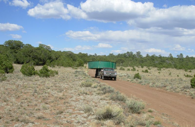
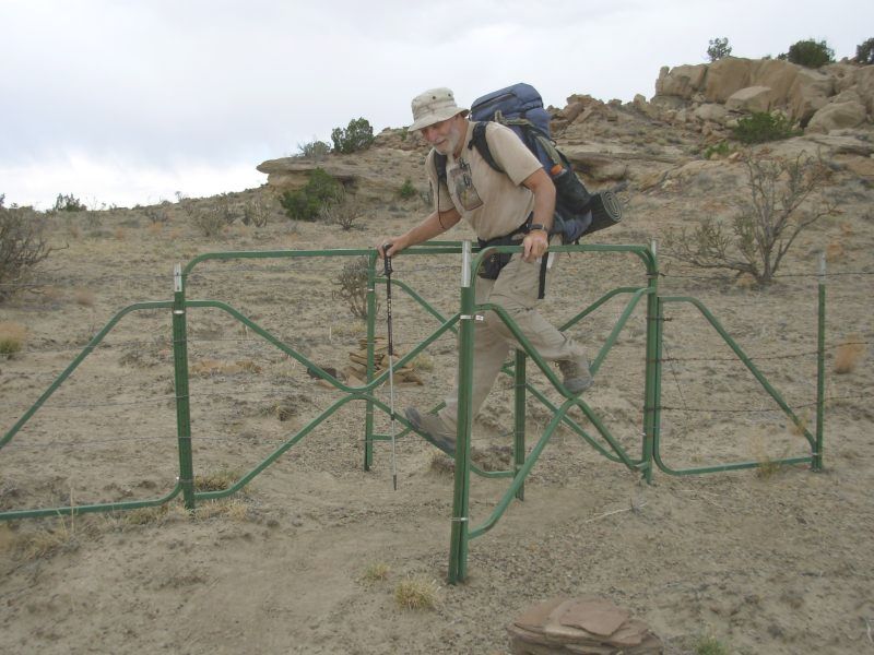
We enjoyed a relaxing two days off in town, but this morning I was ready and eager to be back on the trail. Yesterday we drove our rental car out to the end of the road, where the Forest Service had closed it, and left water for ourselves and the Minnesota Crew. This morning Jim had an even better idea: lets drive the packs up to the campground and enjoy the 11 miles of climbing on pavement instead of merely enduring them. We called Spur and Ready, who stayed over an extra day too, picked up their packs and drove all four out to the barricade. We made it back to town barely in time to return the car at 8:30, ate breakfast at El Cafecito, and then headed up the road.
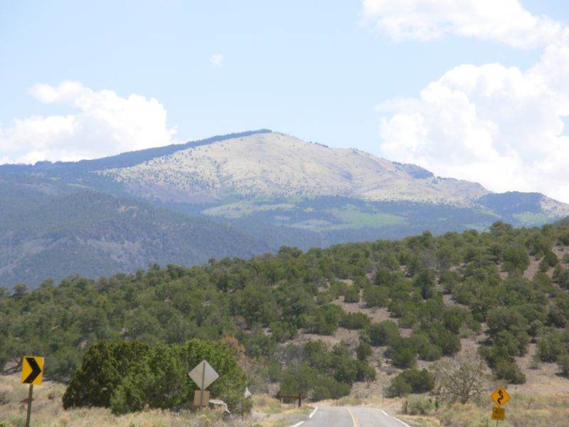
We made it to the campground by 12:30. It was much easier than walking with seven days food and water. We had some nice views of Mt. Taylor on the way up, still winter yellow. We follow graded roads after lunch, but there should be little traffic. With our good start, we can take our time and stop early. It looks like rain: big dark clouds are gathering and we heard thunder earlier. It does cool things off though.
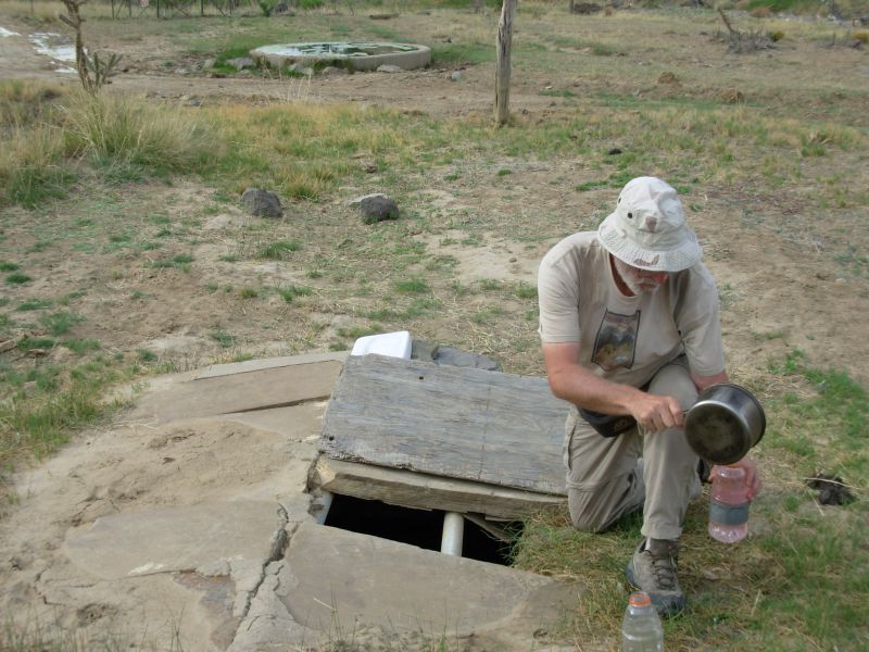
About an hour after lunch we met Tom returning from his good Samaritan works. He put water out at about 20 miles, 30 miles and 45 miles. He said that they are considering closing the forest entirely to CDT hikers because of the water issue. What if a hiker arrives at an empty cache, dies of thirst and his family sues the Forest Service? We told him that, aside from the unlikeliness of that scenario, given that there are still people in the forest -- authorized ones like local ranchers as well as hikers -- most thruhikers would keep going to the next water, no matter how far it was, and besides, we are the tail end of the northbound hordes. As far as I know, there are only four hikers behind us: La Zorra and Cupcake, who may be off the trail due to injury, and Team Doodah, (GI Jane and Chuckwagon) who got off the trail because of problems with their dog and may or may not still be hiking. There may be others we havent heard about who started late, but not many. So the nine five-gallon containers Tom put out today should be more than enough.
It was really good to see Tom again. We enjoyed a leisurely breakfast with him yesterday, catching up. On our last hike we stayed with Tom and his wife for a couple of days. He is as nice as I remembered.
We were slow once we donned our packs. We were carrying six liters of water each, plus 6-7 days' food, so the packs felt very heavy, especially after two days off. (Packs gain five pounds a day on days off, completely aside from the food weight.) Our feet held out until about 15 miles, then we decided to stop early at about 18 miles to give them a break. The climb today was about 2700, long and steady. It wasnt difficult, just continuous. We had views down Lobo Canyon and up to Mt. Taylor and La Mosca and a couple of other little peaks beyond. We climbed up into the ponderosa pines above 8500. Our only wildlife was a turkey that flew off as we passed, plus the usual squirrels, rabbits, prairie dogs and lizards. We only got a few drops of rain this afternoon but we decided to put the tent up anyway because some of the clouds are still lingering and we dont intend to be surprised again. It has been a rather nice roadwalk all in all. Town ends at the prison about four miles out. There is another cluster of houses at 10 miles, but then it is continuous forest. The pavement ended at about 13 miles, though walking on gravel is almost as painful. That will end tomorrow and well be back to a plain dirt road, which should be easier on the feet. There was green in some of the draws, new grass, plus some aspen in leaf. It looks like theyve had a little rain here.
Spur and Ready arrived at 8:00. They planned to continue a couple more miles to the next water, but decided to stop and be sociable for a while instead. I was really looking forward to hiking with them, but our timing has always been a bit off. They either leave early in the morning or very late out of towns so we havent had a chance to hike with them during the day at all. We just say hello in passing. As it was, darkness ended the discussion soon after they arrived.
Jim: Leaving town is always "interesting" - there's always the pull of "one last meal" or some other attraction to keep you in the gravity well. But sooner or later, you do have to leave if you're gonna make it to Canada (or wherever you're going). By the time we got out of town, the Minnesota crew was well into the Cibola Forest. Wonder if we'll see them again?
Gotta wonder about the result if they were to actually close the Forest entirely. I'm sure some hikers would jump ahead - and some of them would actually come back to fill in the section later. But a number of them would probably just take their chances with the $250 fine and go for it.
Saturday, May 20 22 miles

We woke early when Spur and Ready headed out. The morning hike was through the edge of the mountains, mostly in pine forest. Then we descended to more open country. There were some nice views of La Mosca with light green aspen contrasting beautifully with the dark pines. We got water at Toms caches, first at dry San Mateo Spring, then at Antelope Flats. There is more water three miles beyond and again 16 miles later, so well be in good shape.
We saw several rabbits in the woods and a few cows, but otherwise it was an uneventful morning trekking on the jeep roads. There were some scattered clouds, providing occasional welcome shade. The winds kicked up a couple of big dust devils on the open sage flats. We joined Spur and Ready for lunch, but they soon took off, intending to go all the way to Ojo de los Indios, a 28 mile day. We have no desire to push that hard, so we decided to relax in the shade for a long break instead.
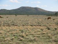
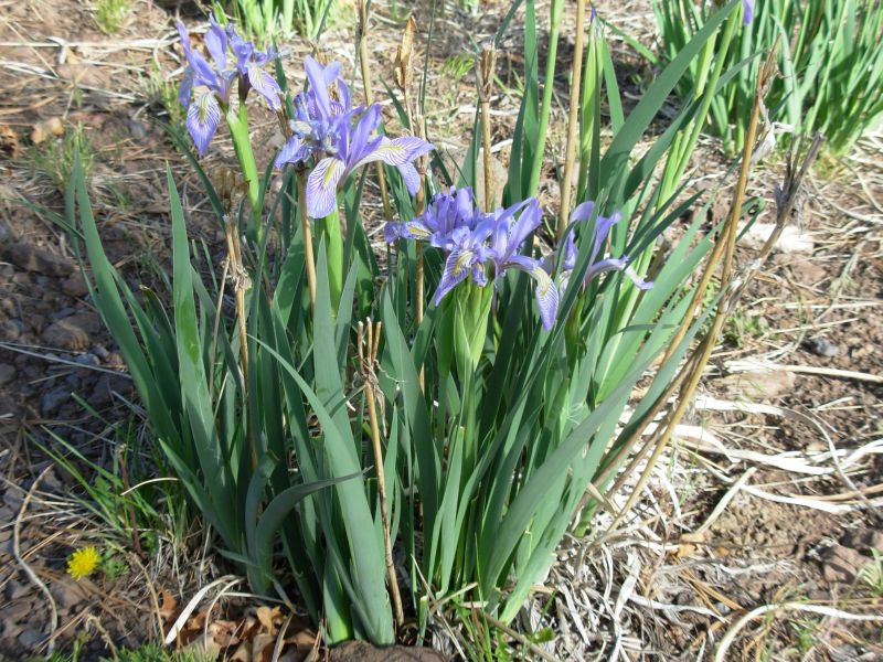
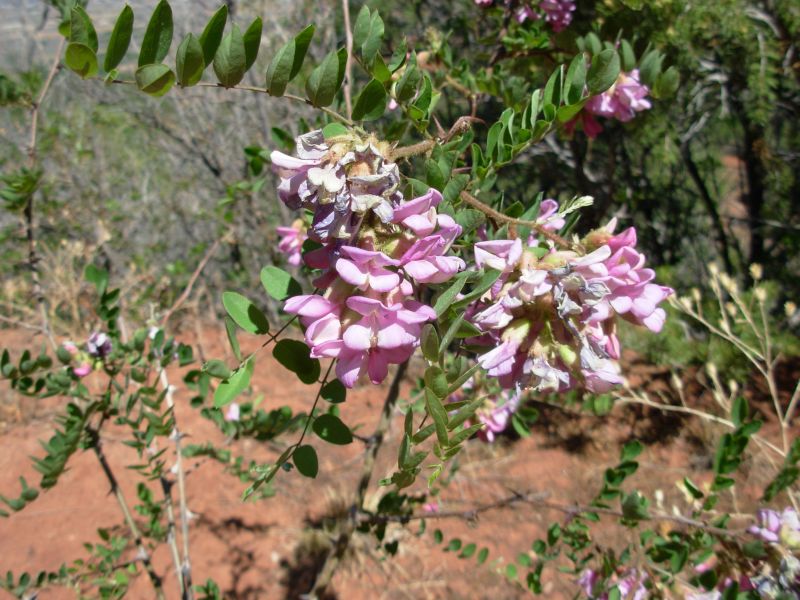
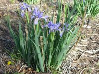
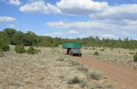
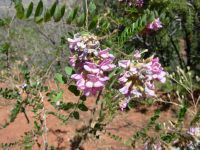
Our afternoon hike was through open sage and pinion. Looking back toward Mt. Taylor and La Mosca, we saw what appeared to be a large plume of smoke. We later found out there was a small fire there. There are several pretty round hills, partly covered in trees. All day we kept seeing patches of beautiful blue iris. There were also patches of a white daisy-like flower, plus the occasional asters and paintbrush. We met a couple of section hikers heading south, Nona and Del. Del knew us from the internet. They were doing the section from Cuba to Grants, I think. The conversation was a bit confusing. Later we saw our first cars of the day: a rancher transported a huge green fiberglass tank atop his truck, followed by another with a generator. They were either putting in a new water source or taking it out. It did look odd.
Late afternoon we were tired and sore but it was too early to stop (4:30) so we decided to just take a long break, reading, drinking and enjoying the shade. An hour or so later we started again. Just because we can do big miles doesnt mean we have to, or even that we should. Our bodies make us pay for big miles. Its not worth it.
Jim: Not going over Mt Taylor was both a disappointment and a relief. After all, it IS a big climb. But it's also a great view from the top.
Sunday, May 21 20 miles

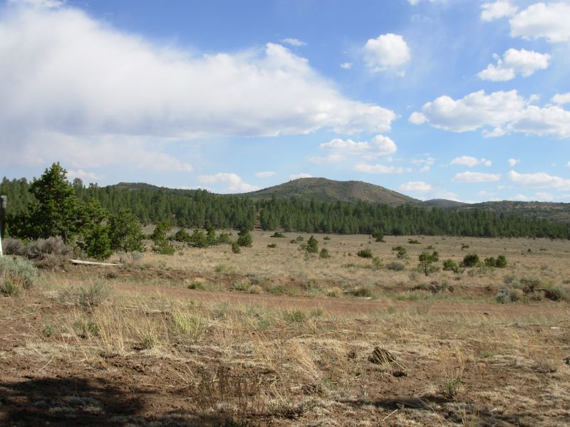
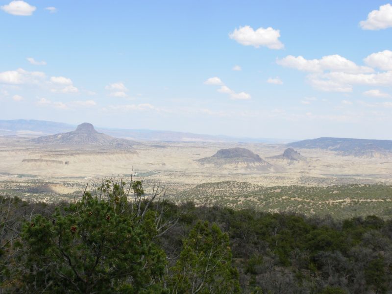
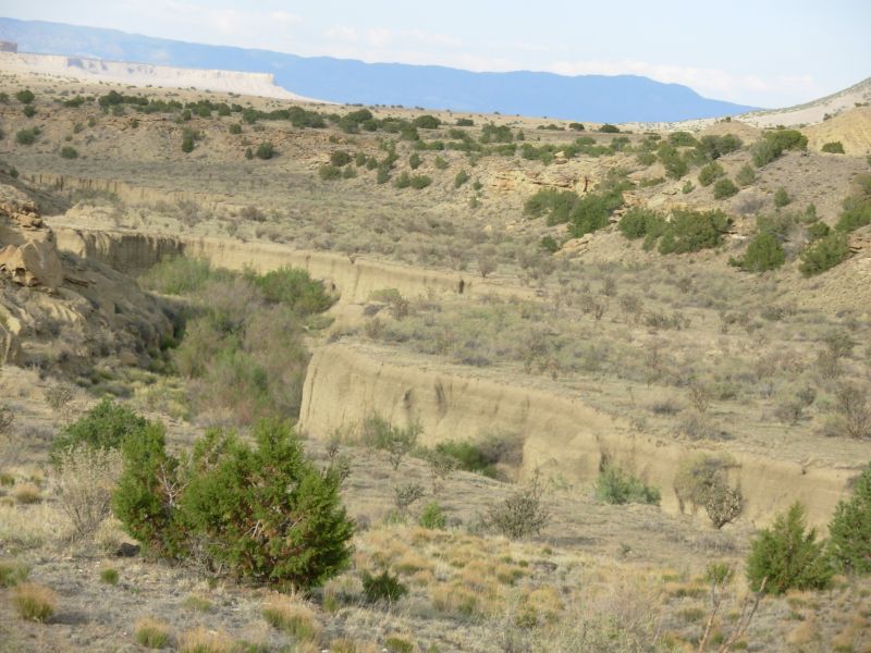
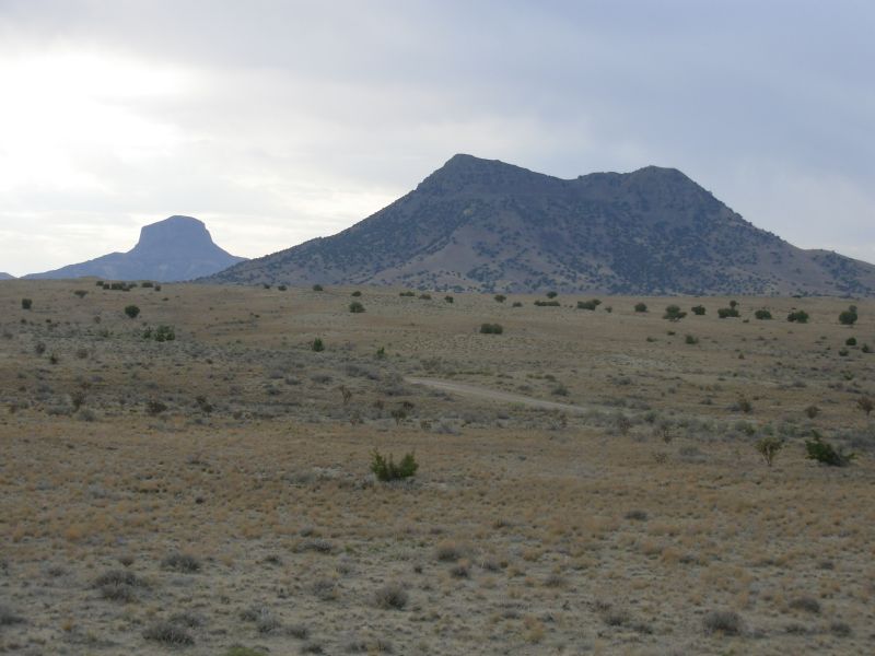
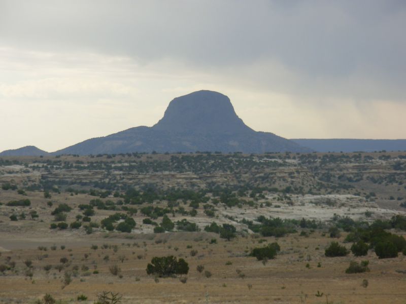
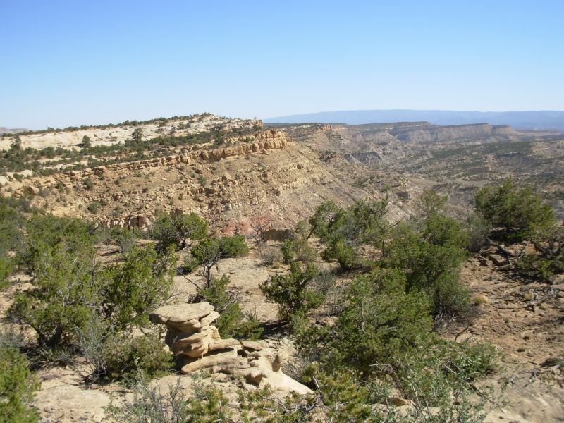
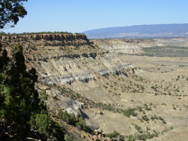
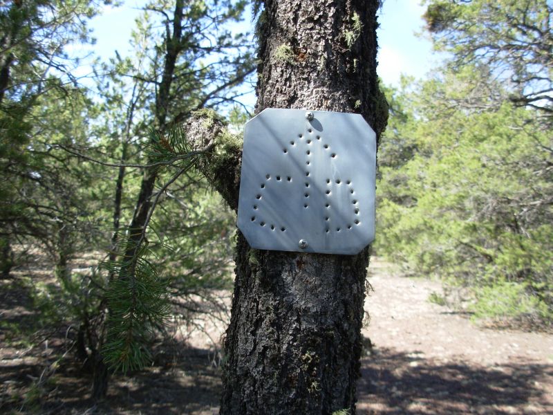
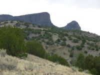
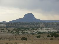
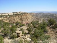
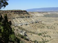
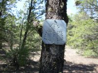
Last time we hiked through here we ran into a man at Cabezon who said they were building a new route through the Piedra Lumbre that would take the CDT off gravel roads. At the time, it seemed easier to just keep going on the known route, but we knew that next time we would do it differently. Sure enough, we left the Cibola National Forest at Ojo de los Indios, where Tom had left a final water cache, and began following rock cairns and new metal CDT markers through the forest and across the Mesa Chivato. Tread varies, but it is easy to follow because it is so frequently cairned. Many of the cairns have collapsed already, but you get the idea. The land is pinion - juniper grassland, with a few scattered pines at about 8000. The route is better watered than the old one, with water every 12-14 miles instead of 20-24 miles. It is also more interesting, though views of Cabezon, a notable volcanic plug, didnt come until we began descending off the mesa. Those views were spectacular, which helped take our minds off the steep and sometimes slippery descent.
Before that the trail crossed the mesa for about 8 miles, sometimes in trees, mostly in open grass. It wound a lot, but generally headed east. One quarter-mile section was burned. Most of the trees are still standing, so for now it was easy to find the way. There were flowers in the burned zone, but no fireweed.
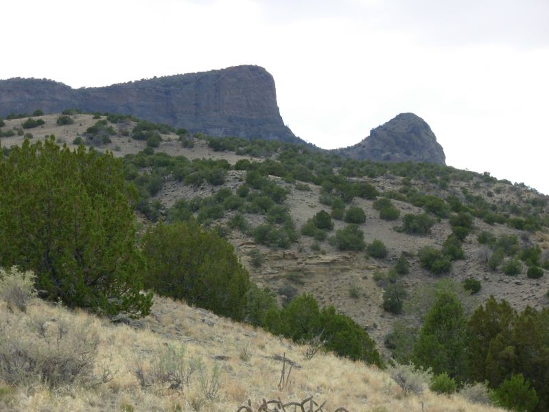
There were a couple of views north, but the more spectacular ones were on the descent, heading east toward the volcanic plugs: Cabezon, Cerro Cuate, etc. There were some dramatic cliffs to the north too. We could see why they call that part of the mesa Bears Mouth. It does look like a big mouth.
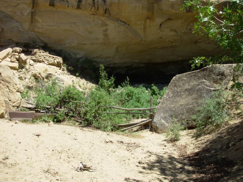
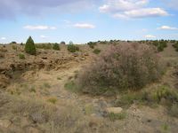
We stopped for an early dinner at the spring at Ojo Frio. I washed up a little, which felt good. Its a good spring with an underground cistern and an above-ground cement tank. Nice as it would be to camp there, our presence would prevent wildlife from approaching, so we moved on another two miles after a break. The land was interesting: deep eroded canyons with purple blooming salt cedar bushes. We dipped in and out of the canyons, finally stopping for the night at the third.

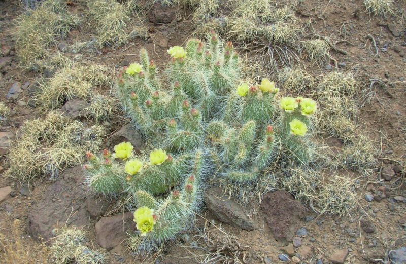
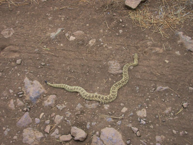
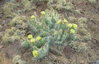
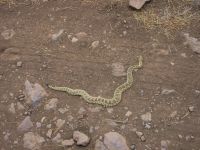
We saw a young rattlesnake this morning (only four rattles) and a new to me cactus that looks like a cross between cholla and prickly pear, very low to the ground with long white spines. The prickly pears are starting to bloom.
Jim: Ojo Frio is a water source that we didn't stop for in 1999 because we didn't need it at the time. This time we did need it - and it was good water, if a little on the sulfur side.
This section of trail is new to us, too. It was being built in '99, but we were told it wasn't ready to be hiked at that time because it wasn't complete. It's a lot prettier than the roadwalk we did back then.
Monday, May 22 13 ½ (?) to Cerro Colorado
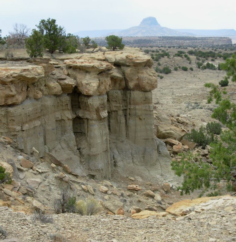
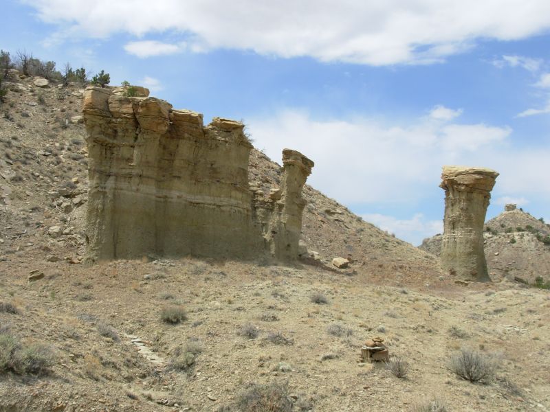
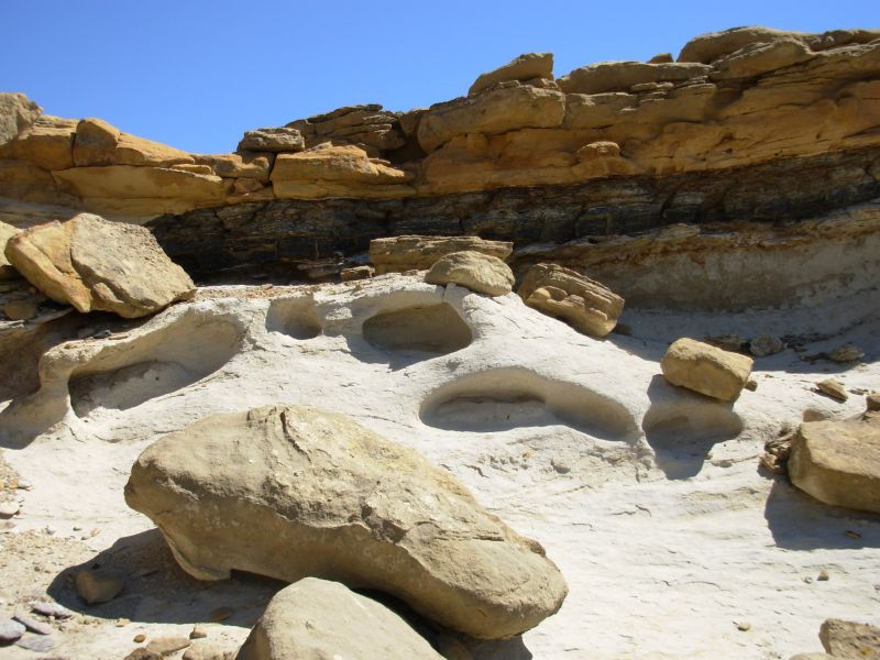
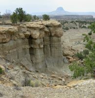
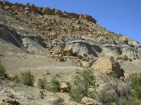
It was an interesting morning, more strenuous than usual, but with a lot of beauty, fascinating rock formations, cliffs and views. We started out wandering across and around various arroyos. The one we camped in last night had four levels, so this morning we had to climb up the four levels. There were a couple of steep climbs, but they were short. For a while we went along the base of a cliff, then over to the north side then up to the top. The views were incredible. We could see a half-dozen volcanic plugs to the south, including Cabezon. The rocks were all sorts of colors: orange, yellow, red, purple, grey. The sandstone was carved into weird shapes. It reminded me of Utah. All in all, it was very picturesque and dramatic.
The weather this morning was interesting: first clouds, then sprinkles, then sun and wind. As we were walking along the edge of the cliffs, the winds buffeted us. I thought Id lose my glasses so I took them off. Fortunately the wind blew us toward safety, not out toward the edge, but it was still hard to walk. We spotted our usual New Mexico hawk, a harrier, by some red cliffs.

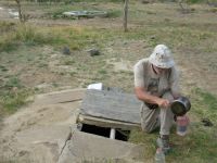
After lunch the winds picked up, making walking extremely difficult. I was knocked off my feet at one point. Worse was that the winds were filled with dust, filling our eyes and noses with blowing sand. We got to the water source in Cerro Colorado Canyon a little before 3:00. The windmill was broken, but nearby there was an algae-covered stock tank. There was a faucet, but it wasnt working so we spent half an hour filtering water. We discovered later that the winds had taken out the power. The tank provided some protection from the wind, but not much. The canyon acted as a wind tunnel. We were unable to clean up there because of all the blowing dust and sand.
Jim wanted to stop for the day since there was a possibility of getting knocked off a cliff by the high winds. I wanted to keep going, unwilling to waste the afternoon waiting for the winds to die down. We kept going, but only made a few more miles since we stopped frequently behind trees or rocks to get a break from the winds. We argued about whether to stop several times. I won, largely because there was no good campsite until we reached a ravine on the side of Cerros Colorados that provided some protection. Before that we staggered along the edge of the cliff trying to avoid the cactus that lined the trail. It was a long way down. Ordinarily this climb would have been terrific; instead it became frustrating and occasionally scary with strong enough winds to make us stagger with almost every step. Jim was right, we should have stopped, but I really didnt want to spend the afternoon hiding in the tent, listening to the wind roar. There were big black clouds all around but it was hard to tell whether that was a thunderstorm or dust storm. The whole sky was solid black. Actually it was both.
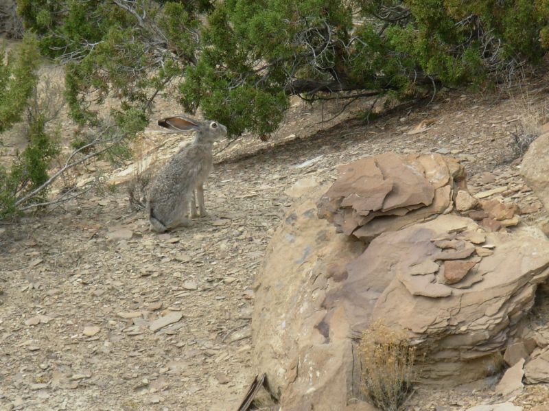
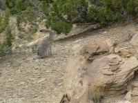
We got a few drops of rain and saw a couple of bolts of lightning, but most of the afternoon was just windy. We did see a mule deer near the top of Cerro Colorado. We also got a photo of a jackrabbit that posed for us near the windmill.

Jim: Still on the new cairned route - past sculpted sandstone formations, in and out of arroyos, along the rims of multicolored mesas, with great views and water every 12 to 14 miles. Really interesting country.
The most "exciting" part of the day was walking through an all afternoon sand/dust storm. The sky was black, the air thick with blowing dust. There were occasional drops of rain and flashes of lightning, but nothing to break the wind. Since we were walking along the rim of the mesa, and the wind was doing its best to knock us off our feet (and occasionally succeeding), life was pretty exciting for a while. Finally we gave up and found a dry canyon to take shelter in until it passed, sometime around sundown.
Tuesday, May 23 18 ½ miles
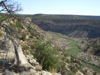
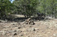
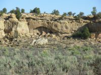
I really enjoyed the hike this morning. We woke to clear cool skies as we climbed up to the ridge next to Cerro Colorado and headed north. It was another day of rim walking, following rocky ledges above deep canyons Rincon de los Viejos and La Ventana Mesa. The views were good in all directions and the walking fun, frequently crossing open rocks through sculpted multicolored sandstone. After about 10 miles we dropped into Jones Canyon, which has a piped spring coming from an Ojo or cave filled with pink roses. There was a ruined stone cabin a short way up the canyon. Our hike had a lot of up and down as we dropped into several side canyons. I really had fun with all the views of steep cliffs and distant green along the Rio Puerco and occasional cow ponds in the canyons down below. They built a really nice trail here. We arent sure where the cairns go next. The map shows possible springs, but we have no idea if they have water or even if the trail has been completed. Weve heard that the trail ends unexpectedly. It seems unlikely, given all the work done so far, but well see.

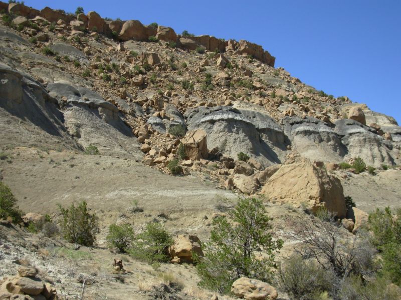
The afternoon continued to be interesting though not quite as expected. We headed across an open sage flat for a couple of miles to Mesa Portales a large multi-colored mesa. It was black and white on the bottom with red rocks on top and mostly yellow boulders along the base. The trail wound up and down and up and down through the gullies at the bottom of the mesa, then climbed straight up several hundred feet. The climb was a little scary since it was very steep on very narrow trail with loose rocks and sand underfoot. They had built steps, but some have already slipped. The last part I had to pull myself up with handholds carved into the rocks. As I said, it was interesting. I would not enjoy climbing down that. It was really steep. It was only about ½ mile, but even so!
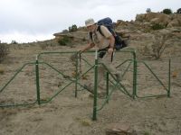
As expected, the trail then followed the rim of the mesa with frequent views off the side. The top was mostly sage and pinion. After about a mile, the trail ended, abruptly, at a gate. We had read about that on cdt-l, but I assumed that the previous hikers had just missed a turn. If so, so did we. We spent half an hour wandering back and forth, looking in vain for cairns. Spur and Ready, whose tracks we had been following, headed west to some jeep tracks. We decided to do likewise since the tracks headed north and northwest. We could have continued along the rim, but the trail map we have, though wrong in places, shows the trail heading away from the rim. In any case, the road will take us north and off the plateau, and eventually to Cuba.
We decided to stop early (5:30) in a grove of trees with views of the mountains to the north because we dont want to get caught up in private property that would make camping difficult. We could see the town of Cuba, far in the distance. That doesnt mean much. We saw Grants from 10 miles away and Lordsburgs freeway from almost that far. But it should be an easy hike to town anyway. Im anxious for a shower, but otherwise town has little appeal right now. Im happy here.
Jim: After leaving Jones Canyon (and the spring), we followed an absolutely straight line through the sage across the valley to Mesa Portales. This kind of trail is "machine-cut" and I found it interesting the the Forest Service now has the money to buy one (or more) of the machines. They don't come cheap.
Then we got to the Mesa and found the trail that's been built up the face of the mesa - that doesn't come cheap either. The only (slight) downside was that the cairns ended about a mile up on top of the Mesa. But it was easy enough to follow our noses and the dirt roads.
Wednesday, May 24 8 miles to Cuba
We had a quiet night aside from one little visitor that chewed a hole in my fanny pack, probably looking for the granola bars Id forgotten inside. I heard footsteps, but never did see what our greedy guest was: mouse, squirrel, skunk? Its only a little hole, fortunately.
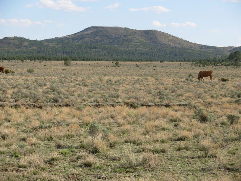
It turned out we were about 8 miles from Cuba. We followed jeep roads down to Kincaid Canyon, a pretty red rock canyon with an arch. We lost Spurs footprints, but picked up those of another hiker. Basically we just followed our noses north and east until we reached the highway about four miles from town. We saw lots of rabbits and a few cows that tried to follow us. Jim said he felt like the Pied Piper of Cowdom. It used to be that cows would run in fear of their lives when we appeared. This year, they follow us. My theory is that the ranchers have had to supplement their feed because there is so little grass this year, so when they see humans the cows assume were bringing food for them.
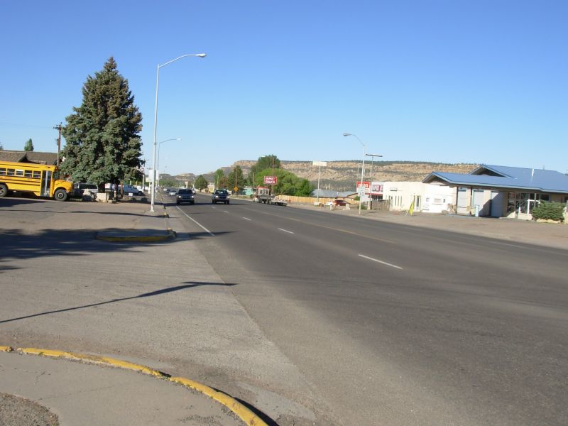
We reached town at 10:30, just in time for a second breakfast at the Cuban Cafe. Then we went to the library to check email. The computer was very slow, so we didnt linger. We noted that the hikers who left Chama last week ended up with serious snow problems. That is no surprise. Im not sure what they expected, but even in a low snow year, there is still snow in Colorado in May. The snow is melting fast, but it makes for some really nasty walking, with postholing at every step. Where the snow is gone it is very muddy. Not fun. As Jim said, Low snow doesnt mean no snow. After all, the yearly average for Wolf Creek Pass is 480 inches 75% of that is still a lot of snow. We tried to warn people that May is too early to be in the Southern Colorado mountains, but no one paid attention. Some will get off the trail for a while; most will road walk around the snow. Only a few will do the San Juan loop, which really is too bad as that is one of the most beautiful parts of the trail. Of course, north of the San Juans the snow levels were normal this year, which means they will still be hiking in snow until mid-June or later. Ten days can make a big difference. We expect that there will still be snow when we reach the San Juans, but it should be less than the knee to hip deep wallowing Stacy wrote about in her journal.
After the library, we picked up lunch at a convenience store and finally enjoyed a most welcome and overdue shower. Laundry and grocery shopping will keep us busy this afternoon.

Random thoughts: Im really enjoying this hike, aside from the occasional and unavoidable roadwalks. This last section with its rim walks and beautiful views and rocks was spectacular. Im looking forward to the upcoming San Pedro Parks and Ghost Ranch sections.
My advice to any future CDT hikers: any time there is a choice between a roadwalk and a more remote trail, take the remote one. That was true in the Cebolla Wilderness, in the Bootheel, in the Rio Puerco, Chama area, etc. Roadwalks are fast and easy, but mind numbing, not to mention foot numbing.
Getting lost: Weve only been really lost twice so far, both times in bad burn areas. A GPS wouldnt have helped. In both cases we knew where we were and where the trail should be, but the mixture of downed trees, spiny undergrowth and steep terrain made it difficult to get back on track. Weve missed a turn or two, but by paying attention it really wasnt hard to figure out the error and get back to our route quickly. I don't really think of that as being lost, just temporarily confused. Having two sets of eyes really helps with that.
Water: Some people advocate water caches in the desert. Aside from the one we set out as we headed for the border (since we had no information about possible water sources on the new trail) and those forced by the forest closing near Grants, none have been necessary. Because of the uncertainty about water sources weve ended up carrying a lot of water, about six liters some days, but that really isnt that difficult. It is a part of hiking in the desert. This was a serious drought year (actually the 8th year of drought) but there was still water along the trail. As on the PCT, weve occasionally taken water from caches to supplement what we were carrying, but, in all cases, we would have been fine without them. Twice we had serious water worries that were solved by outsiders the rancher next to the campground on NM 15 who filled us up when we reached there and the man near Collins Park who gave us a very welcome gallon of water. Had we not met him, we would have had to go four more miles to the next spring not a big problem. And that could have been avoided by heading to the off trail springs that we passed because we were too lazy to go an extra 1 ½ or 2 miles. But trail magic does happen. When there is a need, God does provide, or you just manage to do without.

What can be more helpful than caches is for the hikers who are ahead of the pack to inform the hikers behind about the current water situation. Windmill working or not? Spring dry or not? The internet can be really helpful in spreading this kind of information to other hikers, both thru and section hikers, who are behind. A couple of hikers followed our lead in putting out water reports, but not enough. This saves some worry, knowing, for example, that Jones Spring has water but Ojo del Dado is nearly dry. (Later in the hike we tried to get information about the Wyoming desert, but because there were caches put out for some of the northbound hikers, they didnt pay any attention to the natural sources, and we were unable to find out what the situation was until we got there. None of the southbound hikers put out water information, and because of the rains this summer, what they found in New Mexico was very different from what we experienced.)
Re: the Cibola NF closure: Because we knew that New Mexico was experiencing serious drought conditions, we expected some sort of fire closures this year. It is not unusual for northbound CDT hikers to run into closed forests or fire restrictions. This year, the fire closure kind of worked in our favor. Yes, we missed the climb up Mt. Taylor, which is a special place, but it also meant that all the roads were empty and we had the forest mostly to ourselves. Jim Wolfs route through that area is mostly on jeep roads, ours was simply a higher grade road, for a while. By the second day we were back on the Wolf route. The view off the top of Mt. Taylor is beautiful, and I would recommend it highly, but it was a shorter easier hike not climbing with a full pack and water bottles. That climb is easier southbound, when your pack is empty. So, although we worried about the fire closure, north of Grants it wasnt that big a deal. (The roadwalk into town was a bad one though. I hate paved road walking!)
Health: Jims feet are a major problem. Hes on his third pair of shoes, each worse than the last. He has blisters on blisters toes raw and excruciatingly painful. His bandages cause new sores. Nothing sticks for long. It makes him slower than usual, and eager to stop at the end of each day. Our mileage has been affected not badly, as were still ahead of schedule. More important, he is in constant pain, so hes not having as much fun as I am. So far his knees have not been that much of a problem, thank God. My ankle stopped hurting after several ice packs in Grants, but I know how pain influences mood.
May 25 Rest Day in Cuba
We decided to stay an extra day to allow more time for Jims feet to heal. A blister tore off several layers of skin from his little toe and it is red and raw and very painful. Another toe is red and swollen. With his diabetes, healing takes a long time anyway, and we cant risk infection. So we ate, watched TV and read books picked up for a quarter at the library. (I asked at the grocery where I could buy a book and the clerk looked at me like I was asking for something very strange. Nobody sells books in Cuba, she said. Luckily she was wrong.) Spur and Ready took off at noon. Now we really are the last of the northbounders, since Team Doodah jumped ahead. (Their dog was having a hard time in the desert.)
Jim: Cuba has changed, too. But for the better. Evidently the State has put some money into the town, and built some new buildings (a library among other things). That doesn't however, change the fact that nearly every business in town is for sale. Not a sign of great economic prosperity.
Home | Links| Trail Journals |
The Thruhiking Papers | Bun-bun
Created: Dec 2006
Revised: 30 Sept 2016Copyright © 2006-2017 Spirit Eagle