|
 |
 |
 |
 |
|
|
|
|
|
|
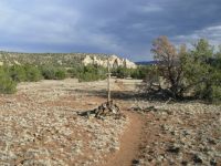
Tuesday, May 9 15 miles to Mangas Mountain

We had a leisurely start to the short 40 mile stretch to Pie Town. Mara came by at 7:00. We enjoyed a good breakfast at Caras Café, then headed up the highway. We were on the trail around 9:00. Jims feet are a bother his insoles are giving him blisters so we stopped a couple of times to attempt fixes. So far, no good. Yesterday we noticed that his feet were red and swollen, but we dont know why.
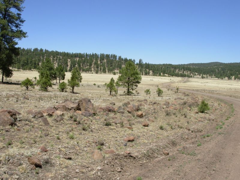
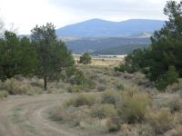
The trail winds through pine-covered hills on jeep road. It is easy walking--not memorable, but pleasant. Well have a big climb this afternoon over Mangas Mountain, but so far it has been easy. We have food for three days but will probably only take two to get to Pie Town. Trouble is, Im expecting a priority package there and it may not arrive before we do. (My pack strap is fraying and Brian agreed to send me a loaner while he fixes it.) There is camping in a park and a trail angel in town, but Id rather not be held up there more than a couple of hours, if possible.
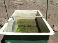
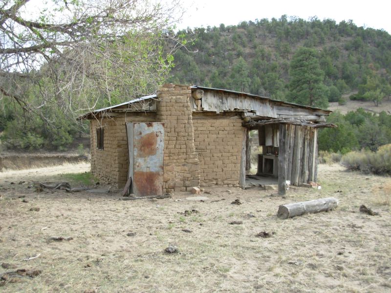
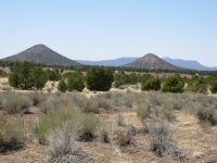
We got a little bit of water at Tio Vinces Spring. The troughs in the corral were bone dry, but there is a spring uphill that had a few inches in the bottom of a large fiberglass tub. It was green with algae, but there was clear water underneath so we loaded up with three more quarts and headed up Mangas Mountain. Climbing 1700 with a gallon of water on your back is always painful. We decided to check out the fire tower on top. It is sometimes manned, but no one was home today though there were signs of occupation (dirty dishes by the door, an axe etc.) It was a rough bushwhack from the road to the top, but not far, fortunately. Rumor has it that sometimes water is available by the cabin, but not today. So we began our descent following utility poles and an old road. At the first likely flat spot we decided to call it a day. Fifteen or sixteen miles was enough. Were at 8900, in pine forest, so it is chilly, especially since it is very windy with strong gusts.
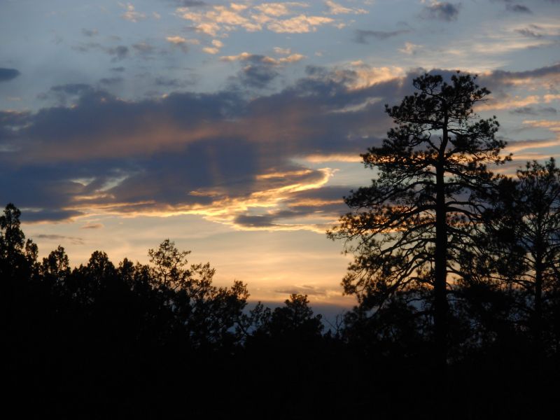
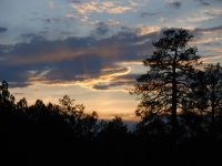
Todays main highlight, besides easy trail through open forest and occasional meadows, was a golden eagle that flew beside us and around us, allowing us a good view. In town we saw some broad tailed crows that were interesting and on the trail we see lots of blue birds. Some are jays, some are bluebirds, some are indigo buntings. New Mexico has a lot of blue birds. The views were good as we climbed the mountain, mostly to the south and west since the mountain was north of us. It felt like a long day, but all in all it was a good one.
Jim: The eagle today was hunting the south face of Mangas Mt. - and we lost her when she found what she was looking for. It was a wonderful straight-in dive - and then she disappeared.
Several people have said they couldn't find water at Tio Vinces Spring. I suspect they failed to read Jim Wolf's guidebook - he gives directions to the upper tanks if the lower ones are dry. There WAS water there although the quantity and quality were nothing to brag about.
Wednesday, May 10 17 ½ miles
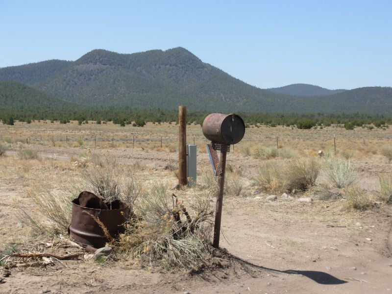
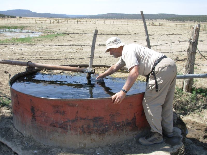
This was a day for following jeep roads out of the Gila Forest toward Pie Town. Its hilly ranch land with pines and pinion and juniper trees. We passed some volcanic plugs and Allegre Mountain. Only two cars passed all morning. One was an old rancher taking food to his cows in an ancient pickup. He stopped to chat for a few minutes. The other sped by. Water was plentiful. There were two new electric wells, one about 5 miles in and the other at about 8 miles. Fortunately you could switch on the pump and get water from a pipe since the first tank had several dead animals on the bottom (rats, squirrels and chipmunks) and the second was a muddy pond. Pat Radney left a water cache for her crew, but we didnt need any so we left it for others who might need it more.
The walking was easy but painful with a few hills but no mountains. If only our bodies werent acting up, this would be really good hiking. The afternoon was more of the same, rounding Allegre Mountain and the neighboring cones, passing old cabins and ranches, one grave and lots of rolling pinion grassland. We got water late in the afternoon at the windmill at the ranch 6 ½ miles from town and found a spot away from the road behind some trees to camp. The map says this is not private land, but wed rather not have trouble. Most of the walk today was accompanied by No Trespassing signs. Our assumption is that the road is public even if there are gates across the road that say, No Trespassing. One was more specific, No hunting, no shed hunting, no camping, no fishing, no hiking, no digging. I spent a few seconds wondering who hunts outbuildings, (Is it okay to hunt barns?) but finally figured out they meant shed antlers. Live and learn. The signs have a very unfriendly tone though.
It was warmer today, probably because were lower (7600) and the wind was intermittent. Usually its calm in the morning and then the wind picks up. By late afternoon it blows about 20 mph, then at dark it stops again. Weve been lucky, most of the time the wind has been at our back.

Jim: This was another of those "improved" roads that we've been seeing. In '99 it was a dirt two-track and the "trail" over Mangas Mt. was a lot more obscure. The road from the top of Mangas to Tio Vinces was rutted and overgrown back then. Now it's been widened, graded and graveled. Progress???
The ranch where we got water is the same place we stopped at in '99. But back then, there were dogs and horses running loose. Now there are no dogs or horses - just the cattle in the north pasture - and the ranch is apparently deserted. This ranch was also where some CDT hikers walked into the house, took some water and left a note for the owners several years ago. There was a faucet outside as well as the windmill - there was no excuse for entering the house. Idiots abound. You don't invade someone's house like that.
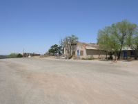
Thursday, May 11 6 ½ to Pie Town
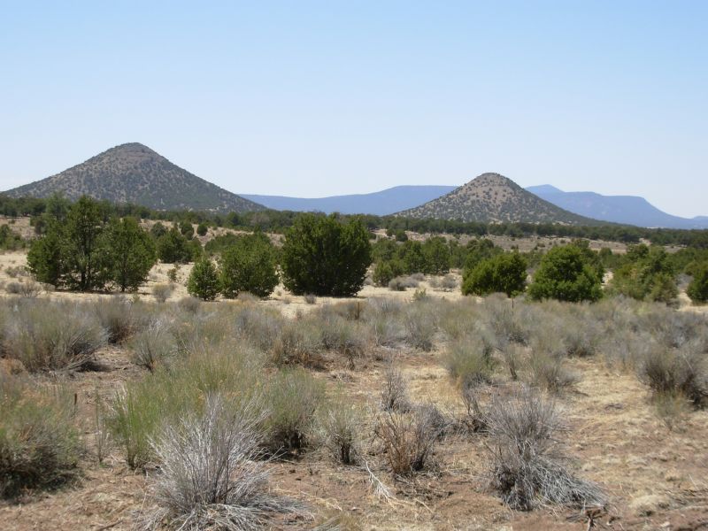
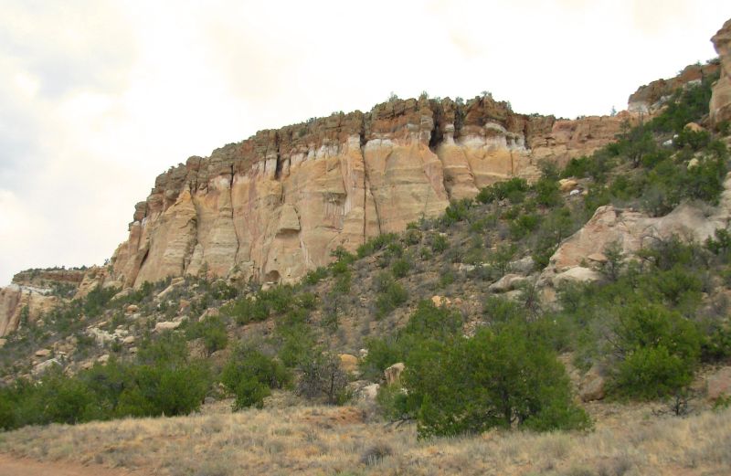
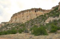
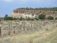
While walking to town, we spotted an antelope ambling across the sage beside the road. It was not at all scared of us. Jim got out his camera but the battery was dead so the pronghorn was long gone by the time he got new ones out. The cliffs above town were as interesting as I remembered, narrow and volcanic. We watched a dozen vultures fight for control of the high ground there. It was interesting.
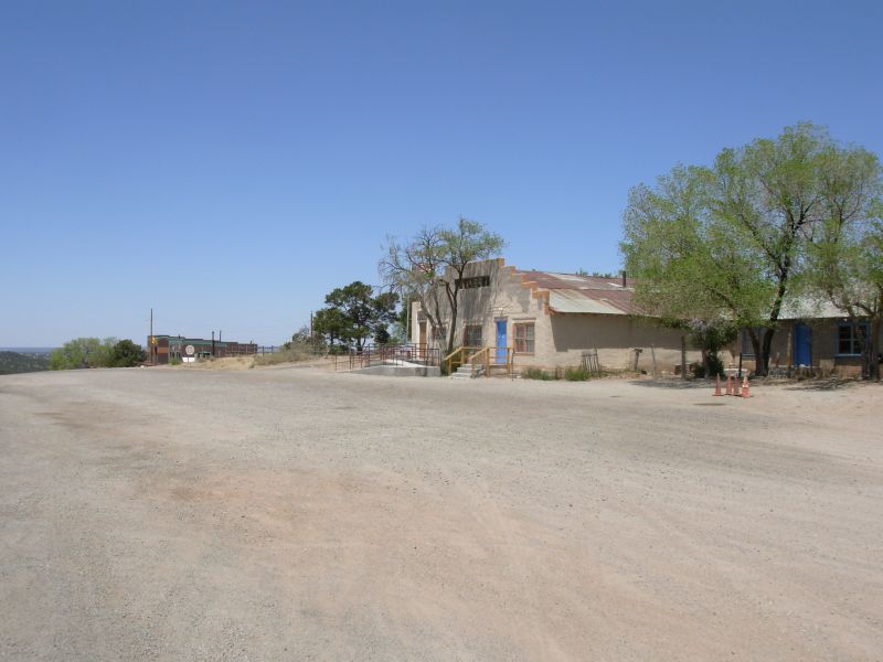
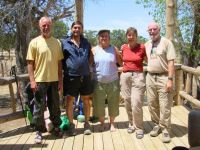
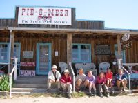
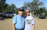
We made it to Pie Town and Nitas home in time for a late breakfast. Nita is the trail angel we had heard about, but didnt manage to meet last time through Pie Town. Her home is an oasis. Two new hikers, Thermo and Five Gallon, were here when we arrived, as was Pat Radney. (Thermo and Five Gallon had an interesting experience in the Gila when they headed up the wrong trail and didnt discover the mistake for 22 miles. They were following the official trail, which had no water. Finally they found a five gallon container left for a fire crew, which they carried for the next three days. Hence the trail name.)
While we were eating a late breakfast at the café, (blueberry pancakes, eggs and sausage terrific!), the Minnesota crew showed up. They are two sisters whose trail names are Poly and Ester, with one husband, Id, and one S.O, Andrew. A third sister joined them here in Pie Town. Weve already met more thruhikers than we did on our entire hike in 1999. After breakfast we got a hot shower and Nita prepared a comfrey poultice for my ankle and Jims foot, followed by an arnica salve. It is nice to be resting.
Jim and I walked to the diner for a burger and piece of pie, then we spent the afternoon talking with our feet up. Nita prepared a really nice dinner for all of us pork roast, potatoes and corn. We watched birds out at the feeder and by the water very peaceful.
Jim: So much for spending only a couple hours in Pietown. By the time we got here my right foot was swollen and Ginny's feet were giving her major problems. We were glad to see Pat again, but the rest of the Express had already left. They're into 25-30 mpd mode.
Ginny got a loaner pack from ULA today. She'd been having problems with the pack we bought a couple months ago and when she called Brian, he told her he'd send a loaner to Pietown and then we could send hers back to him so he could fix it. He'll send the repaired pack to Chama. Good customer service.
Friday, May 12 Rest day in Pie Town

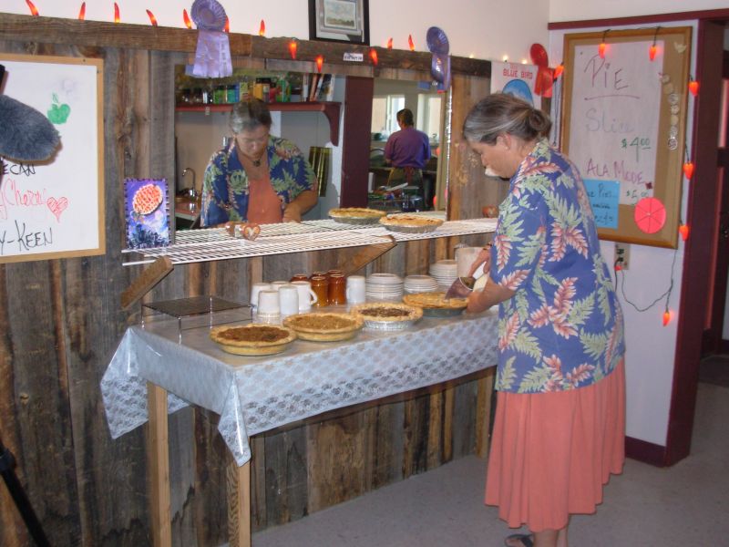
We decided to stay over a day. My ankle feels better after all the TLC, but it still hurts. Jims foot is still swollen and red. Although I wasnt planning a day off, this is a very quiet peaceful place for a break. We walked to the Daily Pie for breakfast, then back to the house, then back to the other café, the Pioneer, for pie. Mark Flagler filmed us all eating pie at 10:30. We sat and talked, then had lunch, and finally headed back to the comforts of Nitas porch. Were probably here for the duration. Neither of the cafes is open for dinner. We met a couple of Great Divide Trail bike riders, finishing up their trail after four years. They joined us at the café for lunch. They had called up the café to ask about groceries and were told, The grocery closed years ago, but Im going shopping tomorrow. What do you need?
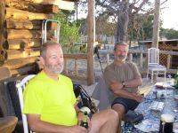
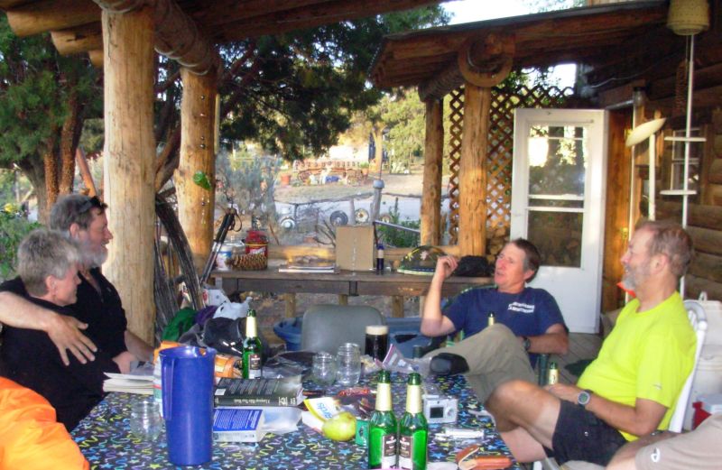
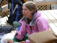
Around 3:00 Spur and Ready, long time hiker friends, showed up. They ran off to get lunch before the café closed, then came back to wash up and do laundry. We wanted to rest our feet so didnt go with them to get a final piece of pie, but we should have. Don, Nitas husband, arrived around 6:30. Hes a prescribed burn specialist with New Mexico Fish and Game and only gets home on weekends. He was a really interesting man. I enjoy hearing an expert talk about his field. Its a window into a new and different world. He and Nita are both a lot of fun to talk to. Nita made broccoli casserole and salad for all of us. They have a friend, Jeffrey, who has been visiting who is also interesting. He lives a peripatetic life, working seasonally then traveling the world for a few months every year.
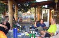
Jim: It was good to see everyone - Spur, Ready, the Minnesota crew, Thermo, Five Gallon - and then Mark Flagler showed up and did some interviews. We've met more thruhikers so far in NM than were on the Trail in 1999. And this time we got to meet Nita - she's truly a wonderful Trail Mama. When Don got home things got really interesting. He's cool, too.
Both cafes were open - and Pie Town lived up to it's rep - the pies were great. But there is NOT a grocery in Pie Town no matter what anyone tells you. Someone was spreading bad information about that.
May 13 Saturday 16 miles to the Thomas Ranch
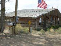
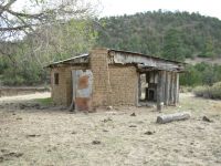
Although we arent really healed, it was time to go, so after a good breakfast at the café, we headed north around 9:00. Spur and Ready decided to wait to have breakfast with Don and Nita so didnt leave until much later. The walking was rather dull as we followed a graded dirt road through pinion juniper flats with only occasional views of distant mountains. We made one foolish mistake. In talking about this section, someone mentioned the Thomas Ranch at 9 miles where we could get water. I assumed, erroneously, that that meant 9 miles from town. No, it was 9 miles from the north end of the section, mile 9.7 in the guidebook description. Unfortunately that meant we had to go 16 miles to the first and only water source, and we were only carrying two quarts apiece. We got very thirsty on our dusty road walk. About three miles from our destination, a truck stopped and Mr. Thomas, the owner of the ranch, told us where to find the water (from a faucet next to the metal building) and said we were welcome to camp on his property. Hurray!
We stopped early (4:45) but happily after quaffing a liter each by the faucet. This is the same place, the same people, where we got water last time through. Since there is less water along the trail than in 1999, thanks to new home construction and one well that was turned off, it was very welcome. We are both in a fair amount of pain, so this early stop seemed like a good idea, especially since we can camp here legally. The road goes through private property for the next several miles, which can be a problem.
Jim: Pie Town - was all anyone ever told us it would be. Nita was home this time and she spent two days nursing our feet back to life - Ginny had tendonitis (still does) and Jim's foot was swollen to well beyond normal size (both of them right feet). But both conditions were mitigated by Nita's treatment of comfrey baths, arnica salve and ice packs. A little rest helped too. We took an unplanned zero day there.
Nita is a super lady - and Don is a trip - he and I drank beer and told lies until I collapsed in exhaustion on Friday night. OK - not really lies - but some really good stories. Don is a prescribed burn specialist for the State of New Mexico. The bad news is that Nita and Don are moving 5 miles away - a process that will be pretty much complete by this coming weekend when their last daughter (Autumn) graduates from High School. The good news is that they'll keep the house, and the porch will still be open to hikers. The bad news is that it won't be the same without Nita and Don there.
Leaving Pie Town we hiked 15 miles to the Thomas Mt Ranch - where we met (again) John Thomas and his wife, Anzie. In 1999, we met them just after they had bought the ranch and they gave us water when we desperately needed it. This time they once again gave us water when we desperately needed it. And allowed us to camp on the property. Wonderful people. The freeze proof faucet by the metal building is about 600' off the road in back of the log building and is available year-round. That's the first water source north of town currently working. In '99, there were several water sources between Pie Town and the Thomas ranch. Things change a lot in six years.
Sunday, May 14 17 miles to the Cebolla Wilderness
Spur and Ready showed up at the ranch at 8:00 a.m. They didnt leave town until 3:00 yesterday. We saw them by the water faucet and went down to say hello and also to say goodbye to the Thomases. We ended up visiting for about an hour. They are really warm and kind people. They have church services here once a month and spend part of their time at their home in Albuquerque. Mr. Thomas reminded me a bit of Keith Shaw on the AT. She is the epitome of a grandmother the storybook kind, not like mine. We finally headed out around 9:15. It is a warm day with intermittent clouds, much like yesterday. The land is open, with few trees and bushes, just grass and sage. Along the way we passed some new housing developments. Nita said land speculation is hot right now, despite the lack of water. We saw a lot of For Sale signs south of Pie Town too.
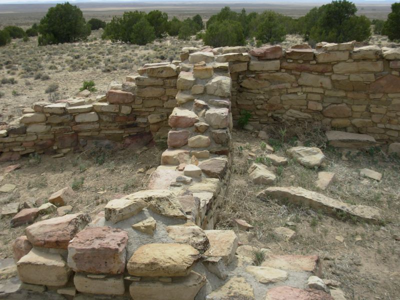
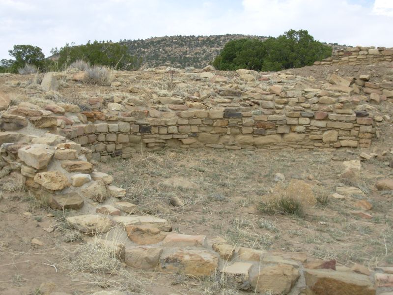
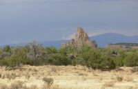
We topped off our water at a solar well along the road. We got the overflow from the top of the well, a shower running down the side of the tank. Shortly afterward we saw an antelope. He stopped to look at us, but ran off when Jim got out the camera. Were doing the same route through here we did the last time for two reasons: I want to look for the Dittert Site some thousand year old Indian ruins plus there was a message on CDT-L that most of the wells on Jim Wolfs route arent working. We are hoping Armijo Spring will have water, but we wont know until we get there.

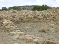
Later: We never did see Spur and Ready again. They plan to follow the graded road to the highway, but we want to get away from the roads for a while by going through the Cebolla Wilderness. The mileage is the same, but Armijo Canyon is definitely prettier than dusty CR 41. We were able to find the Indian ruins -- two sites actually. One had been excavated so you could see the shape of the rooms (one round, several square) and some excellent stonework. There was mortar, which surprised me. The other was up a hill and only one corner was exposed, confirming that it was an old village site. There is supposed to be a petroglyph nearby, but we didnt find it. Both ruins were found more or less by happy accident. The old jeep tracks are filled in and there are a multitude of cow paths through there. We followed some and found the ruins. I knew what to look for (rocky ridges) which helped.
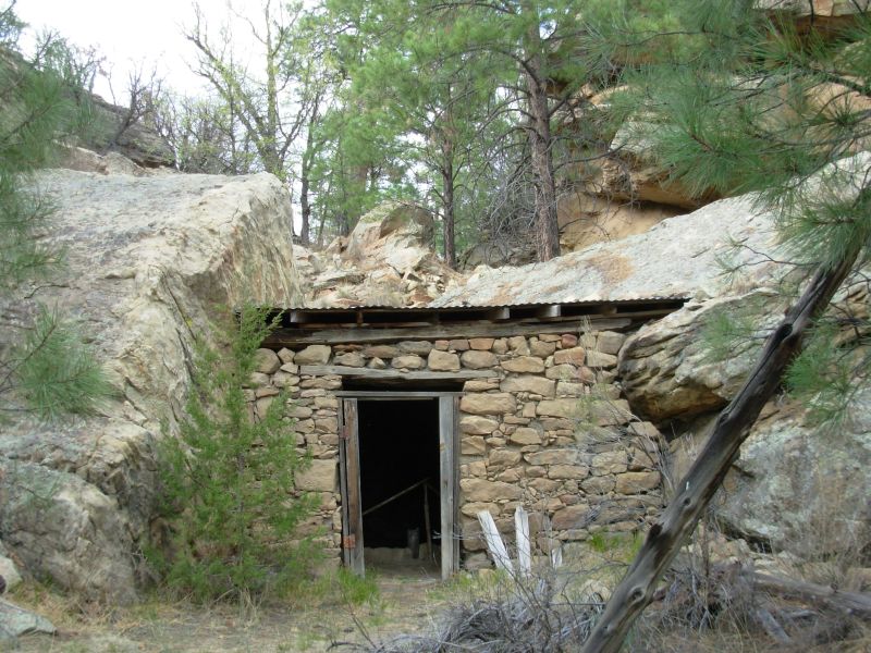
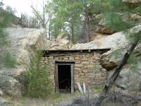
We followed cow paths to a windmill which had some water in a mucky cow pond about a half-mile beyond the main site. We left it to the cows and headed up canyon in search of Armijo Spring. There is an old cabin, pretty derelict but still useable, and the spring is 100 or so above it. There is a good path up to a big spring house. Last time we were here, it was full of water; this time it was bone dry. So we kept on going. Our final option for water was another, larger stock tank. It had water, but was milky, so we decided to make do with the four quarts we still have and call it a day. We hiked 16 or 17 miles and are pretty tired. It is about 8 miles to the next water, maybe less. Well be thirsty but okay.
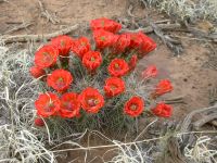
The clouds are still gathering. There was some virga falling to the north, but no real rain despite the dark clouds. There were a few flowers to liven up the landscape: our first Indian paintbrush, a tiny white daisy and several blooming hedgehog cacti. They are a bright spot of color against the rocks and sand. Armijo Canyon is interesting because the arroyo is so steep and narrow. It makes you think that the only time it sees water is in the brief flash floods that tear through the sand.
Jim: We parted company with the route taken by some of the other hikers and once again took the Armijo Canyon route through the Cebolla Wilderness. The bad news was that Armijo Spring was dead dry; the good news was that we spent some time exploring the Dittert Site (pueblo ruins that date between 600 and 1000 years ago). We took nothing but pictures, which will be sent to the appropriate people when we get home.
There's a real sense of remoteness in the Cebolla - it's much better than the roadwalk alternative.
Monday, May 15 20 miles to the Zuni-Acoma Trail
We woke to the gentle pitter patter of raindrops on our faces only about 16 drops but it was enough to make us put up the tent, just in case. We never got any more rain, but the wind beat at the tent mercilessly. Sleep was scarce. We woke to clouds almost a cold fog all around us. The clouds lifted soon after we began walking, though there were a few that offered shade. At noon a big black cloud built to the north while we ate lunch at a picnic table at the Narrows. We decided to take it slowly.

The walk down Sand Canyon in the Cebolla Wilderness was a pretty one. Rocky cliffs rise 100-200 above the jeep track that we followed. There were pinion, ponderosa and juniper trees and many intriguing side canyons that Id like to explore. I was a bit irritated when I realized that the guidebook route is not the one shown on the Ley map. Jim Wolf includes a route through Cebolla Canyon to take advantage of a good spring there, so the information we had from the CDT-L email list about there being no water in Sand and Bonine Canyons wouldnt have applied to the guidebook route we would have taken if we hadnt heard there was no water. On the other hand, many of the natural springs have been dry this year. Only Mud Spring and Davis were flowing as expected. Still, I would rather spend more time in the Cebolla Wilderness and less on CR 41. I dont understand why people skip the Cebolla and follow roads instead. Roadwalking may be faster, but its not nearly as pretty.
We didnt run into any wildlife except prairie dogs out by the highway. We saw lots of those. We got water 1/4 mile from the end of the section. We still had a little left from yesterday. Its another 22 miles to the next on-trail water. They moved the road at the entrance to the BLM land so it no longer passes by the windmills. One is ¼ mile away the other ½ mile. It also extends the walk on the highway, which really wasnt welcome. Our plan is to hike the Narrows Rim Trail, unless it starts raining. We did 12 miles before lunch, so we can afford a long break while we wait for the clouds to pass.
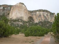
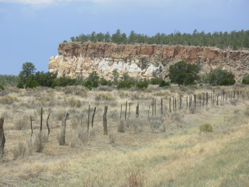
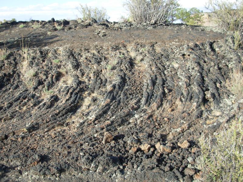
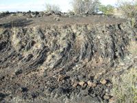
Later: While we sat under the shelter of the picnic pavilion, the dark clouds grew, thunder rumbled and eventually a little rain fell. When it stopped we decided to get going as it was already 3:00, but we decided against the Rim Trail since that was high and exposed and would require a steep scramble down, not a good idea during a thunderstorm. Sure enough, half an hour after we started out, it began to rain again in earnest this time. Even with rain gear on we got soaked. I didnt mind since the desert needs rain so badly. The afternoon walk was along the highway through the Narrows, a beautiful area with black lava on one side and tall orange and white sandstone cliffs on the other. We reached La Ventana New Mexicos largest arch in full deluge, so we stepped into the outhouse to wait for the rain to ease. In about 10 minutes the rain stopped and we did the final few miles on the highway in sunshine. Then we headed across the Malpais on the Acoma Zuni trail which crosses several lava flows in 7 ½ miles. It is intermittently very rough walking, not ideal for the end of a 20 mile day with a full load.
We topped off our water at the trailhead, where we found two water caches, one that Pat put out and one that Spur had arranged. They werent necessary since we were carrying a full load from the last windmill, but at least we wont be worried about water tonight. And when in doubt, we always fill up. There is supposed to be a windmill in ten miles or so, and even so, I think Spur and Pat both have caches ahead. Im not big on the water caches, since most of the time they arent necessary and they dont seem to have any relation to any real lack on the trail. Weve found caches within a mile or two of a good source. Pat just puts out water every 15 miles, regardless of wells and windmills. Admittedly, the water does taste better than windmill water, but its still not necessary. Some hikers arent willing to accept the uncertainty about water that is a part of the CDT. To me, its an integral part of desert hiking, no big deal. We usually end up carrying more water than we need, but so what? Yes, it is a worry not knowing if the well ahead will be working or not, but most of the time weve done fine even when the well was broken or the spring dry. Thirst is not fun, but it is a part of the desert experience. It is possible to be too comfortable. Hiking this trail takes you out of your comfort zone or it should. Some people dont accept that. Ive learned that I can be thirsty and still survive. I can be hungry or cold or dirty, and still be open to the beauty around me and still happy. OTOH, I wont refuse good water when its offered to me. Im not that big a fool.
Jim: We didn't follow the Narrows Rim Trail - we stopped to eat lunch and the thunderstorms hit - and continued through the afternoon. The Rim Trail was no place to be while the lightning gods were playing. So we had a long afternoon of paved road walking to get to the Zuni-Acoma Trailhead. We camped about a mile from the trailhead - after all, it was only a 20-mile day.
Just as we got to the eastern Zuni-Acoma Trailhead (past all the road construction), we saw Mark Flagler drive by. We waved but he didn't see us.
Tuesday May 16 24 miles to Grants
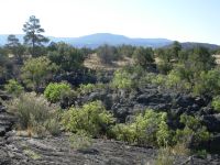
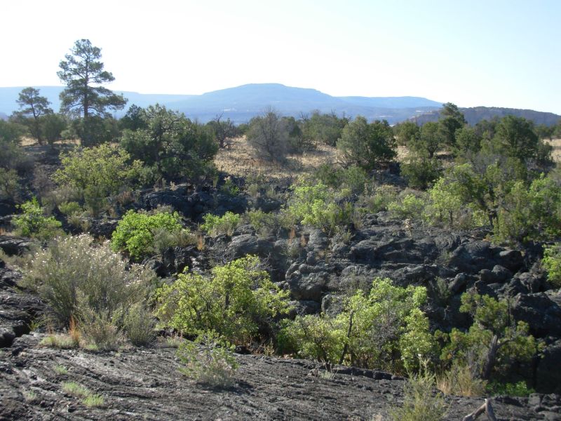
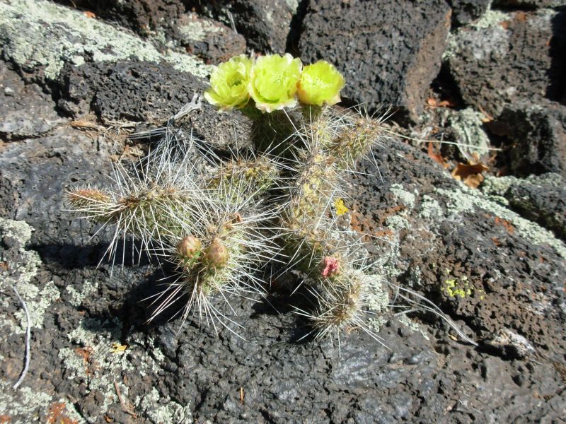
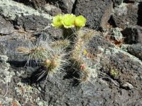
It rained again during the night. Fortunately, this time we had the tent up so we were able to just roll over and go back to sleep. Getting out was a bit slow as we wanted to dry the tent a bit before packing it, but we still were able to be on the trail across the lava by 8:00. It took 4 ½ more hours, plus the ½ hour last night, to hike across the Zuni-Acoma Trail. Either our memories are faulty or they moved the trail. It felt longer and more difficult than we remembered. It was also much better marked. We remembered breaks in the lava, but there were none except at each end. With bad knees, feet and ankle, we were very slow and careful and still ended up with a lot of pain. It is interesting hiking on all the ropy rock, the fissures, holes and caves, but a little of that goes a long way. There were lots of flowers since the hedgehog cactus is in bloom. With prickly pear, they are the dominant cactus. The prickly pears are just starting to bud with yellow flowers. We saw some orange paintbrush, purple phlox, white asters or fleabane and a white bush and another with a very sweet-smelling flower. The signs of life mixed into the lava is part of the fascination, but still I was very happy when we finished. Jim was in a lot of pain, so he was really unhappy with the whole mornings exercise, especially with a full load of water.

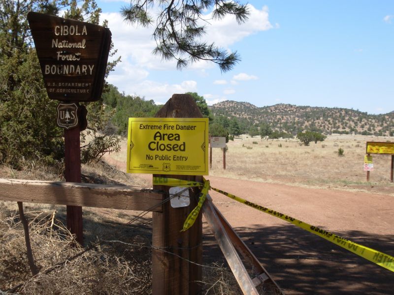
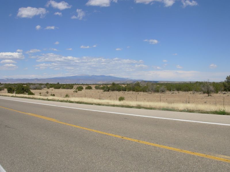
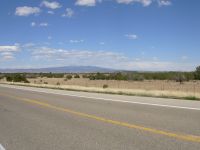
Our plans changed after lunch. We left our picnic table at the trailhead, intending to follow the route up Bonita Canyon to Zuni Canyon to Grants. We hoped for a short day to make up for the difficult lava walk. Instead we ran into a yellow tape across the road and signs saying, in English and Spanish, Area closed. Extreme Fire Danger. No entry allowed. We had heard that parts of the Cibola National Forest were closed, but I didnt connect that with the area south of Grants, just Mount Taylor. We briefly considered going through anyhow, but Ive become impatient with thruhikers who think theyre so special the law doesnt apply to them, so reluctantly we headed up the highway. We were about 15 miles from the edge of Grants. Parts of the walk were pretty, especially in the beginning. By the last seven or eight miles we were seeing houses and trailers on one side and open desert on the other. Lots of prairie dogs and singing birds, a few horses and ponies, but not much else was of interest besides the red ridge to our left.
We really really didnt want to do the long roadwalk, but there was nowhere to camp after the first couple of miles and no water. We were offered a ride twice in five minutes, but reluctantly we refused the offers. We may not like roadwalking, but if its part of the trail, and this year it is, we cant skip it just because we dont like it. Its not a thruhike if you decide not to hike a section just because its not ideal. A lot of thruhikers dont agree. But where do you draw the line? Skip the paved sections, and you miss at least 50 miles of the CDT. Graded roads are boring too, so will you skip another 100 or 200 miles? Some do. We wont. Missing a section because of an emergency situation is different. Fire closures are not a choice. Weather or injury may force you to leave the trail in a place where you cant get back on without major problems. But road walks are part of the CDT, at least for now, so well do them even if we do grumble a lot.
When we reached town it was 8:00 p.m., getting dark and we still had two or three miles to the nearest motel. Grants is really spread out. We ate dinner at MacDonalds and headed east. We stopped at the first place we saw, the Sands Motel, partly because, unlike the nearby motels, it didnt back onto the railroad tracks. The Minnesota family was also there. They arrived this morning. The Post Office is about a mile back. Were here three days ahead of schedule and we hurt enough that we may end up staying two days instead of the one we had planned.
Jim: We crossed the Zuni-Acoma - and got highly frustrated. In Nov '99, the trail consisted of sections of lava interspersed with sections of grassland. This time there was a mile or so section of grassland on either end and the rest was solid lava - even when there were sections of grasslands paralleling the trail. The good news is that the trail is easier to follow because there are at least 3 times as many cairns as in '99. The bad news is that the trail is harder to walk because of the constant lava with no break. Speaking as a trail builder and maintainer, the relo sucks swamp water.
After we reached Bonita Canyon, we learned that the Cibola Forest was CLOSED (thanks to yellow tape across the gate, and big signs that said, "Extreme Fire Danger. Area closed to all entry.") So we had a choice - walk Bonita Canyon illegally (a $250 fine if you're caught), hitch into Grants, or do the 16 mile road walk to Grants on top of the 7.5 miles Zuni-Acoma trail. Being not too bright, we chose the roadwalk - and paid the price for it. Both of us have trashed our feet, so now we'll take at least 2 days off in Grants - which will still put us at least a day ahead of schedule.
The roadwalk did provide us with some minor entertainment - prairie dogs now inhabit the places where cows once roamed. They seem to have a constant death wish, crossing the road randomly, paying no attention to traffic. We wondered where the coyotes and hawks were - this would be heaven for them. But don't get to thinking that prairie dogs are better than cows - if cows are on the land, then the land gets managed. The prairie dogs simply destroy everything in sight.
Water - has been a constant problem, but not deadly. There have been water caches left for hikers, and we've taken some of the water, but truthfully, have never actually needed it. We've always reached another water source while we were still carrying more than we took from the last water cache. Means we've been carrying too bloody much water.
Dehydration - is another problem. Generally, between the temps and the humidity (or lack thereof) we can't drink enough water to stay hydrated. Doesn't help when the water is lukewarm to downright hot. Koolaid (sugarless) helps tremendously in making it possible to swallow a gallon or more a day. Yesterday my last urination was at 2 pm - the next was at 2 am this morning - in spite of more than a gallon of water, three MacDonald's sodas when we got to town and a quart of Mountain Dew in those 12 hours. Yeah, I know - that's more than anyone wants to know about this subject.
One good thing about the dehydration - there was only one big bush in the entire 16 mile section to provide privacy from the passing cars - and fortunately we never needed another one. Yeah, I know - you didn't want to know that either.
May 17-18 Days off in Grants
We decided to rent a car this morning so that we didnt have to wander miles in search of the grocery store, post office, internet, etc. It costs a lot more than I like, but given the state of our feet/legs, it makes sense. We did laundry, visited the National Forest to get a permit to enter the closed forest (and avoid the $250 fine if caught without a permit), finally caught up on reading emails, ate a lot, shopped at the Super Wal-Mart on the edge of town, made some phone calls and got no rest at all. Thats tomorrows project, though Im not sure whether that will happen either given current plans. We are allowed into the Cibola National Forest only if we remain on one main dirt road that goes around, instead of over, Mount Taylor. A local trail angel, Tom B., has permission to enter the forest to put out water caches since the road does not pass by any viable springs. Of course, with so many hikers ahead of us, we could still get there and discover that the caches are empty. Tom put out five gallons today, but there are seven hikers heading out tomorrow, plus us the day after. Unless he goes out again, well be out of luck, with the first natural source in about 40 miles. It will be interesting. Oddly, only two forests in New Mexico are closed so far, despite the drought: Cibola and Lincoln. The rest are still in Stage 1: no open fires. Stage 2 means no stoves or smoking. Stage 3 means closed, but entry with permission. Stage 4 means no entry, at all. Not being able to use a stove is a problem only because Ill miss my morning coffee, but Ill live. Its only two days. Weve gone cold for part of the hike already in anticipation of just these kinds of restrictions. It just makes us appreciate our hot meals more when we do get them. Scarcity serves a good purpose.
Jim: We had a little rain this week, the first for the entire trip. Didn't do much besides dampen the ground (and us), but it was still a welcome sight. We actually had to put the tent up two days running. I think that makes four nights out of the past 29 that we had to sleep 'indoors'. We missed the stars and moon. It rained when we were in Silver City, but that doesn't count because we were eating Gelato indoors at the time.
Spirits are good - and the feet are getting better, in spite of yesterday's long, long miles. We expected the forest closures because of the drought, and just feel lucky that we've gotten this far without being affected by them. We hope we manage to get through the rest of New Mexico without any more unexpected roadwalks.
Thanks to the forest closure, we're now faced with another 40 mile road walk out of Grants. Only ten miles are paved, the rest is gravel/dirt, which is not quite as hard on the feet. And since the road is closed, we won't be eating car dust all day. It makes for quick walking - but the feet don't appreciate it much. There's a trail angel here in Grants who has special permission to provide water to the hikers (the roads are blocked). Otherwise we'd really be in trouble because there's little to none along the roadwalk. There may be water in some of the springs along the trail we'd normally take, but we're not allowed to go there. So we'll just be thankful that the Forest Service is being this flexible.
The BLM lands we'll pass through aren't closed yet and as far as we know, they aren't restricting stove use except in the Cibola Forest. The Carson and Santa Fe forests still seem to be okay.
Home | Links| Trail Journals |
The Thruhiking Papers | Bun-bun
Created: Dec 2006
Revised: 30 Sept 2016Copyright © 2006-2017 Spirit Eagle