|
 |
 |
 |
 |
|
|
|
|
|
|
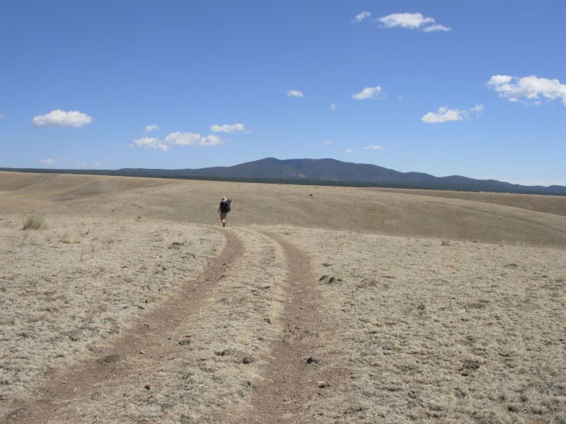
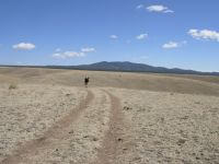
Saturday, April 29 13 miles to Bear Creek
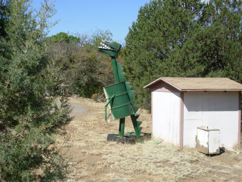
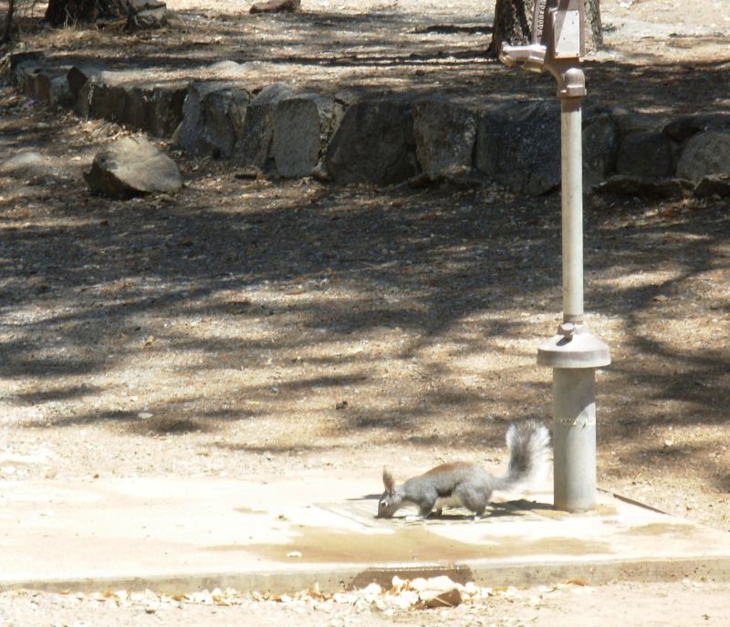
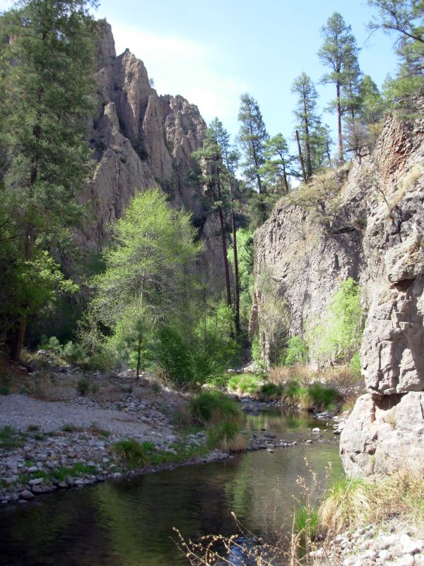
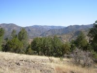
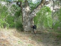
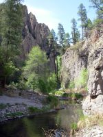
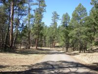
It wasnt as cold this morning as yesterday, but it was still chilly. No rain or snow today, just cool clear sunshine. There were snow flurries yesterday in the mountains. We left town around 9:00 heading north on a paved road past houses for about five miles to the Gila National Forest. There were some nice houses and some not so nice ones. A castle on a hill, an oil barrel dragon, Jack Frost Road (my brother and father are both called Jack Frost), and a meeting with Jerry were the highlights. We stopped for an early lunch at Walnut Mountain Picnic Area where we were visited by a flock of woodpeckers and a squirrel with tufted ears, probably an Abert Squirrel. It is a nice area with tall fragrant pines and a noisy bird population. We decided to follow Jonathan Leys route here since the official route is longer, with no water for the first 16 miles. On this route there should be water at 6 and 12 miles. We learned that several northbound hikers are a day or so behind us and plan to take tomorrow off, so well still be ahead for a couple more days. Theyll probably pass us in Reserve. I'm looking forward to meeting them.
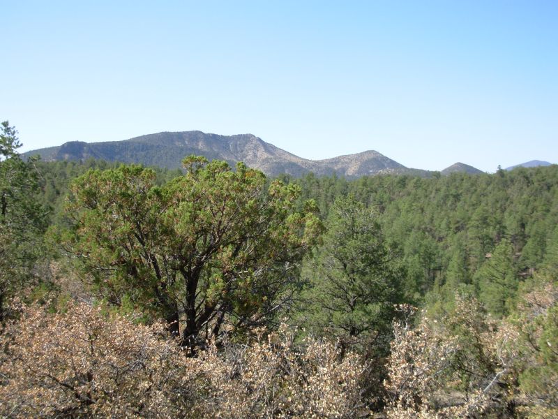
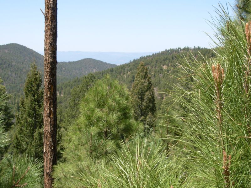
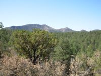
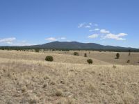
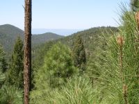
Much as I enjoyed town, Im happy to be on the trail again, despite a too heavy pack. It always feels good to start a new section. The Gila Forest is beautiful with lots of peaks and ridges, tall pine and spruce trees. One of the surprising things about the CDT in New Mexico is how little of it is true desert. Except for the area around Ghost Ranch, were done with the Sonora desert.
A note on Jonathans map warned about an obscure turn. Instead we found an obvious jeep track heading north. It turned out to be the wrong jeep track--we had turned too soon in our anxiety not to miss the turn. We bushwhacked through dense scrub oak to the right road, which wound up and down and around through the hills. It was a rough and rocky road, but easy to follow, just steep in places. We ended up camping along Bear Creek, which has only a little water, but enough for our needs. Its a steep narrow canyon, so finding a campsite for the three of us wasnt easy. Were tired but content, especially since we stopped early. The route climbs from here and no one was in the mood to do that now with a full load of water. Mara is slow after five days off and were no better. All the up and down, plus the six miles on pavement, have hurt Jims knees. An early night was definitely called for, even though we did only 13 miles. Preachers Point above the campsite was lit up with alpenglow.
We had been following ATV tracks all afternoon, but were surprised when three people on two ATVs passed us at our campsite, heading back toward Silver City. They also had three shotguns mounted on the vehicles. I have no idea what they expected to hunt right now.
Jim: I don't like paved road walks much - they aggravate the knee damage. OTOH, they're part of the trail, so we'll walk them. Some people blow off the paved road walks - then later they start to blow off the dirt road walks. Where does it stop? The CDT has a LOT of road walks of one sort or another. Personal opinion is that if we're not doing the road walks that are part of the Trail, then we're not thruhiking the Trail.
The wrong turn off the road today was an interesting case, because we were ALL paying attention - but NONE of us thought to do a time check to determine how far we'd come on the road. A case of paying attention - but not paying attention. I'm old enough to know better than that.
Sunday, April 30 11 ½ miles to Sheep Corral Creek
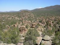
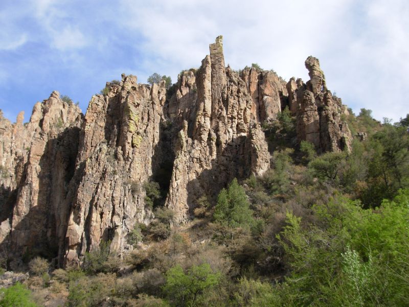
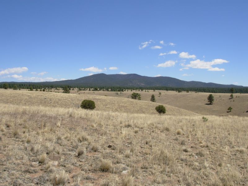
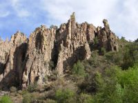
A cold night made for a late start since no one wanted to move this morning. We were warned that the trail today would be obscure. Jonathan was right. First we followed ATV tracks past a couple of ruined cabins. When the tracks disappeared in the rocks, we followed cairns until they vanished. We wandered in circles for half an hour before we finally found more cairns. Trouble is we were trying to go up the wrong drainage. We turned back and there they were - cairns. We were also following horse tracks, which really helped. We passed a really interesting area known as the Devils Garden with volcanic rock formations all over and nice views of the ridges beyond. The route finding was really slow and we had a lot of miles to go to get to water.
Later: It was a difficult day, but an interesting one. We lost the trail several more times in a large burned area and spent a frustrating amount of time bushwhacking in search of it. Some of our routes were pretty hairy, either through dense brush or straight down to a ravine, then up it. Mara was terrified at the descent. Since she was wearing shorts, she really wasnt happy at all the brush either. Parts of the trail were nice, through pine forest. Some was in brushy manzanita. Mara was considering leaving the trail, but reconsidered when the trail got easier. At the end of the day, she decided that it was time to stop hiking with us. Mara is slower than we are, despite her long legs, and she says that she is tired of playing catch up all the time.
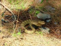
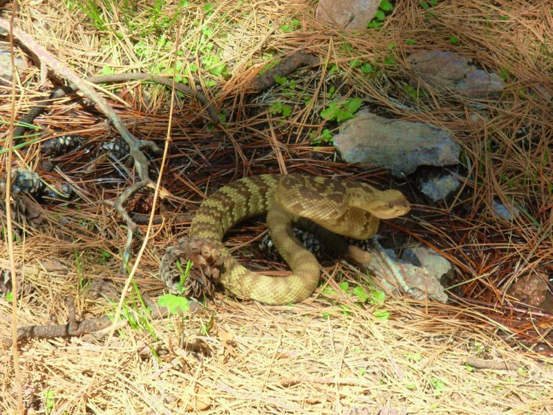
We didnt manage to hike the 16 miles we had planned to do today, thanks to all the wandering and route finding, but we did find a nice spot to camp next to dry Sheep Corral Creek. Sidewinder, another CDT hiker, showed up about 10 minutes after we stopped. It was fun to see a new face and hear his story. We had other interesting encounters: a big fat rattlesnake near a spring and six deer, four in the last mile. We were lucky to find a very nice spring that made it easier to stop early. I hate carrying a lot of water uphill for miles, but today it was worth it.
Today was a day of firsts: first thruhiker, first rattlesnake, first time losing the trail in a big way, and first time putting up the tent. Big dark clouds have been building all afternoon. I only felt a few drops of rain, but you never know, so we put up the tents as a precaution. We had a good thunderstorm in town, and Id hate to have one in the middle of the night without shelter.
This afternoon I found a camera hanging in a bush. It was digital so we looked at the images and I recognized one of the hikers so well see if we can return it. Its a nice camera that probably was snagged off someones belt by the dense brush.
Jim: The "lost" parts of the day were frustrating, but they were the normal sort of "lost" out here. We knew where we were and we knew where the trail was - the question was - How do we get from here to there? In heavy brush and broken terrain the answer isn't always obvious, but it's ALWAYS doable. It can, however, be difficult. This isn't a problem that's resolvable by GPS, either. Sidewinder also had more than a little trouble with that section.
Jonathan's route out of town may be the shortest but it's not necessarily the fastest. We enjoyed the Devil's Garden - but lost the trail completely in the burn area north of there. It only cost us an hour or so. But we did find the spring - a welcome sight, in spite of its guardian rattlesnake.
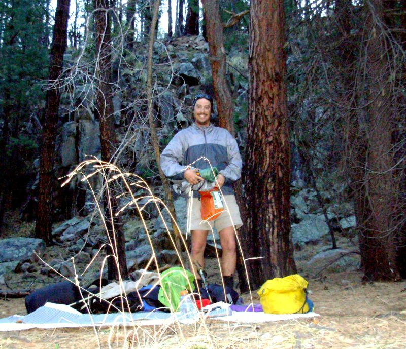
This was the first time we've put the tent up. I'm much happier without it. But I don't like wet sleeping bags even more than I don't like wet tents.
Monday, May 1- 12 miles
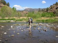
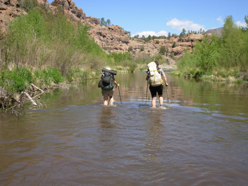
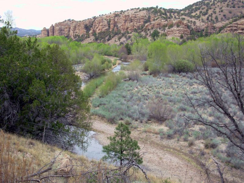
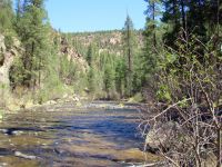
Today was interesting in a different way. After 4 ½ miles of rocky steep descent on pack trail, we reached shallow Sapillo Creek and the deeper Gila River. Ive read that the confluence can be a problem during snowmelt, but it was less than knee deep today. We passed an old abandoned campsite with a sleeping bag, chair, fry pan, etc. all well gnawed. We wondered why they abandoned all their camping gear in such a hurry. All afternoon we criss-crossed the river through a steep rocky canyon. It was very beautiful. There are mint-green cottonwood and sycamore trees and huge pinion pines and ponderosas. Some of the walking was easy on smooth trail in the trees, some was very hard on soft sand or round river rocks. None of the crossings was difficult. Most were knee-deep or less. A couple were above my crotch. Sometimes the water was a bit fast but we never fell. Fortunately it was all quite warm, so we didnt mind being in and out of the water all day. We saw three mule deer that bounded straight up the hill and a couple of ducks. We heard a turkey by Sapillo Creek and saw a lot of bear scat. This is a very beautiful area. It is fun walking here when its warm. I remember falling into the creek in November it didnt feel nearly as good as my bath this evening.
I looked up at the caves above our campsite and wonder whether any of them are occupied, either now or in the past. Did the Anasazi live there? We found a nice little spot in the pines, sheltered from the wind. We were in shadow by 5:30 because of the steep canyon walls.
Jim: At last - back in the Gila. This is one of my 37 (or maybe 53? - or was that 79?) favorite places on the CDT. In any case, the Gila is beautiful at any time of year. The major problem is the amount of traffic it gets.
The abandoned gear is a mystery - at first we thought a bear might have scared off some fishermen, but the damage wasn't nearly great enough to have been caused by a bear.
Tuesday, May 2 12 miles
We finished the last five miles of the Gila around 11:00. Along the way we passed one man camped by the river. We said hello, but didnt chat long except to give him some idea of how far he had to go to reach the confluence with Sapillo Creek, since he had no clue. We walked the road to the Wilderness Lodge B&B, where we had sent our maildrop. We had planned to stay there but it was so early we decided to keep going. The owners were friendly, but busy. Jane was learning how to make teepees from Laura, a woman who lives across the state. Laura offered Mara a ride to Silver City on Thursday, if she still needs one. Mara decided to get off the trail here. I feel badly about it. I think we were pushing harder than she was happy with. To me it feels like were doing low miles and stopping often and long, but she wasnt happy always falling behind. Her plan is to catch rides up to Albuquerque, pick up her car, and look for new adventures. She may linger here a few days, exploring more of the area. She hasnt decided.
We picked up Sidewinder at the Visitors Center. He had spent the day visiting the cliff dwellings. We spent time there last time through, so decided not to make the detour. We plan to go up the Middle Fork of the Gila. It is longer, with more river crossings (125 or so in 41 miles), but different from the West Fork that we did last time. Jim Wolfs route shortens the river stretch by going over a ridge from the cliff dwellings, but weve enjoyed the river and look forward to more, plus theres a hot spring Id like to visit.
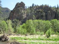
We only hiked another mile or so before we stopped since Jims knee was hurting. We passed a large NOLS group camped near the trailhead. The Middle Fork has a very different feel from the river we hiked yesterday and this morning. It feels more intimate somehow. The canyon is narrower, with steeper rock faces and lots of caves. The rock layers are more obvious: right here the upper 30 feet are a yellowish color, below that the rocks are dark brown. Stream crossings are easy and obvious ten feet across instead of 50 without having to search for the trail on the far side. This morning there were some nice long stretches of good trail in the trees but also a lot of rocky beach or walking and bushwhacking through chest high sage looking for the trail. I heard a rattlesnake underfoot but couldnt see it in the brush scary. All the routes are beautiful through here. The lush vegetation and dramatic rocks make for an awesome hike. Dramatic cliffs towering above, cool green shadows in the pines, flower gardens looking fine the beauty of the Gila. The official trail doesnt go along the Middle Fork or near the cliff dwellings. I think that is a mistake. The Black Range is beautiful and very remote, but the Gila is an oasis in the desert, a unique and beautiful part of New Mexico. Since water is so uncertain in the Black Range, and distances between resupply so much greater, very few hikers do that part of the trail. In late fall it might be a good option, when the idea of so many stream crossings doesnt appeal, but in the hot days of May, this is a joy.

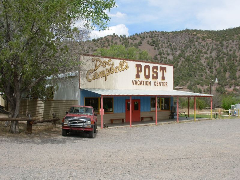
Jim: Once again, we stopped at Doc Campbell's Trading Post. We didn't have a maildrop there this time, but thought we might get a shower. No such luck - the water system was broken and probably wouldn't be fixed for a couple of days. But that didn't stop us from eating. The ice cream was good, but the microwave hamburgers weren't nearly as wonderful as they were in 1999. Maybe that's because we've only been on the trail for a couple weeks this time - in '99, we'd been on the trail for over 5 months and were a LOT hungrier.
Funny thing - about a month before we started the trail, the webmaster for Doc Campbell's contacted me about a problem with their website. We managed to resolve it, but I just thought it was a little strange.
Wednesday, May 3 15 miles - Gila
I went swimming twice this morning, once on purpose and once by accident. I almost went in a third time at an area of busy beaver activity. They flooded the whole canyon and the footing underneath was pure muck. We kept getting stuck in brown goo. My first fall was early when I slipped on some wet wood. I was feeling so proud that we had managed so many crossings so far without falling. Oh well, pride goeth before a fall heres proof.
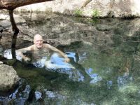
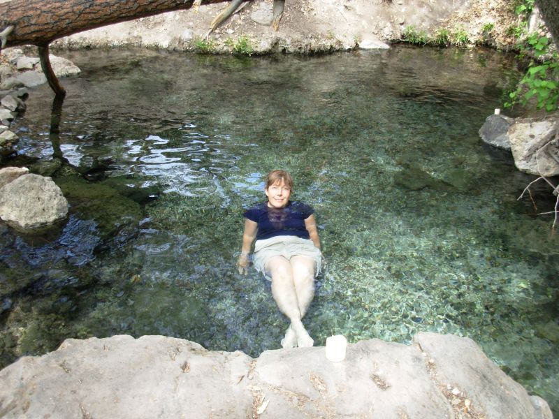
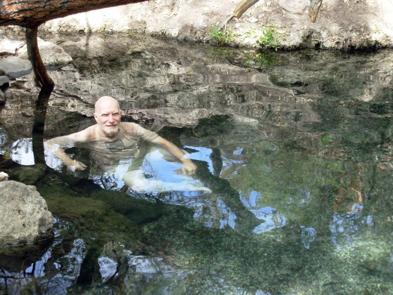
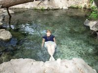
The highlight of the morning was a visit to Jordan Hot Springs. There are several hot and warm springs in the Gila, but few are good for real bathing. Jordan is big 20 feet long or so and chin deep when sitting on the bottom. The water was clear, no mud or muck, just gravel underfoot. We actually missed it since it is on a side trail at one of many campsites. We met two backpackers going the other way who said it was just around the corner. Which corner? We went too far but decided after 15 minutes to turn around and try again. Just when I reached the point of turning around again, we found it. We spent about ½ an hour floating in the warm pool. The water temperature is supposed to be 92 degrees quite nice and well worth the time spent looking for it.
The morning hike, aside from detours and beaver swamp, was really spectacular. There were jagged spires towering overhead, new green leaves on the oaks and cottonwoods glowing in the sunlight. There were beds of blue lupine, white violets, and Solomon seal and a yellow flower in the pea family I didnt recognize. Birds serenaded us as we walked. We kept stopping to take pictures, even with the understanding that the camera is utterly inadequate to capture the beauty. At every crossing we said, Look at that!
The afternoon was a bit slow as the canyon narrowed and we had more crossings and more cobblestone trail. One section went high above some small waterfalls. We only saw two more hikers, heading the other way four total, plus Sidewinder saying goodbye this morning at 7:00. Theres a reason hes able to hike 20 miles a day. He hikes much longer days than we do. It was good to meet him, though we probably wont see him again on the trail. (Actually we ran into him in Dubois, WY when he was hiking south after flipping from Colorado.) We stopped early again, after 15 miles or so. There were several large 8-10 fish in the river. Yesterday we ran into tadpoles that were so big they looked like fish--each was about 3 long. We almost ran into a rattlesnake yesterday. I heard it in the sage as I passed by and warned the others off.
Food is a problem right now. We have too much, but nothing we really want to eat. Were still going cold (no cooking) and both maildrops (Gila and Pie Town) resemble our starting menu, which was way too heavy, too boring and not appetizing when youre tired and dry. We left some food at the B&B, but not enough. Eating snacks for lunch and dinner sounded like a good idea, but I also included snack breaks and its all too much. Well probably eat about half of it before we reach Reserve. Jim jettisoned the Slim Jims, which he hates, so we dont have half our protein either. I can eat nuts at least. The meal bars are good but theyre so dense theyre hard to eat. They dont just fill you, they leave you feeling stuffed.
We found a really nice campsite on a pine-covered bench well above the river with nice views of hoodoos on both sides. The wind picked up when we stopped and the sun was already gone from our side of the canyon, so I didnt bother bathing in the river. Besides, Id spent all day wet so a bath didnt appeal the way it usually does.
Jim: Jordan Hot Spring is on the east side of the river, on a side trail from a campsite close to a corner marked by a set of spires. We missed it the first time because we were told it was "right on the trail." Once again - how much do you believe of the directions given by others? Anyway, it was worth the time it took to backtrack.
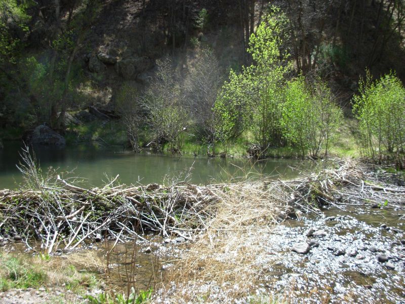
Thursday, May 4 18 miles to Snow Lake

Last nights winds brought cooler temperatures. My feet stayed frozen until about 10:00. The crossings were short and shallow but cold! Our morning hike was less dramatic than yesterdays, but still pretty with the clear river, tall pines and rocky cliffs. We passed three more beaver dams, but none affected the trail. We could easily cross below two of them and the other was beside the trail. We saw two skulls, deer probably, though one may have been a horse. I saw a little grey and white bird with a very red head, not a woodpecker or finch as it was smaller than that. A nuthatch and warbler entertained us at lunch. Most of the walking has been easy, with lots of sidehill above the creek, some flat walking across pine flats but also some very slippery river crossings. The water is only ankle-deep most of the time, but you can still fall.
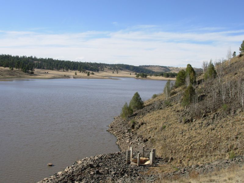
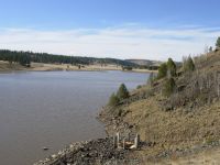
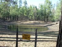
In the afternoon the canyon changed, becoming wider and gentler. There were several broad grassy meadows that made for nice easy walking. We had planned to stop for the night before Snow Lake, but we were moving so well, before we knew it we were there. Snow Lake is a large manmade lake with a developed campground. We didnt want to pay to camp, so we got some water and kept going a short distance beyond. I had already washed up late in the afternoon since I thought this might happen and also because energy was fading and a good dip usually helps me feel better.
The area around Snow Lake is pretty, with rolling grassy hills and scattered Ponderosa pines. There were a few cattle wandering around. We saw lots of deer tracks and coyote scat, but the only wildlife we saw were lizards and birds, including a great blue heron. Its quite windy tonight chilly too.
I really enjoyed our hike in the Gila and Im sorry to see it end. It was always interesting and I usually enjoyed the stream crossings. It was nice not to have to be concerned with water availability or route finding. We almost took a wrong turn just at the end, where Gilita Creek turns off. The obvious trail headed southwest in the wrong direction -- but we caught our error quickly so no harm was done.
Today was over 18 miles. Were tired and sore, but generally doing all right. Yesterday I was complaining about our short 12 mile days teach me to keep my mouth shut.
Jim: The campsite tonight was just off the road north of Snow Lake. I prefer to be a little further from road access - and a little less visible, but sometimes you don't get your druthers. At least there was water at the campground. Life is good.
The Gila was great - an oasis after the heat and drought of the desert. We followed the Middle Fork of the Gila and enjoyed a long soak in Jordan Hot Springs. We really enjoyed the dramatic rock formations and the green lushness along the river. Getting wet every 100 yards was a real treat too - we never got tired of that cool clear water - which is a good thing since we crossed streams about 200 times in our 4 days in the Gila Wilderness.
Friday, May 5 19 miles to Collins Park
We heard the wolves howl last night for the first time, way off in the Gila. It got very cold during the night; we woke to frozen shoes and water bottles. We waited a while for the sun to thaw things out before we left.
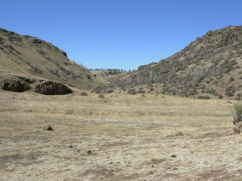
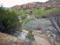
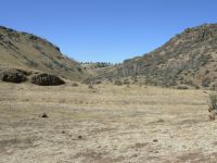
We decided to follow Jonathan Leys route up through T-Bar Canyon. It was a good one, easy to find and follow with little real cross-country. We followed a jeep road to the canyon, then cow paths up the canyon a couple of miles, then another cow path past some red rocks up to the ridge where we had a little cross-country hiking to a jeep road that we followed through open rolling grasslands for three or four miles. To the north was Elk Mountain, so at each junction it was easy to know which way to go. Our only confusion was topping the ridge: my sense of direction was off, but Jim and his compass soon set us straight. We saw lots of cows and one cowboy off in the distance. There were a couple of pools in T-Bar Creek and a good stock pond well below the ridge, but so far weve just been using the water we picked up at the campground yesterday. I felt really sorry for one herd of cows that were on the wrong side of a fence, with a big pool of water just out of reach.
Lunch was spent trying to decide our route. We had planned to walk to Reserve from here, instead of heading north and hitching the 35 miles to town. Its a hard hitch. But water is totally unknown. Does Negrito Creek have water? We have no way of knowing. Given the drought, do we dare trust that there will be water? Finally, reluctantly, we decided to stick to the CDTS route where potential water sources are mapped and described in the guidebook. This is the first time since we started this hike, except for the 5 miles near Gila Hot Springs, that we have repeated ourselves. For the first 250 or so miles of our hike we followed new routes. We didnt really expect that to continue for long, but this stretch was one we hoped to hike differently as well. Maybe next time.
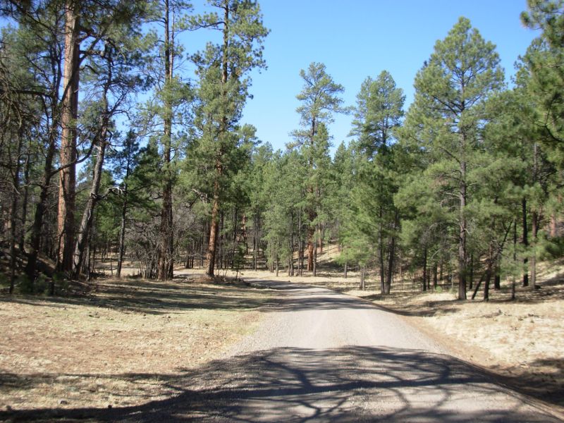
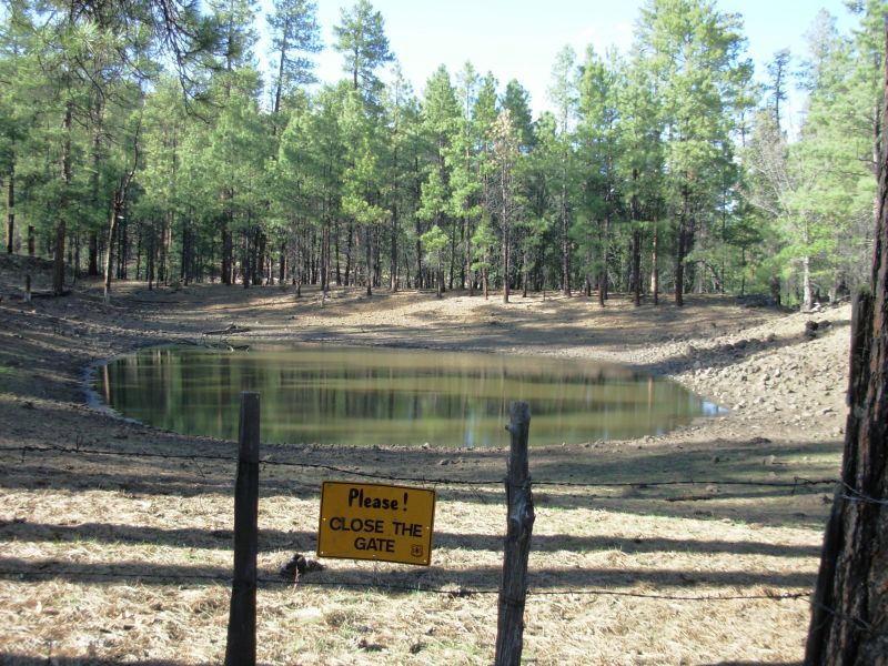
We spent the afternoon following gravel roads through the forest. Traffic was light, about one car per hour. We got a gallon of water from one of them. Mike Davicek stopped and I asked him whether he knew if the well near the road six miles ahead was working. He didnt know, but said he had extra water in the car. We were lucky to meet him, since the well we were counting on wasnt turned on. We knew when we saw no cows nearby that we were out of luck. It was an electric well, so I hoped Jim could figure out how to turn it on, but it was very old and not worth the effort. There is another water source about five miles ahead, but we were ready to stop for the night and were glad we had Mike Ds water. We had bypassed a couple of springs that were down side roads because they were ¾ mile and one mile off trail and we hoped the one at Collins Park would be working. We were wrong. Thanks to trail magic, we were able to dry camp in the pines after 19 miles instead of pushing on to the next spring.
The walking was easy but boring along the road. I have some tendonitis in my right ankle, the one I sprained on the PCT, so it really hurts. The wind was a constant today, blowing at 10-20 mph, with gusts that had me staggering. Its a cold wind, coming from the west. I saw a reddish brown cow with three black calves papa bred true. Were well hidden off the road under a pinion tree. The ground was really rocky so finding a campsite wasnt easy, but its a nice area.
While I enjoyed the morning hike up T-Bar Canyon to the T-Bar grasslands, by afternoon I was in so much pain all I could think of was stopping. Were still 30 miles or so from Highway 12 and our next rest stop. Ill probably make it, but it wont be easy if my leg doesnt improve soon.
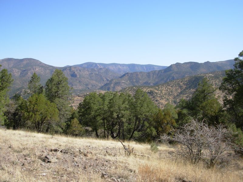
Jim: The ridge north of T-Bar Canyon is several miles of open grassland with views seemingly into the next county. There was a cattle tank (Gail Tank) with lots of water in the valley - but it was several hundred feet below us. You'd have to be really desperate for that one.
When we got to the road just east of Negrito Fire Base, it didn't look familiar even though we'd walked this same road in 1999. Then I realized that they'd "improved" it by widening, grading and gravelling it. That may make it better for cars, but it's not easier on the feet if you're walking.
The CDTS route goes past the Negrito Fire Base, which is a hiker-friendly place and a good water source. Using the T-Bar Canyon route bypasses the Fire Base by a couple miles.
We camped well off the road at the top of the ridge. Just before we got to the top of the ridge, there was a van on the side of the road that looked like it had broken down. I figured someone would be back for it. I was right - they showed up a little while after we'd settled down to cook dinner. But we were well out of sight - and stayed that way.
Saturday, May 6 18 miles
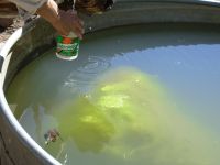
Our early stop yesterday helped. I was able to walk fairly normally all morning though the ankle is still tender. We followed gravel FR 94 about eight miles through open ponderosa pine forest. We were quite happy to see that Davis Spring was running. It didnt have a large flow, but the water was piped out to a tank and we were able to fill our water bottles and bags. It hurt to continue with all that weight, but since future sources are iffy it seemed best to stock up. Sure enough, Dutchmans Spring four miles later was just a small puddle, though the stock pond half a mile south had water. Davis had a dead bat in the tank, but we were able to get water from the pipe.
The afternoon hike was not as easy. There is a very rough foot trail along the divide, starting out rocky with lots of briars. There was more than one reason we wanted to take an alternate through this section of trail. Actually only the beginning was really bad. We had to backtrack when the cairns led us past a turn though a gate along the fence we were following. It wasnt an obvious turn, and the cairns seemed to lead us away from the fence. (Lots of hikers missed that turn, which led to some interesting alternate routes.) We should have gone back to dismantle the misleading cairns once we found the gate, but we had already lost too much time.
We followed the divide and the official trail for several miles. It was well marked with axe blazes but no CDT markers. There were some nice views of the hills and mountains surrounding the divide. There was also some burned forest nearby. I spotted an elk and a mule deer. There were a lot of game trails that occasionally led us astray, but on the whole it was fairly easy, just rolling up and down and up and down along the ridge. Late afternoon we left the official route, which follows a jeep road in and out of every side gully, to follow a Jim Wolf alternate that leads past a couple of stock impoundments. Disgusting water, but it was useable. We picked up a few quarts and cleaned up a little. Were still carrying some good water from this morning, fortunately. There should be a spring in seven miles, so the stock pond water is our backup, just in case that source is dry, but we shouldnt have to use it for drinking water. We hiked about 16 miles today, despite the fact that my ankle and Jims knee are both acting up.
Jim: I took the dead bat out of Davis Spring (after taking a picture). Hope nobody used water from the tank for a while - or that they used a filter.
Sunday, May 7 15 miles to Highway 12 to Reserve
We did all right following Jim Wolfs route down the little valley and up the next one on old jeep roads. We misread the directions for the cross-country portion after Lopez Tank and instead ended up following the road ¼ mile or so then doing a cross-country jaunt 100 yards to the divide where we picked up axe blazes. There was no treadway there, but it was the CDT. It was a different route from the one we followed last time.
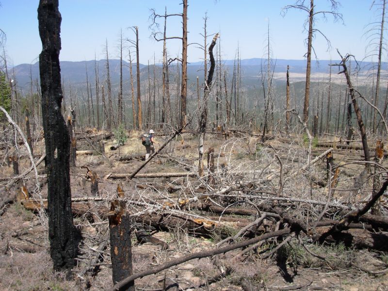
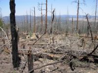
We climbed steeply up Wagontongue Mountain, following cairns and blazes, then descended on steep trail down the other side. About halfway down we ran into trouble: there was a big fire there several years ago. The trees are all down and briars have grown up between the blowdowns. No path has been cut through the downed trees. There were a few cairns at first, then nothing to indicate the path. Since the trail had been switchbacking, it could have gone anywhere. We decided to descend, carefully, to the live forest below and then sweep for the trail. It was very scary since the mountain was steep and soft, with lots of trees to climb over and around. I really worried about either falling or breaking a leg, but we got through in one piece. We headed toward a group of elk we saw on a ridge ahead, since elk like to follow trails, backtracked them and found the trail again. Hurray! It took us about an hour to go through that burned area; supposedly there was only ¼ mile of trail missing. The descent was steep and nasty, but aside from that burned section we were mostly able to stay on the trail, aside from a few game trail detours.
At the bottom of the ridge, we went looking for water at Damian Spring. We climbed to the top and found just a tiny puddle. We got one quart of muddy water from the puddle, using both filter and iodine to clean it up, then continued the eight miles to the highway for our long hitch to Reserve. We should have gone ahead and walked directly there as we planned, even with the uncertainty about water.
The best part of the day was five separate elk sightings, for a total of 12 elk. There were occasional flowers: golden banner, a holly with a yellow flower and a couple of others. Big black clouds gathered overhead for a while, cooling things off nicely. We did get a couple of quarts of water at Aragon Windmill, one mile before the highway, and we washed some of the soot off before trying to catch a ride to town.

It took us about an hour to get a ride with a priest who lives in Arizona but works a 250 mile circuit that includes several towns in New Mexico. He was interesting. We stopped at a church in Aragon to drop off a paper for the deacon there. He only planned to go as far as Apache Junction, but fortunately for us he agreed to drive the extra 15 miles to Reserve to drop us off. He left us with a good prayer. We got the last room, a smelly smoking one, at the Rode Inn. All the restaurants in town were closed by the time we got there at 6:30, so we went to the bar across the street, ordered a surprisingly tasty frozen pizza to go and a six-pack of Coronas (no bar service on Sundays, but she can sell for off-premises use) and ate dinner in the room. Given how badly we smelled, that was probably for the best anyway. I finally got a shower after 9 days on the trail. It felt wonderful.
Tomorrow will be a zero day to do laundry and rest up. Were both exhausted. We only hiked 15 miles today, but because of the problems with the burn and the fast miles from Damian Spring to the highway (about 3 mph) we really feel tired. I need to rest my ankle and Jim his blisters and knees before we go back out. Reserve is a small town with most services close together. The motel has a laundry, the grocery is across the street and the Post Office around the corner. What more can you ask? I know, food. But the restaurants should be open tomorrow, just not on Sunday evening.
Jim: Houston, we have a problem. The Aragon Well tank isn't likely to be around for long - it's much too close to a brand new high-dollar housing development. As it is, they've made it difficult to get water (unless you're a cow). If it disappears, then it'll be a long, long waterless stretch. And the next water north of here (Tio Vinces) is reputedly no longer reliable.
Worst problem of the day was the blowdown/burn on Wagontongue Mountain. For a short section there is no trail left there. There has been little or no maintenance in years, but now all the dead trees are down and the briars have grown up, so it's impossible to find a clear route through the burn area. It isn't big - only 1/4 mile or so, but the mountain is steep and loose, with lots and lots of downed trees. We finally found the trail on the east side of the ridge.
Monday, May 8 Rest day in Reserve

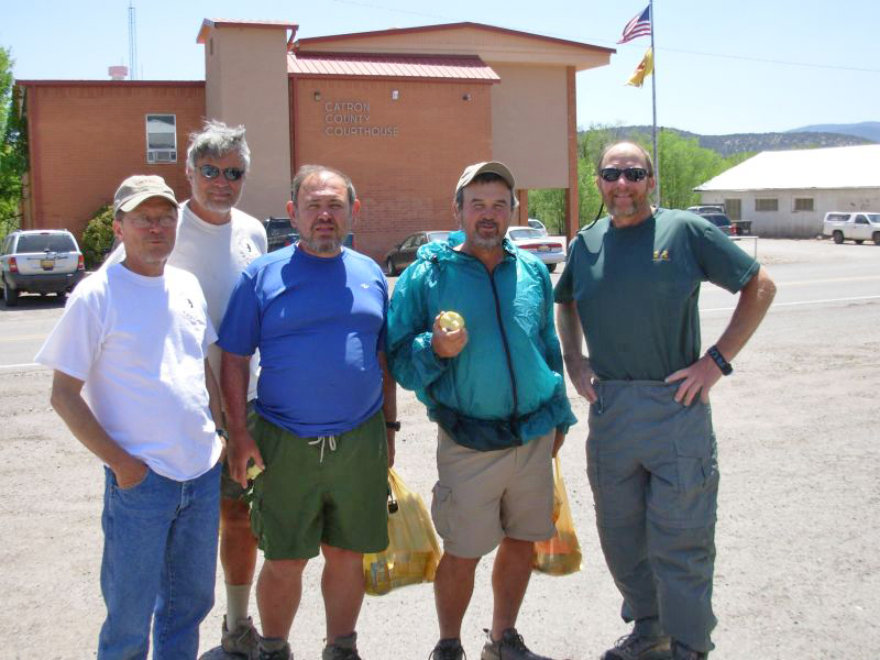
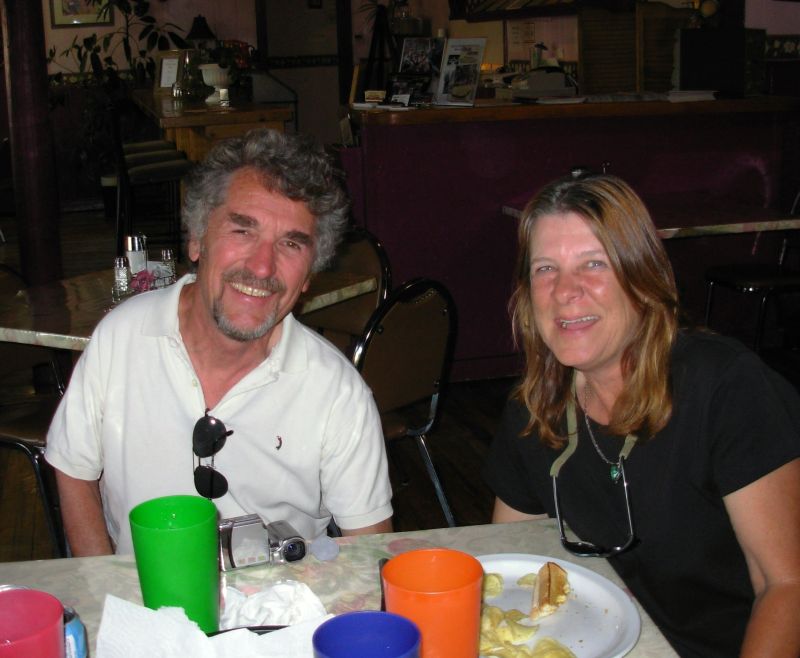
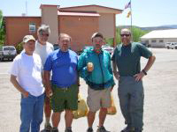
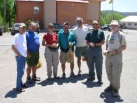
When we entered the only diner that was open this morning, we were surprised to see a table full of hikers: the Andiamo Express. That is a group of five thruhikers doing the trail with van support. We already knew Walt and Pat Radney and had met George Traveling Man. The other two, Tincup and Floater, were introduced to us. (There was another hiker, Pat aka Mountain House, who was part of the group that I knew from hiking the AT in 1992. He had to go home to take care of a medical problem, so I missed meeting him again.) We joined their table and enjoyed a leisurely New Mexico breakfast (sausage, home fries and eggs covered with hot chili sauce and refried beans and tortillas). Later I did laundry while Jim organized our gear, then we walked up the hill to the library, which was closed for a long lunch.
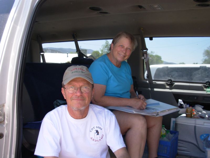
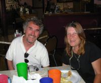
We dropped down the hill and ate lunch at Carmens and met Mara again. She managed to hitch all the way to Albuquerque in three rides and now plans a leisurely car trip around the west for the next three months. She offered to drive us back to the trail in the morning. Pat also offered us a ride, but at 6:30, before breakfast. The five Amigos (Andiamo Express) are much more ambitious than we are. They are in a lot more of a hurry to finish and generally hike 25 or more miles a day. Well take Mara up on her offer; it is more our style. With Mara we can enjoy a leisurely breakfast before heading back up the highway. We spent the afternoon together. We went back to the library, but internet was so slow we only managed to read a few messages before we quit in frustration. We did send out a short update though. Then we came back to our room to rest our feet and chat. I bought a few groceries, but we dont need much. Weve been consistently carrying too much food. This next stretch will be no exception.
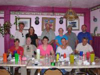
We met the Andiamo Express crew at 6:00 for dinner and got another surprise: Liz La Zorra and Jerry were in town. She is two days behind us, but they came to town to rest her strained heel. She says there is a group of four just behind us from Minnesota. They may pass us today or we may see them on the trail tomorrow. How strange but fun it was to meet so many other hikers. We probably wont see the Express again, though we may run into Pat. Liz may catch up sooner or later. Last time we hiked the CDT we only met eight other thruhikers. This time weve met six in our first month. How different it is, knowing there are people only a day ahead and behind us.
Jim: The trail is getting crowded. 'Nuff said about that.
The hike has been a good one so far - in fact, as good as expected. There's beauty and remoteness out here. When you can hike for two or three days (or more) without sight of another human being, you feel like you really are in wilderness. Weve followed elk tracks more than weve followed human tracks. The stars are an incredible array, out here where the nearest town (of 300 people or so) is 35 50 miles away.
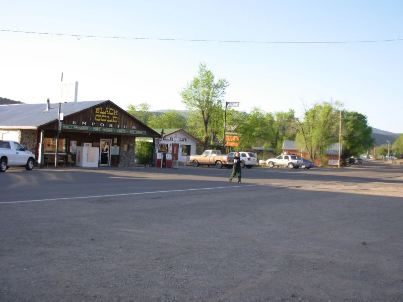
Reserve is a good trail town, even though it's a long way off-trail. It has most of what a hiker needs at this point in the hike - motel, grocery, restaurants, and laundry - even a free book exchange at the Black Gold Emporium. And the people are friendly. The hitch is hard mainly because there's so little traffic on the highway. But it's worth it.
Home | Links| Trail Journals |
The Thruhiking Papers | Bun-bun
Created: Dec 2006
Revised: 30 Sept 2016Copyright © 2006-2017 Spirit Eagle