|
 |
 |
 |
 |
|
|
|
|
|
|
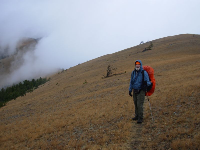
Thursday, October 5 15 miles to Flesher Pass

It was a beautiful autumn day hiking along the Divide. We left Lincoln in dense fog and 39 degrees. Getting a ride out of town was slow; we spent an hour shivering in the fog before we got a ride half way to Rogers Pass. It was sunny where we were dropped off, so the half hour or so that we waited there wasnt too bad. As we were getting into the car, one of the women who picked us up asked, Werent you on the news? It seems that our St Marys interview did make it to television. Too bad we cant watch it.

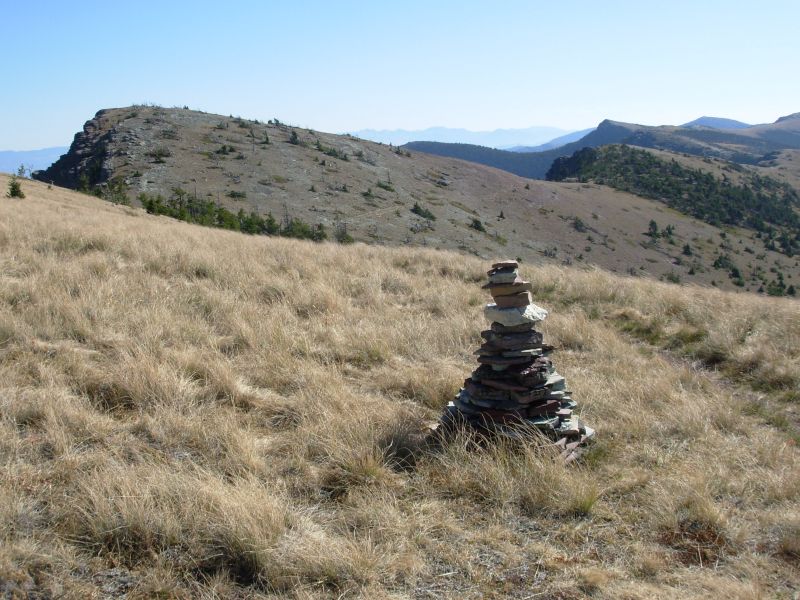
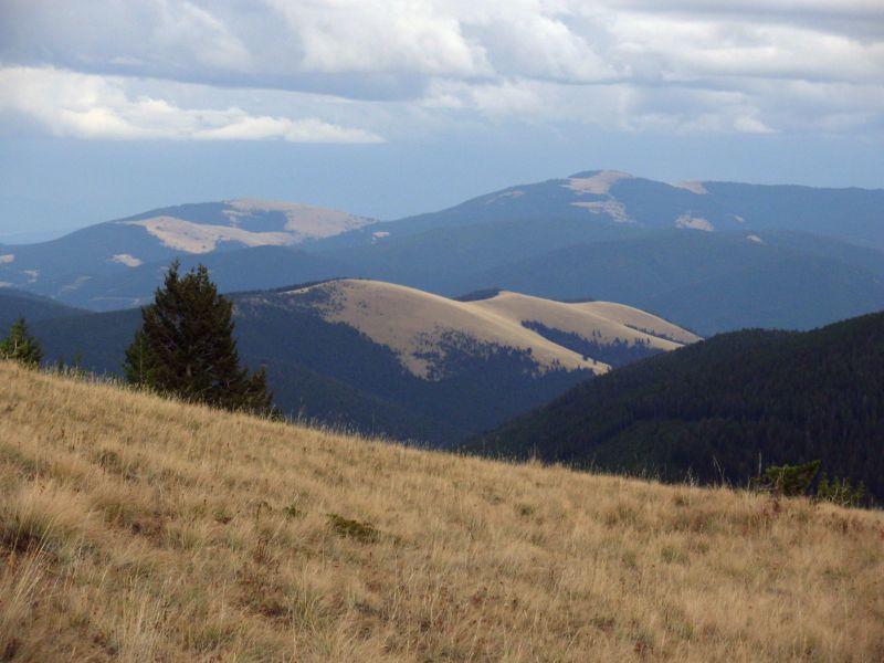
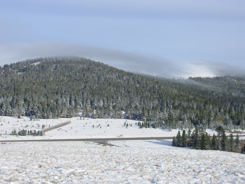
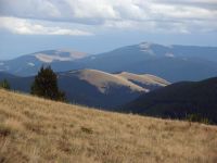
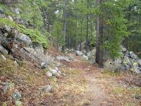
I feel good about starting this next section, especially with the sun and beautiful views. When it took so long to get a ride, I was worried because our only water is ½ mile off trail at Flesher Pass, which is 14 miles from our starting point at Rogers Pass. We started at 11:00, so we should make it before dark, though it will be close. We have lots of little climbs, but our biggest uphill was the first two miles, when we climbed 1300. Now we just get to follow the crest. There are interesting rock formations red and blue shale to spice up the ridges.
Later: We had a few drops of rain mid-afternoon, but nothing serious. The rest of the day was warm and sunny. We saw no people or wildlife on the trail. The water near Flesher Pass was interesting. From the road we couldnt see any water, but we could hear it. The water came out of a culvert under the road in pulsating spurts. It was a bit of a problem to get to, as the side of the hill was very steep, but the water was clear and came out in strong bursts.
We camped about ¼ mile above the pass. There was an old woods road beside the highway that we considered using for a campsite, but it was too close to the traffic. I like a bit more distance between me and the cars. So we headed up the trail and found a spot in the woods, out of sight if not quite out of earshot. (In the morning we discovered that theyve built a new parking area with outhouse and picnic tables about ½ mile away. I wish we had known.)
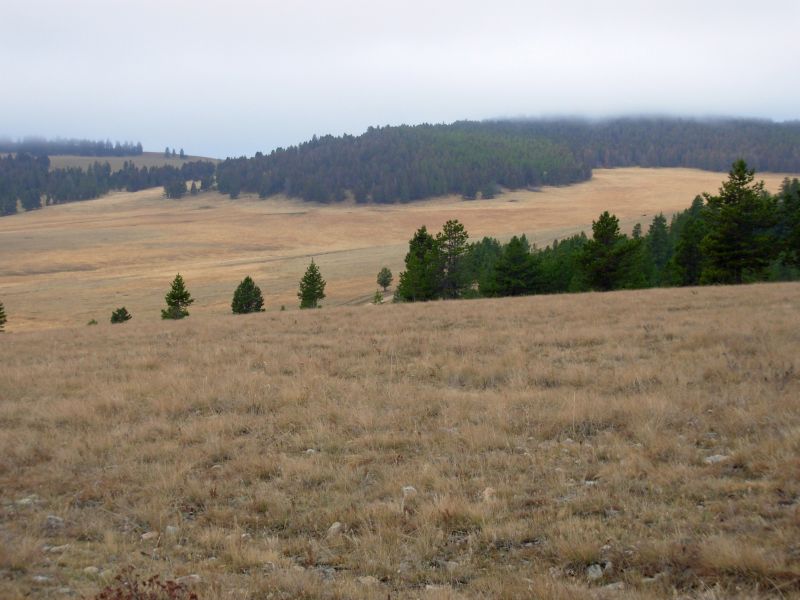
I really enjoyed the hike today. The open ridges epitomize the CDT for me: views, views and more views. The trail was good cut side-hill that was easy to follow. The ridges were open grassy alpine meadows beautiful. The smoke had cleared, so we could see for miles.
Jim: It was foggy this morning, but when we got to the pass, Indian Summer was back and continued the rest of the day. It'll be interesting to see how long it lasts. Maybe till we get to Butte? One can only hope.
Getting water at Flesher Pass was interesting because there was no apparent water in the stream above the road, but there was an intermittent flow from the culvert on the downhill side. And it was a steep downhill. It was even steeper getting out of there.
Friday, October 6 18 miles to grassy pass
Last night, just as we headed to bed, as darkness fell, it began to rain. Lightning and thunder soon followed. I slept through the hailstorm that hit an hour later, but it must have been a good one since we found hail on the trail in the morning. We woke to clouds and fog, but the sun burned through by 9:00 or so. We stopped for an early lunch to take advantage of the sunshine to dry out our soaked tent before the clouds returned.
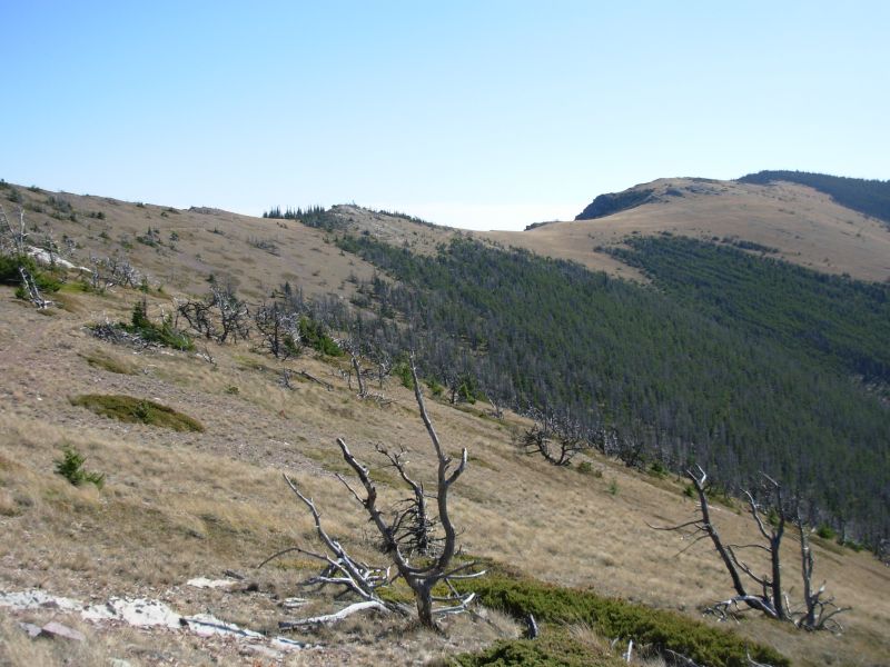
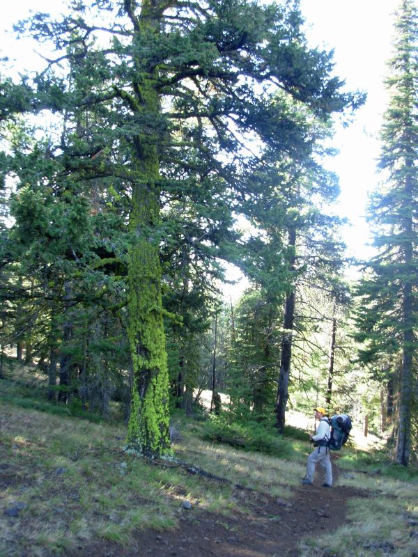
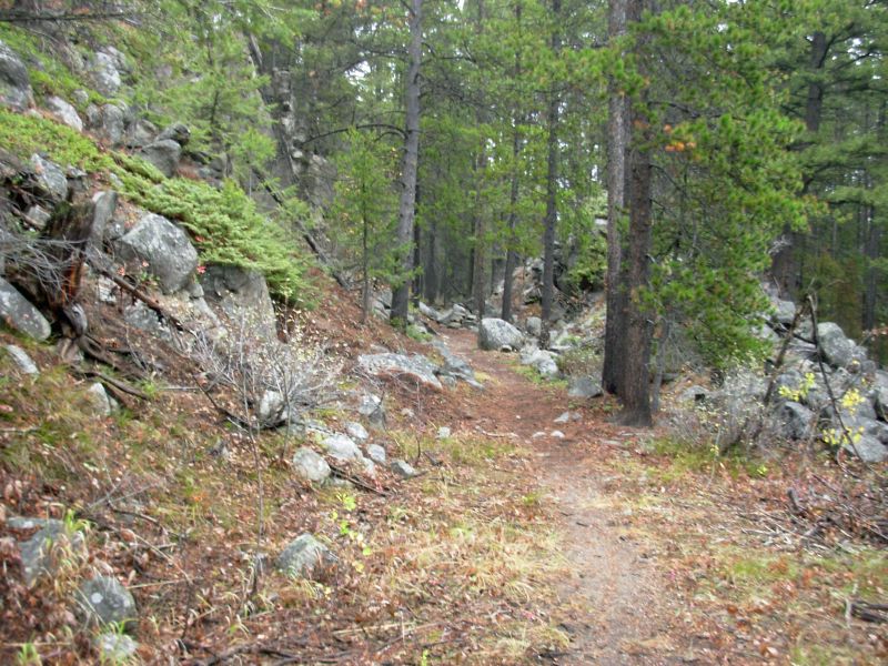
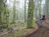
The morning hike was easy up and down through the woods, following along or below the Divide. It wasnt particularly memorable hiking, but was easy to navigate and not too strenuous. After the Wilderness, this feels like cruising trail. With Jims knee problems, a little respite feels good, though the knees are still giving him trouble, even with the more gentle climbs.
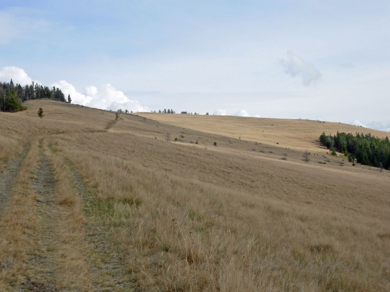
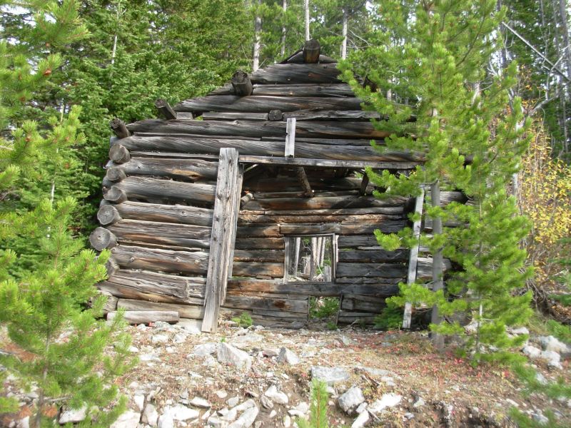
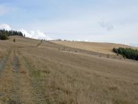
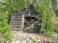
Mid-afternoon we climbed 1000 to a long grassy ridge, which we followed for about a mile. There were good views of mountains near and far, as well as the black storm clouds encircling us. We didnt linger. We stopped at a very small creek to get water for tonight and tomorrow morning. It was trampled by cows, but useable. Thats why we carry a filter. The cows were no longer in evidence, aside from dung here and there. Their season is over. They should be much lower now that winter is approaching. We passed some clear-cuts that are starting to grow back. We havent seen a lot of those on this trip. For the next week or so we will follow a lot of jeep roads and logging roads through National Forest so well see more. We passed a couple of old log cabins along the roads and the remains of some mine buildings. We saw one truck on the road, but no other people.
Toward the end of the day we left the jeep roads and went back to trail: an old jeep track, but now closed to motorized use. We almost missed the point where we picked up real foot trail. As we wandered around looking for a campsite at a grassy saddle, we spotted a trail heading into the woods. We headed up it looking for a place to set up our tent and saw CDT markers. At a different time of day, we would have just kept going over the saddle and missed the turn entirely. Were camped in the woods next to a large grassy meadow. The black clouds still linger, making for a beautiful purple sunset. We heard thunder, but so far weve had no rain. A blue jay scolded us from a tree.
We heard a beautiful elk call this morning. They vary from very musical to very harsh, to something like a high-pitched scream. Someone asked me to describe an elk bugle once and I couldnt, since they vary so much. The first one I ever heard I thought someone was playing an instrument in the woods.
Jim: It's gotten colder - happiness is a warm sleeping bag.
Saturday, October 7 17 miles
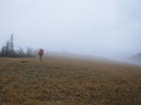
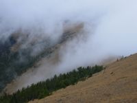
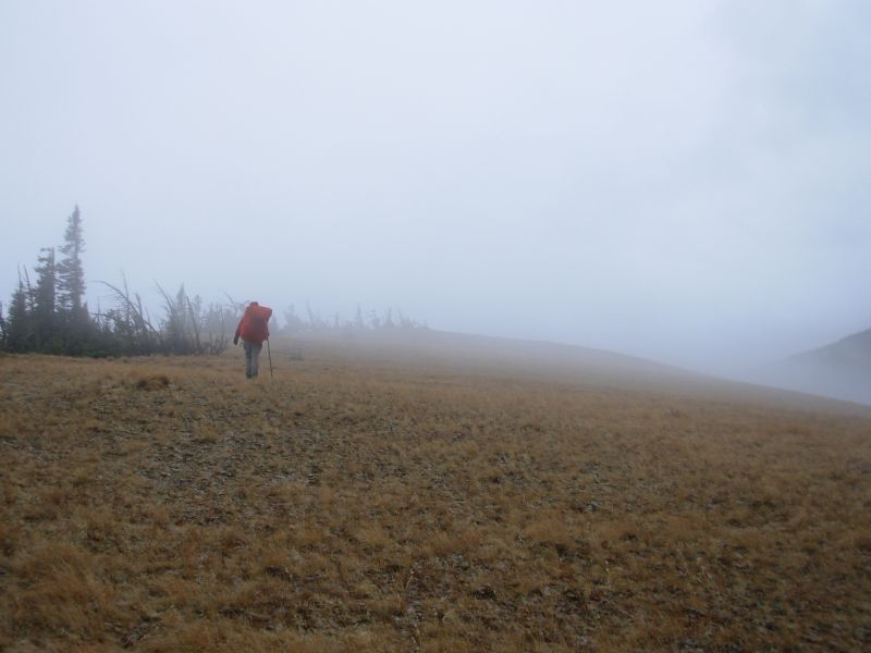
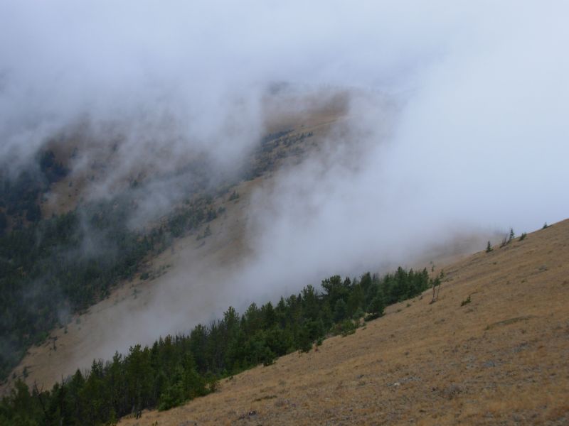
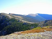
We woke in the night to another rainstorm. It was still raining this morning, so we had breakfast in the tent and I skipped my morning brew up. It stopped while we were packing, but we were completely covered by clouds. That was too bad as today was supposed to have good views, but all we saw was the great white sheet. About an hour out of camp, it began to snow, lightly. The snow came and went all day, especially when we were trying to eat lunch and dinner. It never added up to much, just a dusting, but it was a constant companion all day. The clouds made navigation interesting when we climbed up into open meadows and couldnt see where the trail went. One meadow had cairns, so although they were spaced farther apart than we could see, we did get across its 1/3 mile fairly easily. One person stood at a cairn while the other went searching for the next one. The harder meadow was about a mile long, with no cairns and no tread. We climbed, thought we might be going the wrong way because we saw no cairns, backtracked, then went back to where we had been. I thought we were going to have to set up camp right there. Then the clouds lifted for a minute and we could see trail on the hill ahead, so we got through that one all right. We saw three deer atop Nevada Mountain. The climbs and descents up Nevada and Black Mountains were long and very rocky in places. The road down Black Mountain was an eroded mess. It gets a lot of ATV use, evidently. Last time we were here, they were covered with snow, so although navigation was harder, the walking was in many ways easier.

The biggest surprise this afternoon was that Dana Spring, the only water source on the trail today, was dry as a bone. We almost missed it in the fog, as it is a little off trail, but it really wouldnt have mattered. The spring box and the cattle tank were both empty. We looked at the guidebook and it mentioned a spring at some private property several miles ahead, and then nothing certain for a long way. Jonathan Leys map showed an alternate route that had water when he came through in a dry year, so we decided to try it. The alternate route connects to the CDT in about 10 miles, and although it goes through private land, the road is open to public use. As long as we camped in the National Forest, we would be legal. Happily for us, the creek was running well. There were a lot of cows, so we filtered, but it was good water. The country is beautiful, with rolling yellow hills and lots of black cows. We found some trees just beyond the ranch to set up our tent. Evidently the cows like this site too; it took a while to find a clear spot. While we were eating dinner, several trucks passed by and one RV. One of the trucks stopped and the driver blew an elk call, but he heard no response so he soon moved on.

Jim: Memories of 1999 - climbing Parkview in Colorado in whiteout, Dana Spring with good water, views from the ridge, and massive snowpack on Black and Nevada Mts. This time we had the whiteout and some (but not nearly as much) snow on Black and Nevada Mts, no views and no water at Dana Spring. Changes - The trail is constantly changing. Those who expect it to be static are doomed to be disappointed.
Once again we changed our plans to accommodate the existing trail conditions. We've told people for years that the prime requirement on the CDT is "flexibility." Now it's our turn to demonstrate that we're flexible enough to not only survive the CDT, but enjoy it. So far, so good.
Sunday, October 8 11 miles to MacDonald Pass/Helena

It was foggy all day, but otherwise dry. Clouds hugged the hills, but there were some nice views of golden meadows. The aspen leaves are mostly gone, but here were a few golden patches. We walked past a ranch where we saw a coyote running across one of the meadows. As we were packing up this morning, I spotted three deer on the hill across the way.
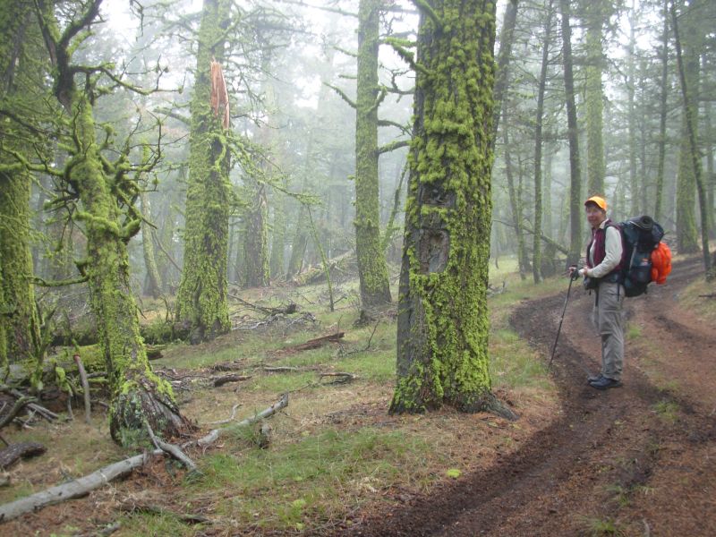
We rejoined the CDT at Mullan Pass, where we saw a couple of men target shooting in the fog (away from the trail, fortunately). I liked the trail around Mullan Pass, with open meadows and nice forest with an old railroad trestle on old railroad grade. The climb to the electronic installation near MacDonald Pass was on really rocky jeep trail, much used by ATVs. Snow pelted us as we walked from the trees above the trail.
We ate lunch on top of the mountain, watching the clouds come and go. Sitting in the fog was cold, so we didnt stay very long. Besides, town awaited. We got a ride to Helena with a very nice young professional potter who drove us clear across town to the Days Inn where we stayed last time. It has laundry, internet, a full hot breakfast and is across the street from a grocery store. Unfortunately, the restaurant across the street is gone, but there is a Golden Corral a mile away where we had dinner.
Jim: Gotta love the ATVs. Or not. A lot of the foot trails that we walked in '99 are now ATV trails. They do nasty things to the trails. So suck it up and hike. There's still a lot of trail the ATVs haven't touched yet. Enjoy what you've got - it won't last forever.
We're back in Helena - it's changed, too. But it still looks like a good trail town to me. Maybe that's because we're across the street from a grocery store and they have more ice cream than even I can eat in the time we'll be here.
Monday, October 9 Rest Day in Helena
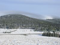
It rained and snowed last night. The mountains were dusted with white. I was very glad to be warm and dry in town. The forecast for the next week is rain/snow showers every other day. Wednesday is supposed to be very cold and wet. Well see how it goes. Im not looking forward to six days of cold and wet weather. Its not the way I had hoped to end this hike, but it may be like our last week on the PCT: a little sun, a little snow, and a lot of beauty. It is so strange to think that we are entering our last section, at least for this season. Well be back. Ill be sorry to stop hiking, but happy to be warm and dry again, I think.
Today was a really quiet day. Jim got his eyes examined, though new glasses will have to wait until were off trail for a few days. Pearl couldnt do one-hour glasses, despite their advertisement. We bought groceries and spent a couple of hours arranging transportation from Montana to Arizona. The rest of the day we read, talked on the phone and ate.
How am I going to go back to normal eating again? I look forward to eating fresh fruit and vegetables again, as they have been really scarce this year, and Ill happily forego tuna noodles for a long while, but eating all I want, whenever I want, is addictive and dangerous. Quitting the pint (or two or three) of ice cream every day in town will be hard for Jim I think. He hasnt lost as much weight on this hike as he did last time, because we began eating extra much earlier in the trip. I think when he discovered he had lost 22 pounds in Pie Town, he decided that he needed to start eating more. Not hiking every day will be hard for me to handle. I need to keep up the daily exercise for both my physical and emotional well-being. Mentally I am already starting to move away from the trail. Tomorrow my reality will be new mountains to climb in cold and snow. Only six more days what will they bring?
Jim: Pearle Vision couldn't cut new glasses 'cause their technician was off today - it's Columbus Day weekend. So the glasses will have to wait. But they did sell me a pair of "prefabs" that will allow me to see at a distance.
Trying to arrange transportation from Butte has been an exercise in futility. You can't get anywhere from Butte. At least not at a reasonable price. Right now, we'll walk the trail to Butte, then take a bus back to Helena so we can rent a car to drive to Arizona. Convoluted, but a lot cheaper than flying out of Butte. It'll also give us some time to decompress.
We've been watching the rain in Helena - I'll bet it's snow in the mountains. We'll find out tomorrow.
Home | Links| Trail Journals |
The Thruhiking Papers | Bun-bun
Created: Dec 2006
Revised: 30 Sept 2016Copyright © 2006-2017 Spirit Eagle