|
 |
 |
 |
 |
|
|
|
|
|
|
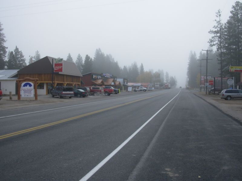
Saturday, September 23 16 miles from East Glacier to Marias Pass
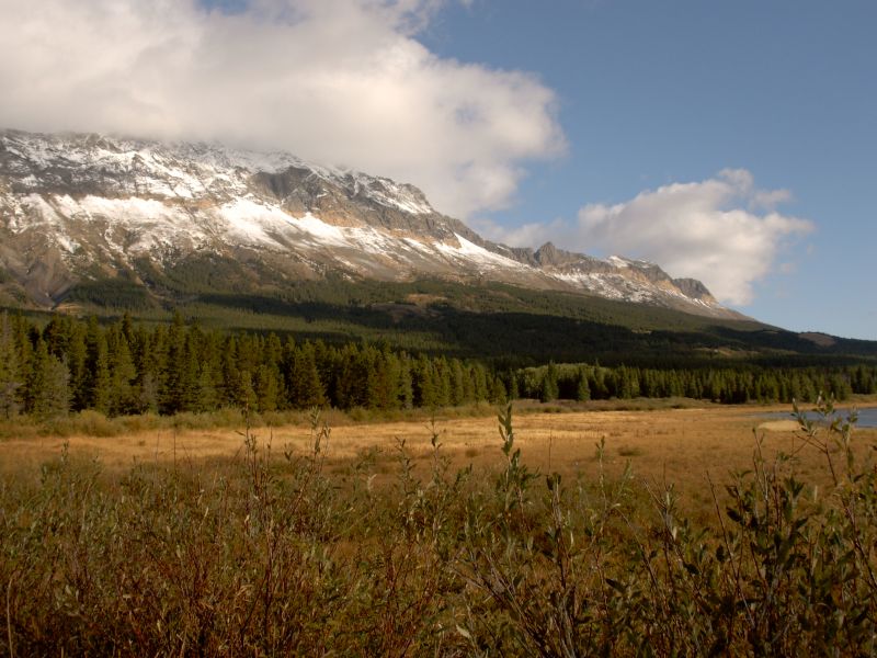
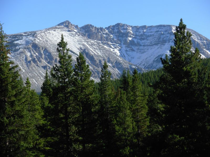
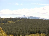
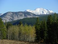
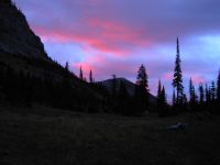
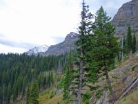
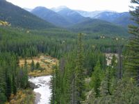
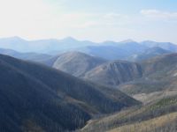
It was a beautiful day, with blue skies and sunshine, cool breezes and views of snow-capped mountains. Yesterday we took the day off and it rained all day. Nice timing! Today we decided to dayhike the section from Marias Pass to East Glacier, keeping our warm dry motel room for one more night. It means we can leave town carrying only seven days food instead of eight, which is some weight savings. Our packs are very heavy with the new tent, winter bags, warmer clothes and big food load. Jim called Benchmark and found out that they are open and our box did arrive, so at least that is covered. We were told the Scapegoat Fire is out and the trails are open. Hurray.
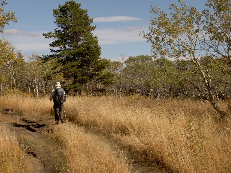
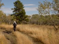
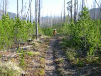
One of Marks employees gave us a ride to Marias Pass after breakfast. A train was stopped there, a very long train. We waited a few minutes for it to leave, then Jim began climbing up on the train and across it to the other side. I was scared the train would start moving, but followed his lead. The train didnt take off, and the train it was waiting for didnt come until we were safely in the woods. The trail along the southern edge of Glacier was better than I remembered. There was a lot of trailwork done this summer, sidehill and new bridges, which helped. Blazing was good for the most part. It was still somewhat overgrown, so I got soaked from the wet grass and bushes, but the trail was easy to follow. There were some very nice views of snowy mountains both north and south. With the sunshine, it was a glorious day. There were lots of dayhikers going from Lubeck TH to East Glacier about nine or ten miles. Some were guests at the lodge, some park employees working off a hangover.
One disaster: Jim lost his glasses. He hangs them on the front of his shirt and has almost lost them several times in the past. We always managed to find them after a search. This time, we didnt notice they were gone until we had hiked seven miles in. They could be anywhere. He stopped to retie his shoes several times, and they must have fallen off when he leaned over. Jim walked back a mile or so, but didnt find them. With all the tall buffalo grass, they would be hard to spot. Unfortunately, theyre bifocals; Jim cant read without them. Not being able to read drives him crazy. He was a very unhappy camper. We asked at the Lodge and at the grocery and both agreed: Ben Franklins in Browning might have reading glasses, but theyre closed on Sunday. One girl suggested trying the gas station next to the motel. She was right; they did have some reading glasses that sort of work. Well go back to the trail tomorrow and look for the glasses in the first mile or so, but if we cant find them, at least Jim can read a map again.
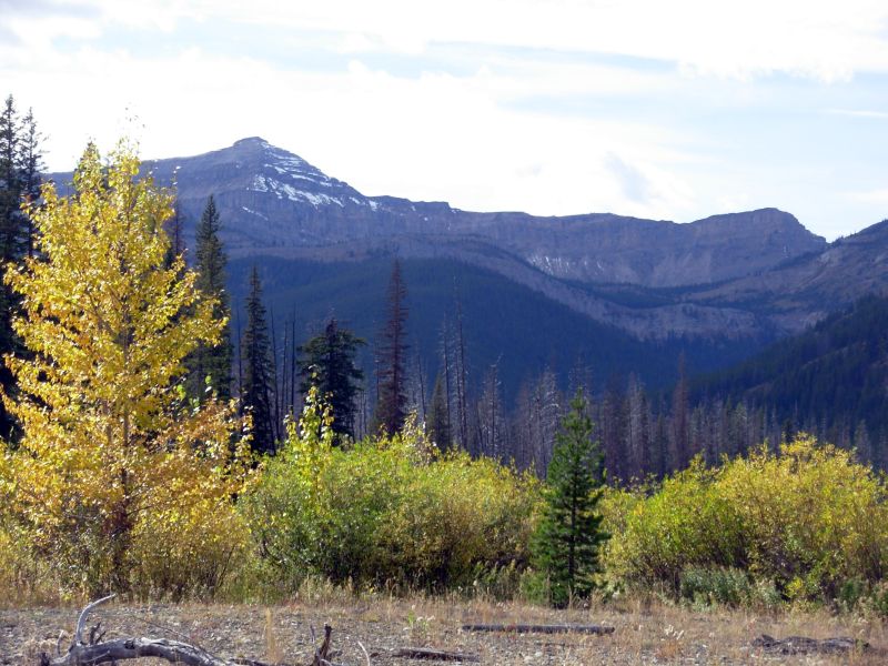
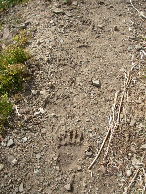
No wildlife today, though we saw tracks of three different bears, coyotes, elk and deer. A bear had torn apart a rotten tree. Last time we hiked that section it was raining, so it made a bad impression. Today was sunny, the trail was easy with little climbing, and the views, when we had them, were good. What a difference.
The forecast is good for the next five days: not sunny, but not rainy, and fairly warm. I sent ahead some of the winter gear I had planned to carry since the current prediction is for highs in the 60s. Of course, this is a 10-11 day stretch, and that can and probably will change before we reach Lincoln, but it seemed foolish to carry the extra vest and fleece balaclava unless it is absolutely necessary. We will continue to carry the rain pants, just in case it snows again. Forecasts are often wrong, and we need to be prepared for the worst.
Jims knees are really hurting so I doubt well be able to do our original plan of continuing to hike south past Butte to Yellowstone. Hes stubborn enough to go the 350 miles from here to Homestake Pass, but I doubt well go much beyond there, once weve completed our border to border trek. It would be fun to continue south as long as the weather holds, but not if hes in constant pain.
Jim: After the last week, we added some weight to the packs - our winter gear. While it's not a lot of extra weight, we'll feel it on the trail. But if it snows or turns nasty, we'll be really happy to be carrying it. Ultralite sucks when you're plowing through wet snow and you're 70 or 100 miles from the nearest trailhead. The forecast looks pretty good, but I'm a pragmatist - no matter what the weather forecasters say, I KNOW that the probability of their being right isn't nearly as high as they'd like to believe. I spent too long in the business to bet my life on those odds.
The glasses - were pitted and scratched almost beyond usability anyway. They were due to be replaced as soon as we finished hiking this year. I got a pair at the gas station that are marginally useful for reading. We'll get new glasses someplace down the line - maybe Lincoln or Helena.
The knees - have gotten progressively worse. Not so bad that I'm ready to quit and go home, but bad enough that I'm using pain killers to hike. Since I knew it might get to this point, I'm not about to complain - this is what we "expected" would happen at some point.
Sunday, September 24 -- 16 Miles to Badger Creek

We got off to a slow and uneven start. It was another beautiful day, cool and sunny, without a cloud in the sky. We said farewell to Mark, who has been very generous to us during our visit. He has so little time, with four businesses to run, but he was always willing to listen and help where he could. Hes a good man.
We got a ride out of town quickly with a couple of climbers who work at the lodge. We hiked north one mile, looking for Jims glasses, then gave up and turned around. Jim tried to call the kids from a pay phone at Marias Pass. He had problems with the pay phones in town, but didnt manage to reach anyone from the pass either.
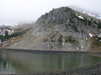
We started up the trail from the campground, but turned around at the top of the hill when I noticed that the guidebook said we were supposed to be on foot trail, not jeep road. So we went back to the beginning and discovered that there is no foot trail, all there is is an ATV/Jeep road. So back up the hill we climbed. The rest of the guidebook description matched, so off we went.
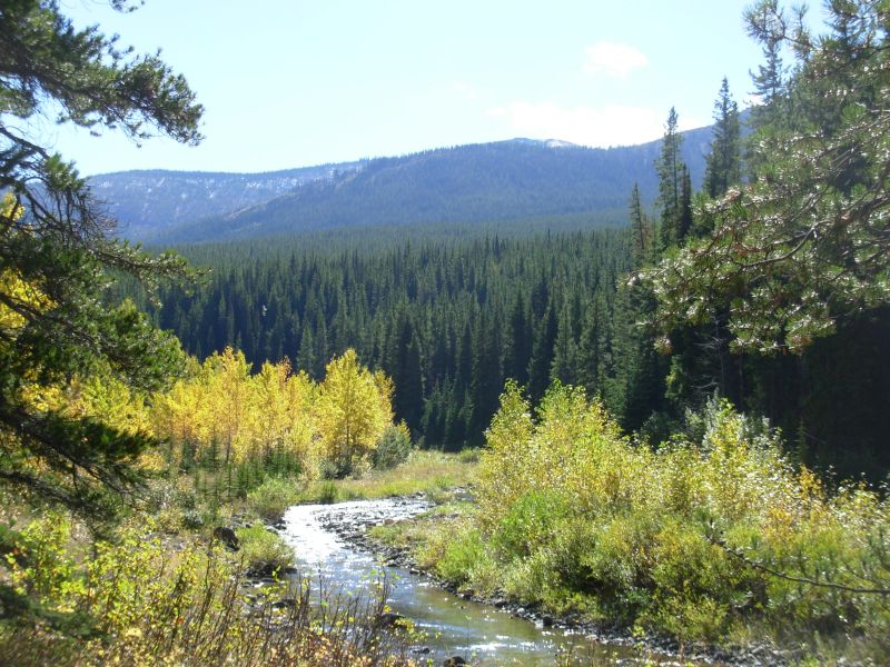
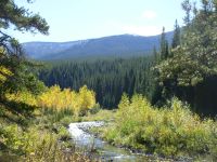
The crossing of the South Fork of the Two Medicine River was almost a rock-hop all the way. At one spot, I got my feet a little wet, but the water was only about 5 deep. What a difference from last time, when the water was so deep we couldnt cross the river at all. On the far side, we picked up a jeep road that is much used by motorized vehicles. The road was very wet and muddy, with deep ruts. I was happy when we met foot trail coming in about three miles up. From our last hike, I remembered that they had built a high water trail to avoid multiple river crossings. You go back and forth from the road to the trail several times. It may climb more, but at least it avoids the ATVs and the huge mud holes. There were five sections of high water trail; we followed all but one. The river crossings didnt worry us since the river is so low right now, but slipping and sliding on the muddy road trying to avoid the mud holes got very tiresome. The trail was much nicer, even though it too is open to motorbikes. Since its a Sunday, we met several people out enjoying the day: four on ATVs and three on motorcycles.

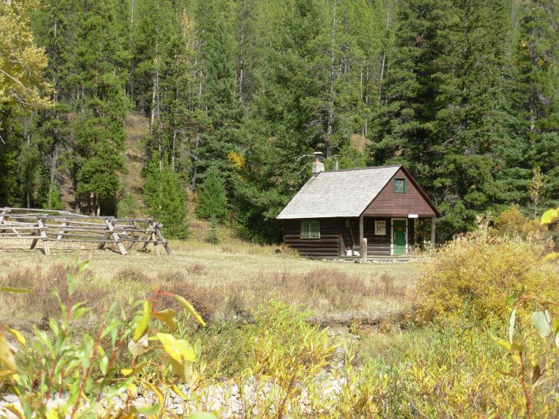
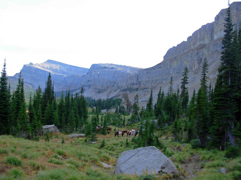
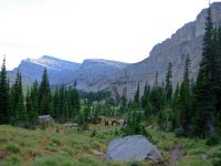
Near the Ranger Cabin we met a ranger on an ATV. I asked him about all the motorized use and he said that the area is open to vehicles except during certain times of the year. We talked to him for a while. His brother works on Landsat 7, one of Jims projects. He recommended a side trail loop, the Kip and Lee Trails, but it is longer and climbs more so we passed it by. It is actually the official CDT, perhaps because its non-motorized. He said its very cool, and if it hadnt been the end of the day, I might have gone for it. As it was, we just wanted to find a flat spot with water so we could set up camp. The ranger suggested that we go to a meadow about a mile away where some hunters had left some horses and a tent with an electric fence around it. He said they wouldnt be back tonight, and the horses might provide some protection, or at least warning, in case bears came around. Only one of the horses was tied up. The others wandered loose. We set up on the other side of the meadow.
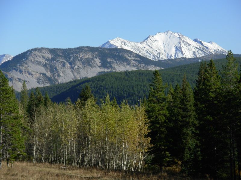
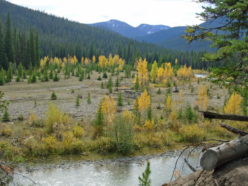
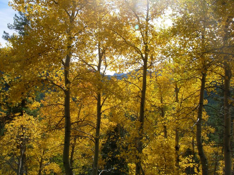
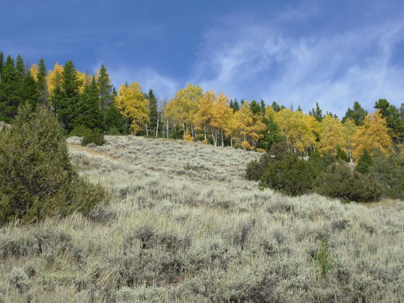
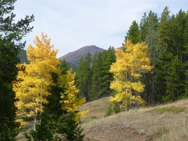
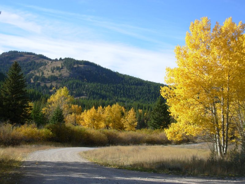
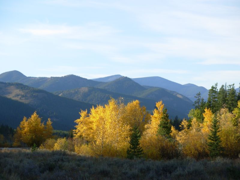
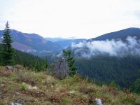
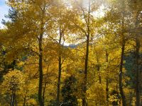
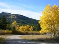
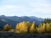
We had some nice views of snowy mountains and golden aspen, but most of the hike today was a woods walk. Ill be glad to get away from the muddy road, though already it has improved as weve gone farther from the highway. There are still fresh tracks, but fewer people drive this far.
Jim: We had a little rough start this morning - first a useless 2 mile side trip to see if we could find my lost glasses (we didn't), and then the trail south of the highway didn't match the description we had because of the ATV use and abuse.
I found it interesting (and irritating) that the northern district of the Lewis and Clark NF is completely open to motorized use. It says something about the mindset of the Forest Service. We ran into the same thing in the Rio Grande Forest in Colorado. It doesn't bode well for future CDT hikers. One of the many problems with motorized use is that it tears up the trails so badly. We passed potholes that you could lose a car in. When it gets that bad, the ATV's just go around and make new trails.
The horses were really interested in us - too much so. We had to shoo them away repeatedly. They probably thought we were gonna feed them.
Monday, September 25 14 ½ miles to Badger Pass

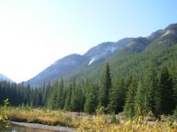
Another beautiful sunny day. Funny, weve had good weather for most of this hike and we totally took it for granted. After a week of rain and snow, sunshine feels like a real blessing. I think the forecast of cloudy and partly cloudy makes me appreciate the blue skies a lot more. I remember the PCT in Washington, where we had several days of low clouds where we could see nothing. Even though it didnt rain, it felt dreary and the lack of views was depressing. I was afraid of a repeat, but so far weve been lucky.
Were lucky for another reason: the lack of rain this summer means the rivers are very low. Weve crossed a couple that were knee-high and fast last time we were here; this time we crossed on rocks and didnt get our feet wet.
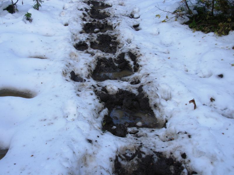
This morning was very cold, so we didnt get an early start. It is hard to leave a warm sleeping bag when its cold outside. There was ice in some of the puddles at 10,000 and still a few patches of snow in the shady areas. We followed fresh moose tracks for about a mile, then changed trails and lost them. We also saw deer, bear and coyote tracks. An elk bugled very close to the trail, but the trees were too dense to see him. The morning hiking was easy, with switchbacks for the climbs, which are only about 500 up and down. Were mostly hiking in trees, but there are occasional views of nearby peaks. This stretch isnt very memorable, but its nice easy hiking.
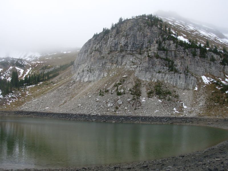
Later: Ironic that I wrote that just before conditions changed. Only a couple hundred feet higher in elevation, there was still snow on the ground. Where there wasnt snow, there was mud, lots of mud. We spent the entire afternoon slipping and sliding in either mud or snow. The snow was less slippery, but often had water underneath, so we would step into about 4 of water. It was slow frustrating walking. There was a lot of turnpiking on the trail, but even the raised areas were a muddy mess. About half a mile from Badger Pass it got worse: three strings of pack mules passed us, going the other way. Then the trail was total muck and mire. I was very unhappy. They had come up another trail, so after we reached the Pass we went back to wading though snow. We stopped early because I got paranoid that we wouldnt find a dry spot to camp ahead. Badger Pass has meadows that have been in the sun, so although patches of snow remain, there were some dry spots. We found a relatively flat spot near the trail. The sun went behind a hill soon afterwards, so we were cold and wet, but at least we had a place to sleep, even if it was too close to the trail. Trouble is, we knew there were lots of bears in this area; we saw tracks in the snow, big ones and little ones. The stream was dry, but we had enough water for the night.
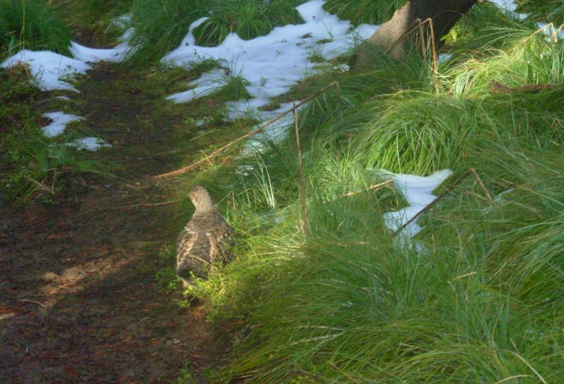
We saw three deer this afternoon, bouncing into the woods, and soon after we heard something large (bear? deer? elk?) crashing into the trees. Lots of ptarmigan, as usual. They are very common. Finally, we saw a redtail hawk.

Jim: This wasn't one of our better days. The trail was a mess - in large part due to horse traffic. I thought it was great when we got into the wilderness and lost the ATV traffic. But the hordes of pack mules and horses had damaged the trail even where it was turnpiked. With the snow on top of the mud, that made for miserable walking. Even the wildlife doesn't like it - we followed a bear that was obviously trying really hard to walk on the edges of the turnpiking where he could keep his feet dry. And that's exactly what we were trying to do.
The campsite wasn't great - it was right next to the trail. And "food-hanging trees" were in short supply. I finally managed to hang the food, but it was right over the trail where any bear that came along couldn't help but smell it. Not good, but better than not hanging it.
Tuesday, September 26 17 miles
We had no nocturnal visitors, thank God. I didnt sleep well because I was listening for bears, plus I was cold. My feet were very slow to warm up from being wet all afternoon. Jim solved that problem for himself: he put his mittens on over his socks. His feet warmed up and he was able to sleep.

We didnt allow ourselves to enjoy our warm bags too long this morning; we actually got up with the sun, (which doesnt rise until 7:15 these days. It also sets at 7:15.) We followed the trail along Strawberry Creek all morning. We descended past snow level in about a mile and after that had much less mud than yesterday afternoon. It was still wet, but not ankle deep bog. This afternoon we will begin an ascent of Clack Creek, a new route for us. That will connect with the Pentagon Creek route we couldnt take last time because of high water. Our crossings this morning were rock hops again, though we may have a deeper one later. Jonathan Ley said it was waist deep in June. Well see.
We ran into two hunters on horseback who were very surprised to see us out here just hiking. We passed a big camp by the creek and heard a shot to the south. There is a special early hunting season here in the Wilderness. We had read that rifle season for deer and elk doesnt begin until mid-October. We didnt realize that the Wilderness has different seasons. I suppose its because access is so hard in the backcountry. By the end of October, it may not be possible to get into the Bob Marshall or Scapegoat because of snow. I thought wed have the wilderness to ourselves; but we didnt know about the special season.
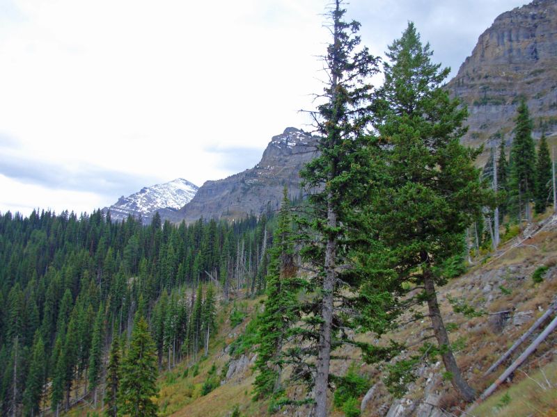
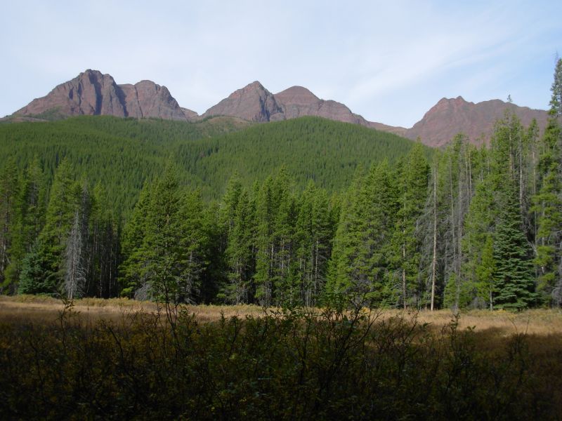
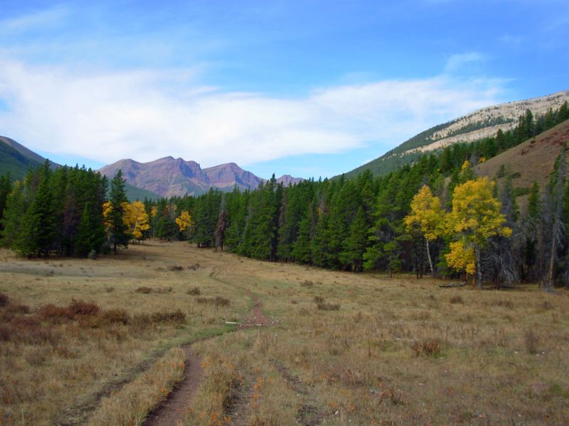
We had a nice sunny overlook for a lunch spot. We could see the creek lined with green and yellow trees and some distant peaks. One was covered with snow. Our meadow last night had a nice view too. There were purple clouds at sunrise. Today there are high thin clouds, as predicted. Night before last we saw a really pretty alpenglow on one peak. It was hidden behind the trees, so wasnt good to photograph, but it was a beautiful gold then pink.

We spoke with two more hunters as we were packing up after lunch. We didnt hear them coming up the trail until they were right behind us. One said, Good thing Im not a bear. He was right. Wed be dead. They were on foot this time, but camped with the others we met this morning. They said a grizzly was feeding on a dead horse near their camp on Strawberry Creek. I thought of asking why they didnt move camp, but I kept my mouth shut. Its not a safe situation for them, but the outfitter doesnt seem worried, so why should I? They have guns, even though they dont seem to be very good shots. We heard them shoot earlier, twice, and they had no game with them. After they passed us, we heard three more shots.

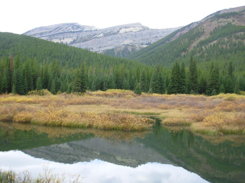
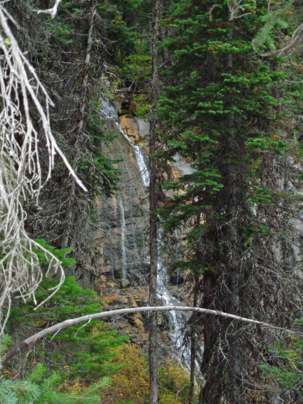
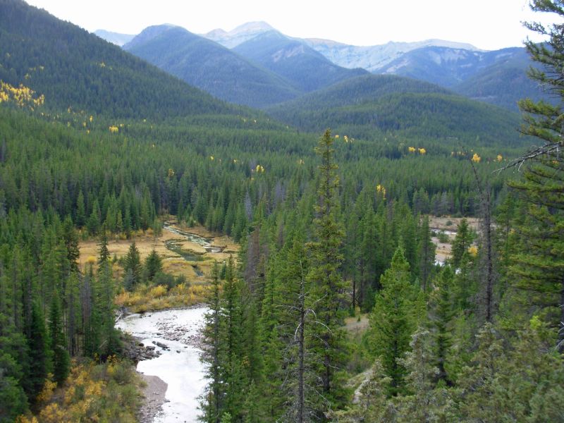
Later: The Clack Creek Trail turned out to be a good choice. I wasnt sure at first since it started out as just another woods walk. The crossing near Gooseberry Cabin was only mid-shin deep, our only wet crossing today. We followed a creek for a while, then began a 1000 climb on switchbacks. We passed a nice waterfall hidden in the trees, then climbed some more to the base of some cliffs. Like the Chinese Wall, there were layers of sedimentary rock that made a very dramatic display. There was a line of peaks that were quite beautiful on both sides of the valley. When we were walking down low, there were some really nice views across a couple of beaver ponds lined in yellow willow bushes with peaks and cliffs in the background. Later we looked up at snowy Pentagon Peak. Our campsite was in a round dry meadow at the base of a cliff. In todays muted light, everything was shades of gray. It looked like it might rain, since the sky has been gray all afternoon, but we got lucky again. We saw five deer this afternoon first a pair, then three more an hour later as we began climbing up the cliff. We followed interesting tracks all afternoon: a moose, a huge elk, at least two bears, and deer of course.
Four more deer came to visit while we were eating dinner. They ran off when they spotted us and circled around the bowl of the meadow, but then came back. They werent going to allow us to interrupt their dinner. It was too dark for pictures; the flash scared them, but resulted in nothing worth keeping.
Jim: The stream crossings so far have been really easy. It's been nice. In '99 there were several stream crossings that we just flat refused and had to find a way around because they were so dangerous. Hip-deep, fast snow-melt isn't something to mess with when the temps are in the 30's or below. But we don't have that this time. Much better.
We tried to get to Dean Lake to camp tonight but we just ran out of daylight. So we camped in what was once (and may be again) a grass-filled high altitude tarn. The deer showed up as we were setting up camp and circled about 50 feet away. Not quite fearless, but still wary. I tried to get photos but for some reason the camera was being a problem - it kept taking really fuzzy pictures no matter what I did. I had the thought that maybe it's broken, but it could just be the very bad light conditions.
The lower (southern) section of Strawberry Creek was a bear highway - there were a whole lot of bear tracks (different bears) heading in both directions. Gotta wonder how many hikers have come nose-to-nose with a bear on that trail.
September 27 16 miles to the Spotted Bear River
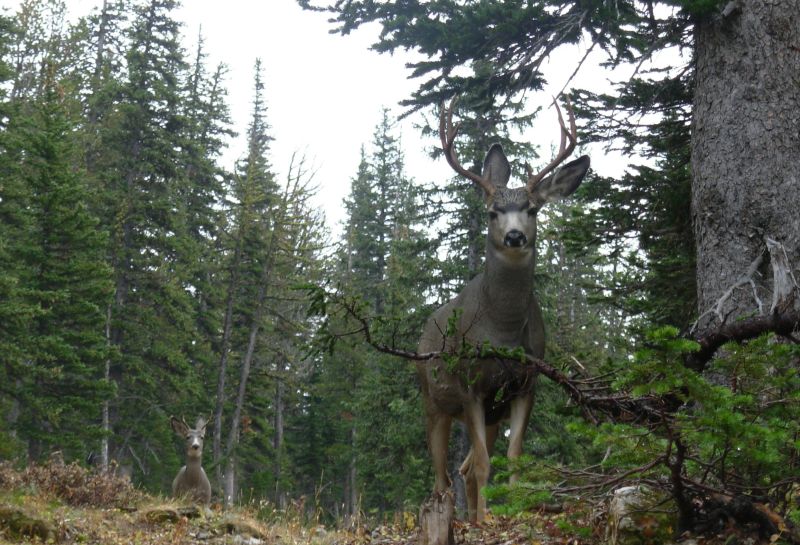
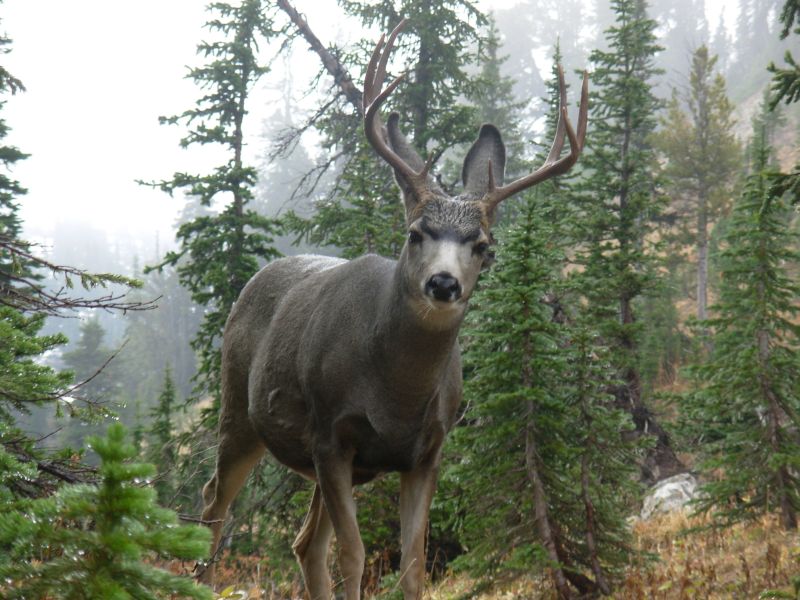
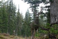
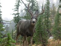
Soon after we went to bed, it began to rain, which continued off and on for a couple of hours. We woke to gray skies and low clouds hiding the peaks. A few minutes of sunshine at lunch allowed us to dry out the tent, but it didnt last. There were few views as we climbed to Switchback Pass because of the clouds. We did have an interesting encounter with two mule deer an eight-point buck and a six-point buck while we were getting water. They approached within 20 feet of us, utterly unafraid. We got some nice pictures of them. A doe, seen an hour later, was much more shy.
Because of the rain, as well as a lot of snow still on or next to the trail, the climb up was a mucky mess. One section of recently rebuild sidehill was totally torn up by horses in the past few days.
The descent to Pentagon Creek was much drier, though very narrow in a few spots. Its a 3000 descent; I was glad we didnt climb this side. I was sweating enough with the 1500 climb we did, plus an additional 300 when the trail dropped down after barren Dean Lake, despite the damp clouds that covered us. A few distant peaks were seen, but there werent any really good views on the descent.
We found a fresh bear track less than ¼ mile from our campsite this morning. I heard footsteps past the tent around 6:30 and assumed it was the deer from last night, but I may have been wrong. We back-tracked it for about ½ mile; he slept quite near us. Mostly weve seen deer tracks; elk are much more scarce. I asked one of the hunters if the special season here included deer. He said he supposed so, but why come all this way in and then have to pack it out, just for a deer, when they are so easily found elsewhere without as much effort? So I suppose the deer are mostly left alone and the elk are all hiding until hunting season is over.
Our afternoon hike was easy but unexciting as we dropped down to Pentagon Creek Guard Station and began the climb up the Spotted Bear River. Most of the hike was in trees, with only occasional views of green hills or yellow aspen. Walking in fall is such a pleasure. I love the reds and yellows of turning leaves. We stopped early to camp because the guidebook warns that there is no decent camping for the next six miles. Since the last six were mostly sidehill high above the creek, I could easily believe it. Trouble is, there isnt any good camping here at the river crossing either. We found a small relatively flat spot, but its not great. We passed some very nice campsites down by the river but they were back a ways. One caused us some concern: a trail turned right toward the river about ¾ mile before our crossing. I was fairly sure it led to a large outfitters camp, but we worried that it was really our trail until we reached the real crossing.
We saw no people today, and no more wildlife except ptarmigan and squirrels. The sun came out after lunch and the day got warmer, but then the sun went behind the ridge at 4:30, so it is cold again. There were a couple of shallow fords, but nothing big at this time of year, fortunately.
Jim: I'm happy we didn't make it to Dean Lake last night - there's really no place to camp there. The only attraction is the water - and it's not much of an attraction.
The deer this morning were funny - it was almost as if they were posing for us. I haven't seen deer that fearless since the Shenandoah. We spent most of the day following deer, elk and moose tracks.
Our campsite was a sorta flat spot between the blowdowns. But there was water and trees to hang the food.
Thursday, September 28 17 miles to Burnt Creek

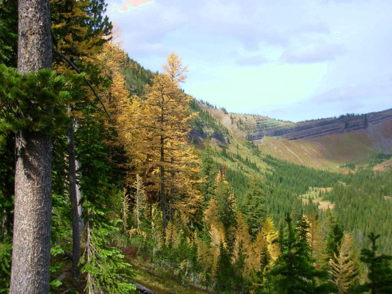
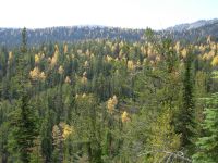
It turns out there were a couple of nice campsites upstream after all, but we were comfortable enough in our little mossy spot. The morning was spent climbing gently along the Spotted Bear River to Spotted Bear Pass. There were few views, just an easy woods walk. After the pass there were views north to Three Sisters and south to Larch Hill, which is yellow right now. The whole area has a lot of bright yellow larch beautiful. The only other places Ive seen larch were in northern Washington on the PCT and northern Pennsylvania.
We spent the afternoon walking below the Chinese Wall, the highlight of the Bob Marshall Wilderness. It is a long cliff which the trail follows for several miles. We were too late for really good photographs, the lighting was wrong, but it is still a very dramatic sight. Lunch was at green My Lake, surrounded by yellow larch. I wanted to do the higher and more scenic route past Larch Hill, but Jims knees were really hurting so he didnt want to do any more climbing than we had to. The hike along the base of the Chinese Wall has several short ridges, followed by a long descent, so his knees got enough of a workout.
It was a mixed sunshine and clouds day, but mostly it was cool and sunny so we enjoyed the hike. We heard three elk bugling and followed several different bears tracks but saw no wildlife. We did run into two hunters on horseback with pack animals who had been out for five days. Were camped next to Burnt Creek, which has a nice little waterfall dropping into a large pool below. The waterfall isnt visible from the trail; you have to go through the campsite to see it. What it doesnt have are hanging trees. The lodgepole pines here have no large branches, just short dead ones. Jim has gotten good at the two tree method of hanging food since weve been in a lot of areas with skinny trees. Its harder, but works well if you know what youre doing.
Ive had too much time to think lately. Woods walking doesnt take all that much attention, though watching for bears should. As we approach the end of our hike, Ive started wondering what it has meant to us. Did we find what we were looking for? Was it what we hoped/expected?
I came out primarily looking for three things: adventure, wildness and wilderness. To a large extent, I found what I wanted. Although weve had a few adventures of the nasty uncomfortable kind, for the most part my sense of adventure comes from exploring new country or revisiting familiar places in new ways. There is so much out here to explore and discover, the adventure is in doing just that. Choosing and creating alternate routes really satisfied my desire for adventure. It was fun heading out on a new section of trail, uncertain how far it was to the next town or the next water or the next campsite. We didnt know what to expect, and that was fun for me. The wildness yes, there has been a lot of wildlife and beautiful flowers, majestic mountains and awesome views. I have been immersed in nature, which always makes me happy. As for wilderness: there wasnt as much of that as Id hoped. The trail is changing. There is less of a sense of remoteness, with so many more people, both hikers and others. The trail is better marked and defined. It is easier, in a lot of ways. Hikers are also trying to tame the trail, taking away a lot of the challenge and sense of wilderness with water caches, slackpacking, everything you need to know planning guides, GPS, computers, and cell phones. I wish I had done the trail 20 years ago, but since I didnt, Im glad we did it now and not ten years from now when everyone will be following the same single marked route (or be stigmatized for deviating from the official route) and trail angels will provide group feeds, keep the water caches filled, etc. It will become just another trail, and not the special adventure that it is now.
Jim: I have good memories of the Chinese Wall from '99 - even though the whole area was nose-deep in snow. So I've wanted to see what it was like without the snow. Strangely enough, I pictured it with gaggles of horse packers camped in the area - but when we got there, there were no horse packers - and no camping. Happiness is. The Wall itself is just as impressive as I remembered. The trail past My Lake and over Larch Hill Pass is another "bear highway" - more bear tracks than you'd believe. But they don't seem to come down along the Wall trail. Maybe because the Wall trail has been moved away from the Wall. When we came through in '99, we walked up close to the Wall. The new trail is further away from the Wall and provides considerably more exercise for the hikers (lots of up and down).

Ginny's ruminations are a reflection of what we've both thought for the last several months about the future of the CDT. And actually about the future of all the long trails. There are those who would deny what I call the "wussification" of the trails, but I believe those people either haven't given any real thought to the subject or are ignorant of reality. For the most part I find hikers to be no better or worse in that regard than any other segment of humanity. As William James once remarked: "Most people believe they're thinking, when all they're doing is rearranging their prejudices"
I suspect the concept of "wussification" is gonna draw a lot of flames from some quarters. S'OK - as someone else said: "The truth of a proposition has nothing to do with its credibility - and vice versa." You can bet the farm that this subject will be discussed later - probably at "high volume."
Friday, September 29 21 miles to Benchmark Campground
It was a peaceful easy day hiking down the West Fork of the South Fork of the Sun River to the South Fork of the Sun. It is good trail, easy trail. It was so different from our hike in 1999, when we couldnt even cross the river because the water was so high and fast. Now theres a bridge across and easy rock hops of all the other side streams. Mostly we were walking in the woods, but there were occasional views of beautiful Red Bluff and up and down the river with colorful patches of golden aspen. It was beautiful.
We stopped for an early lunch in a meadow above the creek to enjoy the views. We saw two whitetail deer at one creek crossing. The weather was warm, in the 70s, and mostly sunny.
We hurried so we could get to Benchmark in time to take a shower and pick up our supplies. Last time we also rented a cabin. Unfortunately, this time was different. Our box was there, on the porch in a metal locker, but no one was home. Worse was that the water was shut off, as I discovered the hard way, after I had gotten undressed and was standing before a dry shower. I was very unhappy. I dont know if theyve gone away for the season, or just for the weekend. I was looking forward to getting clean again.

We walked a mile to a campground near the trailhead. We ate dinner in the dark, but at least we were able to set up while it was still light. There were a few cars here at the campground, probably because its Friday night. We saw a deer wandering through the campground.
Jim: It was an easy, pretty walk today with a surprise ending. I'd talked to Beverly before we left Glacier and she assured me that the maildrop was there, and that the trails were open and invited us to take a shower when we got there even though she wasn't sure she'd be there on Friday night. So the lack of a shower came as a real disappointment. And I do NEED a shower. But we'll deal with it. At least we got our maildrop so we can eat for the next few days. We were getting really low on cookies - and I get really grumpy without my cookies.
Saturday, September 30 19 miles to the Dearborn River
It turns out the CDT south of Benchmark, the Straight Creek Trail, was closed because of a fire near Cigarette Rock that began a couple of weeks ago. We had heard that the fire was out and the trail open, but we were misinformed. There were notices at the trailhead that six miles of the trail, plus a couple of other trails, were closed and that about two miles of the CDT were burnt. This was not happiness. Three trail closures in one year? Despite all the rain and snow last week, the fire is still smoldering. There was a lot of smoke in the area, and haze blanketed the peaks for miles.
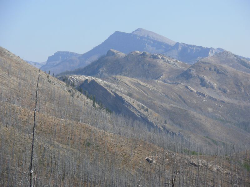
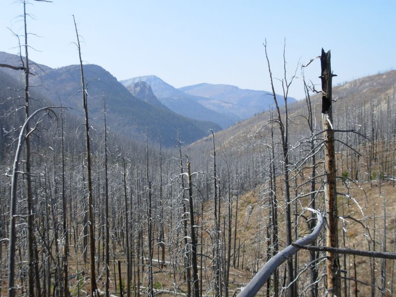
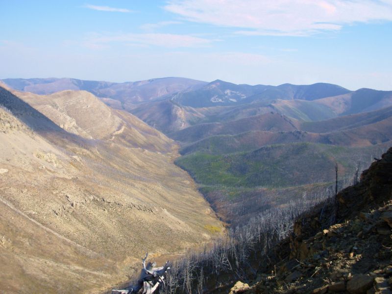
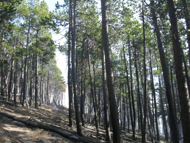
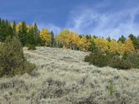
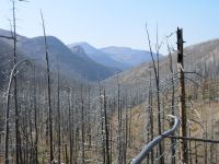
Later there were some striking views, but we took almost no pictures because of the smoke. All afternoon we hiked in an older fire zone from the Crown Creek Fire of 1988 that burned something like 300,000 acres in the Scapegoat Wilderness. The ghostly gray trunks accompanied us for about eight miles. Regrowth was really erratic. Near Straight Pass there were only scattered seedlings, few over four feet tall. Near Welcome Creek Guard Station there were thousands of saplings all crowded together.
The day was warm and sunny but very windy. The wind screamed through the dead trees like a horde of banshees. It was eerie. A couple of times I was almost knocked off my feet.
We saw no other people today, though there were some tents by the guard station. We only saw one man yesterday, a hunter on horseback leading two more pack horses. There were four mule deer in the burn zone, including one spike buck.

I dont remember this area. Some sections of the trail I remember clearly, others not at all. When we were here in 1999, there was lots of snow that hid the white cliffs, and we were mostly concerned with navigation and river crossings. Today we crossed the Dearborn River twice without getting our feet wet. What a difference. It does mean that water may become a concern in the coming days. Several of the creeks listed in the guidebook have been dry. Thats not a problem here, where there are plenty of alternatives, but south of the Scapegoat there arent a lot of options.
Jim: This is another of those areas where the trail has been changed or rebuilt (or maybe "built) since we were here last. There are new switchbacks on part of the trail - and it's recent (2006) work. Our last pass through here was a little tougher than this time - there was no trail, a LOT of snow, and it was a LOT colder.
The burn area is strange. There are large areas with no growth at all alongside large areas that have millions of saplings so close together that there's not room to walk between them. And the dividing lines are very sharp. But there IS new growth. Life goes on.
Sunday, October 1 15 miles to Valley of the Moon
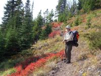
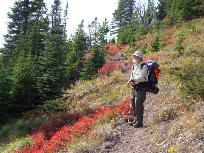
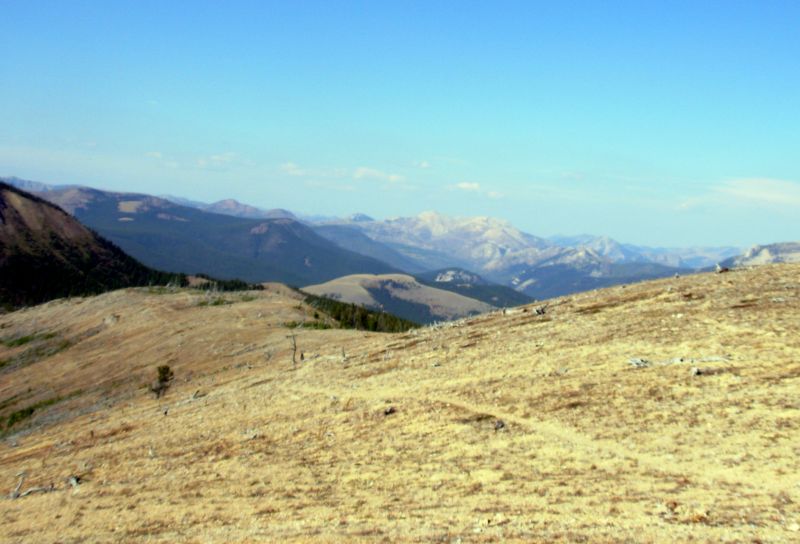
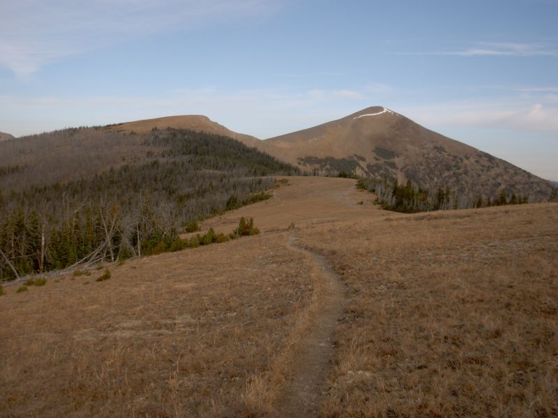
It was another beautiful Indian summer day. The sun was shining, the wind blowing, colors were vibrant red, yellow and green. We descended along the river for about 4½ miles with occasional views, then began a long steep switchbacking climb up to the Divide, which we followed for the next several miles.
We saw two beautiful bull elk first thing this morning. One was dappled, very light for an elk. A great horned owl serenaded us last night and again at dawn. We met two hunters on horseback just before lunch. We had our first wet foot knee-deep crossing of the Dearborn River. I think that makes a total of four wet crossings in the past eight days. In June we had five or six knee to thigh-deep crossings every single day. I like traveling the Bob Marshall in the fall.
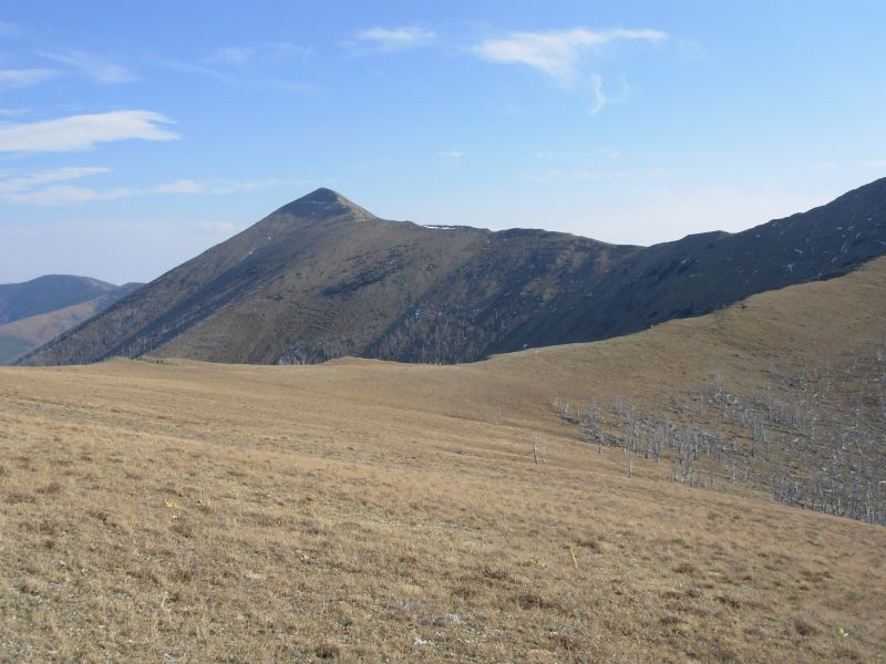
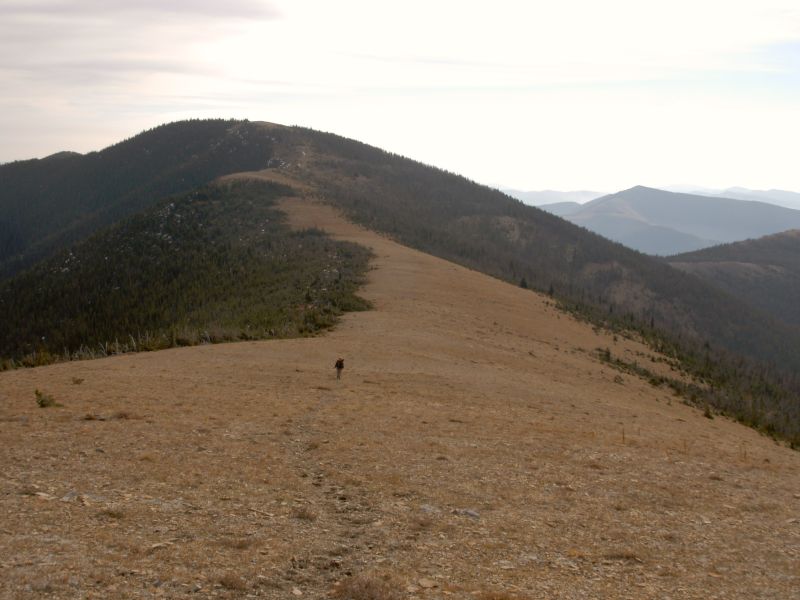
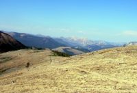
Our afternoon was spent climbing and climbing, about 3500 in all. We climbed along the Divide, then dropped down to a narrow valley which we followed back up to the Divide, which we followed until we finally dropped down to the Valley of the Moon (great name!) below Caribou Peak. It was beautiful hiking. We decided to camp in the Valley of the Moon because there's water, trees and good campsites. Tomorrow the trail goes back up to the Divide again, and campsites are limited on the ridge. It is rocky, windy and there are no trees to hang food. We are better off here. This afternoon was very windy. It was hard to walk since we were fighting the wind with each step, plus it stole our breath, which we needed for the climbs. Fortunately, the wind was only a problem at the saddles; usually the trail was slightly below the crest, which helped. The views were great, though the sky was still hazy from the smoke. Still, we enjoyed mile after mile of ridges and peaks in all directions.
Close to us the view was less inspiring as we walked through old burn areas: lots of dead gray trees with very little regrowth. One valley to the east had one side green while the other was gray. We couldnt tell whether the green was old or new trees. One advantage of the open forest: we spotted a small herd of elk through the trees on a ridge a good distance away. Yesterday I saw a squirrel on a dead tree, trying to hide where there were no branches that was sad. From the ridge we saw more smoke, this time to the south. Not another fire!?!

As we approached the Valley of the Moon, we looked down from the ridge to the valley below. The creek and pond were dry. Since it was ten miles to the next water source, we were not happy. Jim looked up the valley toward Caribou Peak and noticed water higher up the valley. So when we reached the trees, I set up the tent while Jim walked ¼ mile upstream to where the water vanished in the sand and got us enough to carry us through the night.
Jim: In '99, Ginny came very close to dying in this valley. It's a memory that still haunts me. That story is in our '99 journal for anyone who has a burning desire to know about it.
Some hikers have reportedly not found water in the Valley of the Moon - probably because they expected to find water in the stream. What they didn't do was to walk upstream far enough - there IS water up there, but it goes underground above the dam and doesn't reappear, probably for a mile or more downstream. This situation is familiar to us - we encounter it a lot in Pennsylvania where the water sources are intermittent.
Monday, October 2 18 ½ miles to Lincoln

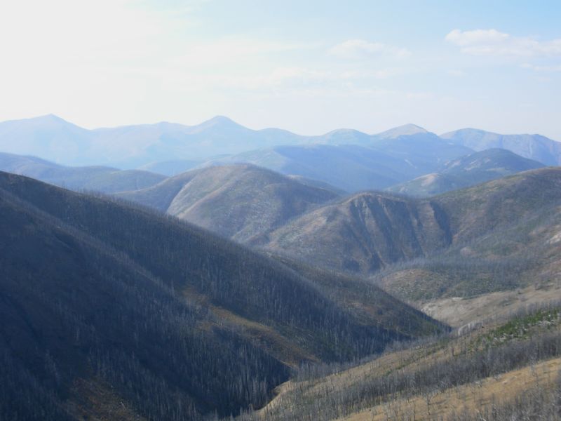
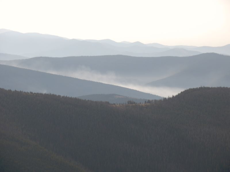
Summer is over, or at least this latest warm spell. We woke to gray skies and cold temperatures. The 500 climb out of the valley warmed us up a little, then we followed the Divide up and down for the rest of the day. Because of the wind, we kept our jackets on most of the day. Views were spectacular.
Because of the clouds and haze, the distant ridges were blue and looked more like the Appalachians than the Rockies. It was strenuous climbing up and down on the ridge, but great hiking. Sometimes the trail was clearly visible; sometimes we walked on alpine meadows with no tread at all, just an occasional cairn. Since we kept following ridges, getting lost wasnt an issue except when we switched from one ridge to another. Even then, the only real uncertainty was at Cadotte Pass, where there was a new building, new fences and roads and we wondered whether they had finally relocated the trail as planned. They hadnt. We walked between the house and the fence up the ridge, exactly as described in the guidebook.
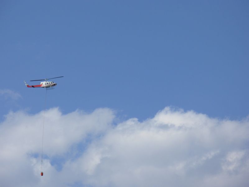
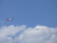
It was a long day. The most exciting part was stumbling into another wildfire. We saw smoke yesterday and knew there was a fire to the south. This morning we could see smoke a couple of valleys away from the CDT. We didnt worry about it. However, when we descended Green Mountain, we walked right into a fresh burn. There were scattered areas that were still smoking, and lots of burned grass and logs. The fire seemed to have started or ended at the trail, which was the fire line. In places the fire jumped the trail and burned both sides. Most of it burned a day or two ago, but there were hot spots all over. All day we heard the helicopter flying over us, dropping water. As we walked through the burn area, the helicopter was right above us. We would have turned back, except that we could see the clear ridge that the trail follows less than half a mile away. It seemed better to go forward than to back out and run into the fire again elsewhere, especially since the fire seemed to be along the road that heads out toward Lincoln. We met one of the fire crew when we were safely on the far side. I asked why they hadnt put out a notice at Lewis & Clark Pass that there was a fire ahead. He said it was a prescribed burn that got out of control and jumped their containment lines. The high winds we had yesterday and again this afternoon werent forecast. It was supposed to rain. I got a little upset with Jim for stopping to take pictures while we were trying to speed past the burning trees. Theres a time to take pictures and a time to MOVE, I said. His response was, Theres always time to take pictures.
Our only wildlife today was a couple of mule deer at one of the knobs. Yesterday we watched a couple of golden eagles soar past. One surprise both yesterday and today is that there is still snow on some of the high ridges. As warm as its been, that was unexpected, but the shady spots stay cool.
Jim: Today is much like what I remember from our '99 hike - ridgewalking on the Divide with superb views that seem to go on forever. The only nit has been the wind, but we've dealt with that before. At least it's not a really cold wind.
Ginny seems to be a little nervous about being in active fire zones. I wonder why? I took some photos on the way through the burn zone and then stopped to talk to the fire crew. We assured them that we would probably be the last hikers who'd be in the area. I watched the helicopter make several trips with the water bucket. Afterward, another chopper came looking for us. We know they were looking for us cause they had to search for a while and come across the ridge that we'd just crossed. When they were sure we were out of the burn area, they left.
The hitch into Lincoln was easy. A woman whose son is deaf had been to a meeting in Great Falls concerning where he would attend college. One of his options is Gallaudet in Washington, D.C. My niece graduated from Gallaudet and then married one of the other students. Anyway, we got into town, got a room at the Sportsman Motel, took a shower and got a meal next door and crashed.
October 3-4 Rest days in Lincoln
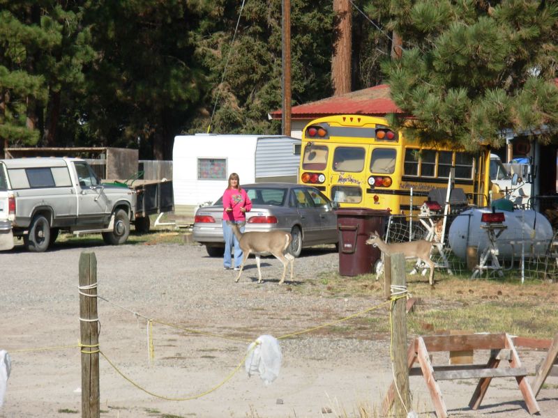
We decided to take two days off in town, one to do chores, one to really rest. It seems a shame to waste the good weather. It has gotten significantly colder (by about 20 degrees), and the forecast is chance of showers every day this week, but in town we had dry clear skies. At Garlands Store, Becky said she heard it was supposed to snow this week. I hope shes wrong. Mornings are already too cold. Weve eaten well, slept a little and stayed warm and dry. Lincoln is a small town, with everything hikers need within about ½ mile on the main street, which is also the highway. Deer wander through town, quite unafraid of the people or cars.
Most interesting has been reading the old trail registers at the Post Office. They cover 1979 to the present. There are so many familiar names even though a lot of hikers never signed in. As Jim said, there are a lot more Triple Crowns out there than most people realize. The ALDHA and ALDHA-West organizations mostly include recent hikers; a lot of the hikers from long ago have no involvement in the long distance hiking organizations, which is really too bad. There were a couple of hikers in the register who went from South America to Alaska, one in 1975, another in 1979. Id love to talk to them. Some of the people in the register complain a lot, some rhapsodize over their hikes, some complain about the complainers. It was interesting reading.
Im not ready for this adventure to end. As hard as it can be, hiking all day every day, dealing with the changing seasons, carrying the weight of our winter gear, etc., it is still a life that makes me happy. I love living surrounded by beauty, where every day brings new vistas, new chances to see wildlife, the joy of moving my body freely (albeit sometimes painfully) across the land, the happiness of exploring new places . . .
For six years I have looked forward to doing another long hike and aside from the constant worry about Jims knees, this hike has been all I hoped it would be. I love hiking, and especially long distance hiking where you become so fully immersed in the land and the seasons and the simplicity of life at its most basic.
Im not ready to return to the uncertainties of life off the trail. Here I have everything I need with me at all times: Jim, something to eat, a warm place to sleep and the possibility of adventure around every corner. Off trail we deal with other much less pleasant realities: finances, health, politics, and a society to which I no longer belong, if I ever did. We had plans for the next few years to hike and travel long trips and short ones. With Jims knee problems, well need to come up with some alternatives.
Jim: We didn't plan on staying two days - it just happened, largely because of my knees. But since we're here, I've made the most of the eating opportunities. I've also photocopied the entirety of the Trail registers from the Post Office. We'll see if I can do something useful with them when we get home.
Seems this hike will end much like our '99 hike - with neither of us really ready to end it. I'm not quite talking about hiking the CDT again next year, but I've certainly been thinking about doing it again in the future. I used to wonder how people could go back to hike the same trail time after time. And I still do. But this isn't the AT or the PCT. It's an entirely different animal, with multiple possible routes and therefore multiple different thruhikes. Much of our thruhike this year has been on trail that's new to us either because the trail has changed or been rerouted or because we chose entirely different routes. I could, perhaps, hike the AT and/or the PCT again. But it wouldn't give the same satisfaction because those trails have become too civilized. They lack the degree of wildness, beauty and difficulty that the CDT provides. We may yet walk those trails again. But right now, that's not a great "need" or "want" on our part. But as the man says: "Never say never".
Home | Links| Trail Journals |
The Thruhiking Papers | Bun-bun
Created: Dec 2006
Revised: 30 Sept 2016Copyright © 2006-2017 Spirit Eagle