|
 |
 |
 |
 |
|
|
|
|
|
|
September 12 20 miles to Butte
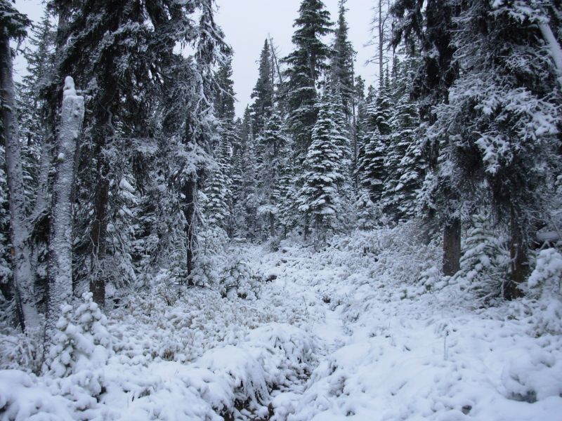
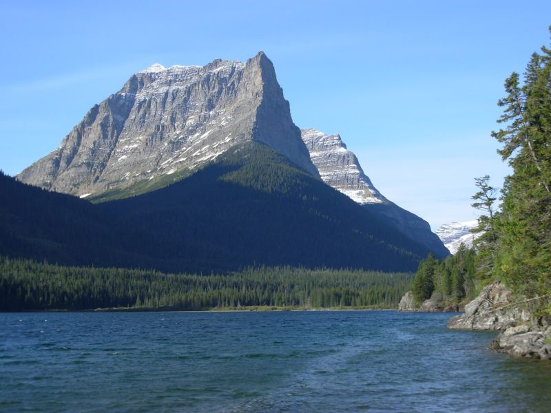
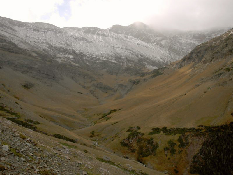
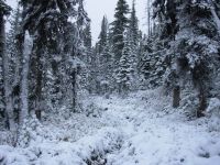
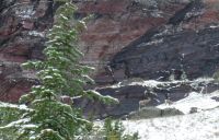
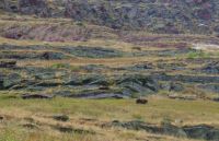
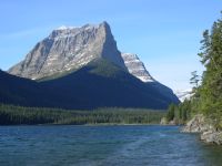
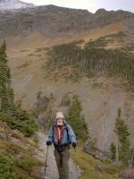
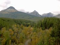
Our long roadwalk from Whitehall to Homestake Pass, where we reconnected with the official CDT for the first time in 300 or so miles, wasnt nearly as bad as I expected. Only the first eight miles were paved, and only the first 4½ miles were on a road with traffic. After that we left Highway 2, walking past ranches and a derelict hot springs resort to BLM and National Forest dirt roads where the walking was quite nice through lodgepole and juniper forest in an area of big boulders. Climbs were gentle and the walking easy.
We had a slight problem when the road we were following headed in the wrong direction. We followed it for a half mile before turning around to pick up a very faint track that I had noticed in a logged area that we passed. It turned into a cow path, which split and climbed over a rocky knoll, then somehow turned into the jeep track we had been planning to follow all along. We were paralleling the freeway, so I knew we werent likely to get lost even by following cow paths that ended unexpectedly, but it was still a relief when the faint tracks heading west turned out to be the ones we wanted. We saw five deer this morning along the highway, but none in the forest. There were lots of cows in the BLM land.
We reached Homestake Pass, where the CDT crosses I-90, at 5:15. It is about 10 miles to Butte. We headed up to the freeway, where we got a ride in about five minutes in the back of a pick-up with an Hispanic family. He warned us about some broken glass in the back of the truck, covered by a blanket. That made Jim laugh, since he has often joked about finishing the trail, . . . if I have to crawl on my hands and knees across broken glass. The driver dropped us off near the airport. Unfortunately, we started walking toward the airport, in the mistaken belief that we would find some inexpensive motels nearby. Instead we found a convention center full of drunken tavern owners on a convention spree. We used the telephone there to find a hotel and call a taxi. The long walk in the wrong direction for the second time today was not appreciated. Even with the detour, we found a room at the Super 8 and were settled in by 6:30. The motels are all by the freeway, and there are lots of restaurants nearby, so were happy.
We decided to rent a car in Butte to drive north to Kalispell Airport, where well drop the car off and catch a train to East Glacier. Im not sure how well get from there to Waterton or Chief Mountain, or when. The car is more expensive than taking Greyhound, but the bus leaves at 5:00 a.m. This way we can enjoy the journey, starting at a more reasonable hour and stopping when we want to.
Jim: Yeah - even this far into the hike it's possible to have a brain cramp and find yourself headed in the wrong direction. As usual, the question is - how long does it take to wake up and realize you need to backtrack. And since we're not doing actual "trail" there are no markers to wake us up. Keeps life interesting.
So now our end point for completing the trail is Homestake Pass near Butte. As I said - not ideal, but workable.
I spent considerable time trying to find a way out of Butte tonight. There are no buses that go to East Glacier at this time of year (or maybe at any time of year). The trains run from Kalispell but that would take us 2 days to get there - one day into Kalispell on the bus and catch the train the next morning. Flying to Kalispell doesn't change the timing. Nor is there a bus or train (or plane) to Browning on the east side. In other words, wherever you want to go from Butte, you can't get there from here. So - the first solution was to rent a car, drive to Kalispell, then do the train the next morning. Then I talked to Mark Howser and he had another solution that would get us into East Glacier in one day rather than two. Thank you, Mark.
Wednesday, September 13 East Glacier Park
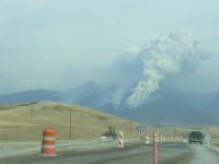
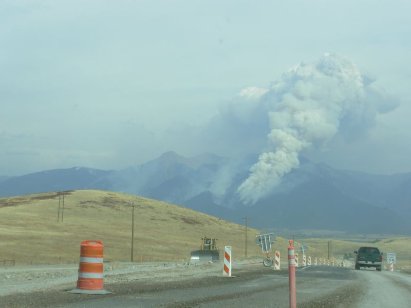
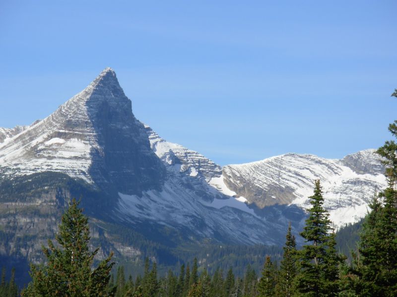
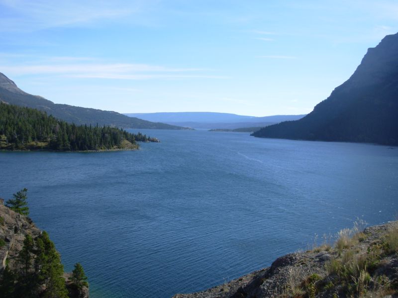
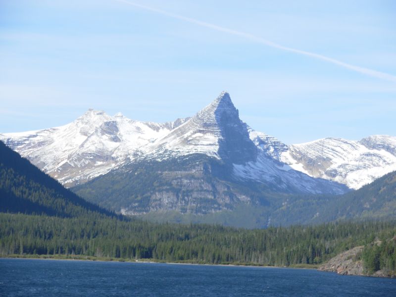
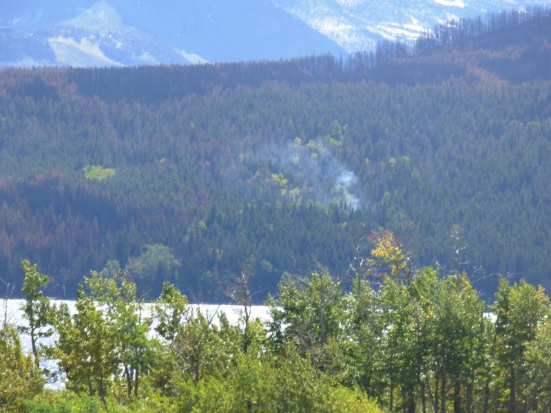
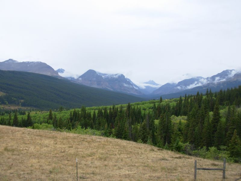
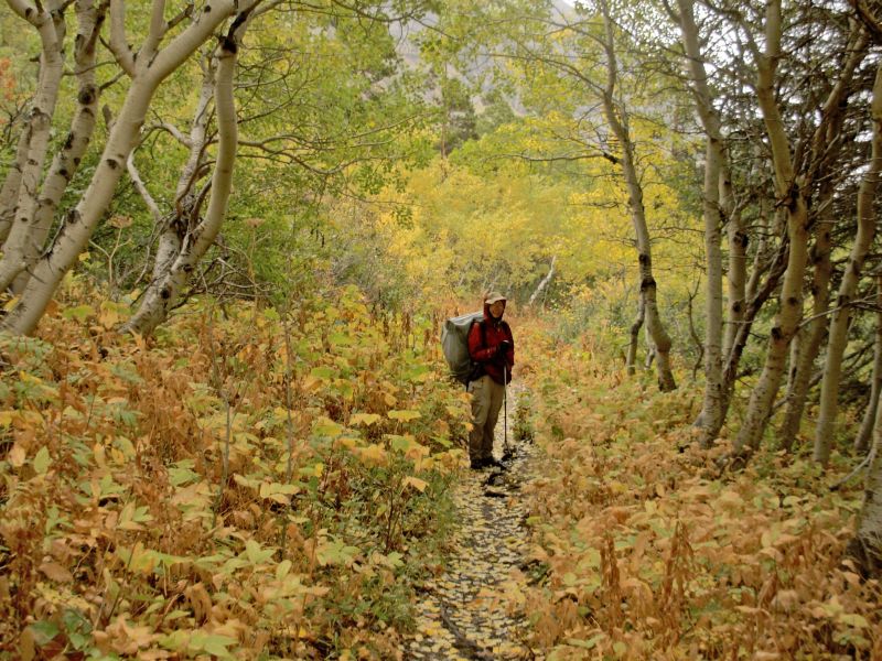
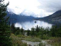
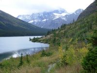
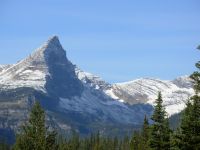
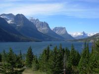
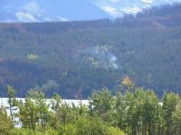
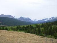
We enjoyed a leisurely drive from Butte to East Glacier. The country was new to us and some of it was quite spectacular. The Mission Mountains north of Missoula were very dramatic and Flathead Lake was enormous and quite beautiful. Late in the season as we are, there were still a few sailboats out on the water. I would like to come back to this area. It was very smoky again today, partly from the Idaho fires, plus there were several burning in the Mission Mountains as we passed. We could see the flames from a couple of miles away and a huge plume of smoke was visible for miles. We spotted a smaller fire north of there as well. The aspen are turning, adding some interesting color to the mountainsides. Flathead Lake had an interesting color combination: blue green water, dark blue hills, purple blue mountains and grey blue sky. It was beautiful.
We were late leaving Butte since we stopped at Wal-Mart and an outdoor store to look for new shoes for me. I didnt find any. We ran into Karma on our way out of the motel; he and Mark stayed there the previous night. I wish we had known. We had a taxi waiting to take us out to the car rental office at the airport so we couldnt talk.
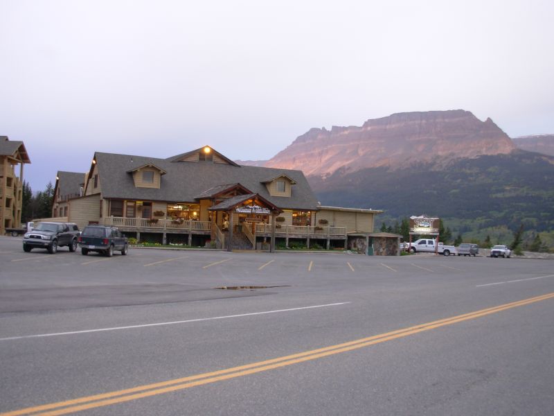
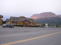
We are staying with an old friend, Mark Howser, in East Glacier. He owns a motel, diner, car rental agency and grocery in East Glacier. Jim has known him since 1991, and he has been very helpful to us on our past visits to Glacier. We ended up driving one of his rental cars from the airport in Kalispell to East Glacier after dropping off our Butte rental.
Spur and Ready are also in town. It seems that many of the northbound hikers are finishing up this week. Several took off today: Adam, Homebrew, Kalyn, Matt, Blister Sister, Packrat, Stacy and her husband Greg. Thermo and Five Gallon finished yesterday.
We learned that the CDT is closed in the Red Eagle Lake area because of fires that started about a month ago. Some are roadwalking the entire way from St. Marys to East Glacier 40 miles or more. There have to be alternatives. I dont want to do that much walking on a busy narrow highway. No way.
Jim: It was a fairly long day driving from Butte to East Glacier. We didn't get here until just about dark. And I was really happy to stop moving. Tomorrow we'll get the permit for Glacier National Park. Tonight it's dinner, shower, and sleep.
September 14 East Glacier Park
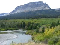
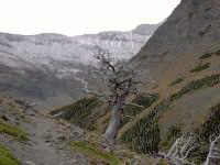
It was an interesting day. Yesterday evening the temperatures plummeted and it began to rain. We woke to snow on the mountains, and continued rain, snow and clouds in town. We drove to Browning in one of Marks cars, got the oil changed, and then drove to St. Marys Ranger Station to talk about our permit. We can do most of the trail through the Park; only 23 miles are off limits between Reynolds Creek and Triple Divide Pass. We will have to walk paved road for 25 miles or so, plus hike ten miles on trail, to get around the burnt section. Were not happy about walking the highway for 15 miles, but its better than 37. This way we get to hike near Two Medicine Lake and Pitamakan Pass, which are both beautiful areas, and Ive heard nice things about the Cut Bank Valley. This is just another alternate route.
After finalizing our permit, we stopped for lunch at the lodge in St. Marys and ran into Stacy/Simply Seeking and her husband Greg/Grizzly entertaining a busload of ladies with tales of the trail. Stacy is finishing her hike. Greg, who thruhiked the CDT a few years ago, came out to join her for the last week. We sat and talked for an hour or so, then drove them to the trailhead at Jackson Glacier Overlook (which you cant see any more since trees have grown up to cover the view.) On the way back, we picked up a young hiker we had met at lunch who was shortening his hike through Glacier because of snow and the forecast for continued bad weather for the next week or so. He woke to three inches at his campsite this morning. The heavy snow is supposed to fall Saturday, with possible rain and snow on Friday, Saturday, Sunday, Wednesday and Thursday. Oh joy! Our way of dealing with this bleak forecast is to plan for short days, with a couple of stops at a park lodge/motel so we can warm up and dry out, if necessary. I know its wussifying the trail, but since we have the option of a motel right now, and we may need it badly, I see no reason not to enjoy the amenities offered. We thought the lodges closed tomorrow, but theyre open through the weekend, then theyll close for the season. We barely made it. Our next section through the Bob Marshall and Scapegoat Wildernesses will be quite different, with 11 days in the backcountry and no egress. Of course, it gets more complicated: there is currently a fire in the Benchmark area where we sent a resupply box and they have evacuated the area. The rain should put out the fires, but will they allow the people at Benchmark to return to the Lodge before we get there? Will the Lodge still be standing when we get there? Will the trails be closed?
On the drive back to East Glacier, the sun shone briefly and we had some beautiful views of the lakes and the south end of the park. We saw some hikers on the highway: Matt, Kalyn, and Packrat. Blister Sister was a bit behind, so we didnt get to talk to her. We said hello, then drove on, stopping again to let Spur and Ready know about the others a few miles ahead. Some hikers are headed north, some (Blister Sister, Packrat, Homebrew and Adam) are hiking south like us. We decided to try to get a ride to the border tomorrow and hike south. I thought wed meet all of the northbound hikers that way, but some of them had the same idea. Anyhow, well be able to go south for the rest of our hike, which is a bit easier mentally except when we try to explain why were heading south on a hike from Mexico to Canada.
It is unsettling to be heading out now into winter conditions, after hiking in summer for so long. A few days ago it was 85 degrees; today its 40. Fall has fell, and that means more than just pretty leaves on the aspen trees. Glacier is such an incredibly beautiful place; I hope well be able to see some of it. Today low clouds hid the mountains, except for a few minutes when they lifted just a little. I hope we dont have to hike in clouds for the next two weeks. Weve been so lucky this year with the weather; I really hope that luck continues. I want to see Glacier and the Bob Marshall Wilderness. Other hikers raved about the wildlife. Will we be as lucky? They got the Wilderness in the last days of summer. What will we encounter?
Jim: It's been a wet, nasty day. And we haven't been hiking in it. Lucky us. Unfortunately, the weather won't be much better for most of the coming week. And we WILL be hiking in it. We did manage to get our permit - and it's a little strange. We'll start at the Chief Mountain trailhead, camp the first night at Upper Elizabeth Lake, then go through the Ptarmigan Tunnel into Swiftcurrent and stay in a cabin the second night. The next day we'll leave Swiftcurrent, cross Piegan Pass and camp at Reynolds Creek. Our next night will be either in the motel at St. Mary's or we'll camp somewhere along the highway between St. Mary's and Cut Bank. In either case, we'll probably camp at the Cut Bank campground before pushing over Pitamakin Pass to Two Medicine. Next day would then be back into East Glacier. We'll see how it works out.
Back in East Glacier, tonight (again) is dinner, shower and sleep. Oh - I should also mention - ice cream.
Friday, September 15 10 miles to Elizabeth Lake
Karine/Blister Sister stopped by last night. I was glad to see her. She has had a rough hike the last few weeks with 25-30 mile days, pushing hard. She has one more day to go 27 miles along the highway then shes done. She is very ready to be finished. The nasty weather really doesnt help. They had vehicle support for some of their hike, but it doesnt make the big mile days that much easier. The feet still get pounded, and mentally it is still exhausting, even if you arent carrying a full pack.
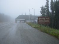
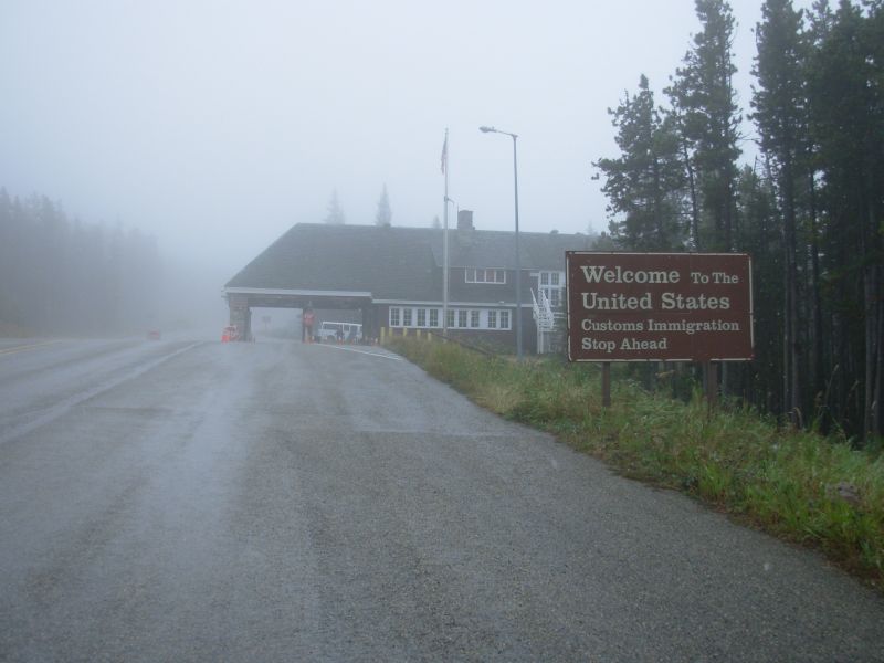
Today was another rainy/snowy day. It was very hard to leave town in this kind of weather. We tried to hitch a ride north, but there were few cars heading our way. After 45 minutes standing in the rain, we gave up and decided to pay for a shuttle with the Park transportation system. Its expensive and took longer because of side stops, but we were warm and dry and comfortable as we headed up the highway to the border station at Chief Mountain. We didnt start hiking until 1:00, so we were happy we had chosen to do a short day today.
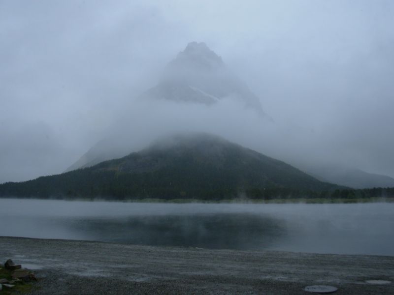
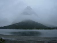
Clouds covered the mountains. There was one interesting spot where clouds of steam rose from a lake. The water was warmer than the air. It was the same at Many Glacier, where we stopped for a long break. Jim and I ate a quick lunch there and watched the rain and snow fall outside. There were a couple of mountain goats on the cliffs above the lodge, which we spotted as we drove out.
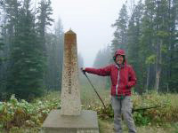
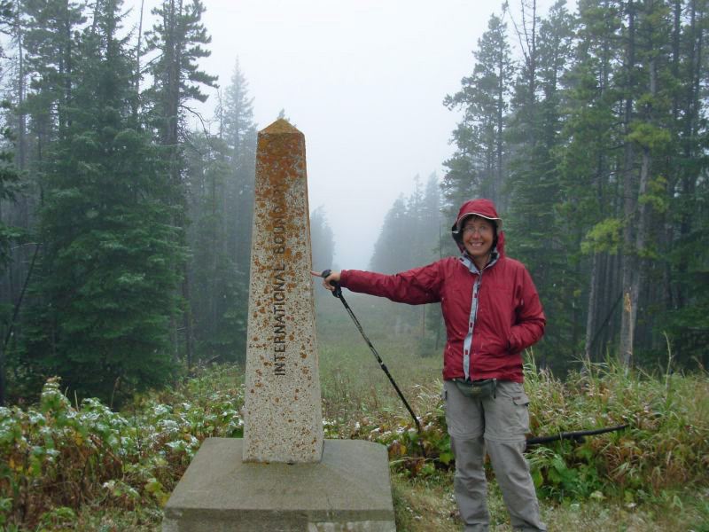
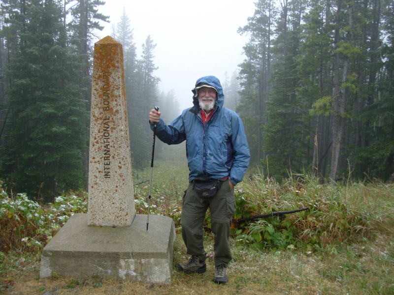
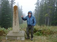
We started our hike in light snow. We walked to the border to touch the monument and get the obligatory border photos. I was excited, since it felt as if we werent just starting a new section, but almost a new hike. Northern Montana, plus winter conditions, is very different from sunny sage-covered Southern Montana. It was like starting a different state entirely, like the transition from New Mexico to Colorado, or Colorado to southern Wyoming. Im worried about the weather, but our plan of using the motels to dry off should help if the snow doesnt get too deep.
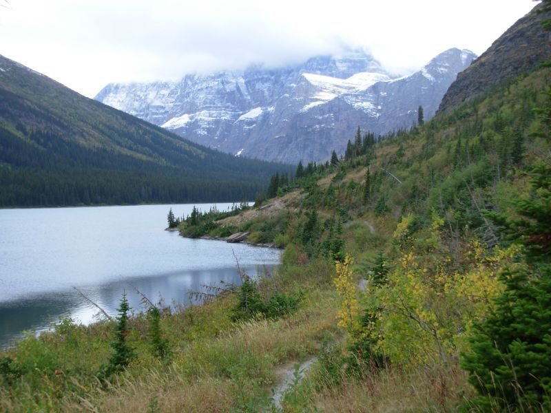
As we dropped down toward the Belly River, we met a couple going the other way. The woman said, Youre going in? Everyone else has bailed out. Theres been a mass exodus. They were worried that they had missed the shuttle, but it turned out that they were using a map or guidebook that listed a campsite that doesnt exist any more. Since they hadnt passed it, they thought they were farther out than they were. They were the only people we met on the trail. Our campground is empty. In Glacier, unlike Yellowstone, the camp areas have several campsites, not just one. Today there is no one here. Karine said it was packed when they came through.
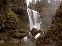
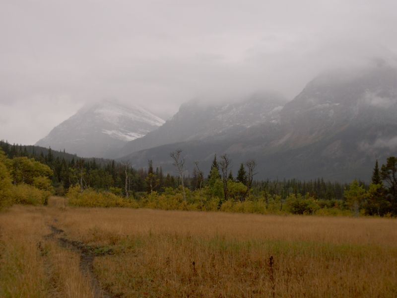
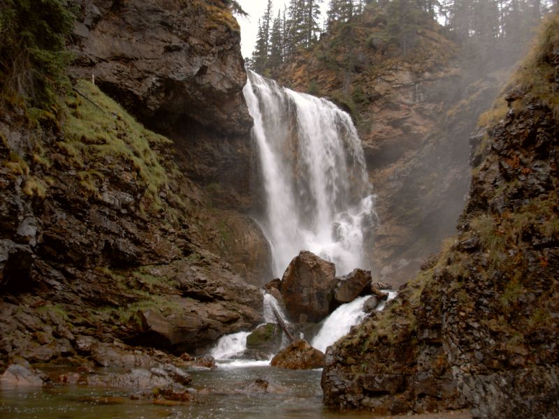
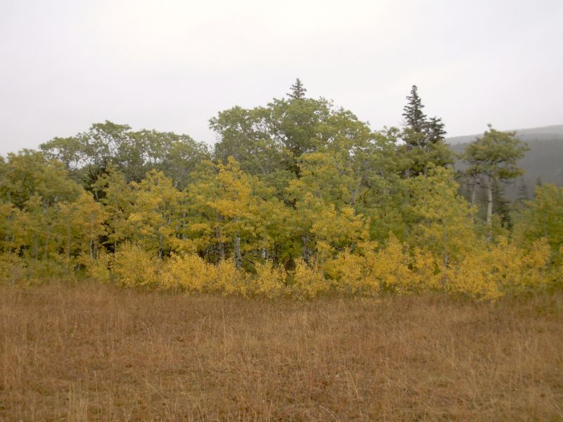
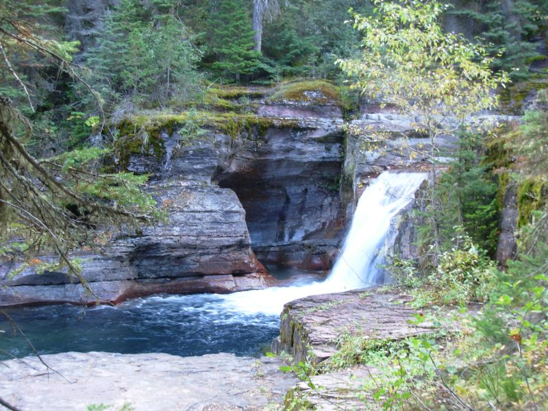
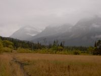
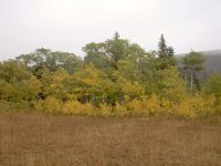
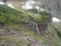
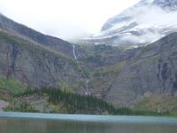
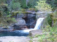
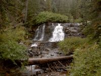
We saw one deer when we stopped to take a picture of a meadow. Most of the beautiful scenery was hidden by clouds, but occasionally they lifted a bit so we got a glimpse of peaks hidden by a light veil. It was still pretty. The aspen are beginning to turn yellow and the meadows are golden. Dawn Mist Falls was the afternoon highlight. Its a big beautiful waterfall, the most powerful on the CDT.
They have bear boxes at the Elizabeth Lake campground nice. We arrived at 5:45, pitched the tent and cooked dinner, all in a light rain. There was a dry spot under a tree in the cooking area, so I wasnt unhappy, though it was cold sitting there in my wet gear. It felt really good to put on dry clothes and socks and hop into bed, even if it was only 7:00.
I find it amazing that so many of the northbound hikers are here at the same time. Usually everyones speed and timing is so different, the hikers spread out a lot more than that. This year some flipped (Sidewinder and the Amigos) but most of the group that started out within a week of each other reached the border within a week of each other. We flipped and Stacy skipped some sections so she could get home to finish organizing the Gathering, but still there were 11 thruhikers in the park on the same day, and two others just finished. Thats amazing. There are only two hikers who havent reached the park yet.
Aside from the bad weather, Im glad were not done yet. I dont want this adventure to end, so I dont envy those finishing their hikes now. Most of them are more than ready to stop. They pushed hard to get here and theyre exhausted. Im cold, but not tired. Well see how were doing after the Bob Marshall and 11 days of wilderness travel in winter conditions. Should be interesting.
Jim: Well - back to winter. It was cold and rainy most of the day. That'll change to snow if it keeps on through the night. This is our second time through the Belly River route - it was raining last time too. Still, it's a beautiful hike - even in the rain.
The bear boxes are a new addition. They used to just have bear poles - horizontal poles strung between two trees. But when we were here in 1999 some of the hikers were victimized by squirrels that would chew through their food bags and let the food drop to the ground - where it would be easy pickin's for the squirrels - and the bears.
Saturday, September 16 10 miles to Swiftcurrent Motel

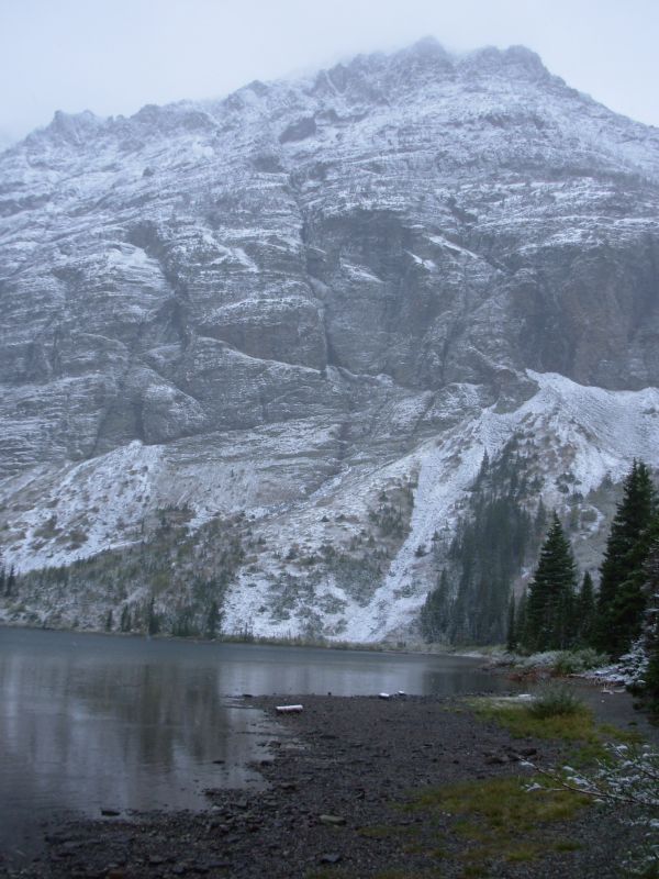
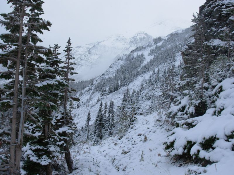
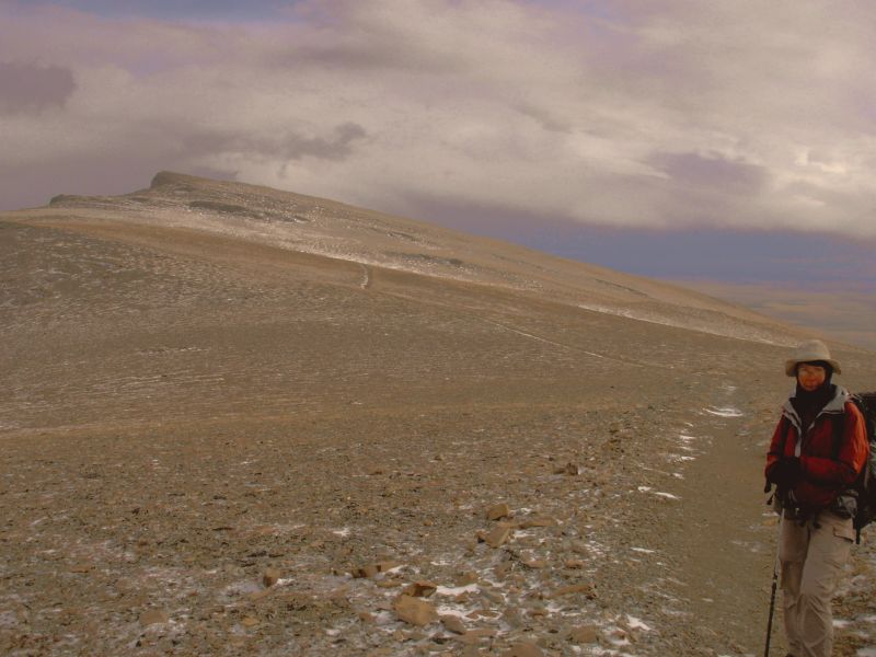
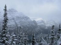
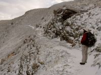
The rain turned to snow overnight, but not in great abundance. The vegetation was covered with white powder, but the campsite and trail were clear. The tent was soaked and sagging, but didnt have much accumulation. From Lake Elizabeth the trail climbs so we got into deeper snow as we got higher. Mostly it was only 1- 4, but here were foot-deep drifts in places. The clouds were low and it continued to snow lightly for the first couple of hours as we hiked.
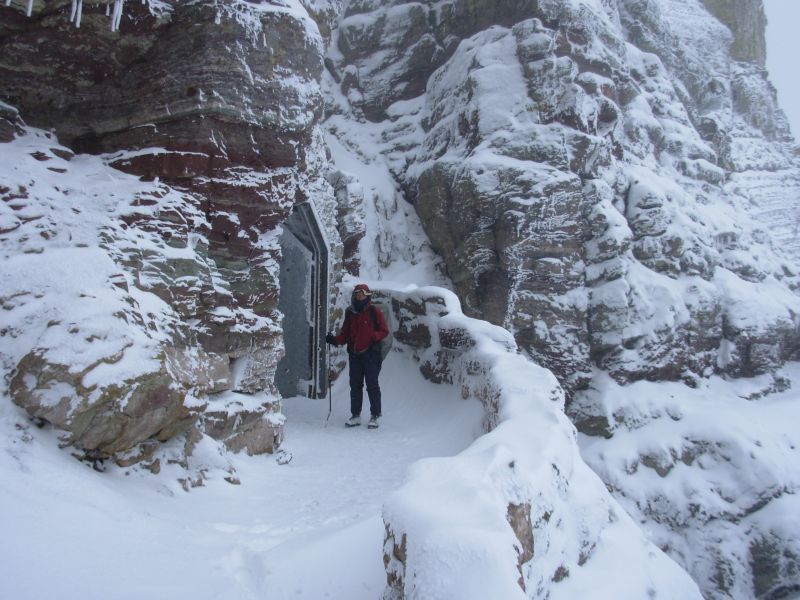
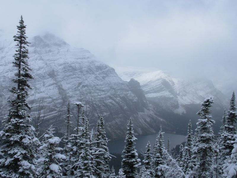
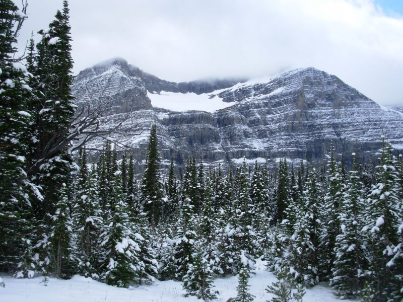
We took a new (to us) alternate route through the Ptarmigan Tunnel. It is closed early season so we didnt get to take it when we were here in June, 1999. It is a gorgeous climb. Even with the low clouds, we could see enough to know that. What was mostly lost were the colors. The mountains in that area are very vibrant red, yellow and green. Some are striped. With the cloud cover, they all looked black and white. It was still beautiful, but not the same.

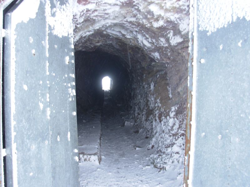
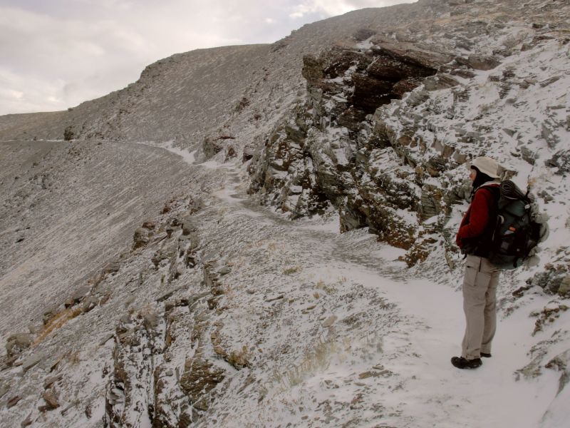
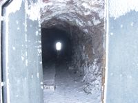
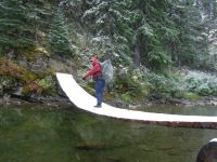
We had a couple of interesting suspension bridges: one yesterday really swayed and one today both swayed and was covered with snow. One of our reasons for jumping north is that they take down the bridges for the winter soon, and the creeks are really cold and sometimes deep and fast. Even slippery, I would rather take the bridges. The trailwork on the north side of the tunnel is incredible. They blasted a trail into the red rock and built a three foot rock wall to keep you safe. It was beautiful work. Then they blasted a tunnel through the mountain, with doors on each end. The other side was just normal side-hill with a 500 drop. A bit scary in the snow. The tunnel isnt very long maybe 40. You can see light from the exits and snow had drifted in. The view south wasnt as dramatic as the view north, though there was a lake below.
Farther down the trail the views improved and we had some jagged cliffs behind us and steep walls ahead. The colors were beautiful: muted autumn reds and browns, with dark green spruce below. We passed a waterfall, but it was mostly hidden in the trees. We saw lots of people, including Matt and Kalyn, finishing their CDT thruhike. They seemed very nice, in the few minutes we spoke to them. It was too cold to linger long. Then two backpackers asked us if we had seen the sheep and goats. We hadnt. So they told us there were some bighorns ahead and pointed out a mountain goat lying on a rock way above us. They had good binoculars. We saw three bighorn sheep a few minutes later, which we were able to share with three backpackers who came along then. Soon we began running into day-hikers, lots of day-hikers, some heading up to the tunnel and some to Iceberg Lake. One told us there was a grizzly ahead and, sure enough, about 100 yards above the trail a large dark brown male griz was feeding. A ranger was keeping his eye on him, to make sure he stayed away from the hikers. Another hiker told us there was a bull moose nearby, but we missed him. All in all, it was a really good day.
We got to Swiftcurrent Lodge too late for lunch, since we got a late start this morning, but dinner begins at 5:00 and the desk clerk was nice enough to get me a big cup of hot soup when I said how much I had been looking forward to some hot soup on such a cold day. We also bought a couple of microwave sandwiches to tide us over until dinner, then went to our cabin, turned the heat on high and got everything out of our packs to spread out to dry. Although it had stopped snowing, it was still nicer in the small cabin than out at the campground. Warmer anyway.
Spur and Ready showed up as we were leaving dinner at the Italian Restaurant (lasagna, salad and brownie sundaes yum!) They said some of the snow ahead is knee deep in the drifts oh joy.
I have some concerns: our little single-wall tent had a lot of condensation inside and was sagging badly, so the sleeping bags got soaked. Today, thats not a problem, because we can dry out at the motel, but next week we wont have that luxury. Jim called Leslie at home and asked her to search the storage unit for another tent we own that is a three pole freestanding tent. Its heavier, but better for snow. It should be waiting for us in East Glacier on Thursday. Were using down bags, so we really need to be able to stay dry in the tent. We exchanged our cheap Marmot bags for good 10 degree bags a couple of weeks ago. They really are warm, as long as they stay dry.
My other concern was my feet. As we hiked I was warm all over hot even while we climbed except my feet, which were wet and frozen. It was painful and worrisome. Eventually the day warmed up and my shoes thawed out a bit so I was wet, but not in pain. For a while, I was seriously afraid of frostbite. Last night it took a long while for my feet to warm up in the sleeping bag. Ive had circulation problems in the past in my hands (Reynauds), so I was picturing 500 miles of agony. I guess Ill see what happens over the next week. My big concern is the river crossings in the Bob Marshall Wilderness. If its still cold and snowy, they could be a problem. On the other hand, I survived it last time and that was spring snowmelt. A lot of thruhikers do the CDT in running shoes, even in the June snow. Since I cant get decent boots right now, Ill have to make do with what I have. If the temperature rises above 35, I should be all right, if today is a good sample. Tomorrow we have a much snowier pass and more snow is expected to fall today and tonight. I really enjoyed having the break in the weather this afternoon. I am so easily satisfied: no rain and a few wildlife sightings and Im happy. The snow was beautifula touch of Christmas in September. I loved seeing the fresh powder on the trees and bushes.
Finally, I'm really worried about our rain jackets. We bought Marmot Precips, one of the most popular hiker jackets because they are so light. Unfortunately, ours leak like a sieve and soak up rain like a sponge. After 10 minutes in a light drizzle were wet. Because it has rained so seldom on this trip, and generally for short periods of time, replacing them was a low priority. Now were stuck. Most raingear Ive owned eventually leaked or soaked up water, these did from the beginning. We tried spraying them with waterproofing, but it didnt do much good. They keep us a little drier and a little warmer than nothing, but in the long term, and especially after three or four days of rain, they could be dangerous. We picked up our cheap nylon rain pants in our East Glacier maildrop. With all the wet bushes along the trail, theyve been great, except that I sweat so much in them that I get soaked from the inside out, but at least Im warm. Theyre worth the weight in the snow. My light polypro balaclava worked well today too. I took it off when I got warm, but mostly it stayed on. It fits under my rain hat, which the fleece hat doesnt do as well.
So, first impressions on dealing with winter weather: Im okay while hiking, except possibly my feet; Im fine sleeping as long as I can dry out the sleeping bag; hardest are camp times when Im cooking wearing wet clothes. While were in grizzly country I cant cook near the tent. So all I can do is try to stay active while waiting for the water to boil and eat fast. Lunch may be a problem. We dont stop when its wet and a handful of gorp just doesnt satisfy long term. I have a couple of meal bars that need to stay near the surface, or we need to make sandwiches before leaving camp so we dont have to sit for long in the cold. But all in all, I think well be okay.
Jim: Coming into Swiftcurrent there was a grizzly upslope from the trail. He was totally oblivious to all the people standing there watching him. There was also a ranger keeping an eye on the situation. He could - and would - close the trail if the bear had come much closer to the trail. Funny part is, he didn't realize for a while that we were backpackers, but when he did, the attitude went from friendly, open and sharing to frosty officiousness with demand to see our permit. I don't think he likes thruhikers.
For anyone who hasn't figured it out, Marmot is on my blacklist. The Precip rain jackets don't work worth beans and the 20 degree Marmot sleeping bags that we got to start the trail "might" be good to 50 degrees (maybe). That's two strikes - and that's all they get.
Winter hiking/backpacking is always an adventure. Partly because we don't do it consistently and need to relearn the lessons, partly because our bodies are constantly changing and react to the weather/temperatures differently. And sometimes because we have to compensate for inadequate equipment. But it's always fun if you can get past the cold and wet.
Sunday, September 17 15 ½ miles to Reynolds Creek
We met Spur and Ready for breakfast then headed out at 8:45. It is getting light later. 7:00 a.m. is still barely light now. I didnt sleep well due to too much liquid intake yesterday (3 trips to the bathhouse!) but we were warm and everything dried out, even our boots. It wasnt cold when I got up during the night, but while we were at breakfast the temperature dropped at least 10 degrees. At least it wasnt raining or snowing. The forecast was much worse than reality so far. They said we would have 9 snow on Friday, 6 Saturday and 4 on Sunday. Instead, a lot of Fridays snow has melted. The first six miles or so were on dry trail.
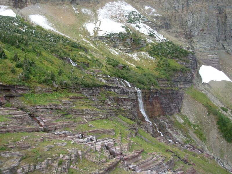
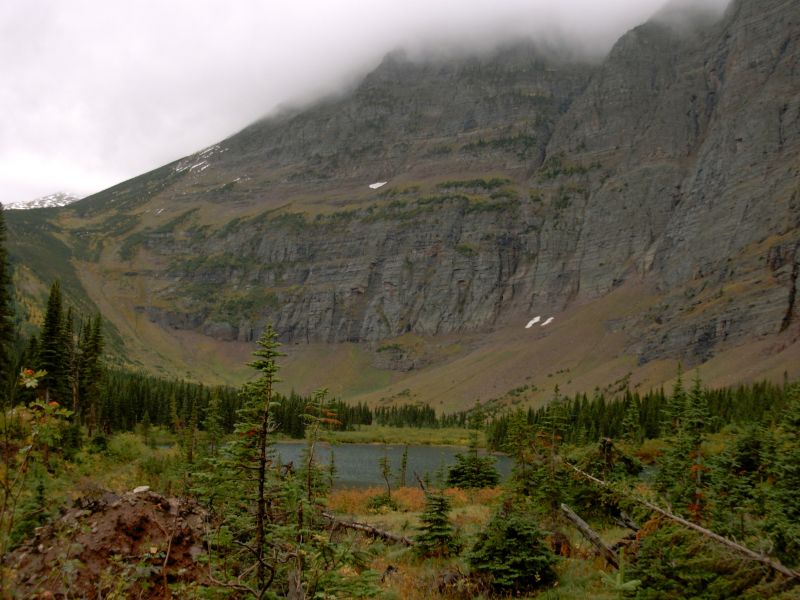
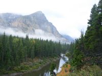
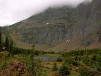
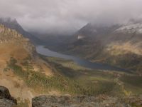
We hiked past Swiftcurrent Lake and Lake Josephine to Grinnell Lake, where we turned to head up to Piegan Pass, which was covered with snow and clouds. Morning Eagle Falls was beautiful against the red rocks. Grinnell Lake was a rich deep blue. Many of the falls we saw the first time we were here, in July of 98, are dried up or frozen right now. We saw a female moose hidden in the trees and eight mountain goats: two high on the rocks and a herd of six grazing on a green patch. Our best wildlife sighting was a mink. It was about a foot and a half long, with a long tail, dark brown with a cute little weasel face. At first I thought it was an otter, but a closer look said it was in the weasel family. We played hide and seek with the camera, but got only one not so good picture. That mink was fast.
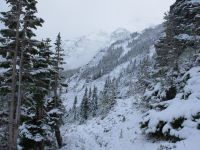
The mountaintops were covered with clouds, but we had a couple of brief glimpses of blue sky and sunshine. It was cold, but I got hot climbing toward the pass. There was still a lot of beauty, even with the cloud cover and gray light. Lunch was eaten sitting on the trail above the waterfall. It was beautiful! We heard an elk bugling earlier, its pitch almost too high to hear. Snow was only a problem for the two miles on each side of Piegan Pass. We could step on the edge of the trail most of the time where the snow was shallower, but that could be slippery. The snow had drifted, so there were no footprints, even though Spur and Ready were there just yesterday. Some of the drifts were knee-deep, sometimes the trail had been blown clear. Mostly it was just covered by a few inches of snow. Walking was a bit slow, but not as bad as it could have been. The experience was very similar to our hike there in June of 99, though we had a lot more snow then.
We met a few dayhikers coming up the other side of the Pass, and we stepped in their tracks for about half a mile, which helped. Then the trail cleared, though there was still snow beside the trail. We dropped through dense forest to the road, then past it to Deadwood Falls and the Reynolds Creek Campsite. We have it to ourselves, which is no surprise as its intended only for people walking all the way through the park. Were tired, partly from the snow and partly from last nights sleeplessness. The clouds cleared off for the most part, though they looked very dark and dire as we were descending. The snow is melting in the sun. Our campsite is well below snow level; its wet, but snow free.

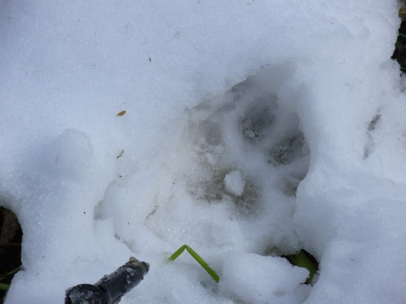
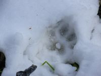
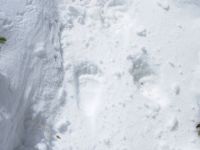
We saw some interesting tracks in the snow. A black bear had crossed our path only 10-20 minutes ahead of us. We looked for it, but couldnt spot it. A large coyote or small wolf also crossed the trail this afternoon, but the dayhikers had stepped all over its tracks. There were elk, deer and moose on our trail, as well, this morning. I love looking at tracks in the snow or just after a rain when they are fresh and clear. Even mouse tracks show clearly in fresh snow. A mouse actually ran under my feet this morning, making four Ms today: moose, mouse, mink and mountain goats. What fun.
Jim: Piegan Pass has lots of good memories. In '98 we came across the Pass in early August - hot, lots of tourists, we ate lunch at the top and then saw a mountain goat posing for us up on the ridge. In '99 we came across the Pass in early June - cold, eyeball deep snow, lunch was halfway down the south side, no mountain goat but we wondered who was the crazy who was snowboarding down the sheer (150% slope) face of the mountain (we met him in town later). In '06 we came across the Pass in early Sept - cold, shin deep snow, no lunch, no mountain goat and no snowboarder but lots of tracks (bear, coyote, elk, deer and moose).
We thought about bypassing Reynolds Creek and going out to Rising Sun, but that would be about a 25 mile day and neither of us felt like pushing that much. So we're camped at Reynolds Creek. There's no snow here but it's still cold. Happiness is a warm sleeping bag.
Monday, September 18 14 miles to St. Mary Lodge
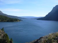
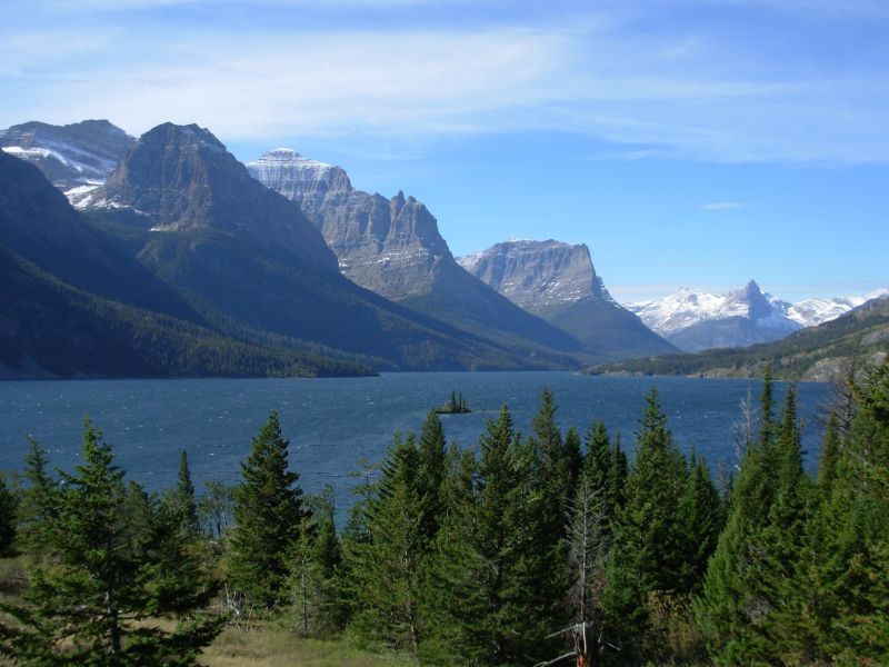
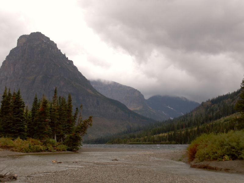
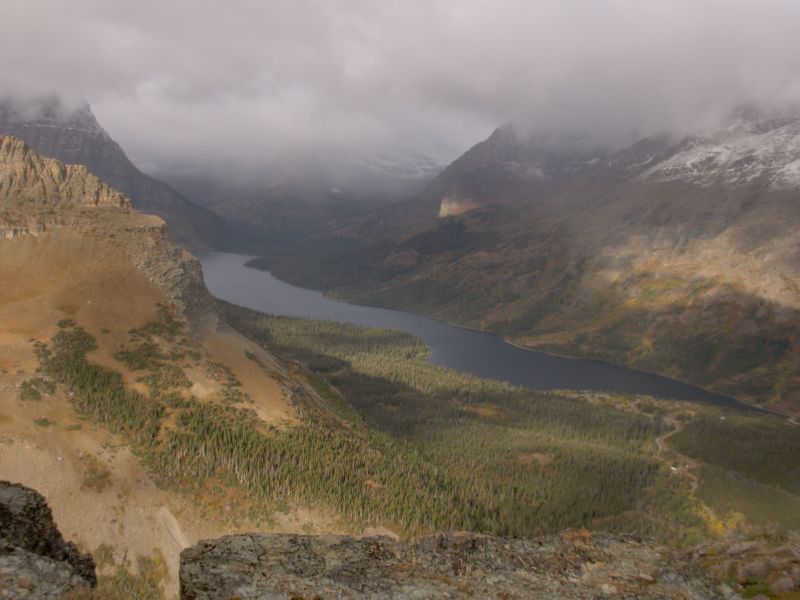
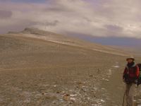
Today turned out to be a gorgeous day. So much for weather forecasts! The sky was blue, the sun was shining, it was even fairly warm (50s). The mountains and St. Marys Lake appeared in all their splendor, lightly touched by snow. It was really beautiful. We were able to hike on trail near the lake for the first four miles, so we only had ten on pavement today after all. The view from Sun Point was spectacular, but was followed by several great views along the road. Roadwalks arent all bad. Theyve closed Logan Pass from this side, and Rising Sun (motel, campground, store and restaurant) closed this morning, but there was still a lot of traffic. The road has no shoulder, but there are lots of pullouts, so all in all it wasnt too bad for a roadwalk.
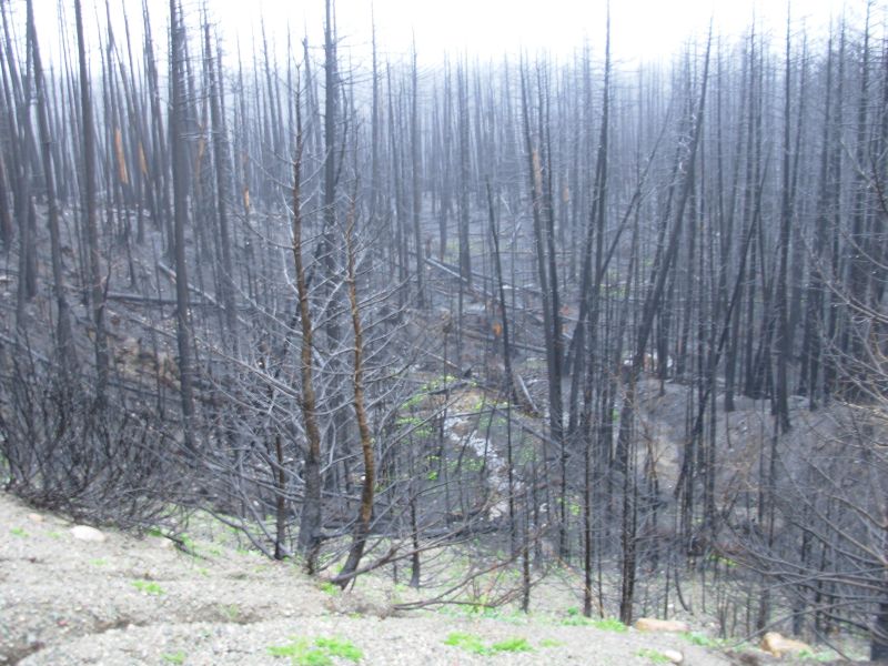
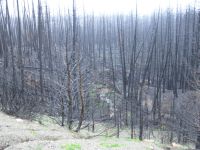
On the way to St Marys we saw puffs of smoke from the fire across the lake. Its still smoldering, despite the rain and snow. Evidently it started at the campground at Red Eagle Lake and spread for miles. I doubt theyll open the trail next year, and certainly not the campgrounds. Hikers will have to walk 24 miles between the Atlantic Creek and Reynolds Creek campgrounds, when they do open the trail again. Its not that far, but I find it depressing walking through fire zones.
We only walked as far as St. Marys. South of here the forest is burned for over five miles. The highway goes through the Blackfeet Reservation, so camping along it would be a problem, especially since we dont have a tribal recreation permit. Plus, we really dont want to camp in the burn zone. Staying at the motel was better. It will make tomorrow a long day, with 15 miles on the highway followed by five on dirt road to the campground, but thats okay.
Late afternoon the clouds came back and it looks like more snow or rain. The forecast hasnt changed much; it still calls for rain or snow every day this week. Today was an unexpected gift. I was happy.

At St Mary's we walked up the road to a motel above the highway, but it was almost as expensive as the Lodge, without the amenities. Their café was closed, so we would still have to walk back and forth to eat and get groceries, so we decided to go back to the lodge. On the way, we stopped at another café for a piece of really excellent pie. The men at the next table were a news crew from Great Falls, in Glacier to film pieces on the closing of the road over Logan Pass and the fires. After a few minutes of conversation, they asked if they could interview us. Of course we said yes, and enjoyed a few more minutes of conversation in front of the camera. I doubt it will be aired, but it was fun. Weve talked about our hike to more people this trip than we did on our last three hikes combined. I love the amazement on peoples faces when they hear what were doing. Youve been walking for five months? It is fun.
Im not looking forward to tomorrow. Today had beautiful scenery: the lake, the peaks, even Triple Divide Pass off in the distance. Tomorrow well look east toward the Great Plains, not nearly as stunning. And I hate roadwalks. But its only one day, then well be back in the Park.
Jim: It was an easy day in spite of the roadwalk. Sun Point provided a really good view up St Mary's Lake and then there were some other viewpoints along the road. Even the weather cooperated so we got some fairly good photos. We stopped at Rising Sun with thoughts of hamburgers, but Rising Sun had evidently closed yesterday. So we ate lunch (without the hamburgers) and kept walking to St Mary's. When we got to St Mary's we stopped at the Park office and I asked about a tribal recreation permit. They normally sell the permits there, but only through the backcountry office - which was closed. Of course. When Glacier closes down - they CLOSE DOWN.
Pie and ice cream - who can resist it? Not us - and the best pie in Montana (on or near the Trail) is at the Park Cafe in St Mary's. Which is where we met the news crew that interviewed us. My attitude about the interview was - "OK, so why should I believe that this is gonna ever get aired?" We'll see.
Tuesday, September 19 20 miles to Cut Bank Campground
We started our hike in a light drizzle that came and went all day. We began the day with a good breakfast buffet at the Lodge. Only a few guests were up and about but one, Judy Singer, was the mother of an AT thruhiker. She talked to us for about 15 minutes, saying she ought to go wake up her son, who would be sorry to miss meeting us. We needed to get started though, so we headed off into the rain. Another guest patted my shoulder saying, Youre going out in this? Bless you. He thought we were absolutely crazy. I almost left my rain pants and gloves behind. They were in a plastic bag that fell into the trash can and was covered with garbage. If it hadnt been raining when we left, I wouldnt have noticed they were missing until the next time I needed them. Instead I was able to run back to the room and search for the plastic bag until I finally found it.
Aside from the rain, it wasnt a bad day. We got chilled when we stopped, so we didnt stop long, but it wasnt all that cold. We walked the highway for 14 miles. The first six had a shoulder, the last eight none, but traffic was light enough that cars could go around us easily, most of the time. The first seven miles were burned, sometimes on one side of the highway, sometimes both. One area was striped green and black where the fire skipped sections of trees. There were lots of free range cows along and in the road. We walked fairly quickly and were able to turn off the highway by 1:30.
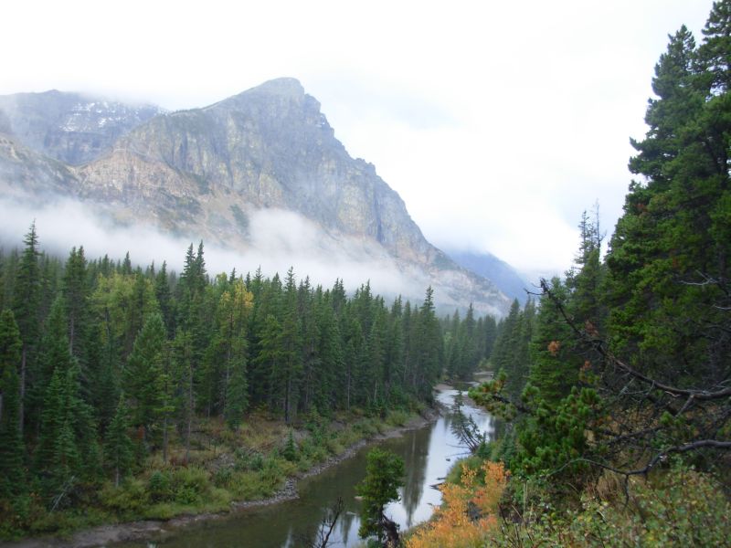
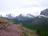
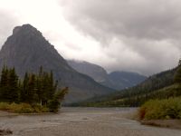
The Cut Bank Valley is beautiful with big dramatic peaks, wreathed in clouds today, and lots of aspen, lightly tinged with yellow. The Park boundary was five miles up the very muddy road. We ran into a ranger in her car, who asked if we had a permit. We dont need one here as this is a car campground, not a backcountry one. The same is true for tomorrow night. We told her that we had one for the parts of the trail that required a permit. A volunteer mans the ranger station at Cut Bank. Herb is 75 and has been here off and on for many years. Hes a bit taciturn, but not unfriendly. Were the only campers tonight, though a few cars drove in and left as we walked down the road. Its a nice campground with a bear box, tent platforms that are level and fairly dry, picnic tables and an outhouse. Theyve shut down the faucets for the winter so theres no potable water, but there is a stream just below the campground, which works for us. Two Medicine Campground, where we will camp tomorrow, is also on primitive status, which means cheaper camping in exchange for no water. Big deal. It started to rain while we were putting up the tent, so we threw everything inside and dove in ourselves after getting water and putting the food in the bear box.
Jim: This was a "connector" day. There were cars and cows and rain and mud, but nothing we haven't seen before. But it was a necessary day if we're to "connect the steps."
The access road to Cut Bank campground was a muddy mess. When we got there, Herb greeted us (the ranger told him we were coming) and he walked with us down to the campsite. After we got settled, he came down to talk for a while. I think it gets a little lonely out here at this time of year.
Wednesday, September 20 18 ½ miles to Two Medicine Campground
It was a blustery drizzly day. We had rain last night and woke to low clouds but no precipitation. We even saw a few blue patches in the sky. The first four miles were mostly flat and easy, following Cut Bank Creek. Then we began the long six mile climb up to Pitamakan Pass. It was a pretty climb, even with low clouds. We passed three lakes on the way up, beautiful blue and green water, and several waterfalls, then we passed another lake on the way down. There were three or four elk bugling in one meadow area. One ran past us. There was a herd of eight or nine mountain goats on the cliff above the trail. The clouds descended and the wind picked up so we didnt stay long to admire the view at the pass. We walked in snow the last ¾ mile, so I was very cold. It started to rain around 9:30 and sprinkled off and on most of the day. The bushes along the trail were soaked so I never did dry out, even when it wasnt actively raining. It really was too bad the weather was so dreary. What we could see of the cliffs and lakes was beautiful, but I remember how spectacular Pitamakan Pass was in the sunlight, and today just wasnt the same. There were some colorful rocks below the pass: the cliffs were purple, blue, red and orange, just gorgeous.
We took the Dry Fork route this time, not the trail to Dawson Pass. There would have been no views on that route and it is very exposed, not a good thing when the weather is as uncertain as it is today. The winds were strong and cold as we descended to Oldman Lake, then it began to rain again, so lunch was a handful of Oreos that Jim pulled out of his pack. The lake and campground were closed because of grizzly activity, but we didnt see any bears. We ate quickly, but soon moved on. It was too cold to stop for more than five minutes, so we never even sat down all day, not until dinner time, which I cooked under the overhang of a closed and locked outhouse. There is one pit toilet open at the campground, the rest have been closed because the water has been turned off for the season. We considered going to East Glacier today, either hitching or walking the road, but in the end we set up the tent. Im too tired to walk any more, and Mark isnt expecting us until tomorrow. Besides, I want to hike the CDT south of Two Medicine. Hopefully well get a view from Scenic Point. I remember it as a nice hike. We'll see.
Jim: Coming over Pitamakin Pass, we saw a lot of interesting tracks on the snowy trail - Mt sheep, mountain goats, elk, deer, wolf -- even some human tracks. At one point on the approach to the pass, we saw a herd of mountain goats. And we listened to at least 5 elk bugling - then one of the elk lost his nerve and ran across the trail in front of us - beautiful --- and BIG, with a trophy sized rack. Too bad I couldn't get the camera out fast enough, but it was buried because of the rain and snow.
It was a long, cold day. But no more so than we expected. It got really cold in the wind coming over Pitamakin Pass - and the trail switchbacked down seemingly forever. The Two Medicine campground was also further than I remembered. So much for memory. We were both happy to eat and crawl in the sleeping bags.
Thursday, September 21 10 ½ miles to East Glacier
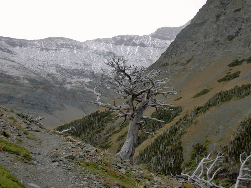
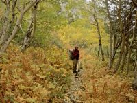
It rained all night, with a light dusting of snow in the high country, not much, just a little fresh powder that touched the peaks. The clouds were low again, wreathing the mountains. We could see glimpses, but the tops were all cut off. It was pretty, but not particularly photogenic. I enjoyed the climb up to Scenic Point as it was steep enough to warm me up, but not especially difficult --2000 in three miles or so. We stopped to check out Apistoki Falls on the way (not that impressive), then pushed onward and upward. We had a mixture of sunshine, clouds, blustery winds and snow flurries. The white dead trees on the climb to Scenic Point looked even eerier against the snowy hills beyond. Scenic Point is alpine meadow, all brown right now except for snow patches. There was some snow on the trail, but only a few drifts were more than an inch or two deep. It was easy walking.

We stopped for an early lunch at Forty Mile Creek, the half-way point, because it was sheltered from the wind. I enjoyed the hike despite the weather. We had some views north and west into Glacier, and excellent views of the Great Plains to the east and the town of East Glacier and the Bob Marshall Wilderness to the south. The aspen made a scattering of yellow amidst the trees south of the Park. After we left the Park, the trail got a little confusing with multiple horse trails, but by sticking to the most obvious one we ended up right where we were supposed to be, at East Glacier Lodge. We had the trail to ourselves until the very end when we passed a dayhiker. Yesterday we didnt see anyone on the trail and there were only a half dozen people at the big campground. They had closed off half of it, but since there was only one pit toilet, we were all clustered in its vicinity.
I saw a couple of whitetail deer in the woods today, but no other wildlife except a couple of hawks. There was one BIG bear track amid the horse tracks. Yesterday we followed wolf tracks in the snow for a while.
Today we stopped by Mark and Karmas room at the Whistling Swan for a catch up visit. They came to town to interview the northbound hikers before they left East Glacier, but have been otherwise stuck indoors because of the bad weather. There were few views and besides, moisture is very bad for cameras. Karma is going a little stir crazy.
They told us that Team Doodah have decided to leave the trail. Im not sure why, unless its that they dont want to deal with winter conditions. We could have snow and cold for the next month or not. We dont know. We are prepared to deal with it, but not everyone is willing to carry the heavy gear and extra food needed for a winter hike. After a week or so, we may not be either. I was looking forward to meeting them in the Bob from now on, well be alone out here, the last of the northbound thruhikers.
Jim: There was a little snow on the climb to Scenic Point, but not much. The only thing that's changed in this section is that the "Dead Forest" (the forest of dead trees in the Apistoki drainage) has been thinned out a lot. Apistoki is where a Park employee was killed and eaten by a mother griz and her 2 cubs back in 1998. He broke the rules by hiking alone. That happened the week before our 1998 Glacier hike.
We first did this hike in 1998 - sorta. There are some definite variations - the Dawson-Pitamakin Pass trail and Red Eagle Lake that we did in '98 but not this time. But Glacier is just as beautiful in her winter coat as she is in her summer greenery. Just different. This was our last day in the Park for a while. But we'll be back. I said that in '98 - and again in'99. I just hope it doesn't take that long to get back here again.
Friday, September 22 Rest Day in East Glacier
Jim: We spent today eating, reorganizing our gear, eating, doing laundry and checking e-mail, eating, talking to Mark, eating, making phone calls, eating - and eating ice cream. It's not quite the forcefeeding that was necessary during our 1999 thruhike, but it's close. I haven't lost as much weight this trip, but only because I started a heavy duty eating program earlier in the hike.
Tomorrow we'll get a ride out to Marias Pass and walk the 15 miles back to East Glacier. Then the next day we'll go back to Marias Pass and head south toward the Bob Marshall Wilderness.
Home | Links| Trail Journals |
The Thruhiking Papers | Bun-bun
Created: Dec 2006
Revised: 30 Sept 2016Copyright © 2006-2017 Spirit Eagle