|
 |
 |
 |
 |
|
|
|
|
|
|
Sunday, July 9 10 miles to S. Fork of Williams Fork
Another gray day. We were tempted to stay put, but decided that enough was enough; it was time to leave. We regretted that decision later on, but by then it was too late.
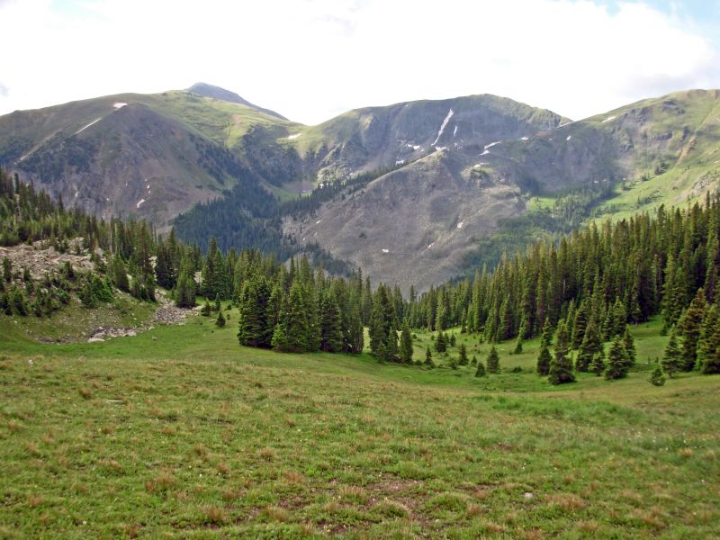
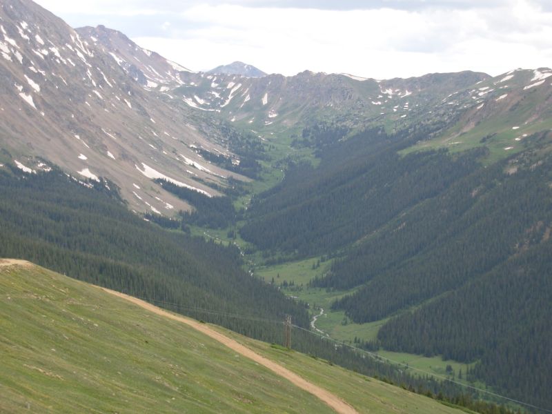
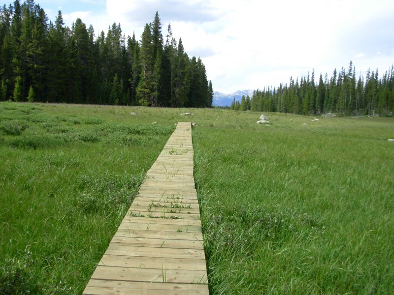
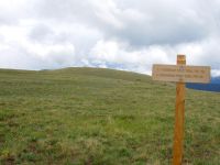
The climb out of town was a nice one, with frequent views south and east to the Dillon Reservoir and the mountains south of town. It was a fairly busy trail this Sunday morning seven cars were parked at the trailhead so we met lots of runners and dayhikers. We climbed above treeline in 3 ½ miles and had lovely green meadows all around. The main trail leads to Ptarmigan Peak in six miles. We split off after four on a much less used trail heading to Ptarmigan Pass. There was, at first, no tread. We bushwhacked from cairn to cairn.
The clouds wed been watching on the horizon, in anticipation and dread, finally reached us. The peaks south of town had been hidden all morning. Big black clouds, hanging low, appeared to the west and swept over us. For a few minutes we were in total whiteout, but they lifted enough that we were able to find and follow the trail. Then it started to rain. Like yesterday, it wasnt just a passing shower but the all day soaking kind of rain. Actually we had a 15 minute break around 3:00, at which point we set up the tent and crawled in to get warm. Jims back/sciatica problem is back and he was in agony, in no mood to go six more miles to the next flat camping area. We were supposed to climb 2000 and then descend again between the South Fork of Williams Fork and Bobtail Creek, our intended destination. It will change our options for the next few days, but we have enough food we can take it slowly. If Jims back problem continues, well have no choice but to take it easy.
I have mixed feelings about this stretch. It is one of the more difficult in Colorado, especially the five 13,000 peaks coming up. It is also where Jim and I ended up tentbound for 22 hours in a snowstorm and had to bail. I really wanted to see the Ptarmigan Trail, but I also knew that the trail can be pretty obscure, according to the guidebook and maps. I recall the Vasquez Peak area as being beautiful but with a long climb to Jones Pass from the south on jeep road. I loved the Indian Peaks Wilderness, but were taking the official route this time, to see what its like, and will miss the beauty of the Wilderness area. The forecast is for rain every day. It seems that July is determined to make up for Junes unusually warm dry weather.
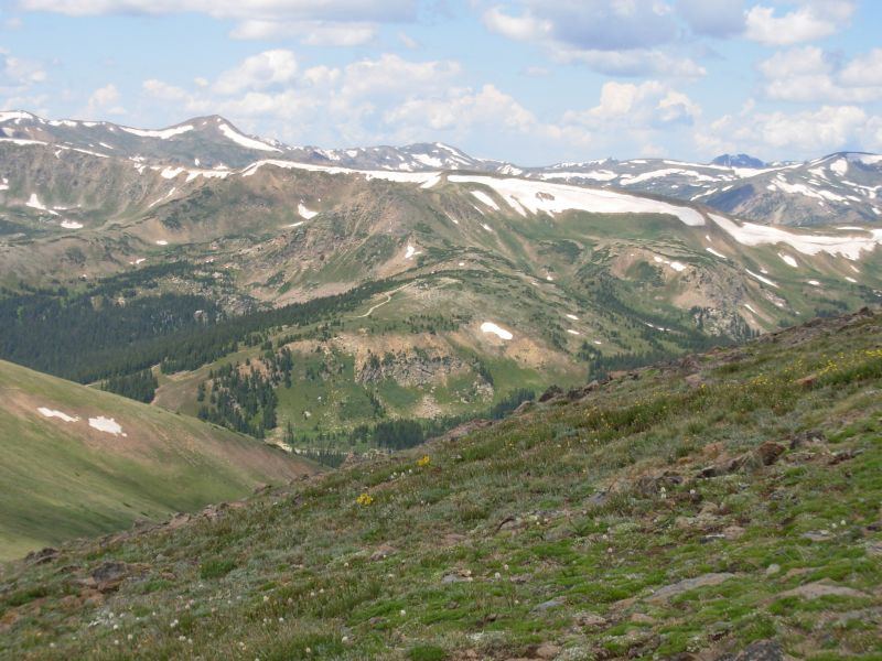
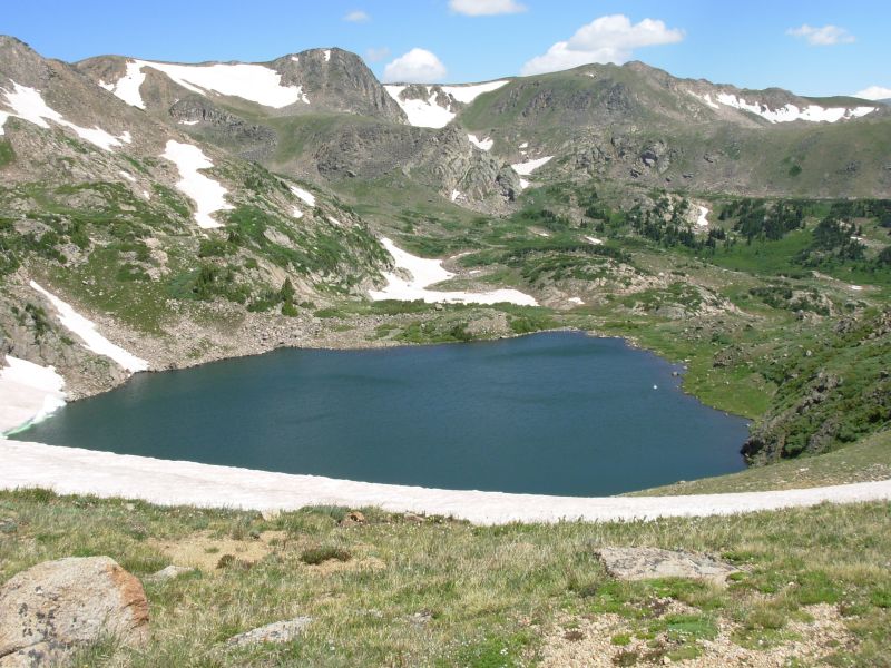
We cant see much of the Williams Fork area as its too cloudy. We did see four elk just past Ptarmigan Pass. There are a lot of dead and dying trees (pine borer?) so it looks like autumn with yellow and red trees on the ridges. The meadows this morning were full of the dry country flowers: lupine and orange and yellow paintbrush, but all this rain is having its effect there were lots of mushrooms in the woods. We only hiked about 10 miles today. It was slow, between the 3000 climb, the route finding and the wet rocks and trail. Im glad we didnt continue over the next ridge, even if it does affect our options over the next few days. We were too close to hypothermia as it was. The final stream crossing cold and knee deep was the last straw.
Jim: Not sure what it is about leaving town that upsets my back, but I'm getting tired of its complaining. Of course the crappy weather didn't help. So between the back, the weather and the terrain between here and the next campsite, when we got to a flat spot next to the stream, it was time to say "Goodnight, Gracie."
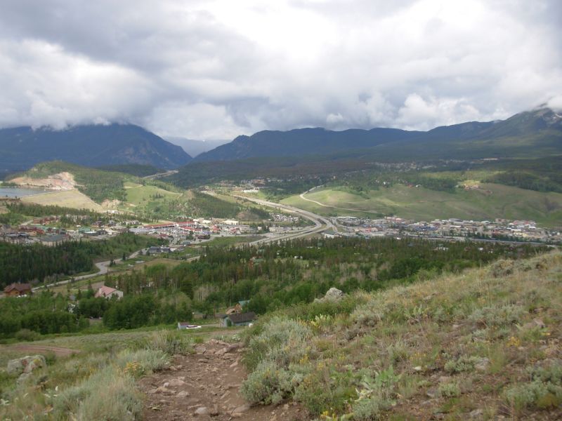
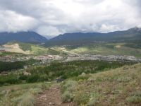
Silverthorne/Dillon is NOT on our short list of places to live.
Monday, July 10 16 miles to Vasquez Peak area
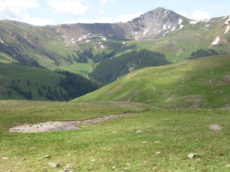
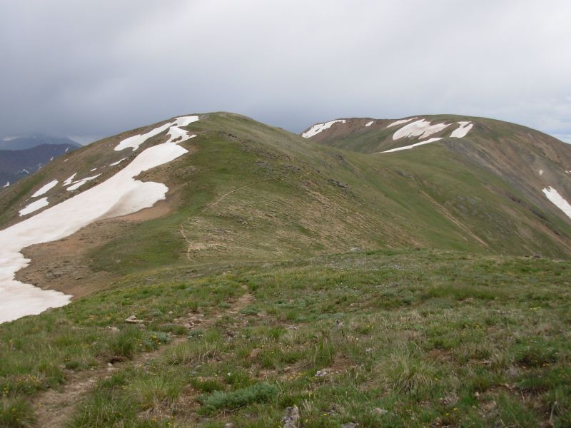
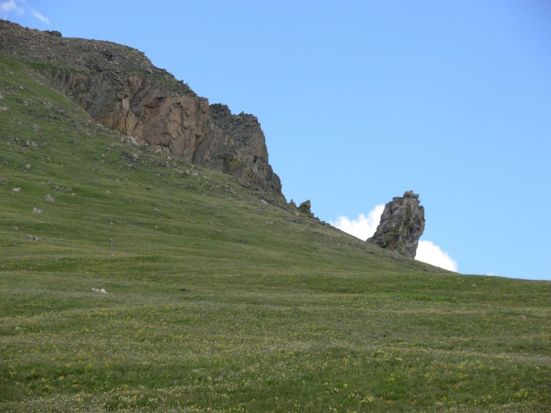
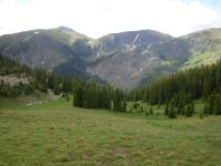
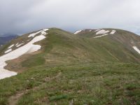
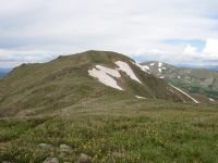
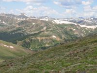
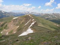
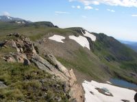
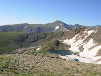
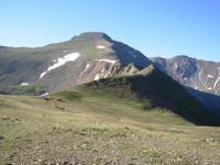
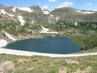
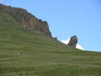
The rain finally stopped around 9:00 last night, except for the dripping off the trees. This morning everything was wet: the tent, sleeping bags, clothes, etc. Condensation inside the tent didnt help. Bushes along the trail were soaked. We climbed up to a ridge above treeline and stayed high for the next few miles. The views were spectacular. Although clouds hid the more distant peaks, the nearby area was really beautiful. Sunshine was intermittent but very welcome. It was cool, so our hats and jackets were pulled on and off depending on sun, climb, etc. The trail was also intermittent. Sometimes there were cairns, sometimes treadway, rarely both at the same time. A couple of snow banks blocked the trail, but there was nothing difficult to get over or around. Every distant ridge had a cornice. The contrast of snow with green meadows was very appealing, especially with the dark green spruce on the lower slopes as further contrast. The mountains are mostly rounded here, not sharp jagged peaks. When those appear, they look very dramatic. One such peak stood out this morning. I took pictures but dont know if the beauty will be as evident to the camera as to the eye. Usually it isnt.
At lunch, we were able to spread everything out on rocks to dry. The sun came and went but at least the tent and sleeping bags dried out in the sun. I love western sunshine. Our feet are still wet from all the stream crossings and wet trail. Snowmelt fills the trail and there are streams every 50 or so. We should dry out on the climb to Jones Pass 2000 in three miles on jeep road. Well be warm anyway.

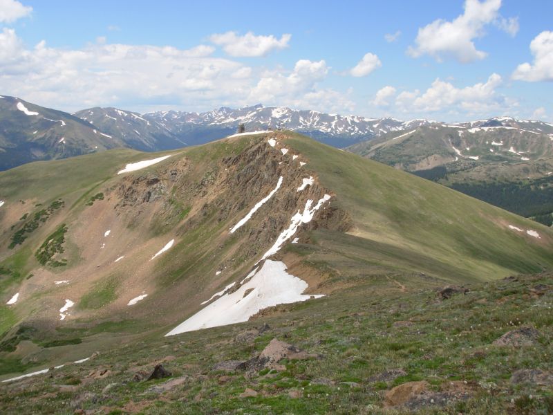
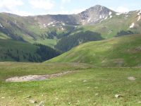
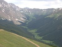
Later: As we climbed, we could see rain falling in the nearby mountains and valleys. Sure enough, just before and shortly after Jones Pass, at 12,400, we were hit by showers. Because it was also windy, we were cold but managed not to get too wet since the showers passed through quickly. After a while, the sun came out again. Happiness! The hike in the Vasquez Peaks Wilderness Area is a pretty one, with several high hanging valleys and trail that is often on or near ridgeline. Fortunately, it contours around Vasquez Peak but with nice views of the valley below. The mine was quiet. We saw an ATV earlier, near Bobtail Mine, but the road over Jones Pass was still closed by a big snowdrift so it was quiet. We spotted a couple of deer near the trail late in the afternoon. We found a fairly flat sheltered spot with a good view and spent the evening absorbing the beauty of the nearby mountains.
Jim is still in a lot of pain -- sciatica from knee to hip -- but we decided to push on as long as possible, taking advantage of the good weather and good trail. Were both tired after climbing 4700 for the day. I feel good because it was such a beautiful day and because the sun is shining, the birds are singing, and dinner is almost ready. I worry about Jim and his constant pain, but feel that it is up to him to tell me when hes had enough. I cant force him to stop. The source of the pain varies, but there is always something. Usually whatever is giving him trouble (feet, back, shoulder, knees) gets better after a few days and then something new comes along. The improvement gives us hope, but is also frustrating because there is always something else. And Jim is way too stubborn to quit we call it intrepid, but we know what it really is.
Jim: It's better that we stopped yesterday - doing the miles between Williams Creek and Bobtail Creek would have been a PITA in yesterday's rain. There was no place to camp, and no water. The trail isn't as obscure as it was in 1999 - some of it has been rebuilt and it's easier to follow. But it's still not a place to be in bad weather.
After Jones Pass, the trail through the Vasquez Peak area has been partially relocated, too. In '99, much of it went considerably lower down the hillside. Some of the trail then was amateur-built sidehill that I predicted would wash out within a year or so. But I didn't find out what happened to that because they put the new trail "way up high" on the ridge.
The pain - is affecting our mileage, but hasn't stopped us.
Tuesday, July 11 17 miles to James Peak
God loves fools and drunks, at least sometimes. Im not sure if we were truly foolish, or just pressing our luck. We were definitely fortunate today.
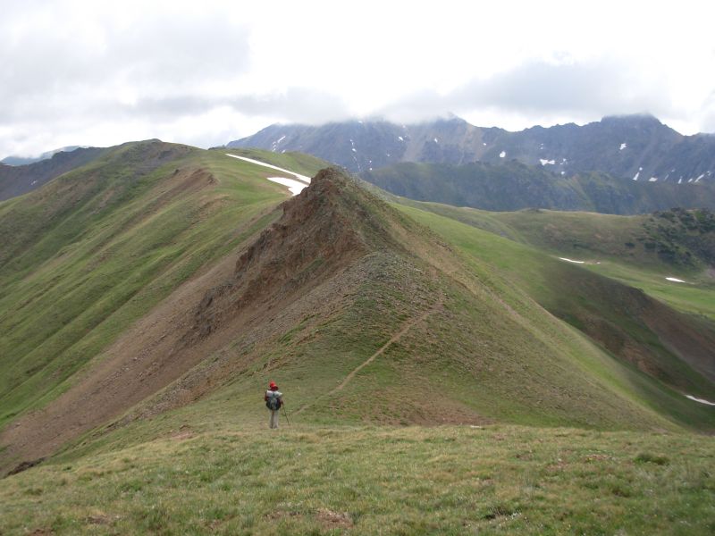
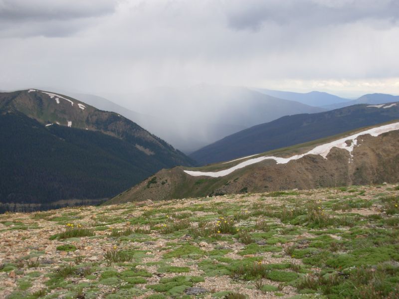
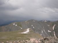
We knew that today would be almost entirely above treeline and that we would be walking the Divide past five 13,000 peaks. Because of our early stop two days ago, the mileage worked out so we reached Berthoud Pass, the beginning of the really high stretch, at 11:00, much later than we had originally planned. The previous four miles were also above treeline, but the thunderstorms lately have usually begun around noon, so we were able to enjoy blue skies, sunshine and terrific views for the first part of the day as we hiked around Stanley Peak. We saw three dayhikers and a herd of 11 or so elk below the peak.

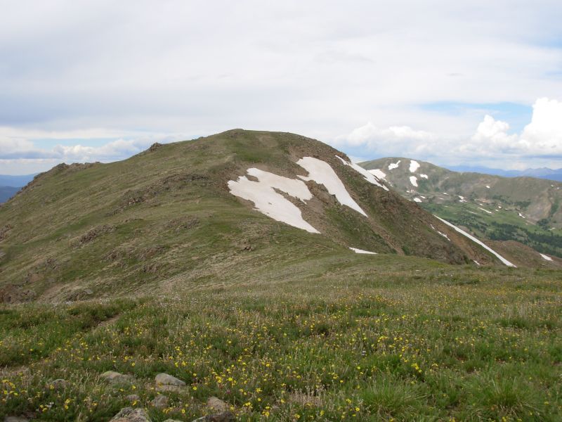
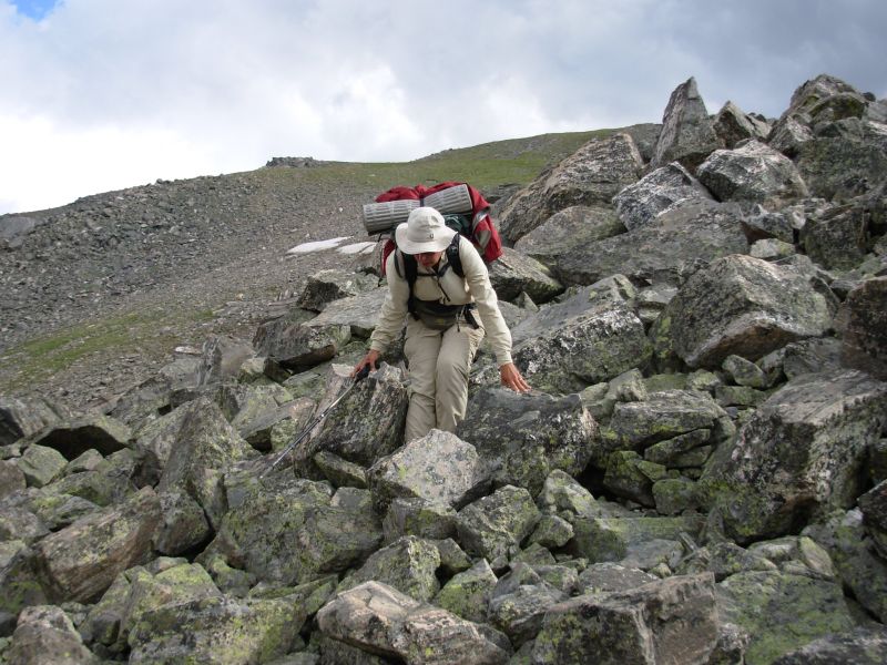
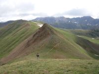
At Berthoud Pass we met a backpacker, just out for the night, and a couple more dayhikers. As we climbed the ridge to Mount Flora, we saw rain to the south of us. At Mount Eva it was to the north and west. At Parry Peak the rain was just beyond James Peak and when we reached James it was just beyond Parry. Somehow, although it rained all around us, we never saw a drop. Much of the day the sun shone on us. Views were limited but it was still beautiful. We saw another small herd of elk as we were climbing Flora. The views below were interesting: lots of lakes, some still partially icebound, lots of long green ridges covered with alpine flowers. It was really good hiking through here. The climbs were more strenuous than I remembered, but the footing was mostly better. The descent on the north side of James was probably the worst, aside from the infamous Notch between James and Bancroft Peaks that lived up to its reputation: a steep, narrow, rocky notch, requiring hand over hand climbing in a few places. It used to be easier, with more cairns to mark the way. We had a hard time figuring out the route at the end. There was snow on the rocks, so we needed to find a way up the talus away from the snow. Nothing looked feasible. But finally we found a cairn, then another, and eventually we reached the plateau.
Last time, this was our hardest day on the trail, both physically and emotionally. This time were tired and sore, but happy.
We should have taken the official CDT through here, given the probability of afternoon thunderstorms and what I remembered about the notch. As it turned out, we were lucky and survived both. The lightning stayed off in the distance and the rocks all remained more or less in place. It was funny. It rained to the north, to the south and to the east, but the wind came from the west. There were clouds there, but no rain.
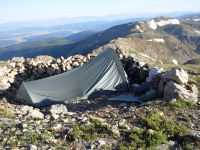
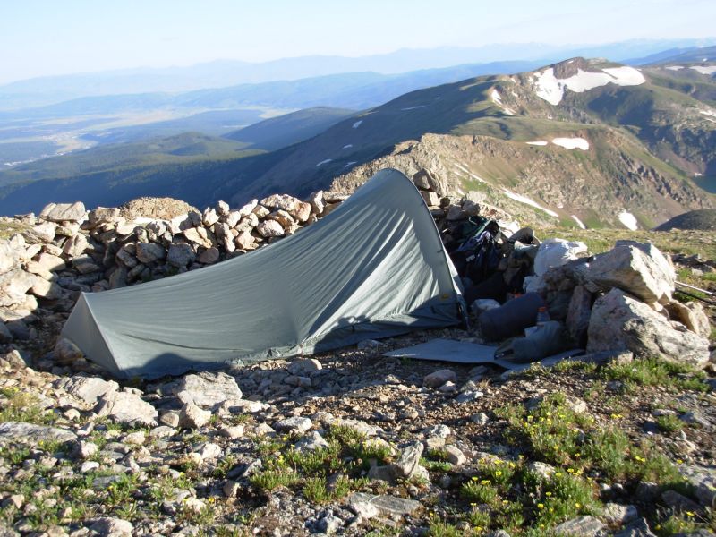
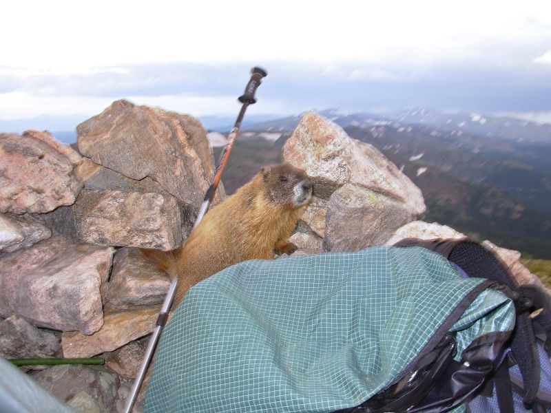
We camped just below James Peak in a circle of rocks mentioned in the guidebook. We were very ready to stop. The view is incredible. Unfortunately, we have troublesome neighbors: a couple of marmots that are after either our food or the salt on our gear. They are utterly unafraid of us and have tried several times to get into the tent and our packs.
The marmots kept coming back, sticking their heads under the tent flap, chewing on hiking sticks, trying to climb into the packs. They were not afraid of us, of noise, gravel thrown at them, nothing. Finally, when it started to get dark, they went home. We put everything in the tent and awaited the dawn. We left very early, before they came back to try again.
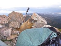
Jim: Somehow we got lucky again. The morning was sunny, the afternoon was threatening, but at a distance, never on top of us. And then it all cleared off so the marmots could see us better. Or so we could see them better - or something. They were a trip - annoying, but funny. And cute. Which is probably why they're so unafraid - all the tourons who come up here think they're cute, so they feed them. But I don't carry food so I can feed marmots - they'll have to fight me for it. Of course, the last time I said that, it was a bear -and he won.
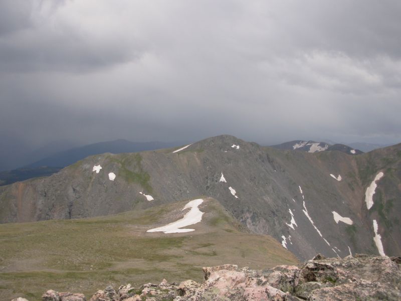
The Notch is a narrow ridge between Bancroft and James Peaks. It's always been difficult, but it's getting more so because the ridge is gradually eroding (yes, we have the pictures to prove it). Seven years ago there was something resembling a trail across there. There still is (sorta), but it's a lot less obvious and a little more difficult. Somehow the other peaks (Flora, Eva, Parry and Bancroft) weren't as frustrating as last time. Overall it was a beautiful, if challenging, day.
Wednesday, July 12 18 miles to Junco Trailhead
Today was a day of contrasts. Freezing morning, hot buggy afternoon. Open walking along the Divide, followed by an afternoon in the forest. It was a beautiful sunny day, with only one 30-second shower at lunch time. The wind was fierce all morning, cold and it made me stagger, but once we got in the trees, all was quiet again.
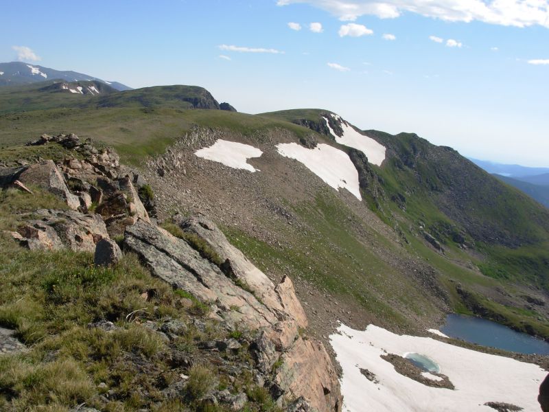
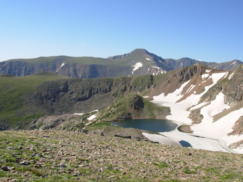
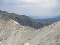
We started with several miles along the Divide, with beautiful views. Midway, we skirted a summit, ended up low, and lost the Divide. Rather than climb back up, we contoured around the hills through open meadows. It wasnt easy walking, between grass tussocks, willows, and strips of talus, but it was pretty and easier than going up several hundred feet to look for the elusive cairns. There was no tread up high and very few rock cairns to mark the way. It was fun to look back at the ridges we hiked yesterday and down at the half frozen lakes below. Iceberg Lake lived up to its name.
Rollins Pass was a busy trailhead today. There were people all over, including a Boy Scout troop heading to King Lake near the trailhead. The climb to Devils Thumb Pass had some steep bits, but also had nice views west toward Winter Park. We ate lunch in the lee of some rocks near the pass as it was quite windy. The descent was on old badly eroded trail through dense willows, but once down at Devils Thumb Park, the trail became quite nice. Its cruising trail, mostly in forest with occasional meadows. I really think the alternative route through the Indian Peaks Wilderness is much more beautiful, but this is easier with little climbing and you dont have the permit problem. Southbound hikers can get a permit at RMNP or Monarch Lake, but northbound hikers are out of luck and have to follow the official route.
We are camped in the woods near a trailhead at Junco Lake. Theres an outhouse, but no people, though some came by earlier to use the facilities. Theres a Forest Service cabin, but it isnt occupied tonight. A creek runs nearby so I was able to wash up when we got water. Nice.
Jim: We left camp early this morning in an attempt to avoid confrontation with the marmots. We succeeded. But it was cold on the Divide until we got into full sunlight.
This is truly Colorado - there are people all over the place. Coming down from Devils Thumb we caught up to a couple who decided they should be faster than us. Well, he did anyway. How many times have we seen this? Anyway, if he wanted to be faster, then he was welcome to it, so we stopped for a break. Later, we met them again - going the other way. He was going so fast that he'd missed the side trail to the parking lot where they'd left their car. Such is life.
We bypassed the Indian Peaks Wilderness today - and frankly, the route through the Wilderness is much better. More elevation gain maybe, but far more scenic.
Thursday, July 13 22 miles to Grand Lake
We hadnt planned to come all the way to town today, but once started, we couldnt stop. Visions of cold beer and juicy burgers kept us going. The fact that the trail was relatively flat helped.
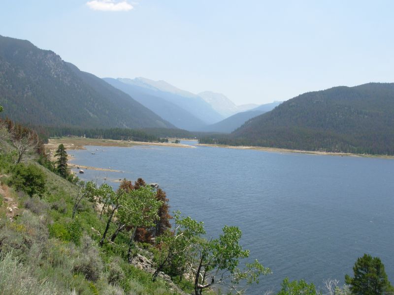
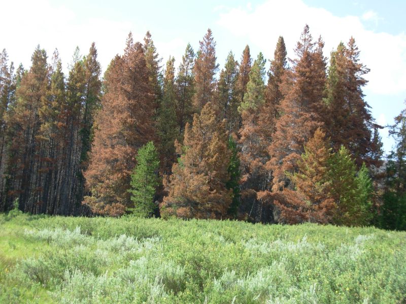
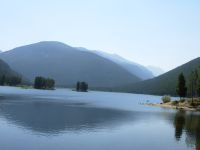
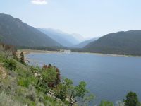
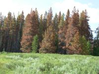
Today was a lake day, first around Monarch Lake, then Granby and Arapaho Bay, then past Shadow Lake to the town of Grand Lake. It was really hazy, so views werent particularly good, but the water sparkled in the sun and looked very inviting on a hot sunny day. Oddest part of today was the trees. They are dying. The hills looked like New England in October, all red and brown with dead and dying trees. There were lots of blowdowns on the trail and lots of undergrowth sprouting in the sun. We had a hard time finding and following the trail in a few places as a result, especially at Monarch Lake where there were multiple trails around the campground and the one we wanted was buried in wildflowers. It was frustrating. We stopped for lunch by the beach and started over after spending half an hour wandering in circles. We had the trail to ourselves, though we saw lots of boats out on the water.
I really enjoyed wandering around the lakes; it was different, though I kept fantasizing about one of the boaters inviting us to share a cold beer with them. Didnt happen. Wildflowers were abundant: harebells, columbine, gilia, four foot tall mullein, wild roses, geraniums, and more. There were some pretty meadows a few miles from town and when we hiked near the lake we were in sage country with xeric flowers like lupine and paintbrush. We also had an unexpected treat: our first ripe strawberries. Weve seen lots of flowers; today an old logging road was lined with berries. Yum.
We had planned to stay at Shadowcliff Hostel above Grand Lake, but all they had available tonight are dorms, no private rooms. Jim and I hate to sleep separately, so we got a motel room in town. Expensive, but convenient, and its a nice room.
Wildlife today was mostly birds. Last night we fell asleep to the sound of several different birds out on the pond, in the woods and by the marsh. One sounded like a loon. We saw a pelican, I think, (white with black wing tips) at Granby Lake and a grouse flew into a tree right in front of us. We also saw moose tracks, but no fur.
Jim: The fiasco at Monarch Lake was frustrating. I was beginning to think maybe we wouldn't be getting to town today, which would have been okay, but it would have made a really short day. There's no camping for the last 8 miles into town.
When we got to town we stopped for food first, then called Shadowcliff and got the bad news. Then there was more bad news at the first motel we tried - they were full. But she sent us across the street and we got a room.
Friday, July 14 Rest day in Grand Lake
Jim: There was the usual list of town chores to be taken care of - and food to be eaten. We wandered into the library for Internet access. It's the same story everywhere - a 30 min limit on Internet access. The only difference is in the system they use to track your time. Some libraries track the time manually, some have software that cuts you off. But they all guard their access time jealously.
Seven years ago the libraries were just getting into the Internet age - some of them didn't have anyone who knew how to use them, some were so proud of them that there were no limits on usage, some of them charged very expensive rates. In one town the librarian sent us up the street to an Internet access shop with the words: "It's cheaper there." Now they're all free - but limited. The only constant in life is change.
Home | Links| Trail Journals |
The Thruhiking Papers | Bun-bun
Created: Dec 2006
Revised: 30 Sept 2016Copyright © 2006-2017 Spirit Eagle