|
 |
 |
 |
 |
|
|
|
|
|
|
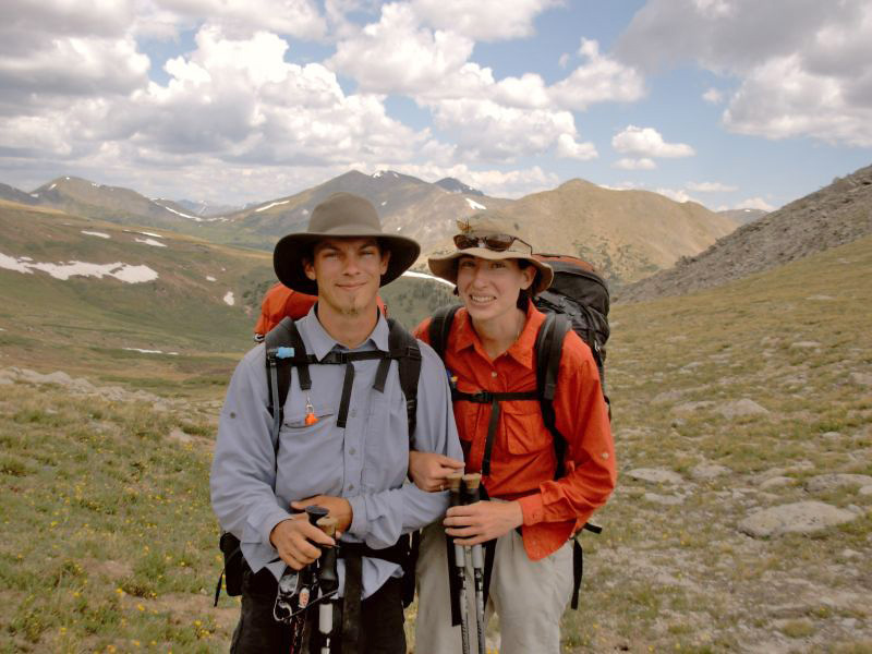
Tuesday, June 27 16 miles to Hancock

Salida wasnt a restful stop, but it was a pleasant one. The town is spread out, with downtown about 1½ miles from motel row, so we did a lot of walking. We met John there and had lunch with him at Amicas, a good Italian brewpub. Jim found a dentist and was able to get his broken crown fixed. It came off a week or so ago.
The motel owner drove us back to Monarch Pass early this morning, after a good breakfast at the café. We had heard about the motel from a CT hiker. The room was cheap and the ride to the pass was only $10. Given the distance, that was a real bargain. We had stayed at another motel last time, but it had changed completely, and is now much more upscale than it used to be. We were happy with the one we chose, even though it was on the edge of town.
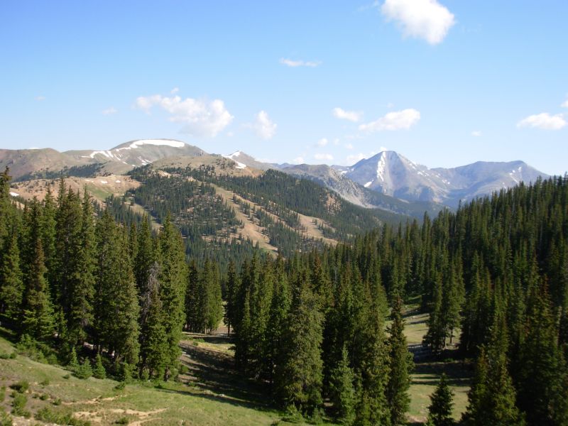
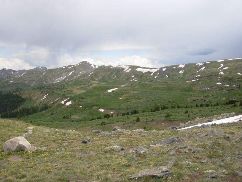
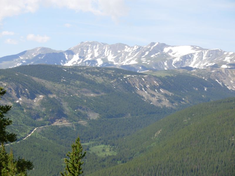
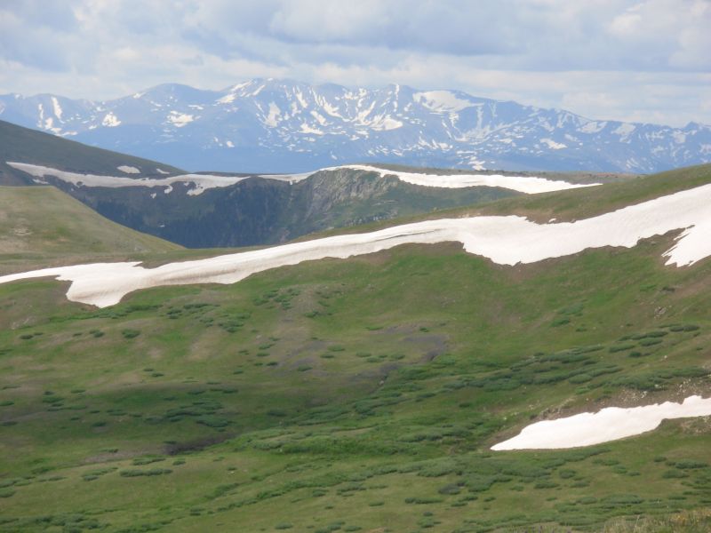
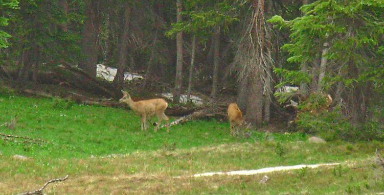
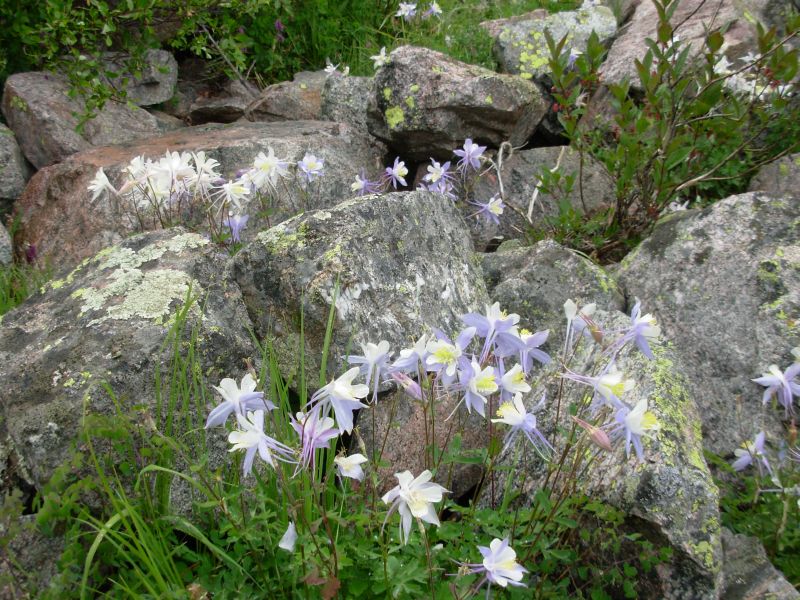
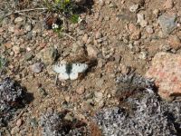
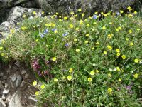
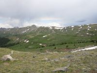
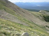
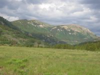
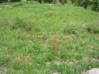
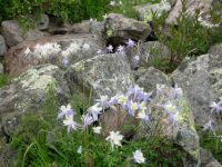
Our morning hike was a beautiful one around the Monarch Pass ski area and back up to the Divide. There were a few confusing junctions, but all in all, the route is better than it used to be. One spot had two different trails both marked CDT; the next had a road junction with no indication of trail direction at all. I vaguely remembered where to go, around the west side of the ski area, which helped. The views were great and so were the flowers, which were abundant and varied, and the butterflies, which numbered in the hundreds, if not thousands. Most were white with black spots; a few were the brown spotted ones weve been seeing for weeks. One thing I enjoyed was the stripes on the mountain: one section of talus, one of flowers, one of rock, the next more flowers. It was very pretty. The clouds began gathering around 9:30. By 11:00 there was thunder very close to us. Then came the hail. So far, not much, but the big black cloud is still hovering just south of us. One wonderful aspect of the day: no people. I love having the trail to ourselves again. This afternoon we drop to some lakes, away from the Divide. Given the weather, thats a good thing.
The afternoon was less enjoyable than the morning. For one thing, almost as soon as we finished eating lunch, it began to hail. That lasted half an hour or so, until the ground was white. It stopped, but the sun never did return. It stayed cold and gray all day, with occasional sprinkles. Nothing major, but we left our rain jackets on all day. Then Jims leg became excruciatingly painful for a long while. I thought we might have to leave the trail; that may still happen. He decided to continue after taking some Advil and the worst of the pain eased for a while. Then we had all sorts of confusion about the trail: first at Boss Lake Reservoir, then later as we climbed the Middle Fork of the Arkansas River. We followed a jeep road north along the creek, but it was evidently the wrong one. The maps only showed one road. Eventually we joined the good road near some cabins but we lost some time winding through the woods on muddy trail. The climb up the river was a strenuous one, especially the last 700 climb up the headwall. Still it was better than when Jim Wolf first hiked it, since there was marked trail. The old guidebook says, There has to be a better way. They found a reasonable compromise between willows and talus.
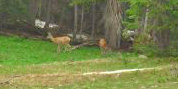
Wildlife highlight of the day was our first mountain goat of the hike. It was during the hailstorm: I heard falling rock and looked up to see a white goat cross the rocks and climb the wall of the cirque. We watched it for a while as it climbed. Along the Middle Fork we found elk first ten or so high above us, then a single elk down by the river, then four next to the trail. After we crossed Chalk Pass we saw some people way ahead of us who were camped at the trailhead. We continued another mile or so to a protected car camping site next to the jeep road/trail. As we were setting up, I spied three elk across the meadow. We watched them graze there as we ate dinner, until we jumped into the tent to get warm.
Jim: We got a couple hours of sunshine this morning - then the weather witch worked her magic and it disappeared. The mountain goat was cool - even if we didn't see a lot of him. I tried to get some pictures, but somehow the camera wasn't cooperating today and the pictures weren't worth having. Coulda been the lighting, too - really dark and gray. The only thing I don't like about this camera is that it doesn't have an optical viewfinder. If the lighting is wrong, the screen gets wiped out and you can't be sure what you're taking a picture of.
We got a lot further than I expected at one point - the pain in my leg was bad enough that I considered going back to town. It started on the downhill coming out of the ski area - just about the time we saw the mountain goat. Problem is - there was a bailout point a mile ahead on the trail so temptation and opportunity coincided. But I took some Advil and we rested for a while on a log at the junction where we could have bailed and gone out to Garfield. After a few minutes, I was just enough better to try walking again - so we did. The pain didn't go away, but it's down to a dull roar and I can stand that. Don't know what the problem was but I hope it's not a continuing thing.
Wednesday, June 28 18 miles to Sanford Basin
One elk watched us for half an hour as we packed up. It was far enough to feel safe, close enough to be curious. We headed toward the old mining town of Hancock, about a mile away. On the way we ran into a section hiker, Stan, headed south and two northbound thruhikers, GI Jane and Chuckwagon (aka Team Doodah). They got off the trail for a week for a wedding, which is why they are back with us. Theyre young and fast, so we probably wont see much of them. Theyre in more of a hurry than we are. Stan was not in a hurry. He was taking his time: Silverthorne to Silverton in eight weeks. Nice.
We started on nice easy trail, railroad grade, to the Alpine Tunnel, and then climbed on pack trail above the tunnel. There were some snowdrifts we had to detour around, but nothing major. It was beautiful. We startled a deer right next to the trail. Around noon it began to rain and hail, lightly, but by 12:30 the sun was out again. We met a Forest Service crew, building new trail to Tincup Pass. The old route follows eroded jeep road to the Pass, then down to Mirror Lake. Not fun. It sprinkled a couple more times. We met some dayhikers, then ran into several ATVs and motorbikes by the lake where we took a short break. I think the new trail is a necessity, even if it does parallel the road instead of following the ridge on the other side of the valley, which would avoid some unnecessary up and down.
Soon we began climbing in forest to a ridge between Garden and Sanford Basins with some beautiful views. We detoured around a large snow bank right up at the top of the ridge. Jim pointed out a couple of elk near Tincup Pass and I spotted another deer near the final ridge top. It was a long way down to a campsite on a meadow; before that there was no water and no place flat to camp. It was nice trail, even though it was an ATV trail. We ran into a group of about ten horses, heading toward Mirror Lake. They still had four miles to go and it was already 6:00. They were mostly teenagers maybe a camp group? Despite all the people and the horrible eroded jeep roads, it was a nice day. Not much sun, but a little. Beautiful ridges. Plentiful water. Team Doodah joined us at our campsite. It was fun to talk trail with them.
Jim: I'm surprised at the condition of some of the roads - unmaintained and really eroded. Not that I'd want a lot of traffic on them, but some of these roads used to be well graded and maintained. Now you'd need a 4x4 to get to Tincup Pass. The new trail will undoubtedly be better than the road for walking. Might have been better to put the new trail higher up in Sanford Basin and avoid a big descent/climb, but there's also snow/water/camping to consider so they might be right.
After Mirror Lake, it's a long way to anything that resembles a campsite - there's a lot of sidehill. When we found a campsite, complete with water, Team Doodah camped with us. Cool. They said that John was somewhere close behind us. So we might see him again.
Thursday, June 29 16 miles to Illinois Creek
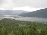
The morning hike was rather boring following ATV trail through the trees. There was a lot of up and down with few views. We ran into a group dayhiking. They asked how far it was to the top of the ridge. I didnt tell her there was no view from the top. We ate lunch by pretty little Texas Lake. It was on a reroute that adds a couple of miles to the trail. We already had a long day planned, so the extra miles werent a welcome change though the lakes were nice and I enjoyed the walk down Texas Creek, even if it was on a jeep road. In the end, we changed our plans to do a short day instead of the really long one we intended. Camping is limited in the next few miles since the trail is mostly sidehill with few flat spots. The guidebook mentioned one site that had both water and campsites. We grabbed it. Otherwise wed have five more miles, with a big climb at the end of the day, to Lake Ann. We had no problem agreeing to a short day instead of a 21-mile day. This way we have a little sun to dry out our sleeping bags, wet from condensation last night.
We had a couple of nice views, though it was gray to the south, limiting visibility over Taylor Park Reservoir. The best part of the day was the walk along Texas Creek. Worst were the mosquitoes, which have come out to plague us.
Jim: When we were almost down to Texas Creek, the trail took a sudden left turn and went off into never-never Land. We ended up at Texas Lake, which added a couple unplanned miles to the day. The only apparent purpose of the relo was to keep our feet dry by using an existing bridge. Gotta love it.
Friday, June 30 15 miles (?)
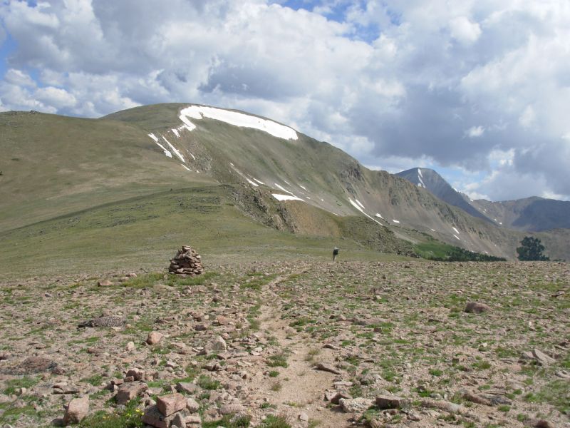
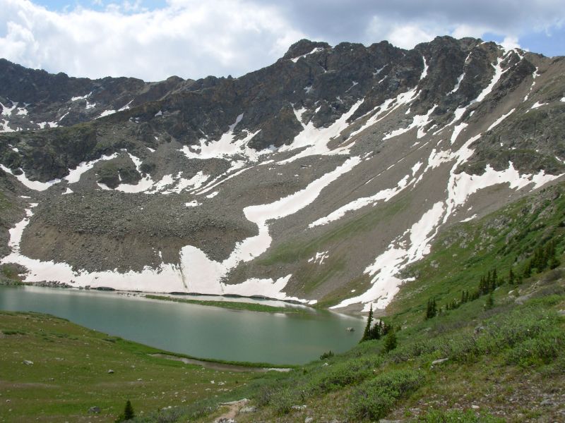
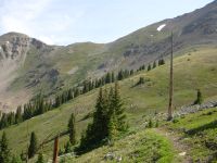
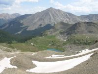
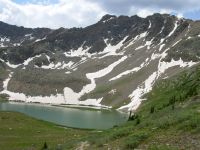
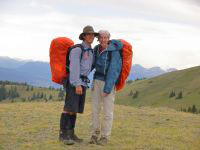
John joined us last night after we were already in the tent, hiding from the bugs and a passing shower. Later still (8:30), Mark and Michael passed by, though we didnt know at the time who they were. We visited with them this morning and Mark filmed us slowly climbing up to the pass above Lake Ann. The view was gorgeous. I really like this valley, with Mt. Huron on one side and jagged peaks all around. I did not like the descent from the pass. There was a big snow cornice, so we detoured around it, which entailed sliding down on very loose scree. I was not a happy camper. Soon the trail improved. Theyve done some really good trailwork in this section with nice switchbacks.
The clouds began gathering and at noon we got our first sprinkle while we were eating lunch. Since the sun was still shining, it was hard to take it too seriously. Later it got darker and darker and, sure enough, at about 4:00 as we were partway up the climb to Hope Pass, it began to hail, rain and thunder. The rain lasted until about 5:30 when we reached the top of the pass. Only one lighting bolt was close, right overhead, while we were still in the trees. The climb was a hard one: 2500 in less than four miles. Our total elevation gain for the day was about 4200 a tough day.
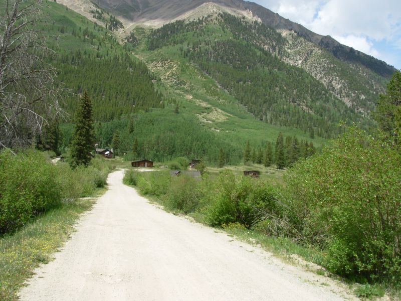
We hiked about 17 miles to a campsite in the trees next to Little Willis Gulch. John is camping with us again. Were all cold and wet and tired. Im glad we stopped when we did, though the wet clothes may be a problem in the morning. I was just happy to find a relatively dry flat spot to set up the tent. We considered continuing to Twin Lakes, but decided that it was unlikely that we would get a room on a Friday night, especially since this is the 4th of July weekend. Clear Creek was lined with campers and hikers. The old mining town of Winfield had residents in several of the restored cabins. The dirt road we walked from the Collegiate Peaks Wilderness Area was busy. It wasnt like this when we were here in September. The Mt. Massive area will really be a zoo this weekend.
One funny incident: as we were eating lunch, a couple passed by. Are you Jim and Ginny? they asked. When we answered in the affirmative, they said, George says hello. He told us all about you. We have no idea who George is, except that he is from California, knows us from the internet and was here yesterday looking for us. Im sorry we missed him.

Jim: It was good to see John last night. And then Mark and Underdog passed us just at dusk. We didn't see them 'cause we were already in the tent. They camped down in the next drainage, but they came back this morning. So we climbed to the pass and sat and talked with Mark for a while, then went down to Lake Ann. It's better that we didn't try to do that descent yesterday when we were tired. Too much scree and talus for either of us to be happy with it at the end of the day.
John found the campsite tonight - good work, especially with water close by. So far the trail from Hope Pass has been better than I had any right to expect. In '99 it was a nasty, muddy gully.
Saturday, July 1 19 miles
The holiday hordes were out in force: Twin Lakes was a zoo and the trailheads at Mt. Elbert and Mt. Massive (two 14ers) were packed. In between we had the trails to ourselves, more or less.
We dropped down to the village of Twin Lakes just in time for breakfast at the café. We took a longer route into town via the Interlake and Willis Gulch Trails to avoid a river crossing that can be quite bad if you pick the wrong place to cross. Early season hikers mentioned, waist deep and fast. Team Doodah said they crossed and it was only knee deep. Rather than take the chance, we did the detour. We ended up taking an extra detour on the way out of town too. The official route goes all the way around the lake, 11 miles, and heads up to the divide a couple of miles east of town. Very few long distance hikers take that trail as it is longer and it misses Twin Lakes, where many hikers do a mail drop. We didnt want to walk the busy highway to pick the trail up there. We had already had 1 ½ miles of roadwalking coming into town. J. Ley shows a dirt road west of town that heads north to pick up the trail. The question was, which dirt road? I asked several people and finally found one who seemed to know. Unfortunately, I misunderstood her directions, didnt turn left at the right place, and we ended up wandering the hills behind town, running into private roads with no trespassing signs.
Finally, in an attempt to get back to our starting point, we asked some people working on a house if we could get back down to town from there. One man said, Ill take you back down and show you the right road. Get in the car. So we did. It turned out we passed the road on the way into town. There is a private property sign that was deceptive. The public road turned left just beyond the highway, the private road went right. We headed up the road a mile or more, then turned off on a foot trail which led, in another mile or so, to the CDT/CT at the Mt. Elbert parking area. Hurray! The Leadville 100 ultrarun follows the trails, so there were occasional markers, which helped.
John and Team Doodah are behind us. I hope they had less trouble than we did. Chuckwagon had some family meet him at the village. Their dog, a malamute, was injured last week and hes been staying with the family. Chuckwagon had some problems though: another dog chewed off the straps on his pack while they were eating breakfast. He was really upset, foreseeing the end of their hike, until he figured out a way to fix it. Also, their mail drop didnt show up at Twin Lakes. I dont know if theyll resupply from the very limited grocery, or go with their relatives to someplace nearby to find supplies. Buena Vista isnt that far.
The day was a relatively easy one, about 19 miles, but with little difficult climbing, only about 3000 in all. We contoured around Mounts Elbert and Massive on good trail, much of it quite new. One section looked like it was cut last week, it was that fresh. There were few views, between clouds and terrain. We got a couple glimpses of the mountains through the trees and some nicer views of the lakes but mostly we walked in trees.

We only had a few hours of sunshine today. It rained at 12:00, 2:00, 5:00 and 6:00. The most significant was the last rain as it was heavy and continued for a long while. We tried to keep walking but since it wasnt letting up we set up the tent, just before it changed from a light rain to a heavy one. The 2:00 rain hit as we were eating lunch and lasted about ½ hour. The other two were just five minute showers. Its hard to predict what the raindrops mean when they start. Do we need rain jackets, or not? I hate going to bed wet again. Dinner was a cold one, since darkness fell before the rain stopped. Thunder was still booming overhead when we went to bed. I wondered about the other CDT hikers and hoped they stopped before it got really bad.
Jim: The trail from Hope Pass was good all the way down - there's been a whole lot of really good trail work done up there. Twin Lakes was a mixed bag - breakfast and ice cream (good), too many people (bad). We stayed a couple hours and then tried to get out of town. Ultimately we were successful, but it took some time.
We passed through some "different" terrain today - lots of really big boulders with the trail wandering through a lot of little canyons. We ended the day camped on a flat spot - in a pouring rain. We didn't get to cook dinner tonight - but I got ice cream today so it's OK.
Sunday, July 2 6 miles to Leadville
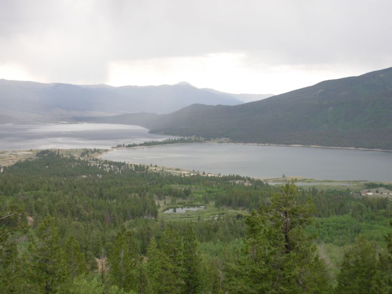
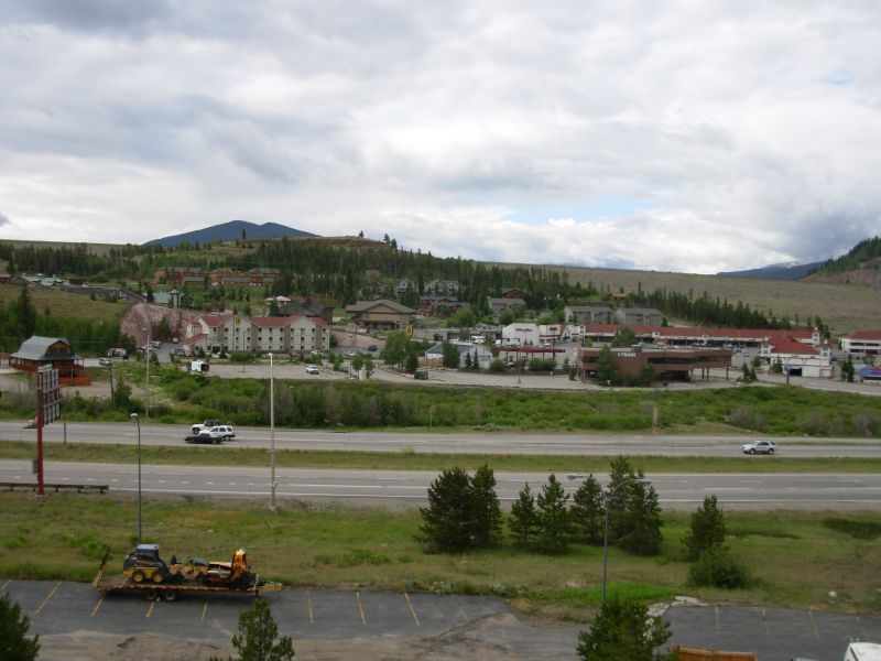
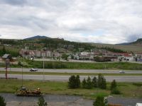
The rain finally stopped last night at 9:00 but the trees dripped on us all night. We packed our wet gear and decided to go into Leadville for a day or two to resupply and dry out. Wed heard good things about the town and the hostel so had deliberately not sent a resupply box to Twin Lakes this time. The only question was where to head to town: from Twin Lakes, Turquoise Lake or Tennessee Pass. Turquoise Lake is supposed to be closer but a harder hitch, but the timing was good for us so we left the trail there and lucked out in finding a nice couple from Arizona out for a drive around the lake who were willing to drive the 15 or so miles to town. First car! Traffic was, indeed, light, except for people coming to hike. (Note: I would actually recommend Tennessee Pass as a better jumping off point.) We probably wont see John again as he wasnt planning to come to town. I expected him to catch up to us today, but we didnt see him. Im sorry not to have the chance to say goodbye. He only has one week left to finish Colorado.
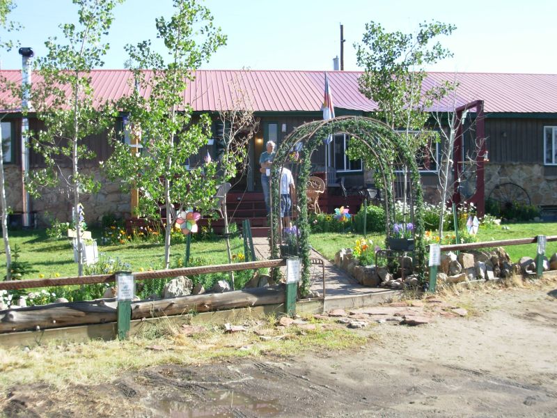
We reached town at 11:30, got a burger and a beer at the Brewpub, then headed up the street to the hostel. It is quite nice. We have a private room downstairs. They serve breakfast and sometimes dinner, have internet and laundry facilities, and it is a comfortable place to hang out. The people are really interesting, a mixture of hikers, bikers, runners, etc. One man does trailwork on the Colorado Trail and is finishing a section hike, another is a serious peak-bagger who has climbed all the 14ers several times, and a woman is here preparing for the Leadville 100 Ultrarun. One of the men plans to ride the Leadville 100 bike race. People stop by just to take a shower after climbing Mt. Elbert or Massive. The owners, Bill & Kathy, are very nice. Wild Bill reminds me of Pooh at Poohs Corner on the PCT. Tomorrow well get groceries (only three days to Silverthorne) and visit the rest of the town. It has one main shopping/dining street, a Safeway about ½ mile away and lots of residential streets. The view of the mountains is incredible. Its a pretty little town. Dinner was at Quincys: a restaurant with only one entree: filet mignon. The only choice is the size. On weekends they do prime rib. We ran into that the other day in Twin Lakes one breakfast, take it or leave it.
The hike today was easy, but not memorable. There were no views except a brief glimpse of the lake through the trees. The view in Leadville is much better than anything weve seen in the past two days.
Jim: It was a short day into town. When we got to the trailhead, it took us about 5 minutes to get a ride from a retired couple in a honkin' big pickup. They did some sightseeing on the way into town, but that's cool - we got to see what they saw. Free sightseeing - I guess that makes us tourists, too. In town they dropped us right down the street from the Brewpub (which we did NOT pass up).
Then it was off to the hostel - a wonderful place - highly recommended.
Monday, July 3 Day off in Leadville

We enjoyed our rest day, especially since it rained most of today. John, whom we met by the grocery, said we were lucky to get off at Turquoise Lake. He kept hiking and got drenched so badly he stopped for the day at 3:30 and decided to come to town from Tennessee Pass the next morning, though that wasn't his original plan for this section.
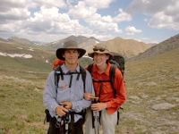
Jim and I visited the Mining Museum, which was interesting with some beautiful mineral specimens. My Dad intends to donate his mineral collection to the museum, so I had a special interest. Then we ate lunch, went to the grocery, then returned to the hostel to read and watch the rain fall. An old AT friend, Karl, came down from Denver to visit and hike with us. He stayed at the hostel and we all met John for dinner barbeque ribs at the brewpub.
Jim: One of the many purposes of this hike is to find possible places that we'd like to live. Leadville is now on the short list. It was good to see Karl again - we usually only see him at the ALDHA Gatherings. And there's never enough time to really talk about anything there.
Tuesday, 4 July -- 19 miles to Camp Hale
It was a beautiful day today with a few sprinkles, but no real rain and lots of sunshine. We managed a nice long hike with Karl, which we were able to hike packless. John dropped us off at Turquoise Lake, then drove Karls car to Tennessee Pass where he got off the trail to come to town. There were a few really nice views of Massive and Elbert and the Gore Range, but most of the day was in the trees. It was nice hiking though. Karl is good company. We ran into a large group out dayhiking sections of the Colorado Trail and a couple of CT thruhikers that we chatted with for about ten minutes. They were really enjoying their hike and made quite a contrast to the couple we met at the hostel who were leaving the trail because of the mosquitoes and because they didnt like being pushed to hike 15 mile days. (He prefers 8-10 miles, which makes resupply a problem. They were not happy campers.)
We left Karl at Tennessee Pass around 3:15 and continued another 6 ½ miles to a camping area beyond Camp Hale. It was easy walking along railroad grade and around a meadow, then above the highway on foot trail. We ran into a large herd of sheep at the old firing range. The smell was as bad as I remember. They were headed the other way down valley fortunately. I didnt want to spend the night listening to them or smelling them.
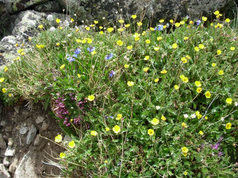
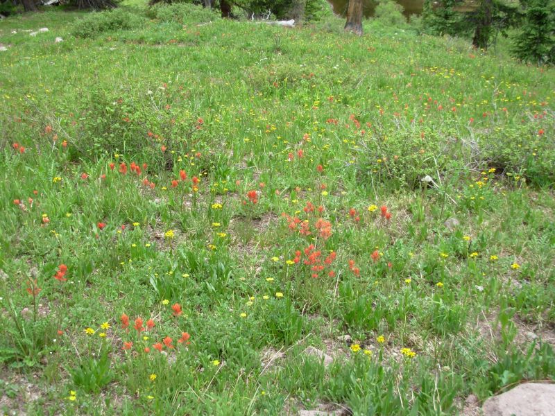
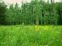
We saw some new flowers, including three foot high larkspurs and delphiniums. There were a lot of nice flowers today. No animals though, except the usual squirrels and chipmunks.
Jim: We stayed at the hostel for two nights and were really tempted to set up permanent residence there. But .... the trail calls. Karl provided our first - and possibly 'only' slackpacking day. It was good to spend some time with him for a change.
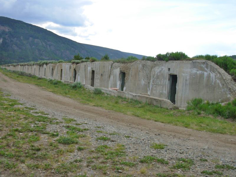
Camp Hale was much as I remember it - except for the sheep and the signs that warn about unexploded ordnance. Camp was across the creek on a flat spot right at the entrance to the campground.
Wednesday, July 5 17 miles to Ridge above Copper Mountain
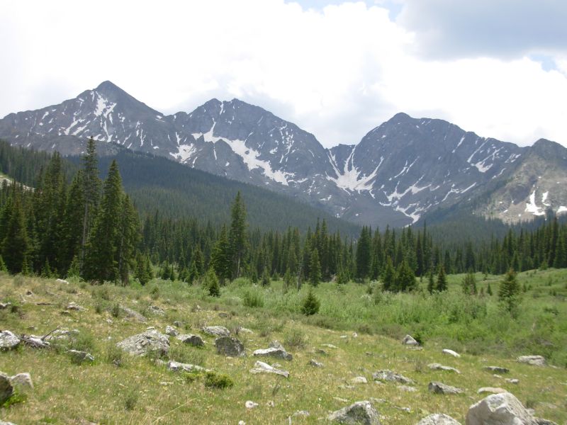
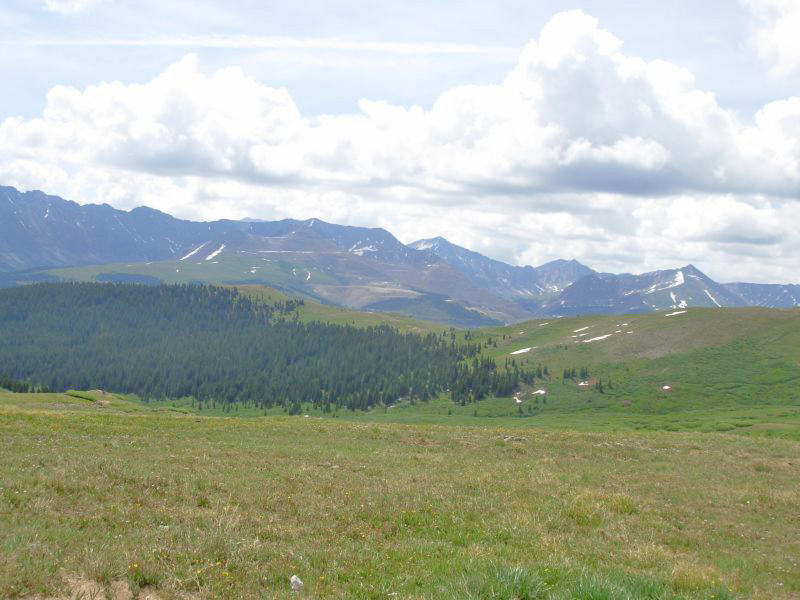
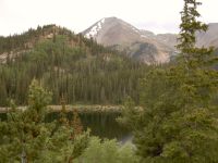
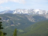
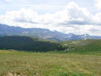
It was an eventful day, and mostly a good one. We climbed about 2900 to Kokomo Pass and Searles Pass before noon. The climb wasnt too difficult, mostly in trees with an occasional flower-filled meadow. The views from the passes south toward Massive and Elbert, east to the Gore Range and the Climax Mine, north to the Ten Mile Range were gorgeous. There were big green and white cirques with a lot of snow in the sheltered areas. We ran into seven Colorado Trail hikers in the area around Kokomo Pass and two more later on at Copper Mountain. Jim and I enjoyed a leisurely lunch just north of Searle Pass, watching elk cross a ridge and marmots run in the rocks, and just enjoying the view. Thunder to the west of us, combined with a sky full of black clouds, soon sent us on our way down the trail again.
The route above Copper Mountain was new, longer than before, and eventually we just took a horse trail directly to Copper Mountain since the CDT was winding so much in the woods above the resort. We asked someone where we could get something to eat and were directed to Endos, a sports bar with good beer and burgers. While we ate it began to pour outside. Our timing was good. It was really nice to be indoors watching that downpour. By the time we finished eating our brownie sundae, it had stopped, so reluctantly we donned our packs to begin the climb toward Uneva Pass. It soon began to rain again. Between that and too much dinner weighing me down, I was in no mood to keep climbing so we found a flat spot in the trees to set up the tent and climbed in. Everything was wet, but we were warm in our sleeping bags.

I enjoyed the day for a lot of reasons: terrific views, walking several miles above treeline, meadows filled with flowers (my first mariposas and monkshood, lots of pink, yellow and orange paintbrush and dozens of others), a stream filled with beaver dams, elk at lunch and a deer after dinner, nice chats with the CT hikers, an unexpected dinner (we had no idea what would be available at Copper Mountain, which is a very upscale resort), and finally the birds whose songs are a constant background refrain that gives me great pleasure. We fall asleep to their tunes and wake up to them. They accompany our walking. This is a great, but subtle pleasure.
Jim: Kokomo and Searles Passes look different in sunlight - last time we were here was at the end of the day with snow clouds threatening and darkness descending and us looking for a campsite. Still beautiful, but different. We talked to a lot of CT hikers today - more than I would have thought were out this early. We even met a couple in Copper Mountain who were on their way to a motel in Frisco to dry out for a night.
Copper Mountain has changed, too. It's much, much bigger - more condos, more shops, more people, too much "more." Too much rain, too. We got a couple miles out of town and decided we'd had enough rain so we found a flat spot and let the rain get the tent wet.
Thursday, July 6 19 miles to Silverthorne/Dillon
We fell asleep to the drumming of rain on the tent, but woke to silence, except a few drips off the trees. It was gray most of the day, with only occasional brief glints of sunlight. Behind us the ridges and peaks were totally enshrouded. I was glad we went over beautiful Kokomo Pass yesterday; today would have been total whiteout.
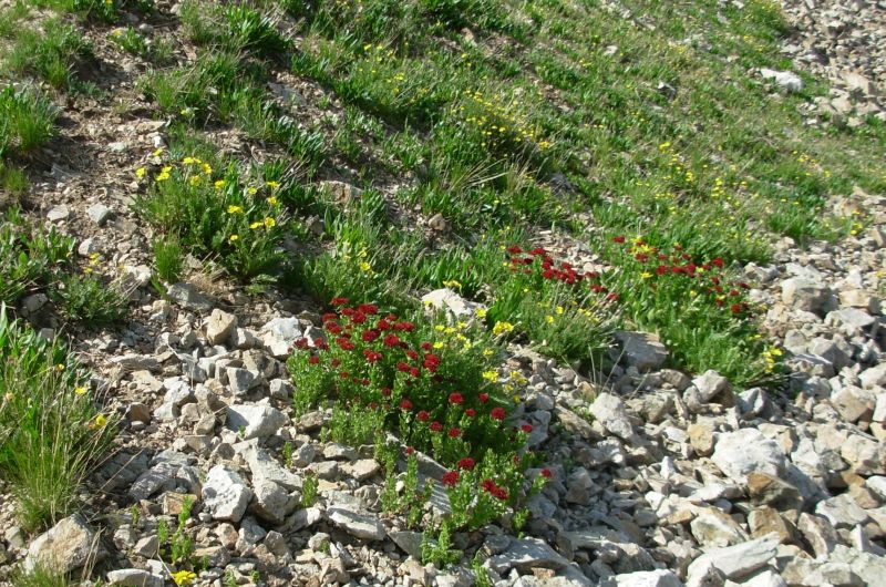
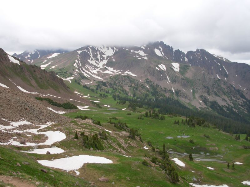
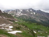
We climbed over two more passes today: Uneva and Eccles. Our total climb was almost 4000; yesterday was 4800. The views were terrific, but climbing 2000 up and 2000 down, then 2000 up and 3000 down that hurts! Flowers were abundant. We saw meadows full of sunflowers, others covered in glacier lilies and a white flower with a yellow center. A talus slope was covered in blue columbine. There was also a lot of snow in the upper cirques. Only two snow banks were steep and the snow was soft enough that Jim could easily kick steps, but I was surprised at how much snow remained.

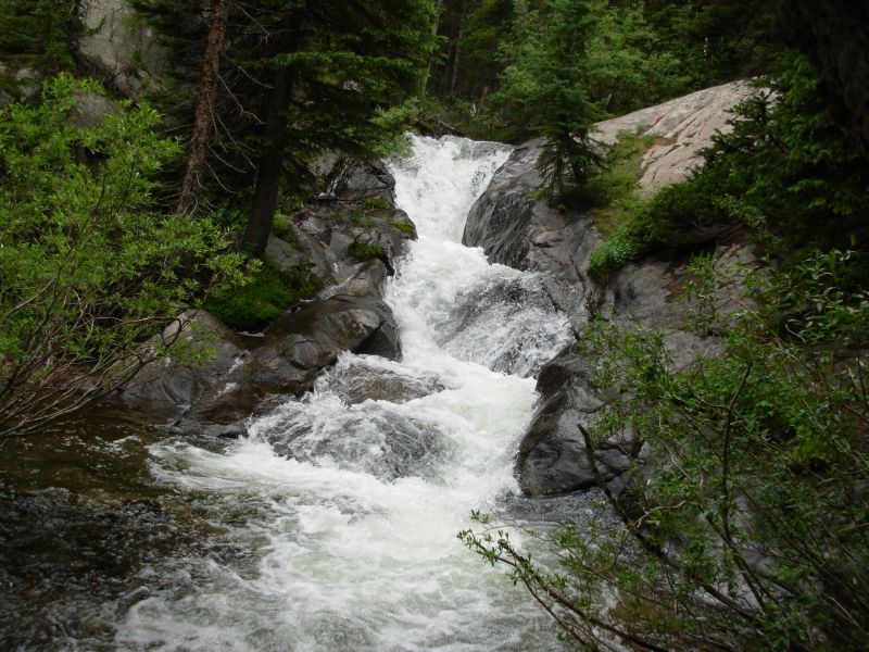
We had the trail to ourselves until just past the waterfall, which was in full spate. A group of dayhikers passed us there. We saw five elk before Uneva Pass, then one sole elk a mile later, then two deer just before we stopped for a late lunch on the far side of Eccles Pass. It started to rain while we were eating (of course!), which lasted about half an hour. It rained again about 4:30. We were soaked from the wet bushes and trees that lined the trail. It hasnt had any maintenance for a while, judging by the blowdowns, etc. Quite a contrast with the Colorado Trail. Parts were really rocky and rooty and reminded me of the AT in New England. Still, I liked the Eagles Nest Wilderness. Considering its close proximity to the I-70 corridor, it felt quite remote. Seeing wildlife helped further the wilderness illusion. When I see animals, I feel like Im really in the backcountry. The past week the trails have been too busy for much wildlife besides picas, marmots and chipmunks.
Weve split off from the Colorado Trail now, and even the official CDT. Well lose our well marked, well maintained footpath, but well also meet fewer hikers, I think. Its hard to tell. Colorado in the summer is very different from Colorado in the fall. I was really struck by that as we climbed above Camp Hale. Last time through the aspen were golden and the ground was covered with fresh snow. This time the aspen are minty green and the ground was covered with flowers. Only the snow-streaked peaks are the same. Its nice to be hiking in a t-shirt and not freezing every morning, though it is still cool before the sun reaches us. I could do without the daily showers and mosquitoes, but all in all, I like Colorado in the summer. One big difference in town there are a lot of festivals in the summer. We skipped the Fourth of July parties, the music festivals, etc., but they can be a fun distraction for northbound hikers if you are willing to make the time.
Coming into Silverthorne was disturbing after wandering in the woods for so long. There is total confusion: a freeway, lots of stores, lots of people, but where are the motels and restaurants? We spotted a sign in the distance for a Super 8 and headed that way, but got side-tracked by Pizza Hut. Several towns in the area are connected by free buses: Frisco, Dillon, Breckenridge, and Silverthorne. The motel is right on the border between Dillon and Silverthorne. Were near the laundromat and outdoor store, and less than a mile from the grocery. Tomorrow will be a busy day.
Jim: Silverthorne/Dillon has gotten bigger, too - although it's a little harder to tell. We didn't actually stay here last time - we stayed in Breckenridge with a trail angel. Not sure where John is now - after seven years, he could be anyplace. But it's a good memory.
July 7-8 Rest Days in Silverthorne/Dillon
Friday was spent taking care of business, plus a few extras: phone calls, post office, laundry, grocery, bookstore, outdoor store, plus a haircut and new shoes for me. We tried to get internet access, but the library was closed when we were there Saturday morning and Kinkos charges 30 cents a minute, which meant we were only on long enough to make sure nothing urgent was happening before we signed off. We planned to leave Saturday, but we woke up tired, not at all rested after all the running around the previous day. Besides, it was gray and gloomy and ended up raining most of the day. So after another visit to the post office and breakfast we retreated to our room to read and watch TV. Our location was a good one at the Super 8 because the bus stopped close by, the grocery and bookstore were only ½ mile away, the outdoor store was closer than that, and there were some decent places to eat (i.e. the Dam Brewery) within easy walking distance. The PO was three minutes by bus, or about a mile on foot. Not bad. The views of the mountains above town are pretty though not quite as spectacular as Leadville.
Jim: A couple good things about town stops - we get to dry the gear out - and no mosquitoes, although they haven't really bothered me except for one day. I've only used Deet once so far. We usually use very little of it on the trail. On other trails (including the CDT) we've never finished a whole 1 oz bottle of Deet. We always end up sending it home (where we eventually trash it because we're not gonna use it.)
Interesting thing happened today at the shopping center - I was eating a pint of Ben & Jerry's, sitting on the sidewalk, waiting for Ginny while she got her hair cut, and an older couple that I took for vacationers started talking to me. Turns out she had talked to Ginny in the Hair Cuttery and was interested in what we were doing. And he was the founder, owner and CEO of the Keystone ski resort. I know better than to make assumptions about people - but I still do it sometimes.
Home | Links| Trail Journals |
The Thruhiking Papers | Bun-bun
Created: Dec 2006
Revised: 30 Sept 2016Copyright © 2006-2017 Spirit Eagle