|
 |
 |
 |
 |
|
|
|
|
|
|
Tuesday, June 20 - 11 Miles to E. Fork Mineral Creek
We enjoyed a restful two and a half days in town. Yesterday we werent ready, emotionally, to come back to the trail, so we decided to give it an extra day. We ate ourselves silly, read a lot, talked to some of the locals, and just relaxed. It was a nice break and once again Im eager to be back on the trail, heading north.

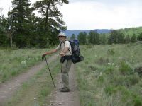
We got a ride back to the trail from a woman who works at the Outdoor Store Lauri which saved time and hassle trying to hitch, even though it did cost us a bit. We didnt start hiking until 10:45 since Jim wanted to enjoy a leisurely breakfast, so we didnt leave town until late. The climb out of Spring Creek Pass wasnt as bad as I feared. Maybe spending three days at 9000 helped me with my altitude problem. Just as we reached Snow Mesa, we were overtaken by a group on horseback, out for the day. Fifty yards farther we met a mother and son out backpacking. He is completing the hike on the CDT in Colorado that he started five years ago. He was injured on that hike and missed the middle section. We talked with them a few minutes, then moved on. When he hiked with his brother, he said, they didnt follow trails, they just followed the Divide. Though it is possible to do that, it makes for some hard hiking, with a lot of up and down, scree and talus. It made me look at the ridges a bit differently from then on I kept asking myself, Could I hike that? Sometimes the answer was yes, sometimes I looked up at snow cornices or steep cliffs and the answer was no. For the rest of our hike through Colorado, I wondered.
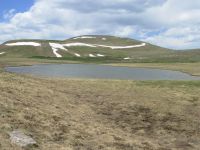
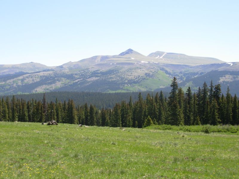
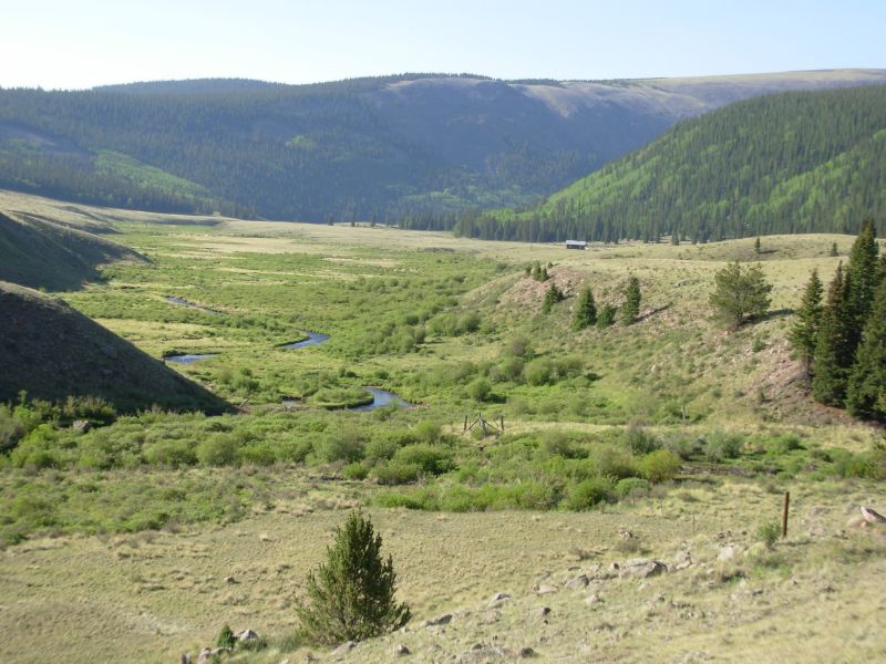
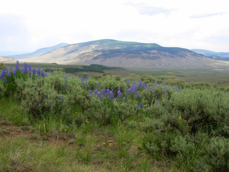
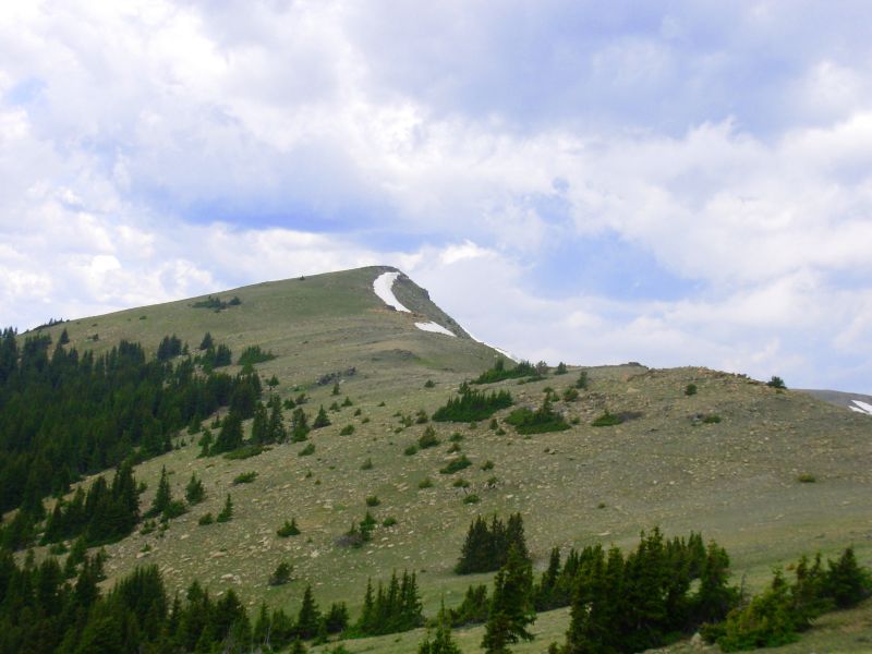
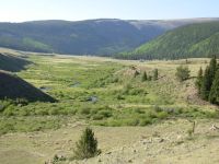
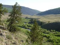
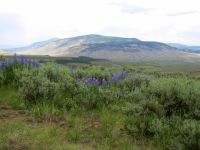
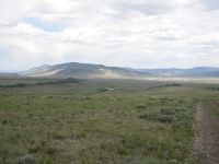
Snow Mesa is flat, green, and treeless, with gentle rolling hills. Quite a contrast to what followed: the East and West Forks of Mineral Creek, which go up and down steeply, sometimes in spruce, sometimes on sidehill. It was beautiful, but we ended up climbing almost 3000 today. We planned to continue farther, to San Luis Pass, but we found a sheltered campsite in the trees with a good spring nearby, so we decided, happily, to stop at about 5:30. As we were setting up camp, a woman hiking the Colorado Trail appeared, heading south. She is the first Colorado Trail hiker weve met this trip. We warned her that there werent a lot of good campsites in the next few miles, but her guidebook told her about one that was ¼ mile off trail, so she kept going. Today was a day of sunshine and shadow. It was warm in the sun, making snow drifts passable, but cool when the clouds appeared. We saw one elk at the West Fork, a deer at the East Fork and a pica by the spring.
Jim: Hmmm - leaving town - hitchhiking is one thing, arranging a ride is something else. The first is free, the second you should expect to pay for. Gas and time are money to people who have a limited time period to make enough to live on for the rest of the year. Make the money arrangements up front so nobody ends up being surprised.
Snow Mesa - I remember it well. In '97 we saw a huge herd of elk up there - a couple hundred of them. This time - nada. The mother and son were interesting. She had done the Divide route through Colorado (yes - ON the Divide - not just on the CDT) twice. And she had the T-shirt to prove it.
Wednesday, June 21 14 miles to Eddiesville Trailhead

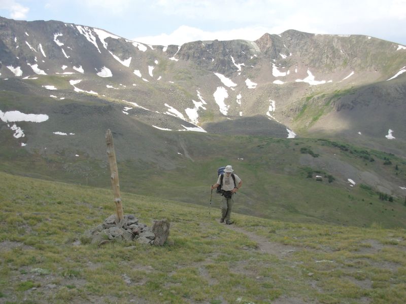
We had a really nice campsite last night, flat and sheltered. Today we have a better view up and down Cochetopa Creek but it is likely to be much more lumpy. Unfortunately, Jim has felt bad all day disconnected and spacey and wasnt up for two or three miles of sidehill above the creek. He has fallen badly twice in two days, once face down into the dirt and the second time he hurt his shoulder. Both times he was lucky there was no drop off, since he fell completely off the trail. We think its altitude affecting his brain not a good sign. He says he feels like he's drunk - but he's not. Well see how tomorrow goes. We only did 14 miles today as a result: up and over San Luis Pass and the adjacent roller coaster of passes, then down Cochetopa Creek to the Eddiesville trailhead. We camped just past the gate there.
It was a relatively uneventful day, climbs in the morning after a late (9:00) start, then easy downhill all afternoon. We saw three deer this morning, the two backpackers we met yesterday and two new ones, plus someone car-camping at the trailhead. It was dark and cloudy most of the day, though it only sprinkled on us twice. Views werent all that spectacular as a result. We had considered climbing San Luis Peak, a 14er, but given our energy levels and the probability of thunderstorms, we decided against it. Maybe next time? I know, that's what I said last time.
Im really worried about Jim: he has no energy, feels awful, trips and falls a lot -- I wonder how far well hike this summer. Because he has really bad knees, (bone on bone one one side and a torn (repaired) meniscus on the other) his surgeon told him, I doubt youll finish your hike, but go out and see how far you go. His internist told him, Dont go. Its crazy to even try it. I dont know if that was because of the diabetes, Jims age, or his bad knees. Jims response was, Im gonna live until I die. See you in November.
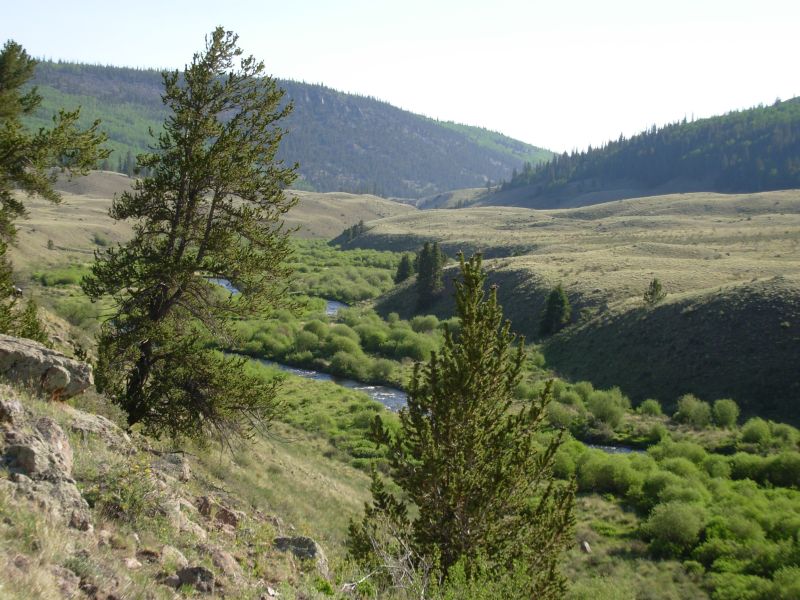
We were amused to note how far up Cochetopa Creek the beavers have moved over the years. There are now dams and lodges almost up to the Pass. When we came in 97 there were few, if any, north of Eddiesville. In 99 they had moved a little north past the trailhead. Now theyre eight miles up the creek. Good work beavers!
Jim: All the evidence says I've got a case of AMS. Specifically, I'm experiencing lassitude, ataxia, pulmonary problems and reduced urine output. Not good.
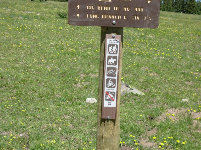
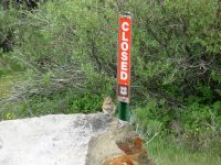
Another kind of irritation - the Rio Grande Forest has apparently opened many of the trails to motorized use - including the CDT/CT. it occurs to me that that may be illegal. Wouldn't be the first time a Forest (or other Government agency) considered itself above the law.
Thursday, June 22 19 miles to Archuleta Creek
We enjoyed our morning hike down Cochetopa Creek. They had relocated the trail uphill a bit so the old problem of eroded narrow sidehill was no longer an issue. They also moved the crossing and put in a foot bridge so we no longer had to wade or cross on rickety beaver dams. Nice work! We looked for moose, but saw none, nor any fresh scat. They must have been hunted out. We did run into a rancher on an ATV, putting out salt for the cows. They havent been released to summer pasture in the high country yet, but its coming soon.
Jim seems to be doing better today. Hes still slow, but hes moving. He shook me this morning by remarking that we obviously arent serious about thruhiking or we wouldnt sleep in most mornings or stop so early. I thought it was part of enjoying our hike, not a lack of seriousness. I want to hike the whole thing, if possible. Jims physical problems have made me doubtful of the probability of our doing so, but I still very much want to hike to Canada. All along weve said it doesnt matter if we dont finish, as long as we keep hiking as long as physically possible, but I still intend to try to reach the Canadian border, if we can. Where do you draw the line between pushing so hard you stop enjoying the hike and enjoying yourself so much with short days and long town visits that you make it impossible to finish a thruhike? Its a conundrum.
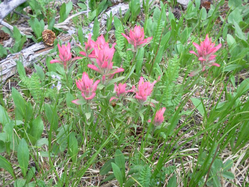
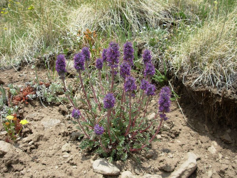
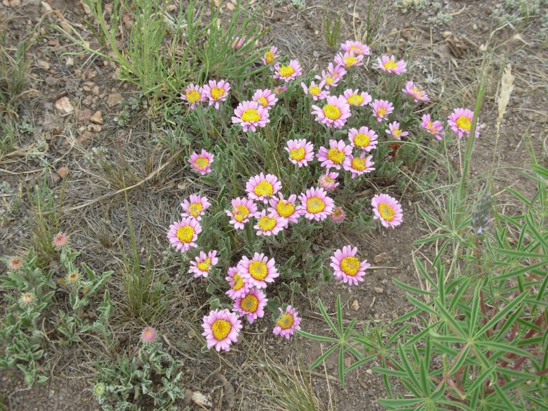
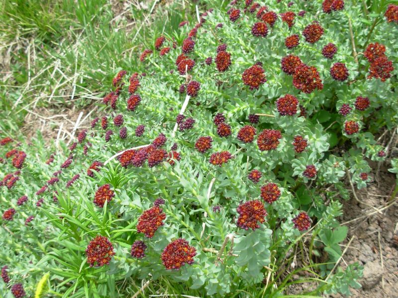
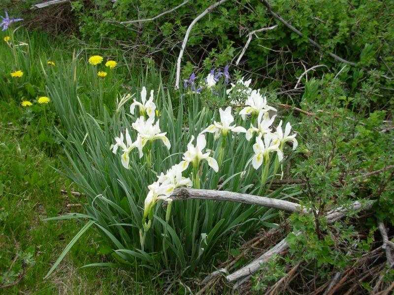
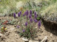
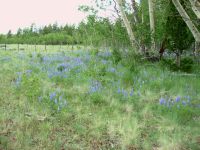
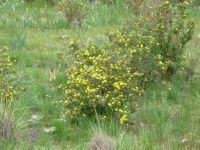
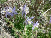
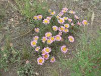
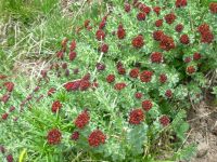
We ended up hiking almost 19 miles today, though we stopped early (5:00). The trail was easy, so we could have done more, but Jim had had enough, so we stopped near a spring in a grassy meadow. It was a nice afternoon, skirting huge open Cochetopa Park. Were much lower (9500) so the vegetation is very different here: sage grassland surrounded by aspen and spruce groves. The flowers were desert flowers and abundant: lots of blue lupine, orange paintbrush, a white sweet pea, pink daisies, asters, scarlet gilia and blue and purple penstemon. It was a beautiful rainbow of colors. I saw my first white iris, amidst the blue ones in a meadow. We first saw iris about 500 miles ago, just north of Grants. I love hiking with spring.
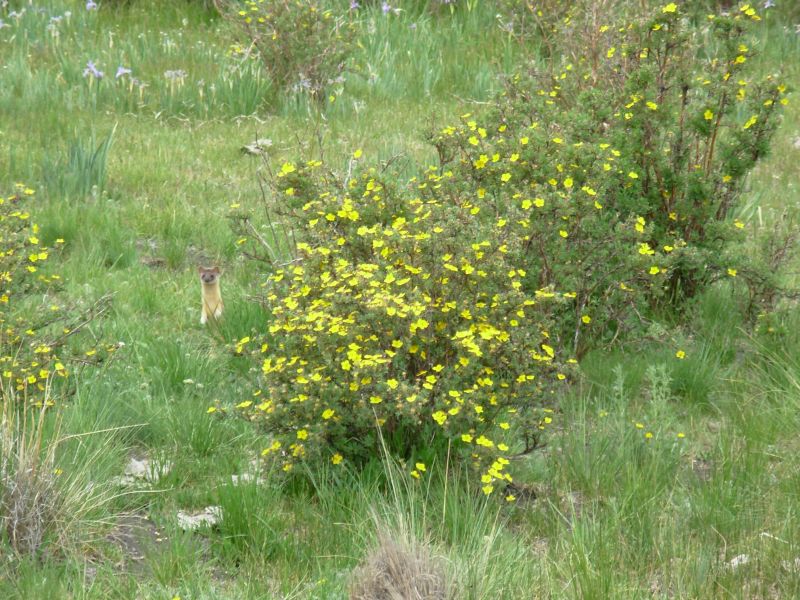
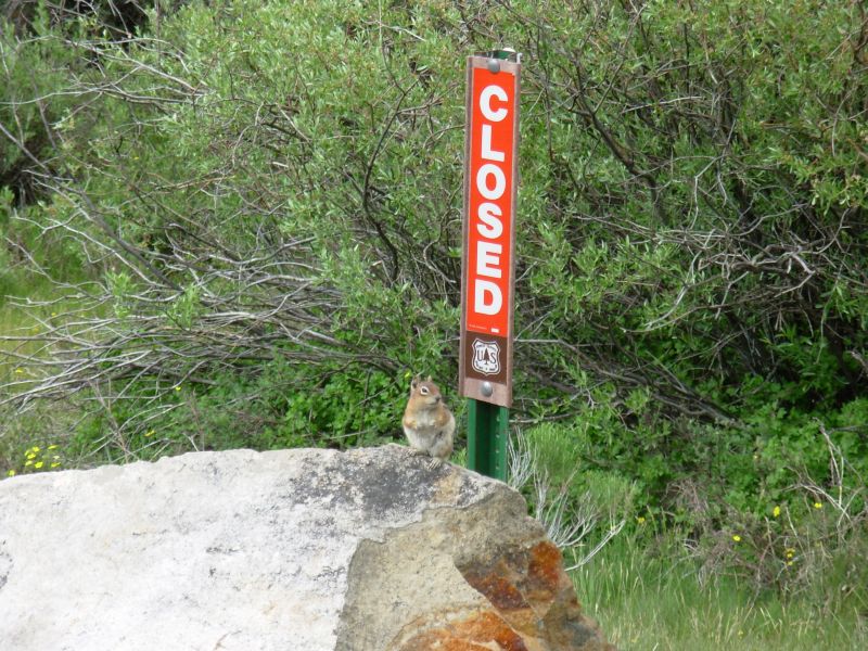
We had an interesting wildlife sighting this afternoon: a long tailed weasel. (I thought it was a ferret, but I looked it up later and it was a weasel.) It stood up on its hind legs to look at us, so we got a good look at it: golden brown, with a whitish face and black tail tip. Later a chipmunk posed for us near Los Creek. It sprinkled on us a couple of times, but nothing serious just black clouds overhead and a few drops to wet the road.
Were camped near Cochetopa Pass in a grassy patch by Archuleta Creek. Its open and sunny. There have been cows here recently, but none are grazing here tonight. We filtered the water from the spring since it was below the cow meadow and was iffy, even though it was fenced off.
Jim: The early stop today was for a specific reason. This is as low as we're gonna get until we get to Salida. And I need a night at lower elevation. The only cure for AMS is to sleep lower. We'll see if it works.
I think I said: "I wonder if we're serious" not "we're obviously not serious". Yeah, we disagree sometimes. All God's chilluns disagrees sometimes. That remark came from a conversation about previous trails and how we'd sometimes be on the trail at first light - and sometimes hike till after dark. We've never made a habit of either of those, but it seems we truly haven't been in a big hurry for the last couple months. OTOH, we're making the miles without putting in 16 hour days. If we weren't serious about going to Canada (finishing the trail), we wouldn't be making the miles. In any case, I apologized for upsetting Ginny. It wasn't meant that way.
This is our third time through the Cochetopa. It's different every time. And that's the way it should be.
Friday, June 23 21 miles to Baldy Lake Trail Junction
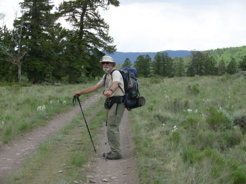
The cows came back, early in the morning. We were also visited three times by a very noisy pack of coyotes. As we started out this morning, a rancher drove past, heading into the hills to look for a couple of missing cows. He was very friendly. All of the ranchers we have met this year were quite old 70s or 80s. Where are the young cowboys? Actually, later a truck stopped next to us and a young cowboy asked, Would it insult you if I offered you a ride? We responded, No insult taken, but we have to refuse. Were walking.
We wound through the hills on old logging roads in the cool of the pines, then crossed Highway 114 and began climbing on another jeep road. It was very hot today -- no clouds yet but the clear sunshine was welcome after so many cloudy days. A trail angel, Keith aka Burnt Foot, whom I knew from the Internet, had put out a cooler of sodas for CT/CDT hikers near the highway. He lives in Gunnison, not too far away, and said that this was his least favorite part of the Colorado Trail, hot and dry, so he thought this would be a good place to do some trail magic. I enjoyed my soda, though I have also enjoyed the past few days: easy hiking with easy climbs, lots of flowers and creeks whats not to like? My memories of the trail north of here are pretty dim -- I just remember a very windy day near Monarch Pass but I am looking forward to being up on the Divide again. Our only wildlife was a hawk at lunch. We met a dayhiker shortly afterwards (Capt. Wilderness, AT 1985).

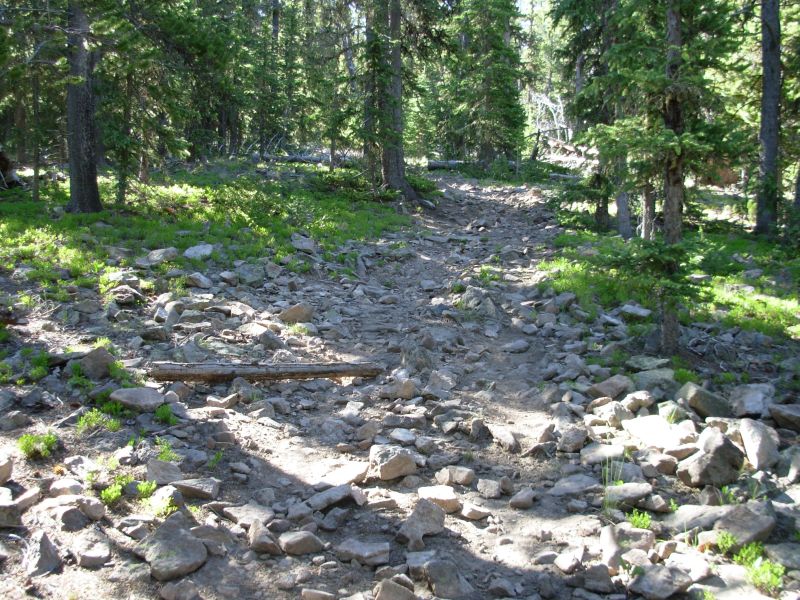
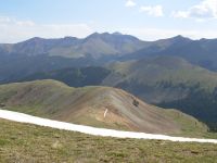
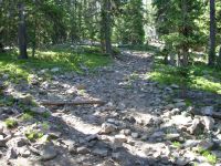
The afternoon hike went up and down along the ridge, but since we were in forest, there were few views. We decided to cook an early supper at Razor Creek, then move on a couple of miles. Our next water is in about 15 miles. There were some women camped at Razor Creek but we never got a chance to talk to them. I wasnt looking forward to the late afternoon 800 climb up Middle Baldy but Jim wants to push the next couple of days to make up for our slow start in this section. Well see. We ended up hiking 21 miles, to the junction with the Baldy Lake Trail. There were some nice views from the two Baldys we climbed and a deer was sleeping in a meadow at the second one. They are starting to grow back their antlers, finally. I wonder why they shed them every year? Seems like it would take more energy to grow them back than to carry them from spring to summer. The meadows were big, reminding me of the San Pedro Parks area. The trail is very eroded, heavily used by motorcycles and ATVs evidently. We kept the sunshine all day, despite a couple of clouds that tried to mass on the horizon.
Jim: This would have been really easy walking if it hadn't been for the torn-up treadway. Not that it was ALL like that, but there was enough of it to make some sections unpleasant. This is part of the price of allowing motorized use of hiking trails.
More Trail Magic - the soda was great. Gave us some energy for the coming roadwalk. CO114 hasn't changed much - but the 'dirt' road heading north is another of the "improved" roads that we've seen all the way from the Mexican border - graded, graveled and maintained. And hard on the feet.
Sleeping lower seems to have cured the AMS. Otherwise we wouldn't be camping near Baldy Lake - we'd still be back at Razor Creek.
Saturday, June 24 21 miles to Marshall Pass
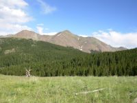
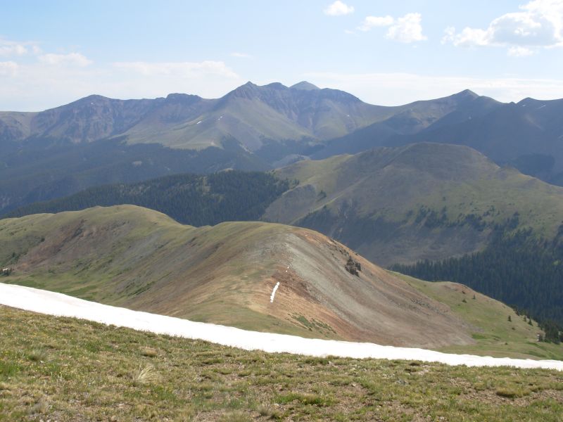
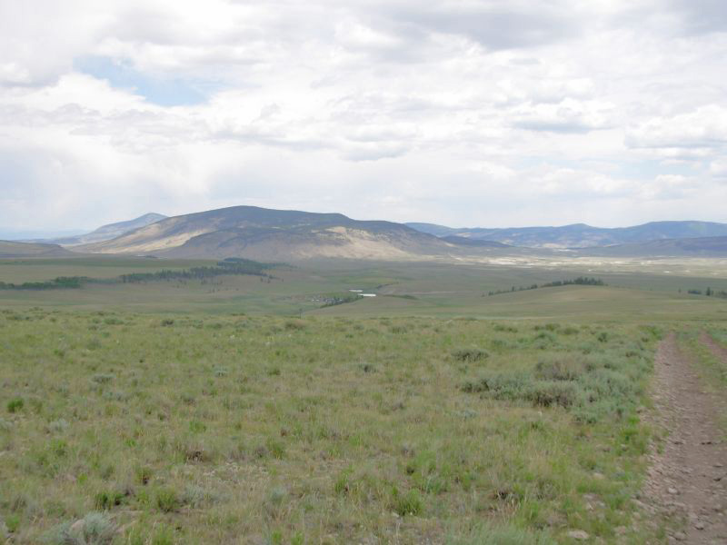
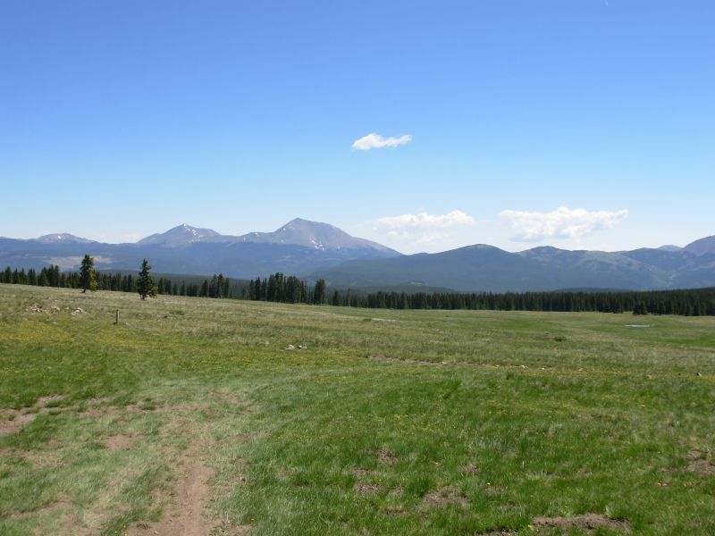
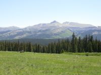
Our morning hike was mostly rather easy downhill, first winding though the trees on eroded motorbike trail, then across the open meadows on Sargents Mesa. There were some beautiful views of nearby peaks: Antora, Ouray, Chipeta, etc. Well hike past those tomorrow. There were a few views south to the Cochetopa Hills and farther west to the snowy peaks of the San Juans. The meadows were green and covered with wildflowers. We saw a couple of bucks midmorning and lots of people: the mother and son backpackers weve been leapfrogging all week, a Colorado Trail hiker heading south, a bicyclist, and three motorcyclists. We exchanged notes with the CT hiker. We enjoyed a cold bath at Tank Seven Creek before lunch; it felt wonderful!
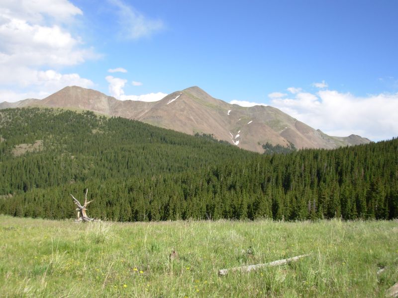
Our afternoon climb up Windy Peak was a tough one: 1000 in 1½ miles. The rest wasnt bad: some up and down, a few really nice views, and lots of walking through spruce forest. We stopped for the night just short of Marshall Pass almost 21 miles. We have a view of Ouray Peak from our campsite. Its a big (13,000) bald rocky mountain. Windy Peak was green -- forested except for the very top, where we didnt go. Antoro was another big beautiful peak nearby.
We spotted two elk watching us from a ridge high above the trail and another buck just coming into his antlers who was heading up the trail toward us until he got a glimpse of us through the trees. There were also two dayhiking women with a dog and a couple more motorbikes that we met on a very narrow section of steep sidehill. We were able to find a spot to climb up, but it wasnt easy. I hate sharing the trail with motorized vehicles. What do the horses do in like circumstances? They asked us where the trail went. We told them, In 1000 miles youll be in Mexico. I dont think they realized we were serious.
Jim: Another long day - so I must be feeling better. We're truly in Colorado - lots of people on the trails. Too many.
The motorcyclists really didn't believe us. But what did they expect us to tell them? They're idiots for being out here without a map, and without knowing where they're going in the first place.
Sunday, June 25 15+ miles to Salida
As we were packing up this morning, a herd of elk tried to sneak past our campsite. When they caught us watching, they turned back, so we only got a brief glimpse of them through the trees. At Marshall Pass we ended up following the wrong jeep road north. There are several that arent on the map. After a mile or so, we met a No Trespassing sign. We knew the trail must be to the right, so we headed uphill and soon found another jeep road, which we followed for a while until it dropped down to the previous road. So again we bushwhacked uphill. After a while, Jim twisted his knee and decided that we should go back to Marshall Pass and find the real trail. Much discussion ensued, but in the end we returned to the pass and asked a biker where the Colorado Trail was, and finally started up the CDT again. We lost two hours with that error. Trouble was, we knew something was wrong since we saw no CT markers or footprints, but we ignored that. I wasnt worried since I knew we could always bushwhack up to the ridge if necessary and follow it. Our problem was we were looking for the trail too low. It was about 400 above us. Oh well. We did see a very curious young deer that came within 20 of us on our detour, so it was worth the extra effort.
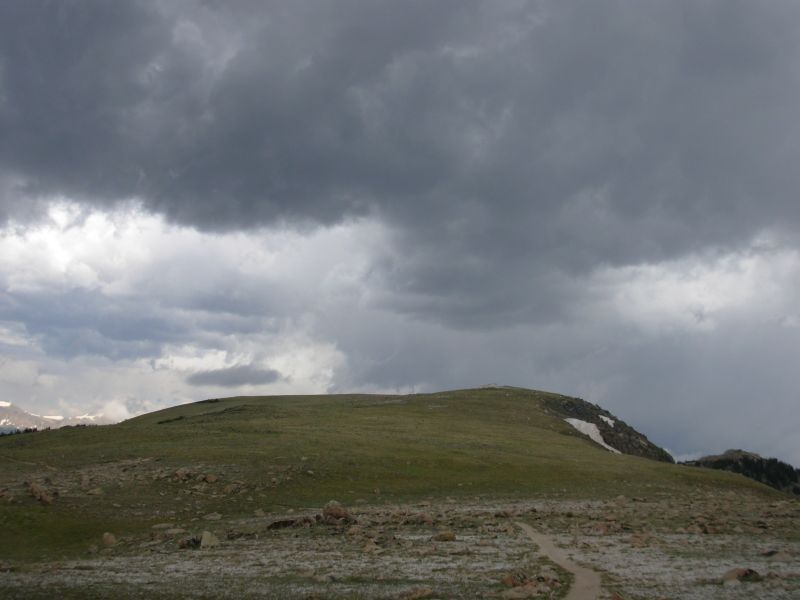
On the trail we met the Sunday hordes: 41 bikes, 3 motorcycles, 2 runners, 2 dayhikers and a jeep. It was a madhouse! This despite very large dark clouds that began gathering quite early. They were black, white and gray -- swirling, towering, boiling . . . quite beautiful, but we did hurry across the open ridges. Not a drop fell on us, though nearby mountains were not as lucky. There were some nice views, despite a nearby forest fire that left a smoky haze. The clouds were dramatic. There were enough trees that we had some protection from the wind, part of the time. There are some beautiful big dramatic peaks in the stretch between Marshall and Monarch Pass. We passed a couple of snowbanks, but they were easy to climb around. The bikes had a bit harder time with them. We reached Monarch Pass around 2:00, enjoyed a big ice cream cone at the store there, then got a ride immediately down to Salida with a bicyclist who had passed us earlier that day. He said that he had gotten a ride back to his car from someone who said, Since I gave you a ride, you should give a ride to the next people you see who need one. That was us. Dinner was an elk, bison and sausage meatloaf very good.
Jim: The day started with sunshine - developed a lot of nasty looking clouds and then just kinda --- waited --- until we were in town before dumping. Interesting. The trail was basically ridgewalking with mostly minor ups and downs and a little snowpack just to spice things up. There were lots of people, including a couple runners who were training for an ultra. We passed the only shelter on the CDT today but we didn't stop - it was full of bicyclists taking a break.
June 26 Rest day in Salida.
Jim: Somehow Salida is one of our favorite towns even though it's really spread out and not a great hiker town. John got into town early yesterday, but we didn't know it until we saw him wandering around downtown. He was smart and rented a bike to get back and forth from his motel to downtown. We made plans to meet for lunch, and went off to the Post Office and library. After lunch we made plans to meet for dinner as well, but then couldn't make it because I had to go to a dentist. I'd lost a cap a couple days ago and wanted to get it glued back where it belonged. Not your usual thruhiker town activity.

One of the additions in Salida is the Super Walmart on the edge of town - just a block from our motel. So that's where we did our grocery shopping. The outdoor shop is downtown and hiker-friendly, but just didn't have what we were looking for (seam sealer for silnylon). The owner at the American Classic motel will give hikers a ride back to the trail for gas money.
Home | Links| Trail Journals |
The Thruhiking Papers | Bun-bun
Created: Dec 2006
Revised: 30 Sept 2016Copyright © 2006-2017 Spirit Eagle