|
 |
 |
 |
 |
|
|
|
|
|
|
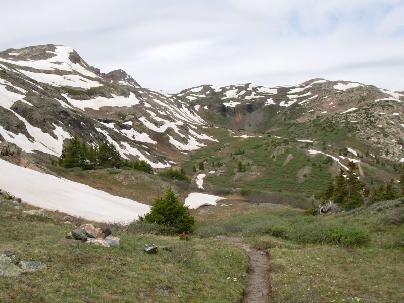
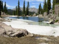
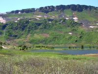
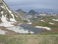
Saturday, June 10 10 miles to Archuleta Lake
We took a day and a half off in Pagosa Springs. It was fairly restful as the downtown area is relatively small. The town is having a folk music festival this weekend that I considered attending, but I was more eager to get back on the trail than to listen to the music. The cost of staying an extra day or two was also a consideration.
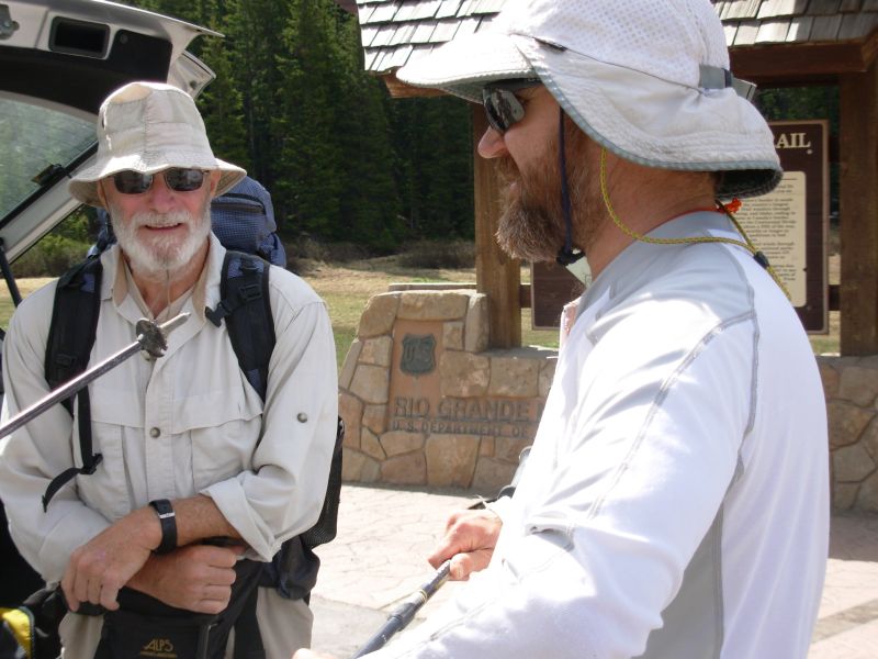
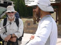
We enjoyed a few meals in town with John and he came back to the trail with us. Id read his 2004 CDT journal, so I felt like I knew him a little bit. He had read our journal, so it was mutual.
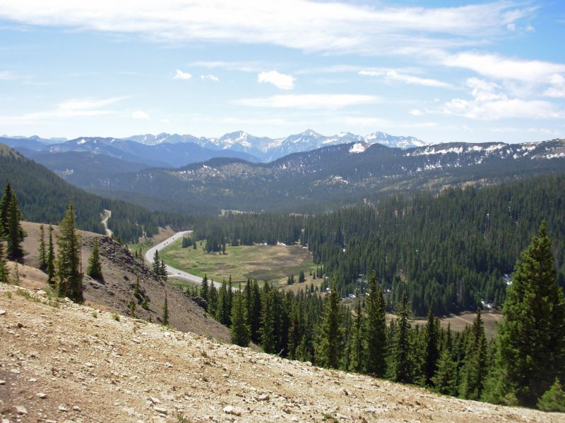
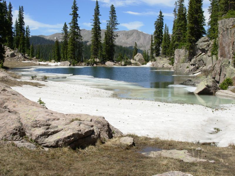
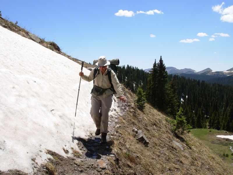
We got a ride back to the trail with the owner of the outdoor store, a very nice man. Today was a beautiful sunny and cool day. No rain, hurray! The trail was mixed: some areas clear and some snowy. One section was a bit difficult for me, but mostly it was just wet. We met a southbound hiker who was finishing up the Weminuche. Matt had been hiking for about a month.
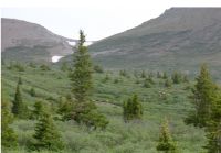
He gave us some idea of what lies ahead. After talking to him, I decided that Id like to avoid the area known as the Knife Edge. Matt met some of the thruhikers ahead of us. There are a few who attempted the trail through the San Juans, despite the snow. The snow is melting really fast. The trail is often a running stream. Matt, the section hiker, works for storycenter.org, an interesting project. I really didnt expect to see anyone besides thruhikers out here so early in the season, so Matt was a surprise. This wilderness is one of the most remote on the CDT, especially this early in the season. Mid-summer you get the boy scouts and other groups, but it still feels fairly wild.
Were feeling the altitude so were slow in the climbs. Jim is coughing a bit. We got a late start (10:30) and decided to camp near Archuleta Lake after only ten miles because there is a good 800 climb from the lake. We have a nice campsite in the sun; who knows what lies ahead? John decided to keep going, so well go back to following his footsteps for a while.
Im happy to be here, though a bit worried about the long stretch ahead. Its 120 miles to the next road. That doesnt sound like much, but at 10,000to 12,000 elevation, with snow on the trail, its a long way.
Jim: We got a late start - as expected - but at least we're out of town. The weather was warm and sunny. Well - relatively warm anyway. The trail had some snow patches on the north-facing slopes but nothing serious. The snow patches only lasted for about a mile. When we were here in 1997, a trail crew had just spent a month rebuilding the trail on the north side of Wolf Creek Pass. When we came through in 1999 much of that work had been destroyed. Today there's little or no sign that anything had ever been done here. The problem? Horses. But this IS a multi-use trail and by law horses are to be accommodated on the CDT. Doesn't mean I have to like it sometimes.
I slipped at one point and gashed my hand, but it's not as serious as it looks. More serious is my reaction to altitude. But we'll see where that goes in a day or so.
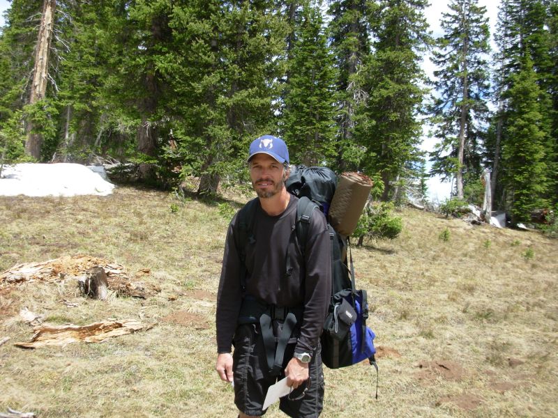
John Brennan (Cupcake) left town with us. He's likely faster than we are so we'll enjoy his company while he's with us and wish him Godspeed when he leaves.
Sunday, June 11 16 miles to E. Fork Trout Creek
Snow wasnt much of a factor today, but it was still a strenuous day. We climbed 3300 and dropped 4300 at this altitude thats significant. It started out very cold: frozen puddles on the trail and frozen boots. We began late, unable to force ourselves out of the warm tent.
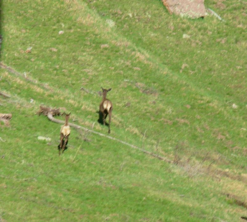
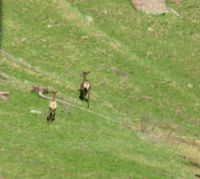
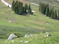
First was a 750 climb to Hope Pass. Then we walked along the divide, enjoying beautiful views and a cold wind. We did a lot of up and down before dropping to Piedra Pass where we met up with John. We had stopped for lunch on the way down and saw him about ½ mile ahead of us. The first 13 miles there was almost no snow. After that, as we rounded a couple of peaks, including Palomino, we ran into a few large drifts. We also saw a herd of elk. First one ran across the trail to the left; then we looked up and saw six more, running uphill to the right. There were two small calves. Later we spotted a couple of mule deer, bouncing into the woods and one more elk hidden in the trees.
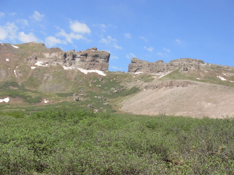
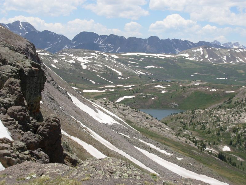
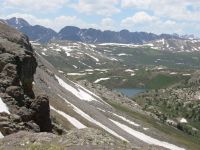
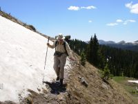
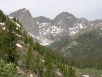
Because of my falling phobia, we decided to detour around the Knife Edge, which is still covered in snow. I gather its a bit dicey even without snow and ice, but right now it has a dozen or more icy snow chutes. Since Jim and I arent carrying ice axes, going around seems like a better idea. John decided to hike it anyway. The Trout Creek detour is a long one: we'll drop 2500 down a side valley, then climbed back up to the divide again, 12 or so miles later. The trail is pretty obscure and not well maintained; we lost it a couple of times in the first mile or so. Well miss 13 miles of Divide walking. Today as we were crossing a scree slope we ran into a couple of washouts no trail, just soft wet mud. I was terrified. It reminded me of why I want to avoid the Knife Edge.
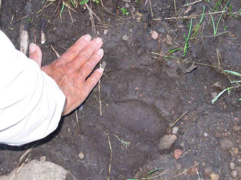
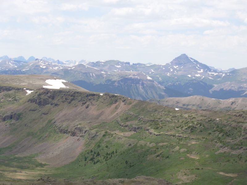
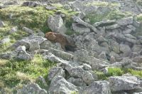
Todays mountains were awesome. One was very red. We could see the very distinctive Pyramid and Window way off to the west. Well pass them in about four days, I think. We saw bear tracks again two days in a row. The marmots are golden and very vocal as we pass.

Jim: Today was some of what I remember about Colorado - lots of rock, lots of sky and trail along the Divide. There were a few snow patches but, again, nothing too serious.
John actually did "leave" us today - he'll go across the Knife Edge, but we'll go down Trout Creek and then back up to the Divide on the other side of the Knife Edge. He has an ice ax - we don't. Whoever gets to the pass first is to leave some sign that they were there. That way we won't be leaving anyone behind for the buzzards and ants. At least not without someone knowing they're being left behind.
Finding a campsite was interesting - there aren't a lot of campsites along Trout Creek for the first few miles. But we found a flat spot in the middle of some blowdowns that was satisfactory.
Monday, June 12 13 miles
It was a frosty morning, but the sun soon warmed us up. That was a good thing since we soon began criss-crossing Trout Creek. The map showed three crossings of Traout Creek, but there were actually 13. The water was snowmelt, so icy cold. After about 10 crossings we stopped to warm up our feet as they were totally numb. The water was about knee deep, fast but not too fast, but really cold.
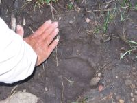
We saw two elk grazing on the other side of the creek and a very large bear track. Yesterdays track was a baby bear. That makes three days in a row that we've seen bear tracks. I wish wed see some fur.
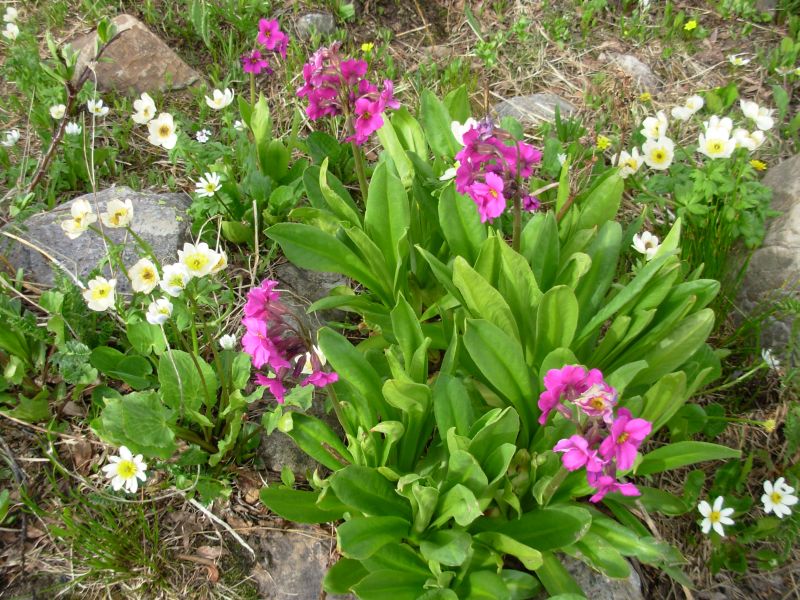
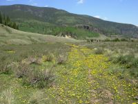
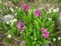
We had an early lunch in a big flowery meadow at the trail junction. From there we climbed back up to the CDT. There were lots of nice flowers today: columbine, calypso orchids, harebells, sky pilot, phlox, bluebells and three different paintbrush: hot pink, yellow and orange.
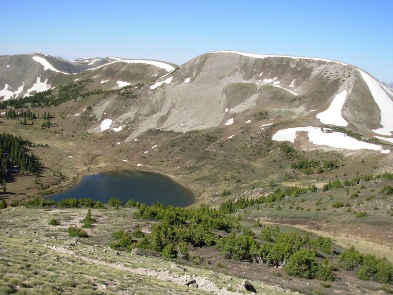
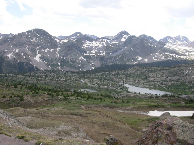
The 2500 climb in four miles up Trout Creek wasnt that bad since there were breaks in the climb. But we were slow. The lakes in the upper basin were pretty, when we finally passed them. We had no snow until mid-afternoon, then we detoured around several snow banks and one big cornice. Occasionally we lost the trail under the snow, but eventually we always found it by looking at the maps and guidebook for clues. We saw a herd of seven elk feeding 500 below us and two more in another valley. We met John again just past the point where the trails merged. He said there were 14 snow chutes on the Knife Edge, not just the four or five we could see from the valley below. He had to posthole hip deep in some of them. Im really glad we detoured, despite the steep descent and climb. I could have done without the stream crossings though. I really feared frostbite. Mostly the snow was only a problem because of the wet trail and mud. The trail was inches deep in water in places under the snow. Slippery. We stopped early, after only 13 miles. We were both exhausted and not up to another 500 climb. John joined us. There are small tarns on both sides of a pass and a nice view south. It is a beautiful campsite, one of our better ones.
We had an interesting conundrum this afternoon. When we realized that John had not reached the trail junction before us, we were really not sure what to do. He's a faster hiker than we are, so we expected to see his tracks on the trail since the distances were about the same for the two routes and we had the greater climb. We didn't know whether we should go back and look for him, or just wait to see if he showed up. While we discussed the matter, we spotted him on the trail about half a mile away. I was very relieved to see him, because I really didn't want to do the Knife Edge, especially after seeing it from below. But we knew that we would have no choice, if he didn't show up shortly.
Jim: The stream crossings this morning were a trip. We'd have both gotten frost-bitten if we hadn't stopped to warm up our feet about halfway down to the trail junction. I haven't been that cold in a long time. Last time was in the Bob Marshall in 1999 - and I DID get frostbitten that time - again from snow-melt stream crossings. We're just happy the weather's good - doing this in rain or snow could be really miserable. The climb back to the Divide wasn't all that bad - just long.
We had some really good views of the Knife Edge this afternoon - and of all the snow chutes we'd have had to cross if we'd gone that way. I won't cry over missing them.
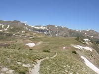
Tuesday, June 13 15 miles to Weminuche Pass
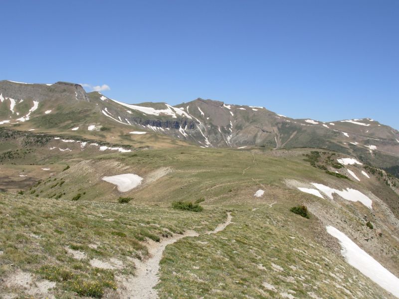
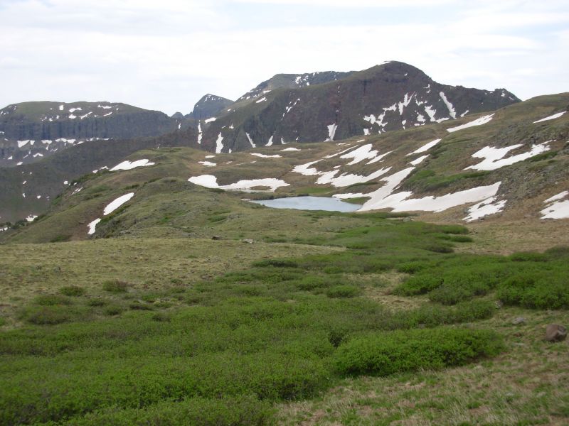
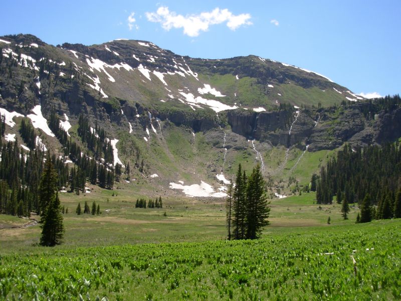
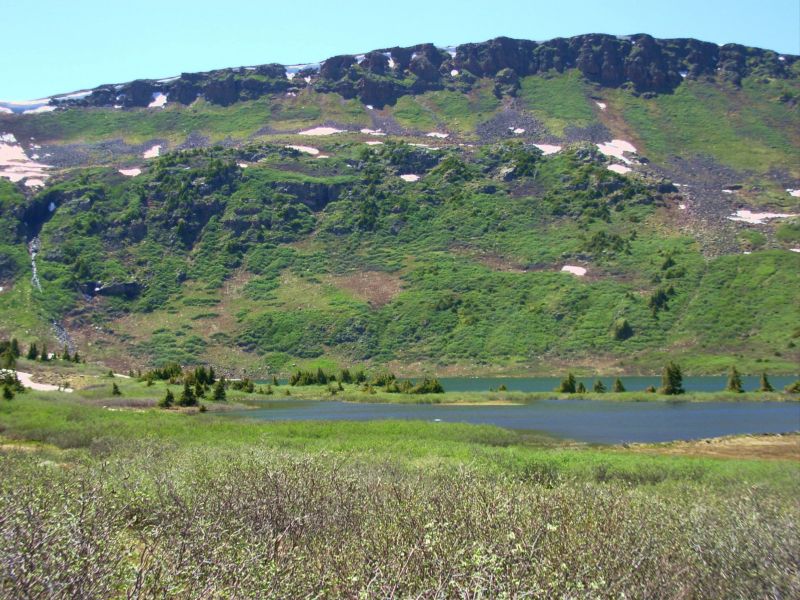
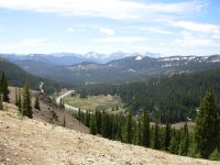
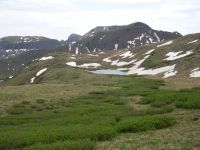
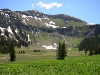
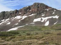
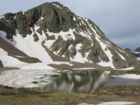
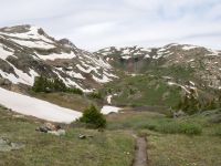
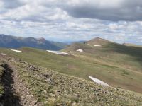
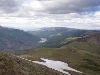
It was a mixed morning, with beautiful views of snowy cliffs and lakes, two separate elk herds (4 seen across the valley as we ate breakfast, then 11 above a lake around noon), and a fair amount of snow to detour around or cross. We had no deep postholing, just frozen drifts that were hard to stomp steps into. Only one was really difficult. The cornice I was dreading turned out to be easy, though the climb was a big one for first thing in the morning. Were slow because of the detours and very eroded trail. We hiked from cirque to cirque, lake to lake. In the afternoon we climbed up to the Divide and had fantastic views in all directions.
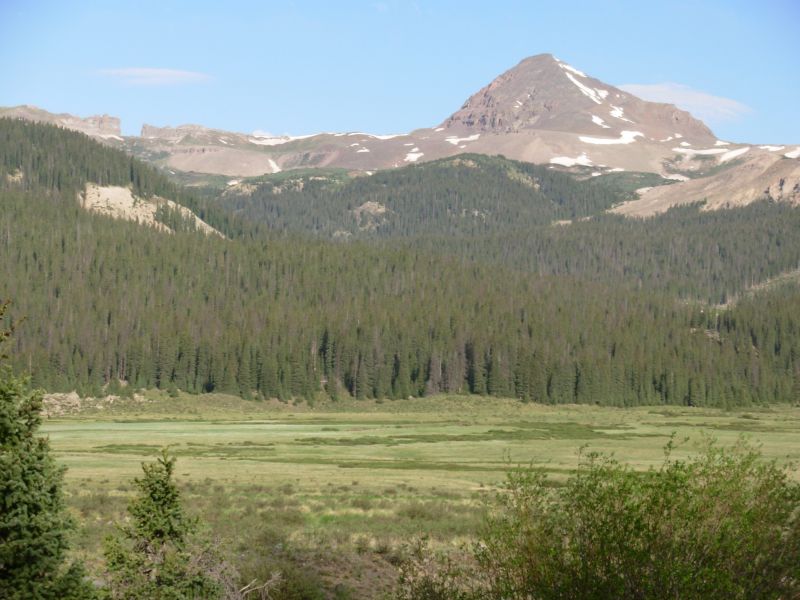
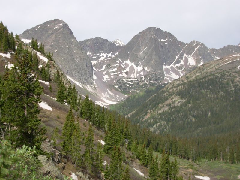
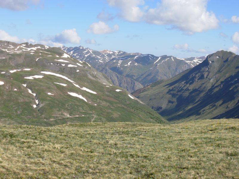
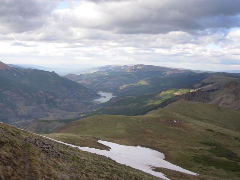
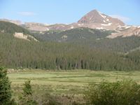
We had good views of the Rio Grande Pyramid and the Window again. The Grenadiers beyond were also beautiful. We could look across the valley to the area well be hiking in five or six days: Snow Mesa and San Luis. Jim and I spotted two mule deer as we began our afternoon climb and three elk later on when we stopped for water at Los Pinos Creek. It was a really nice descent along the river with beautiful sidehill trail above the water. One place had had a really bad avalanche; there were hundreds of trees in the creek. They buried part of the trail, but someone had cut a down and dirty detour to get around the bad spot.
Were camped at Weminuche Pass. There is a view of the Pyramid and the Window from our campsite on the edge of the broad meadow. Mosquitoes are bad. Someone is camped across the meadow about ½ mile away. It was windy all day with some clouds but now it is clear again.
Jim: It's really hard to describe this country - some people are overwhelmed by it and just want to get through it and get out. It's raw and rugged and beautiful and wild. And it can be dangerous. Well, not quite as dangerous as a city street, but here there's more of an "unknown" factor. And the unknown scares some people.
But there are also those for whom this is "home" - the wildness matches something inside them and they're comfortable out here. Little by little that wildness is disappearing.
Wednesday, June 14 16 ½ miles

Last night as we ate supper, we watched a pair of deer emerge on to the meadow. They spied us, shook their ears, and sped off. An hour later, another pair did the same thing.
It sprinkled several times during the night and as we were packing up this morning. We got a late start as a result, since we waited out a couple of showers. By 9:00 the sky was completely clear, but the wind began blowing in earnest. Crossing the meadow was strange because it was so dry compared to the last time we were here. We warned John about the wet meadows in the Weminuche, but instead of squishing, the ground was crunchy. Lunch was in a sheltered patch of willows. We had a big climb, mostly in trees with occasional meadows, up to the Window and the Rio Grande Pyramid. The view of the far side of the ridge was gorgeous, especially the Grenadiers to the west. We saw lots of elk: first two in a meadow, then 13 on a snow patch, then seven on the far side of the Pyramid. During the afternoon, a few more appeared: four lying down in a meadow and two who crossed above the trail ahead of us. I love seeing wildlife like that.

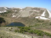
The afternoon hike down and through the Ute Lake Basin was spectacular. I especially enjoyed the view as we descended toward the basin. It was cloudy, so everything was shades of gray. The peaks reminded me of the Sierras or the Wind River Range huge granite domes. The lakes were silvery blue. It was beautiful. We walked past several lakes and tarns. The meadows were wet and full of wildflowers. I love seeing the alpine flowers everywhere.
We met some other people today: a backpacker from New Mexico who was out for just a few days and a couple on horseback with dogs. We were eating lunch in the shelter of some bushes so the horsepeople didnt see us, but it was fun to watch them head up the very steep slope we had just descended.
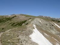
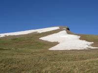
We stopped early to camp again because we found a semi-sheltered spot in the trees. Nebo Pass would be more scenic, but it is also very exposed. Also theres a 700 climb to the pass and we were tired after 16 ½ or more miles. They have built new switchbacks which lengthened the climb considerably, but it was nice to have some good uneroded trail for a while. Because of the wetness and heavy horse use, some of the trails are six inches wide and 18 inches deep. We crossed a few snowbanks, but nothing big. One took a while to detour around, but the snow is melting fast and is taking less time to deal with.
Jim: The Window, the Pyramid and the Ute Basin can be busy places in mid-summer, but this isn't quite mid-summer yet so we were pretty much alone out here. The snow isn't entirely gone - but there isn't nearly as much of it on the trail as the other northbounders encountered.
We had some wind this afternoon - I've never had a tent turn inside out on its own before. The campsite is on the shoulder of a ridge above the stream just south of Nebo Pass. We could have gone on to Nebo pass, but the wind was a deterrent. And camping up there would be really exposed. So we're camped in what's probably the last stand of trees before we go above treeline again. John stopped here with us. It's nice to have the company.
June 15 15 miles to Canby Mountain
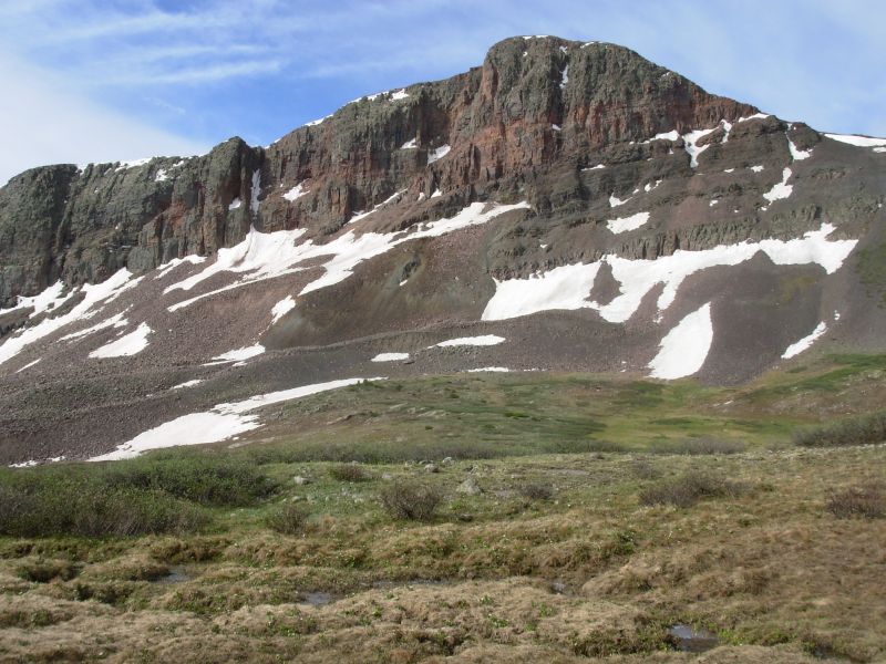
Last nights wind didnt let up until the wee hours. Just setting up the tent was a comedy: the wind tore out the stakes and turned the tent inside out and upside down. We used branches and rocks to hold it down, but it still flapped all night. When we woke the day was gray, but calm, at least for a while. Mid-morning the wind picked up again and it was really cold. Around noon we began having snow flurries, which persisted off and on all afternoon. One of my lenses popped out in the middle of a snow shower, and I had the fun of trying to put my glasses back together with frozen hands. Breaks were brief and in whatever shelter we could find. A rock pile gave us pretty good shelter at lunchtime. We decided to camp beneath Canby Mountain, next to the source of the Rio Grande River. Its a lumpy site, but we didnt want to go back up to the divide again.
The views we had between snow showers were gorgeous. Nebo Pass was especially grand, but beyond there are fantastic views of the Grenadiers, etc. The trail around Stony Pass was as bad as I remembered with PUDs (pointless ups and downs), faint trail and very steep trail. We watched John slide down about 30 while climbing a muddy hill.
We saw a large elk herd this morning about 20. Jim and I stopped to chat with a very nice couple from Durango hiking from Stony Pass to Wolf Creek. John met some geology students from New Mexico. We arent alone out here, despite the early season and all the snow.
Although the sun was shining, briefly, when we stopped for the night, while I was cooking dinner it began to snow again and continued all the time dinner was cooking. In the wind the stove is very inefficient and takes forever to come to a boil. The second the stove went out, we jumped into the tent to eat and get warm.

Stony Pass is the bail-out point to go to the town of Silverton. If anyone had stopped on the graded dirt road there as we crossed, I would have happily gone to town with them. Instead a lumpy meadow is my bed. Hopefully tomorrow will be better. I was really having problems mostly mental -- today. All the climbing (3500) didnt help and the cold meant that we couldnt stop to enjoy the views that werent hidden in the clouds.
Jim: In good weather this section is absolutely stupendous. In bad weather, it's something to be endured. We didn't have a lot of good weather. One of the reasons for stopping where we did last night was to get to Nebo Pass in morning light. But there wasn't a lot of sunshine when we got there. We took pictures anyway.
After that it got colder and wetter - when it wasn't snowing horizontally. When we got to the road we had choices - we could go up on the Divide where we'd be exposed to the worst of the weather or we could turn down the road and try to find a place to camp in the more sheltered Rio Grande drainage. Mama didn't raise any fools.
June 16 19 miles

It was a cold cold night, but we woke to blue skies and sunshine. The morning hike was an easy climb to the head of the valley, then a fun and easy cross-country bit along the Divide, then on trail down one of the branches of Pole Creek. Morning highlights included a couple of herds of elk and meeting a couple camped with two unfriendly dogs. For a minute I thought we were going to be bitten. Dogs frequently don't like backpacks as they're big and smelly, but usually they don't get quite that mean. I really enjoyed the cross-country stretch this morning as the area felt so wild, and yet the route finding was really easy. Lunch was on a small ridge, with really good views up and down Pole Creek. Our afternoon will be spent climbing another branch of Pole Creek.
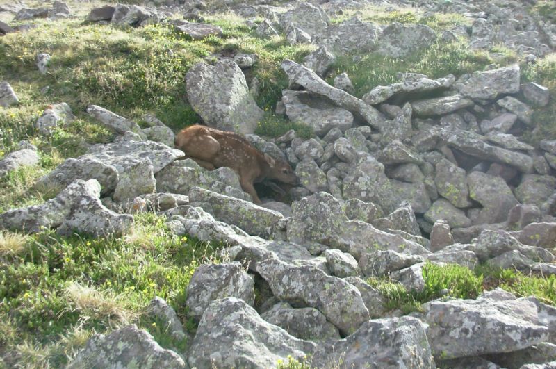
At lunch we spotted another elk and a couple of beautiful reddish-gold marmots. On the way up Pole Creek and down Lost Trail Creek I spotted several more elk, including a herd of seven grazing far below the trail, two at the pass that ran off and two in the willows. After Carson there was one in a bush, and then we saw a female with a newborn calf right on the trail. Mama ran off, but the baby was too wobbly to follow, so it played dead in a rock pile right next to the trail. I hope the mother returned. As we hurried past, we spotted Mama elk 300 yards out in the meadow, watching us and circling around. We saw our first ptarmigan brown and white at this time of year. (They change colors according to the season and are pure white in winter to blend into the snow.)
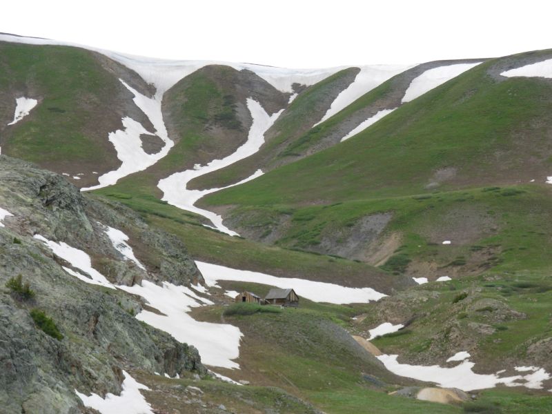
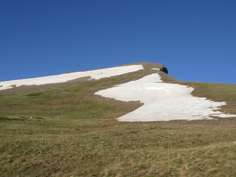
Late afternoon we hiked past the old mining town of Carson, then climbed (and climbed) back up to the divide on new trail, where we were high and exposed to a very cold wind. Views were terrific: open treeless mesas, westward to a couple of 14,000 red peaks (Sunshine and Uncompaghre, I think) and the reservoir below and east to Snow Mesa where we will be hiking in a few days. There were a couple of bad snowbanks though. There is to be a 50 mile ultrarun through here this weekend and someone had flagged a couple of alternate routes through the worst areas, but neither the icy snow nor the alternate talus routes were fun at the end of a 19 mile day. Because of the cold, the snow was rock solid. Kicking steps wasnt easy.
Both Jim and I are really tired and ready for a town break. I love the beauty that surrounds us, but our problems with altitude, plus the cold, are affecting our attitudes. Jim coughs constantly and I just cant catch my breath. When we reached Carson I was ready to quit for the day. I did not want to climb back up to the Divide. But we didnt want to camp there, so we kept on going. Then we couldnt find a place to camp for a couple of miles. I was not a happy camper there.
Speaking of talus, we ran into some beautiful trail construction yesterday. Crossing a talus field below Nebo Pass, someone had found large flat slate-like pieces to lay across the rocks, making a sidewalk. It was nice walking.

Jim: The big Malamute in Pole Creek was interesting - it wasn't the pack he didn't like - it was me. John had passed through there about two minutes before we got there - no barking. And he wasn't barking at Ginny. It's rare that a dog doesn't like me - so this was a surprise. I think it surprised his owners, too.
When we went through Pole Creek in 1997, some motor bikes had been in there and really torn up the trail. The evidence is still there, although it's a lot less obvious now. On the north side of the ridge, the trail to Carson has had considerable trail work done since '97. Not a real surprise, but I had wondered. The trail above Carson (the ghost town) was being built when we came through in '97 - and it's still in really good condition. They've also apparently built trail across the top of the ridge north of there - miles and miles of it. In '97, it was a bushwhack from cairn to cairn. That was an interesting morning in the fog.
It was up on that 13,000 ft ridge above Carson that we saw the baby elk. And it was truly a baby. Like the one south of Wolf Creek Pass, it was too young to follow Mama, so it was less than an hour out of the womb. In fact, I think when we saw it was the first time it had tried to stand up. It was that wobbly. John and I took a couple pictures and we got out of there fast hoping that Mama would come back for Junior.
Camp tonight is only a couple hundred feet lower than the plateau. Ginny and I are tucked into a break in the Krumholz and John is in the next break. Water was from a small tank up the slope. Not great, but none of us want to keep on going. We thought we were gonna camp 3 or 4 miles ago. But that didn't work out.
Saturday, June 17 13 miles to Spring Creek Pass/Creede
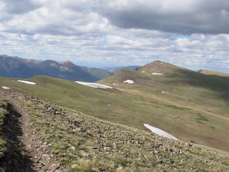
We didnt sleep last night at all -- it was too cold, there were too many lumps in our meadow, and I was too sore so we got up with the dawn and headed across the mesa to Spring Creek Pass. There were nice views toward Lake City Sunshine and Handies Peak and south toward the Weminuche where weve been hiking.
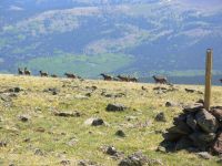
Jarosita Mesa is treeless, with some willow bushes. Theyve designated a new route that goes straight across the rocky top of the mesa. Its very rough walking, though shorter than the old route on the jeep road. We ran into a large herd of elk sleeping on the trail about 25, including 7 babies. One got separated from the rest when they all ran off. The cries were truly pitiful. We saw another herd shortly after, then walked through spruce forest for a while on jeep roads. We reached Spring Creek Pass at noon.
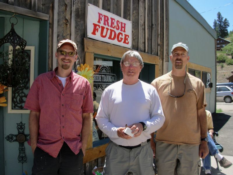
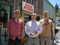
The second car going our way stopped to give us a ride. Tucker, a teacher, was on his way to meet some friends for a six day backpacking trip. At their invitation, we joined the group for lunch. Russ played trail angel and treated us to a good meal. He had seen our web site and is seriously considering hiking the CDT next year.
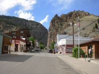
We got a room at the Snowshoe Motel currently home to a dozen bikers. Should be interesting. Because it is the weekend, we need to wait here until Monday for the Post Office. We have several boxes waiting here and besides, we need the rest. Creede is a nice town stop because its small and easy to get around. Everything you need is in one small area. People are friendly too.
Jim: This is one of the few times we've gotten out of camp before John (hmm - maybe the only time). He's usually the early riser and we're the laggards. But Ginny didn't sleep at all last night and I probably only slept about an hour. Our 20 degree Marmot sleeping bags don't do 20 degrees very well - or even 30 degrees. And the meadow was extremely lumpy. So Ginny was ready to leave at first light. And we did leave as soon as we got packed. When we got to the road, it didn't take long to get a ride. We're headed for Creede and John is going into Lake City, so we may not see him again on the Trail. We'll miss him.
Talking to Tucker on the way into Creede, he found out what we were doing and told us about his friend, Russ, who wants to do the CDT. Which led to us having lunch with Tucker, Russ, and Jay. We talked for a long time about the trail and when it was time to leave, Russ bought our lunch. Thank you, Russ. Trail Magic lives.
June 18-19 Rest days in Creede
Jim:As with every other town, things have changed. Some businesses are still here but under new management, some are gone - others are new. All of them are seasonal. And many of them are for sale. As with every town along the way.
Still, Creede is a good trail town - it has a grocery, restaurants, B&B's, a hotel, a motel (with laundromat), an outdoor shop and Internet access. And beer. In several ways it's better than Lake City - the Internet access is better, it's more compact and has San Juan Outfitters. But more importantly, if you're southbound and doing a maildrop, it's right on the way if you get forced into doing the Creede cutoff - Lake City is a long way out of your way in that situation. If you're northbound, it shouldn't make any difference 'cause you wouldn't be taking the Creede Cutoff. The San Juans are too spectacular to miss unless you have to.
It was nice to see that San Juan Outfitters is still in business - and still providing good service to hikers. We talked to them and arranged a ride back to Spring Creek Pass on Monday. They haven't been doing that, but I'm sure they will in the future for those who ask. At least they indicated so.
Home | Links| Trail Journals |
The Thruhiking Papers | Bun-bun
Created: Dec 2006
Revised: 30 Sept 2016Copyright © 2006-2017 Spirit Eagle