|
 |
 |
 |
 |
|
|
|
|
|
|
Friday, May 2: Sand Canyon - Cortez (4 miles)
Jim decided it was time to leave Cedar Mesa and continue our explorations elsewhere. Not that we saw everything therefar from itbut he was ready to move on, leaving the rest for later. It gives us a reason to come back as if we needed it. I love Cedar Mesa!
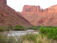
We headed south to the town of Bluff, then over to Cortez in southern Colorado. The plan was to visit Ute Mountain Tribal Park, which can only be accessed via guided tours, like Canyon de Chelly and Antelope Canyon on the Navajo Reservation. I tried to call to make a reservation for tomorrow but couldnt get anyone on the phone. We headed east anyway. It is pretty country: green farms along the river, low red and white sandstone ridges with many alcoves.
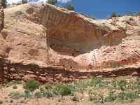
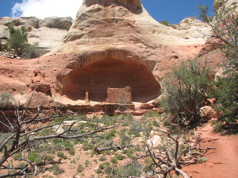
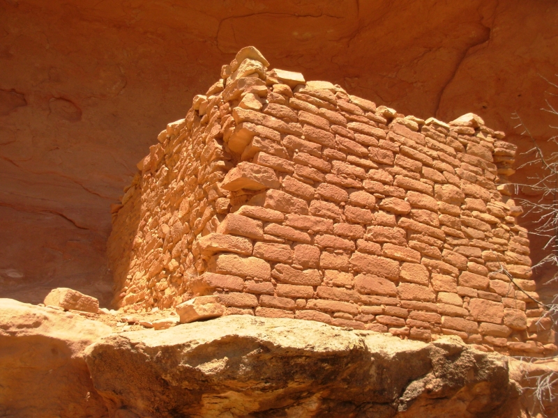
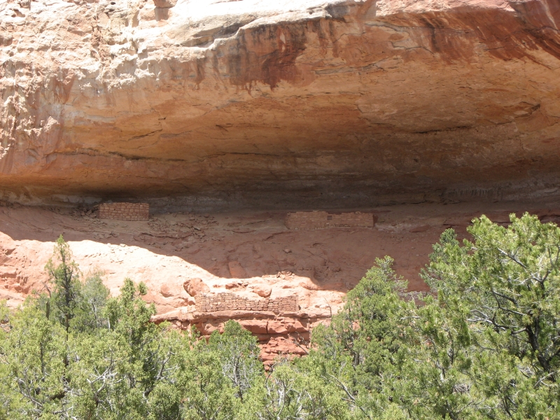
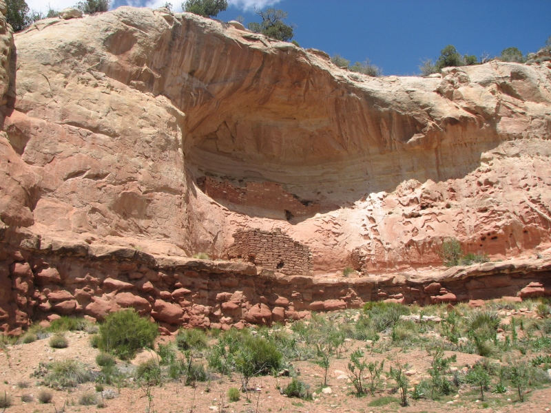
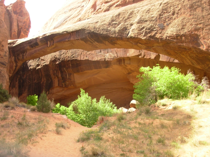
Along the way, we stopped at Sand Canyon trailhead to do a short hike. It was a cool sunny day mid 50s ideal hiking weather. The trail climbs 6 ½ miles to Sand Canyon Pueblo, but since we can access the main ruin by car, we decided to only hike a couple of miles in the lower canyon. We walked about two miles, passing four ruins, then turned around when we reached a really nice double alcove with several intact rooms. I enjoyed the hike, though it was frustrating that a couple of the side trails didnt lead to any obvious ruins. We searched, but found nothing.
We reached Cortez around 4:00, intending to buy groceries and head south to the campground on the Ute Reservation. Jim called again to make a reservation for tomorrows tour. Bad news: they dont have tours on the weekend and the next full tour that visits all the ruins isnt until Tuesday. Now what? Last year we toured Mesa Verde, Canyon of the Ancients and Hovenweep. What are we going to do with three days in this area? I really wish we had thought to call yesterday, but we didnt decide to head east until breakfast today. The San Juans are still covered with snow. How much driving do we want to do since the mountains are closed by snow? I was really upset by the wasted trip to Cortez. Jim just accepted the change in plans. A couple of beers at the Main Street Brewery helped mellow me out. I dont know what well do now, but it will work out.
Jim: One of the reasons for coming to Cortez was to see if we could get together with a friend from the AT Class of '92. But Mike was off to a bike race someplace south of here. It's not the first time we've missed connecting with people this year.
Another reason was the presumption that Cortez was big enough to have a podiatrist and I could maybe get something done about my foot. Wrong again.
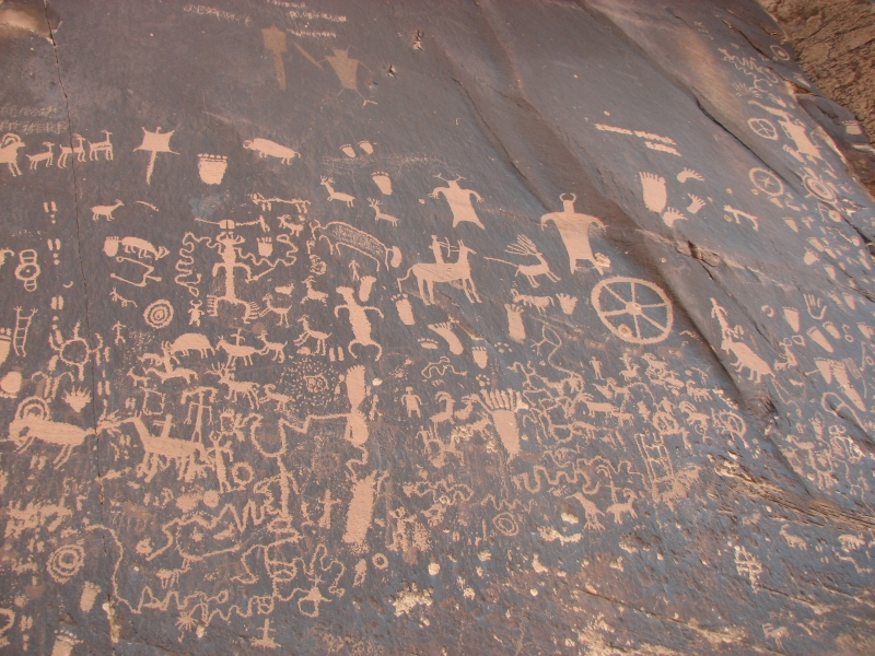
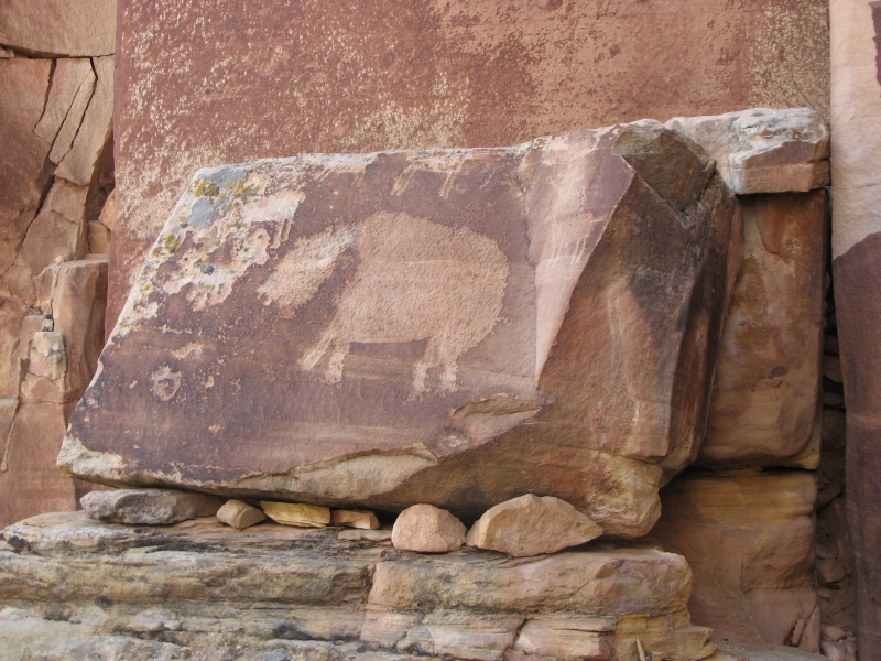
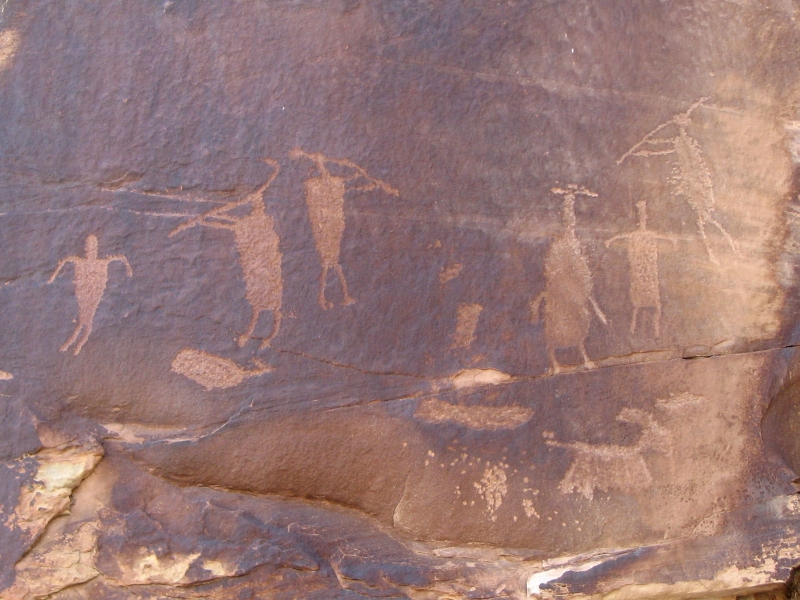
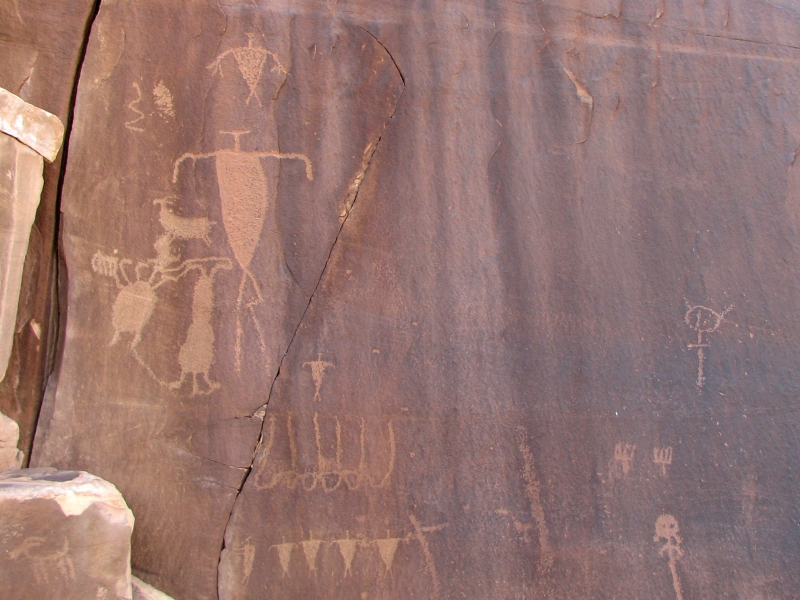
And of course there was the Ute Resevation tour. That's three strikes -Saturday, April 3: Sand Canyon, Newspaper Rock, Shay Canyon, Needles
I was still in a bad mood this morning about our futile jaunt to Colorado. A long long wait for breakfast didnt help, though spending an hour at a used bookstore did restore my spirits somewhat. It always does.
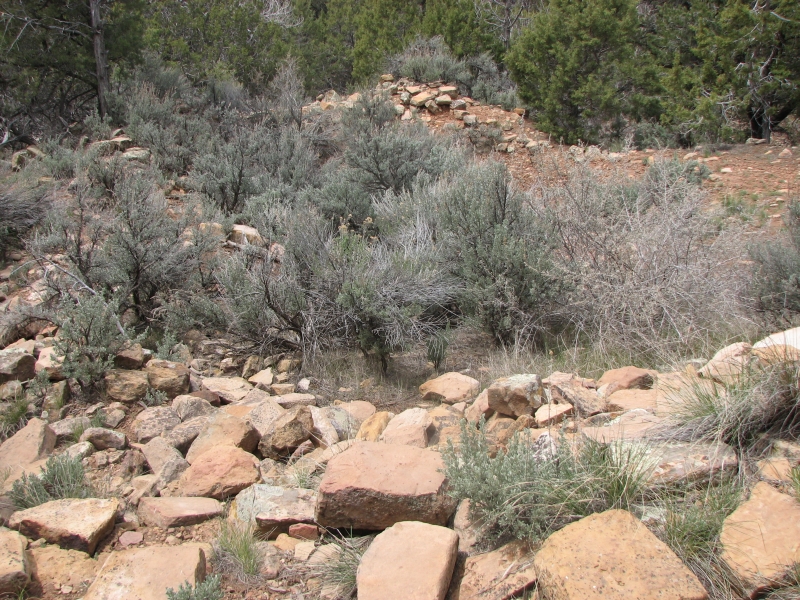
We headed north and west, back to Utah, after a brief detour to Sand Pueblo. It was a huge one with over 400 rooms, including 100 kivas. Now all that remain are piles of rocks; no trace of the 14 towers, no intact walls at all. It had interesting interpretive signs explaining what used to be there, but today little remains but rock piles.
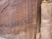
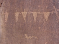
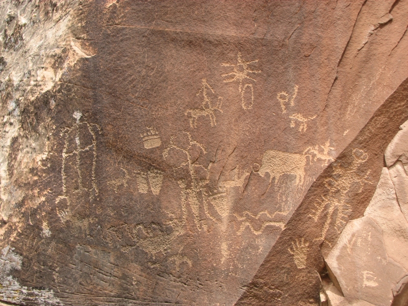
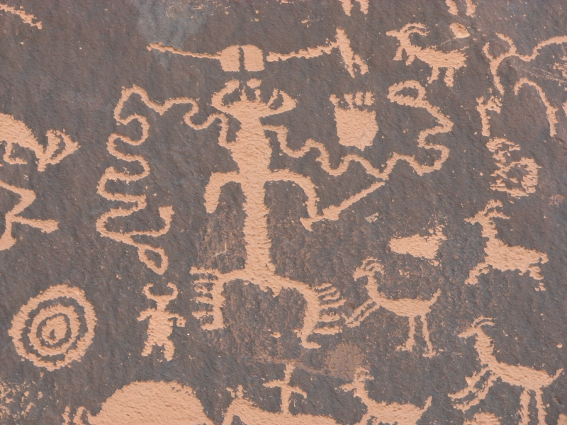
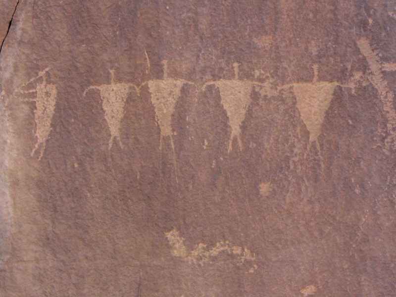
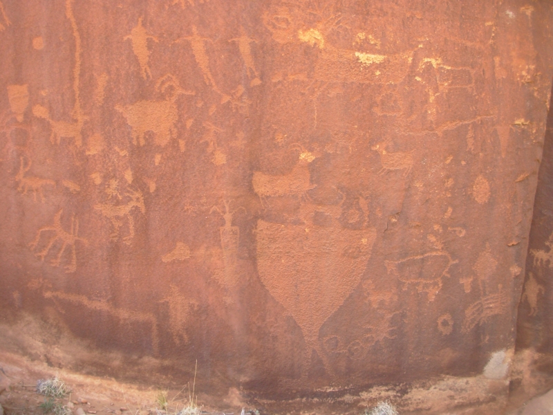
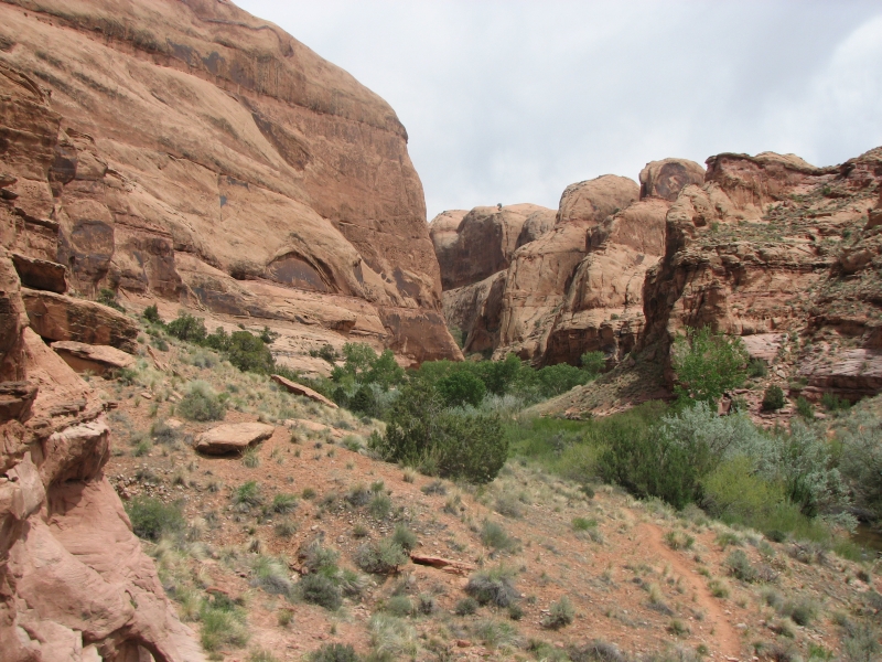
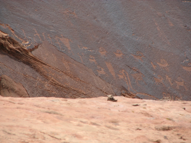
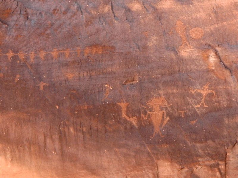
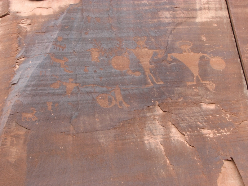
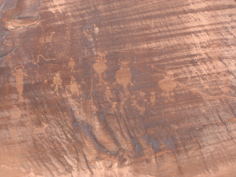
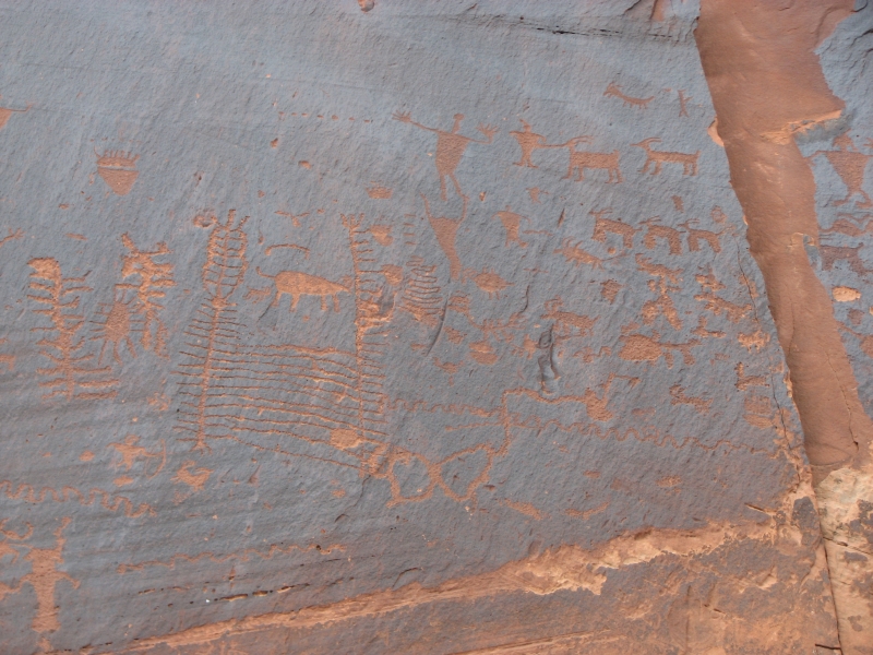
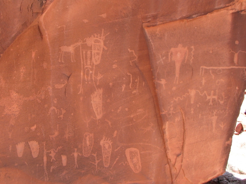
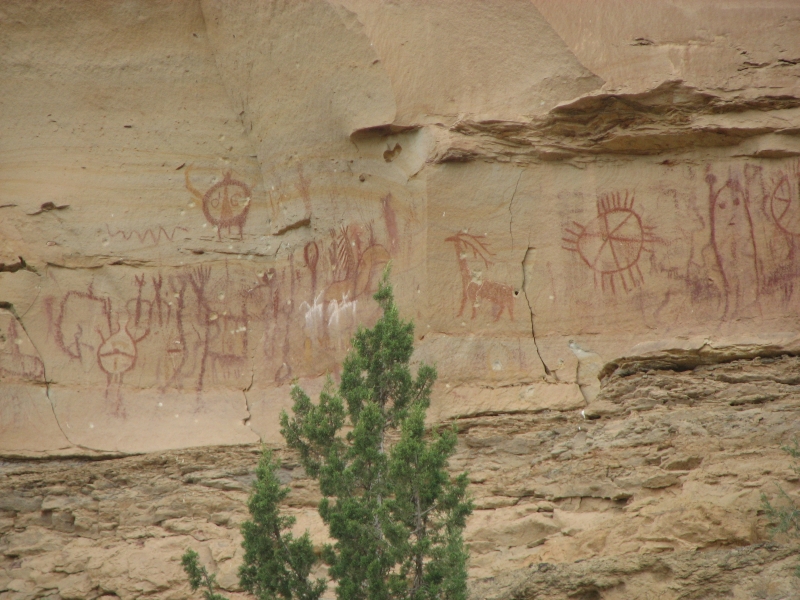
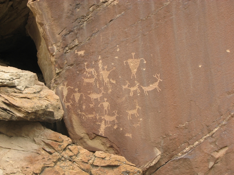
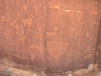
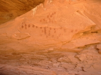
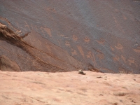
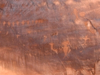
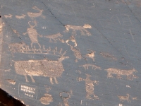
We decided to go to Canyonlands, since there were a couple of backcountry sites I wanted to see, if possible. On the way, we stopped at Newspaper Rock, an impressive petroglyph site, then a couple of miles farther is an even more impressive (though much less well known) site called Shay Canyon. We had to jump across a small creek (a bit scary for me, though the rocks on either side were pretty flat) then walk 200 yards to a cliff face that had several very nice panels. There were Fremont men, Kokopellis, dancing deer, lots of bighorns, old abstract designs, etc. Very nice.

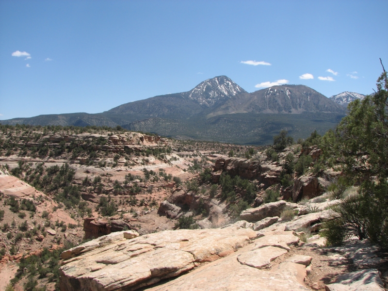
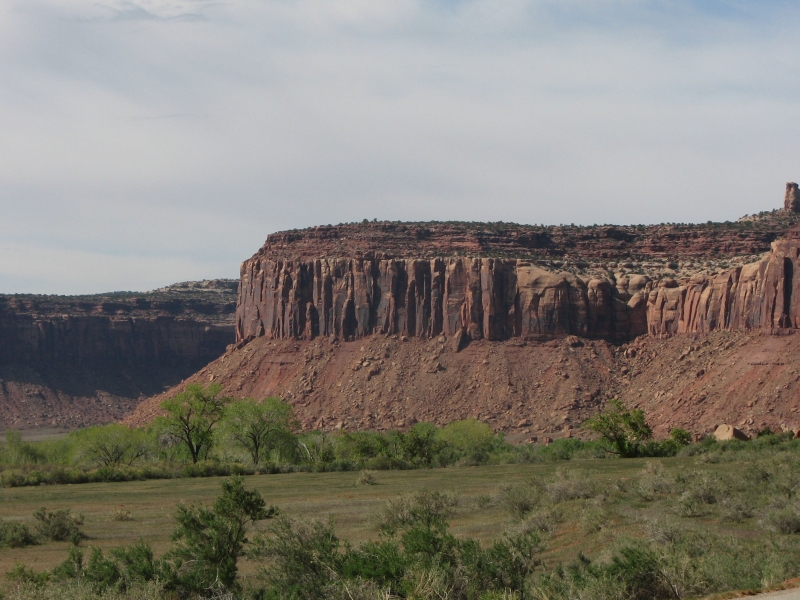
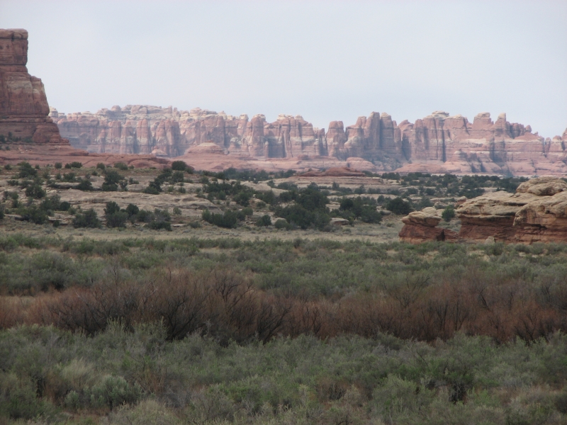
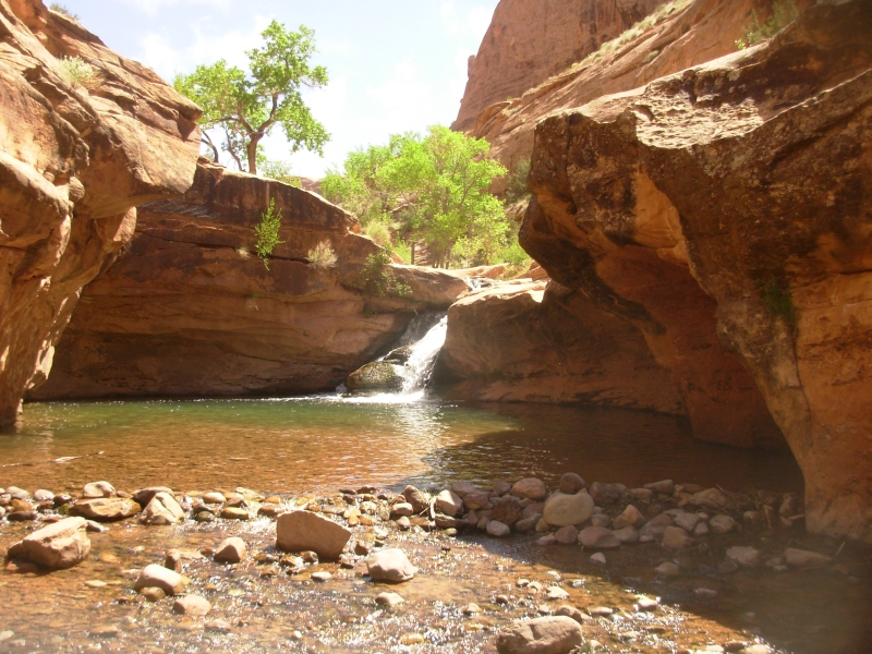
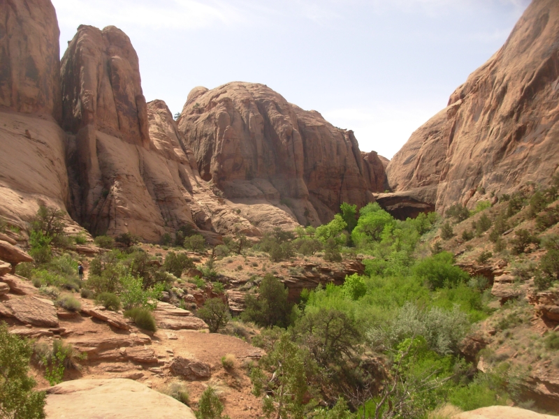
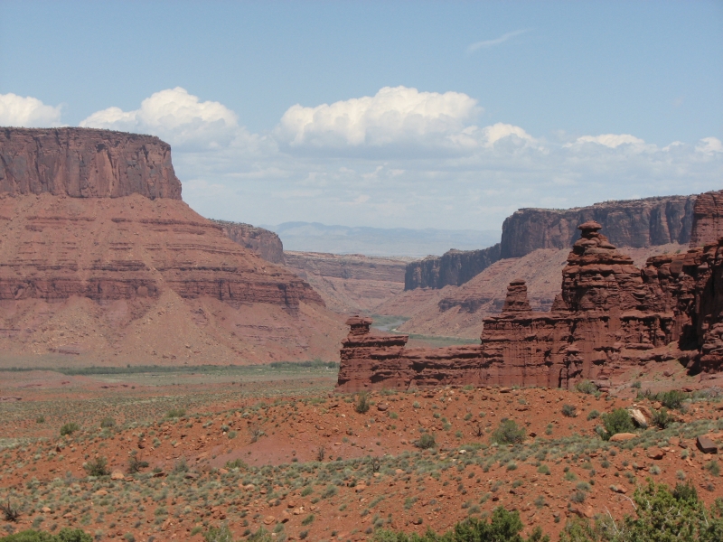
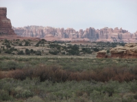
The drive in to Needles is a long one, but very pretty with red and purple ridges all around. It is evidently a very popular area with rock climbers, especially on a Saturday. With Jims foot problem, Im not sure how much well be able to do in Canyonlands. Its very frustrating. I had hoped to visit Davis and Lavender Canyons, but the owner of the Needles Outpost, where were camped, told us that 4WD is definitely needed to get out there. Weve done all the short hikes in the park and I dont think Jim is up to a 10 mile dayhike or another backpacking trip. Still, it is a pretty drive and we have a nice campsite on the edge of the park, so it was worth the trip. Looking out at the Needles off in the distance from the shelter of a red sandstone reef is inspiring.
Sunday, May 4: Canyonlands to Moab
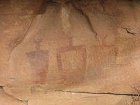
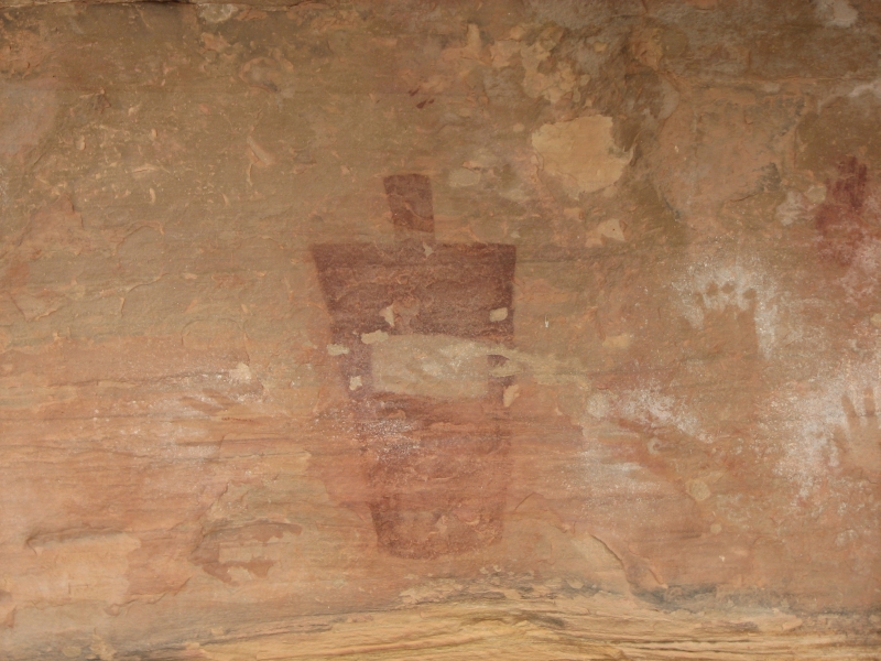
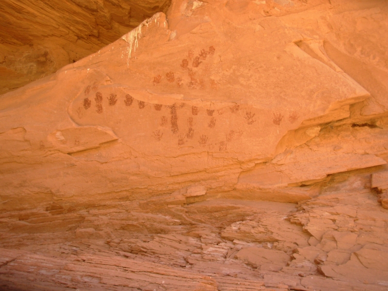
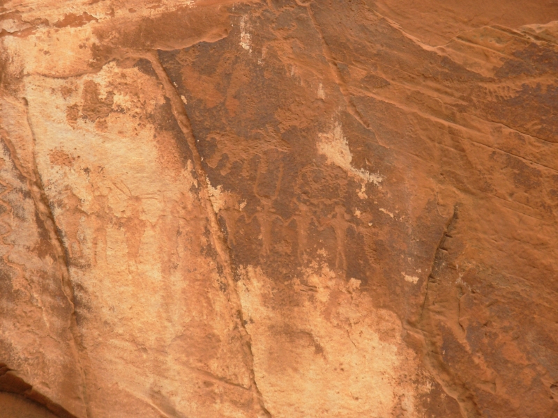
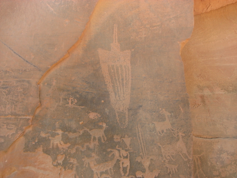
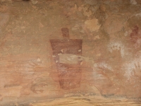
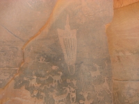
We started the day with a short walk across the desert. We were told about a relatively unknown pictograph panel with Barrier-style figures that we decided to try to find. It took some wandering, but eventually we found the alcove with a dozen or so large red figures. Two had companion animals. One had a snake. Their garments were striped or zigzagged. The images are at least 2000 years old which I find absolutely fascinating. Handprints covered the other walls. It was a good start to the day.
We stopped at the Needles Visitors Center and they confirmed that access to Davis and Lavender Canyons requires 4WD. The guidebook doesnt say that, but the road has probably deteriorated since Kelsey was there. Horse Canyon, which was my first choice, is an eight mile hike each way, and with Jims foot, its not an option this year. You can drive in, but it takes 4WD as well since you cross Salt Creek several times. It isnt happiness, but between Shay Canyon and this mornings Barrier images, I feel the visit to Needles was worthwhile, despite not being able to go to Horse, Davis or Lavender Canyons as I had hoped. Next time well rent a jeep in Moab so we can get out to the more remote places.
Since hiking was out, we drove north to Moab. At the Visitors Center, we asked whether there was a health clinic in town. Luckily, there was one that was open. After x-rays, it was determined that Jims foot problem is not a broken toe, but Mortons Neuroma. Hes depressed. Broken bones heal much faster. The doctor diagnosed it but wouldnt treat it. He suggested we find a podiatrist, which means going to the Salt Lake City area or back to Colorado.
We got a motel, did laundry, ate dinner at the Brewery and got cleaned up. Its time to rethink our summer plans.
Jim: The good news is that it's not a broken toe, which is what it felt like. The bad news is that it's not a broken toe. Morton's Neuroma is a nerve condition that can take a LONG LONG time to heal - if it ever does. And since the doctor wouldn't treat it, I'm still stuck with a lot more non-hiking than I'm gonna be happy with.
Monday, May 5: Moab, North Fork Mill Creek (4 miles)

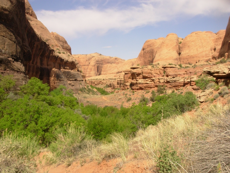
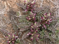
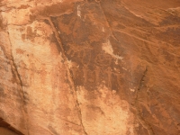
I hiked solo today, which was a mixed experience. I missed Jim, especially when things went awry, and I felt pressure to hurry back so he wouldnt worry, but I was also glad not to be worrying about how much he was hurting or waiting for him to catch up. North Fork of Mill Creek is a pretty area just south of Moab. There was water in the creek and green trees, red canyons, and lots of alcoves and caves. The guidebook map shows some petroglyphs and pictographs, my goal for the hike, but neither site was particularly interesting: just carved bighorns and painted handprints.
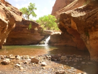
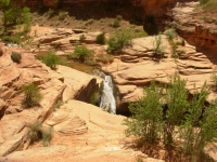
There were a couple of waterfalls with big pools that made me detour up the rocks. The first was easy: a gentle climb up slickrock. The second was harder: a narrow staircase of holes in the rock for hands and feet. Going up was tricky; coming down was downright scary. I sat on the edge for 5-10 minutes, trying to get the nerve to go down the ladder. It wasnt easy because I was really afraid of falling to the rocks below.
I had the upper canyon beyond the falls to myself, but on the way out I ran into several groups out for a swim in the stream. The area was confusing because of a multitude of use trails. I started out on the wrong trail. I soon realized my mistake, but had to bushwhack across the rocks to get back to the trail along the stream. Another woman I met missed a crossing and waded down the creek, looking for the trail. A couple of hikers ended up heading up the wrong fork because they missed a critical junction. As I said, it was confusing. Still, it was pretty and I did find the rock art and make it back safely before Jim came looking for me.
We stopped at the pharmacy, grocery, and another bookstore then drove up and down the highway looking for the Canyonlands Natural History Association. We never did find it, though supposedly we were close. Finally we left town to look for a campsite along the Colorado River. There are several small primitive campgrounds run by the BLM which have the river on one side and red cliffs on the other. We found a shady site with a good view of the cliffs. I had intended to do another hike, but it was hot enough I decided to wait until morning and instead just enjoyed a lazy afternoon reading and watching cars drive by.

After supper I walked to the other end of the campground and saw three people staring at the cliff across the river through binoculars and a telescope. It turned out they were looking at a family of desert bighorns: four adults and two kids gamboling among the rocks. I came back to the car for my binoculars and showed the sheep to Jim. We watched them for a few minutes, but then settled down to read again. Its a pretty area, though busy with cars and bikes passing on the highway and lots of people looking, in vain, for a campsite. The campground was full by 5:00, but a dozen or more cars came in after that, looking for a spot.
Tuesday, May 6: Moab area (6 miles)
I started the day with another short solo hike, this time to Morning Glory Arch in Negro Bill Canyon. It is a pretty walk, very popular with the tourists since it is short (4 miles RT), easy and beautiful. The canyon is a narrow steep walled one with a clear creek. The arch was at the end of a side canyon, easy to find. There were many caves and alcoves with weeping walls and hanging gardens. It was a good little hike.
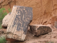
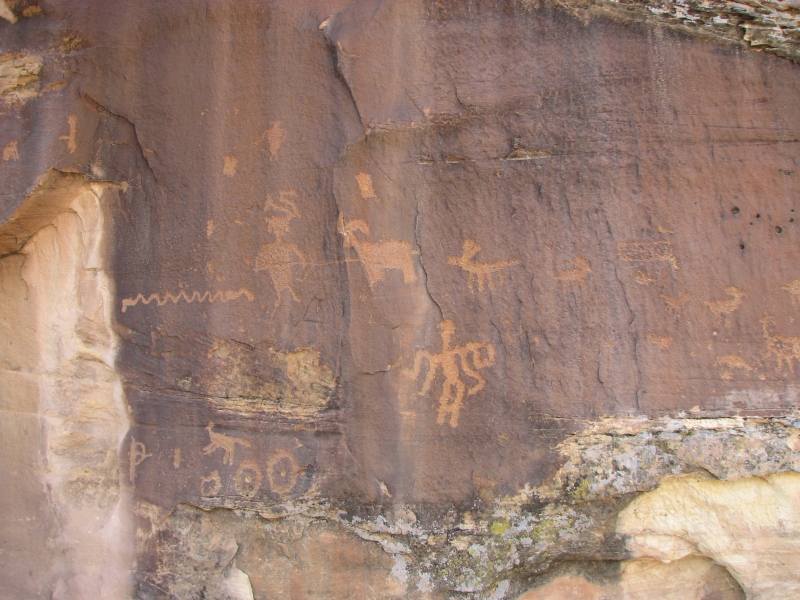
When I came out, we drove to town for an early lunch, then went back out to Mill Creek. Last night I was leafing through a rock art book and found an entry on Mill Creek, which stated that there were some boulders at the confluence of the North and South Forks with good petroglyphs. I hadnt seen them yesterday, but that area is a maze of trails through dense willows, so its not surprising. Since it is only a mile or so of easy walking to the confluence, Jim came with me to look for them. Sure enough, there were three boulders with some good images of shamen, etc. First though, we looked across the canyon and spotted a panel in a slight alcove high above the stream. Both sites were much better than the ones yesterday, but neither was shown on the hiking guide map. Im glad we went back today. Jim climbed closer to the high panel, but wasnt able to get close enough to get good photos. The boulders were easily accessible however, so we got some good pictures there.
Then we headed back out to Potash Road to some sites we had visited last year. We wanted to see how they looked in the afternoon light, plus there was one site at Jug Handle Arch we didnt get to last year. Since we have a campsite staked out, we were free to wander. Our detour turned out to be worth the time and gas. First, its a pretty drive along the river. Second, the petroglyphs really are good ones, worth a second look. And third, we did see some we missed last year, both at the Dinosaur Tracks site and at Jug Handle Arch. The light wasnt great for photos, but it was fun to just see them all. We stopped at the grocery to pick up salad and beer, then settled in at our camp next to the river.
Wednesday, May 7: Fisher Towers, Westwater Canyon, Sego Canyon
A most unusual occurrence: it rained! Not hard and not for long, but the dark clouds actually produced precipitation, for once. I think it has been about two months since we last saw rain, so in a way it was welcome. Of course, it happened while we were attempting to photograph some rock art, so the timing was bad. Oh well, it was a site wed visited before, so we werent upset. We just moved faster than usual.
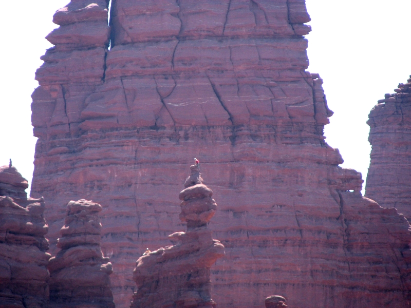
Today was a rock art day, for the most part. We went back to the Kane Road sites near Moab. Light was bad for photography, but it was fun seeing the petroglyphs again. Then we headed upstream along the Colorado past the campgrounds to Fisher Towers, some huge reddish brown rock spires. They were quite impressive, though again the light was bad for photos. We watched a climber reach the top of one of the towers that was really impressive.
One of our rock art books, Castletons Petroglyphs and Pictographs of Utah, mentions a panel near Dewey Bridge, a short distance upstream from Fisher Towers. The old wooden bridge, restored in 2000, was destroyed by a recent fire. A lot of the riverbank has been burned, apparently in an attempt to get rid of the invasive tamarisk or willows along the shore. It took a while to find the panel, since it was actually a couple of miles from the bridge, but eventually we spotted it beside the road. We did quite a bit of wandering in circles first.
Then we headed north and east to another site at Westwater Canyon. Westwater was a good site with some Barrier Canyon style images. The panels were on private land, so we couldnt explore as much as we would have liked, but we were able to spot several images from the road.
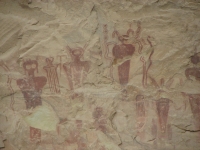
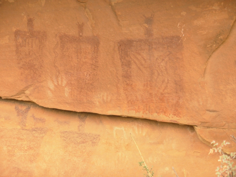
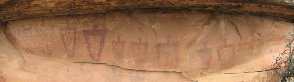
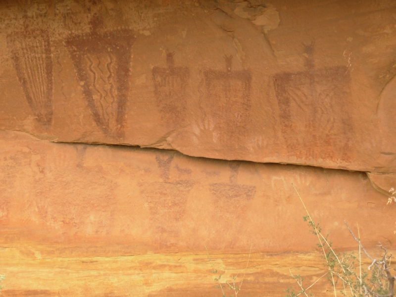
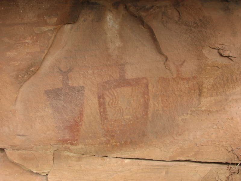
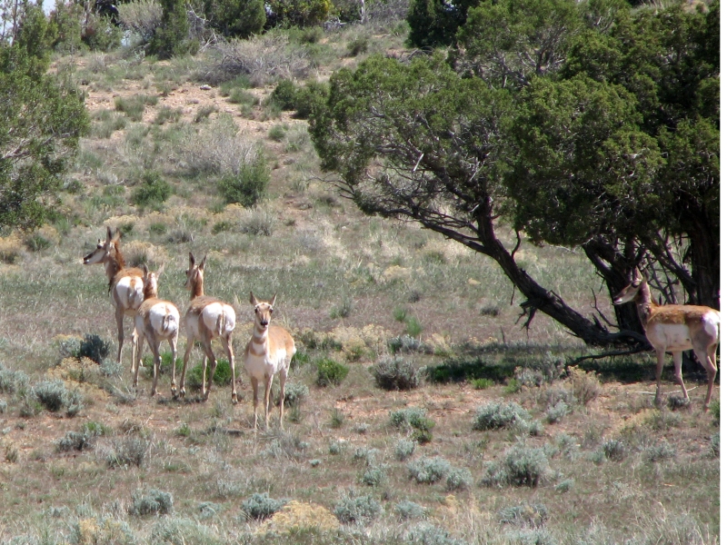
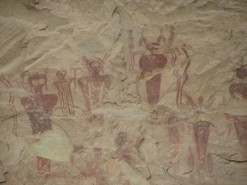
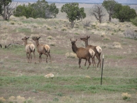
Finally we headed west again to Green River. Since we were so close, we stopped at Sego Canyon/Thompson Springs a very nice site we had visited last year. It has Barrier, Fremont and more modern Ute images, all in a short distance. The panels are really good, worth a second look. Thats when the rain started. No matter. It was a good day. One unexpected treat was spotting some wildlife: first five or six antelope and then four elk. After seeing the bighorns at our campsite this makes a good week. We even saw a deer a few days ago. What next?
Home | Links| Trail Journals|
The Thruhiking Papers Bun-bun
Created: 1 Jan 2009
Revised: 30 Sept 2016Copyright ©: 2008-2017 Spirit Eagle