|
 |
 |
 |
 |
|
|
|
|
|
|
Wednesday, April 23: Slickhorn Canyon (4 miles)
We drove to the trailhead at Slickhorn Canyon and met a couple from Michigan with a dead battery. They had been waiting since yesterday morning for someone to come along who could either jump their battery or drive them to the ranger station. They didnt seem terribly concerned though, since they hiked all day yesterday and were within fairly easy walking distance of the highway if necessary. They had plenty of food and water, so decided to just wait until someone came along who would help. Jim got out our cables and got their car started, then we took off down the canyon.
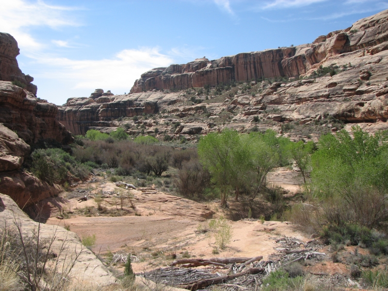
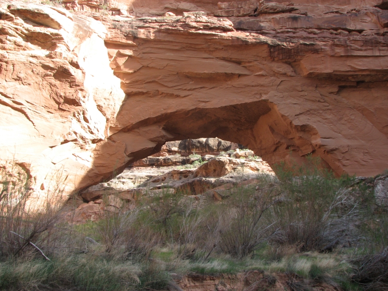
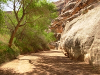
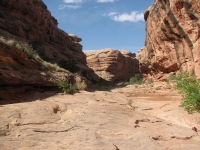
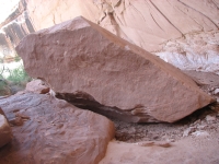
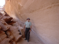
We decided to do a short backpacking trip into Slickhorn Canyon rather than dayhike from the ends. There are three ways (at least) into the main canyon, so it is possible to do either out and back hikes or loops, using the road as a connector. The closer you get to the river, the rougher the trail, so we decided to just go in at the first trailhead and head back out a few miles downstream. Jim wanted a low mileage day, so we figured that with packs on, we could stop when we got tired without having to push to get back to the car. Trouble is, Im not used to rock scrambling with a pack on. Even though the weight is low, it throws my balance off. Going up and down the slickrock just feels odd with the extra weight, so we were very very slow.

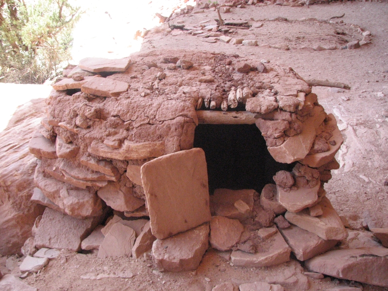
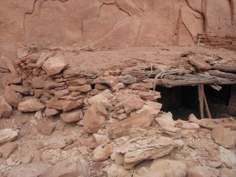
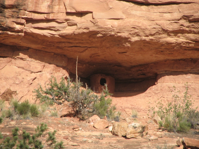
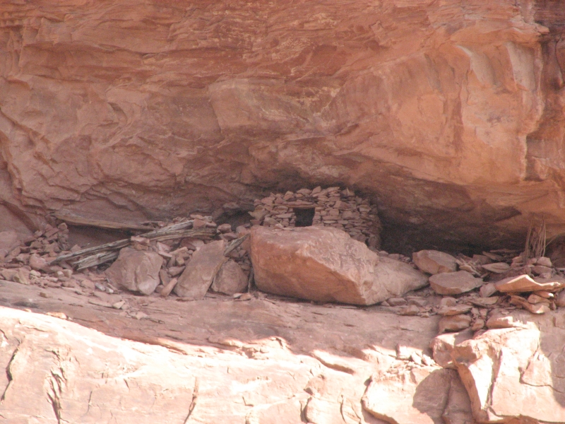
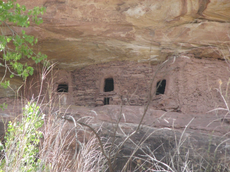
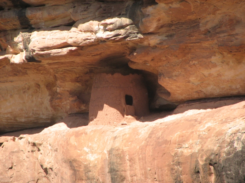
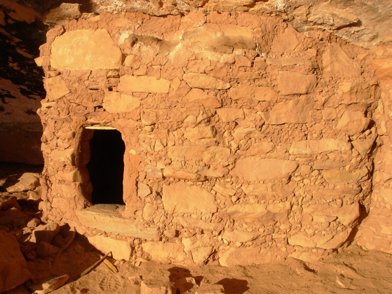
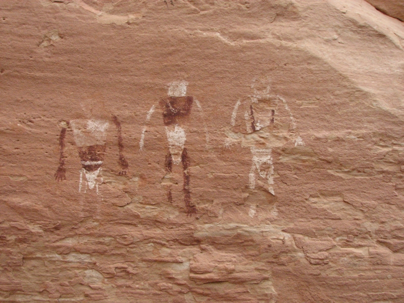
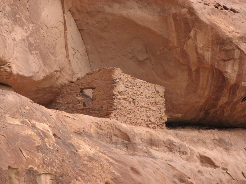
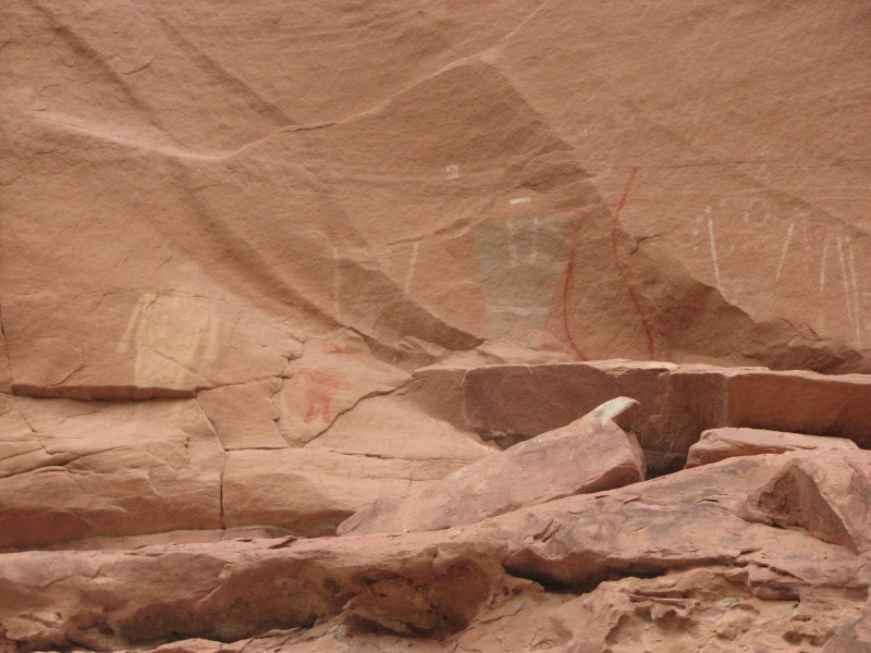
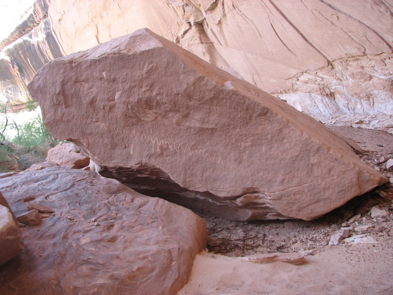
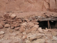
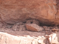
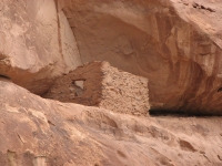
The trail starts out easy following a dry wash, climbs a bit to walk high along a ridge just below the rim of the canyon, then descends steeply back into the canyon. Soon afterwards we climbed again to a site known as Perfect Kiva. You can go into the kiva via a ladder, though officially its discouraged. We didnt go in. The roof is intact and inside the kiva there are a couple of painted circles on the walls. The couple we met this morning said there was another good ruin in the vicinity but we didnt want to do the climb to it, so we skipped it. The kiva and granary were enough for the moment.
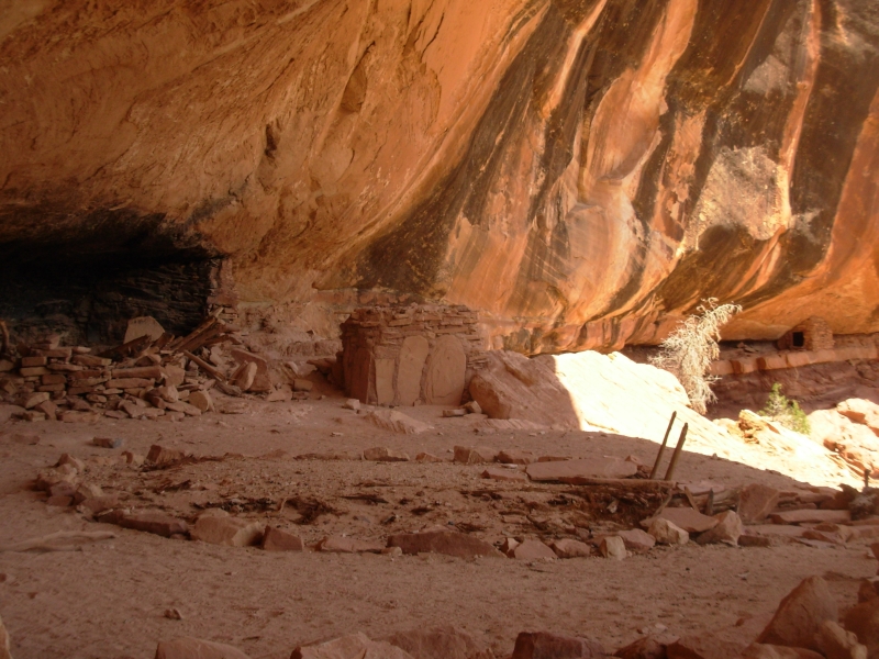
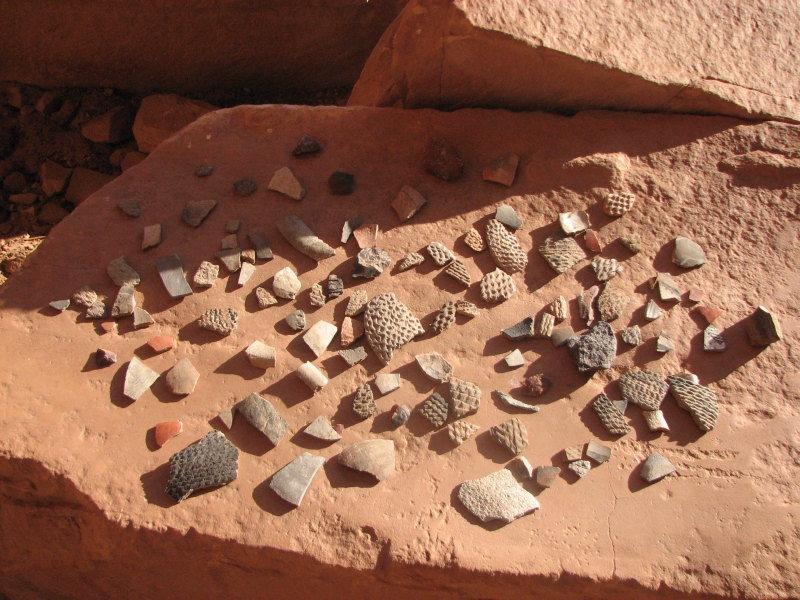
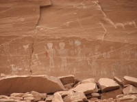
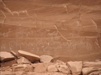
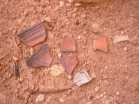
About a mile downstream the guidebook told us there were more ruins and rock art. We found the ruin, pottery shards, old corncobs and dried pinions and some very crude pictographs, maybe painted with mud.
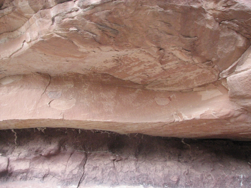
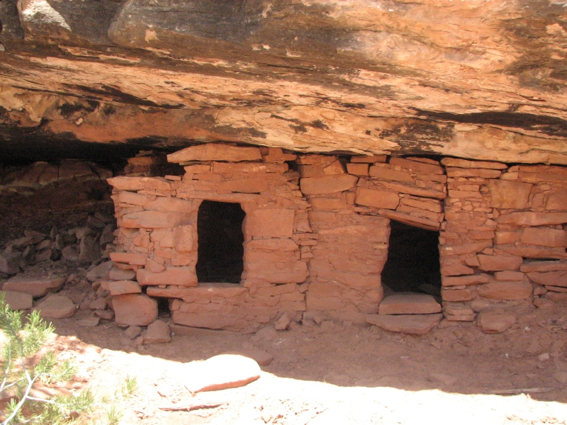
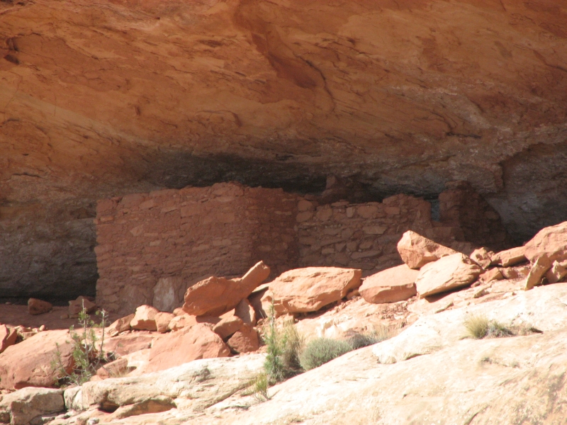
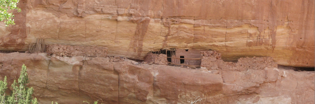
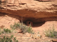
On another level in the same area we found more ruins and pictographs. The top level was cool because it was a shelf about ten feet wide extending one hundred feet or more. Not much was left up there except a few walls, but once upon a time there were homes on that shelf. Down below was a square underground room, with part of a roof still attached -maybe a kiva, since some of the Anasazi built square kivas instead of round ones.
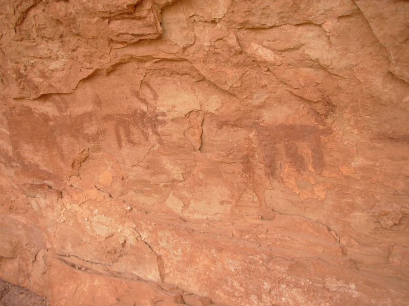
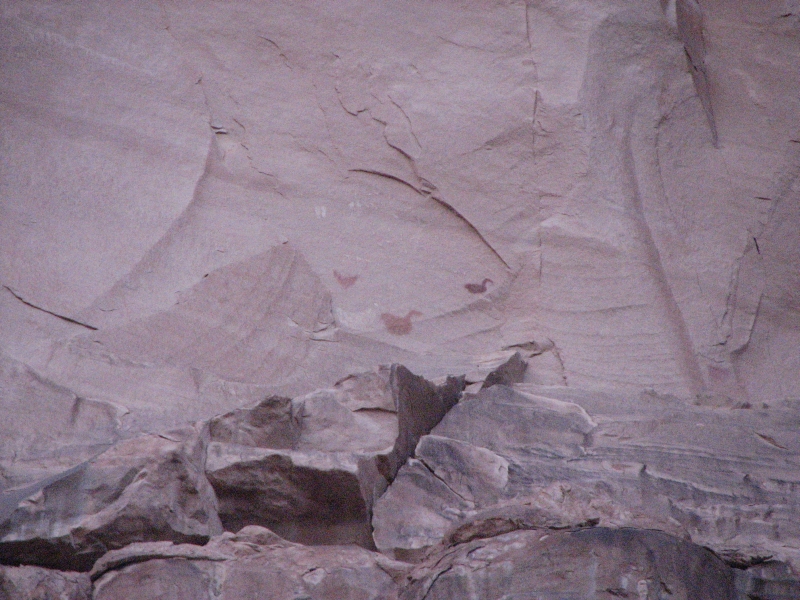
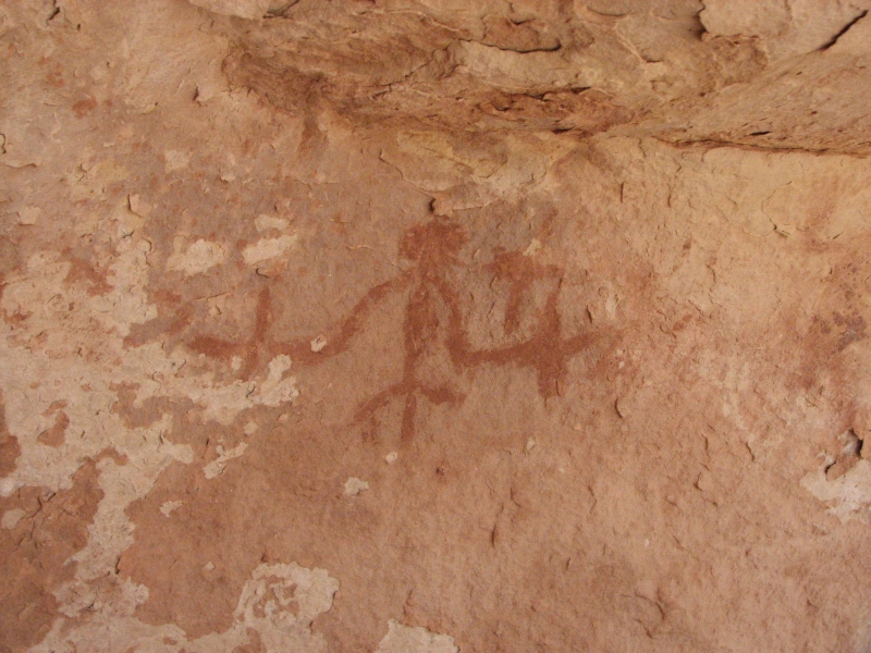
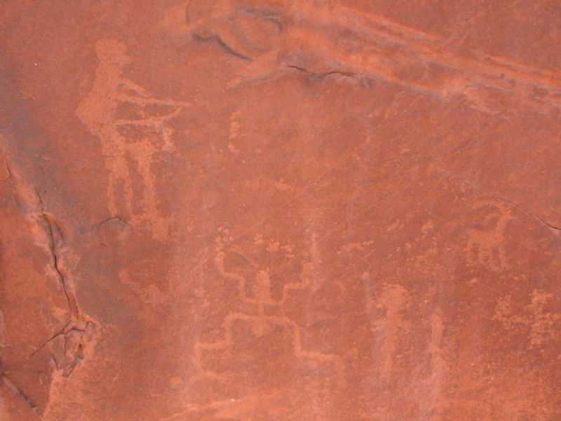
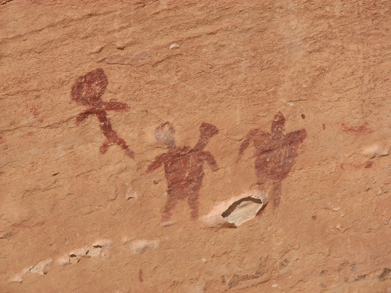
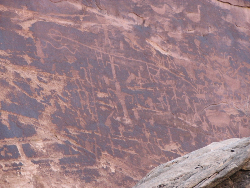
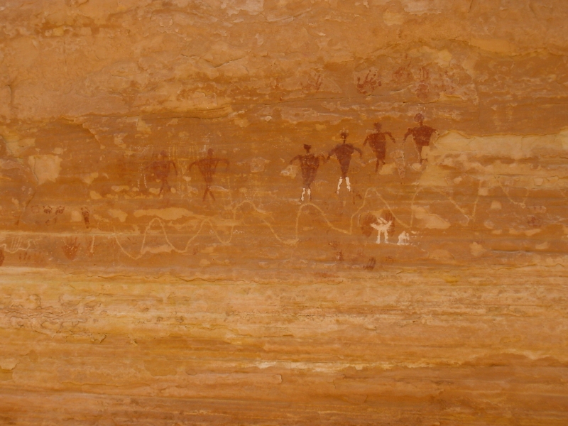
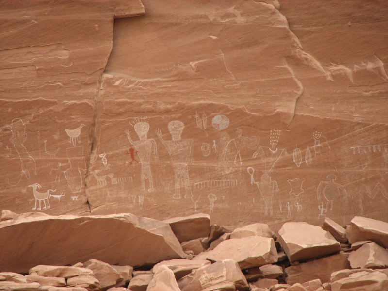
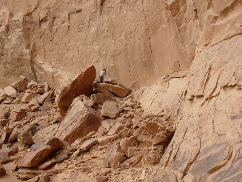
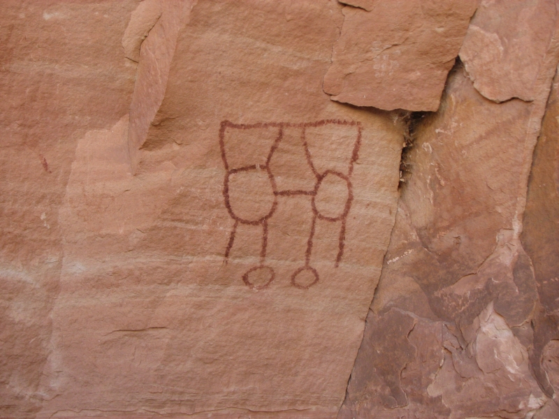
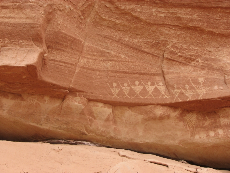
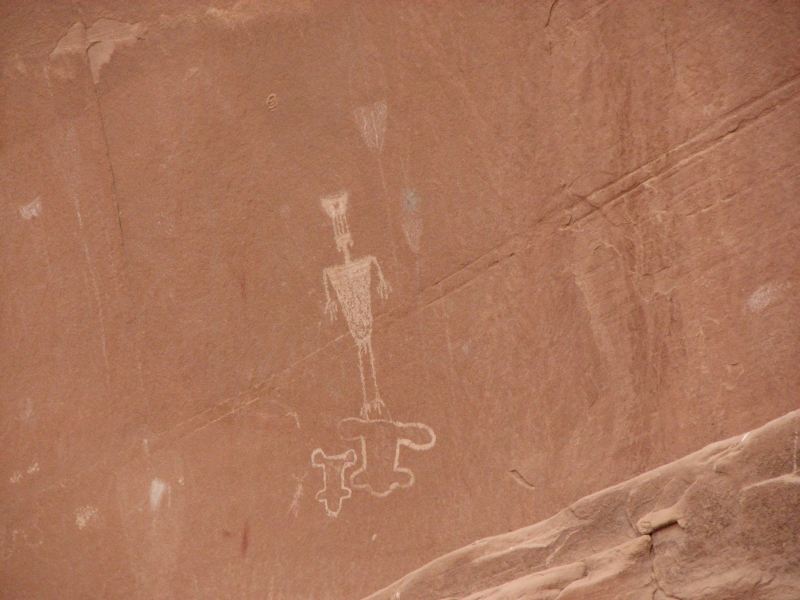
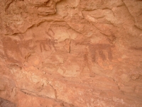
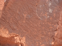
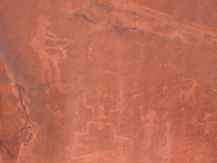
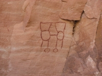
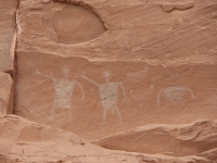
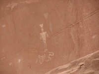
As we descended to the valley floor, I spotted a rock with a few petroglyphs. In the next curve of the river, we went looking for a cave that had pictographs. It was quite a climb to a likely looking spot, but we found three panels: two ducks plus something unclear in one, two ducks and a man in another, and several birds, a bighorn or deer and three men in another. We ended up climbing twice because we found one panel, left to look around the corner, descended a bit and looked back to spot two other panels. It was fun.
We still missed a couple of granaries and some more rock art, according to the Kelsey map, but aside from the first ruin, Perfect Kiva, there were no obvious trails to any of the sites. It was guesswork, map reading and luck that led us to the ones we found. We ended up camping at a previously used campsite near the confluence of two branches of the canyon. There was water not far away so we decided to stop early. It will make tomorrow a long day, but Id rather take advantage of the good campsite than take the chance that we wont find one for a long way. All the up and down today was tiring. Im generally all right climbing, but the steep downhills get to me. A lot of the rock is unstable; its sitting on sand after all. The slickrock is sometimes easy rock steps, sometimes a sheer smooth ramp of variable steepness. My knees and ankle give me problems and cant really be trusted, so I have to be very careful. We didnt go far today, but we did have fun. We had the canyon to ourselves. There are some people backpacking who left the trailhead two or three days ago, but we didnt see them or any dayhikers in our fork.
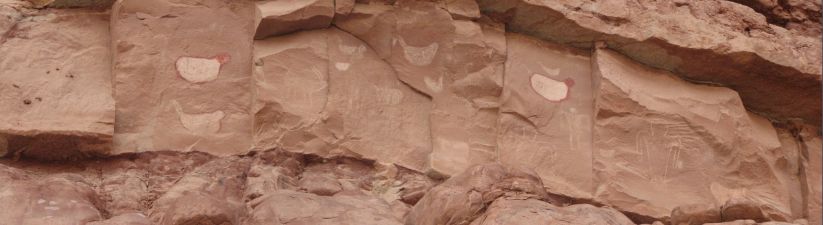
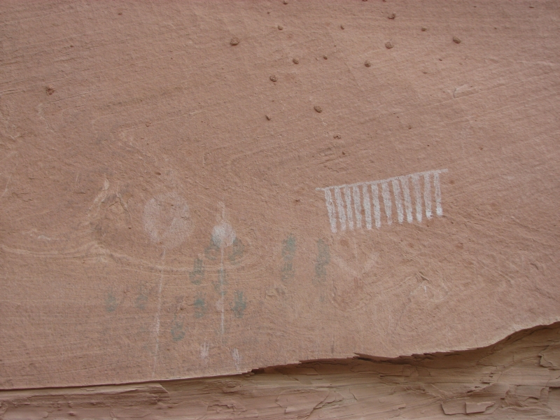
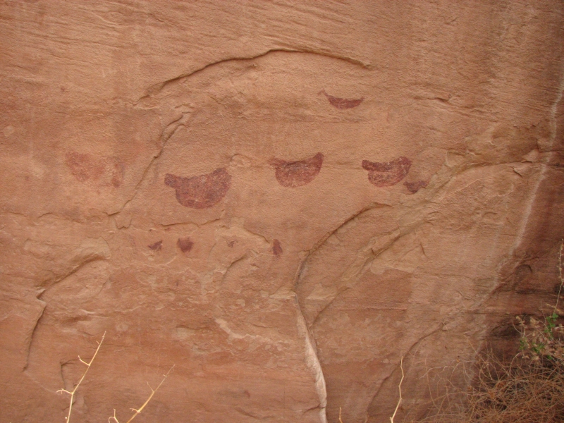
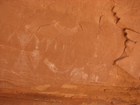
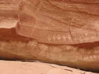
After dinner, I took the binoculars for a walk and spotted another pictograph panel on a cliff not far from our camp (five red birds and a white line of people), then found a lone petroglyph (anthropomorph), so I went back and got Jim. Together we climbed through a pile of huge boulders to the cliff face, which had three or four small petroglyph panels, maybe a dozen images in all. I was happy to find that site. The guidebook map shows four sites very close together and I think we found them all today, except for the granary, of course. I have a very had time spotting granaries which makes sense since they were intended to be hard to find.
Thursday, April 24: Slickhorn Canyon to Blanding (8 ½ miles)
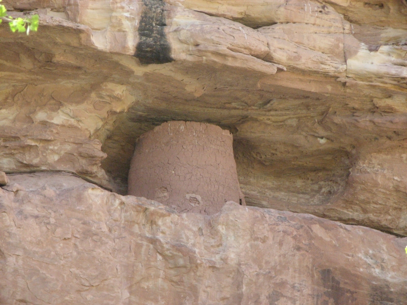
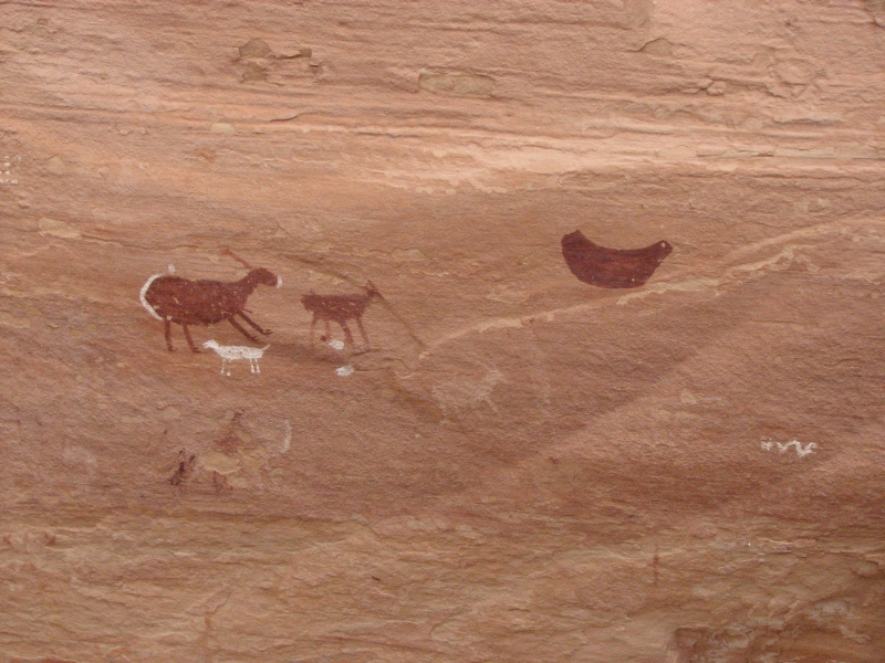
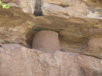
We enjoyed the rest of our hike in Slickhorn. The trail varied quite a bit, from sandy pack trail to rocky stream bottom, to climbing around boulders and up and around waterfalls. Twice we followed rock cairns that led us astray. We climbed and climbed, then found ourselves with no place to go but back to the stream. Irritating. The ruins we passed were good ones. We found the granary near the confluence with Second Canyon; it was much lower than we expected. Usually theyre high and inaccessible. Another pair of granaries was at ground level at the upper end of the canyon. As we climbed above a big dryfall, we spotted a series of small buildings on a narrow ledge across the canyon. Some were in very good shape, others falling apart. We didnt climb down and up again to look at them more closely. That ledge looked narrow! Another large alcove had a few partial walls, but barely a ruin. We also spotted three more pictograph panels, none of them on our map. Two were birds one very high and one in an alcove near the canyon. I also spotted a pictograph of a man carrying two spears/swords/crosses in another alcove.

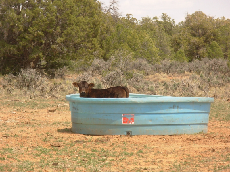
The last several miles of our hike were on the mesa, a cross-country walk past a herd of cows to the road, then up the graded dirt road to the car. There are cows all over the top of Cedar Mesa, but not in the canyons, though they used to be allowed to graze there as well. Some of the ruin sites have a thick layer of old manure. For the ranchers, not using the canyons means having to bring water in for the cows, which is less economical, but better for the preservation of the ruins. One funny incident: a calf had climbed into a large plastic water tub and couldnt get out. It wanted a swim, I guess. I thought about trying to help it out, but didnt really want to wrestle with it. The tub wasnt that high, so it would undoubtedly jump out when it was ready.


We got a ride the last mile and a half to the car from a dayhiker from Colorado. It was easy walking through the sage and juniper, but we were ready to be finished. We never did see any other hikers in the canyon. The man from Colorado had hiked in the farthest section, not the branches that we explored. It was very peaceful last night listening to frogs and an occasional bird song. Today the wind picked up, making the skies gray with blowing dust.
Friday, April 25: Day off in Blanding

Jim isnt feeling well, so were taking a day off to do chores and rest a bit. Were getting to know Blanding very well: the grocery, Family Dollar, Ace Hardware, pharmacy, the two restaurants . . . Its nice to be able to take our time with laundry and shopping, but Jim getting sick is not a good thing. He may just be tired--we never sleep much in town--or he may be coming down with a cold, or maybe its just too much dust blowing around clogging our sinuses. He cleaned out the truck, removing some of the layers of red sand and dust that coats everything, and attempting to seal some of the gaps in the cap where the dust enters. We iced his foot again; hopefully it will help ease the pain. Tomorrow will be another light day.
Saturday, April 26: Comb Wash
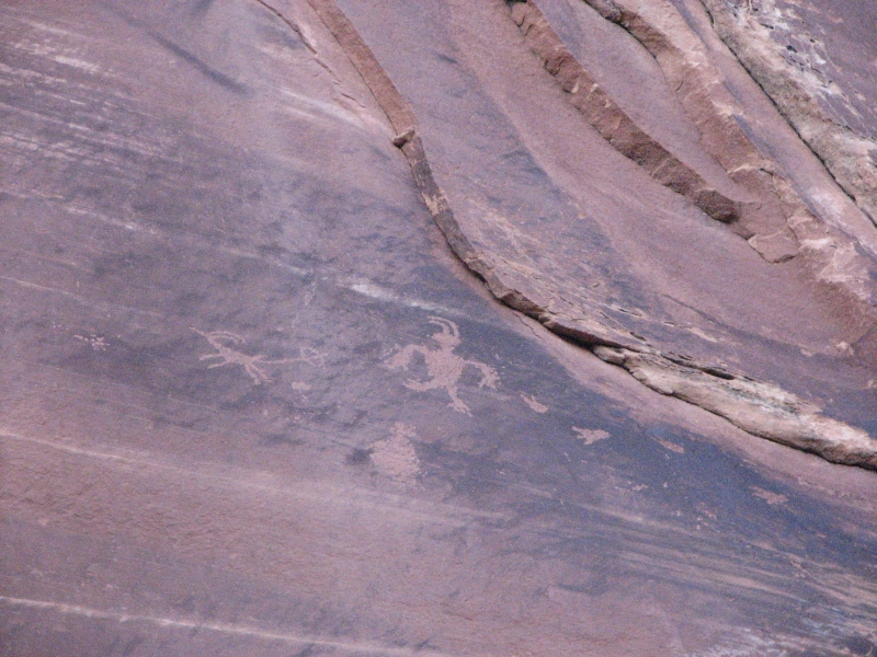
Another windy dusty day. The sky is a uniform pearly gray. The mountains are barely visible in the distance. Its in the 50s, but feels colder with the wind gusts. Neither of us felt inspired to much effort, so we took our time leaving town after a leisurely breakfast at the Old Tymer. We headed to Comb Canyon, where we searched for and found a couple of petroglyph panels on boulders just off the dirt road. The guidebook showed two sites one in the wrong location. We found three. None had much: mostly bighorns, a map and a few odd anthropomorphs (one with wings?). It was a pretty drive along Comb Ridge. Butler Wash is on the east side of the ridge, but there is another graded dirt road on the west side. The rock rises sheer for several hundred feet above the wide valley.
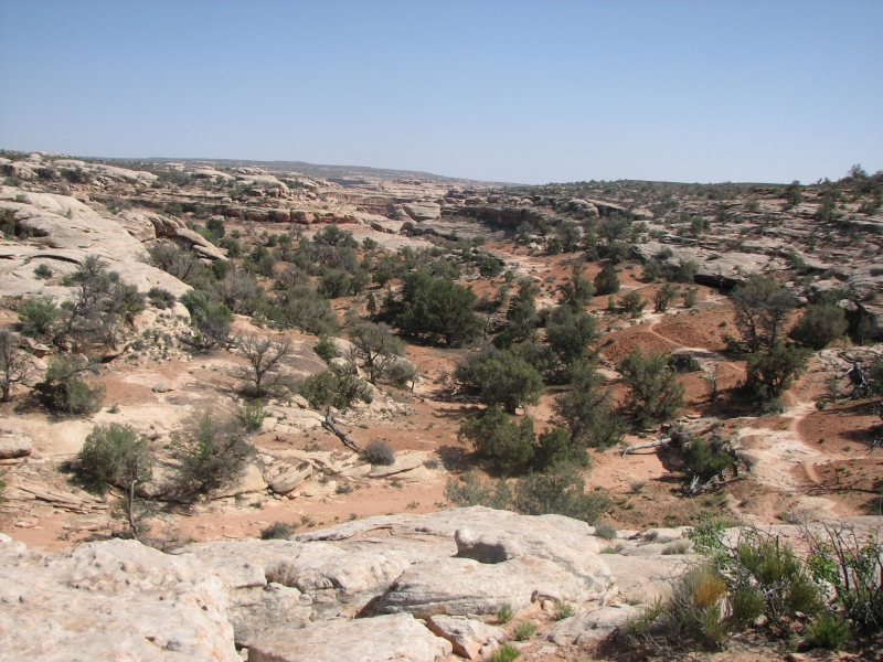
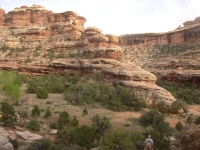
Afterward we drove out to the BLM ranger station to see if we could get a permit to backpack in Grand Gulch tomorrow. It turns out they still had 20 openings (out of 22) for the trailhead we wanted, so she gave us the permit. We drove out to the trailhead at Collins Canyon to spend the night. There were several cars at the trailhead, but few people camped in the area. Its lower and much dryer than the area around Kane Gulch, with few trees. The land stretches out for miles. There are nice red, brown and blue mesas all around. You cant see the canyons until you are right on top of them. Its beautiful country.
Sunday, April 27: Grand Gulch - Collins Trailhead to Pollys Island (12+ miles)
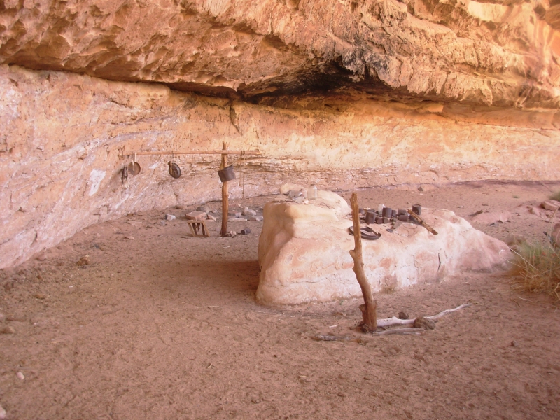
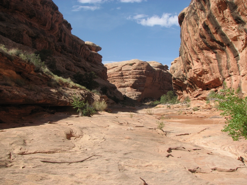
We started our backpack in Grand Gulch halfway in the section we hope to explore. Last year we hiked down Bullet Canyon, along Grand Gulch as far as Pollys Island, then back up to Kane Canyon. It was a fantastic hike, so we both wanted to explore the rest of the canyon this year. Collins Canyon Trailhead is farther downstream, with an easy two mile gentle descent to the main canyon. The trail was originally built (and sometimes blasted) by cowboys as a way of getting their cattle in and out. A large alcove once served as a cowboy campsite, and some of the old tools and storage bins were left behind.

Once in the main canyon, we headed upstream to Pollys Island. About three miles up the canyon we found Bannister Ruin, so called because it has wooden rails across the alcove, a most unusual safety feature.
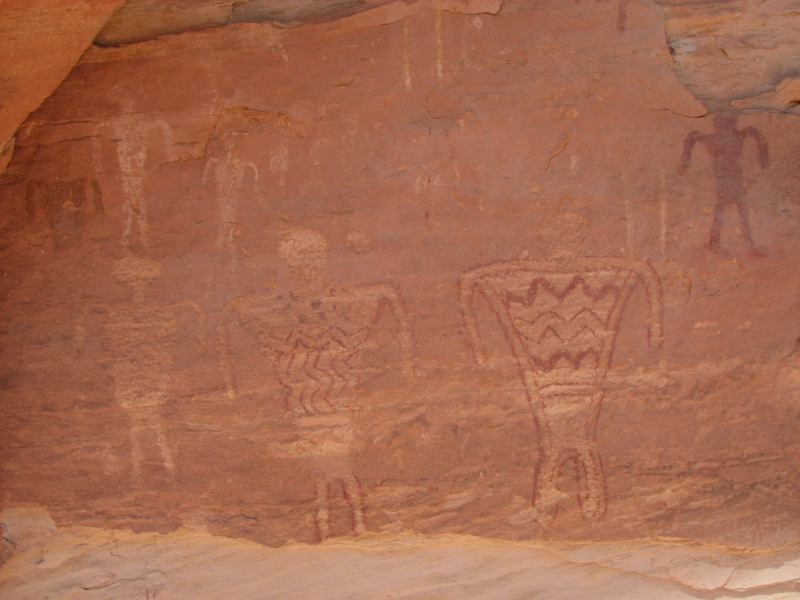
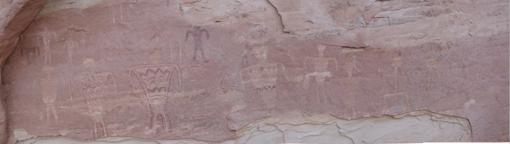
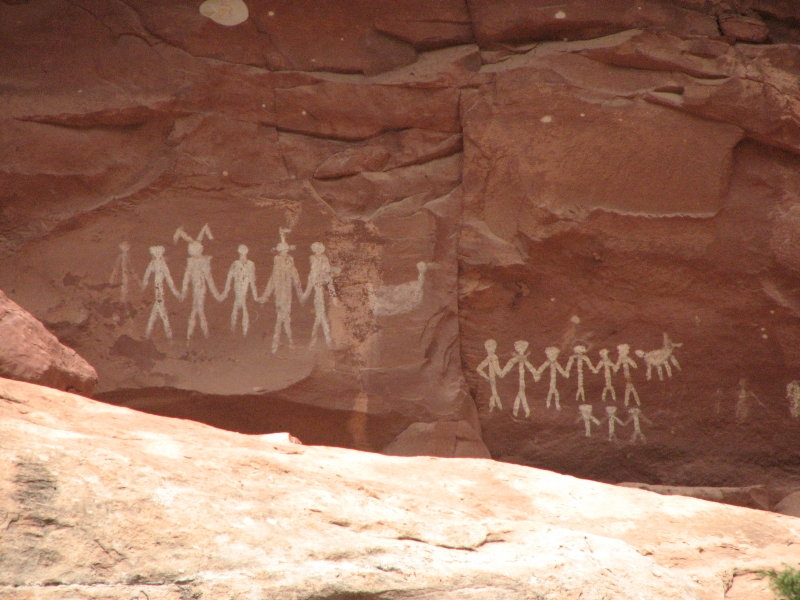
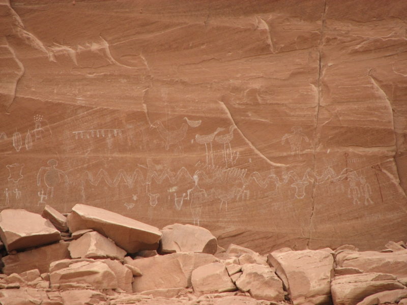
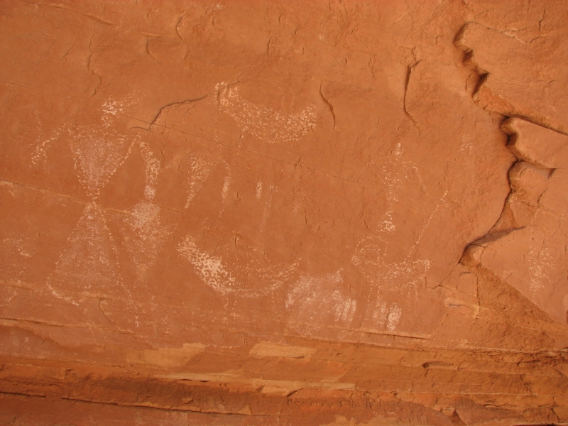
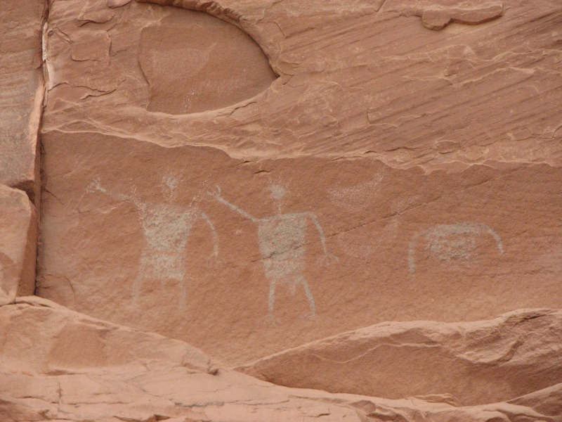
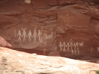
Shortly before that we found a pictograph site with several panels. Most of the images were people, some in clothes with patterns. On one panel a man was lying down under two large figures shamans doing a healing perhaps? The images were faint and a lot of the wall had flaked off. I wonder what else used to be there? There were two petroglyphs mixed in the pictographs.
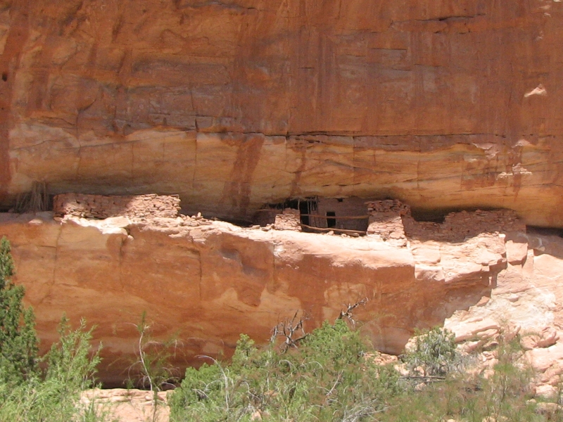
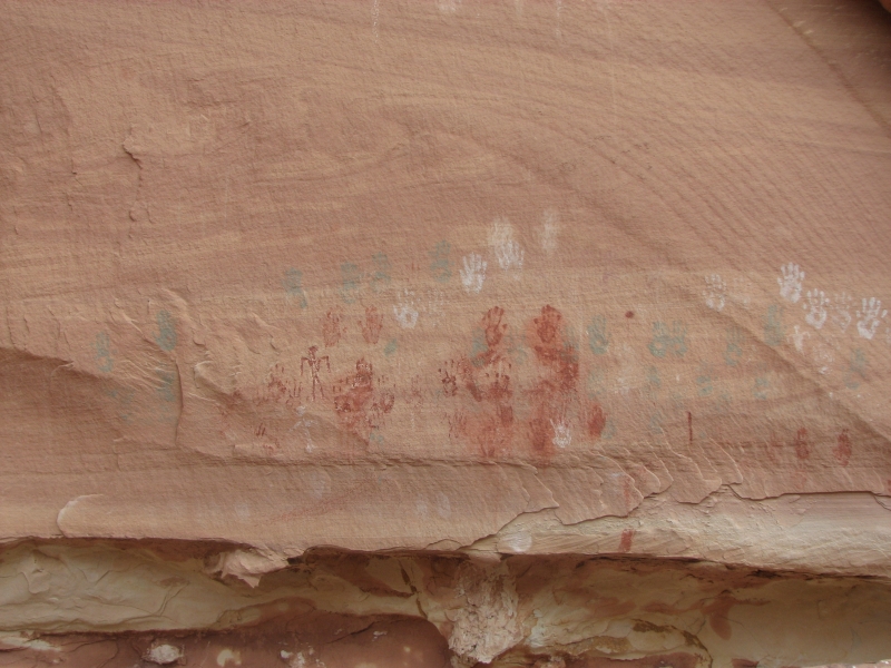
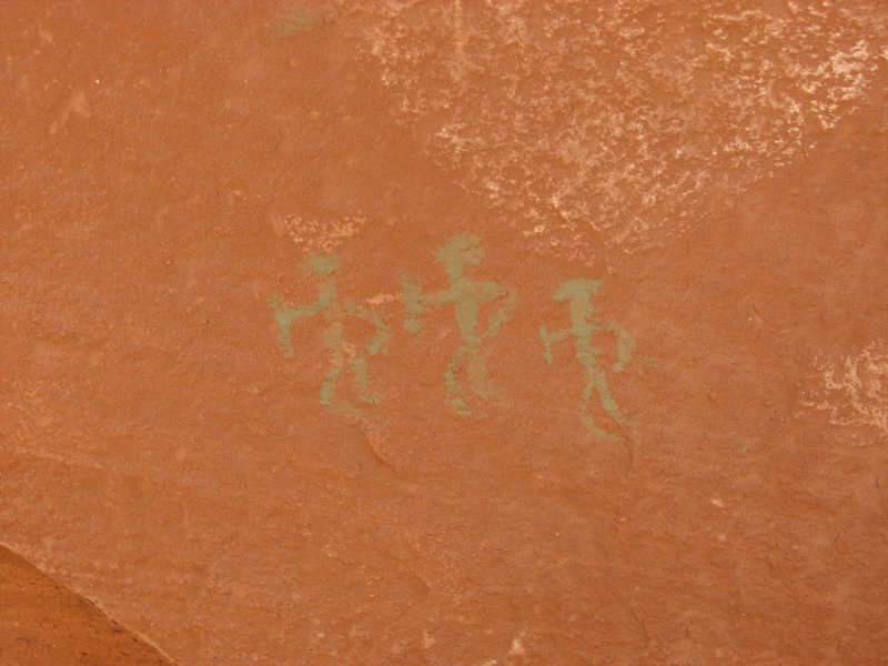
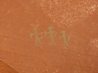
The trail snaked up the canyon. The streambed really twists and turns. Sometimes we followed the stream; sometimes we climbed above the stream to avoid water or to shortcut a meander. There were a lot of false trails that climbed up the side of the canyon and then dead-ended. Some took us to ruins. One took us to a petroglyph panel and another to a pictograph panel with yellow handprints. We saw several other ruins: some granaries, some living spaces and kivas. I think our total for the day was nine ruins. One large granary was in perfect condition, still covered with mud/adobe.
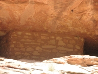
We hiked up to the spot where we turned around last year, found a flat place to set up camp, then circled Pollys Island, looking for a ruin that was supposed to be on the back side. The trail was pretty rough, but we found the ruin, which had a couple of intact rooms and several petroglyphs, plus one pair of painted hands. Elsewhere in the loop around Pollys Island we found another petroglyph panel, high up the wall, above a big boulder. Today was a good hike, with something interesting to see every mile or two. The canyon is a fairly narrow one, with sheer sandstone walls. I really enjoy this kind of hiking.

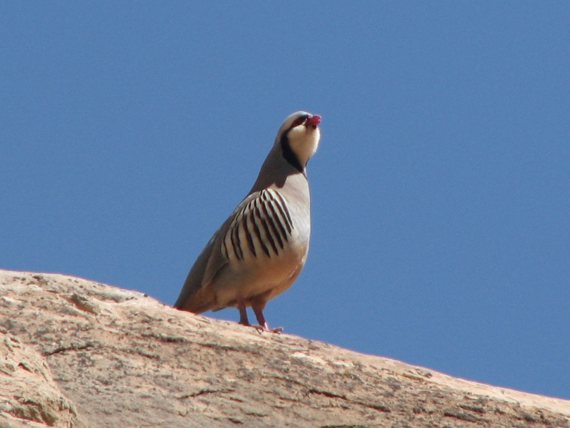
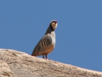
We ran into five groups of hikers today, including a family with an aggressive dog (off its leash of course) that charged me three times. If I hadnt had my hiking pole I would have been in trouble, I think. A lot of dogs dont like smelly hikers with backpacks. Our only wildlife were squirrels, lizards and birds. A couple of chukkars gave mating calls, sounding somewhat like a turkey, but not quite. Were both sore and tired, but happy. Its so much fun finding ruins and rock art, especially ones that arent in the guidebook.
Monday, April 28: Grand Gulch Backpack (10 miles)
We hiked back down Grand Gulch to a nice campsite near the mouth of Collins Canyon. We were both tired, so we decided to stop early, taking advantage of the good campsite with water. The only problem with it is the caterpillars falling off the trees. We ran into that last year as well. Yuck. At least it should be a quiet site. The guys camped downstream from us last night were loud not intentionally obnoxious, just loud voices that echoed in the canyon. A lot of people dont realize how loud they are, but in the quiet of the outdoors, their voices really carry. We saw three groups today: one setting up camp at 11:30 and two pairs headed the other way.

We visited seven ruins today, including two new ones in Deer Canyon that we detoured a short distance to see. They had pictographs and lots of pottery shards. One ruin was in pretty good shape, the other barely visible. We stopped to take photos at some of the sites we visited yesterday to take advantage of different light conditions. One of the pictographs was much clearer today: the man lying down turned out to be two stick people, facing in opposite directions, with another suspended above them. The shaman had designs painted on his clothes. Nice.
It was much hotter today than yesterday. Were both somewhat dehydrated from the heat and intense sun. Stopping early was a good idea, especially since we only have nine or ten miles to go tomorrow.
Tuesday, April 29: Grand Gulch to Shaw Arch (10 miles)
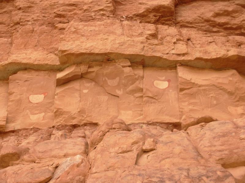
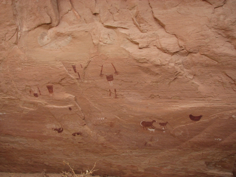
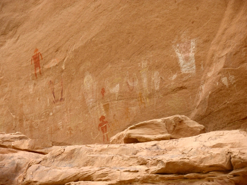
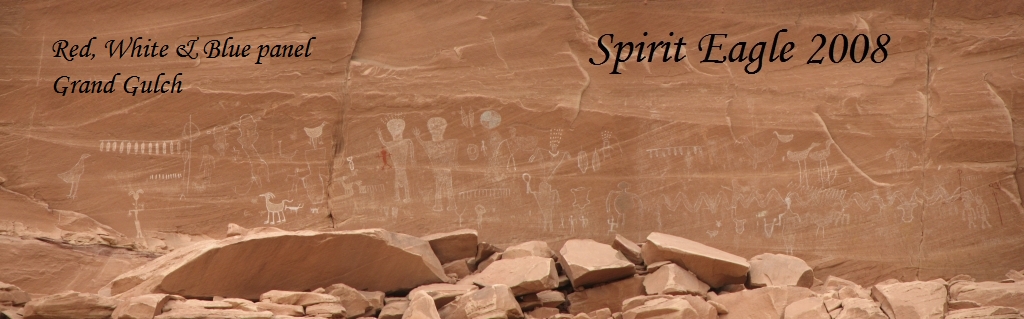
Today was a pictograph day lots and lots of painted images. They started about 1/3 mile downstream from our campsite in a cut-off meander: there were five pictograph sites just in that loop. Lots of ducks, again, but other images as well. Some of the paintings were pretty complex not the usual handprints, stick figures or triangular men. They may have been more modern. If so, he was a good artist. Our next site consisted of two separate alcoves covered with handprints. Redman Canyon had a red man of course, as well as some other interesting images.
Then there were two really spectacular sites with dozens of multi-colored images in long panels: shamans, animals, warriors, atlatls, etc. We saw nine separate rock art sites today (or 14 if you count the first five separately) plus five ruins. We passed a couple of other ruin sites that well check out on our return journey tomorrow. There were several side alcoves that looked like they might have something interesting, but they'll take some effort to get to them. We'll try tomorrow. Today we spotted a few granaries, a square building, and a site that was mostly filled in with sand. We ended up at a large arch, which had lots of multi-colored handprints--blue, green, white, and red.
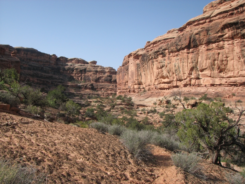
The art today was mixed, some images were really clear, some very faded. We had good climbs to a couple of the sites. The trail down Grand Gulch is less used than in the upper canyon. I am really enjoying it. We saw no people today, but we did see three hawks and a rattlesnake.
Our picture-taking and wandering around looking for art makes us slow, plus weve been stopping often to rest Jims foot. Hes in a lot of pain between his foot and his knee. We considered continuing all the way down to the San Juan River, but its another 14 miles (RT) and with Jims foot in such bad shape, we decided against it. The guidebook doesnt mention any ruins or rock art below the arch, but Im sure its there. We found a granary and three panels today that Kelsey didnt mention. Even so, without some indication that the hike would be more than just very rough trail, it didnt seem worth the effort. Well undoubtedly learn later that there are all sorts of wondrous ruins and rock art down by the river but it will have to wait until another year.
Wednesday, April 30: Grand Gulch back to Collins Canyon TH (12 miles)

Last nights wind remained with us, cooling things off a bit. Yesterday it looked like it might rain, but we got lucky and it stayed dry. Desert canyons are a bad place to be in a thunderstorm. The wind shook the tent, keeping us awake for a long time. We slept badly again. I wonder if were being haunted by the spirits of this place? Ive never slept as little. Yet we seem to be able to hike all right; were just a little tired.
We spent an hour wandering side canyons near Shaw Arch looking for more rock art. Its supposed to be all over the place, but mostly we just saw the handprints on both sides of the arch. We did find two small panels nearby but they werent terribly exciting. (Another red bird; theyre ubiquitous!) We never did find any more petroglyphs; there was only one single one under the arch.
We stopped at Redman Canyon to climb up to the panel there. It had a red man, of course, but also three turquoise men, a bighorn with a spear through it, birds (or bird headdresses), etc. It was a nice panel with some very clear images and many very faint ones.
We wanted to check out a couple of ruin sites that we passed by yesterday. They look like alcoves filled with rubble, but the Anasazi sometimes built homes behind the fallen rock. We got access to the first ruin quite easily and found some petroglyphs on a couple of rocks. In Grand Gulch, rock carvings are somewhat scarce, pictographs are much more common. The second ruin was more difficult to reach and in the end we decided it wasnt worth the effort. There was some steep slickrock to cross and the wind was really gusting. I didnt feel safe crossing the open rock, though the iffy section was short. Without the wind, we might have tried it, but as it was, I was having a hard time walking straight.
The rest of our hike out was pretty straightforward, aside from a couple of wrong turns. We followed a path up and up and up the side of the canyon. It narrowed to about six inches wide with a fifty-foot drop below a mountain goat trail then it dead-ended. We turned around, carefully, and found that the real trail made a sharp left down to the stream. Oh well. We had the trail to ourselves again until we were about half a mile from the car, then a dayhiker passed us while we were resting Jims foot.
We had planned to camp at the trailhead again, but the wind was so bad we decided to drive back to town instead. We couldnt cook in the wind and the truck was shaking with each strong gust. It wasnt restful. Besides, after four days hiking with little water, we reeked! My legs got badly scratched by the brush and we were tired of scratching bug bites. It was past time for a shower.
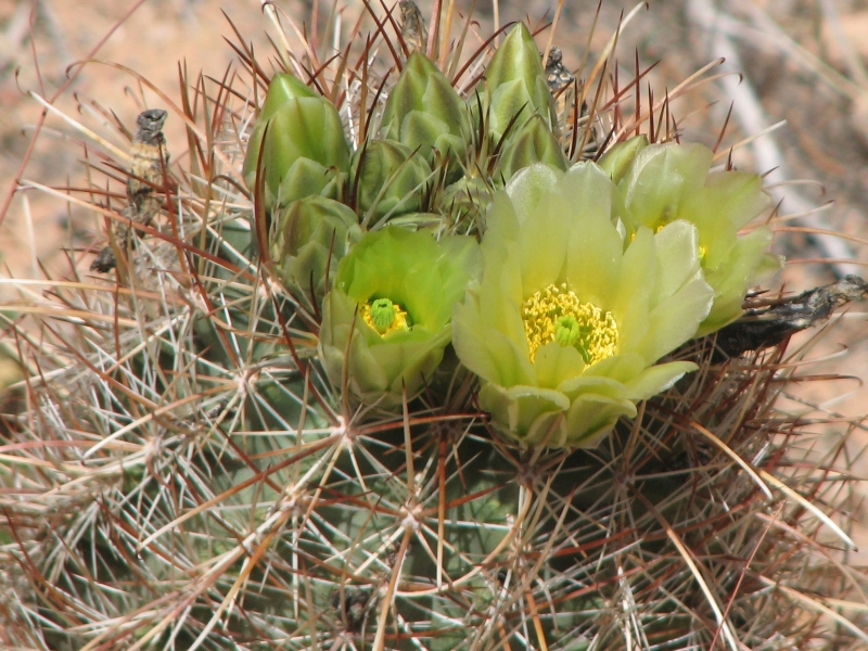
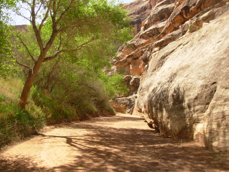
Grand Gulch is one of my all-time favorite backpacking trails. The canyon is beautiful with its steep walls, striped red, white and black. The cottonwood trees are a brilliant green contrast to the red walls. Desert wildflowers are common. Prickly pear, claret cup, hedgehog cactus, globemallow, peppergrass, paintbrush etc. are scattered amidst the sage. The trail is rough and not maintained, but easy enough to follow, just dont wear shorts! Water is getting low already. In a month most of it will be gone. There were some good pools and some really awful ones, especially now that the caterpillars are hatching. I was glad we had our filter, though it still tasted bad.
But what really gives me joy is the frequent archaeological sites, the rock art panels, the well-preserved masonry, the ancient campsites in the frequent alcoves. There is a feeling as I hike that around every bend there will be something interesting. The concentration of archaeological sites is quite amazing. This area used to be nearly unknown. Thanks to the Internet and the proliferation of hiking guidebooks, that has changed. Still the canyon feels remote and wild. Being free to wander through the ruins is amazing as we step carefully around the walls, or piles of pottery or ancient corn cobs. There were many unusual and odd images: hawks, wading birds, waving men, turquoise men, pelts, war lances, warriors, big blue men, white shields, deer, fox or coyotes . . .

Im really glad we were able to do this backpacking trip, though it may be our last one for a long while. Jim was in agony and very very slow. We need to come up with an alternate plan for the summer. I dont think a thousand mile hike is in the cards now. Ive felt guilty about continuing our hiking, even short hikes, when it hurts him so much. At the same time, we both need and want the exercise and we love getting into the backcountry. Since we lack the skills or equipment to get there by boat or bike, we keep on walking, despite the pain. Its our life and our love a necessary part of our happiness. I cant live on memories of past adventures. I need to spend time outside now. I dont know how well manage that. With gas prices so high, can we risk the long drive to Alaska? Where else can we spend months immersed in wilderness and wildlife without doing a lot of hiking or spending a lot of money? Que faire?
Thursday, May 1: Rest Day in Blanding
Home | Links| Trail Journals|
The Thruhiking Papers Bun-bun
Created: 1 Jan 2009
Revised: 30 Sept 2016Copyright ©: 2008-2017 Spirit Eagle