|
 |
 |
 |
 |
|
|
|
|
|
|
Sunday, April 13: Monument Valley, Lower Butler Wash, Sand Island
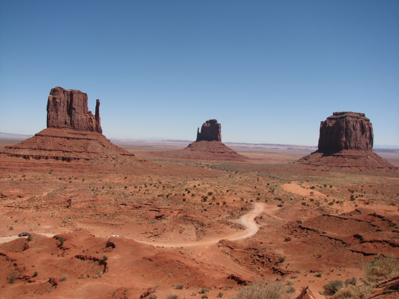
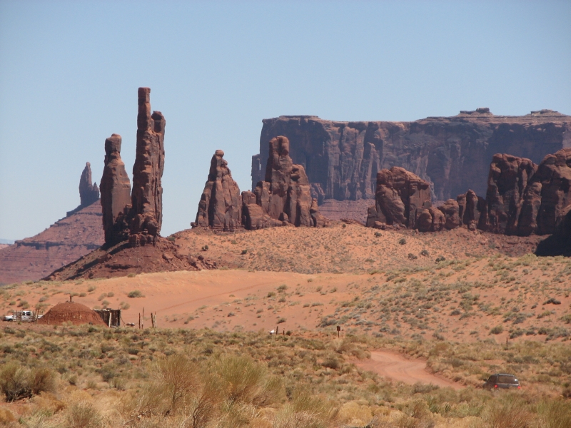
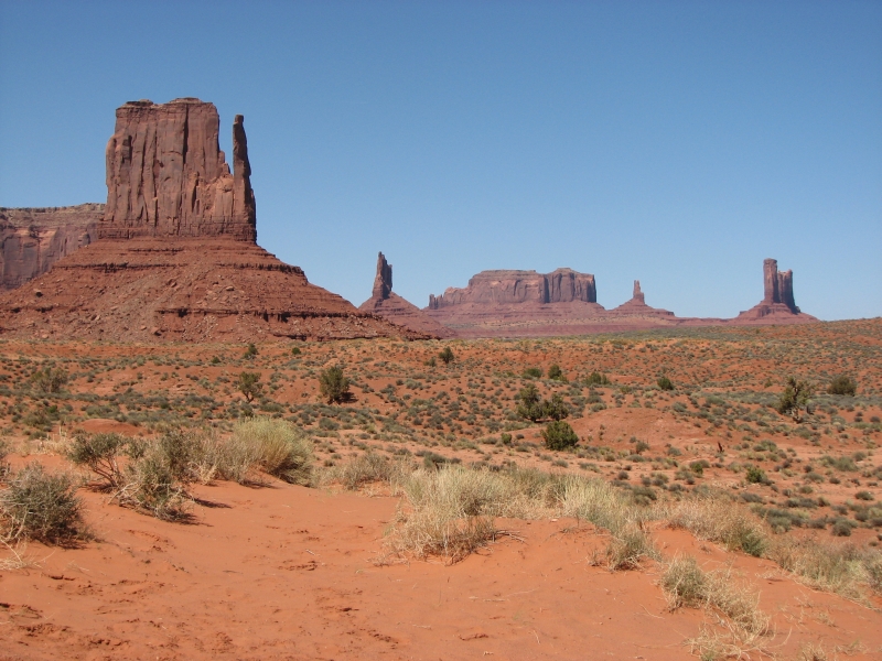
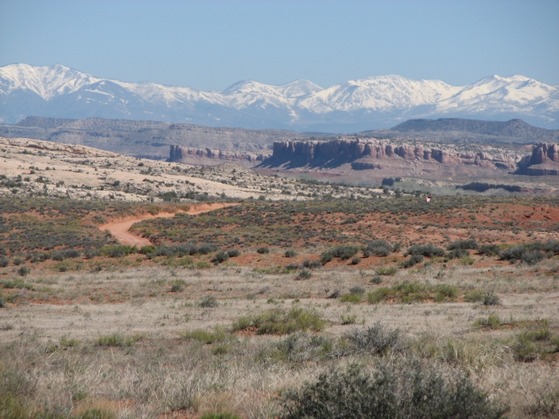
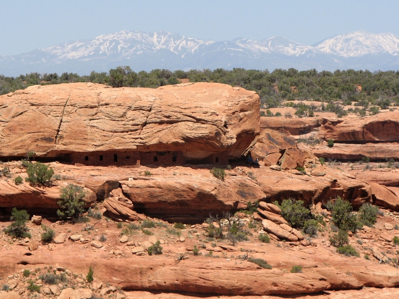
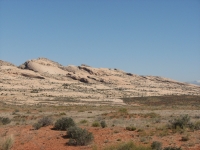
We spent the day crossing the Navajo Reservation as we headed up to Utah. Its a large reservation with some pretty country. Since we missed it last year, we drove the scenic loop at Monument Valley. Its a long slow trip on a bumpy, dusty, dirt road, but the reddish brown sandstone is striking and the formations are interesting. We decided against spending money on a tour, which was a good decision, I think. We missed a couple of arches, but two hours of driving at 10 mph was enough for me. One interesting sight was snow-covered mountains to the north. There is a lot more snow than we saw last year at this time. Evidently last weeks storm dumped a lot of new snow in the area.

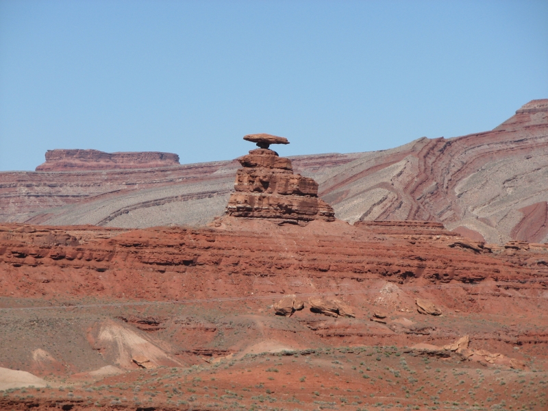
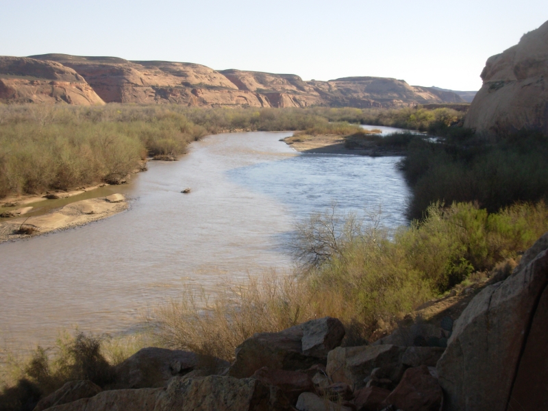
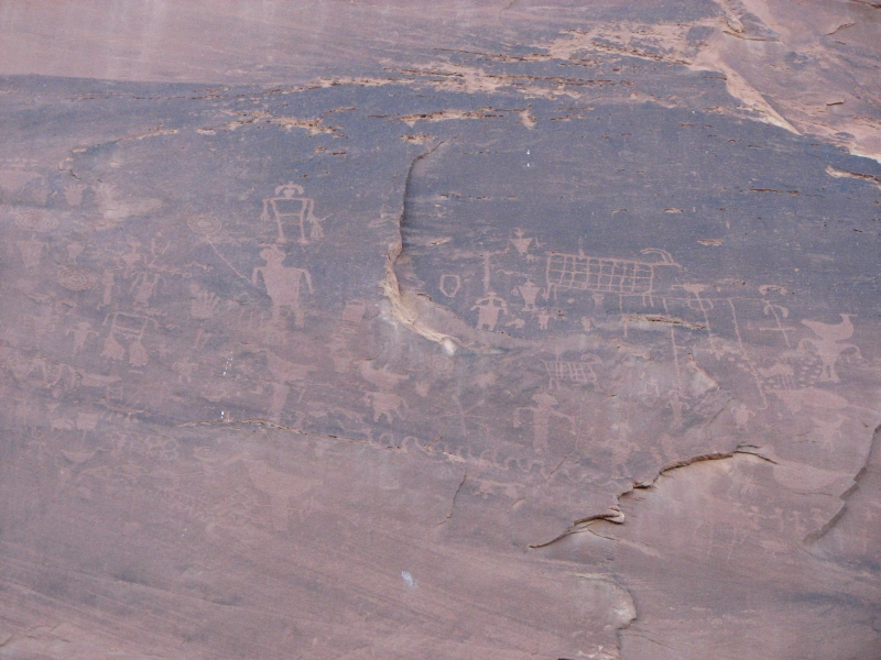
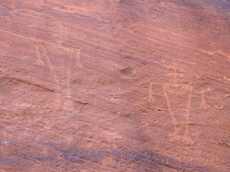
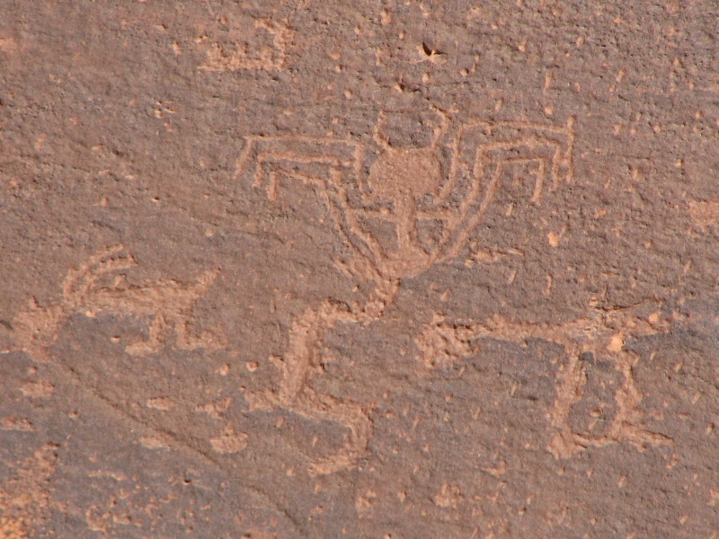
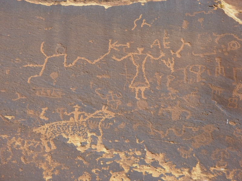
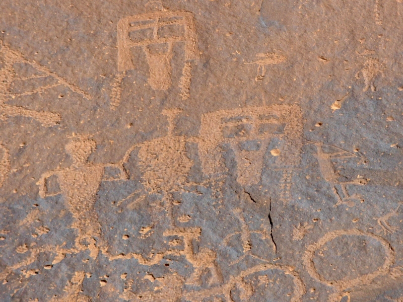
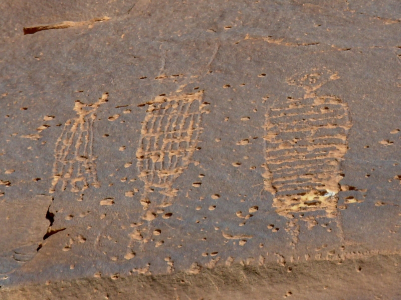
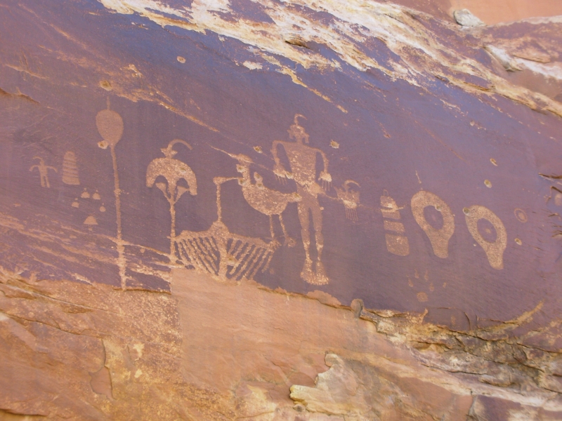
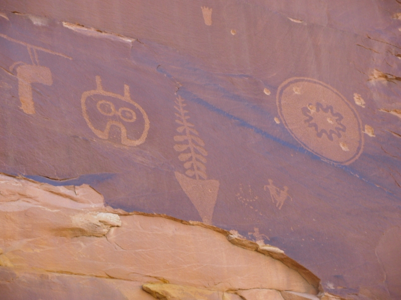
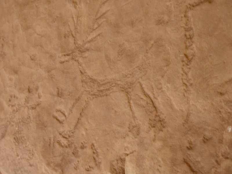
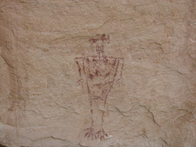
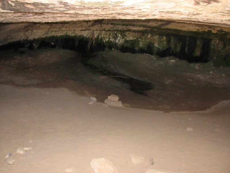
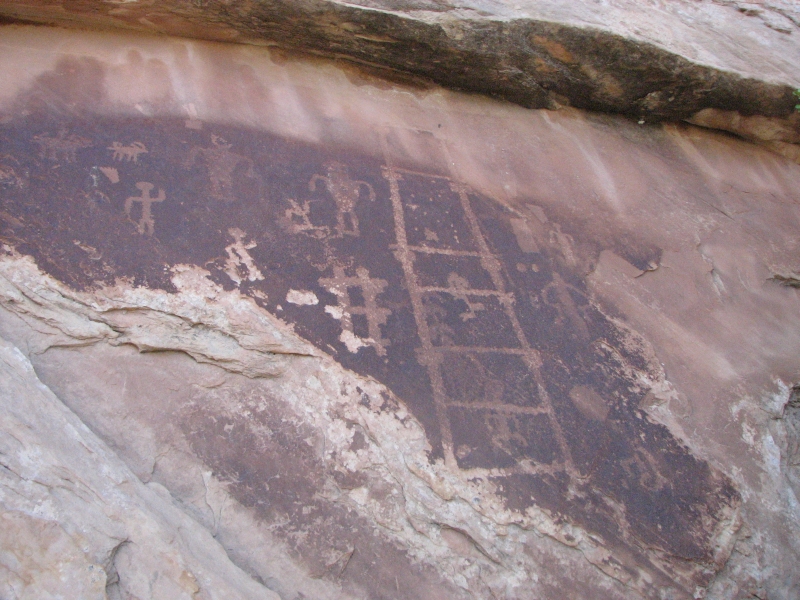
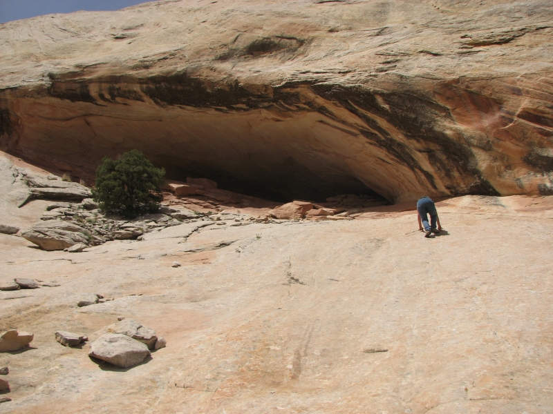
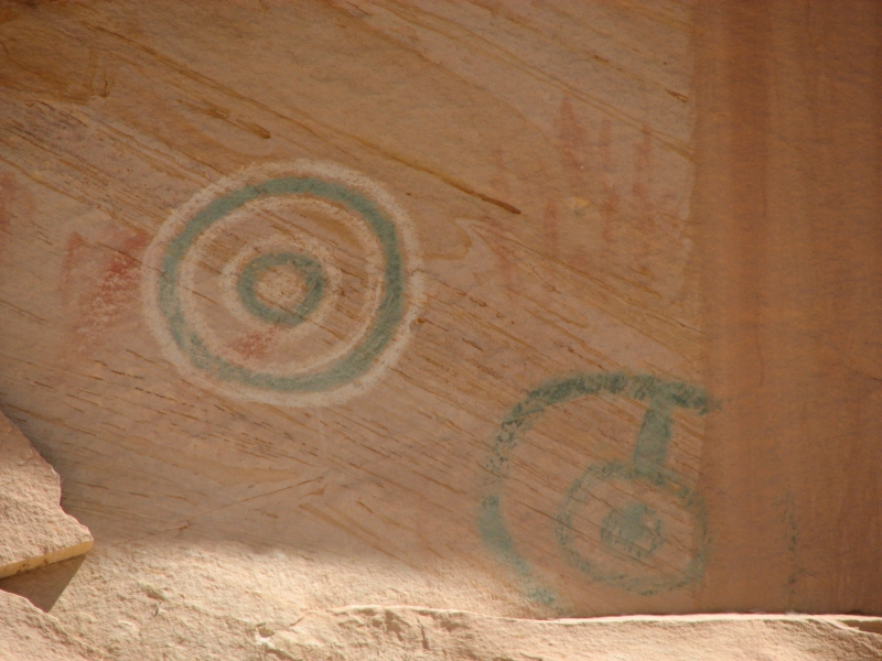
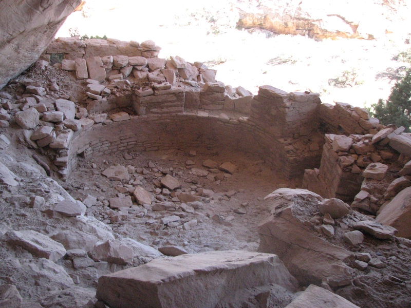
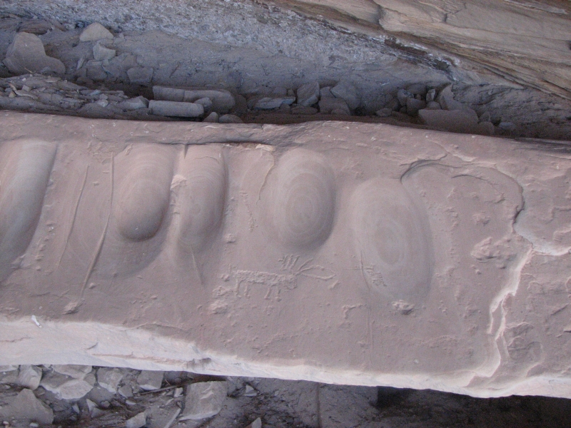
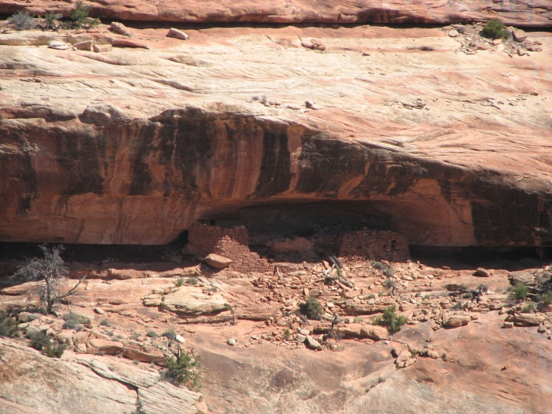
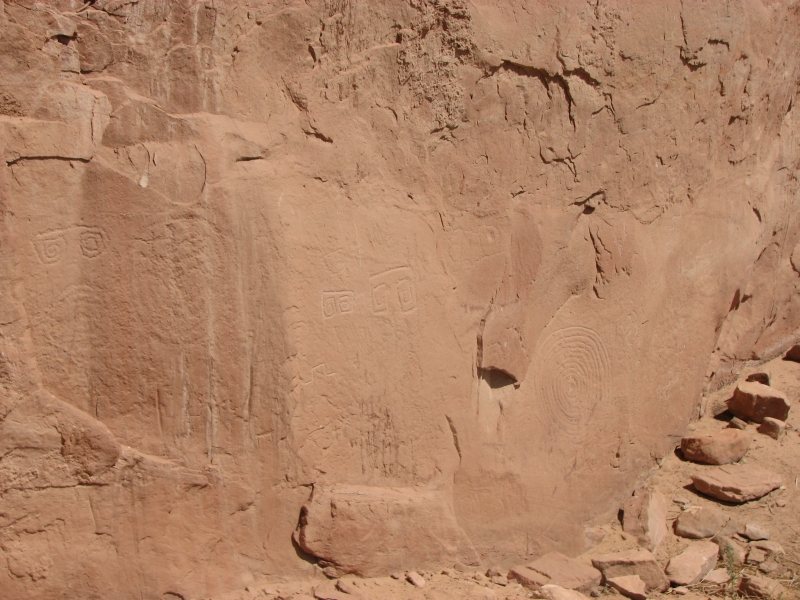
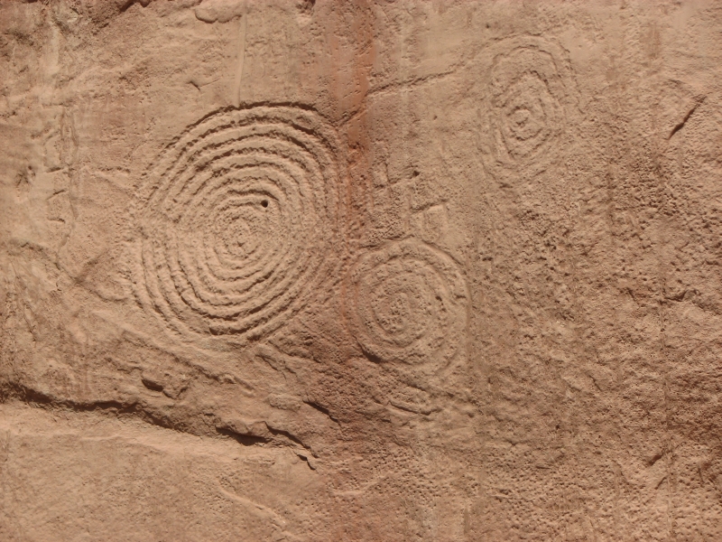
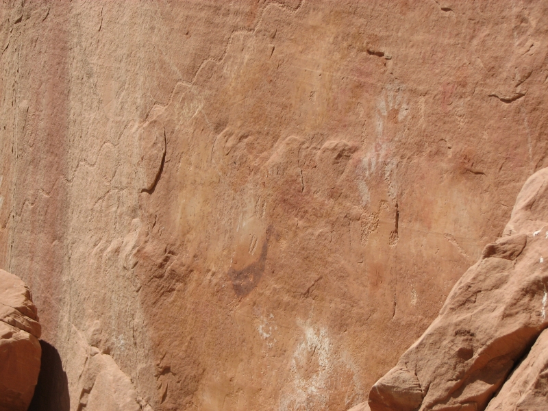
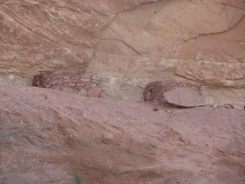
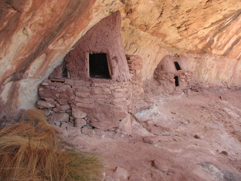
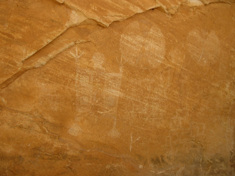
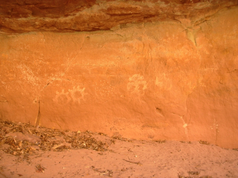
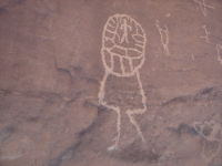
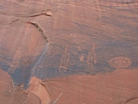
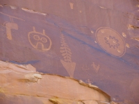
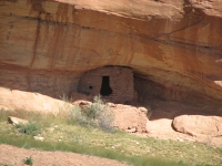
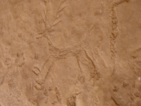
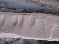
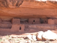
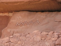
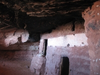
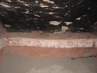
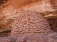
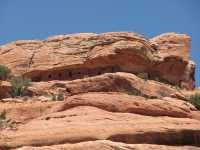
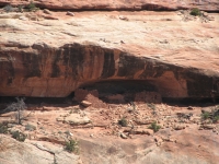
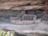
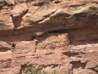
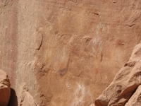
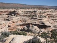
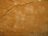
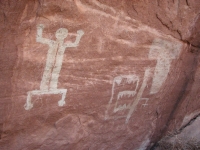
We passed Medicine Hat with its pretty gray and pink striped hills on our way to Butler Wash. Although it was fairly late, we decided to check out some petroglyphs in the lower wash. We followed a somewhat rough road for about 1½ miles, then hiked down a cairned trail to the creek. About ½ mile downstream we saw a ruin. Beyond it was a wall with a few images. We continued to the San Juan River. Where Butler Wash meets the river there is a long cliff face with lots of petroglyphs. Some were quite high up and very hard to see. Some were almost entirely repatinated, but there were a number that were visible and photographable: lots of shamanic figures and Glen Canyon style bighorns, ladders, corn plants, etc. (Glen Canyon style has squarish bodies with striped or checkered patterns in the body of the animal.) Many of the human figures had elaborate headdresses, not your usual shamanic horned hats. We followed the wall down to a large alcove with another ruin and a couple of painted images. Then we turned around and hurried back to the truck. I wish wed had more time to look.

There are supposed to be more panels on the other side of Butler Wash and even on the other side of the river, but you need to be in a boat to access those. A lot of the good rock art in Utah is accessible by water, not foot. Sometimes I really wish we had a canoe.
We talked for a few minutes to a man camping at the trailhead, then moved on to the campground at Sand Island a couple of miles away. We were too late to visit the petroglyphs there, but we can do it in the morning. I just had time to heat up a can of chili before it got dark. The campground was more full than I expected, but then, its pretty small. Were right next to the river so we can hear ducks and turkeys, as well as our neighbors noisy generator.
Monday, April 14: Sand Island to Butler Wash (9 miles)
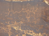

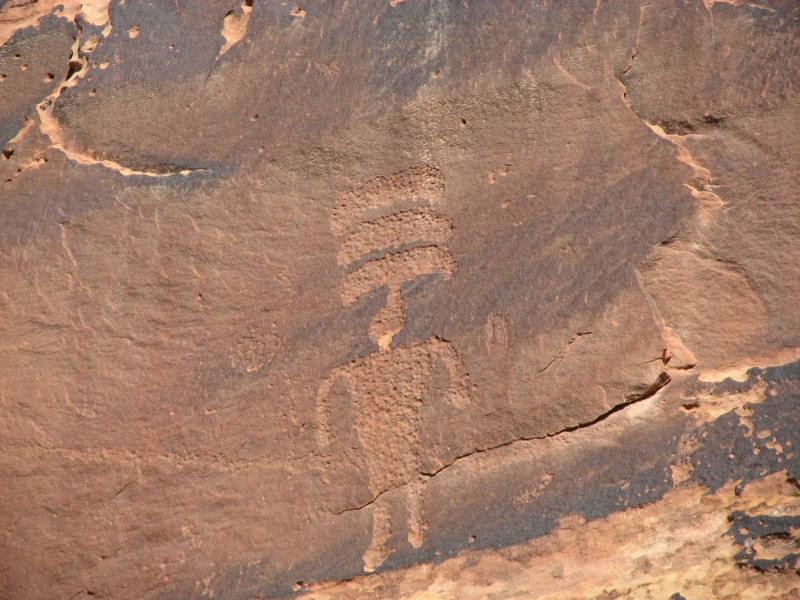
We started the day by photographing the panels at the campground. There are a lot of good images at Sand Island, though yesterdays panels were more numerous. Last year it was raining when we stopped at Sand Island, so only the newer images really showed well. The older more patinated petroglyphs were nearly invisible. Today was a bright sunny morning so we could see them much better. There are several Kokopellis and shamans with unique headdresses, among others.
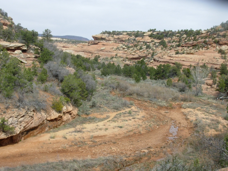
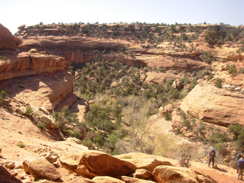
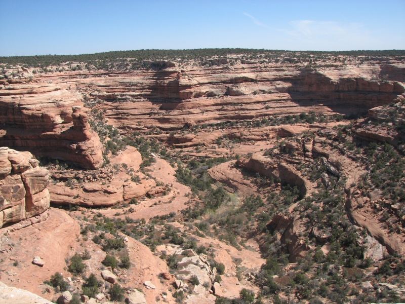
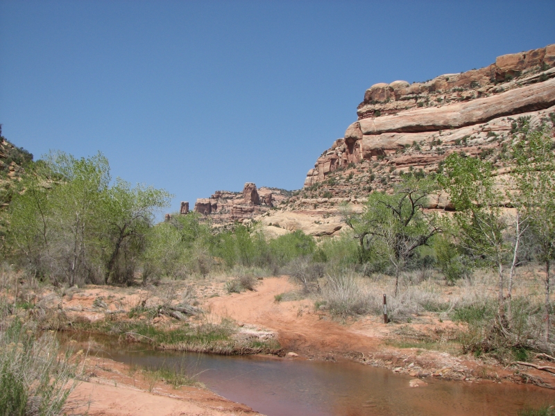
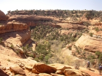
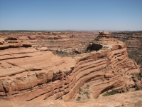
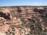
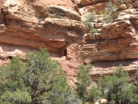
Afterward we headed north on the graded Butler Wash Road. On one side is Comb Ridge, an uplifted white cliff that looks somewhat like the San Rafael Swell. To the east is another line of cliffs, Tank Mesa. In the middle lies Butler Wash and a 24 mile north-south dirt road. There are numerous Anasazi ruins along the wash up the side canyons. Last year we were told that every canyon in Cedar Mesa has something of interest, if you hike far enough in. We cant visit them all, but we wanted to explore what we could, so we decided to pick some of the side canyons along Butler Wash and check them out.

Our first stop was a good one. There was a good ruin across the wash and, on one side, down an old cattle trail, was the Wolfman Panel a really well carved petroglyph panel with some interesting and odd images. There werent many, but they were very clear. I suppose that means theyre fairly modern, but I enjoyed them anyway.
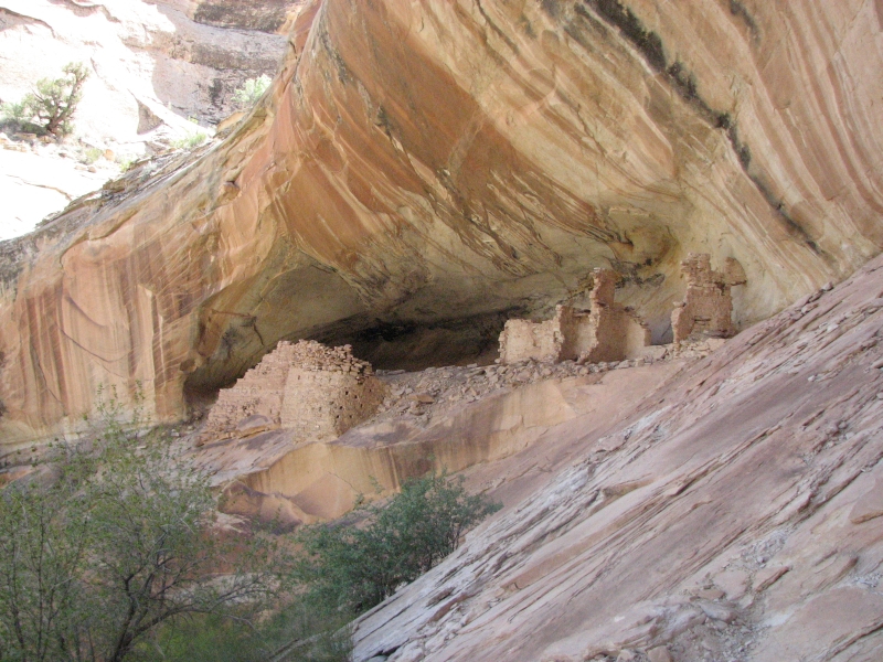
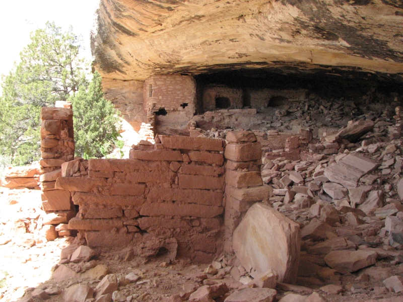
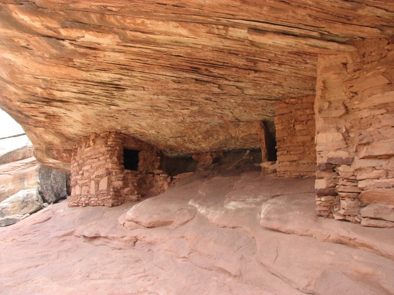
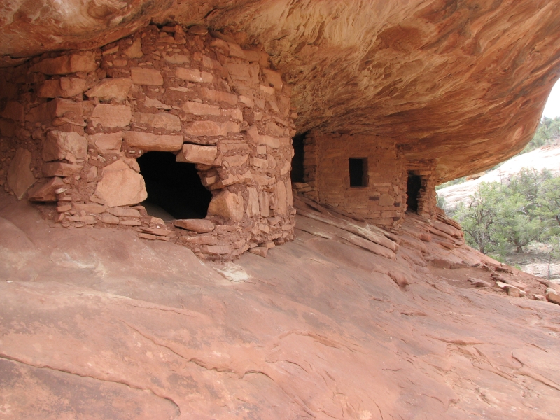
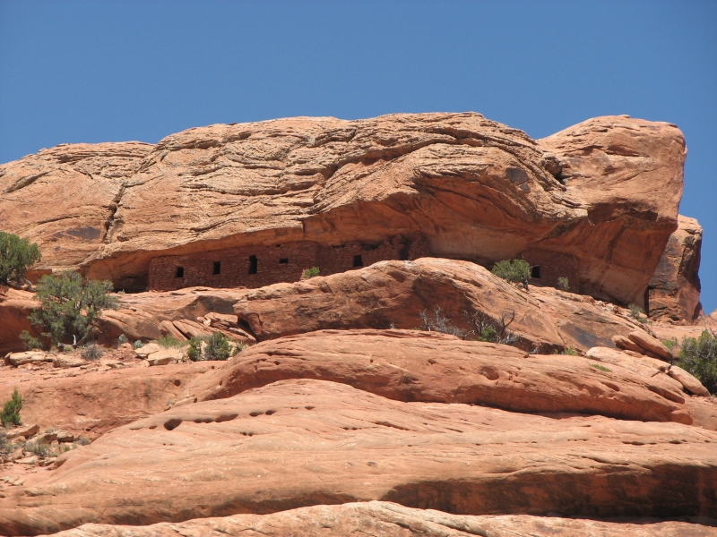
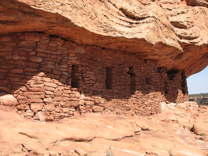
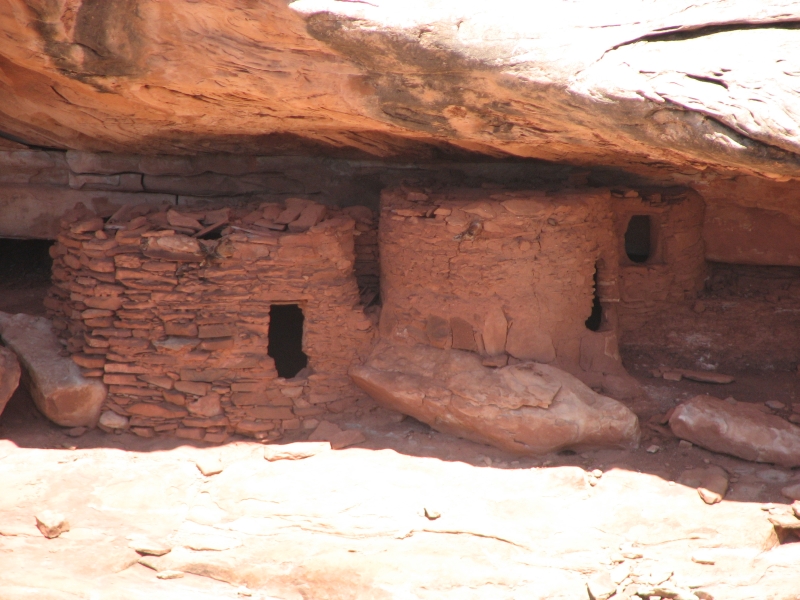
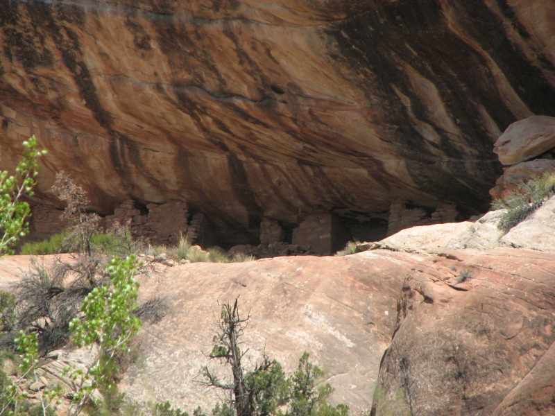
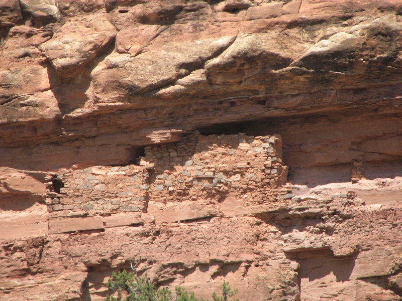
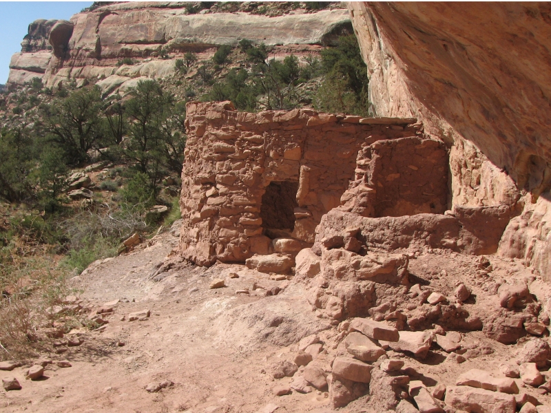
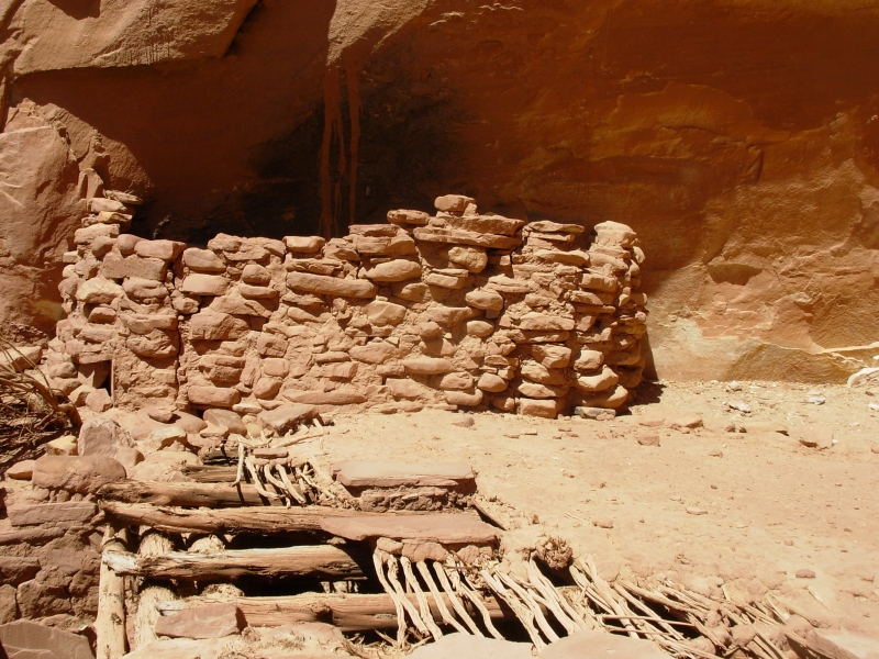
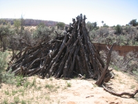
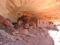
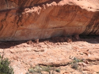
We drove north a few miles then walked across the wash and up a side canyon, passing two Navajo sweat lodges (a teepee made of branches) to an alcove with a nice ruin. It was pretty much destroyed by time and cattle, but it was still interesting. A more intact room was on a ledge high above and inaccessible to casual visitors (which is why it was intact).

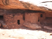
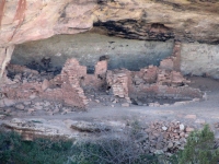
We headed up the road to another canyon that was supposed to have a good petroglyph panel. The guidebook author hadnt seen it, he just heard about it. We didnt find it either. Evidently we went up the wrong draw and ended up in a different canyon which had a really big ruin known as Monarch Cave. There were petroglyphs and pictographs, lots of pottery shards, grinding holes, broken manos, etc.
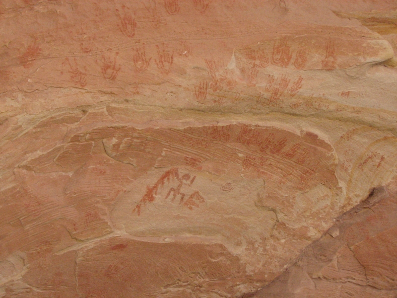
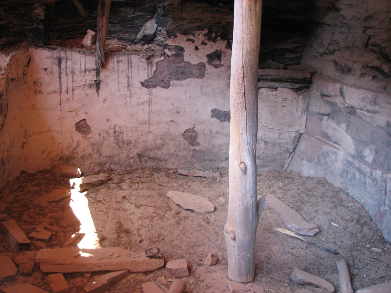
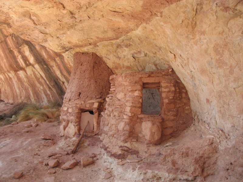
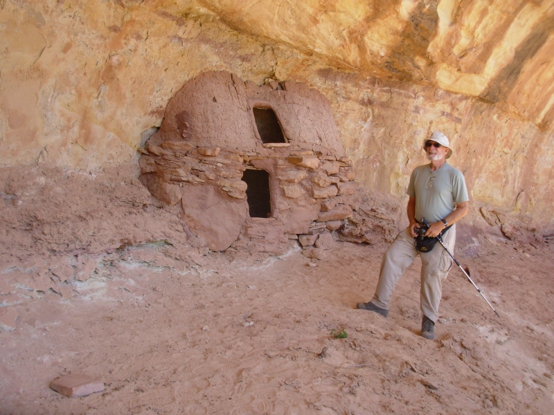
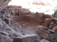
Next we went back to the main road and up another bumpy side track to another canyon. It turned out there were actually two canyons, one of which wasnt described in the guidebook, though the more well worn path led up to it. Carving on a rock told us it was Cold Springs Cave 1892. There was a large ruin complex with a kiva and, once again, there were petroglyphs and pictographs, mostly handprints in red, yellow and blue. Most interesting was that the back of the alcove was a seep and one large room was a springhouse the cold spring. A depression in the middle of the cave was used to catch and hold the water from the seeps.
After exploring a while we headed back out, then followed a faint trail north to the canyon we had expected to find. It had an alcove with several petroglyphs, including a large ladder image. There are a couple of hidden ruins up above, but we couldnt get to them easily. We climbed up the slickrock as far as I felt comfortable, but when it went straight up, we turned around.
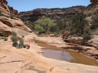
By that time we were tired and ready to stop for the day. I have no idea how far we walked today. Except for the first stop at the Wolfman Panel, each side canyon took an hour to an hour and a half to explore. I figure each was about a mile up and a mile back more or less. It was fun and not difficult since there were trails of a sort we could follow. We met three others out exploring. This area is really incredible with so many Anasazi ruins. Two of the sites had good springs; the one at Monarch Cave is supposed to be a permanent year-round water source. I think lower Butler Wash has water most of the year, but as we headed north the creek went dry. On the other hand, we camped next to some cottonwoods, so there must be water under the sand somewhere.
Were only about half way up the road. We havent explored every canyon weve passed, or even every one described in the guidebook, just the more interesting ones. Well continue our explorations tomorrow as there are still a few side trails that sound like fun.
Tuesday, April 15: Butler Wash to Blanding
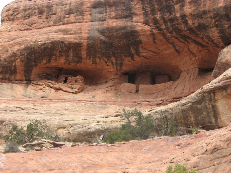
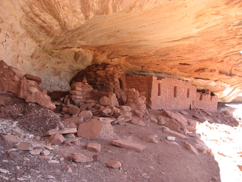
We enjoyed a peaceful night camped in the cottonwoods beside the wash. Only a madly mooing cow disturbed our solitude. We walked up-canyon to Split Level Ruins: some broken walls in a lower alcove and a good ruin at an inaccessible upper level. There were some petroglyphs and pictographs. In the upper ruin were three large clan or shield images -- circles in blue and white. One looked like a pictograph we saw last year in Dry Fork. An oddity was that almost every metate bench had at least one petroglyph mixed in with several grinding holes.
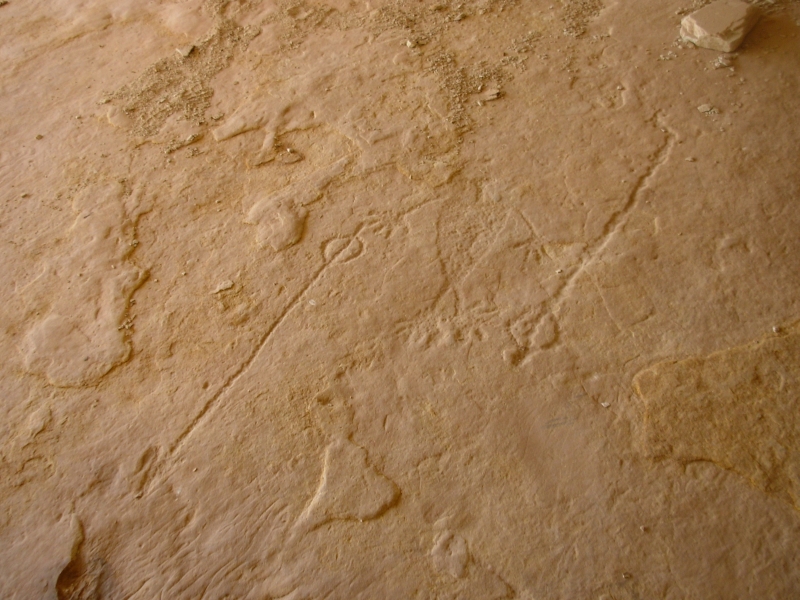
The canyon had several other large alcoves. We checked out four and though there were no obvious building walls, there were handprints and other pictographs and obvious work surfaces and grinding holes. One cave had hundreds of handprints. Another had a large flat stone with several petroglyphs: hands, feet, turkey tracks and a large map-like glyph plus metate holes.

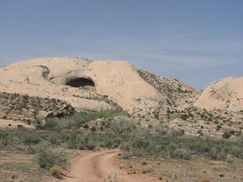
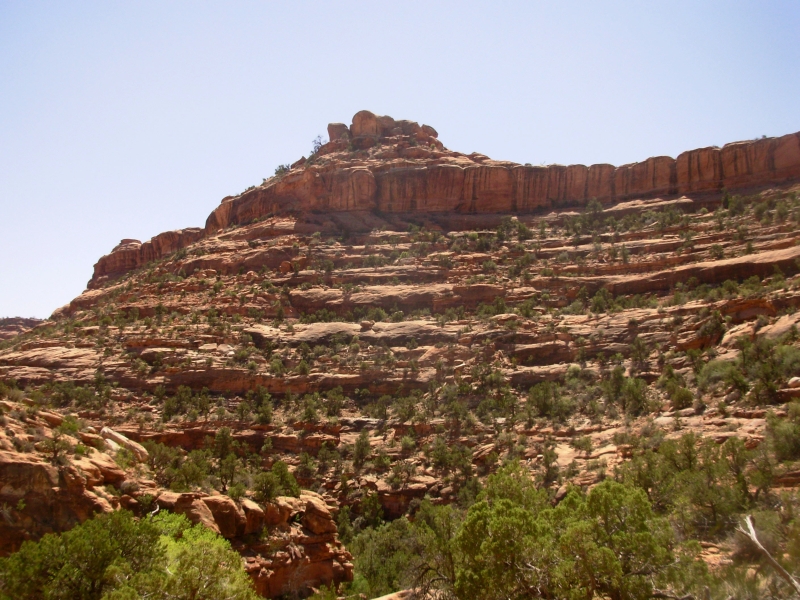
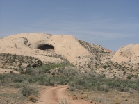
After an early lunch we headed up to Big Cave (aka Giants Cave). It is visible from the road, high above the canyon. On the way to the cave are four ruin sites. The masonry varied in each; some were much older, some much better constructed. Some had well carved cut stones and others just used lots of mortar to hold everything together. Two tiny granaries used little rocks instead of cut blocks for the walls. There were old corn cobs scattered nearby. None of the village sites had rock art or metate holes.
The climb to the Giants Cave was steep, about 400 up, and not worth the effort. The cave was huge, with a nice view, but the walls were covered in modern graffiti names and dates. I hate vandalism! There were no standing walls in the cave, just holes in the floor where people had dug either archaeologists or illegal pot hunters. Coming down afterwards was hard for me since it was steep and on loose rock. The slickrock wasnt as difficult, though it was still steep. Below the cave were some large potholes in the rock filled with water. They must have been the water source for the people who lived in the caves at least some of the time.
We detoured to a side alcove, which had a partial wall visible from below. The climb up the steep slickrock was worthwhile though, since the floor of the cave was covered with petroglyphs. One was a deeply incised snake; another was a man with two atlatls, one in each hand. There were carved footsteps and animal tracks bears, deer and turkeys. Some we could barely see because the angle was wrong and the floor was too steep to walk to them comfortably. That was a really nice find.
Eventually we headed back to the car and headed to town. The wind has been blowing hard all day. It tried to knock us off our feet as we climbed. The sky was gray with blowing dust and sand. We ran into a road grader, which slowed us down for a while, since he was too big to pass. We decided to head to town. Camping in a dust storm is not fun. Been there, done that.
I enjoyed our exploration of Butler Wash. Someday Id like to come back and explore the side canyons we skipped this time. Although none of the ruins was in terribly good shape, there were still interesting to see and I always enjoy the rock art. Mostly I just enjoyed the exploring trying to see if we can find the hidden treasures in the place. Thats always fun, whether were looking for ruins, rock art, wildlife or scenic beauty.
Wednesday, April 16: South Fork Mule Canyon (8 miles)
Yesterdays blustery wind died down but left cold gray skies behind. It was 37 degrees when we went to the grocery for breakfast, only 48 by mid-afternoon. Quite a change from the warm sunshine of the past few days.
Since we were late leaving town, we headed to the nearest canyon we wanted to explore: Mule Canyon. There are two forks to Mule Canyon, each with several ruins, but we chose the South Fork, which is supposed to be a little more interesting. The hike is an easy gentle walk along the canyon floor, criss-crossing a small stream dozens of times. We spotted four ruins in four miles, then stopped for lunch. We decided to turn around at that point. The trail continues upstream and there are supposed to be several ruins in the upper area, but the trail pretty much vanishes at the four mile mark. After wallowing in willows for ten minutes, looking for the trail, we decided enough was enough.
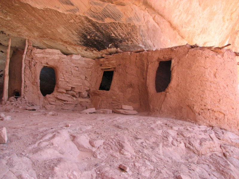
The hike in Mule Canyon was a good one, and very easy. The ruins were interesting, but small -- probably single family dwellings. One still had the front wall, the one that kept the children from falling off the edge of the cave. We only wandered close to one of the four ruins; the others were higher than we wanted to climb, though we did climb part way up in search of a better photograph. Im sorry we didnt go all the way up the canyon, but Jim was hurting so it was better to stop. As it is, I think we passed some ruins without seeing them. They hide well in their hidden alcoves high above the canyon.
We decided to camp at the trailhead for tomorrows hike. It was a rough dirt road to get out there, but with some pretty views of the mesa and snowy mountains beyond. We stopped at the Ranger Station to ask a few questions and learned that, no, there is no water at the ranger station this time of year, but yes, there is water in Grand Gulch.
Thursday, April 17: McCloyd Canyon (5 miles)
We shared our trailhead campsite last night with a hiker from California, but didnt talk much to him since it was so cold. We read in the back of the truck, sheltered from the blustery wind. So did he. The Californian left his cars parking lights on all night. When we went to bed, I saw the lights and tiptoed through the prickly pear to his tent to let him know. I know, he replied, but its a rental and I dont know how to turn them off. Around 3:00 a.m. the lights went off. He had gone hiking when we woke up and wasnt back yet when we returned to our car around 4:00. I hope he finds someone to jump his battery since its surely dead.
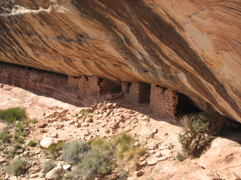
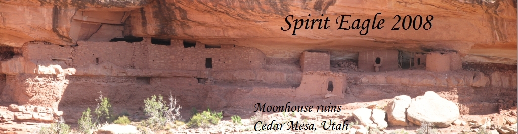
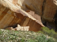
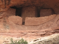
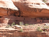
Today was a mixed bag. We slept late and as we finished breakfast a large group drove in, school kids on a BLM service project. We followed them down the steep trail. On the descent we could see three ruins across the canyon, including the most famous Moonhouse Ruin. Its a very nice one, well preserved and quite large. There is an outer wall and inner hall that you can walk in, with several small rooms. A white stripe starts on a wall above, continues down the hall, then into the inner rooms. The windows had tiny white stones above them.

Construction was a mixture of Mesa Verde and Kayenta style some cut stone, square windows and doors and mortar filled with small stones (Mesa Verde) and jacal (vertical pieces of wood plastered with adobe) and horse-collar shaped openings. There was both a square above-ground Kayenta kiva and a round below-ground Mesa Verde kiva in the vicinity. Two BLM rangers leading the kids answered questions. The site was built in the late 13th century. One of the rangers directed us to a few more ruins in the same alcove level. One ruin had six windows and was also well preserved. A couple of others were more decrepit.
We left the Moonhouse and followed the stream up a ways to a waterfall, then turned around. The guidebook suggested hiking a loop downstream. We tried but kept getting rimrocked. The trail climbed above the creek to avoid a couple of waterfalls, but at some point it vanished. We saw no footprints or obvious route around the next point. I wanted to keep going but Jim didnt, so after a heated discussion we turned around. To make up for missing four ruins upstream, we walked along the rim of the canyon a half mile or so until we found one of the upstream ruins we hadnt seen. Then we hiked back to the car and drove out to the trailhead for tomorrows hike. Cedar Mesa, the southeastern corner of Utah, is interesting in that you can camp freely anywhere in the BLM lands, but you have to buy a daily or weekly permit to dayhike most of the canyons.
Todays hike was very different from yesterdays. There was steep rock scrambling, faint trail and a more wild experience than Mule Canyons easy flat walking. Even so McCloyd Canyon was crowded. We saw six groups heading down into the canyon, at least. Cedar Mesa is a really popular area. I thought there would be far fewer people than weve seen this year. Of course, so far, we havent gone too far from the roads. Our hikes have all been short, too short. Ive enjoyed all the hikes, but it worries me that we arent doing any longer ones. When we did the hike in Snake Gulch, Jims foot began to hurt, a lot. That pain hasnt gone away. Between Jims ribs, his knees and now a sore foot, hes in pain most of the time and unwilling to walk very far. Its very frustrating for both of us.
The road out to Road Canyon wasnt as bad as the one to McCloyd, though we had to watch out for cows and open and close a couple of gates. No one else is camped at the trailhead, though we saw a trailer at the Normal Trailhead a couple of miles up the canyon. It isnt nearly as cold or windy as last night, which is more pleasant than feeling the truck rock and rattle. After dinner we walked along the rim of the canyon, looking for the trail down. I spotted a couple of small ruins across the canyon. The directions for tomorrows hike are a bit confusing. I hope it goes better than today.
Friday, April 18: Road Canyon (7 miles)
Today was a successful hike, but utterly exhausting. We started out around 9:00, descending steeply into the canyon. The trail had lots of cairns marking the way as it twisted and turned across the slickrock. The bottom of the canyon was 500-600 down. Jim somersaulted off a rock on the way down. He was shaken, but not badly hurt. It really scared me as I watched, helplessly, while he tumbled down the slope. I hate it when he falls!
We followed the mostly dry wash for a bit, then headed up a side canyon, looking for a ruin that was noted on the map. We climbed a couple of hundred feet up to an alcove, but it was empty. There was another alcove nearby, but we decided it wasnt worth the effort to climb up there. From below, I could see fallen rocks, but no obvious walls. We slowly made our way back down to the main canyon.
Around the corner was the Seven Kivas site. It was disappointing: most of the buildings were gone. Only one kiva was still almost whole, with its roof still attached. The BLM has made most of the site off limits, but I was just as happy since the trails were bad through the fallen walls. I did see a few faint petroglyphs, but only one was recognizable as a four legged animal. We continued downstream, sometimes in the dry streambed, sometimes on a bench above the wash. The canyon narrowed and there were some pools and pour-offs that we climbed above.
When we reached the Little South Fork of Road Canyon, we ate lunch and looked around for the trail. We had been following clear trail up until that point, but it vanished. The guidebook said to walk upstream 400 meters, then climb a rockfall on the south side. That climb was pure bushwhack, 700 straight up. It was steep! Almost at the top of the climb, we were halted by an overhang that we couldnt climb. We followed the edge of the rim, squeezed between two large boulders, then finally were able to climb up to the mesa top. Hurray! For a while I was afraid wed have to go all the way back the way we had come.
From the mesa we had a really good view straight across to a ruin known as the Citadel, a very well preserved ruin on an outcropping that is out on an isthmus of rock. Just getting to it is something of an obstacle course. We headed about a mile upstream to a point where we could easily cross the dry Little South Fork, then we headed downstream again on cow paths. The mesa ended and there was a 50 drop down to the point of land. We slid down to the narrow ridge. Fortunately we had met a family coming up who showed us the easiest way down. It still wasnt easy. On the narrow ridge were the remains of two walls, probably defensive lines. At the far end of the ridge we had to climb back up 50 or so. The ruins were in an overhang. Jim climbed up to them; I stopped at the level below. Today tested my nerve more than once. I thought I could probably climb up that last 10 or so, but I wasnt sure Id be able to get down again, so I passed.

After a few photos, we headed back down, then up the mesa. There is a maze of cow paths through the desert, but eventually we made our way safely back to the car. We saw one other really well preserved ruin between the Citadel and the parking area in an alcove beneath the rim of the mesa. It had two round buildings, maybe kivas. We couldnt see a trail down so we just looked at it from afar. Thats probably why its still intact; its hard to reach. Construction on all the ruins today was interesting. Very little mortar was evident, just well cut and fitted rocks. The walls inside the kiva and the citadel were plastered though.
Today was warmer than yesterday and less windy. I was comfortable in a t-shirt. We decided to stay at our campsite at the trailhead. Seven other vehicles pulled in around 6:00, but they parked down the hill, so we should have a quiet night.
Saturday, April 19: Lime Canyon (4 ½ miles)
We decided to have a short day today. Jims foot is still hurting, making every step painful. We dont know whats wrong with the foot, so dont know how to fix it. Its swollen and painful on the bottom of the foot. Ice is in short supply out here, and thats the only thing likely to help.
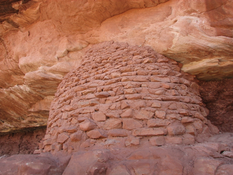
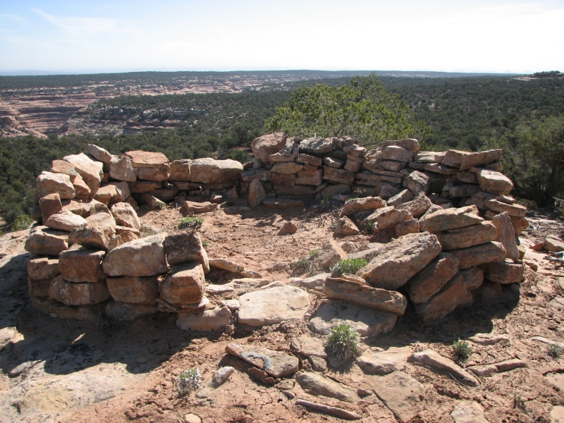
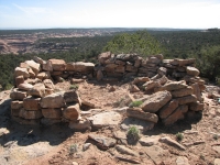
We drove a very bad road to Lime Canyon, the canyon just south of Road Canyon. It took 45 minutes to drive five miles, the road was that bad. There was no trail or trailhead for this hike. Our guidebook (Kelseys Canyon Hiking Guide to the Colorado Plateau) suggests following the rim of the canyon, looking north to spot ruins on the far side. We started our hike with a ruin called Rock Top Lookout on a rock outcropping next to where we parked our car. It was once round, perhaps a tower?
Then we followed game trails and no trails over to the canyon rim, which we more or less followed for a couple of miles. We did a lot of zig-zagging around side canyons or trees, but on the whole it was easy walking. We did spot three ruin complexes across the canyon, too far to photograph, but the binoculars showed them clearly once I spotted them. Im learning what to look for.
We were aiming for a specific ruin, the Little Citadel. We knew it was on a long spit of rock, like yesterdays big ruin. Unfortunately, theres more than one long skinny ridge. The first one we explored was easy to hike, the second a bit more of a scramble. Both were bare of ruins. Eventually we figured out the ruin was in a lower level, like the Citadel, not on top of the plateau. We headed back out the ridge and finally saw the Little Citadel in an alcove under the mesa. Getting there would be more difficult. We looked at what we would have to do to drop into the side canyon, then work our way around or climb back up to the alcove and decided it wasnt worth the trouble, not with Jim in pain. Instead we headed westward until we picked up a jeep track that took us back to the truck. I dont feel bad; we did what we intended, more or less. We found the Little Citadel and four other ruins and had a nice easy walk with only a little scrambling. Now were headed to town to see if we can get a motel room so we can get cleaned up and rest Jims foot. Its frustrating: his ribs are finally much better, but we still cant hike.
Sunday, April 20: Blanding
We spent a lazy day in town, icing Jims foot, reading novels and on the computer. Our only outing, besides breakfast and dinner, was to seek out the Westwater Ruin and Natural Bridge south of town. We missed it since the way isnt marked so went to the Edge of the Cedars Museum to ask for directions. Westwater is a pretty canyon. We didnt climb down to the ruin, just looked at it from across the canyon. We could see a large kiva. The natural bridge was level with the mesa. Water had cut a hole into the rim of the plateau, creating the bridge. It wasnt obvious, but it was a real natural bridge. It was another windy day with a lot of blowing dust. Im glad not to be camping in it.
Monday, April 21: Arch Canyon (6 miles)
It was another mixed day. Warm and sunny, windy and hazy, but not as bad as yesterday. We had breakfast at the grocery again (eggs, sausage and biscuit at the deli counter, much cheaper and faster than the restaurant) then headed to Arch Canyon. We spent some time looking, in vain, for some petroglyphs that are supposed to be on a knob nearby. Which knob wasnt clear. I think it was the one on fenced off private property next to the parking lot.
Then we headed into Arch Canyon. The trail in Arch Canyon is a 4WD jeep road that criss-crosses the stream for about 12 miles. The arches are in the upper canyon. To see them you need to either drive in or backpack. We ran into several jeeps and a motorbike as well as four hikers.

There is a large ruin within half a mile of the trailhead that was fenced off to protect it from cattle. The walls were mostly gone, but there were lots of petroglyphs. We continued up the wash and spotted two more ruins in better condition. We turned up a side canyon, heading toward Hotel Rock, but after a few minutes of bushwhacking, I realized that the trail to Hotel Rock is above Arch Canyon, not in it as I assumed. It has a separate trailhead, a short distance from the one we used. We could see the Rock far off in the distance, but not the ruins. As far as I could tell, there was no trail up from the canyon below, so we turned around.

On the way out, I spotted a wall in a cave barely visible above the brush. It wasnt far, so we bushwhacked through the dense willows (ouch!) to look closer and found several other ruins in alcoves hidden from below. A couple were in good shape and there were pictographs and some petroglyphs: hands, reverse hands, six baby feet, a carved and a painted snake, a few anthropomorphs, as well as two ducks. It was fun to find all that at the end of the day, especially after the mistake about Hotel Rock. Then I found yet another ruin on a knob right next to the parking lot when I was looking for the missing petroglyphs. It was completely fallen in, but the rocks were unmistakable.

We decided to head to Natural Bridges National Monument to attempt a hike in White Canyon tomorrow. Jims feet are still extremely painful, so we may not get very far, but he wants to try. Jim thinks he may have another broken bone. He broke his foot on the PCT in 2000, so knows how easy it is to do that hiking. This may completely overturn our plans for the next six months. Im worried sick about it, but theres nothing I can do but wait and see.
The campground at the Monument was full, so we headed back out to the desert to look for a place to camp. We picked the only dirt road in the area that doesnt have a multitude of campsites (the area burned a few years ago) but eventually we found a very nice site in the trees with a cooking stand.
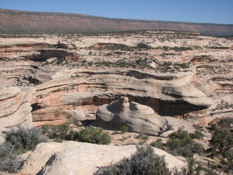
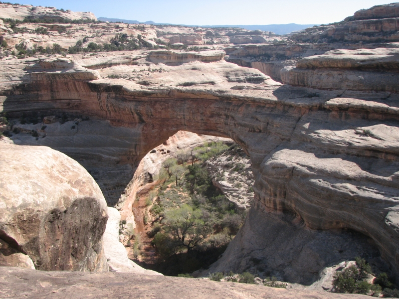
Tuesday, April 22: Natural Bridges (10+ miles)
We had an excellent but exhausting day, hiking in Natural Bridges National Monument. We followed a recommendation in the Kelsey guidebook to explore one of the side canyons in the park. It was good advice. The park doesnt advertise the hike since they want to minimize visitation to the ruins along the way, to keep vandalism and inadvertent overuse damage down. Despite the lack of publicity, and a sign saying Wrong Way, the route obviously does get used. We followed footprints and use trails all the way.

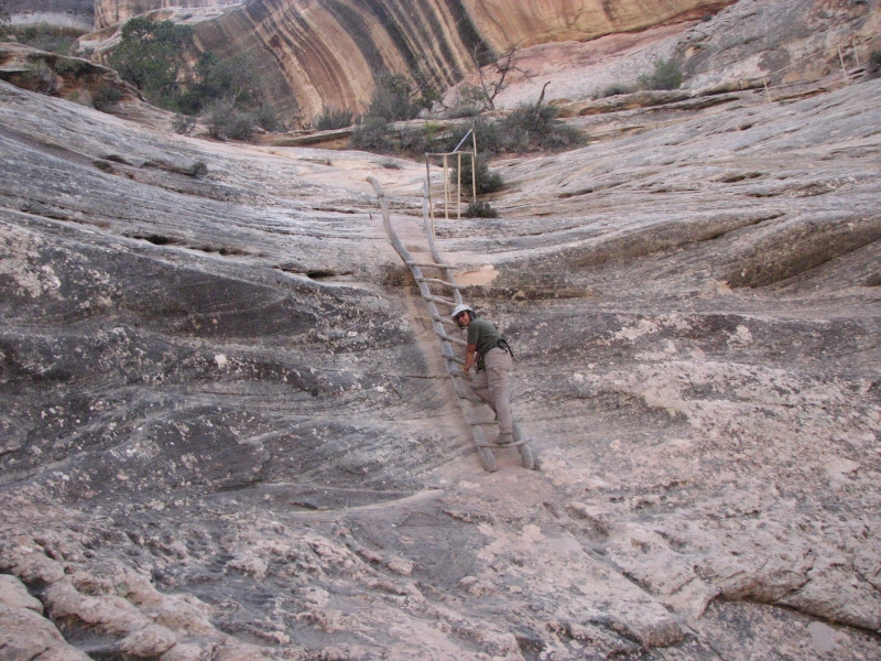
We descended past Sipapu Natural Bridge (the second biggest in the world, after Rainbow Bridge) on steep trail that included three wooden ladders. There are two ruins very close to the Bridge, but high above the Parks loop trail. We could see them, but not visit them. There was another ruin right on the trail down from the rim. Once in the canyon, we saw five other ruin sites. There were also three pictograph sites, as well as a few images at a couple of the ruins. One had dozens of handprints; one had two suns, a person and a snake. The most interesting one was the duck panel, with two anthropomorphs wearing a blanket with duck-like hands and feet. At one of the ruins there was a Godzilla-type creature like the one we saw in Bandelier maybe a Gila monster or chuckwalla? There was a white shield and an anthropomorph there as well.

The ruins were a mixture of good and barely there. One had an underground kiva with its roof still attached and the usual granaries and half walls. A couple of places you could barely tell there was a ruin. One had some intact buildings on an upper ledge while the ones down at ground level (the accessible ones) were demolished. Most interesting, because they were unusual, were a couple of double layer granaries (or very small store rooms). They were built half of stone and half jacal. One had a stone door still in place. The granaries were in really good condition. There was one we didnt see on the way in but only on the return journey because of the angle of the ledge. Another one we thought was merely mud debris in an alcove, until we got really close.
We had the canyon to ourselves until mid-afternoon, when we passed three people going the other direction. It was nice to be walking in a beautiful canyon without crowds of people or vehicles. Ive been surprised at the numbers of people in the canyons. Jims foot was better, or maybe the extra Advil he started the day with made a difference. Again theres no way to be sure how far we went. Though a lot of the walking was easy, we had to detour from time to time around blockages or pools of water, so there was a lot of zigzagging. We started a little after 10:00 and finished around 6:00. A good day's hike. We got a space at the Natural Bridges Campground before we started our hike. It only has 13 spaces, so it fills up quickly. Its a nice campground though.
Home | Links| Trail Journals|
The Thruhiking Papers Bun-bun
Created: 1 Jan 2009
Revised: 30 Sept 2016Copyright ©: 2008-2017 Spirit Eagle