|
 |
 |
 |
 |
|
|
|
|
|
|
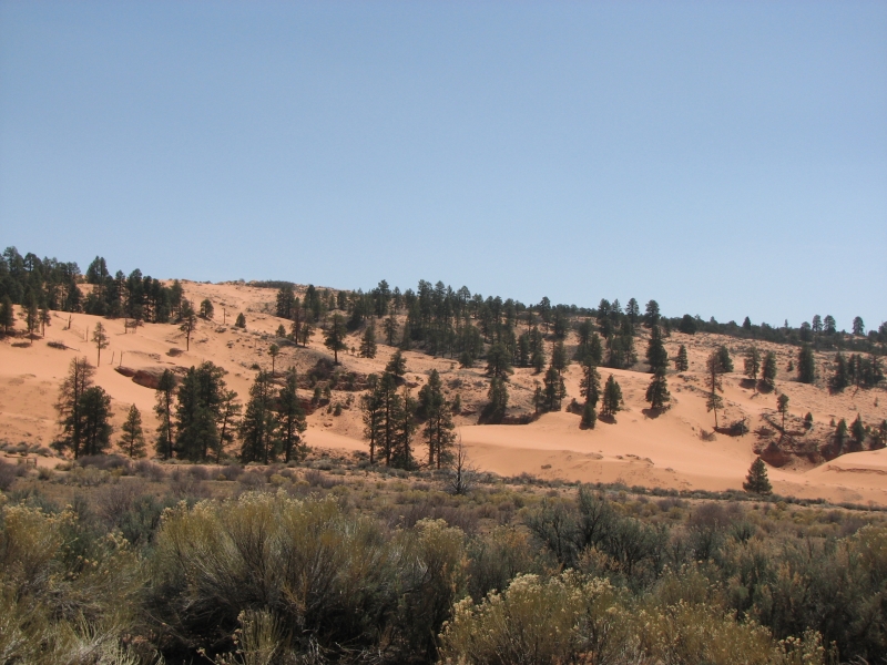
Monday, April 7: Coral Pink Sand Dunes, Kanab
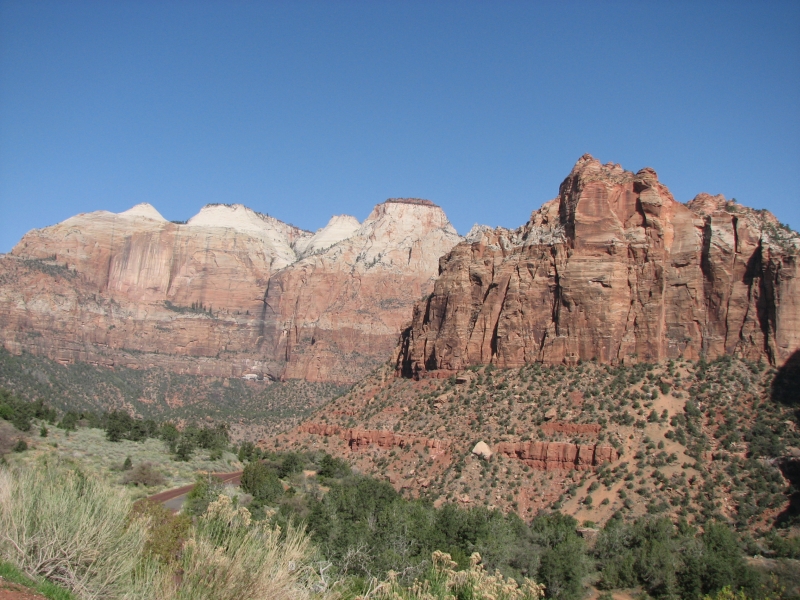
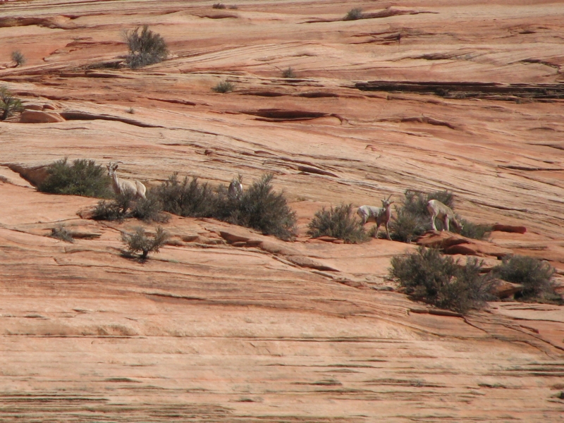
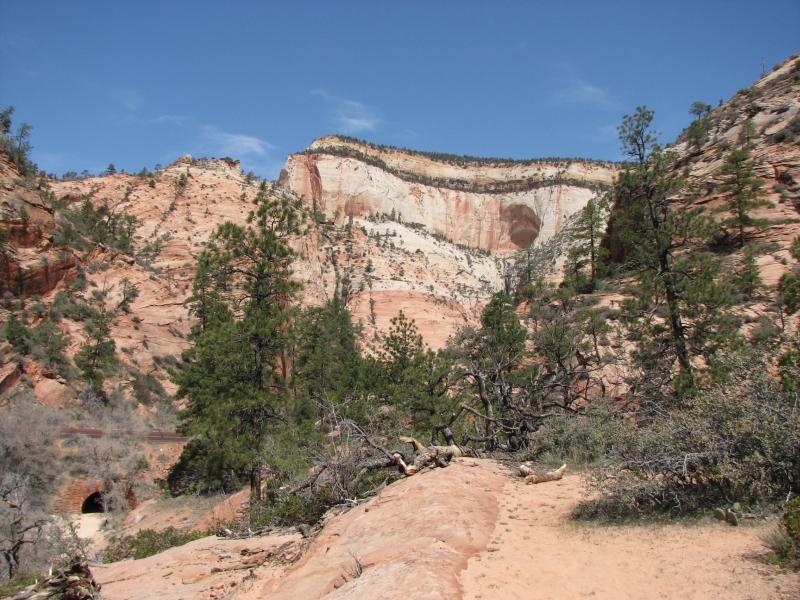
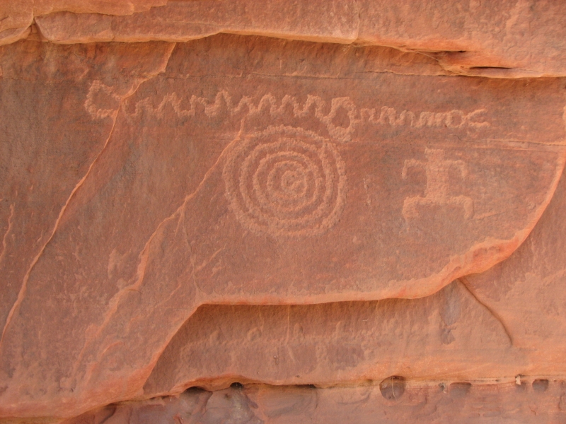
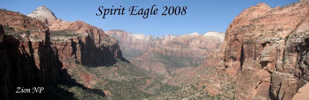
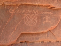
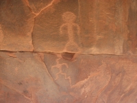
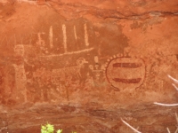
Another low key day, but a good one. We slept late, then did two very short hikes in Zion. The first was to the Overlook, a one mile (RT) hike to a nice view of Lower Zion. We saw a couple of bighorn sheep high above us on the red rock. Our second walk was to a petroglyph site in the park that was quite a nice one. Supposedly there are many petroglyphs in Zion, but they only tell tourists about two of them. These are sacrifice sites and have been vandalized a bit. Todays site had some good images: several bighorns, a joined male and female, a possible birthing scene, mazes, etc. Nice.
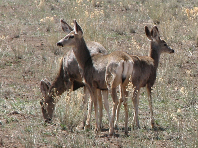
We headed south to Kanab after a detour to Coral Pink Sand Dunes State Park, which really does have pink-orange sands. We saw three small herds of mule deer on the way and a coyote crossed the road ahead of us. The land is high desert--sage, pinion and scattered ponderosa pineswith low red cliffs and lots of silky soft pink sand. The park is very popular with ATVs so we decided to skip the campground and head into Kanab to get an overdue shower and do laundry. We tried a couple of motels that had no one at the desk and attempted to visit a camera store that was also closed at 3:00 p.m. We finally found an inexpensive room at the Sun N Sand Motel, did laundry at the laundromat up the street and bought groceries for the next few days. Dinner was a good one at the barbeque place next to the motel. I ate fish and Jim turkey. On our way to dinner I noticed a hawk sitting on a light pole plucking feathers off a dead pigeon. We watched for a few minutes while he tore into the bird, oblivious of us watching down below.
A cold front has passed through so it is noticeably cooler. Its snowing in Salt Lake, but just cool and hazy here. Rain is forecast over the next couple of days, which could be a problem since well be driving dirt roads in the backcountry of the Arizona Strip.
Tuesday, April 8: Nampaweap, Grand Canyon, Toroweap/Tuweep CG
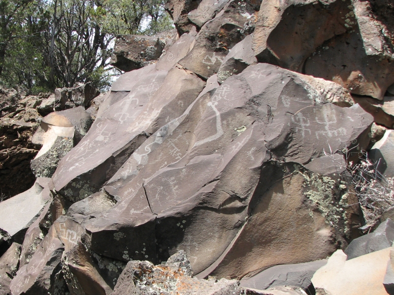
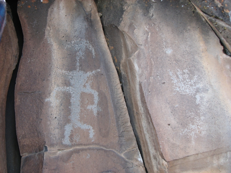
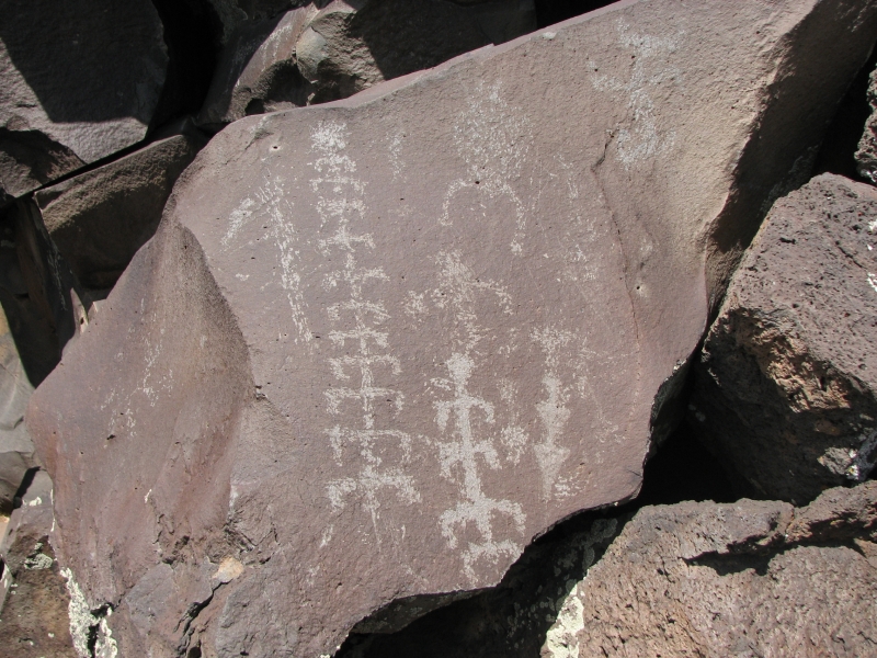
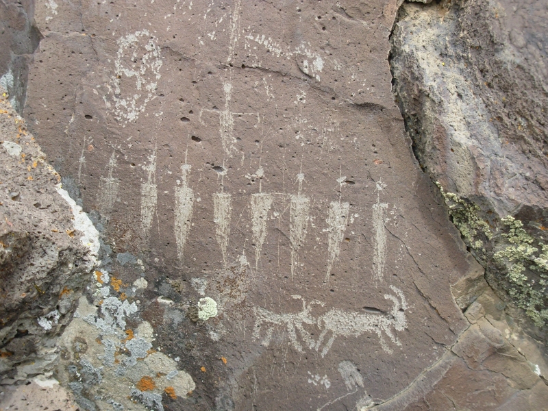
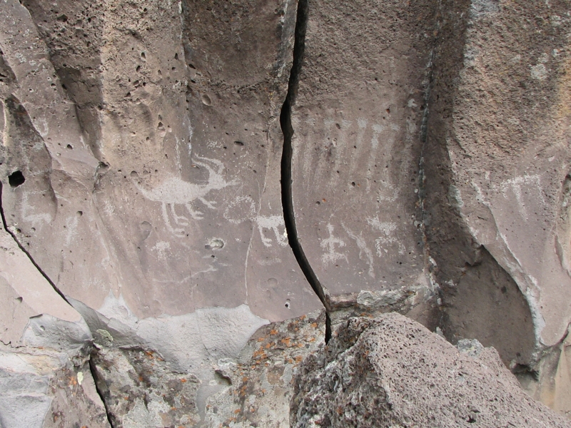
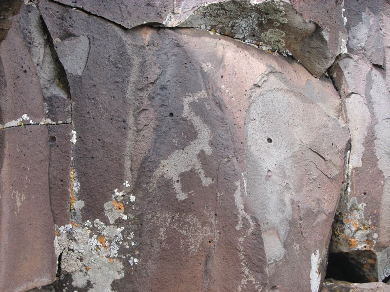
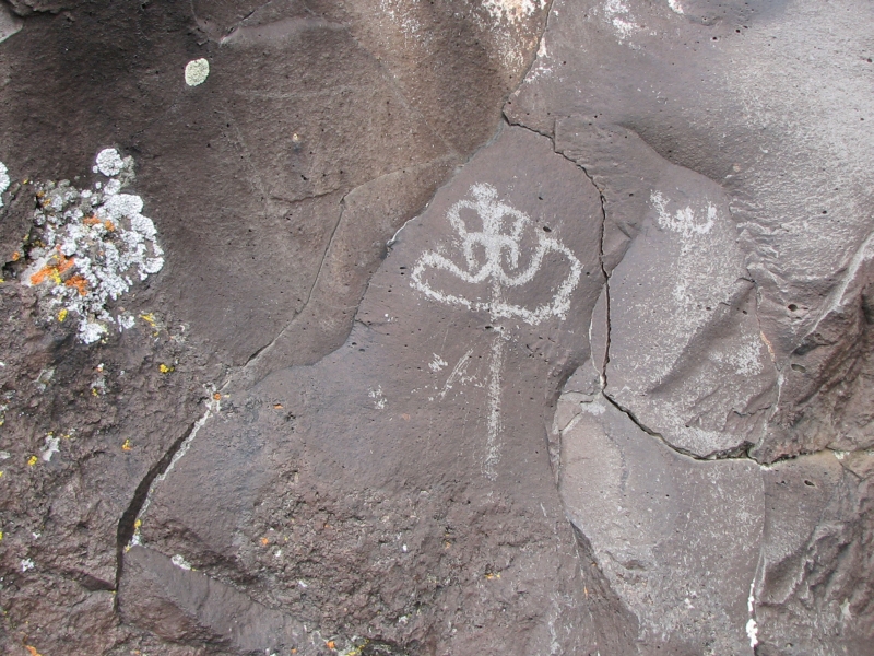
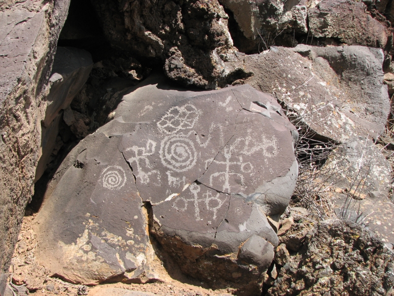
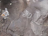
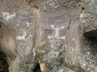
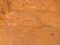
The rain held off, though grey clouds threatened all afternoon. We headed south to Grand Canyon - Parashant National Monument where we found a really good petroglyph site called Nampaweap, aka Billy Goat Canyon. I found out about the site, like Little Black Mountain, from the Internet. Its amazing how much information you can find on the web if you go searching. The BLM provided good directions and the Arizona Strip map notes its location. Nampaweap is supposed to be the best petroglyph site on the Arizona Strip, with thousands of images over at least a half mile. The rock is volcanic, so the images were not as clear or precise as sandstone carvings can be, but there were a lot of good images. There was a short easy hike to get to the canyon (3/4 mile) plus the walk along the rocks.
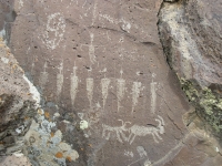
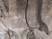
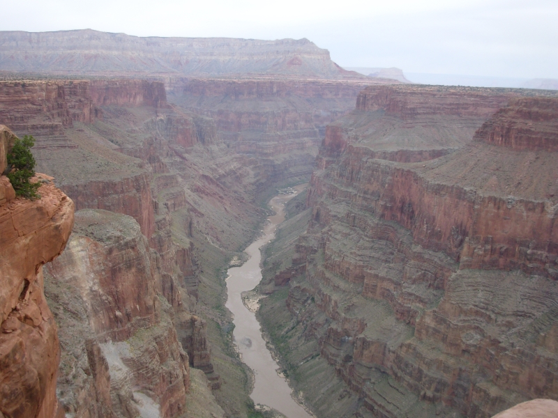
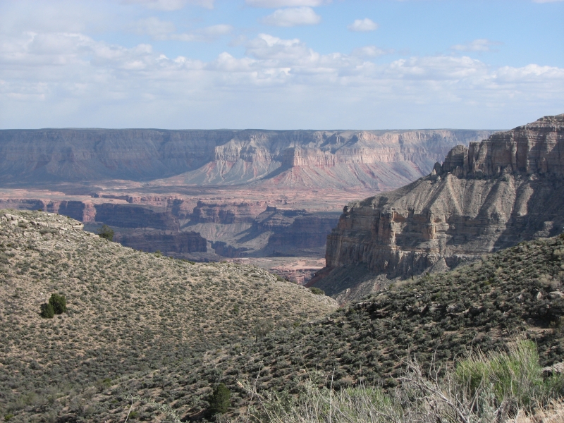
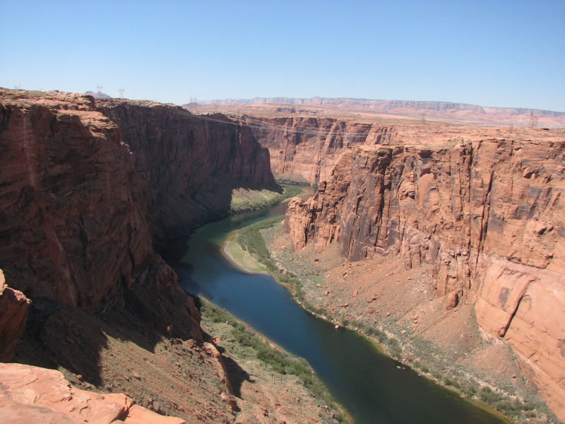
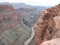
We spent a couple of hours taking pictures of the petroglyphs before heading on to Toroweap (aka Tuweep) Point, which is in Grand Canyon National Park. Toroweap Point is a vista on the north rim of the Grand Canyon overlooking the Colorado River just above Lava Falls. We can see the ancient volcano known as Vulcans Throne and black lava flows leading to the river. Because of the storm, the views were not as spectacular as usual, but they were still nice. The canyon does not show well under cloudy hazy skies. It is still a beautiful area, very remote. There is a 60 mile dirt road out to Toroweap. The first 50 or so miles were good graded road, but once we entered the national park the road got really rough and rocky. I think they are trying to discourage people from visiting the area by neglecting upkeep. We ran into one group that decided to back out rather than continue up one bad pitch. There is a free campground out near the point where people parked and carried their gear out to some of the outlying campsites rather than drive the road. We got lucky and found a site where we could park. Toroweap is a better campground than I expected after driving the road, with 10 sites, two nice outhouses, picnic tables and fire rings. If only the road werent so bad, it would be ideal. About half the campsites are occupied.

The wind picked up mid-afternoon. It made scrambling over the sharp volcanic rock a bit tricky. When we were at Toroweap Point I was afraid of getting blown off the edge, so we both stayed well back. There are no protective railings out there. This is the undeveloped part of the Grand Canyon. Its very, very different from the south rim.
Despite the distance, Toroweap is a popular place to visit, probably because the rest of the north rim is still closed until mid-May. We saw several cars out at the viewpoint, despite the bad road. Its a long way from Las Vegas, or even St. George, so I was surprised to see so many people. We are low enough here (6000) that the land is desert and the snow is gone. A ranger told us that they had a lot of snow this winter, so two months ago the road was impassible. He was a friendly one. We spoke with him for a long time out at the Nampaweap Trailhead.

I asked the BLM ranger about a site we hope to visit tomorrow and he was surprised I even knew about it. He asked where I had heard about it and I told him the Internet". He wasnt happy to know that the information was so easily available, since the rangers dont want more visitors. The site hasnt been vandalized yet and theyd like to keep it that way. I do understand. Jim spoke of the ethical dilemma of sharing your knowledge with people who may misuse it or go out unprepared because the information makes it seem so easy. On the one hand, we enjoy helping people to experience some of the places weve come to love, on the other hand, what are the consequences of more people in the remote and wild places? Is it selfish (or elitist) to want to keep the good places to ourselves? Sometimes it feels that way. We are excited about the places we go, and I love to share that excitement with like-minded people, but when you see the vandalism at some of the developed petroglyph sites or the trails and campsites that have been loved to death, keeping silent seems like a really good idea. The CDT is changing, in part because weve helped make it more accessible, easier to plan and do. Good or bad thing? I still dont know. By sharing our photos of beautiful places and interesting areas to hike and find rock art, we might be helping to destroy the sense of remoteness that is part of the allure. The ranger said, Dont give directions. We wont.
Wednesday, April 9: Grand Canyon
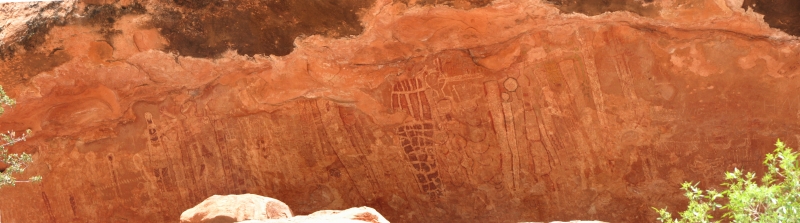

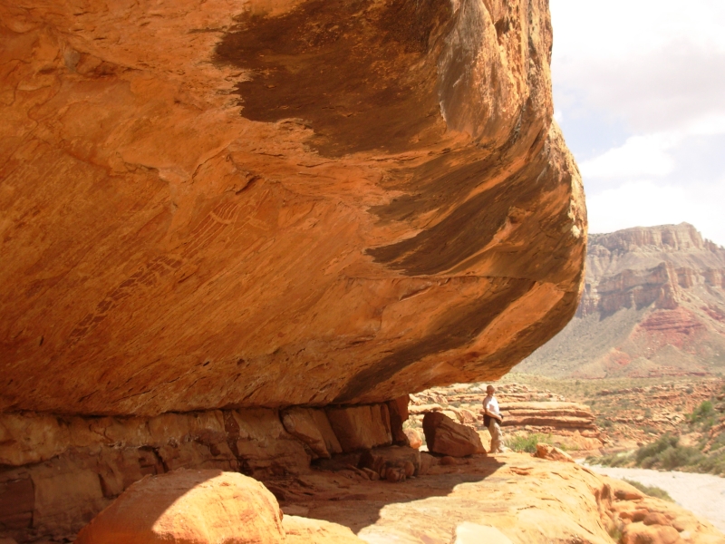
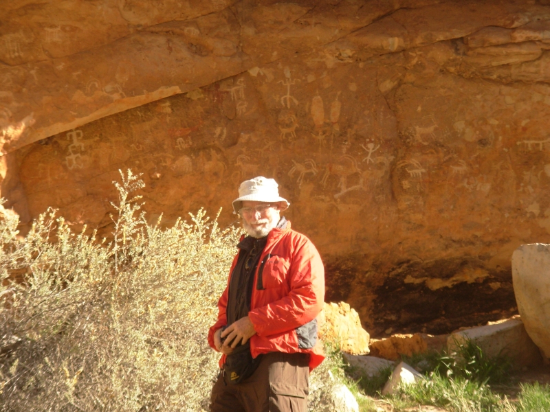
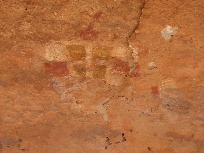
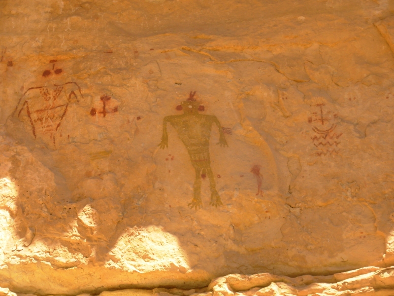
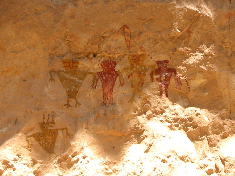
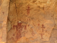
We got lucky today. No other explanation. We shouldnt have attempted todays excursion but we both wanted to do it so badly, we decided to try. A couple of days ago I stumbled onto a website with photos of a spectacular pictograph panel in a remote section of the Grand Canyon. Our hiking guide had directions to a trail that passes the site but noted that the road has deteriorated and now requires 4WD and high clearance, neither of which we have. Weve driven rough roads before, including the one out to Toroweap, so we were willing to take a chance. The guidebook was right, it was a very rough road. An additional element of uncertainty was added by the fact that none of the roads were marked and there were more roads than show on the map, so there was some question of whether we were even in the right place. We just followed our instincts. It was very slow going, and the car got badly scratched by brush growing over the road, but eventually we made it to the trailhead.
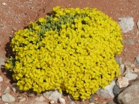

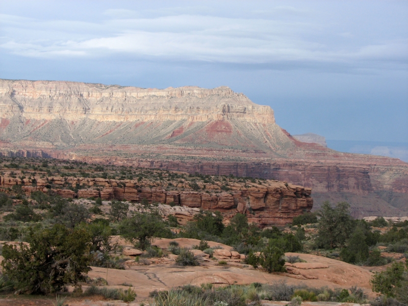
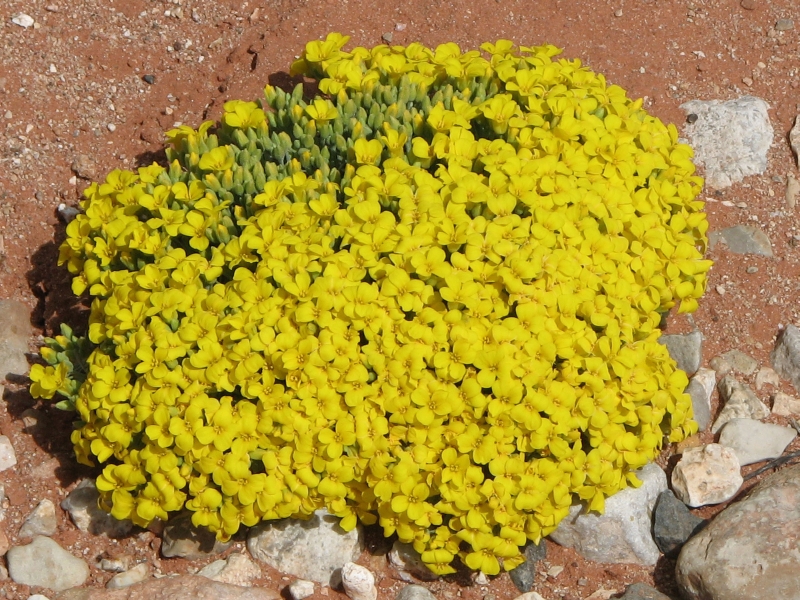
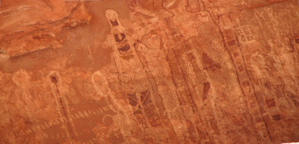
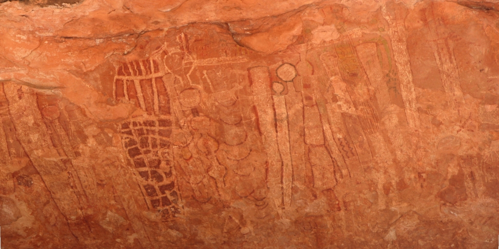
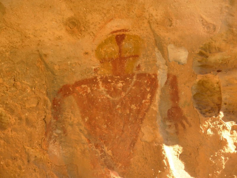
The trail was in better shape than I expected, after driving the road. It was steep and on loose rock in spots, but not that bad a hike. We dropped 1800 in three miles, following a canyon down to a bigger canyon. On one side was black volcanic rock, on the other red sandstone topped with a yellow white layer. There was sage and juniper with a few spring flowers: red paintbrush, purple locoweed, pink and white phlox. At the bottom of the canyon we followed a dry wash for half a mile or so to a large alcove. The sandstone layer is soft and highly erosive, so there were caves and alcoves all over the place. The one we wanted was pretty obvious though. About 25 above the sand was a long shallow alcove with over a dozen large (10 high) multi-colored shamanic figures as well as a few other images. They were very old, so the images were quite faint, but it was a really cool site. It reminded me a lot of the Barrier Canyon panel known as The Great Gallery, which has the same sort of huge ghostly otherworldly images. The Barrier style archaic images in Utah are 2000-8000 years old. I wonder whether these are as old as they look? The style is different and the use of colors (red, white, black, yellow and green) is very different but the Grand Canyon Polychrome style definitely looks similar to the red Barrier Canyon style images we were introduced to last year. We took lots of photos, but the light was bad and the paint is faded, so I doubt well get many good ones. It doesnt matter, I was happy just to get the chance to see them.
We climbed back out to the trailhead and ran into our only other hiker today, a man from Maryland heading out on a backpacking trip. The last person to sign the trail register was three days ago, so I didnt expect to meet anybody out there. But then, all the tourists at Tuweep were a surprise too.
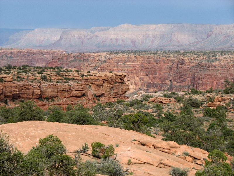
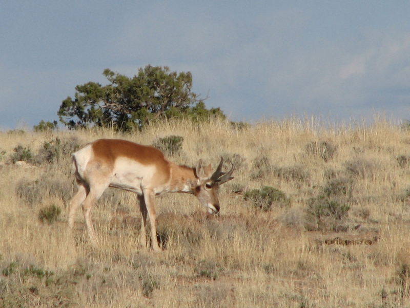
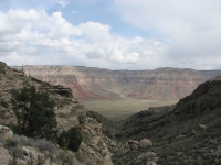
The drive out was worse than the drive in (but without the navigation issue) but we made it out to the highway again without any major problems. One aspect of our luck was avoiding any real rain. There were lots of clouds, but we only got two brief sprinkles. The sun came and went all day. It was cool about 50 degrees but comfortable. It was clear when we reached the trailhead, so we got a nice view of the Grand Canyon far off in the distance. We saw one antelope today and one yesterday. Its their kind of country. We saw lots of cows and a few horses on the BLM lands north of the Park. It is open empty land, but not barren. I dont want to live in sage country, but I enjoy visiting it, especially when it is surrounded by multi-colored rocks and cliffs.
We ended up driving to Pipe Spring National Monument for the night. The Monument was closed when we arrived, but a small RV park next door had space and a nice hot shower. It was cold and windy so we ate dinner in the back of the truck, but we were snug and protected and clean. Happiness is. After all the wind the past couple of days we were feeling very grimy. Everything in the back of the truck is covered by a thick layer of dust and sand. The cap isnt sealed tight any more, so these long dirt roads really make a mess of everything. We have brown sleeping bags, brown pillows, brown suitcases. We shook everything out, but it still clings.
Jim: The locals call this site "The Wall". And it definitely rates the caps. The road to the trailhead was 4-wheel drive rated, with deep erosion channels so the driving, both in and out, was challenging with a 2-wheel drive truck. Long ago and far away in another universe I did vehicle testing for the Marine Corps, but I still need to thank Ginny's brother for teaching me a few new tricks that saved our tails (and the truck) on that road.
As Ginny said, there are ethical issues about this site as well the difficulty of access. I was once accused of being an elitist and not wanting people to hike the CDT. That wasn't true, but in this case I'll freely admit my prejudice for keeping this site way out of reach of the "average bear". If I had my druthers, this is one site that only the most dedicated and respectful would ever see. We've seen too many rock art sites that have been trashed by the "average bear".
Yeah - I've been accused of being "blunt" too. Draw your own conclusions.

Thursday, April 10: Pipe Spring NM, Snake Gulch

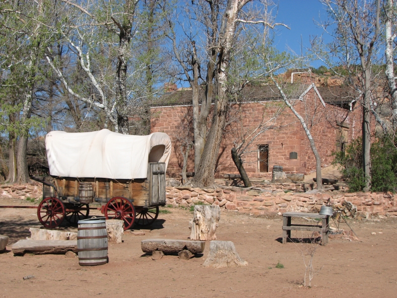
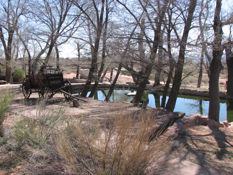
We started the day with a tour of Pipe Spring National Monument. It was a Mormon tithing ranch in the late 19th century, built as a fort to protect the ranchers from Indians and the U.S. Government. They raised cattle and crops to send to Salt Lake City. There were interesting tools and furnishings, the cheese presses, churns, the Mormon telegraph line, etc. It was a pretty homestead, well named the Winsor Castle.
They did a nice reconstruction of the ranch, but I couldnt help but feel angry at the arrogance of the settlers who took control of the only water source in the area, destroyed the grasslands with overgrazing and enslaved the local tribe. Im not sure that that is something to commemorate. Its certainly not something to be proud of.
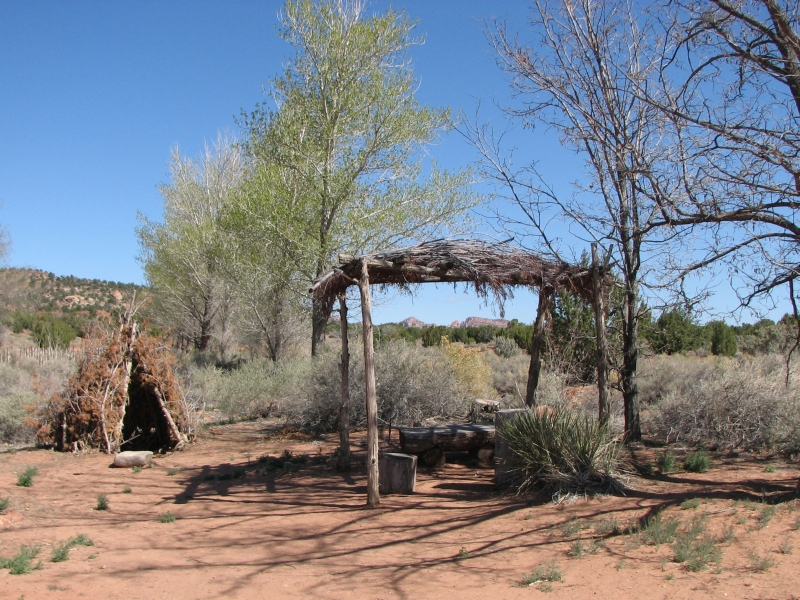
Afterwards, we headed back out to the Arizona Strip to another rock art site well visit tomorrow. Its an all day hike, so we decided to drive out today, spend the night at the trailhead and get an early start in the morning. We did a short walk up a side canyon, then settled in the back of the truck to read and relax. It was cold and windy, so we were happy for the protection of the cap.
Friday, April 11: Snake Gulch, Kanab Wilderness (11 miles)
We had a really good, albeit exhausting day. The rock art we saw was really interesting and there was a lot of it. We didnt go all the way down the canyon, but we made it to Table Mesa Canyon, which was our goal. Its about 5-6 miles in. We started early, for us 7:30 local time. It was so cold, the windows were covered with ice, but when the sun came out, it warmed up comfortably.
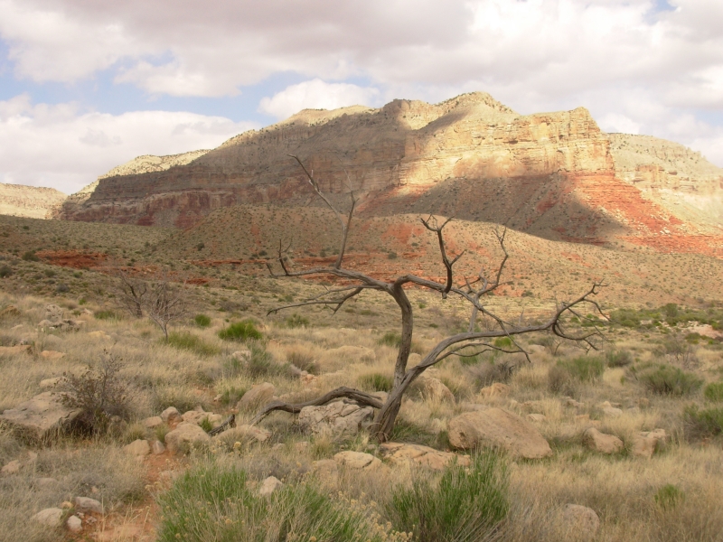
The land is sage grassland with occasional pinion pines and some cactus. Its dry country. The rock is a pinkish orange color Toroweap Formation topped by white limestone. The colors on the rock look like pictures, making it hard to spot the real pictographs sometimes. The canyon is mostly wide, with tall cliffs rising a couple hundred feet on both sides. Theres a lot of broken rock and many caves and alcoves.
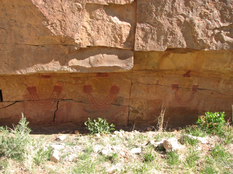
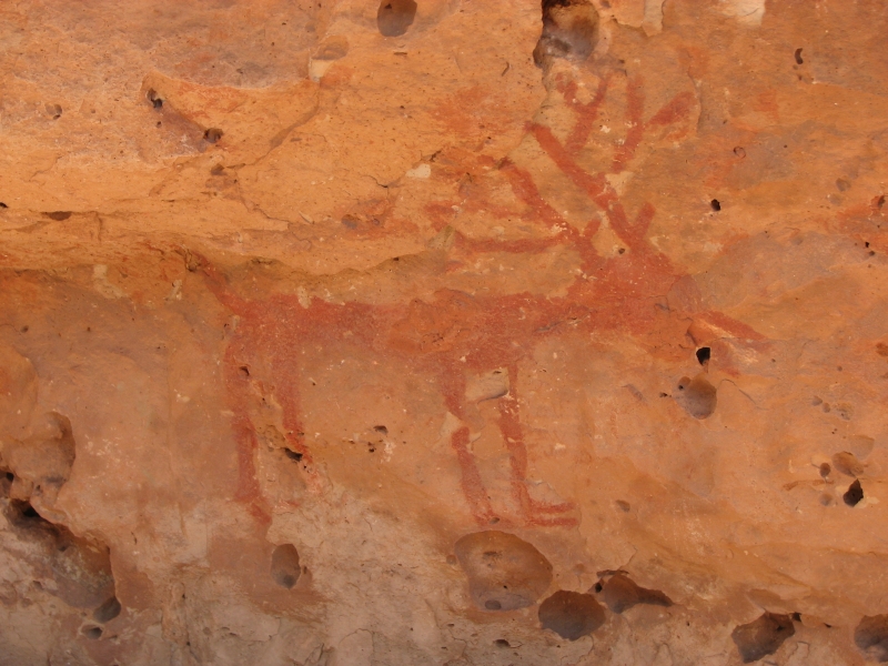
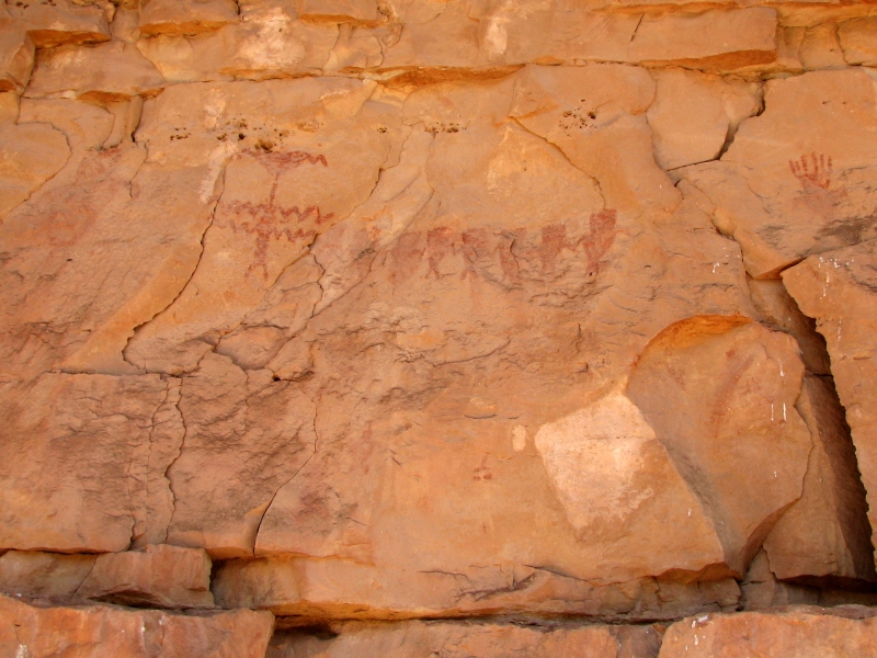
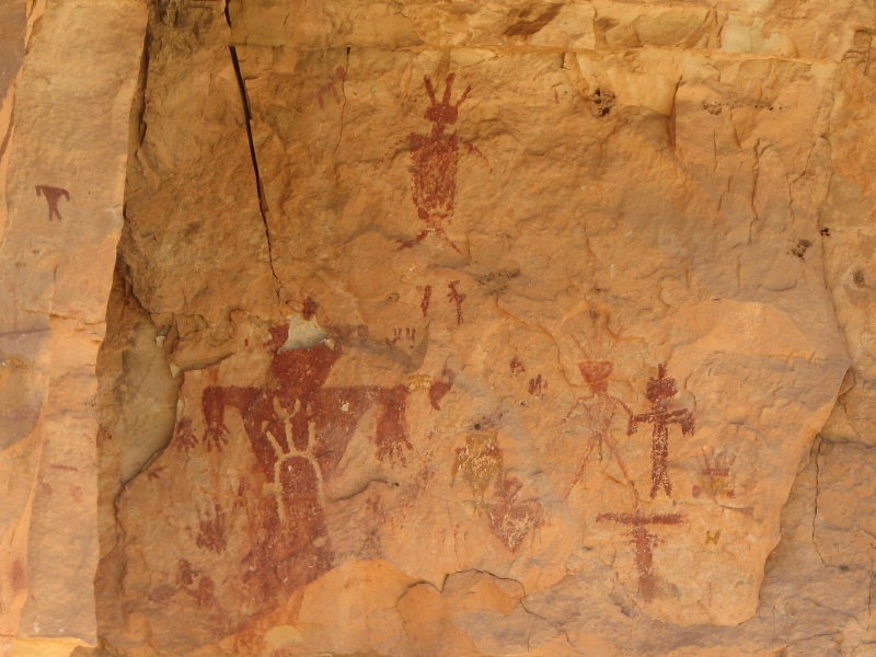
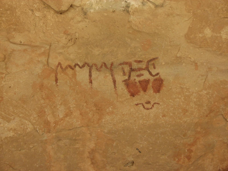
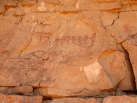
About two miles up the canyon was our first site, an alcove covered in petroglyphs. They were just about the only carvings we saw all day. The rest of the rock art that we saw were pictographs, mostly painted red, but also white, yellow, brown, black and blue-green. Red paint lasts longer than the other colors, so though originally there may have been more white or yellow pictures, now those images are very hard to see. Most of the pictures were on the north side of the canyon, but not all.
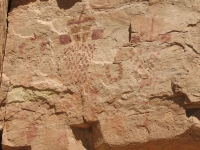
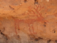
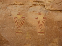
There were scattered images and one long alcove with lots of pictographs, including some two-toned birds that were either buzzards or turkeys. The majority of images we saw were anthropomorphs: little triangular people like we saw at Deer Creek or stick people or shield people or large shamanic figures. There were several Kokopellis, usually portrayed on their backs. Many of the images were similar to the Vernal style figures we saw in northern Utah, where the headdresses and necklaces were clear, but the rest of the body was not. There were a couple of pictoglyphs, both painted and carved. Some of the images had a lot of detail, some were very faded and hard to see, some were very simple representations. There were a lot of different styles, sometimes all mixed together. Some areas had few pictures, while in others every rock face had an image or two. We had a lot of fun looking for images and photographing them.
There were a few small ruins in alcoves, with just a little bit of mortared wall showing. We never did see any of the granaries though. Some of the alcoves had mud spatters on the ceiling. At Betatakin we were told that people threw mud balls up as part of the art or ritual. Weve seen them elsewhere in the area. The reason why is another mystery about the Anasazi. There are so many.
We turned around at about 1:15 and made it back to the car a little before 4:00. We stopped to retake a few photos where the lighting was different from the morning and we spotted several images on the south canyon wall that we had missed. Since there were so many alcoves, we had to follow one wall quite closely as some of the images were pretty low. On the return hike, we stayed on the trail, which gave different views.
We decided to camp at the trailhead again rather than return to Kanab. We are both tired and sore. The hike was an easy one on good trail, but with enough starting and stopping and occasional climbing it felt like a long day. Plus I think all the images in our heads make them tired. Sensory overload. Tomorrow well do a short drive, get a motel, get cleaned up and have a rest day. Getting clean sounds awfully good right now. Were both coated with fine sand.
Jim: Actually I remember a lot of climbing. When you're following a wall and looking for rock art, you get to climb every pile of erosion debris along the wall. And there are a lot of them. But it was worth it. There are more pictographs here than at any other site we've seen yet. And I'm addicted to pictographs.
Saturday, April 12: Marble Canyon, Page, Arizona
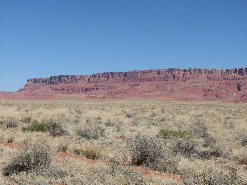
It was a scenic touring day, easy and enjoyable. We did a short-cut to Jacobs Lake that had us driving on snow and ice at 7000 elevation. It wasnt deep, but still it was unexpected, though we had seen snow through the trees up on the plateau. The highway followed the edge of the Vermillion cliffs. They were beautiful, a rich deep red, with many different layers in different colors, from chocolate brown to gray to purple to red to white. It was a gorgeous drive.
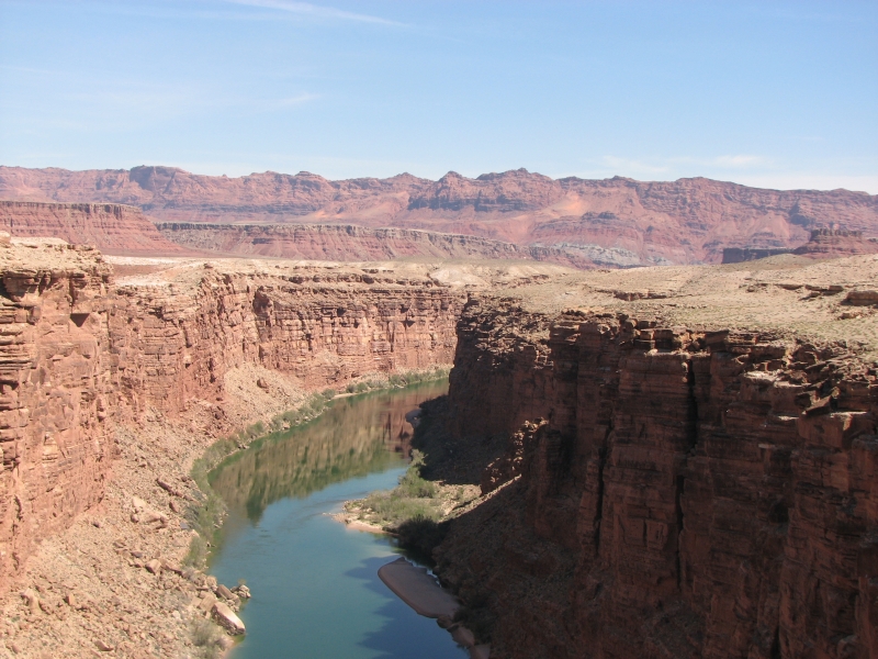
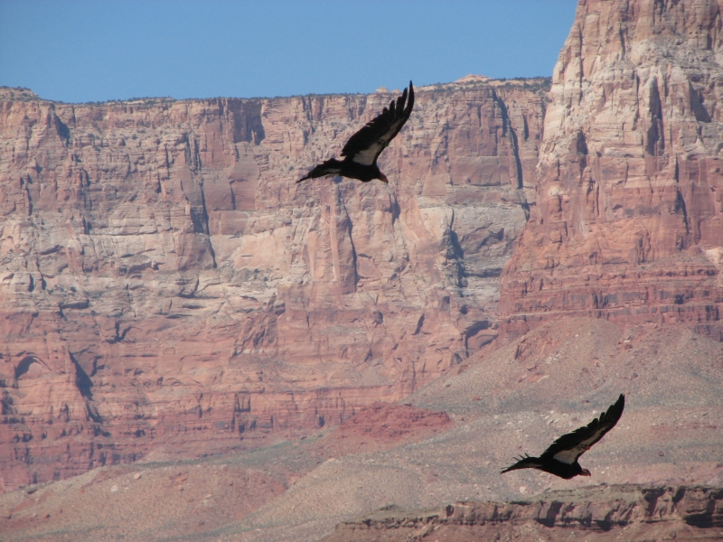
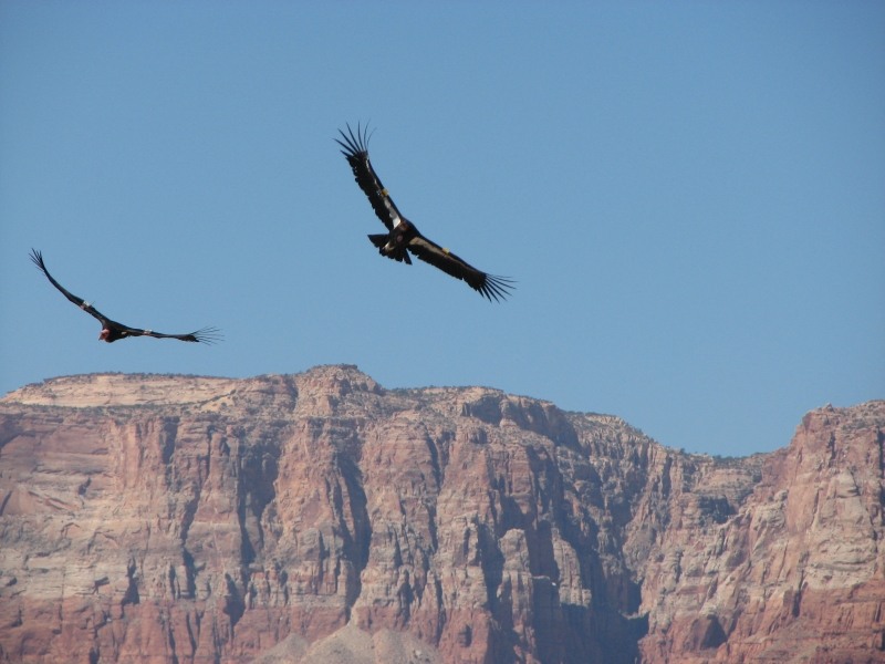
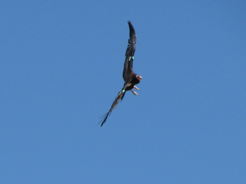
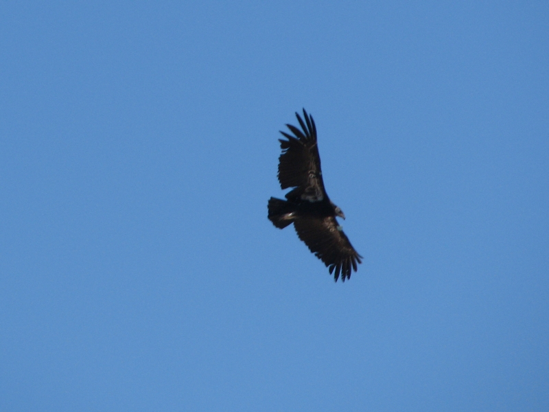
We stopped at Navajo Bridge at Marble Canyon to use the restroom. When we did our rafting trip in 2005 we floated under that bridge on the first day. Its the last one across the river until you reach Phantom Ranch. The river looked very different today. Instead of muddy brown, the water was a deep emerald green. The river was barely moving and looked very beautiful and serene. I talked to a biologist who was monitoring condors in the area. He told me there were five in the immediate area and pointed out three that were sitting on rocks under the bridge. We watched them for a while, then visited the Visitors Center. When we started to drive across the bridge, I looked downriver and spotted a large bird flying over the bridge. We stopped on the far side and watched four of the giant condors circling. They are beautiful, with black and white bellies, but a buzzard head, since they are scavengers. They didnt look as big as I expected, until one flew directly overhead and I saw how large the wingspan is. I was utterly thrilled. As many times as Ive been to the Grand Canyon, this is the first time Ive seen the birds. I was really excited to watch them soar along the edge of the cliffs and over the bridges.
We got a nice motel room in Page. Next door is a car lot with a sign saying Red Hot Deals. Next to the sign is a pen of sheep. I wonder if you get a sheep if you buy a car or if you can buy the car with enough sheep. I wonder how many sheep it takes to buy a pick up truck?
Home | Links| Trail Journals|
The Thruhiking Papers Bun-bun
Created: 1 Jan 2009
Revised: 30 Sept 2016Copyright ©: 2008-2017 Spirit Eagle