|
 |
 |
 |
 |
|
|
|
|
|
|
Tuesday, April 1: Chloride, Grapevine Canyon and Davis Dam in Laughlin
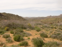
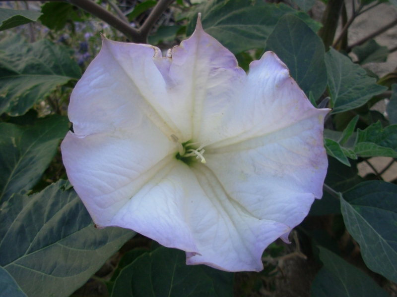
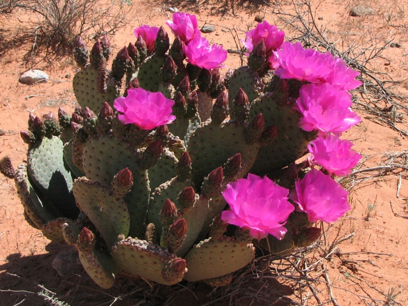
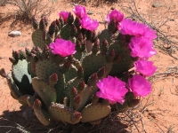
In Flagstaff there are still scattered patches of snow in the trees. The mountains are white. Rather than continue north, we decided to go west, dropping from the high plateau country to desert again. We left town around noon, after breakfast at the motel and a stop at the grocery to stock up for the next few days. We passed from pines to juniper-pinion to agave-covered desert. It was nice to be seeing wildflowers again.
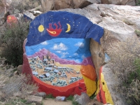
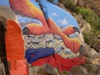
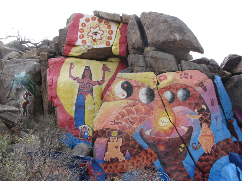
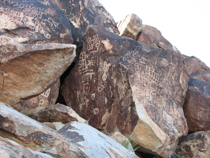
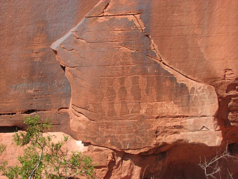
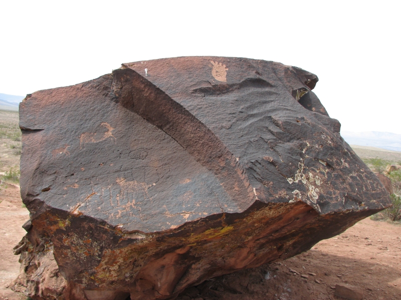
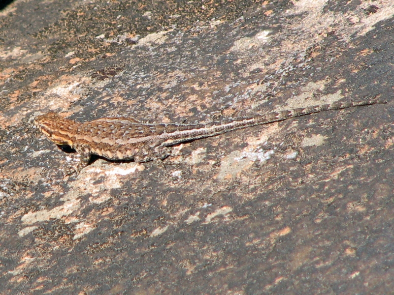
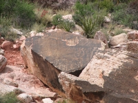
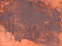
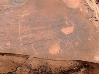
Our first stop was near Chloride, about 20 miles north of Kingman. There is a small petroglyph site there. What makes the place interesting though is that 40 years ago an artist, Roy Purcell, felt driven to paint a huge mural on the rocks opposite the petroglyphs. It was a big and colorful set of images: a mixture of 60s subculture (Buddha, Isis, etc.) and paintings of the town. Purcell was working at a nearby mine, then spending his evenings painting. As he said, he dug rocks by day and painted rocks by night. Evidently he returned to Chloride a year and a half ago and repainted the images, so they were bright and beautiful when we stopped by. The petroglyphs werent very exciting, but the murals more than made up for it. They were interesting and fun. Evidently, they are well known too. There is a guest book at the store in town that had signatures from people all over the world.


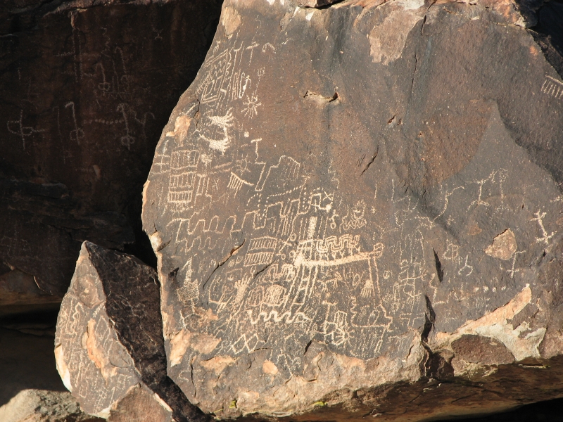
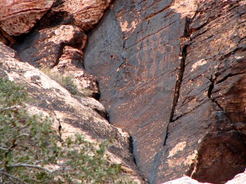
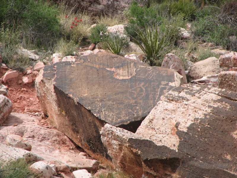
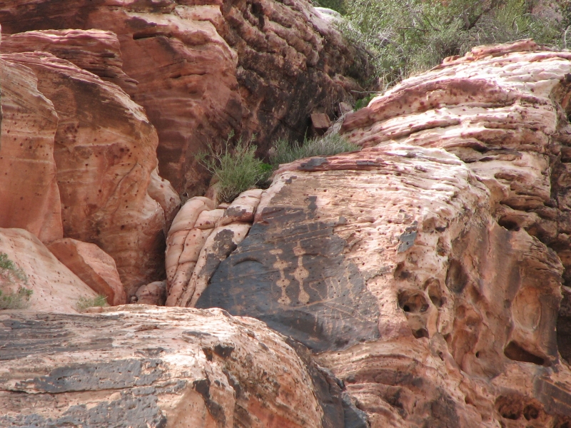
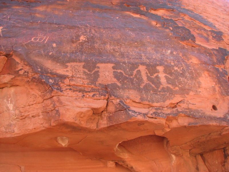
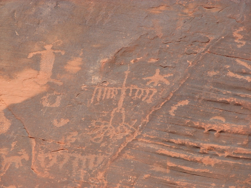
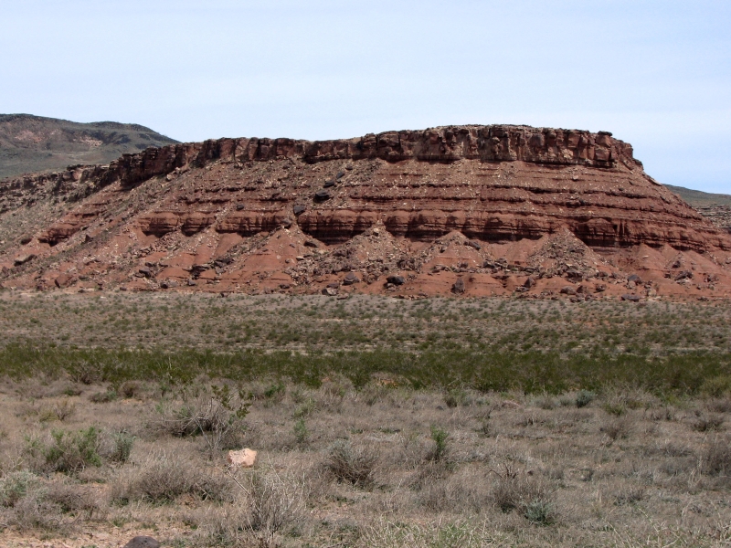
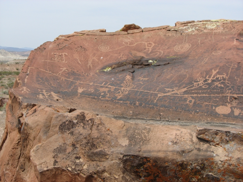
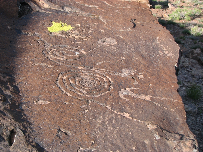
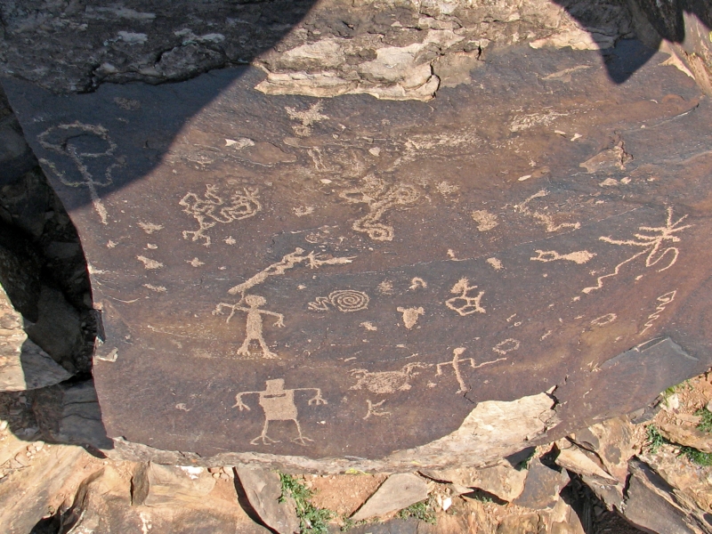
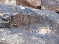
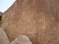
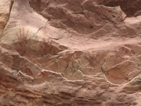
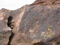
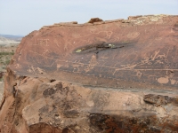
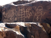
Our next stop was far from disappointing. About eight miles north of Laughlin is an area called Grapevine Canyon that was a very exciting petroglyph site. There were hundreds of images covering rocks on both sides of a small canyon. We didnt see everything, because many of the images were very high and out of reach. We could look across the canyon, but there were so many petroglyphs, they were hard to distinguish. Many were the mazelike maplike images we saw in the Hohokam sites, but different. The archaeological term is curvilinear and rectilinear curved lines and straight lines. Lots of grids. There were masks and bighorns that were obvious and some anthropomorphs and spirals that were easy to spot, but some of the images were really indecipherable. Anyhow, we had a lot of fun climbing up and down looking for rock art and taking photographs. There were several small caves that were used as camping or living spaces: the ceilings were black with soot.
We ran out of time and reluctantly had to leave before the sun set so we drove back to Laughlin, where we got a campsite at Davis Campground next to the Colorado River, a short distance upriver from the casinos. Dinner was at IHOP. When we got back we discovered that the bathroom is locked though the campground has lots of people camped there. Odd.
Anyhow, I feel good about our day. I really enjoy looking for rock art and taking pictures of the petroglyphs we find. Grapevine was one of the better sites because it was so densely packed with panels and had scattered images as well. Supposedly, some of the art is buried, because the ground level is higher now than it was when the rocks were carved. This is one of those mixed sites where people have been visiting for 10,000 years. It does make for an interesting mixture of arcane art.
Wednesday, April 2: Red Rock Conservation Area and Valley of Fire
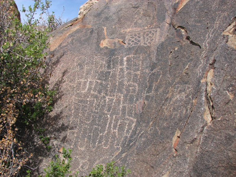
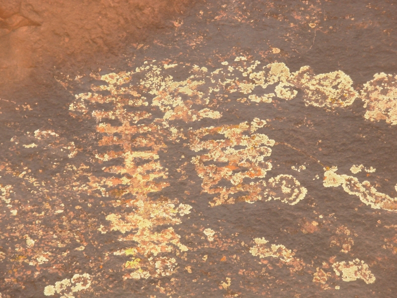
It turned out our campground had its own small petroglyph site: Inscription Rock at Davis Dam. They have fenced it off so our pictures were taken from a distance and shooting toward the sun, so I doubt well get much worth keeping, but it was rather interesting to chance into another rock art site. The Mojave Indians did a lot of grid patterns. I wonder what they meant?
We headed up through the desert to Las Vegas. We had no intention of visiting the Strip; its definitely not our kind of place. Money is too tight to waste on gambling, especially since I dont enjoy playing with machines, and while it is interesting to gawk at the excesses, the casinos are chaotic and crowded, not a scene I enjoy. There are, however, two parks near the city that have rock art.
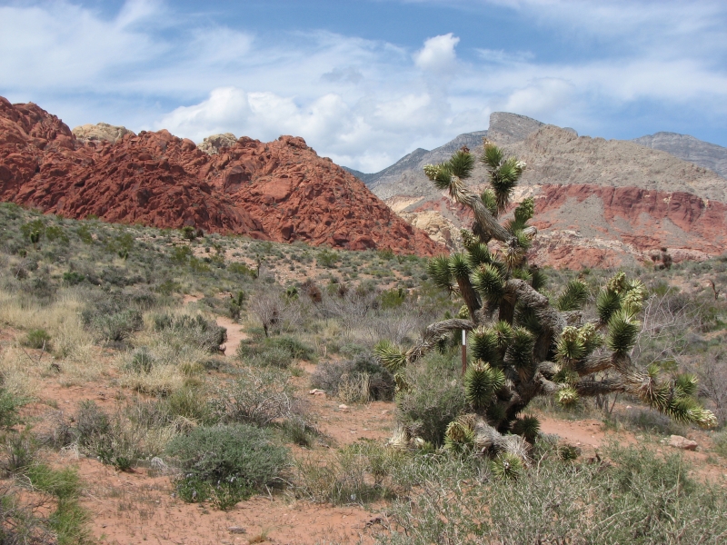
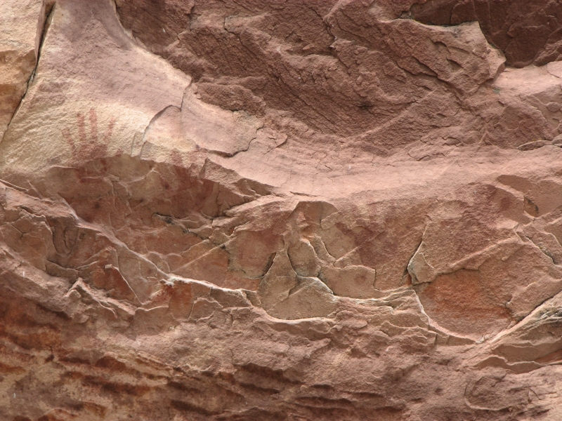
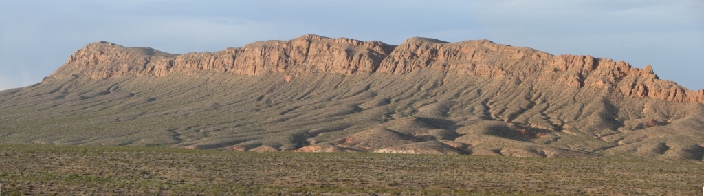
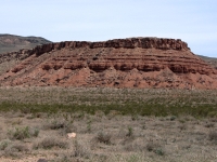
Red Rock Conservation Area is a beautiful BLM area 20 miles west of the city, much visited by rock climbers and tourists. There is a 13 mile scenic drive past large red and white rock formations. There are two rock art sites described in our guidebook. Neither was particularly exciting. Red Spring had a dozen or so petroglyphs on its half mile nature trail and Willow Spring had three pictographs: some handprints at two sites and a deer or shaman at another. There was a very small seasonal waterfall along the Lost Creek Trail not even worth a photo.
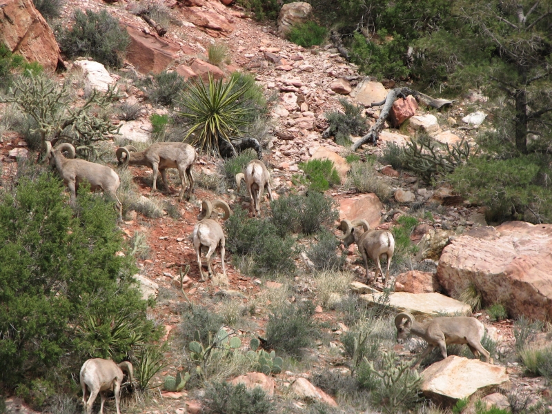
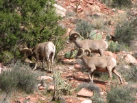
What made the hike fun was running into a herd of desert bighorn sheep not too far off the trail. We took lots of pictures and watched them for a while as they fed, napped, butted heads and wandered. We counted 13 sheep, though there may have been more. It was a pretty and popular scenic area. Evidently there was a fire there in the recent past that burned a lot of the vegetation, but the colorful mountains and canyons were worth the visit.
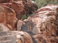
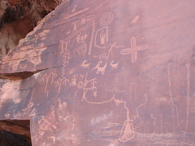
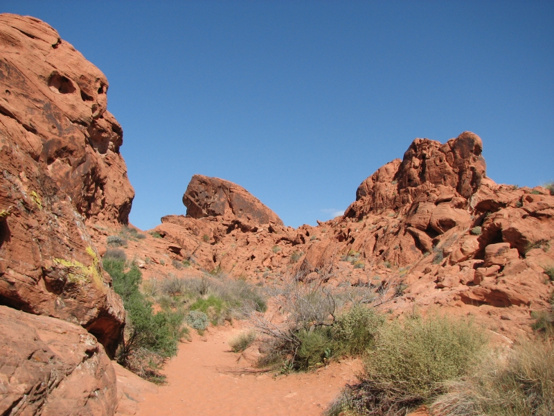
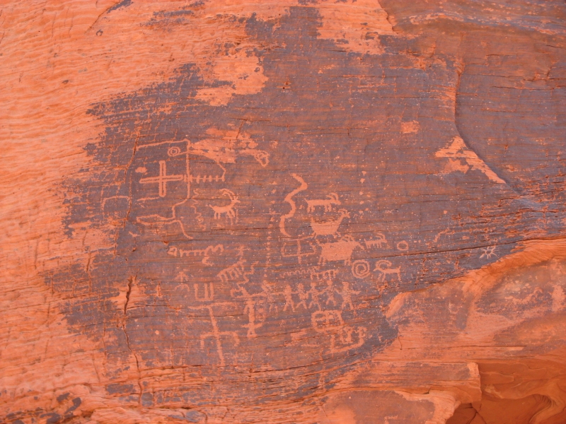
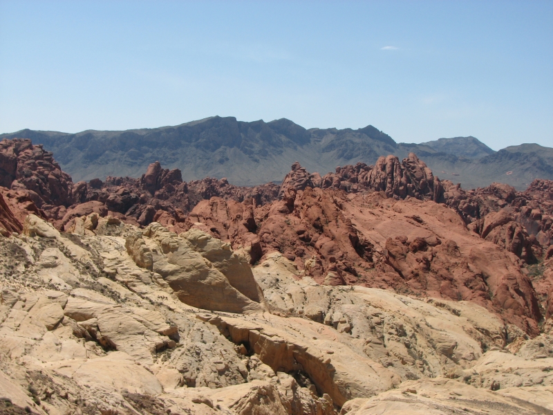
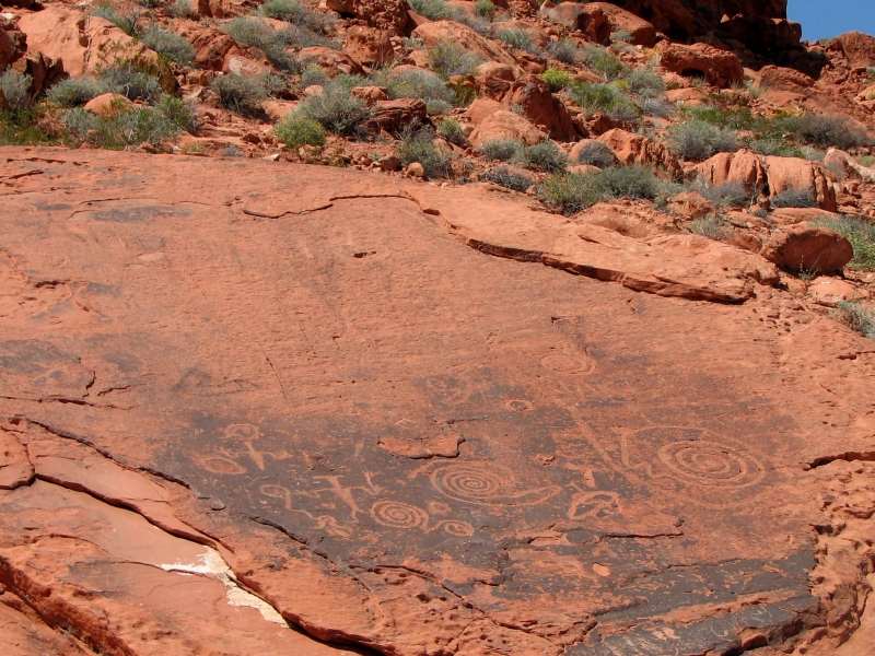
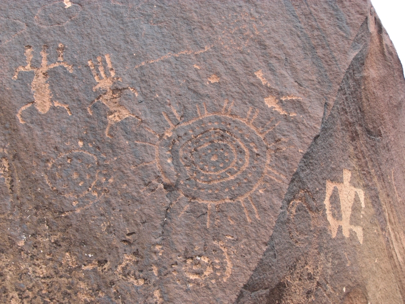
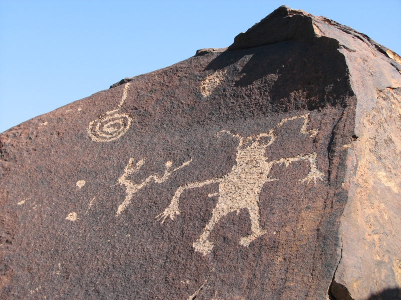
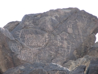
Las Vegas traffic was insane, as usual, but eventually we made our way to Valley of Fire State Park, about 40 miles east of the city. Its another area of large red sandstone formations, very dramatic, especially with the black desert varnish streaking the rocks. We stopped at one petroglyph site this evening next to the campground. Atlatl Rock has some interesting pictures aside from the atlatl (a spear thrower used before bows and arrows were introduced). A man with a spear is connected to a bird/animal, connected to a giant foot. Say what? What is the story trying to tell us?
There are two campgrounds at Valley of Fire. The first has a shower and running water, but was full except for the more expensive full hookup sites. A mile or so away is a more primitive campground with nice private sites tucked into the rocks. Its prettier and only a quarter full. I can live with the outhouse, though a shower would have been welcome. Its very quiet, just the descending trill of a canyon wren and the gentle gusts of the wind break the silence. We arrived just before dark, so didnt get much time to enjoy the peace and quiet, but I was happy with our campsite.
Thursday, April 3: Valley of Fire, St. George
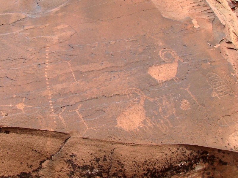
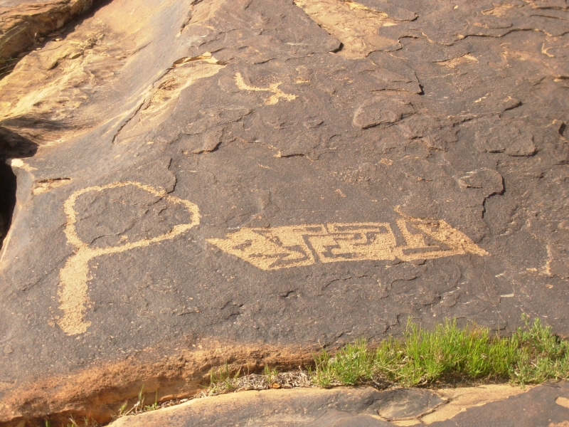
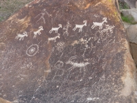
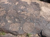
We spent the day playing tourist at Valley of Fire State Park. We knew about five petroglyph sites at the park, so we drove around looking at rock art and taking lots and lots of pictures. The images were abundant and really interesting. The style here is different from what we saw in Arizona. Lots of mazes and grids. People are connected either with power lines or holding hands. One man was attached to a maze the migration story? There seem to be a lot of blanket patterns or something. Maybe beads on a string? Different anyway.
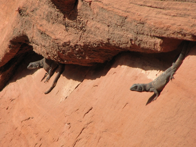
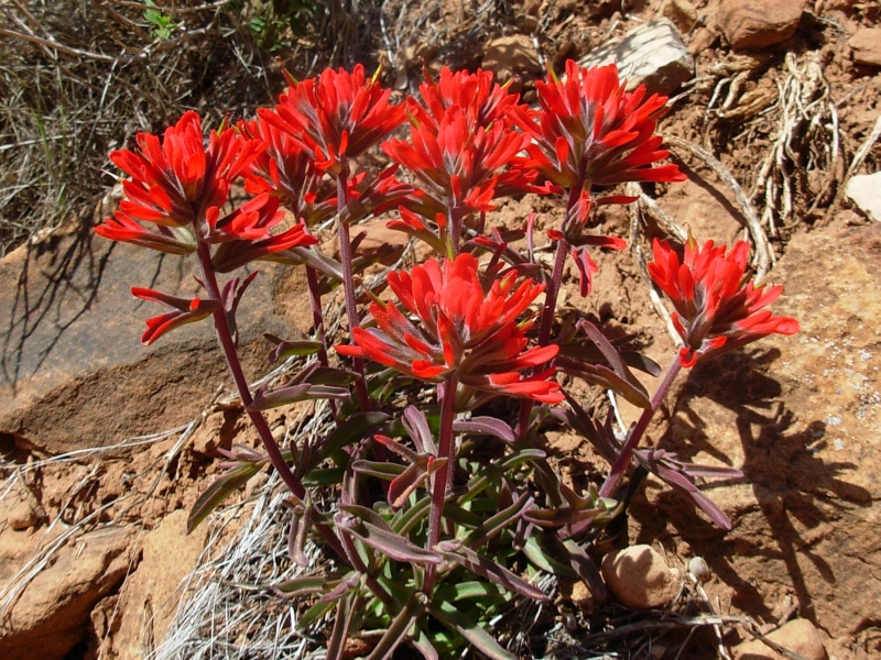
There is a scenic drive through the red, white and orange sandstone that was very pretty. Pink prickly bear blossoms and yellow desert marigolds added to the riot of color. We saw several large lizards, probably chuckwallas, that hid as we approached. The park was crowded with busloads of mostly European tourists. There was an old stone building that used to be tourist cabins. Very small and primitive. The land is very similar to southern Utah, including occasional small arches and many holes in the rocks. We finished our wandering in the park around 1:30 and decided to head to St. George across the border in Utah to get a shower and download our pictures to CD. We hope to visit a few rock art sites in the Arizona strip if possible, but we need to check out the BLM office for road conditions first.

I have really enjoyed our wanderings this past week. If not for Jims injury, I dont know if we would have come to Nevada searching for rock art, but since we needed to find low exertion outdoor activities, and since we love looking for rock art sites anyway, this seemed like a good alternative to backpacking or heavy hiking. Jim is still in a lot of pain, especially at night, but his breathing is better, and though hes slower than usual, he can still hike. Jim leaves the rock scrambling part of petroglyph hunting to me though. We havent tried any long dayhikes yet. Five miles is about the longest weve done since he was hurt, but he is moving better. In a week or so well try a long hike and see how it goes. Eventually well don packs and try an overnight hike. In the meantime, we can play tourist and seek a few more places that are off the beaten path. I was amazed at how many people we saw at Valley of Fire and Red Rock. I didnt realize they were on the beaten tourist path. Even Chloride had visitors, as did Grapevine. It seems that a lot of people enjoy the hunt for petroglyphs and pictographs, even out of the way ones. I wonder if theres an online community for that, as there is for long distance hiking? Id be interested in talking to people who love searching for rock art the way we do, to share information and adventures.
Friday, April 4: Little Black Mountain, Cedar Pocket CG
Today ended up as a somewhat leisurely day since we never strayed more than 20 miles from St. George. We started out with several errands: pharmacy, grocery, Visitors Center, and BLM Office. We needed a decent map for the Arizona Strip since we intend to visit three sites that are all on back roads. At the BLM office, we picked up a trail map for an area northwest of town, Santa Clara River Preserve, which also has rock art. Well visit that area tomorrow.
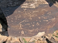
After lunch we headed ten miles south of town to a petroglyph site called Little Black Mountain. The rocks were actually brown, but there was an interesting Black Mesa not far away, as well as some red ones. It is a very pretty area. The site was a good one with several interesting panels and what looked like a water glyph. (A water glyph is a large 48 image, a circle with a line through it that points the way to water. They are supposed to be fairly common on the Arizona Strip.) Some of the images were really old and had almost completely repatinated. Our pictures of those probably wont turn out, but they were interesting to see.
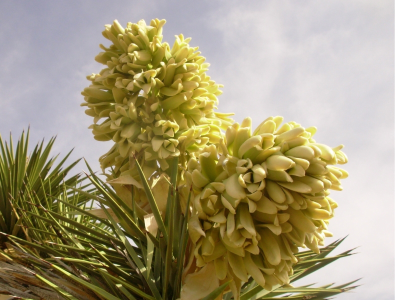
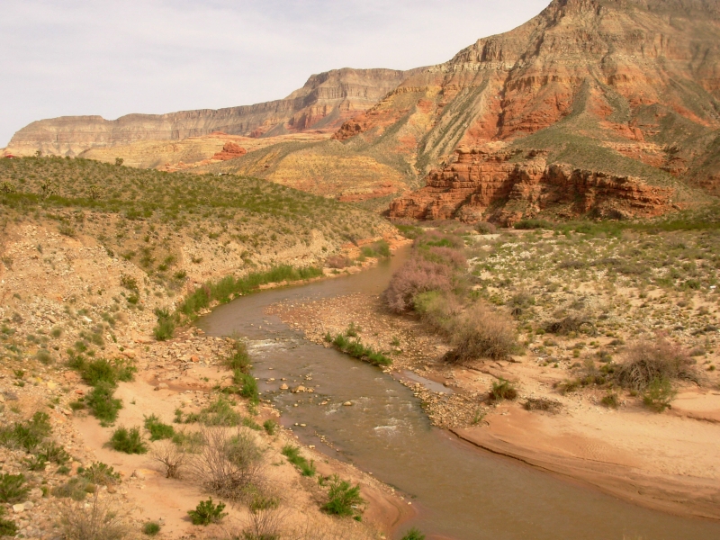
We went back to the BLM office afterwards to get some clarification about Santa Clara. We asked about camping and learned that the nearest campgrounds were full. They are small and tonight is Friday, after all. The clerk recommended a campground about 18 miles southwest of the city on the Virgin River. We had spotted it yesterday and liked the location, so we headed there mid-afternoon. I went for a short hike along the river, admiring the red cliffs above the water. The salt cedar and some of the Joshua Trees are in bloom - pretty. Our campsite looks west over the river and the wilderness area beyond the freeway. Its a nice one.
Saturday, April 5: Zion (5 ½ miles)


After a peaceful night at the campground, we headed north through St. George to Santa Clara. There is a natural area just outside that pretty little town with several hiking and biking trails. We had heard that there were petroglyphs along the ridge, so we decided to check it out. We only walked a mile each way, so dont know about the rest of the Reserve, but the area we explored had quite a few panels from a wide historical range. There were lots of bighorns, including two very impressive ones, many spirals and anthropomorphs, etc. Do the upside down people indicate a death? We saw a few of those in the mixture. We had fun looking for the images, though most were very easy to spot since they were on top of the rocks along the edge of the ridge.
There was a village ruin as well, but it was barely discernable. A lot of the old ruins are just piles of rocks. You can tell they used to be buildings because they have straight lines or all the rocks are the same size, but the walls fell down centuries ago and dust and sand has filled in the gaps. They arent obvious. My brother is an expert at spotting ruins in the desert, but Ive developed a pretty good eye for it as well. Its not like visiting Mesa Verde, but it is still fun to see the outlines of a house or village and know that 1000 years ago, people lived a very different kind of life right where I am standing.

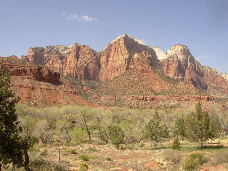
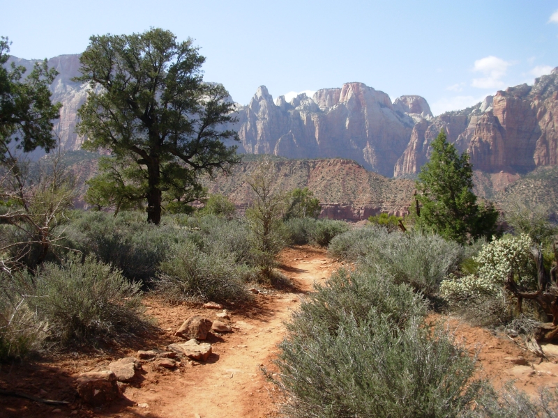
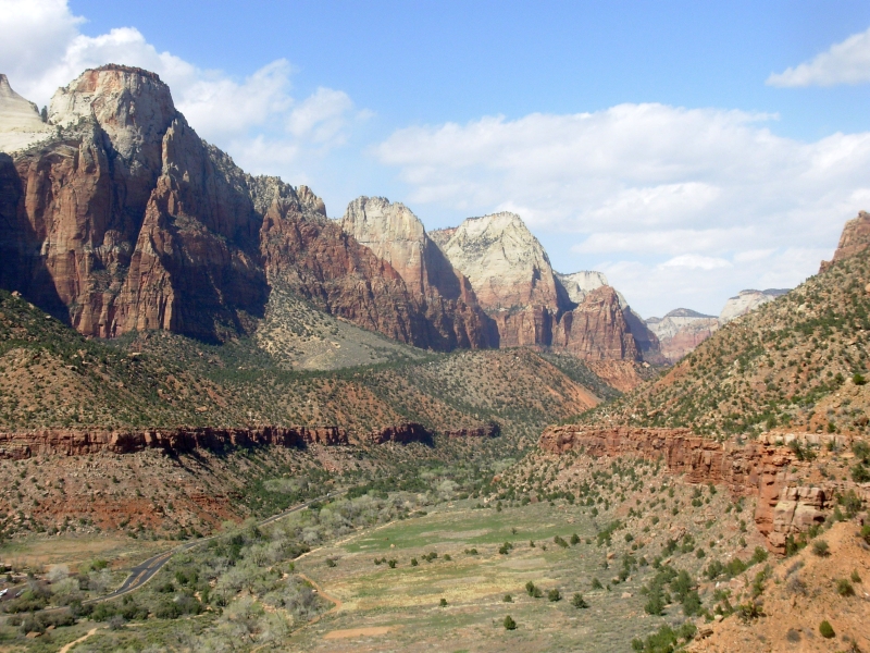
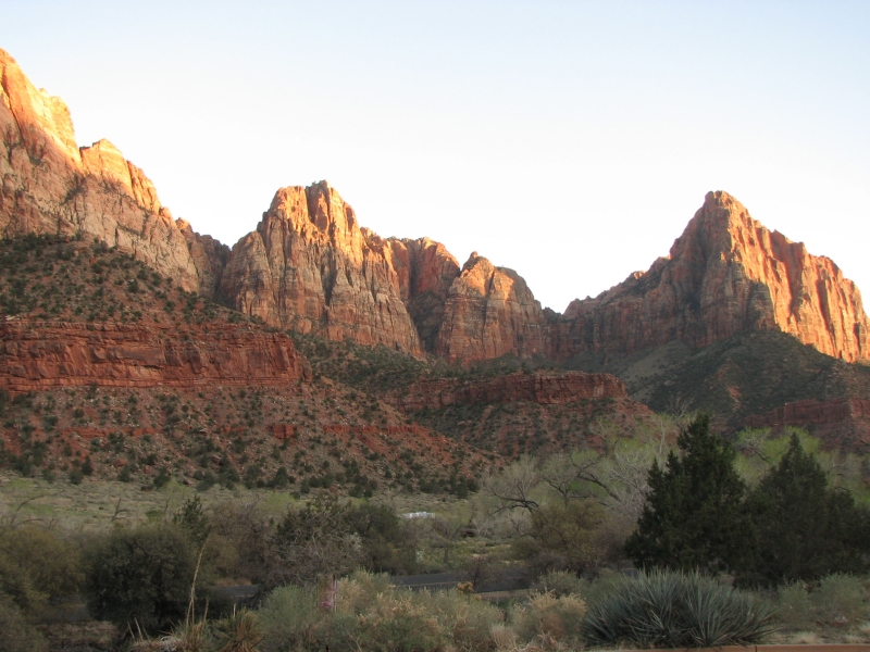
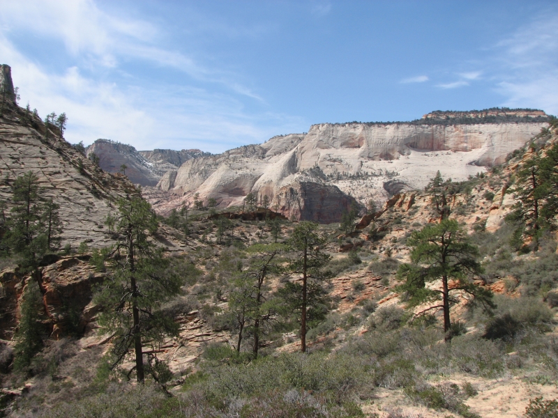
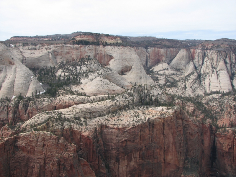
We ate lunch back at the car, then headed to Zion National Park. It was very busy. One campground was full, but we were able to get a nice site at the edge of the South Campground with a nice view up the canyon. I think its the same site we had three years ago when we first visited the Park. Jim twisted an ankle this morning jumping off a boulder, so I went for a hike without him up the Watchman Trail. That was a nice three mile hike with views of Lower Zion and the town of Springdale outside the park. I love Zion with its sheer red and white cliffs. The cottonwood trees are just starting to leaf out. Paintbrush was abundant on the trail. It was a beautiful hike, but windy.
Afterwards we walked over to the Visitors Center to pick up the shuttle bus heading up the canyon. We had good memories of dinner at the lodge, so we decided to treat ourselves. It was expensive, but tasty, and the view was a good one. Another shuttle dropped us off half a mile from the campground, so we followed a trail along the river back to the car. All in all, it was a very good day.
I feel so lucky. We are living a very free and easy lifestyle, hiking, exploring, seeing rock art, and camping in beautiful places. I am so happy out here. I love what we do and how we do it. I really enjoyed the walk this afternoon. It has been a while since Ive just hiked. Our petroglyph excursions are slow, with lots of wandering in circles, stopping to look around, stopping to take pictures. Today I just moved my body and it felt great. Tomorrow were planning a hike up to Observation Point, so well see how Jims ribs handle a real climb. Ive got my fingers crossed.
Sunday, April 5: Zion (8 miles)
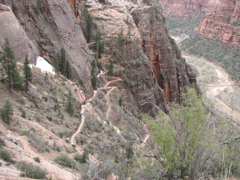
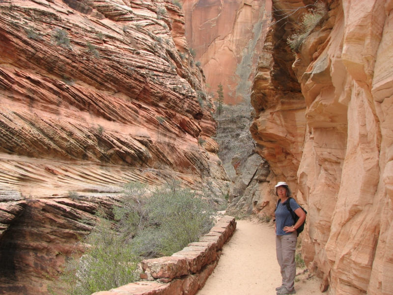
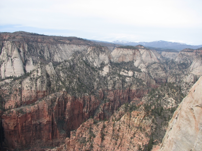
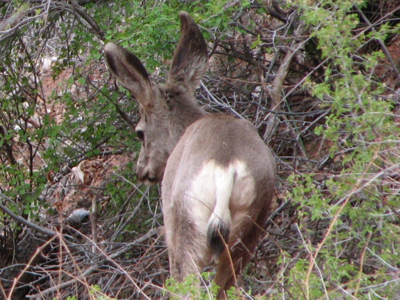
We enjoyed our hike up to Observation Point. It was fairly strenuous with a 2100 climb, but it was beautiful all the way. I especially enjoyed a section of narrow slot canyon. They had dynamited trail in the rock, creating a tunnel effect. There was water in the stream and the canyon twisted and turned as a good slot should. It was a hazy day, so the views were affected, but it was still gorgeous with the dramatic red and white sandstone. We climbed from desert to ponderosa pine to pinion pine and juniper on the open plateau. Biggest surprise was seeing snow on the trail in a couple of spots. Despite the long climb, it is a very popular trail. Not quite as crowded as Angels Landing, which we hiked three years ago, but still quite busy. At the top there are several rocky outcroppings that made good lunch spots. The view up canyon and down was spectacular. There was a lot of snow on the west rim, only a few scattered patches where we hiked. Weve seen a little wildlife: one deer last night and two this morning, one turkey last night and four this afternoon.
We stopped on the way down the canyon to get ice cream at the lodge, then settled in at our campsite to rest our weary feet. We did pretty well, though we were a bit slower than usual. This was our first real climb in a long time. Most of our hiking for the past six months has been pretty flat. Maryland, Florida and Texas are not known for their big mountains. We puffed and panted and Jim felt his ribs a bit more than usual with the added exertion, but we made it, so Im happy.
Home | Links| Trail Journals|
The Thruhiking Papers Bun-bun
Created: 1 Jan 2009
Revised: 30 Sept 2016Copyright ©: 2008-2017 Spirit Eagle