|
 |
 |
 |
 |
|
|
|
|
|
|
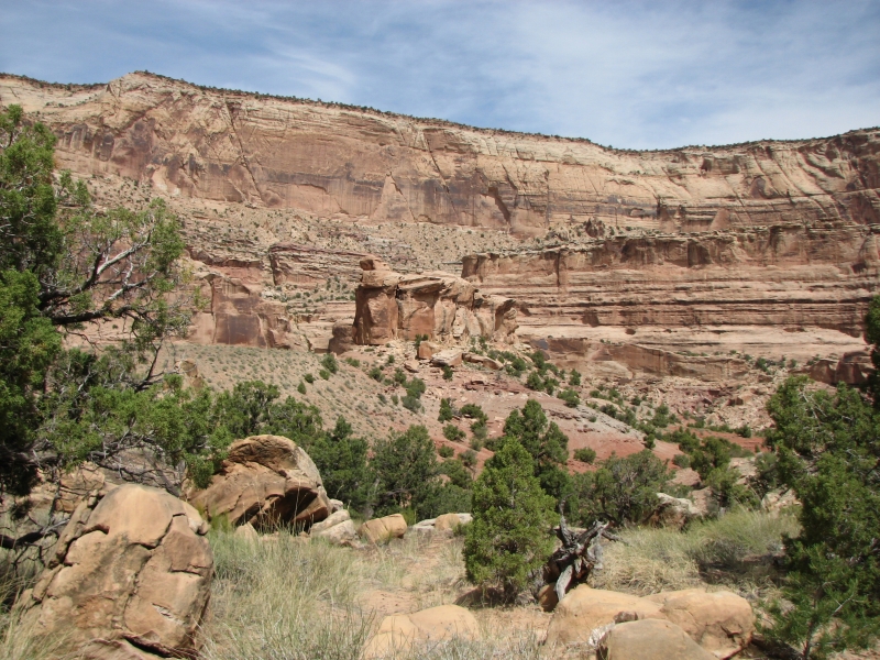
Thursday, May 8: San Rafael Swell, Arch Canyon, Three Fingers Canyon (5 miles)
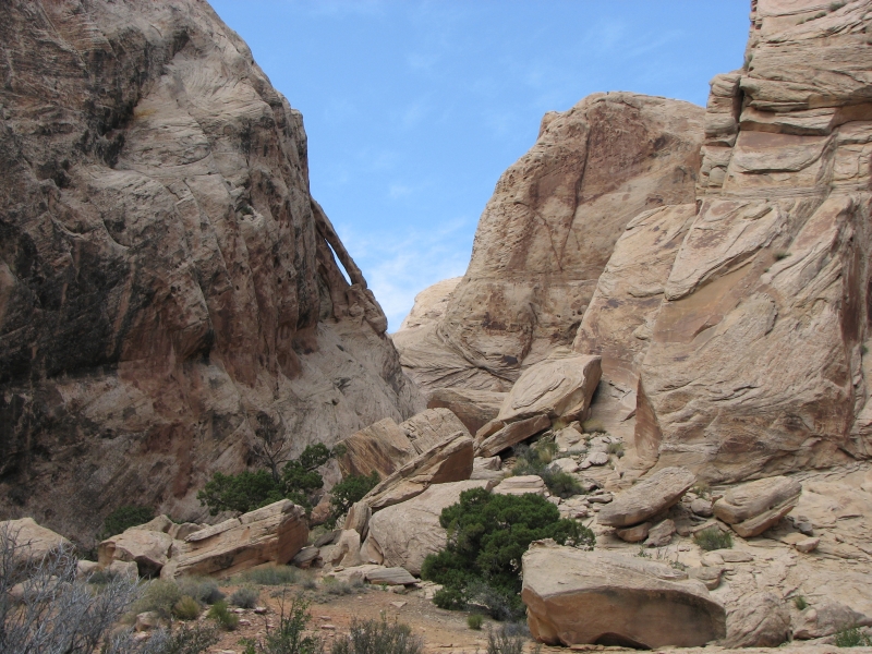
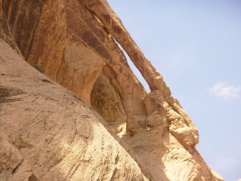
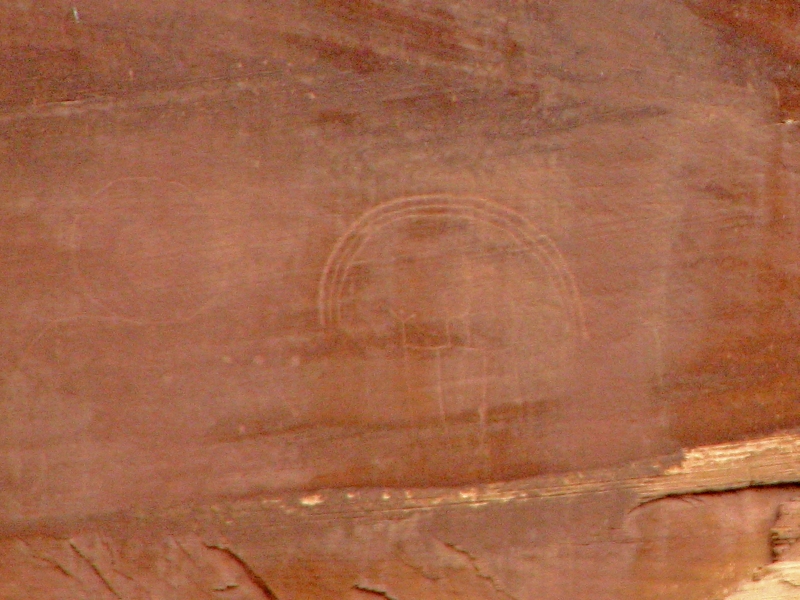
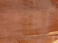
Last night a thunderstorm hit soon after we returned to the motel after dinner. We woke to a very damp desert. We took our time with breakfast and the grocery, then headed a few miles down the freeway to a couple of small canyons I found on the internet called Arch Canyon and Petroglyph Canyon. They are near the Black Dragon site, which we visited last year. We found the trailhead easily enough, but our map was wrong so we ended up bushwhacking up the wrong canyon -- a pretty little box canyon in the San Rafael Swell, with lots of water thanks to last nights rain. As we came out, we met a man looking for Black Dragon. Jim gave him directions (next canyon up) then we returned to the car to discuss options. Eventually we decided to try the next canyon to the south. There was a decent trail, which was a good sign, but since there are lots of cows and cow trails in the area, I didnt take it too much to heart. As it turned out, we were in the right place. Petroglyph Canyon only had two panels one clearly carved, the other very faint. Arch Canyon had three arches one double one much like the Jug Handle near Moab and a tiny one nearby. It was a fun little bit of exploration.
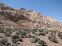
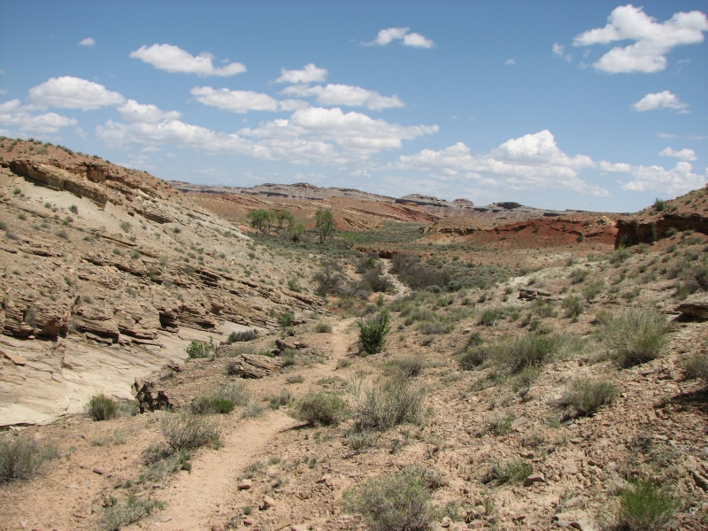
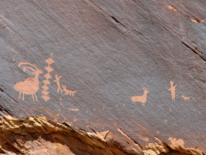
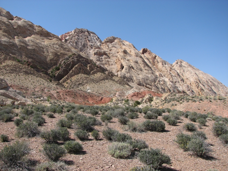
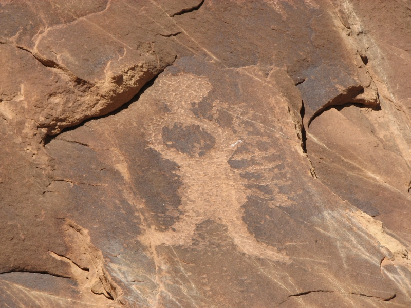
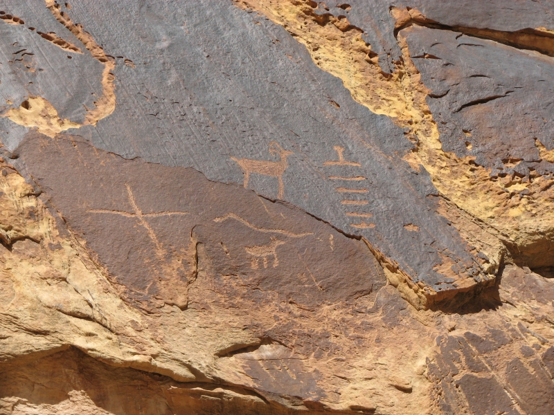
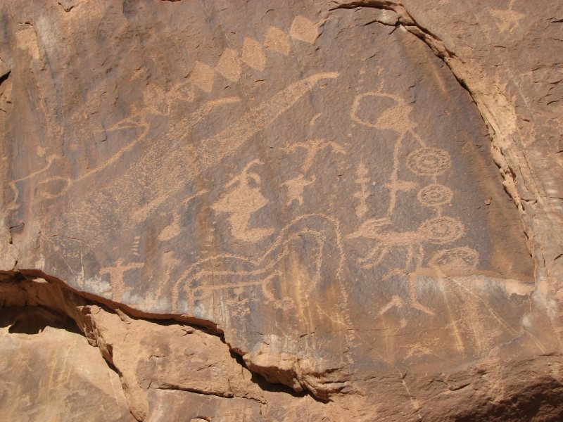
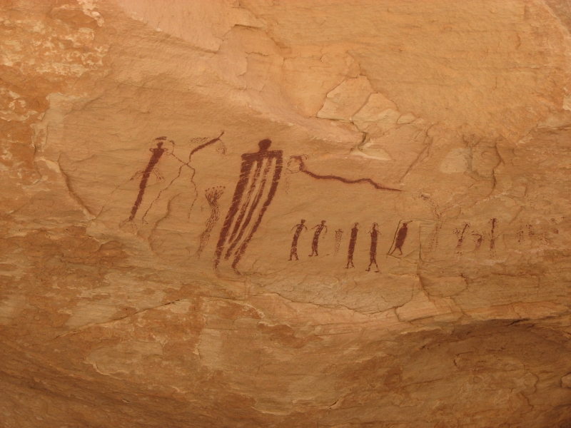
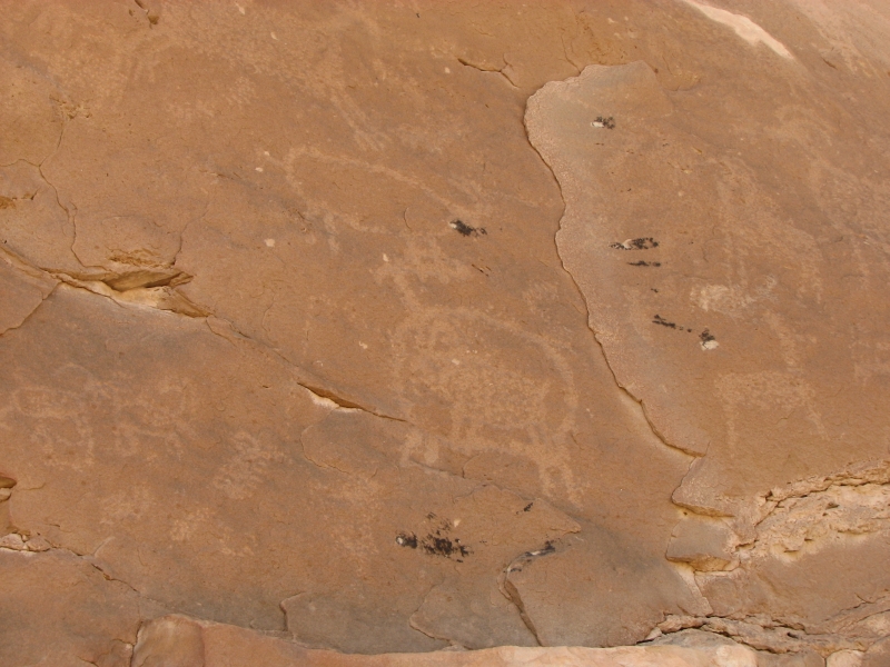
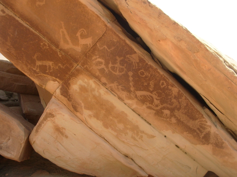
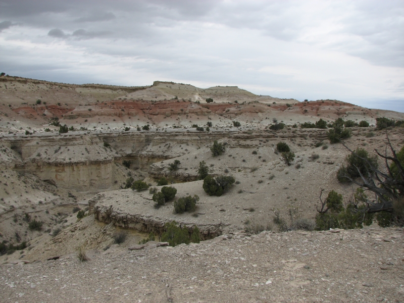
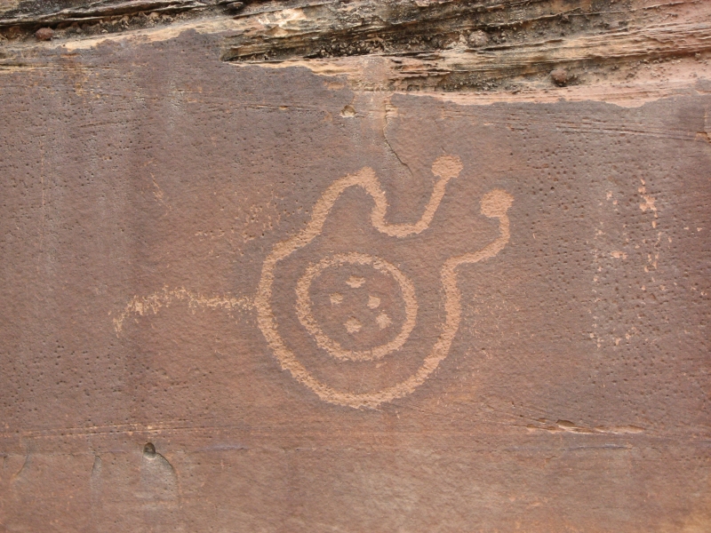
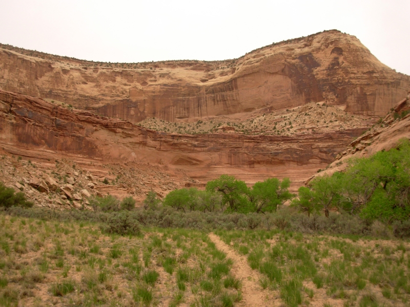
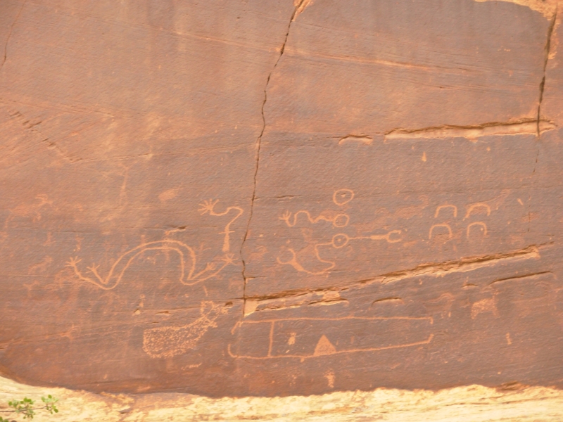
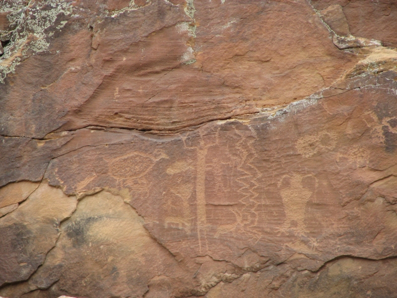
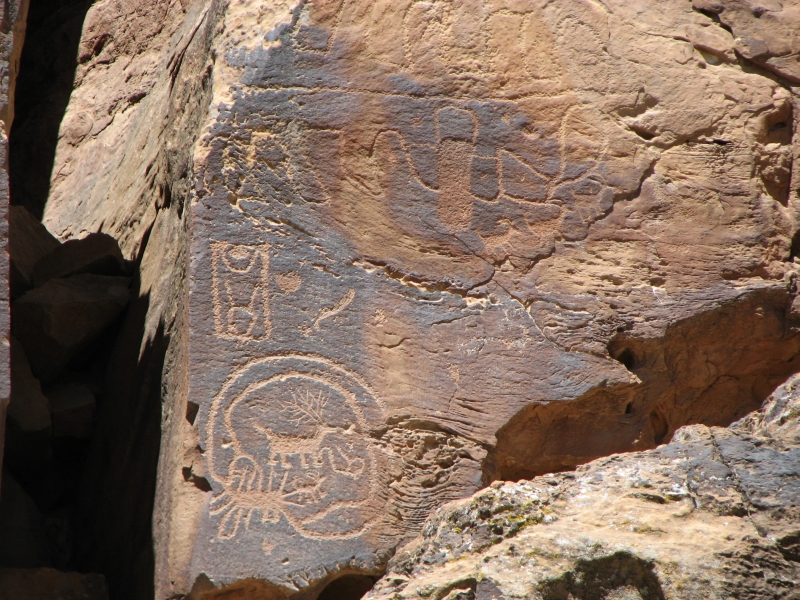
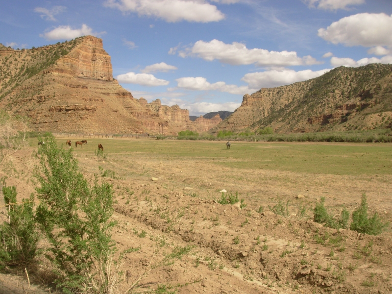
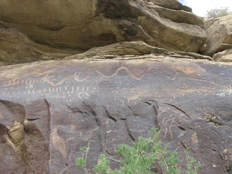
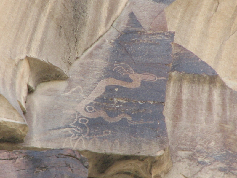
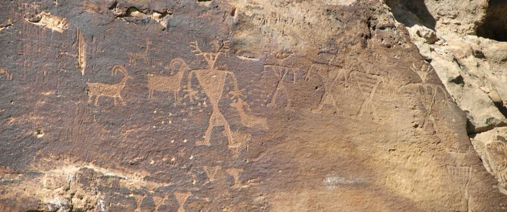
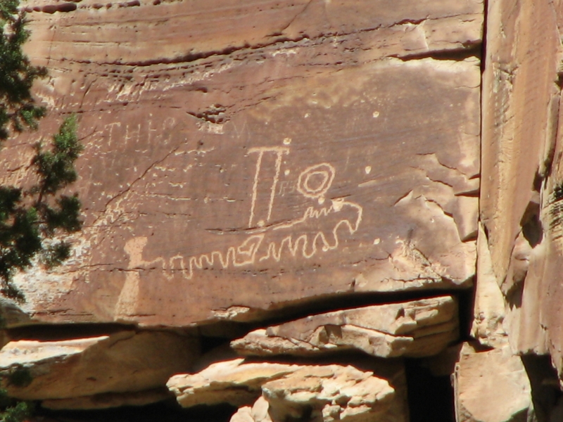
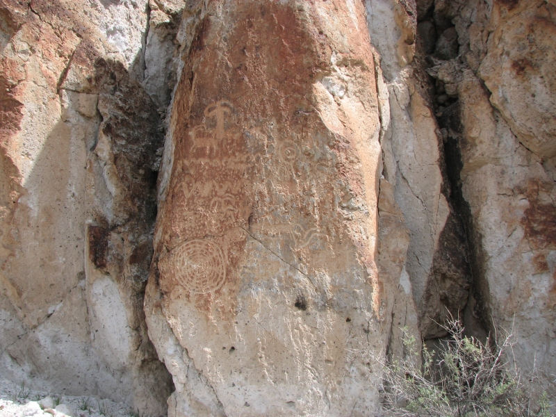
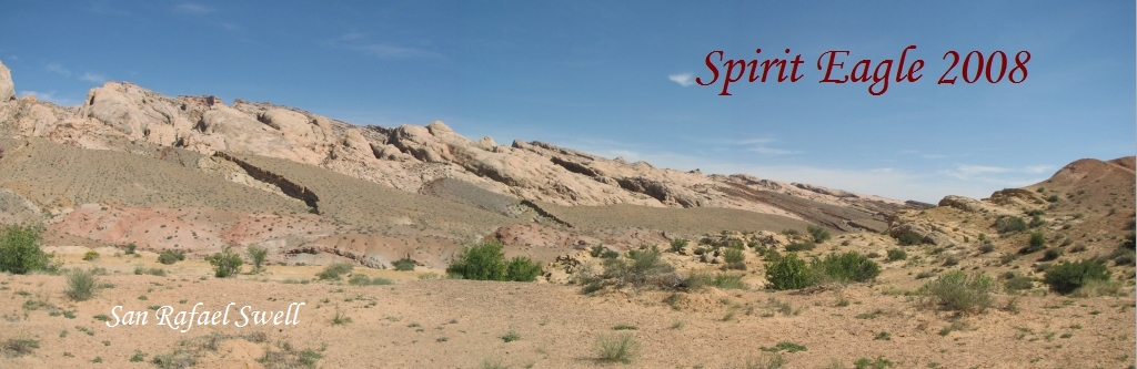
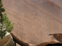
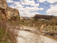
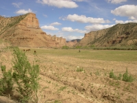
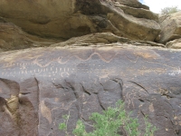
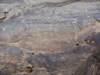
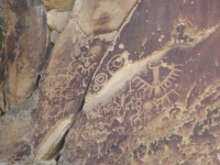
After lunch we headed south along the San Rafael Swell to a good petroglyph site called Three Fingers Canyon. We had to walk the last mile because the road deteriorated badly, but it was a nice hike, looking up at the reef. San Rafael is an area where many layers of multi-colored sandstone were lifted and tilted so you can see the different layers reaching up to the sky: white, red, yellow, chocolate, gray, purple, and green. The layers have been eroded by water to create little side canyons. It is an amazing landscape jagged, desolate, beautiful. Three Fingers Canyon had petroglyph panels at the entrance to the canyon, under a cave and above some large water-filled potholes. Some of the petroglyphs were underfoot. There were atlatls, people, animals, etc. It was a good site.
We then tried to visit another canyon five or so miles to the south, but the road wasnt drivable without high clearance. After we scraped bottom, we turned around. We tried to get a campsite at Goblin Valley State Park, but once again it was full. One of these days well make a reservation and actually get to visit the park, but that requires knowing what you are doing more than 12 hours in advance. We rarely do. You are allowed to camp in the desert nearby, so we found a nice little canyon where we could park the truck. No fee, but no water either.
Friday, May 9: Temple Mountain, Wild Horse Canyon (5 miles)

Another gray day. Dark clouds and virga. So far no rain. We enjoyed our private campsite last night, tucked into a tiny side canyon. Jim wanted to see if we could get a space today at Goblin Valley, so we skipped breakfast and drove back to the park. We were told there were three cars that might be leaving, but four cars waiting for the spaces. We left.
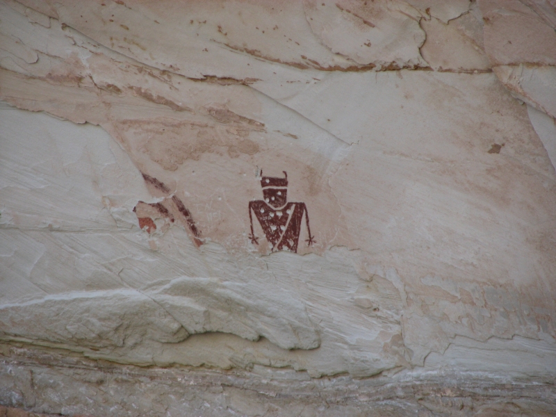
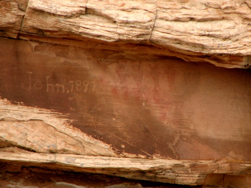
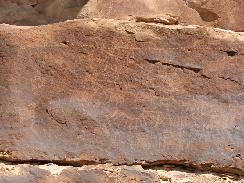
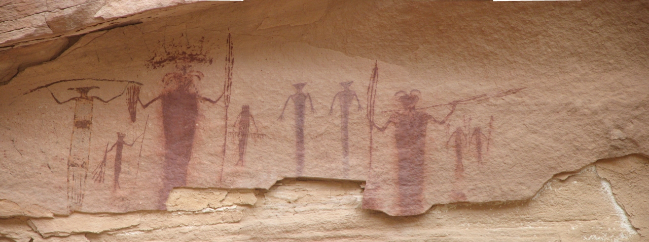
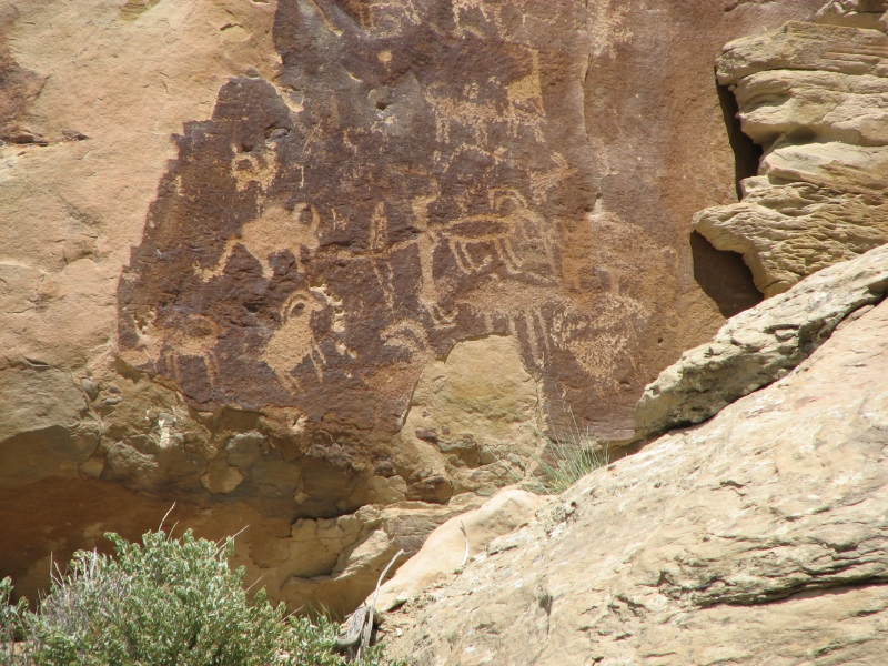
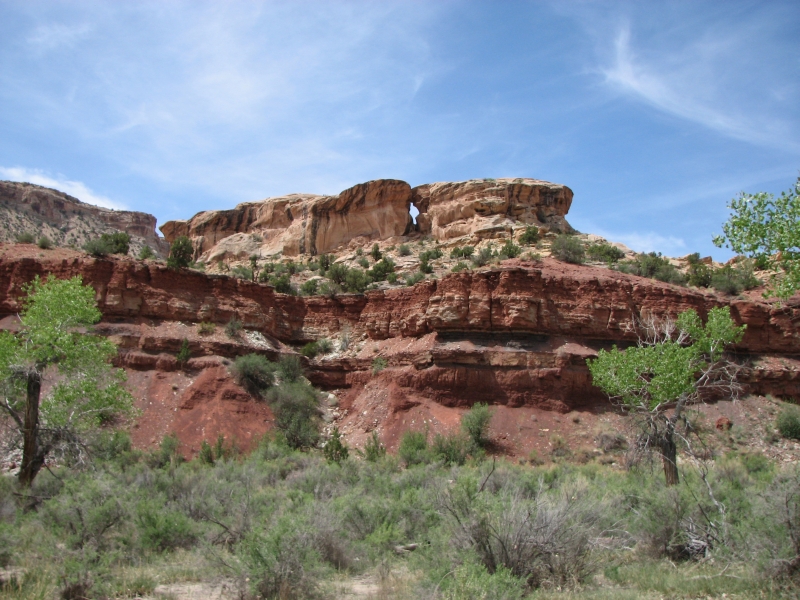
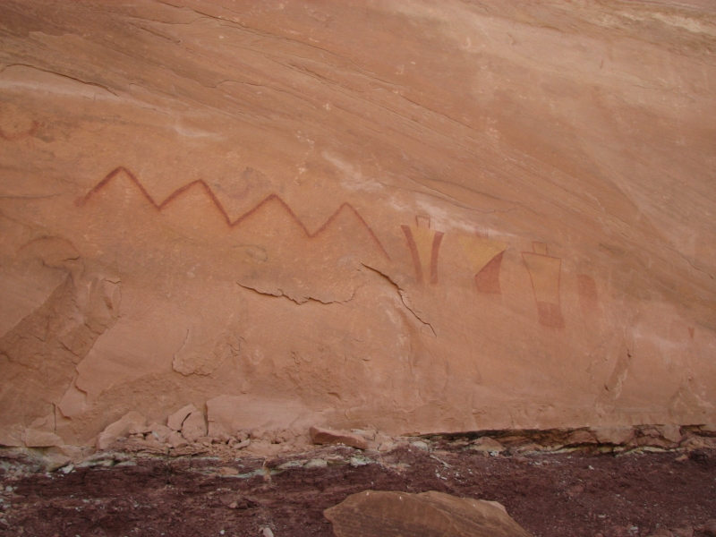
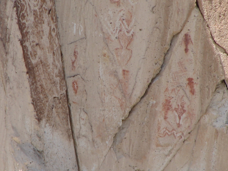
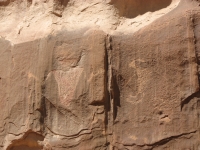
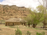
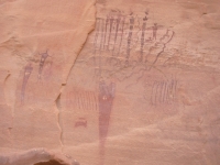
We headed up the road past the Temple Mountain pictographs, a nice Barrier style panel with one Fremont figure. Theyve been vandalized (shot) and a lot of the rock face is sloughing off. People were camped right underneath the panels an illegal but common practice. They had to put up with us walking through their campsite for a closer look. There was also an old mining town next to Temple Mountain that we visited briefly. Hard to imagine hundreds of people living there. Its dry country.
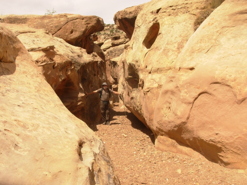
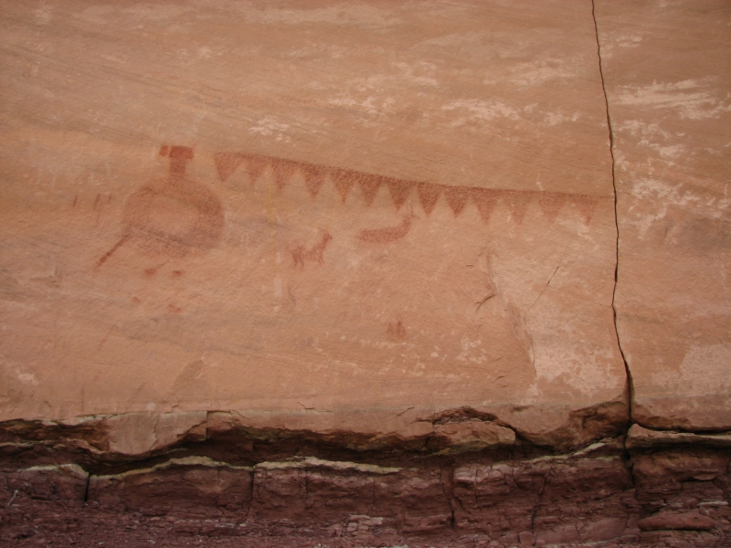
A few miles away is Wild Horse Canyon which is supposed to have three rock art panels along its length. We only found the third one another nice Barrier-type panel in an alcove high above the dry wash. It was an easy hike, mostly through sand. There were a couple of slots that we skirted easily. It was frustrating to not find the other panels, but it was worth the trip since the one panel we found was such a good one. We saw one fairly modern petroglyph on the return trip, but not where the petroglyph panel was shown on our map.
As it got darker and darker, threatening rain, we decided to follow the paved road back to Green River instead of the winding dirt roads along the Reef. We ended up back at Motel 6 and another dinner at Rays, a local tavern with decent food.
Saturday, May 10: Tusher Canyon, Green River
At the motel there was a notebook extolling the attractions of the Green River area. Included was a series of hand drawn maps to several of the nearby rock art sites. There was one we hadnt heard about at Crescent Junction, twenty miles east of town. After breakfast at the truck stop, we headed there. As it turned out, the map was old and the roads have changed somewhat. There was a new DOE site with a locked gate right where the road was supposed to go. We followed another road we thought might go where we wanted, but it ended in the wrong place. We wandered a bit, looking at boulders, but didnt find any petroglyphs. Aarrgh!

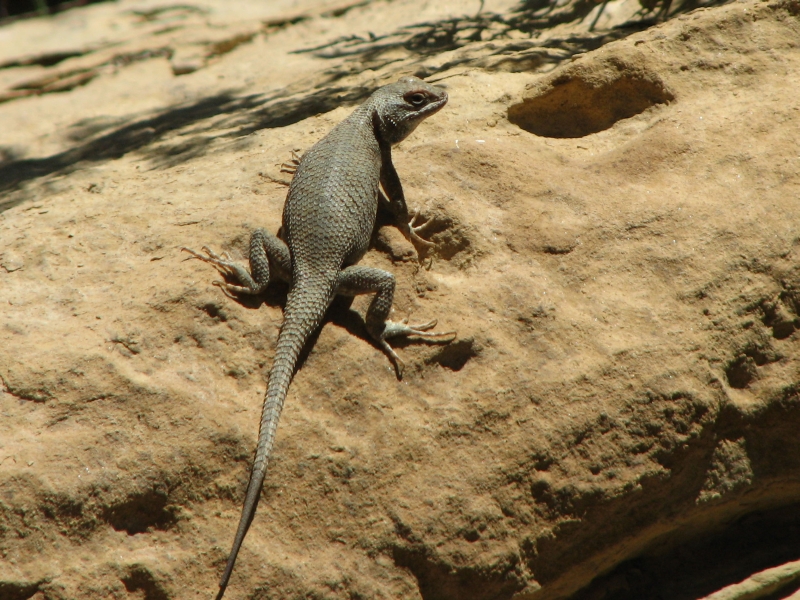
We headed back to Green River and another site nearby in Tusher Canyon. The Green River tourist brochure gave directions and we had another map from the motel set. This time the map was accurate, though it ended in a different place than the brochure. The road followed a dry wash, so Jim was happy to take the shorter version, since he wasnt happy with the sand and rocks and the fact that there was no place to pull over if we met another vehicle. Fortunately, we didnt see another person all day. We did see a herd of antelope at the first site and a lone bighorn at the second.
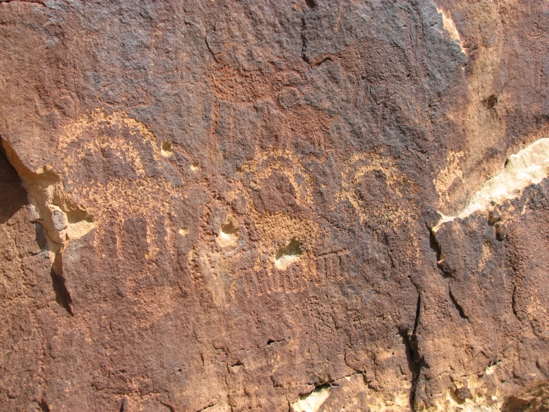
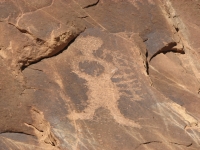
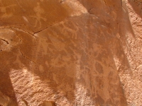
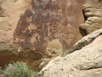
Tusher Canyon had some nice panels. The first one we stopped at (the one deepest in the canyon) was very hard to see, but eventually images of bighorns began to emerge from the rocks. Our next stop had some nicely carved Fremont people, a pregnant bighorn (baby inside), corn plants, etc.
We found the next site on our return: images on both sides of a small wash. The ones on the right side were much nicer. The ones on the left were hard to see and to understand. There were two arrows pointing up; maybe a granary was above, though we couldnt see it from below. There was a big difference in the age of the images.
A lot of the older images had become repatinated so they were very hard to see, or there were new carvings on top of the old ones. Finally we stopped at a pictograph panel with several images of people. The composition was almost Barrier style, though the drawings werent as detailed or otherworldly. Still, it could be that ancient.
We ended up camped at Green River State Park. It was very quiet tonight, especially compared to the last time we were there. We broiled burgers and relaxed for a while, watching the green cottonwood leaves quiver in the breeze. We had to move when we discovered that the nearest bathroom was locked. I think they were painting it. We really needed a hot shower after the long dusty driving weve been doing so we found a site on the other side of the campground. Fortunately, its a big campground with more than one shower.
Sunday, May 11: Cedar Mountain, Cleveland Lloyd Dinosaur Quarry
We started the day with a bit of a disappointment. We headed slowly along Price Creek, looking for some petroglyphs that are supposed to be scattered along its length. Price Creek is not a tourist site, so we knew the odds of finding much were pretty low. The Castleton rock art book merely says that there are petroglyphs accessible from the road. Nothing was said about them being visible from the road and there were no specifics about the location. We drove about five miles before the road started to deteriorate then turned around. We found a few odd carvings, but not the panels shown in the book. Oh well.
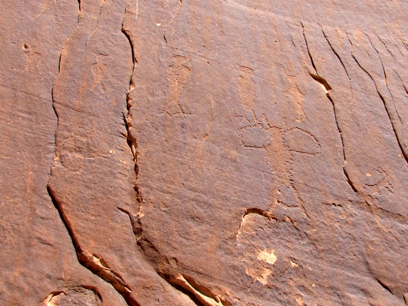
Then we headed up the Green River Cutoff Road. We considered looking for some petroglyphs that are supposed to be up a side road, but again the description was too vague as to their location, so we decided to go to a tourist area where we knew we would find some rock art: Cedar Mountain aka the Old Railroad Grade. Sure enough, there were four sites along the little road. Each had only a few petroglyphs, but a couple of the images were quite intriguing. It was worth the drive, in any case.

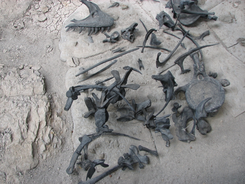
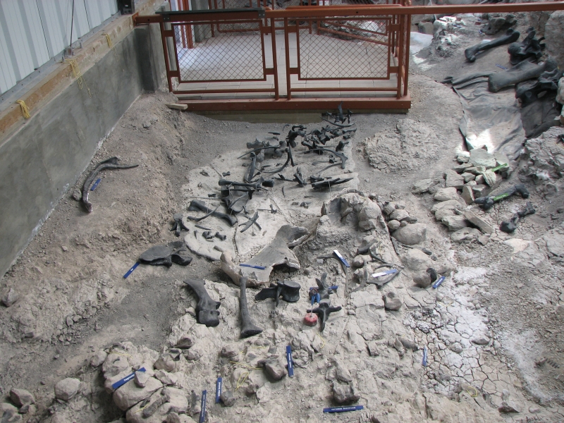
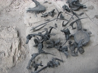
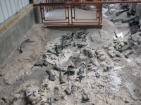
Afterward we headed north on a good oiled dirt road to the Cleveland Lloyd Dinosaur Quarry. We had planned to camp nearby and visit the quarry in the morning, but we saw a sign on the road that said they are only open on the weekends (Friday, Saturday and Sunday). Since they also close at 5:00, we hustled. We barely had time to see the Visitors Center and look at part of the quarry, but we got the general idea. It is another puzzle. They found thousands of dinosaur bones, highly concentrated, mostly predators (allosaurs) but they dont know why. The bones were scattered, not whole skeletons together, but there were a lot of dead dinosaurs in a very small three foot deep mudbank.
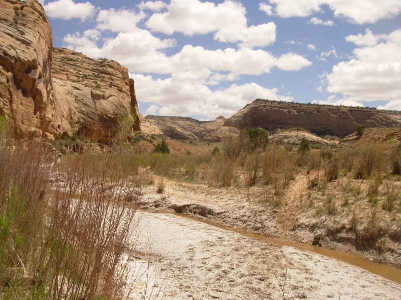
We decided to head to the trailhead for tomorrows backpacking trip up the San Rafael River. Navigation was interesting since the back roads have no signs. There are numerous jeep roads and ATV tracks. We paid close attention to the map, but not all the roads are shown. We ended up following a rough road past Red Ledges to the edge of Salt Creek. We were looking for an Equestrian Staging Area (presumably a trailhead) but the horse trail wasnt very obvious since it was behind a fence erected to keep ATVs out of the canyon. We think were in the right place, but we wont know until tomorrow when we follow the trail and see where we end up. Salt Creek is an interesting area. The flat green plateau is cut by numerous creeks. Eventually they drain into the San Rafael River, which well follow tomorrow. Along Salt Creek and the San Rafael there are supposed to be several rock art panels. I hope we can find them.
Monday, May 12: San Rafael River (11+ miles)
Late yesterday a storm front moved in bringing wind, cooler temperatures and dark clouds. If Id actually believed wed get rain, I might have cancelled our overnight trip into the canyons of the San Rafael, but I was skeptical, so I kept my mouth shut. We started our hike bundled up for winter with hats, gloves and jackets and kept the jackets on all day, though the wind did lessen considerably when we dropped into Salt Wash.

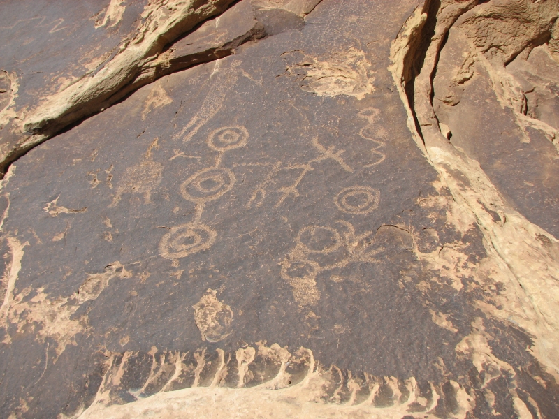
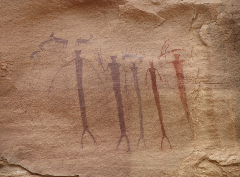
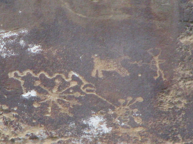
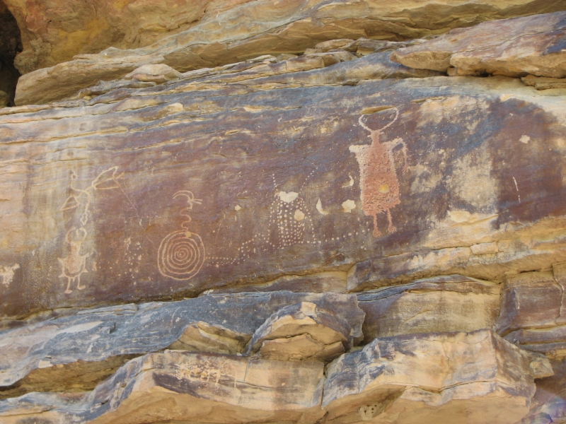
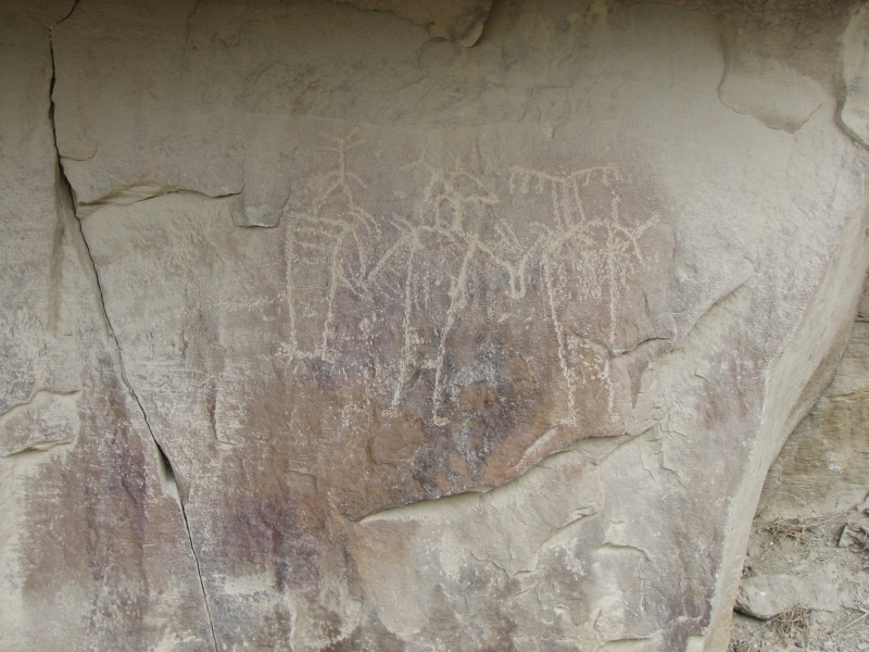
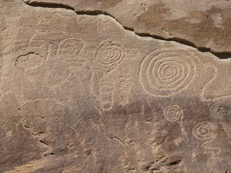
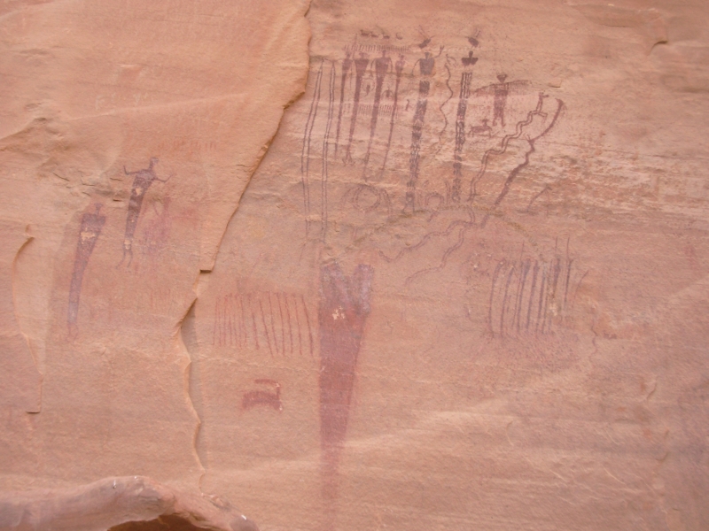
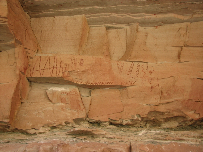
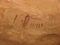
This hike was a combination of beautiful deep canyon hiking and rock art search. The map in the guidebook shows several petroglyph and pictograph panels along the route. We found some and didnt find others. The ones we found were terrific. The first panel was a really long one with some very old petroglyphs. The images were almost completely repatinated, which takes a very long time. Those images were mostly bighorns and deer and spirals. Superimposed on top were other carvings odd ones that didnt make sense. There were also some faint ones off to the side that included a man standing under a rainbow.
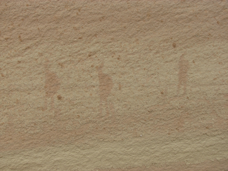
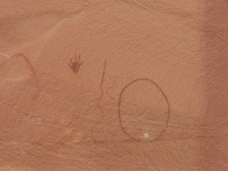
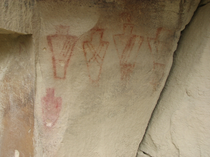
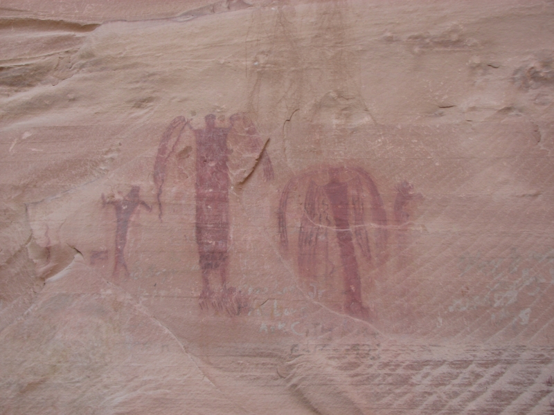
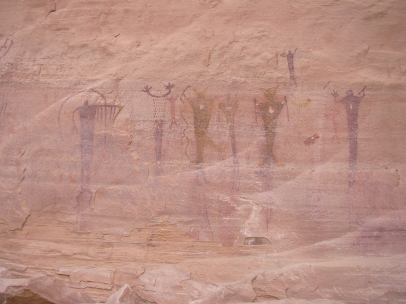
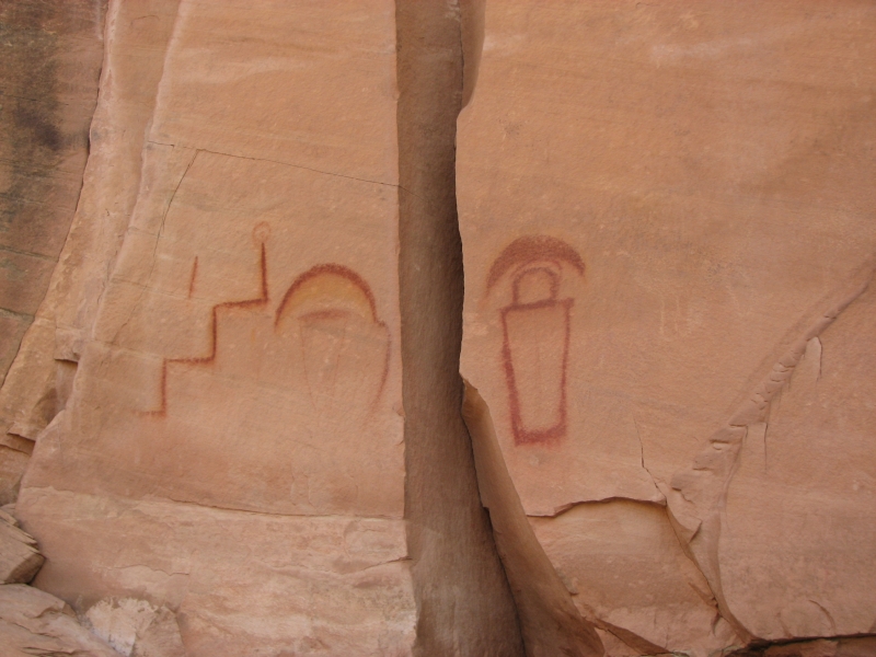
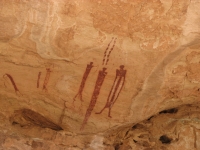
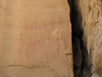
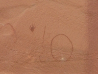
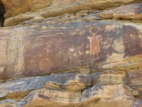
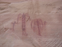
Farther down canyon, past two panels that we looked for but couldn't find, was a small petroglyph of a man with a bow shooting a bighorn, then two pictograph panels: one with several faint burden bearers, one with a circle, a zigzag and a hand. The final one was at our destination, Virgin Spring. The map in the guidebook led us astray. We went too far downstream looking for a trail up over the rocks. We couldnt find the trail, and it looked too steep to bushwhack so we went back to the mouth of the side canyon and walked up easily to a fantastic set of pictographs probably Barrier-style though they were small, only a foot or so high. They were anthropomorphs holding things: tools? spears? There were some companion animals: small deer. One set of five human figures was in incredible condition. Another was very faded and the third set was clear but the rock is peeling so the feet were gone. It was a very nice end to a sometimes frustrating day.
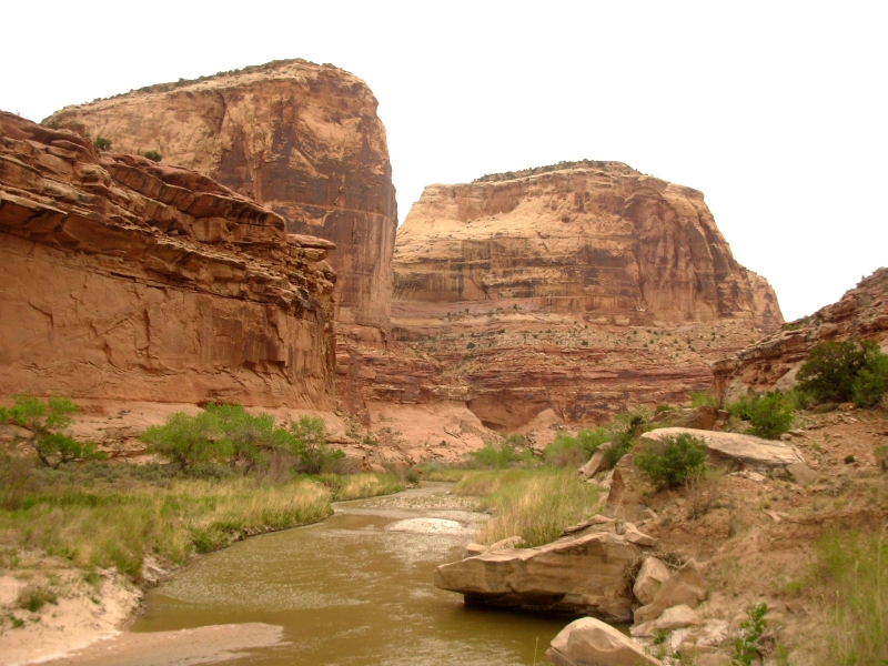
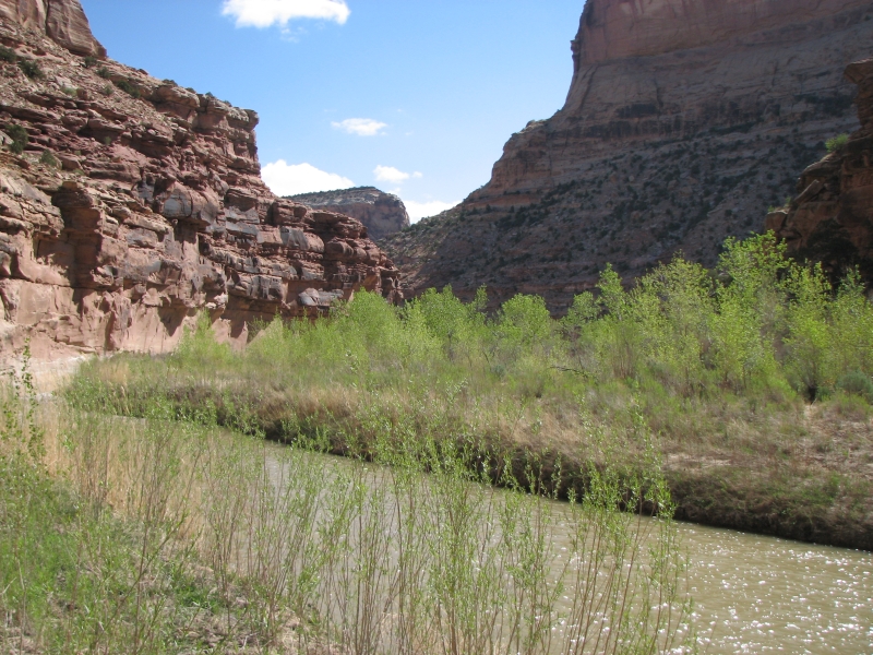
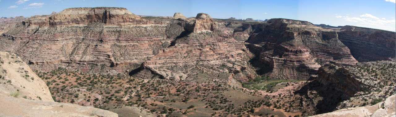
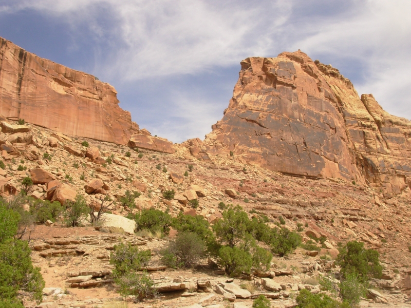
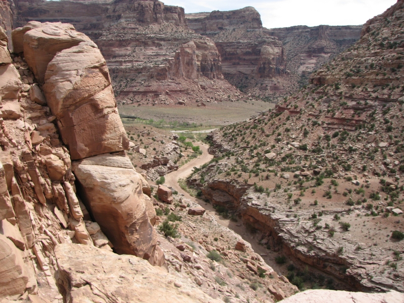
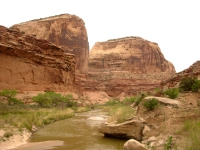
It was a very slow day. The canyon winds, twists and turns. The map was out of scale, so it became very hard to figure out which twist we were on. The river wiggles a lot more than shown on the map. It took us three hours to do a section that is only a half mile by road. That was frustrating. The first half of the day was along Salt Wash, which we crossed 20 or more times. The water was shallow, so usually we could cross on rocks and keep our feet dry but occasionally it was deep enough we got wet. Then we joined the San Rafael and the water got deeper: from knee to crotch deep. The cameras were moved up into the packs. We ended up crossing the river 10 times. It should have been eight, but the map steered us wrong and we went too far then had to backtrack. Since the sun never did come out, we stayed cold and wet. At least its May, not March. The canyon walls rise sheer 300 to 500 above the river in multicolored layers. Green cottonwoods, willow and tamarisk line the streams. There are numerous caves, alcoves and arches breaking up the walls. It was beautiful.
We had hoped to continue another few miles to Kane Creek, but after backtracking to find the spring (the only potable water along the route) we had had enough. It was late and we were too tired to go any farther, especially since we cant tell whether its three more miles or six. Salt Wash was well named; there is a white alkaline residue along the shoreline. San Rafael gets the alkali, plus mine contamination and numerous cows, which is why we were so happy to see the spring. We passed six cows. They add to the confusion because they make numerous trails along the shore. We spotted lots of beaver sign (fresh cut trees) but no fur.
Jim: All of the panels today were good, but the Virgin Spring panel was just superb. Its hard enough to find that most casual lookenspeepers won't bother, so it hasn't been vandalized. But then, I'm a sucker for pictographs.
Tuesday, May 13: San Rafael River (11 miles)
We woke to sunshine and blue skies, but cool temperatures and colder water. We crossed the river four times in the first half hour, knee to hip deep, so our feet were frozen. We headed back the way we had come, searching for the petroglyphs we missed yesterday. The Kelsey guidebook generally shows locations quite well, but the images aren't always easy to find. We found the petroglyphs eventually, but it was easy to understand why we hadn't seen them. The first site had only two small bighorns, high above the trail. I didnt see them until I was about five feet away, after climbing up to where we thought they ought to be. The second set was heavily repatinated, so again we didnt see them until we were right next to the images. Good thing we climbed up to the bench where they were to be found. We had looked right at them yesterday, with binoculars, but didnt see a thing. The sunshine today may have helped make them a bit more visible. It was still slow walking today, but not quite as frustrating as yesterday. We got back to the car around 4:00 and headed north to the town of Price to look for a motel.
I enjoyed our backpacking trip, even though it was harder and slower than expected. Slogging through soft sand is slow going and the numerous stream crossings, especially the knee-deep river, were slow, even though we keep our shoes on for them. I have no idea how far we actually went. We walked about seven hours a day, but part of that time was spent scouting for rock art. We had the canyon to ourselves, didnt see a soul for two days. Our only wildlife was cows and birds, though we did hear a beaver or otter jumping into the pool near our campsite several times.
Wednesday, May 14: Rest day in Price
We decided to take a day off to do chores and rest Jims foot and knee. They behaved reasonably well -- there was pain but it wasnt excessive. Still, hes not ready for more hiking. Besides we got to town late yesterday and had no time to take care of the necessary town chores like laundry, phone calls and grocery.
The need for a rest day was reinforced when we looked at our photos for the past week and I drew a blank as to when and where they were taken. Weve been to so many sites in the past two months. They all blend together. That happened last year to some extent, but there were several very distinctive tourist areas that really stood out. This year weve done fewer tourist sites and more backcountry ones which dont stand out quite as clearly. Cedar Mountain, Temple Wash, Tusher Creek which was which? The backpacking trips really stand out, but there have only been three so far.
I wish I knew what comes next. Although Jims foot isnt as bad as it was (with the help of toe bandages and a metatarsal pad), its still far from healed. His knee was giving him a lot of pain at the end of the day when we were iking. To me, this means that our plans to hike the Idaho Centennial Trail are off. Jim isnt ready to make that decision yet. He is hoping for a miraculous improvement, but even if he got a cortisone shot, that might help his foot, it would do nothing for his knee. The knee isnt going to get better without surgery. We both know that. Even if he ignores the bad knee, we have done so little real hiking this year, we simply arent in shape to do a long distance hike. Jim wont come up with an alternate plan because hes still in denial. Its frustrating. This was probably our last chance for a long distance hike and its not going to happen now. Im not likely to do a thruhike without Jim, and even when he gets his new knee, I doubt well be able to do another thruhike. Jim thinks we will and gets mad when I express doubts, but Ive seen how much hes slowed down the last couple of years and even lost the desire to do longer hikes. I think he goes out in large part because I want and need to spend time on the trail, but hes happier doing three miles than 12. He lets me do all the planning and just comes along, usually expressing a desire to cut it short somewhere along the way. I dont blame him for that. Hes in a lot of pain, so it just isnt fun the way it used to be. Finding good rock art helps, but backpacking just to spend time in nature isnt as appealing for him as it used to be. I dont see us in Idaho, so where will we end up this summer?
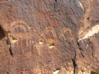
Thursday, May 15: Nine Mile Canyon

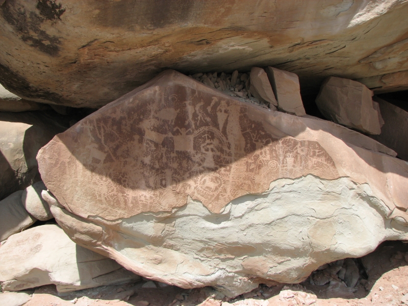
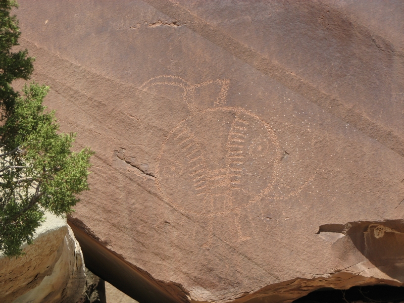
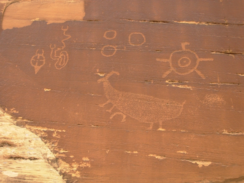
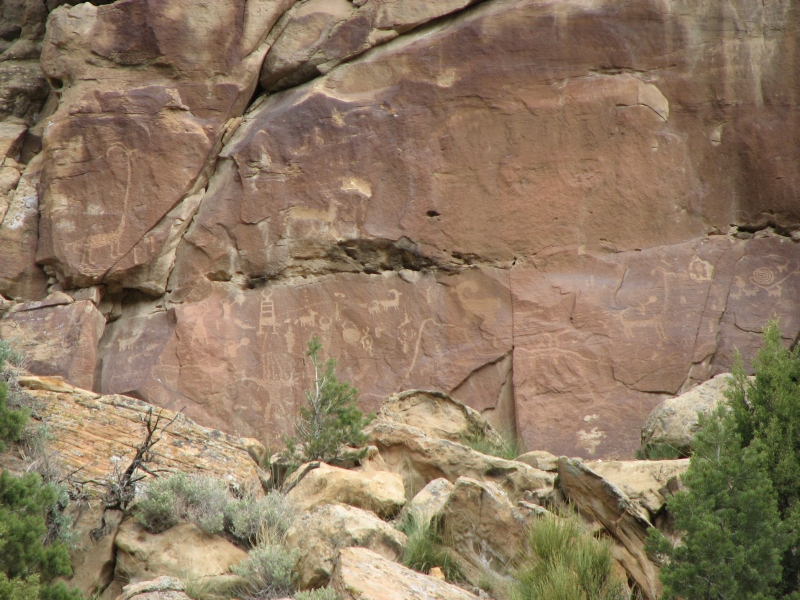
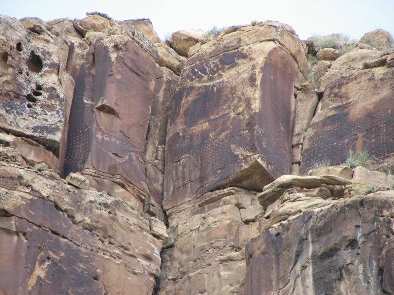
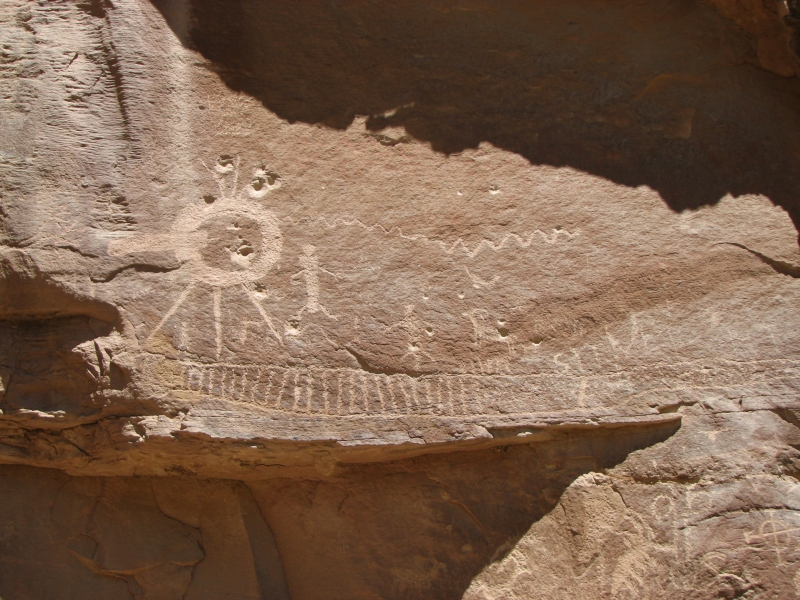
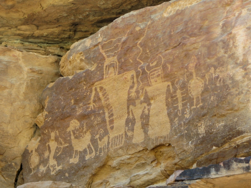
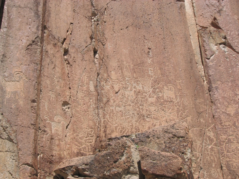
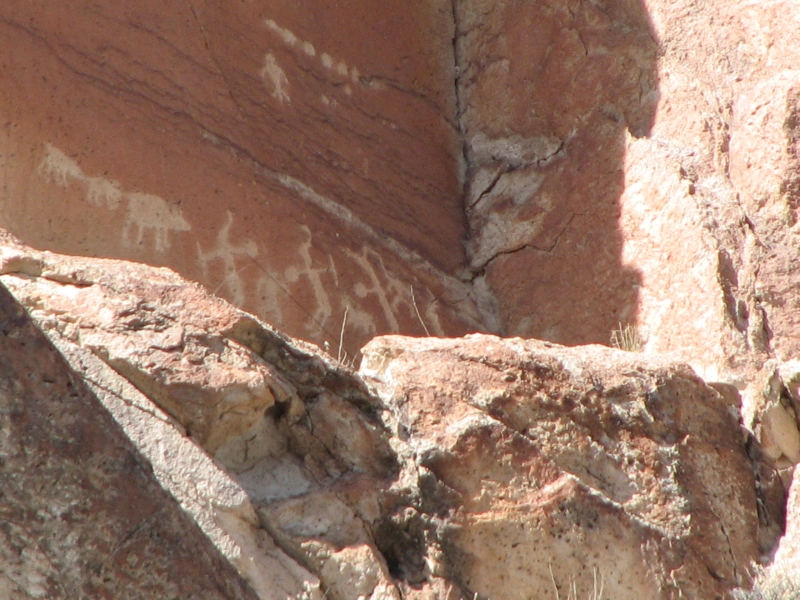
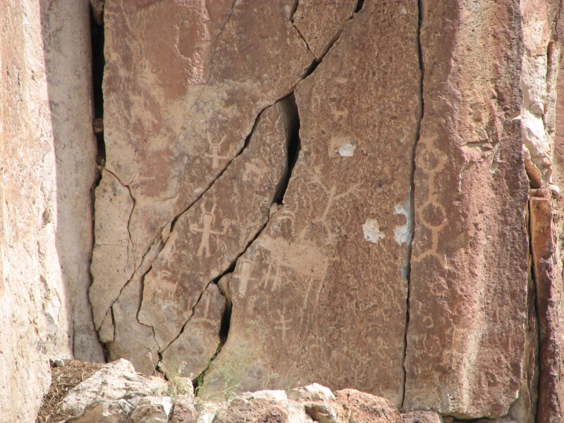
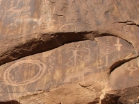
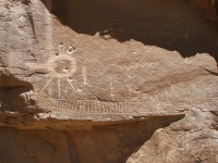
We had a fun day in one of the densest concentrations of rock art anywhere: Nine Mile Canyon. The canyon is actually about 50 miles long, but the main area of Indian archaeological sites is a segment around 30 miles long in the middle of the canyon. In the upper canyon the elevation is too high (9000) to be farmable and farther down the canyon gets narrow, plus it was too far from the trees needed for fires for people to live there year around, so there are fewer archaeological sites. The canyon has thousands of petroglyphs, plus some pictographs, pit house ruins and granaries. Evidently there were some cliff houses on the ridges 300-500 above the canyon, but we couldnt see them from below and I dont think you can visit them.
We visited Nine Mile Canyon last year and loved it. After our tour, we picked up a good guidebook (Jerry Spanglers Horned Snakes and Axle Grease) with a lot of information about the history of the canyon and the location of many of the sites. It lists 85 sites -- mostly rock art, but also old ranches, ruins, mines, etc. Although we did well finding rock art last year using information I got off the internet plus the map in our Kelsey hiking guide, we saw a lot of panels today I dont think we saw last year. It was a lot of fun. We didnt do as much climbing up to the sites since Jim has a camera with a good zoom, but we spent more time just looking around with the binoculars, so we found a lot of panels, especially way high up, that werent in either guide.
It seems to me that the panels are even more dust covered than they were last year. There is mining and gas drilling going on in the canyon, so hundreds of vehicles go up and down the roads each day, including big trucks, plus you have the ranchers and tourists. They will end up destroying the rock art, I fear. I thought going midweek would be quiet; I didnt count on all the commercial vehicles, the two school buses full of kids, plus the ten cars that accompanied the buses. We saw a few other tourists like us, but they werent doing as in depth a visit as we were. Last time we were here was Memorial Day, so all we saw were tourists, just a few mine trucks. The canyon is still worth visiting, despite the traffic. I especially enjoyed having the guidebook, which pointed out some of the more unique features, like the two headed snake, the deer sitting like people facing each other, etc. (They reminded me of the dancing sheep in Shay Canyon.)

It was very cold when we started barely 40 degrees and windy. At 9000 there were snow patches on the ground and fresh snow on the ridge above us. It only rained where we were last night. Clouds are actually welcome when viewing petroglyphs. Although some appear more clearly in sunshine, especially old heavily patinated ones, sun and shadow can hide images or create such a shine on the rock that photos simply dont work. Then late afternoon sun can make it impossible to take pictures because you are shooting into the sun. Still I was happy it warmed up mid-afternoon, though our campsite is both windy and shady, so it is cold again. At least the rain didnt linger. We got a few drops, but that was it.

We didnt finish exploring the canyon today. About 5:30 we were so tired we were missing panels, and worse, not caring that we missed them. So it was time to stop. The bottom of the canyon is mostly private land (ranches, mines and gas wells) but a couple of side canyons are public land, so you can camp there. We drove to Cottonwood Canyon, went up a couple of miles and found a large flat spot beside the road with an old fire ring.
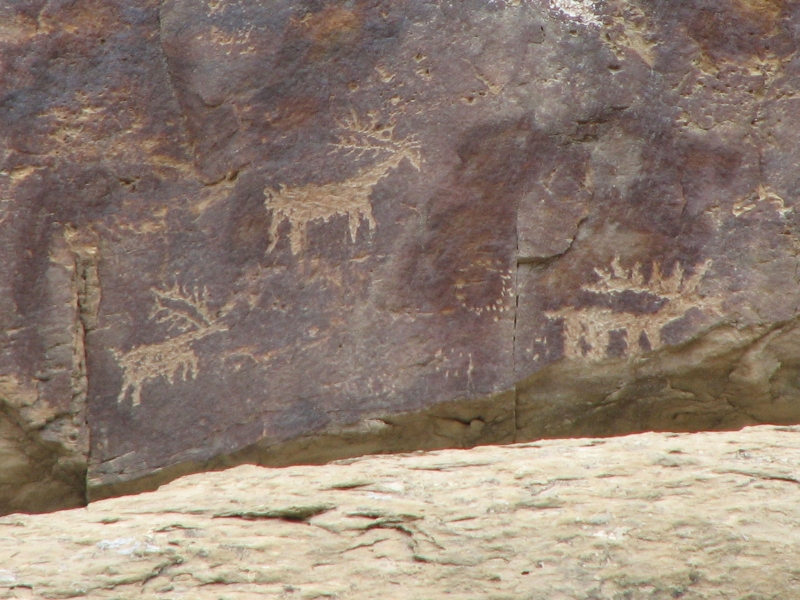
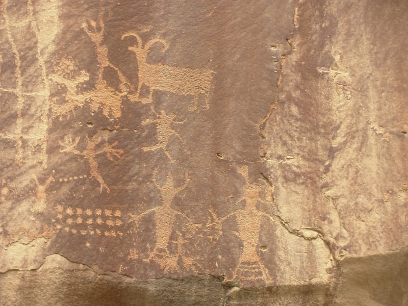
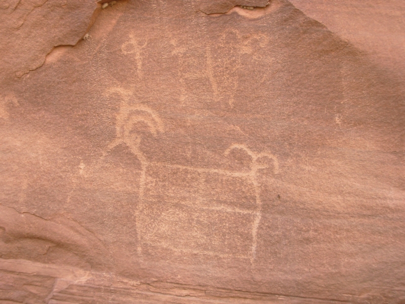
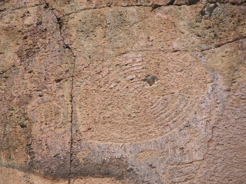
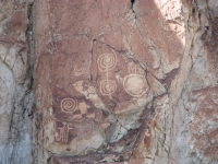
The rock art is mostly Fremont with some San Rafael, Ute and Anasazi images mixed in. For centuries people lived in the valley and left their mark. There are a lot of good petroglyphs: numerous bighorns, buffalo, dotted grids, snakes, spirals, shamans, and some very strange images. Hunting is probably the most obvious theme, but there are a lot of images whose meaning is really obscure.

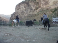
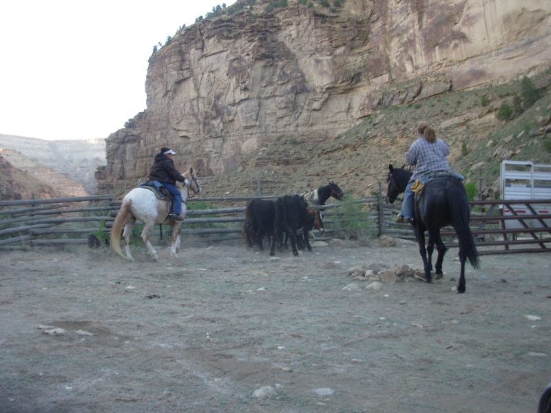
After supper we had an interesting distraction as we watched a couple of women round up some cattle that had gone up the wrong canyon. They said they were moving the cows up the road, got to their destination, counted noses, and realized that four were missing. They tracked them to the little side canyon next to our campsite. When we parked the truck we heard cattle lowing mournfully. Somehow they had gotten behind a fence there. When the horse trailer pulled up next to us we were a bit surprised, so we watched with fascination as the women dismantled part of the fence to use as a cattle chute, then got on their horses and drove the cows up and into the back of the trailer. It took only about 15 minutes not bad. They left their horses behind and sent the trailer back to pick them up about an hour later.
Friday, May 16: Nine Mile Canyon
We spent all day finishing up our tour of Nine Mile Canyon. It was a lot of fun and we found most of the sites we were looking for and a few more besides. We didnt find a couple of granaries that are supposed to be easy to spot, but thats typical. One problem is that our odometer didnt agree with the guidebook mileage. We were anywhere from .1 to .3 miles off. No matter. We usually persisted long enough to find the petroglyphs we were seeking.
Im really glad we came back to Nine Mile Canyon. It is so rich in rock art, both petroglyphs and pictographs. Its a pretty canyon in its own right, with layered cliffs and a green riparian valley. The Spangler guidebook was interesting and we were able to see some of the less obvious sites, like the ones that were hidden behind the tamarisk bushes in the lower end of the canyon or the pregnant buffalo in Cottonwood Canyon. Few of the rock art sites weve visited have had any buffalo, much less the numbers weve seen in Nine Mile. Maybe the broad valley included a local herd?

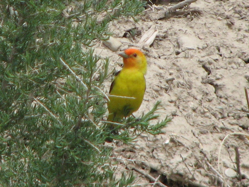
Since we were past most of the mine activity, we saw fewer people today. We did see some deer in a meadow. This is a rich area for rodents too: we saw marmots, prairie dogs, chipmunks, squirrels and a rabbit but only one hawk. It was a beautiful warm day, great for slow wandering.
We stopped for the night at a private campground, Nine Mile Ranch, up near the entrance to the canyon. It only has about eight spaces, but a real bathroom. I guess thats worth $10. We could have gotten a shower too, but were short on cash so well pass for now.

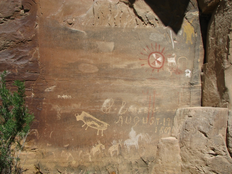
Saturday, May 17: Ferron, the Wedge, Buckhorn Wash, San Rafael River

We were a bit burnt out after two days of intense petroglyph hunting, so we decided to take it easy today. We returned to Price, bought a few groceries, ate brunch, then headed to Ferron about 30 miles south of town. The Castelton book mentioned several sites there and the Utah road atlas actually gave the location of one of them. From the first site we were able to locate three other sites upriver, though not the one we most wanted to find. Still, we had fun looking for them.
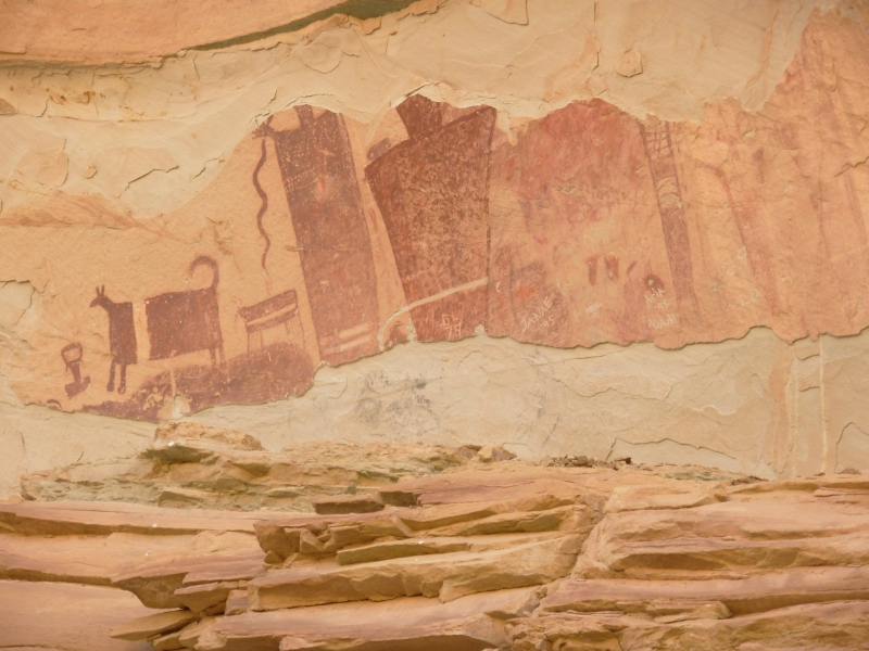
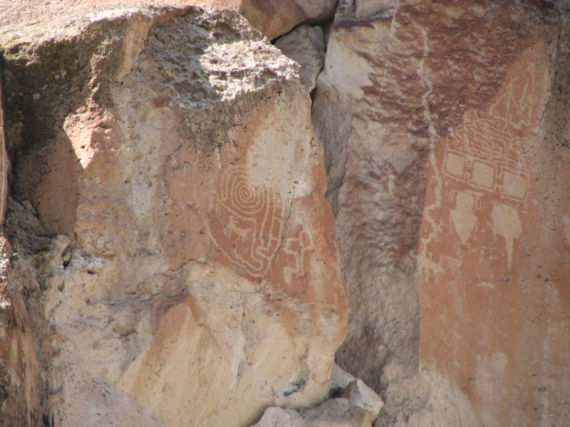
From Ferron Canyon we headed back into the San Rafael Swell. We detoured to the Wedge Overlook, which has beautiful views of the San Rafael River called the Grand Canyon of Utah. Then we went down to Buckhorn Wash and Cottonwood Wash where we stopped at one of my favorite Barrier-style panels, a long one with images of anthropomorphs and snakes.

We had intended to camp at the campground by the San Rafael River Bridge, but there were a lot of people there, including a couple of groups of kids some scouts and a school group -- so we headed a mile or so back to a nice quiet spot next to the road. It doesnt have a table, but the price is right (free) and it is much quieter than the campground. We had bought some ice cream in Castledale, so we ate our dinner backwards: cold strawberry soup, salad and tortellini. Afterwards we watched the colors of the rocks around us change as the sun set. Its a beautiful spot. There were some really nice campsites at the Wedge, but Jim wanted to come down near the river so we could get an early start on tomorrows hike. When we backpacked the San Rafael, we didnt get all the way down to the bridge, so we missed a couple of rock art sites a few miles upstream. From this end its only three or four miles to the sites, if we can find them. Since it has warmed up considerably, Jim preferred to start early. I just hope we dont end up joining the scouts on this hike.
Sunday, May 18: San Rafael River to Green River (9 miles)
It was hot today, very hot. Fortunately, the trail was mostly easy, with little sand and no river crossings. Actually, a few river crossings would have felt good, as hot as it was. I considered jumping in anyway, but the muddy green water with foam floating on top might have been cool, but it wouldnt have cleaned me up any.
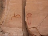
We found our first pictograph panel in Kane Wash quite easily. It was a geometric abstract panel, not too exciting. I like representative art better, even when I cant quite figure out what it is Im looking at. From the alcove with the zigzags, we climbed steeply over a ridge--sort of a short cut-to Pictograph Butte, which had some very nice red and yellow images. Thats unusual since yellow paint doesnt usually age well. These were in good shape though. We dropped down to the trail on the far side and walked the long way around the ridge then back to the car. We met one backpacker on the trail, then his friend who was waiting at the parking area. We had a long chat with the friend. It was a good hike through a pretty red rock canyon, with the rock art as a bonus.
We decided to return to Green River--the nearest town--to get cleaned up, download photos and figure out where we go next. The plans I tentatively made require hiking. Todays excursion was a reminder that Jims foot isnt happy with long hikes, so its back to the drawing board. Were both starting to burn out on the archaeological hunts. All the places and images are merging in my mind. We recently picked up the second Castleton book, Petroglyphs and Pictographs of Utah, Volume II. Like Volume I, it gives brief descriptions of hundreds of rock art sites around the state, with no detail as to where they are located. Sometimes we can figure it out (like Westwater and Ferron) sometimes were not as lucky (i.e. Price River). Just looking at the book totally overwhelmed me. So many sites. Do we really want to make the effort to find them? The book gives both too much and too little information. I give up!
Monday, May 19: Fremont State Park
The forecast is for heat in the mid-90s followed by several days of rain. We decided it was time to head north to see if we can find some trees for shade and cooler temperatures. First we decided on one last rock art stop at Fremont State Park, west of Richfield. We visited it last year, but only spent a couple of hours looking at the many petroglyph and pictograph panels there. There are literally hundreds of panels, thousands of images. Most are close to the road and easily accessible.

Today we climbed the Rim Trail, which took us close to some of the panels we had seen from afar last time. It was a stinker of a trail, basically a bushwhack on loose rock. Nothing was stable underfoot. The climb wasnt so bad, but going down was painful. The images were worth the effort though, I think. We only visited two sections today, but it took all afternoon as we slowly scanned each rock face with binoculars looking for images. We didnt even photograph everything we saw; there were too many and some were 100 or more above us. Jim just took photos of the big panels.
We ended up camped at nearby Castle Rock Campground. Its a pretty one in a small canyon full of cottonwood trees and a small stream. There are few people here, probably because the water is shut off so the main bathroom is closed. Fortunately, theres an outhouse as well, so we decided to stay. We can hear cars on the freeway a mile away, but its not intrusive. On weekends this campground is busy with ATVers, but not today.
Tuesday, May 20: Fremont State Park to Provo
We spent the morning continuing our exploration of Fremont State Park: the Canyon of Life (where we finally found the Marao Panel after half an hour of searching!), the Parade of Rock Art, the Court of Ceremonies and the Hidden Secrets Trail. We visited several panels we didnt see last time and got photos of some familiar ones at a different time of day, which can make a difference in clarity. Most of the petroglyphs were carved in white tuff, with a red iron oxide patina. Some were barely visible because of the way the rock had patinated, or not. We had fun anyway.
Afterwards we drove north to Salina and then on a back road to I-15. Its a pretty drive through ranch country with lots of horses, cows and sheep. The mountains in this part of Utah are different; they look more like the Rockies with new rugged steep ridges, still snow covered, with conifers and aspen. I enjoyed it.
Home | Links| Trail Journals|
The Thruhiking Papers Bun-bun
Created: 1 Jan 2009
Revised: 30 Sept 2016Copyright ©: 2008-2017 Spirit Eagle