|
 |
 |
 |
 |
|
|
|
|
|
|
Thursday, February 28: New Orleans, LA
A beautiful cool day. We headed west on I-10 to New Orleans. It took a long time to cross the lake, thanks to road construction that had traffic at a standstill. (People here do not merge well!) I had wondered about damage from the hurricanes. We didnt drive along the coast, but we saw that several of the tourist sites (i.e. Jeff Davis birthplace, the Wildlife Sanctuary, state parks, etc.) were still closed and some of the highway billboards were wrecked. Driving into the city we saw a lot of damaged buildings and empty lots but also a lot of new construction and repaired buildings.
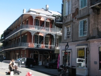

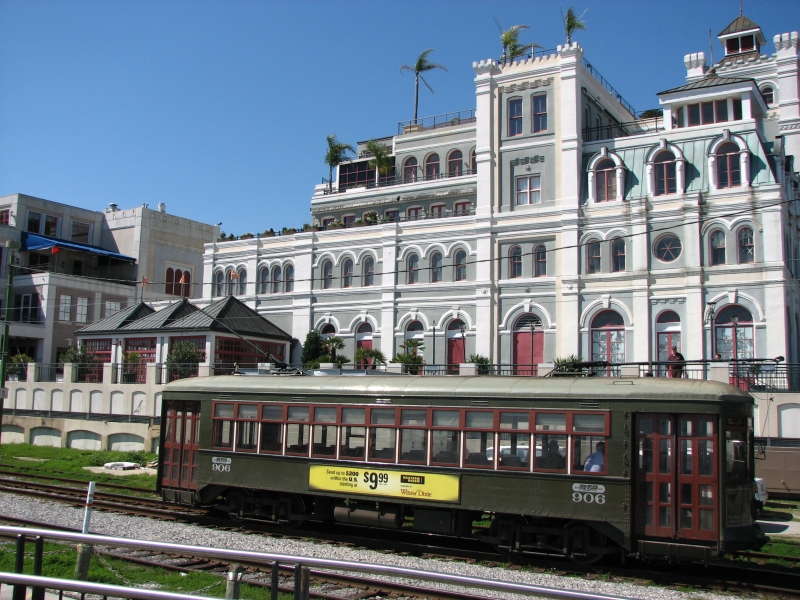
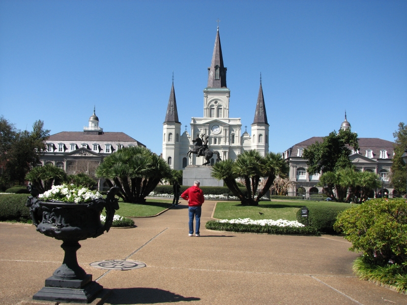
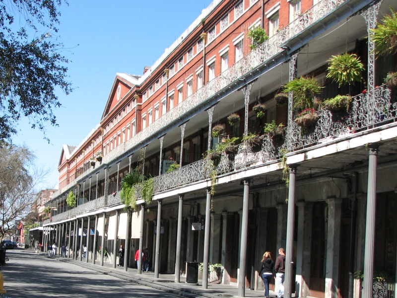
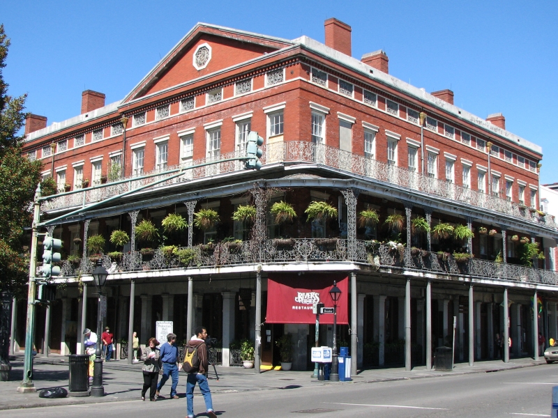
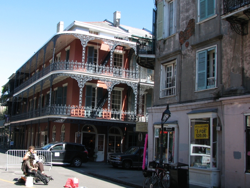
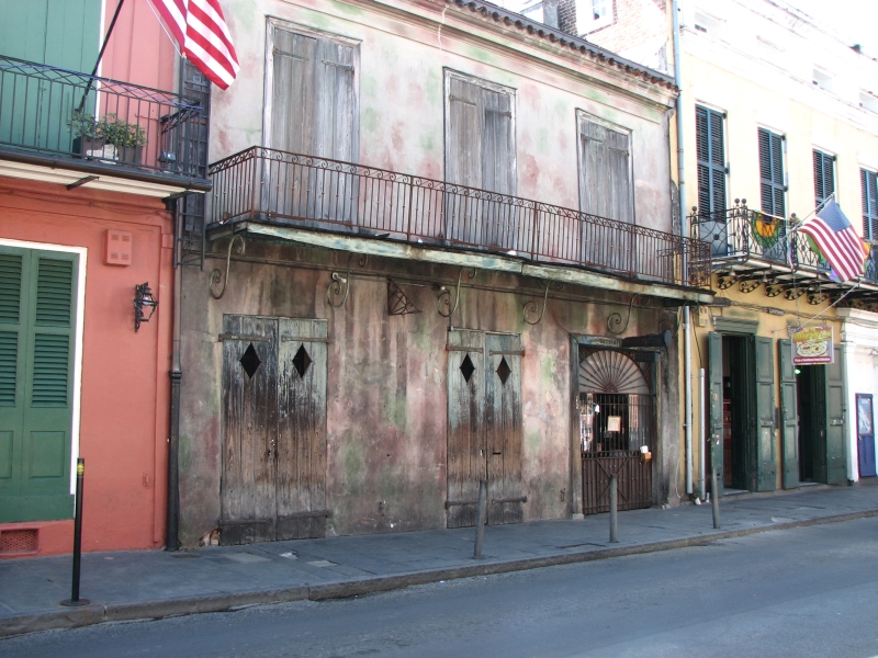
We stopped at the Basin Street Tourist Office to get a city map, then parked the car in a lot by the waterfront and began to wander on foot. There were musicians all over: some jazz, some gypsy (accordion and violin), some pop, and some acoustic guitar. I enjoyed that. We ran into a con artist, who made us laugh (but cost us $5). We admired the wrought iron balconies of the French Quarter, visited the Cathedral, passed by a lot of shops without stopping (not my thing), then ate a muffaleta at the Central Market and a beignet and café au lait at the Cafe du Monde. (Im a traditionalist). Bourbon Street was a disappointment: cheap bars and sex clubs. Preservation Hall was surprisingly hard to find; its really inconspicuous. I was in New Orleans in 1988, but I didnt remember it all that well. Today I enjoyed the street musicians and the food, but was ready to leave after a few hours. It was better than expected, largely because it wasnt crowded, but its still a city.
Friday, February 29 (Leap Day!): Big Thicket Ntl. Preserve, Texas (5 miles)
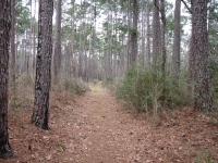
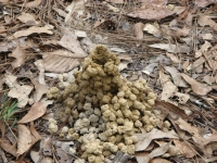
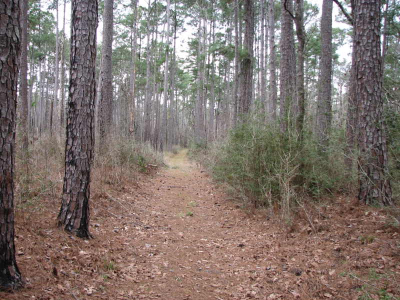
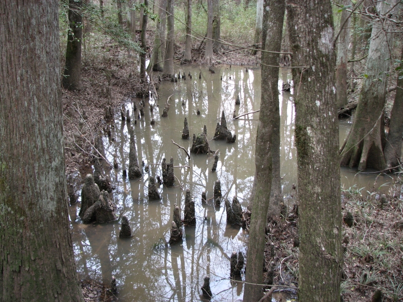
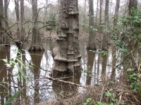
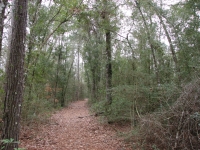
We didnt sleep much last night thanks to noisy neighbors talking outside our room until 3:00 a.m. We still woke up early, but took our time getting on the road. We passed rice fields and cattle ranches and horse farms as we drove to Beaumont, where we bought some groceries, then sat in a construction jam for an hour or so. We reached Big Thicket National Preserve mid-afternoon. It is a large park, with 12 units spread out over a large area. We hiked two short loop trails: The Kirby Nature Trail and the Sandhill Trail. The terrain was similar to what we hiked in Florida, with muddy brown creeks and swamp areas, magnolias and oaks, loblolly and longleaf pines. There was much evidence of Hurricane Rita lots of downed treesbut it was a nice walk through woods and swamp. We saw no people or animals and mostly just cardinals for bird sightings.

Then came a weird (and suprisingly difficult) attempt to find a campground. There are no developed campgrounds in Big Thicket, just backcountry camping. We got a list of nearby private campgrounds from the Visitors Center. We went to the nearest and found it to be very primitive only two picnic tables for the entire place and an outhouse hidden 200 yards away from the campsites. Obviously they mostly cater to self-sufficient RV campers. It was getting late, but we decided to see if we could find a better place to camp. The next two on the list were evidently still closed for the winter; we couldnt find any sign of them. It would be 20 miles to the next, so we turned around and got a spot at the first primitive campground. I didnt want to cook in the dark. As it was, we ate in the dark, but at least we were able to get started while there was enough light to see what we were doing.
Saturday, March 1: Houston (6 ½ miles)
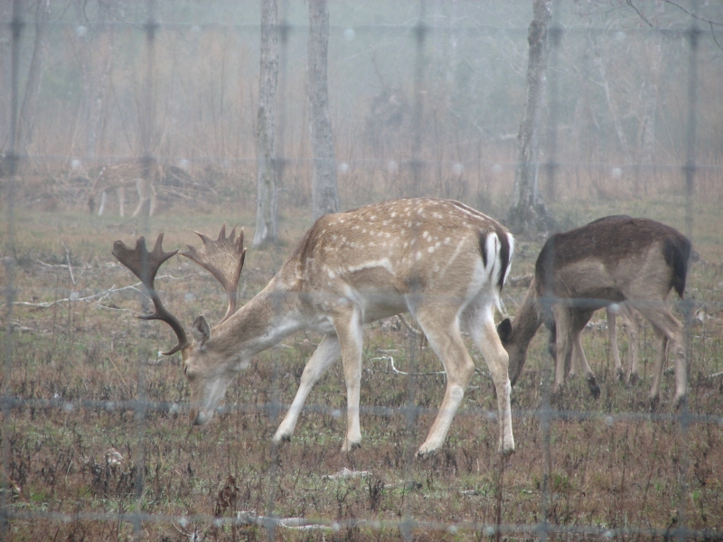
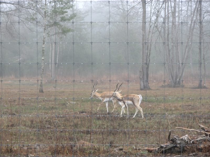
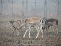
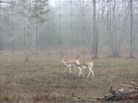
We slept well last night, despite occasional whooping and hollering from a wedding reception at the Barn on the Indian Springs Campground property. Evidently they do a lot of weddings there; another was scheduled for tonight. It was foggy and dripping when we woke up, but that burned off later. Near the campground, we stopped at Post Oak Farm to check out the assortment of exotic wildlife we could see through the fence various African antelope, etc. Im not sure what all was there, but they were interesting.
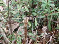
We drove to the north end of the Turkey Creek Trail and hiked three miles to the Pitcher Plant Trail. Its too early for the plants, but we could see last years dried flowers, so we could get an idea of what the swamp looks like in summer. Evidently four out of the five US carnivorous plants grow in Big Thicket. There is a Sundew Trail as well, but without the flower in bloom, I doubt wed be able to tell which plants are sundews. It was a nice hike, though the area was affected by Hurricane Rita in 2005 with lots of downed trees. It was mostly pine woods with a few cedar groves and some scattered oak, magnolia and beech. There were a few flowers: yellow jasmine, purple phlox and violets, but it is still winter, even though the temperature is 70 or so.
Sunday, March 2: Houston (4 ½ miles)
We arrived in Houston Saturday afternoon after laboriously driving though miles of highway construction. How do so many people live here? My dad lives here with his wife Betty on the west side of town, so we eventually reached his house and settled in for a couple of days of good food and conversation. Sunday we chatted all morning, then went out to walk on the Terry Hershey Trail a nice hiker/bike trail. There were lots of people enjoying the day. We got sprinkled on a couple of times, but kept on walking. We came home to read and do laundry, then went out to dinner at Bettys daughter Kathys home where we enjoyed a good meal and more interesting conversation with the family. For two hermits like Jim and me, being around people can be either a joy or a penance. Today was all pleasure.
Monday, March 3: Houston
A cool, gray, rainy, windy day. We relaxed all morning, reading and talking, then headed downtown to the Natural History Museum after lunch. It is a good museum. We wandered through the gem and mineral collection breathtakingly gorgeous though the shell display, past a tintype exhibit on cowboys, to Lucy an exhibit on Ethiopia and one of the earliest pre-human hominid skeletons. I knew little about Ethiopia, so it was interesting. I did know a little about Lucy so it was fun to see that display as well though I thought the ticket to see it too expensive for the little we saw.
Then we headed upstairs to the Hall of the Americas, which had some beautiful Maya, Aztec and Inca artifacts as well as Plains Indian beadwork and southwestern pottery. It was fascinating. We ran out of time: a guide had to usher us out the door, locking it behind us. It was a fun way to spend a rainy afternoon. We stopped at an Asian restaurant that had a mixture of Chinese, Vietnamese and Thai dishes. I enjoyed my curry. Im not sure if it was Thai or Vietnamese or a combination of the two, but it was tasty.
Tuesday, March 4: San Antonio
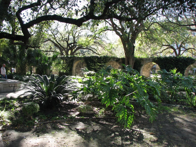
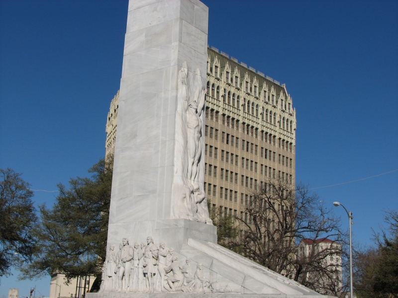
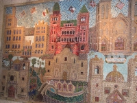
We puttered around for a while this afternoon, but eventually left Houston heading west. We had hoped to visit Jims cousin in Austin again, but today was primary day and they caucus in Texas, so she wasnt available. Instead we drove to San Antonio where we toured the Alamo, which was quite interesting. I had completely forgotten the history behind the siege. There is a beautiful plaza around the building with flowers and shady oak trees.
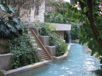
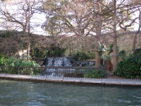
Afterwards we walked to the nearby Riverwalk, which is a big development of shops and restaurants along a canal with many fountains and waterfalls. The Riverwalk must be marvelously cool in the summer with all the fountains and running water. There were musicians (a jazz trio and some Andean musicians tonight) to entertain the shoppers. Boats take tourists up the canal. We wandered a bit then decided to look for a motel. We should have stayed at the Riverwalk for dinner, but we assumed wed find restaurants along the freeway near our motel. We were wrong. There were lots of fast food places, but few real restaurants away from the tourist center. We drove miles along the freeway before we found a Dennys. It was better than MacDonalds, but not quite what I was hoping for. After Houston, with its multitudes of restaurants on every corner, San Antonio was a bit disappointing. We should have returned to the Riverwalk, but I didnt want to pay for parking twice in one day. Still it was a fun afternoon, playing tourist.
Wednesday, March 5: Amistad NRA (4 miles)
Almost as soon as we left San Antonio, the land changed from green ranchland to dry desert. Mesquite and creosote replaced post oaks. It is still winter, despite the heat, so everything was very gray. There are a few wildflowers, but none of the paintbrush we saw yesterday in such abundance. There were lots of goats and a few cows and horses grazing the brown fields.
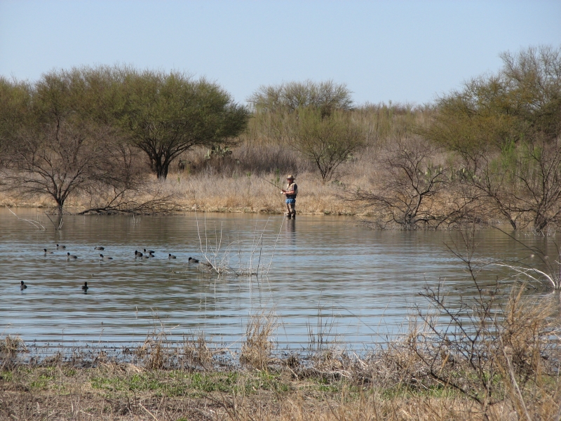
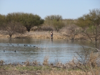
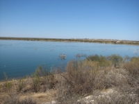
We bought groceries and gas, then headed to Amistad National Recreation Area. There are a couple of pictograph sites in the area, but we learned they are accessible only by boat. Amistad is a big reservoir on the U.S. Mexican border. There are a few boats and fishermen, but today, at least, its fairly quiet. The land around is flat desert. There are thousands of birds on the lake, mostly coots I think, black with white beaks. The water is a beautiful blue, reflecting the sky. We crossed several small rivers today that were a beautiful clear aquamarine, very different from the muddy bayous we saw in southern Texas and Louisiana or the black waters in Florida.
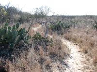
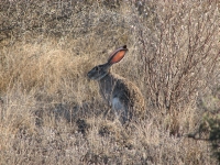
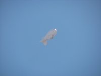
We found a site at a campground overlooking the lake, then hiked a two mile trail (each way) from the Visitors Center to another campground. It was a nice easy walk through desert scrub and prickly pear. It felt hot at 82 degrees, especially since I was wearing jeans. We spent a while at the Visitors Center talking to the rangers and watching a video on the Indian art sites in the area. The Rio Grande style is distinctive, though I saw some images that were similar to ones we saw in Utah last year. We saw one deer and a jack rabbit and several caracaras along the highway. Theyre an eagle/hawk common in this part of the world, but rare elsewhere. I hadnt seen one before.
Thursday, March 6: Seminole State Park
It was a noisy night, since the highway runs right behind the campground. In the middle of the night clouds rolled in, obscuring the clear bright stars. It sprinkled a little, but mostly just got cold, gray and windy. We slept in, ate breakfast, then attended a ranger talk at the campground about the archaeology of the area. It was a really good talk, though of necessity fairly cursory. The ranger had hands-on exhibits like woven sandals, a basket and a rabbit skin. They provided hot coffee and cookies, which was a nice treat. It was really cold, but a fun way to start the day.
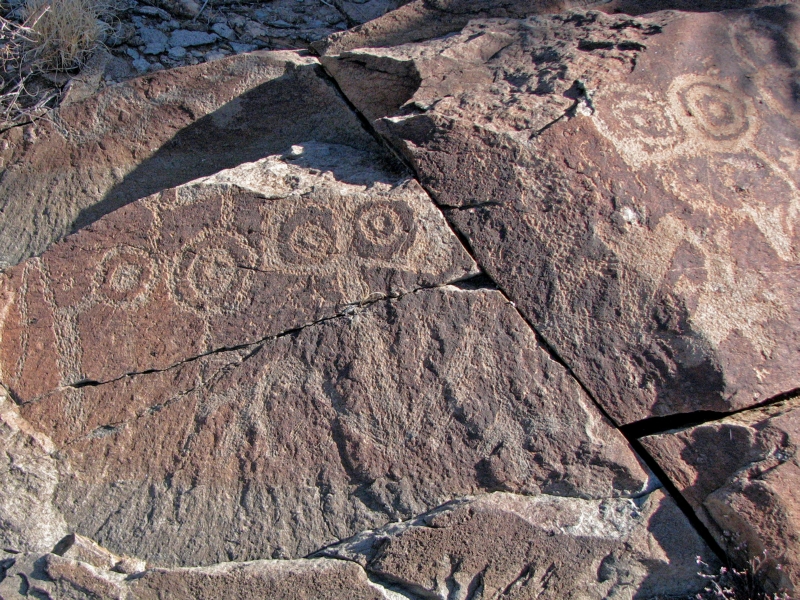
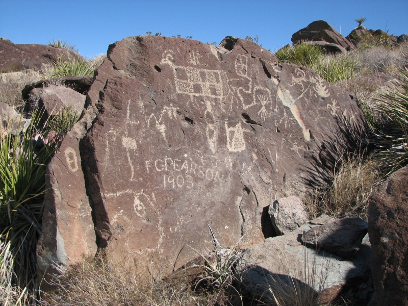
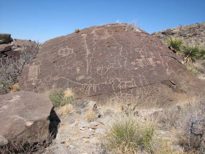
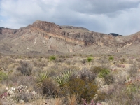
About 40 miles away is Seminole State Park, which has several caves that contain rock art. One is open to tours every day, another just once a month, and a nearby cave is only open on Saturdays. You cant visit any of them on your own. Frustrating.
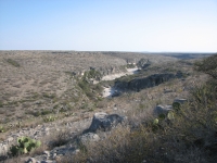
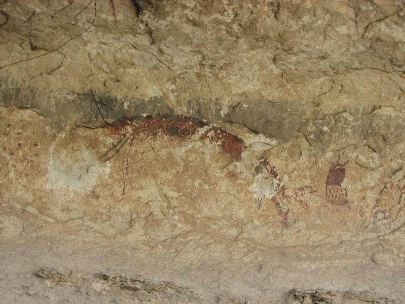
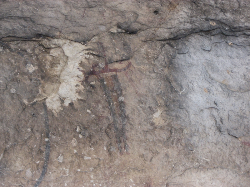
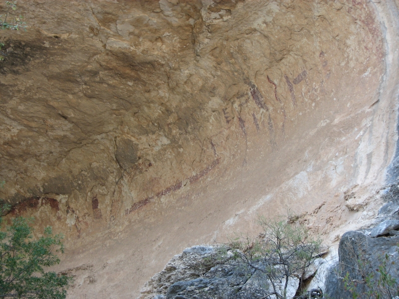
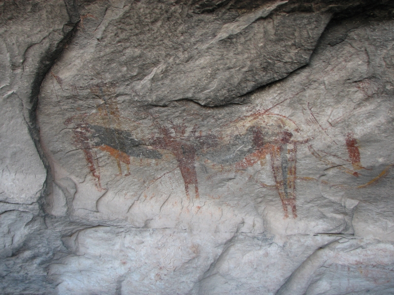
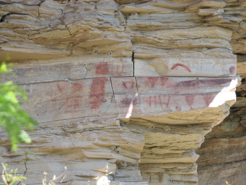
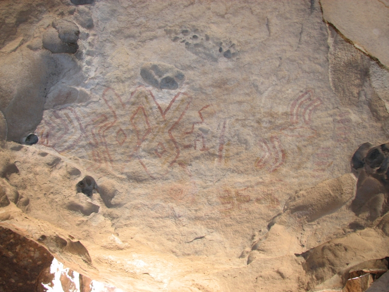
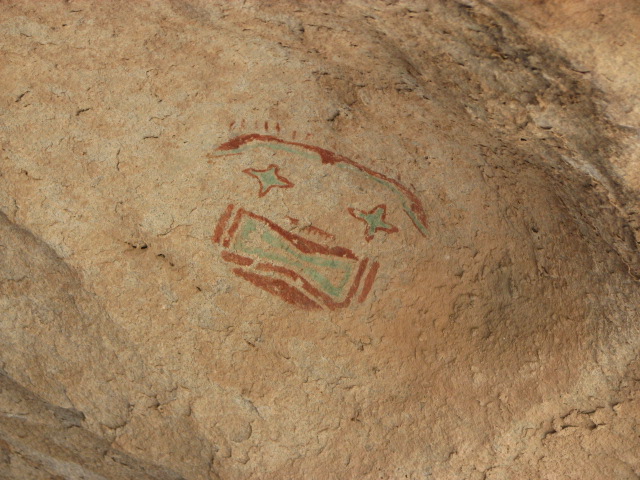
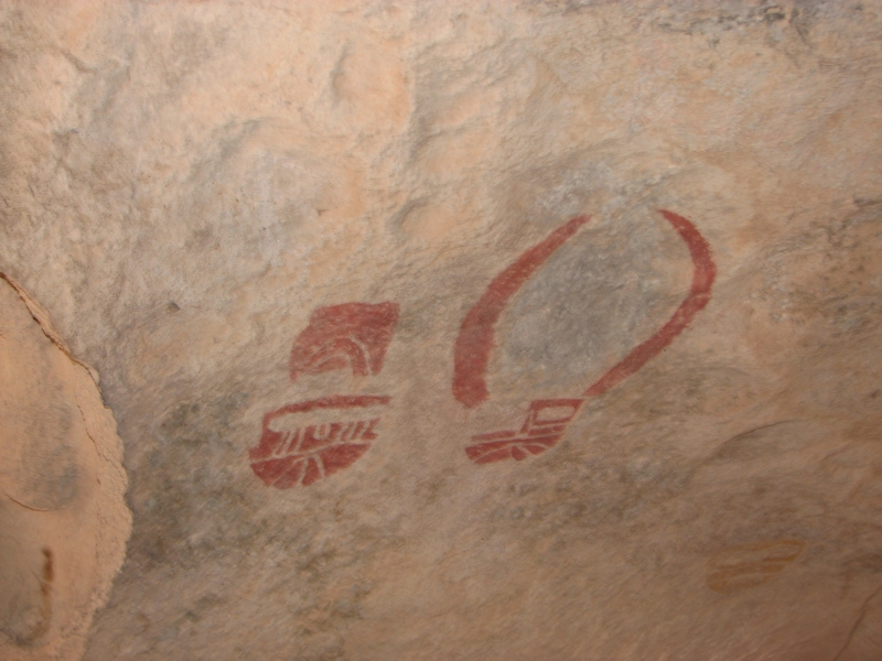
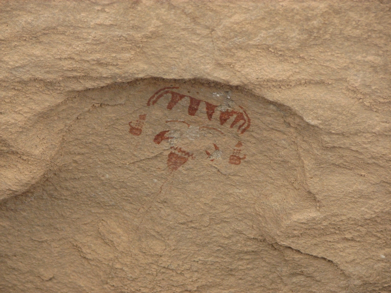
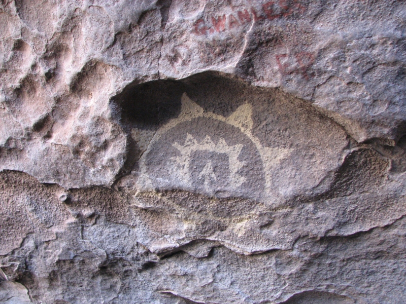
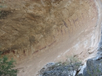
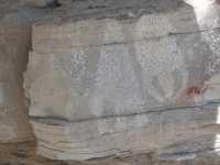
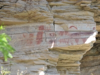
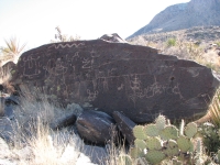
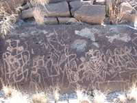
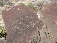
We waited for the afternoon tour to Fate Bell Cave, which turned out to be a nice one. There were only four of us on the tour, plus the guide. We dropped into the canyon and walked ¾ mile to the two large caves/alcoves with images. There were several multicolored pictograph panels, one set that is supposed to be about 4800 years old and the other around 5100. There were several shamanic-type figures with power lines. Like the Barrier style images in Utah of the same era, some were very large, with no arms or legs or heads. There was a lot of detail in some of the images. A lot of the rock is flaking off, so the images are getting hard to see, but it was still fascinating. One unusual aspect is that some of the panels made a single story line, 40 feet long. Again, thats like Barrier Canyon and unlike many other sites weve visited where images that are a few hundred years old are mixed up with or even superimposed on top of others that may be thousands of years old. Usually the rock art is all jumbled together, not in coherent panels. There were some good fossils in the rocks as well. Since we rarely spot them, I enjoyed the shells, etc. that we saw. Id like to see the other caves in the park, but our timing was wrong. Well come back another year.

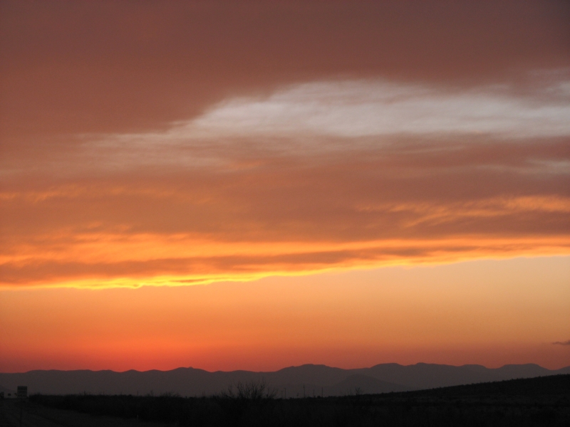
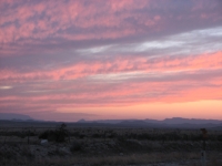
Afterwards, we drove west into a beautiful sunset until we reached the town of Marathon, where we got a nice, but expensive, room at a motel and ate dinner at the little Mexican café a block away. The temperature continued to drop. At 6:00 p.m. it was 35 degrees quite different from last night when we ate dinner in shirtsleeves. We had planned to stay at an RV park in Marathon, but it was so cold and blustery, we opted for warmth instead.
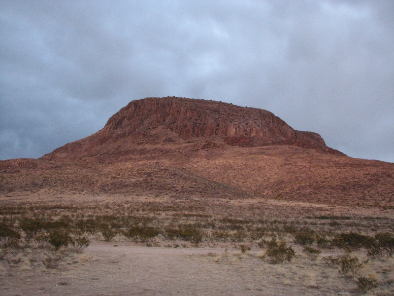
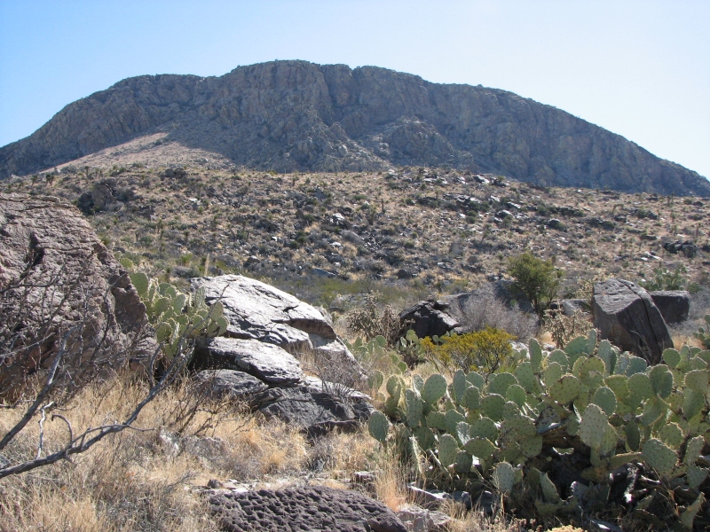
Friday, March 7: Big Bend National Park (5 ½ miles)
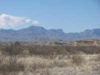
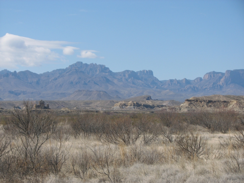
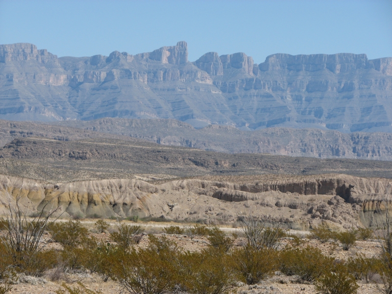
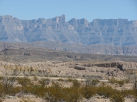
We woke to a cool (40 deg.) clear morning. After breakfast at the motel we headed to Big Bend National Park. It is a long drive, about 70 miles from town to the Parks main Visitors Center. Its 40 miles just to the edge of the park. Because it was a cool clear day, the mountains rose blue and clear in the distance. We visited Big Bend last year, but came back today to see two easily accessible rock art sites that we missed. Since we want to be at Alamo Hueco/Hueco Tanks near El Paso by Sunday, we can only spend one day at Big Bend on this trip. (Alamo Huecos rock art sites, like those at Seminole Canyon, are only open to tours Wednesday through Sunday. Given the distances, seeing Seminole, Big Bend and Alamo Hueco in one week means little time to dally.) The two rock art sites at Big Bend are at opposite ends of the park, so we enjoyed a nice scenic drive as well as some good walking. There are few flowers yet, though the ocotillo is beginning to bud out. Clouds moved in around noon and the wind picked up but it was a nice day to wander.
The first site, Hot Springs, was disappointing. There were some clear petroglyphs of spear points, but the pictographs were hard to discern. They were red shapes, some spears and some oblong figures, but very hard to see. There were also some stick figures. After Seminole Canyon, this was not very impressive.
We reached the Chimneys trailhead mid-afternoon, looked at the guidebook on rock art that weve been using and discovered that they recommend a different trailhead on the other side of the rock formation. On foot its 7-8 miles from one trailhead to the other, but by road its about 24 miles, including a long section on a rough dirt road. The Park literature told us to start at the first trailhead, which was the reason for our confusion. We asked a couple heading out if they had found the rock art, and they said no, so we decided to trust the rock art books directions instead of the park service. Mistake! There was some disagreement about what to do, but in the end we drove to the far trailhead. It is a pretty drive past steep cliffs, narrow Santa Elena Canyon, some pretty red rock and other interesting rock formations. The guidebook said the rock art was 2.4 miles from the western trailhead. The park literature said it was 2.4 - 3 miles from the eastern trailhead. We walked an hour and were still about 2 miles from the Chimney, a large rock formation out in the desert. There were no cliffs nearby or other rock formations that could be the chimney described in our guidebook, so we turned around. Evidently the park was right, not the guidebook. In a way, it didnt matter.
It was an interesting and scenic hike, much nicer than the walk from the eastern side. Our route wound in and around hills and dry washes, through multicolored sandstone that was red, white, pink, chocolate, etc. The vegetation was mostly creosote and small cactus, with some ocotillo and yuccas. We saw a couple of rabbits but no people. It felt very remote and beautiful. Im sorry to miss the rock art, but its not the first time the book has led us astray. Weve come to believe that it is deliberate he doesnt really want people to find some of the sites.
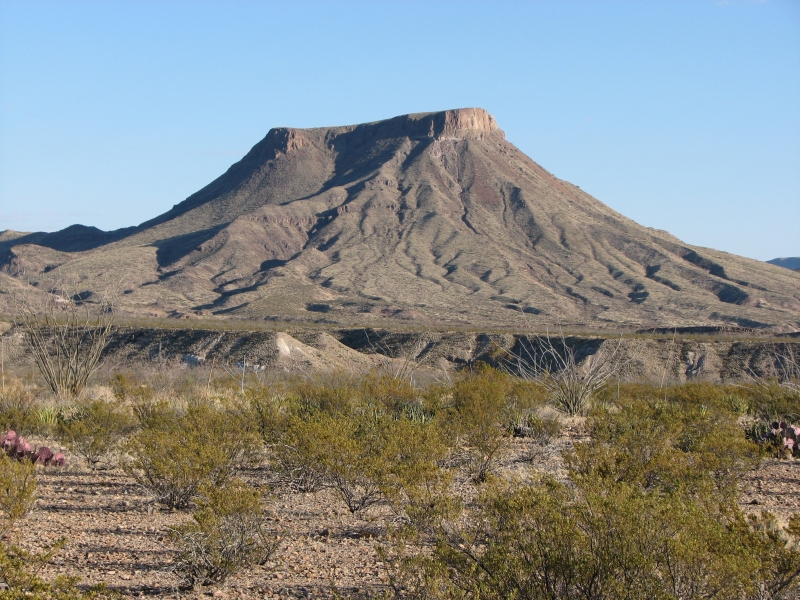
Im not unhappy. In fact Im feeling very content. Big Bend is a beautiful place if you like wild desert, as I do. Its not lush, except in spots, but it is remote and beautiful in a stark arid way. It also has a lot of diversity. The Chisos Mountains are very different from the desert sections, with pines and junipers and the Rio Grande area has lush cottonwood trees and even some palms. Its an interesting place.
Saturday, March 8: Drive to El Paso

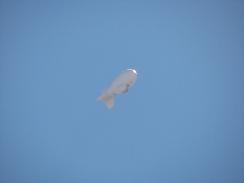
It was a low key travel day. We stayed in Alpine last night, ate breakfast at Pennys diner, bought ice and lunch food at the grocery, wandered through a good bookstore, then headed up the highway. It was a nice drive through the desert, mostly on quiet highways with little traffic. We saw a few antelope and roadrunners and an immigration dirigible overhead, but otherwise it was a day for driving, listening to music and lectures on tape (Philosophy of Science is the current course.) We arrived at our intended destination at 3:00 and learned that the campground at Hueco Tanks State Park was full spring break strikes again! We signed up for a tour of the rock art tomorrow morning, so well come back. You can see part of the park without a guide, but they limit the numbers so there is a waiting list and it was full this afternoon. Maybe tomorrow will be better. Evidently Hueco Tanks is a very popular rock climbing/bouldering area hence very crowded with college kids on spring break.
We headed toward El Paso to look for a campground. There are lots of businesses along the highway, but no lodging. The park is 30 miles from El Paso. We drove all the way to town, stopping at three RV parks. Two had no bathrooms, catering to self-sufficient RV units only. The third cost $30/night. We decided that a motel wouldnt be a lot more expensive ($44) but would be nicer, with more amenities than parking at an RV parking lot. We ended up at Econolodge. I was feeling a bit frazzled by all the traffic, so we ordered pizza, kicked off our shoes and settled in for a quiet evening. Well have a long drive out to Alamo Hueco in the morning, but our tour doesnt begin until 10:30, so well have time.
Sunday, March 9: Hueco Tanks
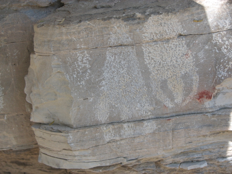
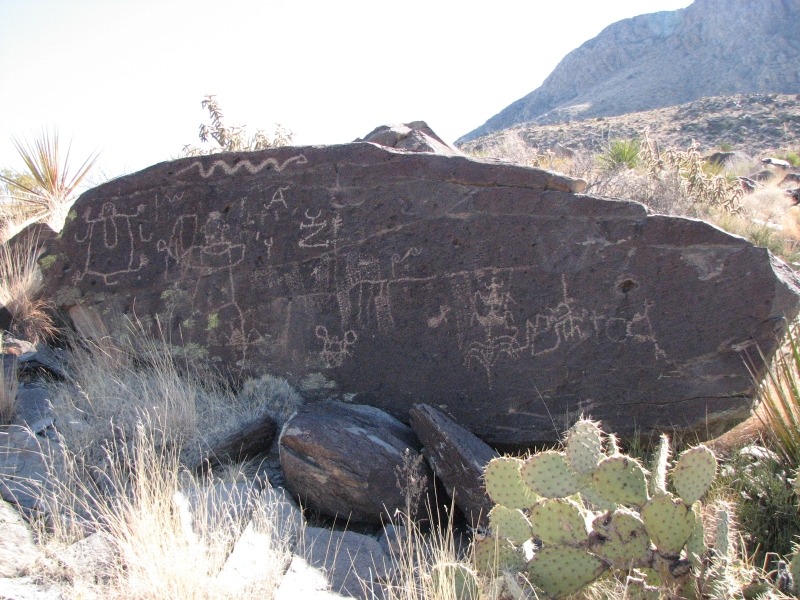
We had a terrific day touring Hueco Tanks Historic Site. It turned out to be a lot more strenuous than expected, but it was a lot of fun. Hueco Tanks is a big granite area, with huge boulders and smooth rock to climb hence its popularity among climbers. Hidden among the rocks in caves and crevices are scattered painted images. Part of the site is open to visitors and rock climbers, but the rest is restricted and can only be visited with a guide. The tours vary according to the guide and the day some last two hours, others four or more. Our guide gave us extra time and effort because there were several of us who were really interested in the images and history. We started out with 24 people, but several left the group midway. One local family group split off, got lost, were found by one of the men in our group who went searching for them, then reluctantly trailed along after is the rest of the way. Our guide was really unhappy when they tried to go it alone and again later when one of the kids stuck his empty water bottle in a hole in the rock!
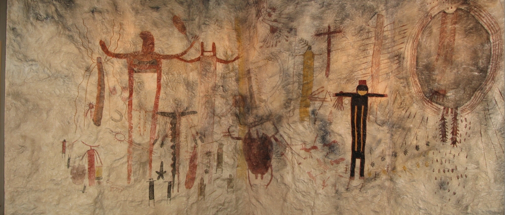
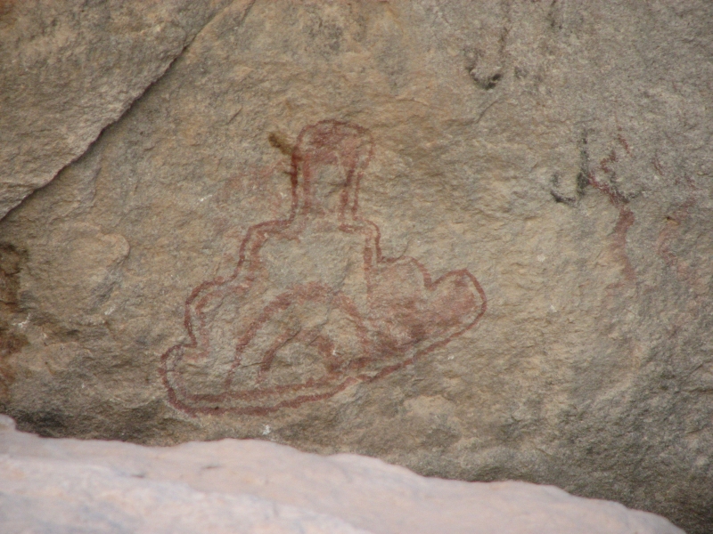
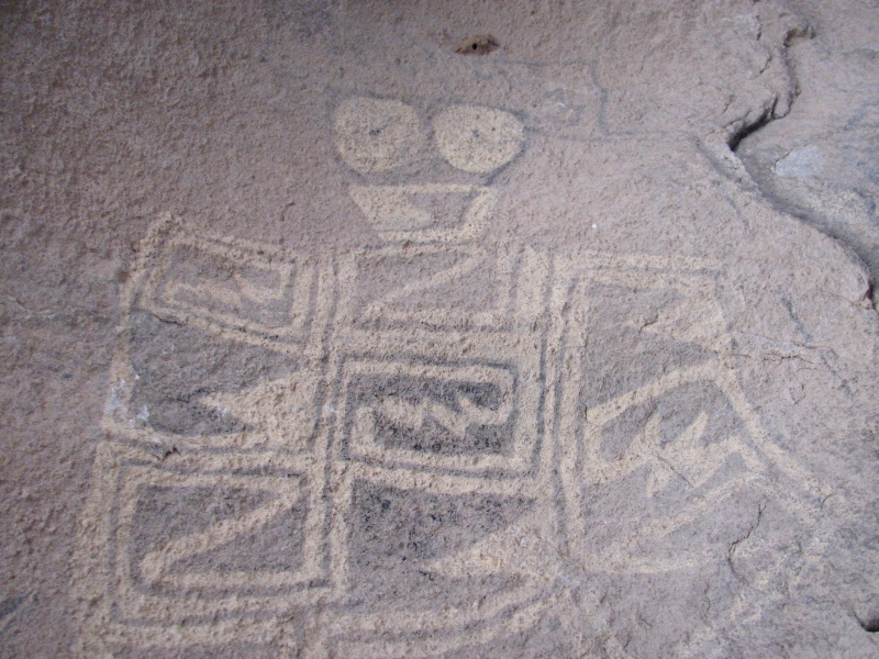
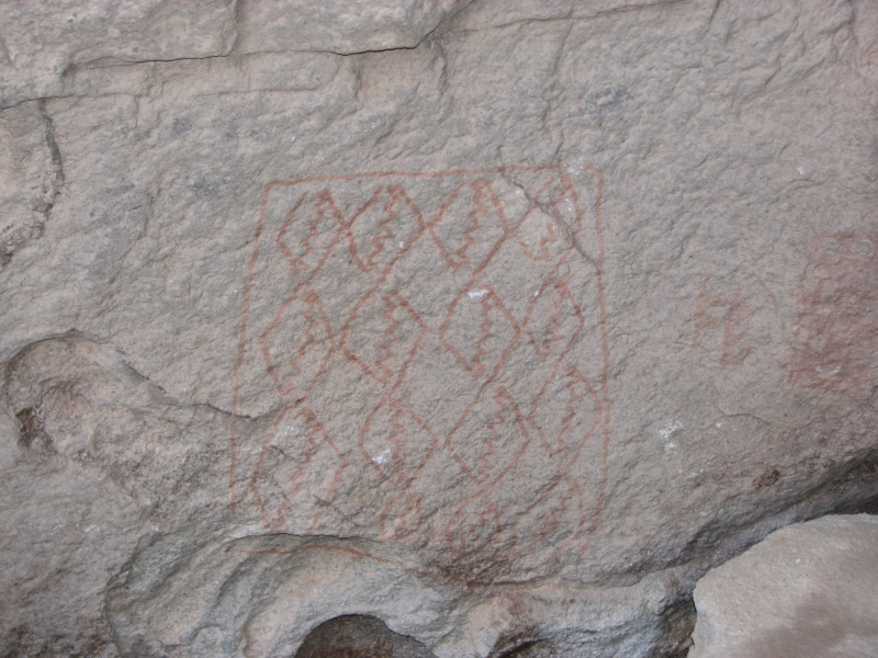
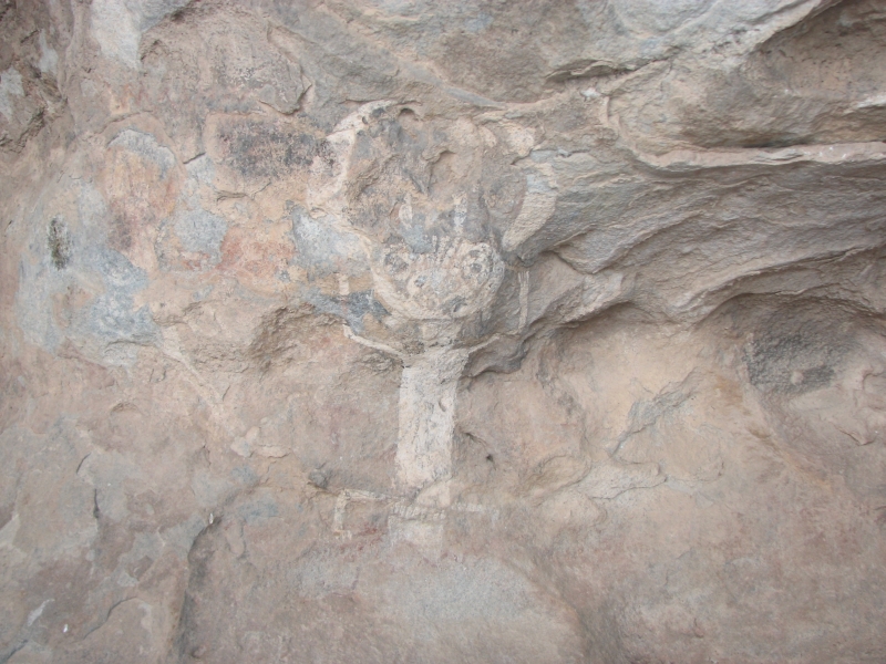
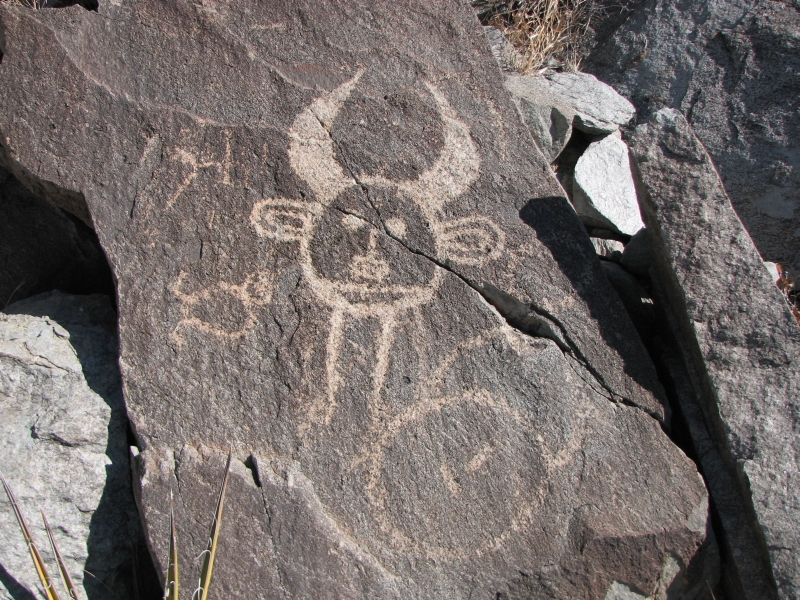
Our tour ended up lasting about four hours, then Jim and I and the guide went to see one additional site in a cave that had seven masks. That was a good climb up the rocks, but it was really nice! Many of the hidden sites were very hard to reach the images were probably not intended for public view but for some secret religious purpose. The pictographs were interesting, with a strong Mesoamerican influence. Quetzalcoatl, Tlaloc, etc. were depicted. I wonder if there were refugees after the fall of the Toltec empire, or missionaries from the Aztec that came to Texas to spread the word.
Hueco Tanks has the largest collection of painted masks anywhere. Because they are hidden, most are in beautiful condition. The best images at Hueco Tanks date from 1000-1200. There were later images done by Kiowa and Tewa as well, but many of those had been vandalized. We did a lot of walking, climbing, scrambling and crawling. Jim hit his head hard on one rock and pulled a tendon in his leg while leaping from rock to rock but he had as much fun as I did.
Bob White, the tour guide, recommended that we visit nearby Alamo Mountain, an undeveloped site nearby that has good petroglyphs. Since we have no set plans, we decided to check it out. The site is on BLM land, so we can camp nearby. Black clouds built up all afternoon and we got sprinkled on as we drove north, but it never rained seriously. We ended up with another beautiful sunset as we looked across 25 miles of creosote grasslands toward Hueco Tanks.
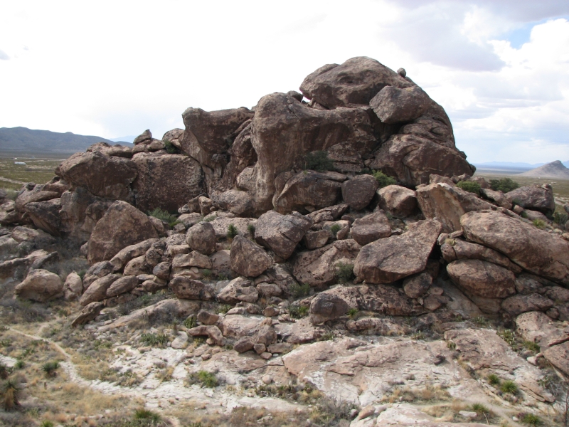
Monday, March 10: Alamo Mountain (4 miles)
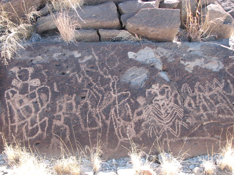
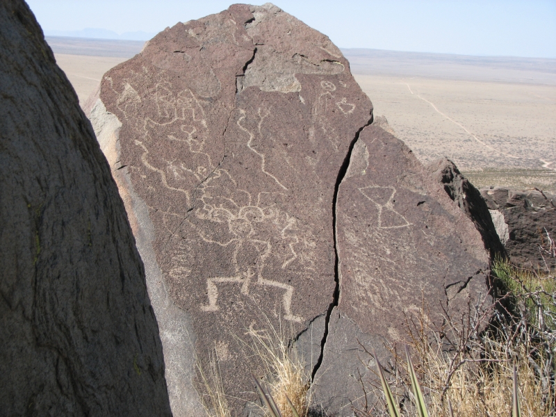
We spent a peaceful night at our desert camp. Only two vehicles passed our campsite yesterday evening. We woke to sunshine and blue skies. Alamo is a large rounded knob. We waited until the sun was high enough that the rocks wouldnt be half in sun half in shade, then began our exploration.
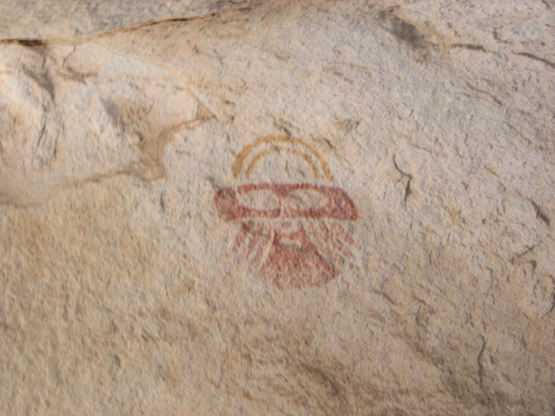
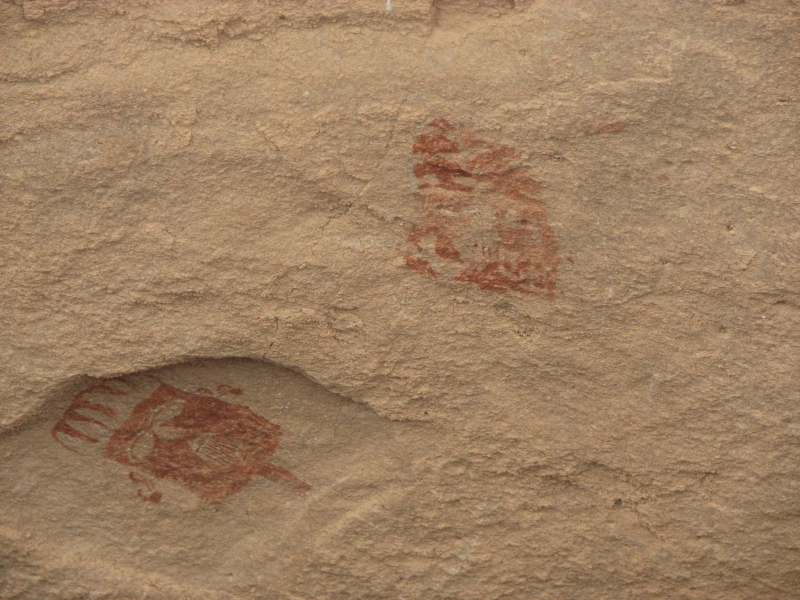
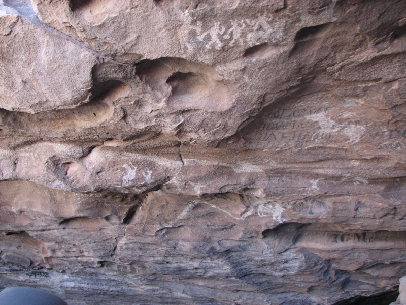
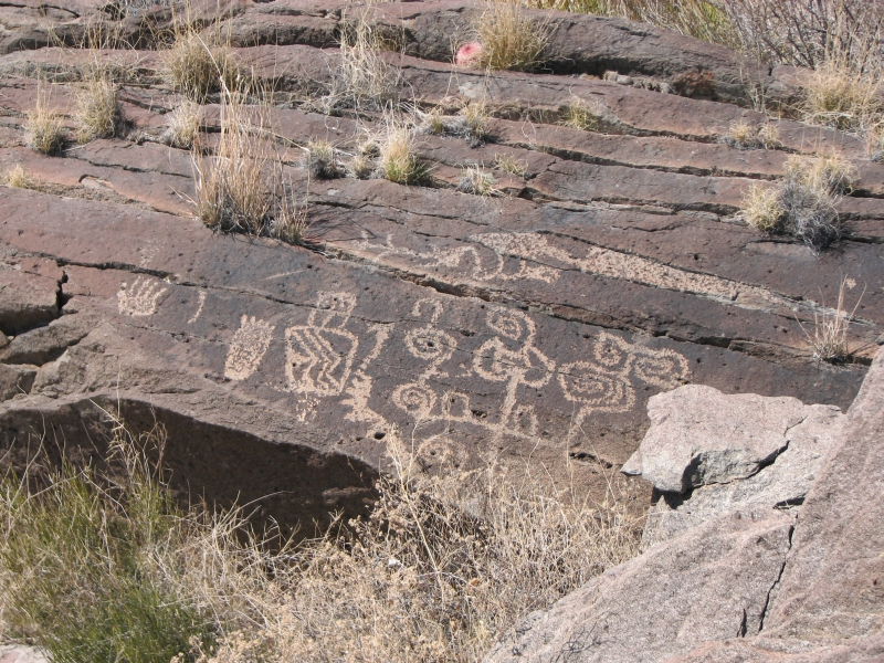
It was a fun day. We spent almost six hours on the mountain, looking for hidden petroglyphs. Most were on the back side of the rocks, so we did a lot of circling around. There were a lot of map-like drawings, but also snakes, turtles, anthropomorphs (look like people, but could be gods, shamans, etc.), bighorn sheep, blanket designs, Tlalocs, etc. The petroglyphs were scattered all over the mountain. In some areas, they were fairly dense with multiple images on a rock or on several rocks in the same spot, in others there would be only one small image on a rock. We didnt bring enough water, so we had to descend before we reached a huge figure I could see from the bottom of the mountain with our binoculars. We saw hundreds of images, but still missed the ones Bob had photographed and told us about. There were a lot of rocks to check out. In places the cactus made walking difficult. I was really glad we were out too early in the season for snakes to be active with all that rock, you know they like to sun themselves there. We did see a couple of kit foxes and jackrabbits.

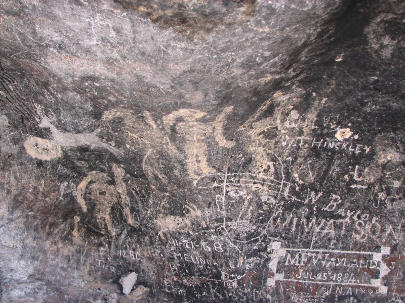
All in all, despite being exhausted, full of cactus spines, thirsty and sore, it was definitely worth the time and effort to get there. Wild sites are more fun for me, though also a bit more frustrating than developed sites. There is no guarantee of finding anything, much less the better images, so when you do find a petroglyph, it is more exciting than if you follow a tourist path directly to the panels. There is a thrill of discovery when you scout around, seeing nothing, then suddenly catch a glimpse of a blanket design or a horned serpent or shamanic figure. We missed a lot of images, but we saw a lot. It is a big mountain. There was very little damage to the site. Most of the graffiti was 19th or early 20th century (i.e. 1884 and 1908 dates were carved on rocks) probably from the days of the stage station. Since I hate seeing vandalism of any kind this wild site was a real pleasure.
Home | Links| Trail Journals|
The Thruhiking Papers Bun-bun
Created: 1 Jan 2009
Revised: 30 Sept 2016Copyright ©: 2008-2017 Spirit Eagle