
|
 |
 |
 |
 |
February 16-17: Prince William, Camp at Francis Marion National Forest
On our way, starting a new adventure, we have our usual mixture of feelings: excitement and worry, plus relief to simply be on our way at last. It was a peaceful winter, but I’m ready to be on the road again.
We left Maryland on a cool sunny day. At 45 degrees, it felt like winter. A day later, in cloudy South Carolina, it was 75 and felt like spring. I spotted daffodils and cherry blossoms while green grass lined the road. South Carolina also gave us our first sight of palm trees and gray Spanish moss.
We’re taking our time as we head south. We have no set plans until mid-March, when we have reserved a permit to hike in Aravaipa Canyon, so we intend to play things by ear. We stopped at Potomac Mills to visit a good used bookstore, then did a short 2½ mile hike in Prince William Forest Park. Our first night was in a motel, the second at a primitive campground in Francis Marion National Forest. I was tired of the traffic on I-95, so we decided to detour toward the ocean. Tomorrow we’ll get to see the water, I hope. We saw lots of swamp through the pine forest, but it didn’t look all that different from Maryland, except for the vegetation. The campground was empty except for another car with some folks who sat talking and listening to music for a while before driving off. It was very quiet in the woods. An owl hooted in the distance while bats circled around us. I liked it.
Jim: We intended to visit family on the way south, but they weren't home this week so we missed them. That's one of the problems with the extreme flexibility of our lives.
The drive down the East Coast on I95 is easy, but not the most scenic or exciting drive in the world. Getting off the freeways and exploring the country is a good way to make life more interesting.Monday, February 18: St. Augustine
We woke to pouring rain, so we rolled over and went back to sleep. It was still raining when we woke the second time, so we jumped into the front of the truck, ate some cereal, and headed up the road to a general store where I could get a cup of coffee. We had planned to go for a walk this morning, but the weather was so nasty we decided against it. The Palmetto Trail crossed the road and there were some natural areas that have some hiking trails, but this wasn’t the right day for it. We ended up blowing right past Charleston thanks to the heavy rains. I would have liked to explore the historic district, but not in a downpour. The rain eased as we continued south and soon after we crossed into Florida the rain stopped entirely.
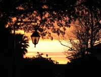
Once in Florida, we decided to visit St. Augustine, to learn more about its history. We didn’t have a lot of time to tour, but we did visit the 300 year old Spanish Fort San Marco, drove out to the black and white lighthouse across the river, then did a quick walk past the shops in the historic district. It was a very enjoyable visit. There was a beautiful orange sunset. We’ve seen a lot of water today, but still no ocean. Maybe tomorrow.
Tuesday, February 19: Bulow Creek Trail, Merritt Island Wildlife Refuge (5 ½ miles)
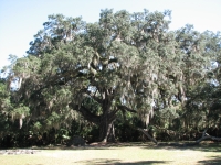
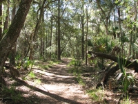
Today was a really good day. We had planned a short hike, so we got off the freeway at Flagler Beach. We took the wrong turn and headed along the coast for about ten miles. It was a windy day and the waves were high. We took pictures of a pelican on the beach, then headed back inland to Bulow Plantation (which was closed) to begin a semi-loop hike on the Bulow Creek Trail. It was interesting country: huge old oak trees, tall palms, short palmettos, pines and magnolia trees. There were few people, no wildlife and only a few yellow flowers. Many trees had ferns growing along the trunks or limbs and Spanish moss hanging off the branches. Near Bulow Creek we stopped to see a huge old oak tree that is supposed to be about 2000 years old. It was a very cool tree.
Afterwards we continued south toward Cape Canaveral to the Merritt Island Wildlife Refuge, which is part of the NASA property. It is swampland between the ocean and the inland waterway. We drove along a scenic drive and spotted lots of birds: osprey, ibis, spoonbills, herons, egrets, pelicans, ducks, etc. I really enjoyed seeing all the water birds. While I’ve seen herons and egrets in several parts of the country, I hadn’t seen wild ibis or spoonbills before. We also saw a small alligator and three wild pigs. We noticed bear scat on the Bulow Creek trail, old but full of berries, but saw no bears.
We had planned to camp tonight, but it got dark before we found a campground, so we ended up in a Super 8 in Cocoa for the night.
Jim: It's been a long time since I was in this area (mid-late 80s - back when I worked on Hubble Space Telescope). And I didn't get much time to explore when I was here. So a lot of this is new to me, too. I seem to remember the WIldlife Refuge but I never got there before. Cool place - lots of wildlife. Just not as many alligators as I expected.
One of the complaints I've heard in the past is that Shuttle (and other) launches interfere with the wildlife. Somehow the complainers always fail to realize how adaptable the wildlife is. I think it may often be that they never get out to actually experience the places they complain about. So they don't know what they're talking about.Wednesday, February 20: Little Big Econ, Ocala NF (4 ½ miles)
It was a mixed day, but mostly a good one. We had intended to go to Kennedy Space Center, but when I looked online and found out how much it costs, we decided against the tour. They wanted $38 per person admission plus $21 for a tour. Neither of us cared that much. Jim worked at Kennedy when he worked on Hubble Space Telescope, so he saw it from the inside. I’ve visited the NASA facilities in Houston and Goddard; neither of them was that expensive. However, this is Florida, where people are willing to pay big money at Disneyworld, Epcot, etc. We’re bad tourists – cheap ones anyway. We did hear the shuttle land this morning – we just missed seeing it since we weren’t aware that today was the day it was supposed to return home.
We decided to go hiking, but, as usual, just getting to the trail took hours. There’s a lot of suburbia here, lots of roads, cars, and heavy traffic. Our fairly late start this morning meant that all day felt like a bit of a push. Traffic was awful and the maps weren’t all that clear, so there was a lot of uncertainty as we wandered around. We have a handout we picked up at a visitors center that describes a couple dozen hikes in Florida, but information is sometimes a bit sketchy about trailheads. We spent a lot of time wandering in circles.
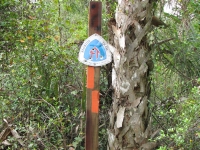
Still, at noon we reached the trailhead for a section of the Florida Trail in the Little Big Econ Forest.
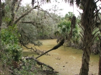
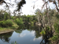
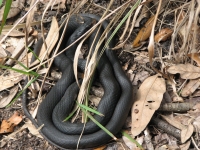
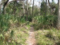
We followed a creek for two miles, then looped back on a couple of other trails. It was a nice short hike. We met a large group of canoeists and kayakers eating lunch by the creek. We saw a couple of hawks begin to mate, but they broke up when a bicycle passed by. Two owls hooted in derision. We stepped past a small curled up black snake. The vegetation was oak, palm, saw palm, pine and cedar forest, with many small side creeks. In places the brush was very dense, in others quite open. The creek was brown with tannic acid and in some sections looked quite stagnant. Not a good drinking source, though I think backpackers do drink from the brown waters. There were some nice campsites though. At one point we heard a very large animal crash through the brush. A few steps farther I saw a small dark piglet, hesitating before running after its mother. She must have been the loud crashing we heard.
We returned to the car around 2:30, then very slowly made our way to the Ocala National Forest where we planned to camp. We zipped past one campground. The next was closed, and the following one was several miles off the main road. We took a chance on it anyway, since we needed a place to sleep. We ended up with a nice quiet site in a developed campground with showers and flush toilets. It’s fairly empty on a Wednesday night.
We managed to cook dinner before dark, but barely. On our way to the campsite, Jim spotted three raccoons crossing the road in front of the car. One ran up a tree, but decided that wasn’t safe so it dropped back to earth and soon vanished in the palmettos. We don’t see many live raccoons, so that was fun. On the trail today we saw the remains of a long dead armadillo, just a few bones and part of its shell. We’re seeing lots of unusual things this trip. I wouldn’t want to live in Florida (too crowded) but it’s fun to spend a few days here. I wish we had time to go south to the Everglades, but that would take at least another week and we’re due in Arizona in mid-March. Maybe next year?
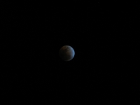
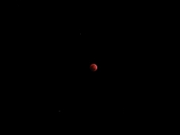
We stayed up to watch the lunar eclipse. There were some light clouds that came and went, but the moon was intermittently visible and quite beautiful. I was glad to be camping so we could lie out on the grass and watch the transition. Funny thing: last year we started our wandering with a lunar eclipse at a campground along the Natchez Trace. It’s a good omen, I think.
Thursday, February 21: Yearling Trail, Ocala (5 ½ miles)
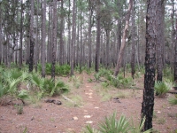
We slept late and woke to a light pitter-patter on the roof. Since it was barely sprinkling, I got up and prepared breakfast at the picnic table before the rain got more serious. We headed up the highway to the Yearling Trail, a 5½ mile loop hike in scrub pine and palmetto in the area where the novel “The Yearling” took place. I can’t imagine trying to farm this country – so much sand, so little water, and such dense scrub. The forest had burned, so most of the old home-site ruins were gone though we did see a concrete cattle dip, an old cemetery and a huge sinkhole. It was a nice walk.
It started raining again soon after we started our walk, but we just kept walking. As soon as we returned to the car, it stopped. We saw three other hikers who had come in via the Florida Trail, which we followed for about a mile.
We stopped at Salt Springs to do laundry and visit the Forest Office, then headed to Ocala to meet our old friend Sandra Friend. She works for the Florida Trail Association and writes guidebooks and magazine articles on hiking and touring in Florida. Her husband Rob Smith is a professional cartoonist, a good one. It was a lot of fun visiting them and talking about Florida. She recommended a drive that will take us off the beaten path. Since she is the guru of hiking in Florida, we also got several suggestions for possible hikes.
Friday, February 22: Cedar Key, Manatee Springs (4 miles)
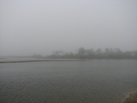
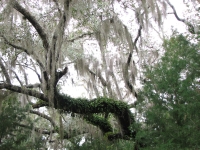
We walked around the neighborhood with Sandy and Rob before heading out this morning. We drove through Cedar Key, a pretty beach town on the gulf side of the state, then headed to nearby Shell Mound. It’s an ancient shell mound about 28 feet high that may date to 2500 BC. There were no signs to explain the history of the mound. We just saw a large hill with a trail, covered in broken shells and vegetation. It was very foggy so the view from the top was a bit limited. The tide was low so there were few birds on the shore. We drove a scenic route through the Lower Suwanee Wildlife Refuge, but saw no wildlife at all. The drive was a nice one through dense forest, then back out to rolling ranch and farmlands with cows and horses. Florida has a lot of wildlife refuges and birding areas. We’re too early for flowers, except a little yellow jasmine and white serviceberry.
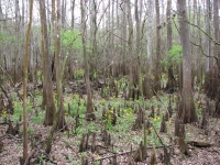
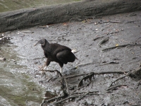
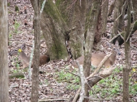
Lunch was eaten at Manatee Springs State Park. We walked the boardwalk out to the Suwanee River, spotting a couple of deer resting amid the cypress and what may have been a manatee in the water, as well as a black vulture and a pretty red breasted hawk. Manatee is a big Class I spring, 25’ deep and discharging 100 million gallons of water a day. It’s a big one. We did a 2½ mile nature walk through cypress and upland forest. Most interesting was a recreation of a Seminole hut, thatched in palm leaves. The Sinkhole Trail was another short one in the park with several deep depressions. It was a good place to visit.
Today was cloudy but hot and humid. In the farm country, the open grassy areas with huge oak trees reminded me of Southern California, especially the Boulder Oaks section of the PCT. We intended to go out to the Dixie Mainline Trail in the Lower Suwanee Wildlife Preserve, but realized that time wouldn’t allow us to do that as well as the drive along the coast that I wanted to do, so we kept going. Heading to the Gulf was our chance to see a Florida not ruined by tourism and development. We did detour to Steinatchee Falls, which was broad but shallow, only about a foot and a half high.
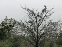
It turns out that Steinatchee was a pretty touristy town. We enjoyed watching the pelicans landing in trees on a small island. There were at least 30 or 40, landing and talking off while we watched. The drive was a disappointment. Turns out we couldn’t see the Gulf from the road. We headed out a side road to Adams Beach, but it wasn’t a beach: the shore was probably ¼ mile away, across swampy wet grasslands that we couldn’t cross without wading. It was too foggy to see far in any case. I had hoped to walk on an empty sandy beach, looking at birds and picking up seashells. Oh well. I am disappointed, but it’s too late to go back to the section we missed. Another day.
We ended up in an inexpensive motel in Perry, which was a bigger town than I expected. That’s been true of most of the towns we’ve passed through. Florida is very crowded. The restaurant in Perry was interesting: it was a small family diner, but offered gator tail and swamp cabbage, among other local delicacies. We weren’t that adventurous.
Saturday, February 23: Wakulla Springs to Tallahassee
We slept late so we could visit the bookstore in Perry when it opened at 10:00. We bought a couple of used books for the road. Afterwards, we tried, in vain, to locate Aucilla Sinks, which Sandy had recommended visiting. There was a sign at the highway, then a maze of sand roads in the Wilderness Management Area. We drove back several miles, but there was nothing indicating where it was or how far, so we turned around. Later we spotted a boat launch sign. I hoped the road would lead out to the Gulf, but instead we wandered back roads in St. Marks Wilderness Area to a river launch. It was almost worth the detour, since we spotted two different kinds of turtles on the road on the way back. One tried to cross the road in front of the car. We stopped and helped it cross safely.
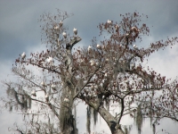
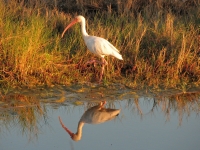
Feeling more than a bit frustrated, we decided to stop at Wakulla Springs State Park for a short hike. The spring is huge, looking like the river it becomes, right from the start. There were several people swimming or wading in the water. The walk took us through upland forest, past some cypress swamps. We saw no alligators, just pileated woodpeckers, herons and egrets, plus a brown water snake with spots by the spring. The spring had several ducks and three trees covered with white ibis. Yesterday we saw pelican trees, today ibis trees. Earlier I spotted an otter in the river as we drove across a bridge.
Eventually we headed to Tallahassee to visit another friend, Linda Patton. Tallahassee turned out to be a pretty city, with real hills and lots of trees. It doesn’t have that raw boomtown look that so many sunbelt cities have.
Sunday, February 24: Tallahassee
We spent a relaxing day with Linda, enjoying a leisurely breakfast before heading out to the Mission San Luis. Rob had recommended that we visit it and Linda had never been there. San Luis is a recreation of one of the old Spanish missions that was a very important part of Florida’s history. Evidently none of the dozens of old missions has survived. San Luis was burned by its owners in 1704 when American troops and Creek Indians invaded the area hoping to drive the Spanish out of Florida. The State of Florida has recreated the old building with costumed interpreters to answer questions. There’s a large mission church, quarters for the priests, a huge Apalachee council house that is 50’ high and could hold 3000 people inside, a Spanish home and the fortress. It was an interesting bit of Colonial history.
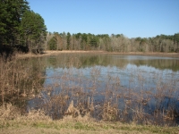
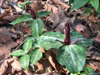
From there we drove to Elinor Phipps Park where Linda has built and maintained a seven mile network of hiking trails. Her plantar fascitis was really bothering her so we mostly drove through the backcountry, getting out from time to time to explore a bit of the park: a pond, a wetlands area with blooming trillium, a nice bit of trail in the middle of a pine plantation. It was a pretty park and a nice trail. Eventually we returned home to grill some huge steaks and chat some more. It was really nice to spend time with Linda. We’ve mostly known her on-line, though we’ve met in person at several hiker functions. She’s a fun and very thoughtful lady. Her house was filled to the brim with trail books. I saw a dozen or more I’d like to read, but I only borrowed an Ed Abbey book this time.
Monday, February 25: Apalachicola River (5 ½ miles)
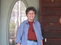
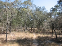
Another leisurely morning, chatting with Linda over a delicious breakfast, then a stop at the grocery to get ice and milk, then the gas station where we discovered the price of gas went up 12 cents overnight. Gas is outrageously expensive here in Florida. Rob explained that Florida has no state income tax, so they make up the money by other taxes, including gasoline. On the other hand, cigarettes are really cheap – 1/3 what they cost in Maryland.
The problem with slow starts is that we usually end up with a time crunch at the end of the day. And so it proved today.
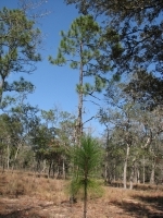
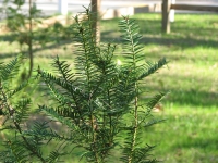
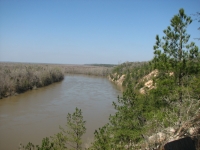
We headed southwest from Tallahassee to a Nature Conservancy trail known as the Garden of Eden Trail on Apalachicola Bluffs. It was a nice one – different from most we’ve done in Florida because the terrain was different with steep ups and downs in narrow ravines. The land in many ways was more reminiscent of the Appalachians in Georgia than Florida. The ridges were very dry and sandy, the ravines cool and lush. There was a nice view of the Appalachicola River and the 100’ bluffs there. The area has a couple of very rare trees: the Torreya and the Florida Yew. The trail went up and down three times in each direction and though steep at times was a nice hike. Then we headed up the road a few miles to Torreya State Park which has a one mile hike to a 25’ waterfall. There wasn’t a big flow, but there was water. We stopped briefly at the Gregory house, a 19th Century plantation house that was quite pretty. It was closed (only one tour a day) but we could walk around it and look in the windows. The house had a nice view over the river.
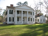
We considered staying at the park, but decided to head on to Florida Caverns State Park instead so we could visit the caves there first thing in the morning. Unfortunately, when we got there we learned that recent rains have caused widespread flooding, so the campground and cave are both closed for a few days. The ranger at the gate said the staff had to row to their homes across the park. We decided to head 20 miles or so to the next state park with camping. We arrived at Falling Waters at 5:20 and found the front gate closed and locked. It was still about half an hour to sunset, the official closing time, but they were closed anyway. Aargghh! Finally we returned to the freeway and found a motel. We got a room, ordered a pizza and called it a day. We were both disappointed because we had been looking forward to camping tonight. Rain is forecast for tomorrow. But we didn’t foresee the flooding at Florida Caverns or the other campground closing early.
Tuesday, February 26: Grayson Beach, Big Lagoon SP
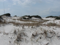
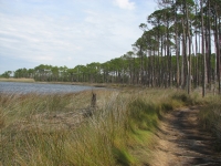
It rained again last night and was still drizzling when we started out this morning. We’ve mostly been lucky that way: the big rains last week (7” and 2”) both happened when we were tucked up in motels, not while we were camping. We’ve only had one day of all day driving in the rain and one day hiking in it. It was pouring when we passed Falling Water State Park so we skipped the waterfall there. Besides, most of the state parks charge an admission fee, and after a while, it adds up. I knew I wanted to walk on the beach and access is through the state parks, so limiting our visits to one or two paid sites a day seems like a good idea. The drive along the coast from Panama City to Pensacola is supposed to be a scenic drive, but it was pretty disappointing. There are few views of the ocean. There is a lot of development: pastel houses, big hotels and resorts and tourist shops and strip malls. Some of the architecture is pretty wild; most is just grandiose.
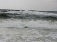
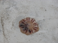
We did stop at Grayson Beach State Park to do a one mile nature walk through the dunes and salt marsh, past a dune lake (evidently a rare phenomenon) and into a pine grove. Then we walked on the beach for a while, watching the green waves. They call this the Emerald Coast for good reason. There were only a few birds – some gulls and a few osprey. Because the waves were high (red flag warning) there were few people on the beach though we did see some on the nature trail. Black clouds came and went but we stayed dry. After lunch we continued our tour of the Gulf-side beach towns. I wasn’t impressed. At Navarre Beach we headed up Route 399, only to learn that the road was closed for construction. We turned around. That area actually had free beach access, but by then we were concerned about finding a campsite so we kept moving.
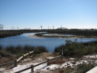
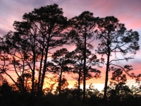
We ended up at Big Lagoon State Park. It has a good-sized campground (75 spaces) and is nearly full. There are few places to camp in this part of Florida and most seem to be hike-in sites. We made it to Big Lagoon just before 5:00 so had time to start the coals before dark. It’s not an especially pretty campground, but it is fairly quiet and there are bushes to screen the sites a bit.
It was a frustrating day. The coast is so over-crowded it’s not at all appealing to me. We crawled at 35 mph all day, from stoplight to stoplight. There were occasional views of the water, but they were rare. Fifty years ago, Florida might have been a nice place to live (aside from the lack of air conditioning) but today it just has way too many people.
Wednesday, February 27: Davis Bayou
It was a very cold night since a cold front followed yesterday’s rain. During the day we watched the temperature drop 15 degrees between 3:00 and 5:00. During the night it got down below freezing, but the sun was shining when we woke up, so we bundled up, ate breakfast, then began exploring Big Lagoon Park. There’s an observation tower with nice views of the lagoon and Perdida Key across the water. We watched some birds (plovers, gulls and egrets) in a side pond. There are some hiking trails that circle the park, so we spent an hour or so wandering through slash pine and saw palmetto on old sand roads. It was a pretty lagoon – very blue—with several small swampy areas.
Later we continued driving along the coast, through Perdida Key and along the Gulf Islands National Seashore. We were both amazed at the huge condo developments right on the beach: no stilts and no protection from hurricane winds or storm surge. This area was badly damaged by the 2004 and 2005 hurricane seasons so they should know better. When we entered Alabama, the gulf waters were a beautiful blue-green, contrasting beautifully with the white sand. I understand wanting to enjoy the beauty of this area but, a) they’re destroying that beauty by building ugly high rises and b) it is ‘jaw dropping’ as Jim put it, to see the lack of concern about building right on the beach in a hurricane zone.
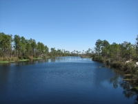
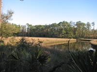
We followed I-10 through Alabama into Mississippi, then searched out a campground at Davis Bayou on the Gulf Islands National Seashore. We had a terrible time finding the entrance and wasted about an hour driving through the very spread out community of Ocean Springs looking for it. School was just letting out and we passed at least five schools going both directions. It was frustrating. We reached the park about 4:15, so had time to get a campsite before heading out on a 2½ mile walk through the park. No wildlife except a hawk in a tree, but it is always nice to wander in the woods and look out over water. No alligators in the pond today, though we looked.
This is another quiet campground, mostly older folks tucked into their RVs. We enjoyed a nice hot shower then settled in the back of our truck to read. A family of raccoons kept approaching us, looking for the garbage bag they had discovered while we were in the shower. It was too dark for good photos, but we tried. After an hour or so the raccoons gave up, mostly, but they would pop out of the brush from time to time and we heard their growls and yowls for a couple of hours.
Jim: The beach development is the biggest single factor in what some people misleadingly speak of as the "increase in the destructiveness of hurricanes". Fifty years ago the beach development consisted of scattered privately owned "beach houses" and the owners understood their liability regarding hurricane destruction. Today most of the development is condos and hotels and hurricane damage is insured and paid for by the US government. Which of course, means you and me, since we're taxpayers. So - where did you think the money comes from?
Personally, I have a problem with assuming financial responsibility for the stupidity/arrogance of those who build their condos on the beach and expect others to pay for their error.
Home | Links| Trail Journals|
The Thruhiking Papers Bun-bun
Created: 1 Jan 2009
Revised: 30 Sept 2016Copyright ©: 2008-2017 Spirit Eagle