|
 |
 |
 |
 |
|
|
|
|
|
|
Tuesday, March 11: Pony Hills
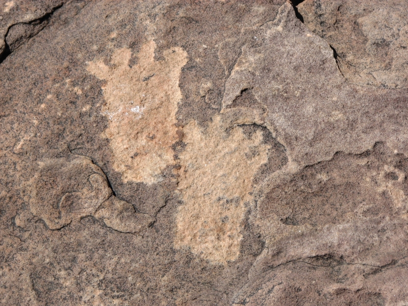
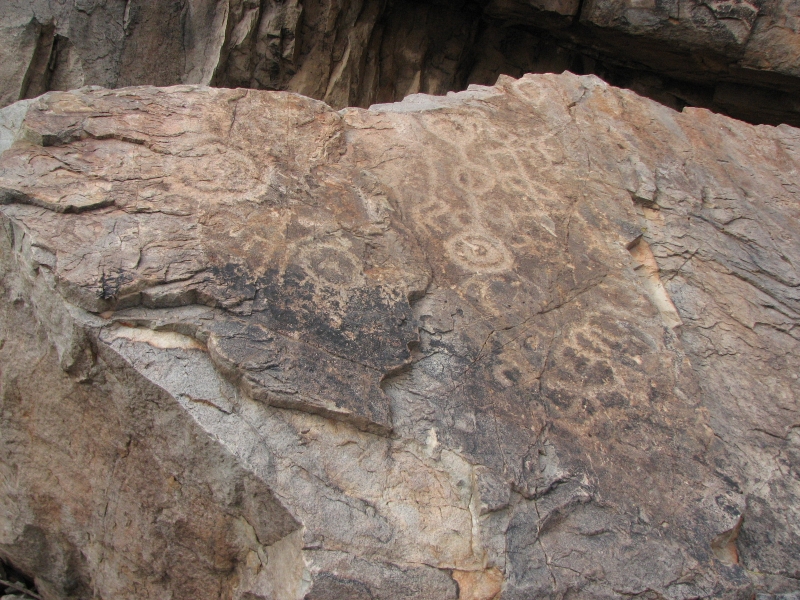
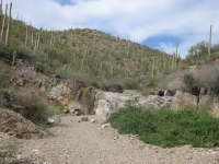
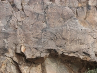
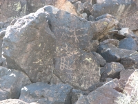
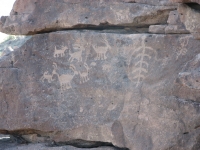
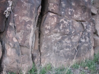
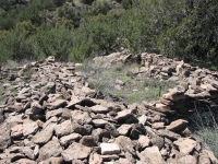
Since we were driving past Deming anyway, we decided to do a five mile detour to another rock art site in the Pony Hills. It is part of the Cooke Range, not far from Jim Wolfs CDT route. (I love finding out how much of the trail we hiked is near rock art sites. I wish Id known about these places when we were hiking the CDT.) The directions were simple, but almost led us astray. We were supposed to park at a dam and climb to rocks nearby. The guidebook didnt mention that there were two dams, half a mile apart. Fortunately, Jim noticed that we were a bit short on mileage, so we kept going.
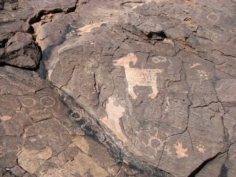
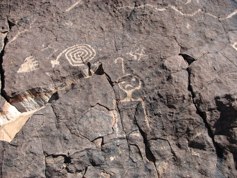
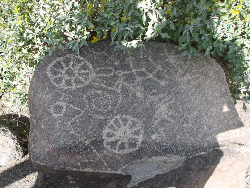
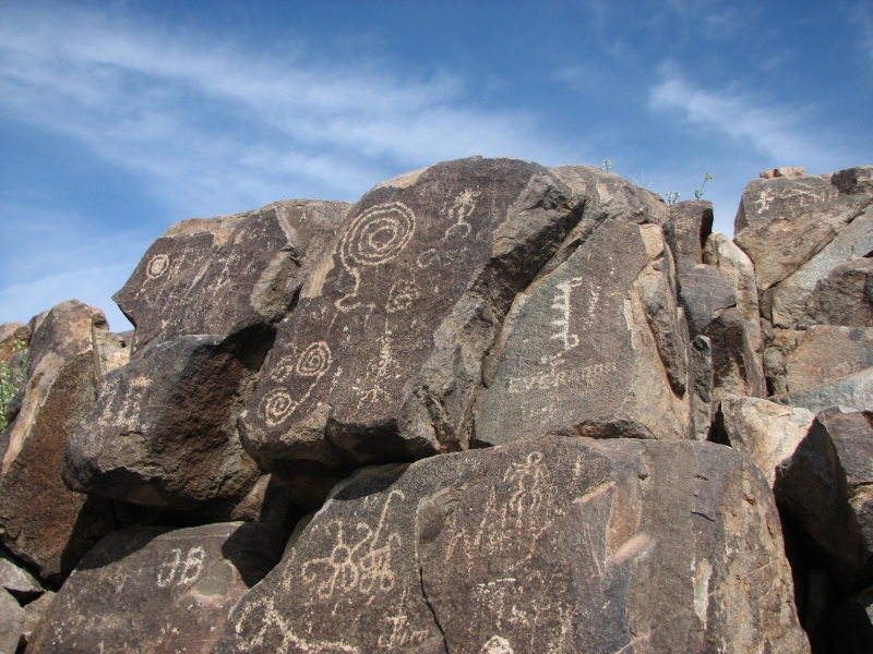
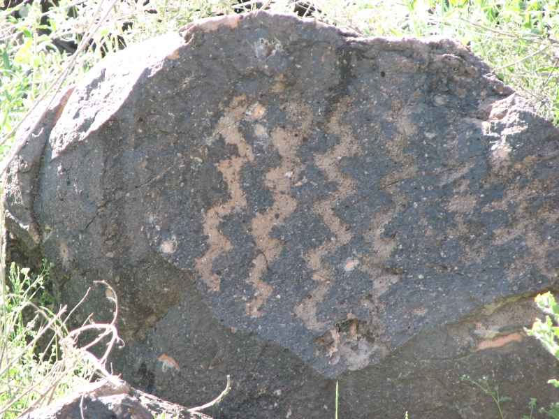
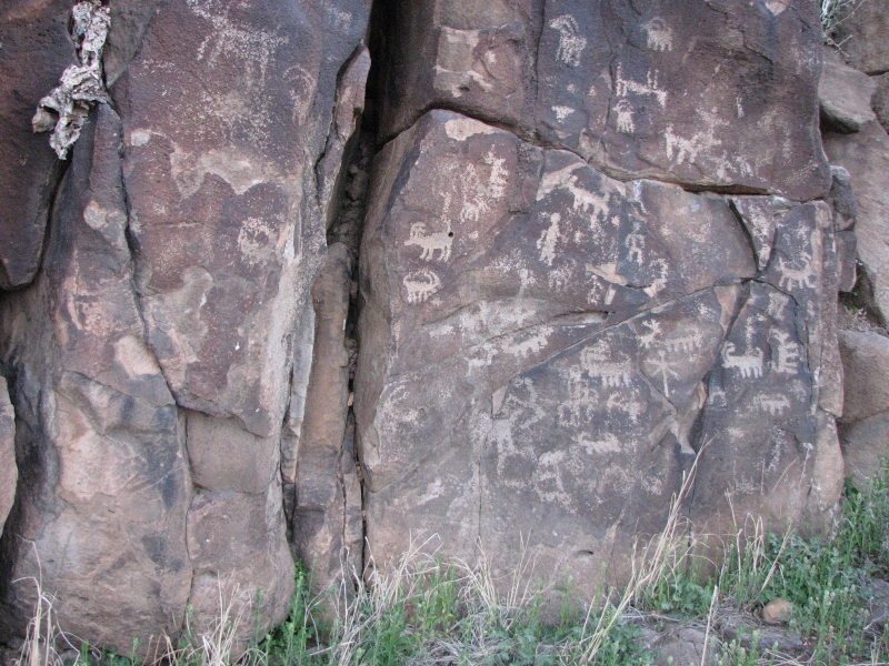
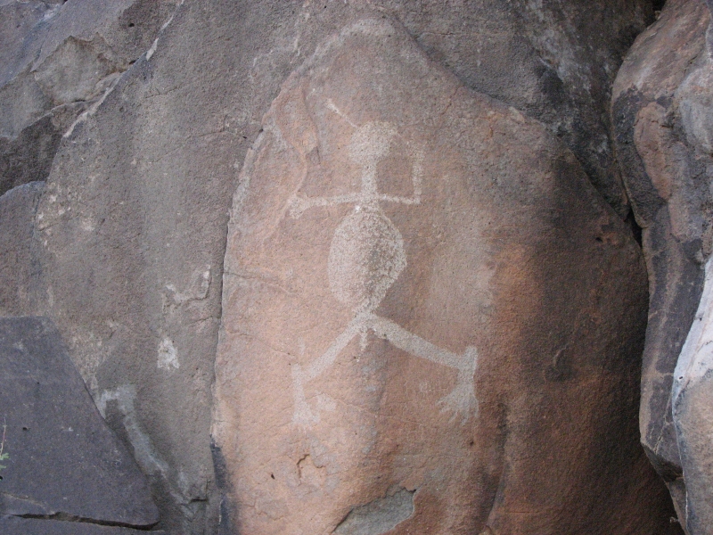
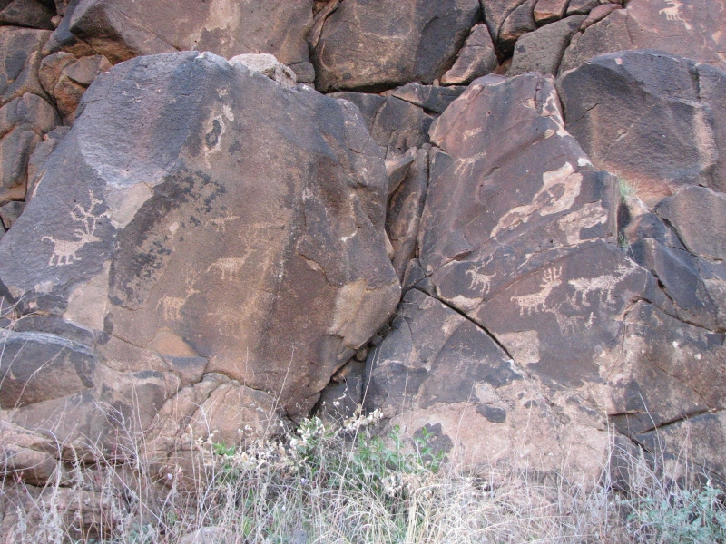
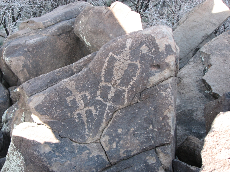
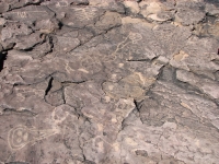
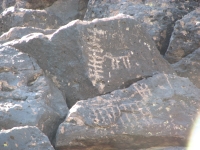
Pony Hills site has petroglyphs scattered on boulders over about ½ mile. Some of the images were really nice. The most famous petroglyph is a horned serpent, but there were also a few Kokapellis, bighorns, lots of atlatls, and the usual circles, zigzags, spirals, combs, etc. The assumption is that the simple geometric patterns are the oldest, possibly several thousand years old, but there is no way to date rock carvings. There were a couple of animal heads that were probably modern. One bird carving used a knob in the rock for its eye. We saw that at a site in Albuquerque. A couple of times, carved footsteps led us to more images. Modern or ancient?
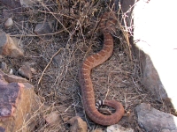
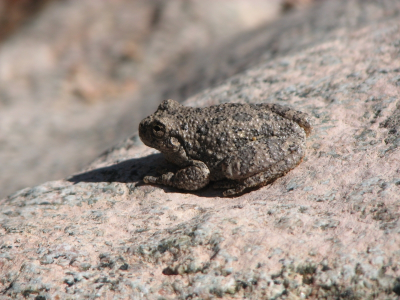
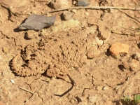
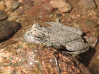
Jim scared up a big rattlesnake and we saw several lizards and rabbits. The snake made me nervous, because climbing around the boulders there are a lot of hiding places for rattlesnakes.
There were some interesting (odd) people sharing the roads today. On I-10 we saw a man carrying a backpack, riding a skateboard along the edge of the freeway. In Deming we spotted two bearded grizzled characters on heavily laden horses. I wish we could have asked either party where they were going. Then there were the three guys on foot carrying a big movie camera along the freeway.
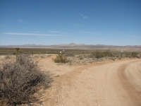
After a grocery stop in Deming, we headed to the Continental Divide Trail near Hachita. Some discussion on the CDT-L forum had raised the question about whether the route we followed in 2006 was still well marked. It was easy to follow when we hiked it two years ago, but several people mentioned getting lost in the bootheel, so we were wondering why. We drove to where the trail crosses NM 81 near Granite Pass. Sure enough, there were big CDT signs every half mile along the gravel road. The turnoff on an old dirt track was also well marked. Oddly, there was another route that was also marked that didnt follow the graded road but went cross-country to NM 81. We could see markers heading out into the desert. The new route misses the very necessary water source along the highway, crossing about three miles south of the old route next to the windmill. I dont know why they moved the trail, or why they marked both routes. That would be confusing for hikers. We ended up in a cheap motel in Lordsburg, NM.
Wednesday, March 12: Fort Bowie, Saguaro National Park (7 ½ miles)
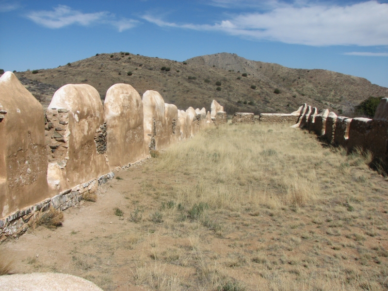
At Hueco Tanks, someone recommended Ft. Bowie National Historic Site. Since we were passing anyway, we decided to make the detour. It was worth the time. Ft. Bowie was originally a Butterfield Station near a spring tucked into the mountains. An ill-advised attempt to capture Cochise in order to obtain the return of a boy who had been kidnapped by a different band of Apaches led to the commencement of 20 years of warfare. The Emigrant Trail ran through the pass, so a fort was established to protect wagon trains and couriers from the Apache. Ft. Bowie was a very isolated post. Today access is via a 3½ mile (RT) trail. Walking in enhances the experience, I think, since you get a better idea of how isolated the area is. It is a pretty valley, but 140 years ago it was a dangerous one.


At the old fort, we ran into a group of school kids. A half dozen cars were in the parking lot, along with the school bus. The trail makes a loop past a miners cabin, the old Butterfield Station, an old cemetery (Cochises two year old son and two other Apache children are buried there, as well as several soldiers and travelers who were killed nearby), the first fort and the very large final fort. The Visitors Center is at the end of the trail near the fort. We returned on a different trail along a ridge with nice views of the canyons and mountains. The fort hasnt been restored, but there are good explanations and photos showing the fort as it used to be.
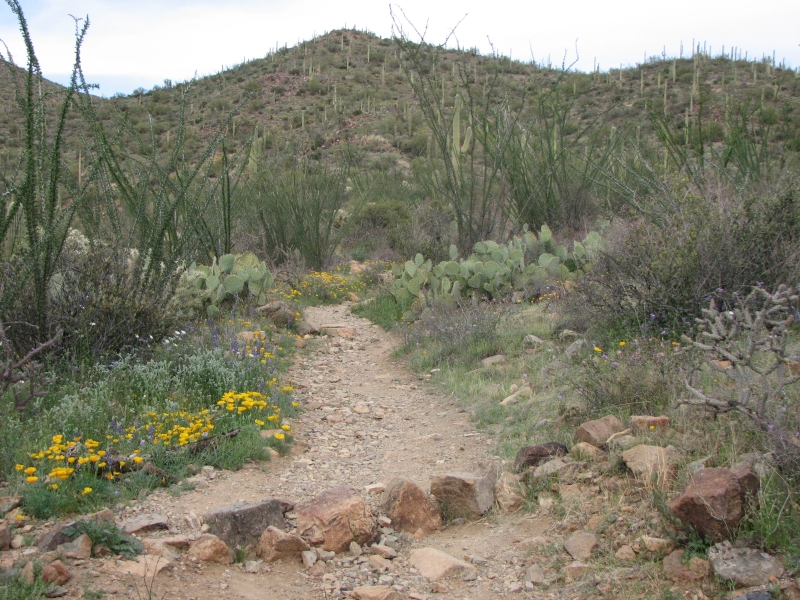
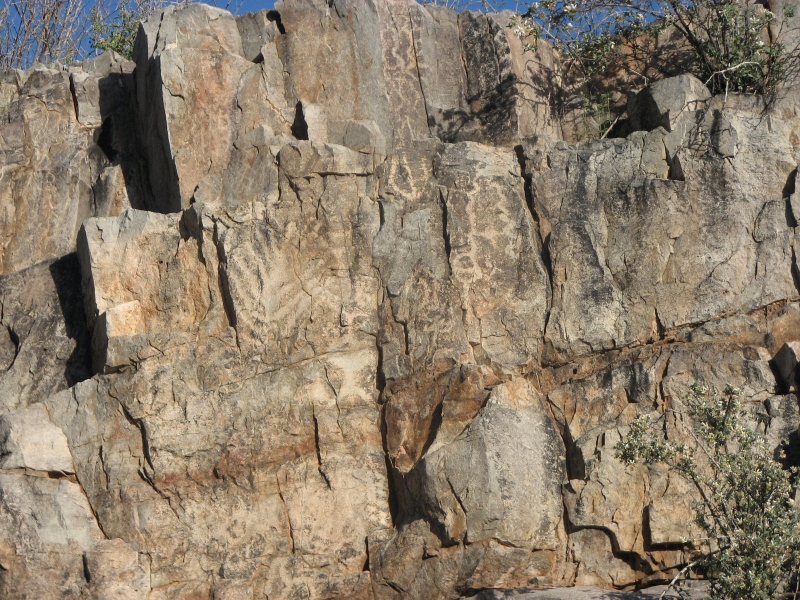
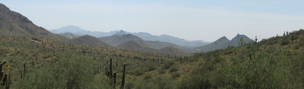
After lunch we headed to Tucson. There are a couple of public petroglyph sites on the west side of town we wanted to see. I rarely visited that area when I lived in Tucson. We lived on the east side, so I did my hiking in the Rincons and Catalinas, for the most part, not the Tucson Mountains. We found the first area we were looking for, King Canyon, but only found one of the rock art sites described in the guidebook. The description was confusing, almost backwards. Still we found an area with many simple geometric images on a rock face above the dry wash.
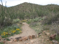
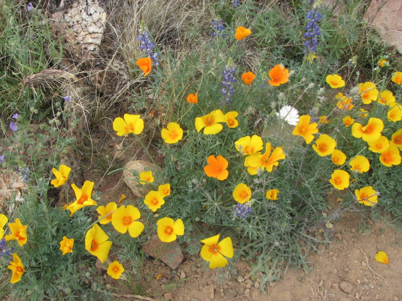
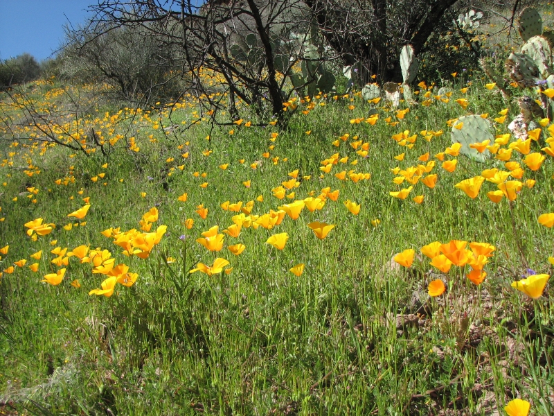
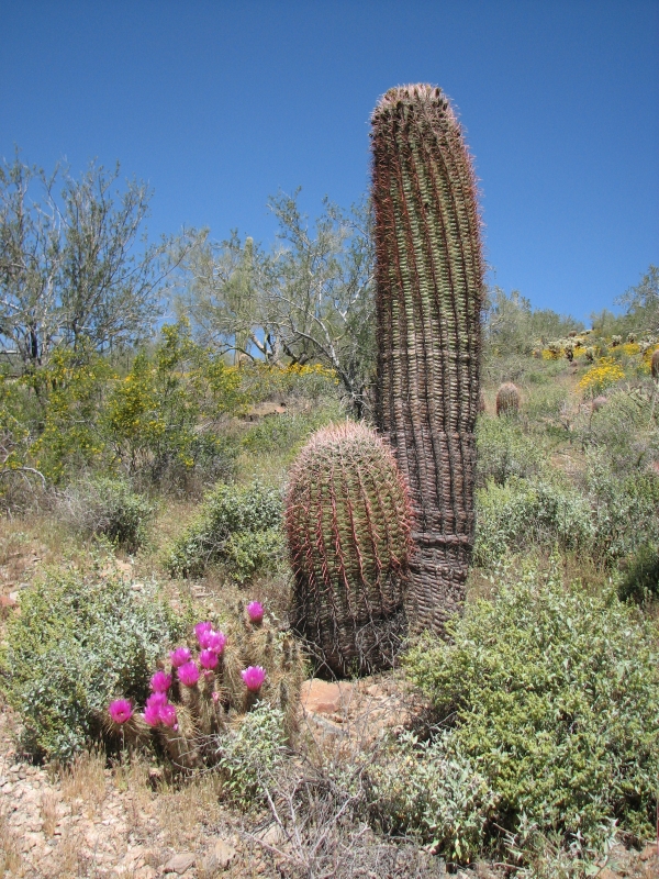
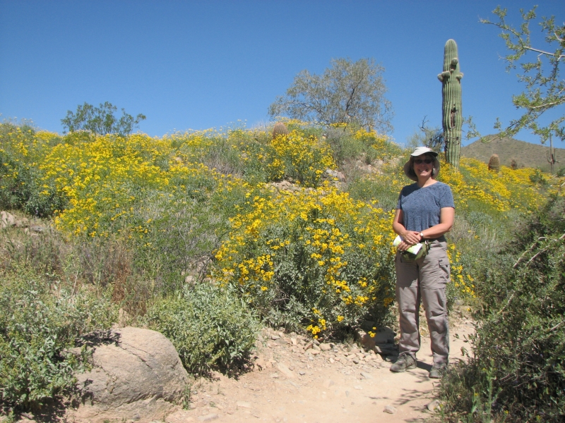
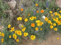
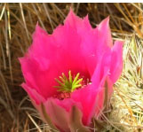
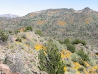
We also enjoyed the lovely four mile hike in a sandy wash and through the desert. Many flowers are in bloom right now, so it was gorgeous. There were numerous yellow and orange poppies, blue lupine, purple phacelia, yellow brittlebush, white chicory, etc. I saw one flower Id never seen before. The bottlebrush and ocotillo are also starting to bloom. We had a nice view of the mountains to the south. All in all it was a good afternoon hike.
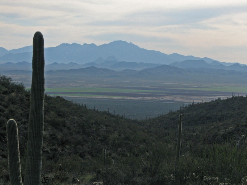
We ended up at Gilbert Ray Campground in the Tucson Mountain Park. Its a big campground, so there were several empty spots, despite our late arrival. Its a quiet site, surrounded by desert cactus and mountains.
Thursday, March 13: Signal Hill, Painted Rock Petroglyph Sites
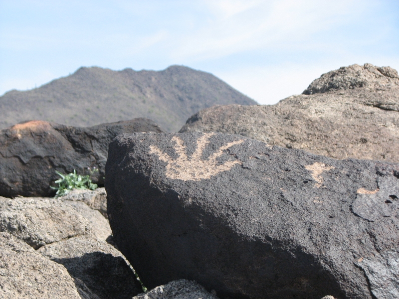
We started the day with a short walk (1/2 mile round trip) to Signal Hill in Saguaro National Park. Signal Hill is a small round hill with a trail around the base and up to the top. While it had some nice petroglyphs, there were not that many and they were far above the trail so hard to see. There are supposed to be 150-200 images, but we only saw 40 or 50. They discourage people from climbing among the rocks, which makes it harder to find the carvings.
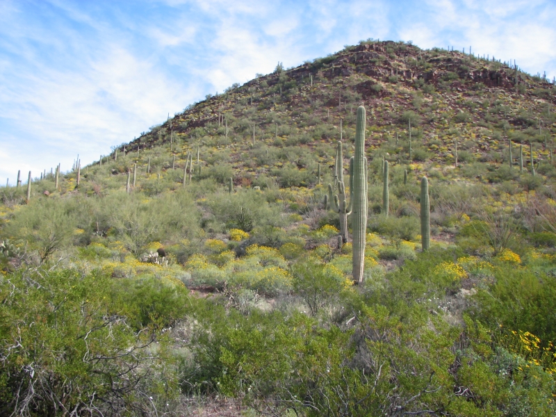
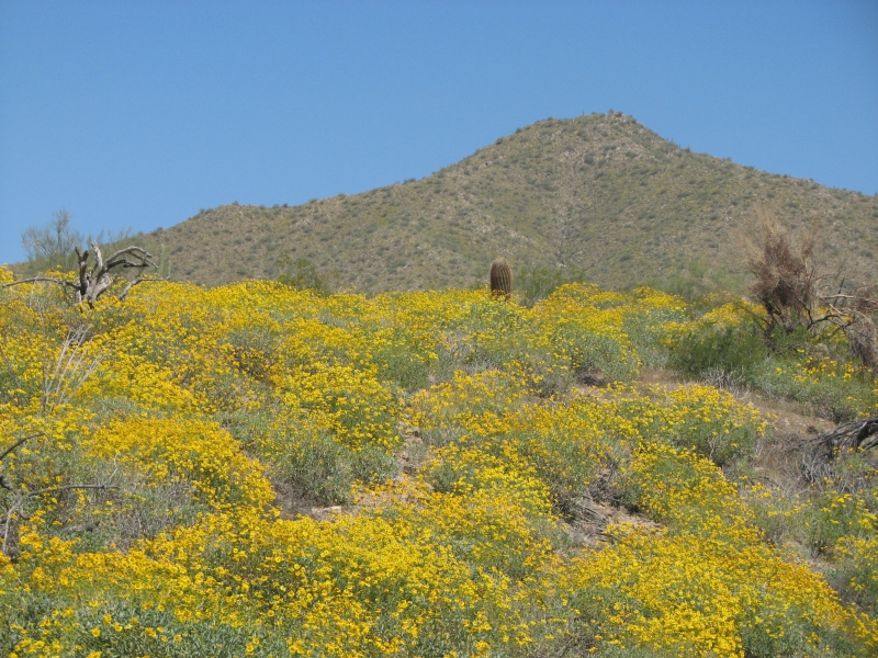
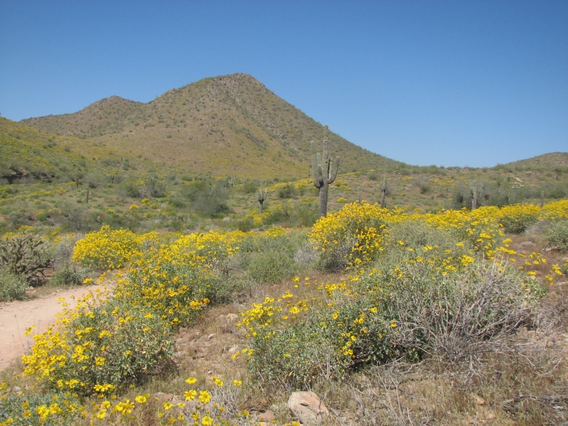
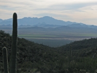
Actually, I enjoyed the drive through the Park more than the rock art. The brittlebush is in bloom everywhere, adding bright yellow bursts of color to the green hills. The Sonora Desert is so much more lush than the Chihuahua desert of Texas and New Mexico. It is more beautiful (to my eyes) but also more difficult to hike through. I enjoy seeing the saguaro and green palo verde and ocotillo. Even the freeway was lined with flowers: lupine, poppies and brittlebush.

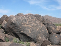
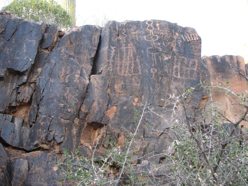
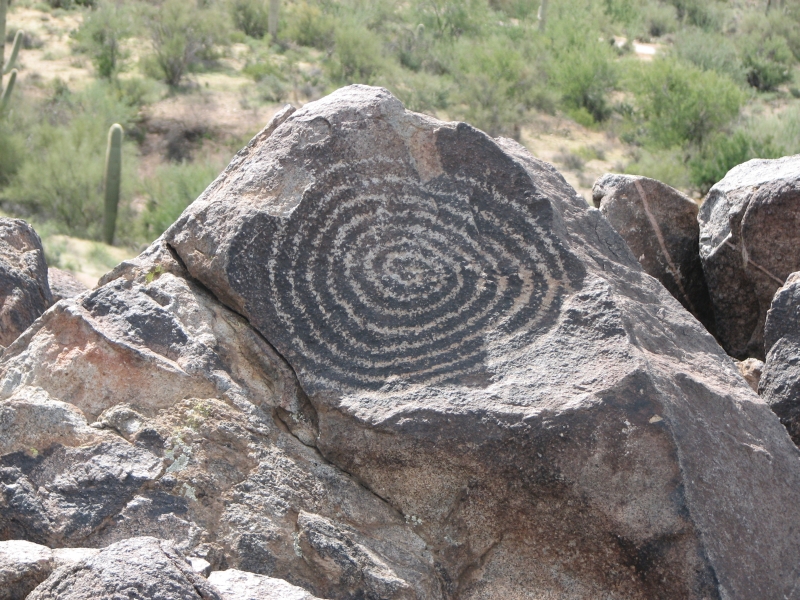
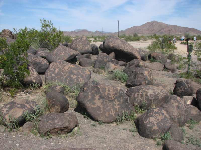
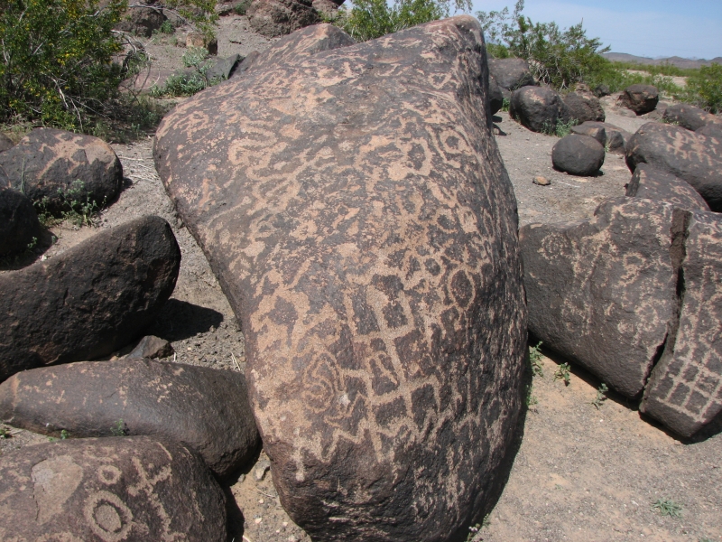
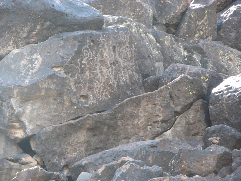
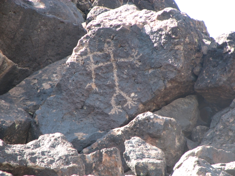
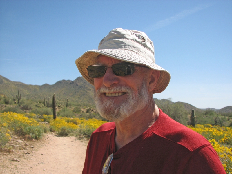
We had intended to hike today, but it was hot (mid-80s) and we wanted to visit a site that was quite a distance away, so we headed up the freeway to Gila Bend and the Painted Rock Petroglyphs Site. It was much more exciting than Signal Hill. Again, there was only a small hill, but every rock in one area was completely covered with carvings. The Hohokam site had lots of suns, spirals, and grids, as well as stick figure people, lizards, snakes and other animals. Jim and I were like mosquitoes in a nudist colony: Where do we start? We ended up using both cameras, because Jim got tired of me saying, Over here! No come here! Quick, turn around theres another one behind you! We took lots of pictures. Again, there are supposed to be more images than we saw (750 or so), many of the carvings have faded or been destroyed by vandalism over the years so it wasnt a surprise that we missed them. Still, we had fun and I felt it was worth the long detour.
Friday, March 14: Casa Grande, Deer Valley. Drive to Scottsdale
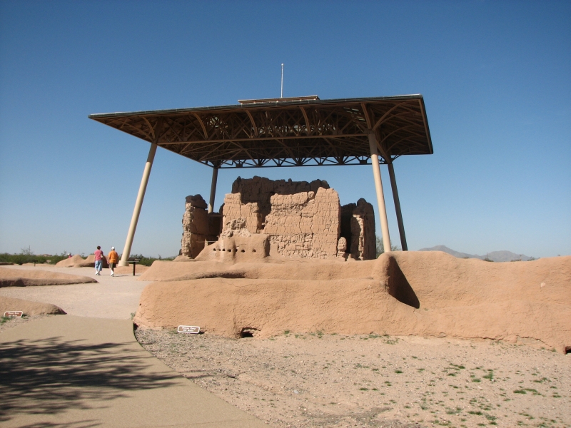
We ended up in Coolidge last night. There was a campground at Painted Rocks, but we finished our visit at 3:00, so decided to move on. I had never visited the Hohokam ruins at Casa Grande, so we decided to head east again. We intended to camp, but the RV parks we stopped at cater to snowbirds, not casual transients. I didnt want to pay $38 for a campsite, so we kept going to Coolidge, where we found a cheap motel room.
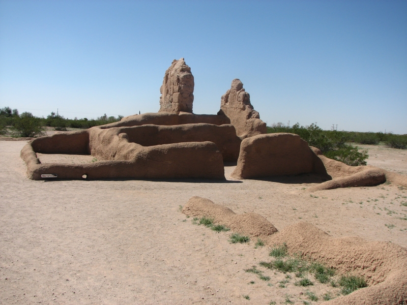
After breakfast at MacDonalds, we headed to the National Monument. A tour was just about to start, so we joined the group and learned the history of the Hohokam (as far as its known or speculated) and about the ruin itself. The Hohokam were farmers who developed a widespread network of towns and villages. They built an extensive irrigation canal system that ran for miles across the desert, creating a prosperous agricultural system. They are considered one of the great cultures of the southwest, along with the Anasazi and Fremont. Casa Grande was unusual in that it was a four story caliche adobe building, not the usual one story stone or pit house. It was not a typical village. Evidently later Hohokam also built great mounds. Early ruins included ball courts. It seems there was a strong Mexican influence. Like many of the great American civilizations, the Hohokam dispersed around the 14th century. One theory is that too much rain after a long period of drought and the subsequent flooding took out the irrigation canals at a time when the tribe was no longer cohesive enough to rebuild them. Since the land could no longer support such a large population density, the Hohokam split up and joined neighboring tribes or became nomadic again. Presumably they were the ancestors of some of the modern tribes in southern Arizona like the Oodham and the Pima. So much information about the past is lost.

The tour was interesting, all in all. Casa Grande is worth visiting if you are passing nearby, but isnt really spectacular enough to merit a long trip to see it in my opinion anyway.
Afterwards we drove to Phoenix to visit the Deer Valley Rock Art Center. It is a research center affiliated with the University that has an area of petroglyphs that are open to the public. Although there are supposed to be more than 1500 images on site, we only saw a small number. The trail is short and doesnt climb into the rocks at all. Light was also very bad. It would be better to visit just before sunset when the rocks are in shadow. We saw wavy lines and a few anthropomorphs, but on the whole it was only worth the $7 entry fee because we got to speak with Desert Little Bear, a Yaqui-Mescalero artist who is an on-site educator. We talked with him for about 20 minutes.
Finally we headed to Scottsdale, where my brother Jeff lives with his wife, Lynn, and their daughter and grandson. Well stay with them a couple of days while we get ready for our hike on the Grand Enchantment Trail.
Saturday, March 15: Agua Fria National Monument
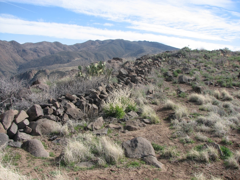
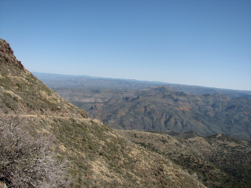
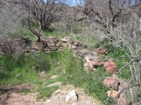
We had a wonderful exhausting day exploring part of Agua Fria National Monument. We visited the Monument last year, but hoped to discover some new ruins and petroglyphs. Agua Fria is a very large undeveloped area an hour or so north of Phoenix, located on a plateau above the desert. Because we were high (5000-6000) it was chilly today, especially in the wind. The plateau is mostly grasslands, especially after a fire a couple of years ago, though there are scattered prickly pear and small cactus. The Hohokam had numerous villages up on the plateau. Archaeologists have found 700 archaeological sites in the area so far.

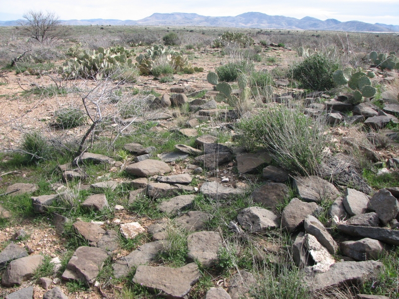
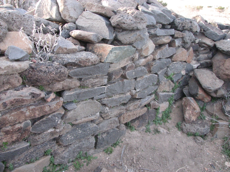
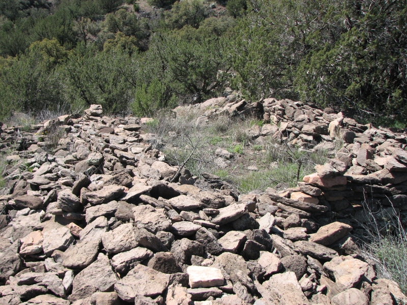
Jeff drove us to Agua Fria in his jeep, along with Lynn and young Jonathan. We visited a dozen or more sites and drove past several others. One ruin had about 100 rooms. Another had 40 or 50. A really interesting new one was located on a rocky spit of land, high above the canyon. It looked like a fortress, remote and inaccessible. The walls were 4-5 high, still standing despite the fact that the rocks had no cut edges and no mortar was used to hold the rocks together. There were three tiny windows still visible.
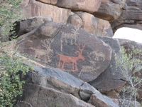
We also visited a couple of cliff areas with some excellent petroglyphs, including four red deer and a red shamanic image. There were many deer, bighorns and lizards, among others. Most of the images were fairly realistic, though there were also some geometric shapes, some odd combs and at least one map. We had fun.
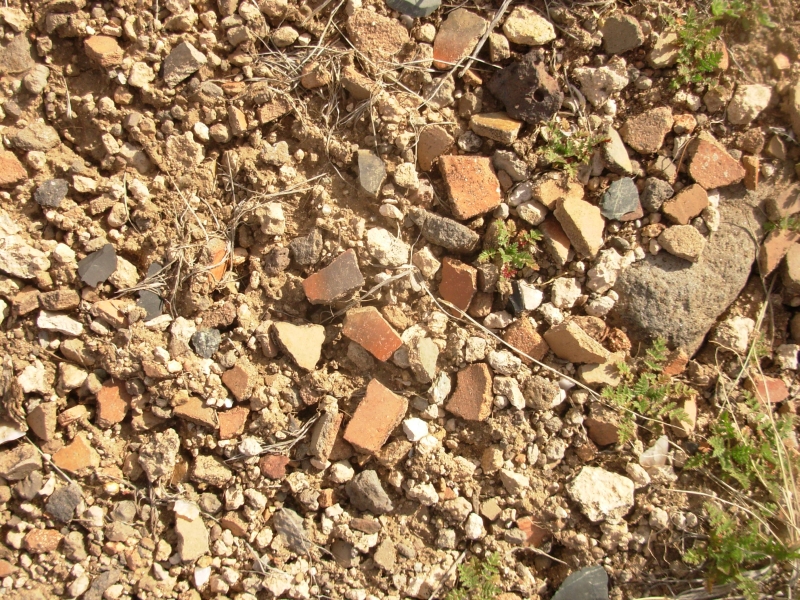
One of the things I like about Agua Fria is that the ground is still covered with pottery and tools. The area hasnt been picked over by thousands of tourists. Most of the shards were red or brown, though we found some that were polychrome red, yellow and blue. There were a couple of areas with dozens of metates (used to grind corn into meal) worn into the rock. Jeff found several broken manos and metates as well. The roads in the monument are very rough, a maze of dirt tracks. You really do need four wheel drive to get into the back country. Jeff knows the area well, but is still exploring and finding new ruins and new art panels to photograph. We watched the sun set, then headed home with a sleeping Jonathan. He was worn out from the long day, and the adults werent much better.
March 16-17: Rest days in Scottsdale
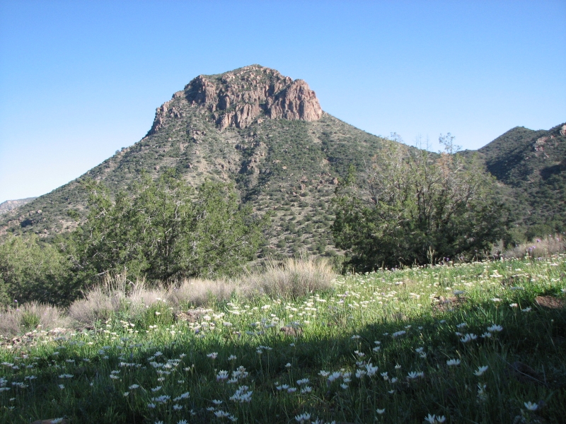
Weve been relaxing and getting ready for our hike on the Grand Enchantment Trail. Our plan is to hike from Mammoth, where we left off, and backpack either one or two weeks, depending on how things go. I am excited to be hiking again, but also a bit nervous. Although we do frequent short hikes, we havent done any long hikes since October and we havent backpacked at all this winter. Now were starting a 100 mile section with seven days food heavy packs! At least water wont be an issue the first two days as we hike through the Aravaipa Wilderness. After that well have some strenuous desert hiking that is likely to stretch our abilities a bit. Brett, the GET guidebook author and creator of the route, has warned us that the Santa Teresa W.A. is very challenging.
Because weve been so busy the past month, Ive had little chance to really think about our upcoming hikes. Weve been living life one day at a time, totally focused on the present. Im not mentally ready for this hike. Physically it will be a challenge because there is a huge elevation difference between Aravaipa and Mt. Graham. Well climb several thousand feet, then drop down to Safford. After six months of flatland hiking, it wont be easy. But I love the idea of getting away from the car and spending time alone (just the two of us) in the desert.
Tuesday, March 19: Scottsdale
Well, you know what they say about the best laid plans. We woke up yesterday at 5:30, intending an early start to the trail. While I scrambled some eggs, Jim decided to take a quick wake-up shower. I heard a yell, a thud, and then a loud moan of sheer agony. I dropped the spatula, raced into the bathroom, turned off the water and waited for Jim to open his eyes and stop groaning. Once I saw he was still alive and not bleeding, I ran back to the kitchen to turn off the stove. Fortunately, Jeff had rescued the eggs from total destruction, though they were definitely well done. I returned to the bathroom to help Jim stand up; he was in no hurry to move. Very carefully he got out of the tub and we got him dried and dressed as we assessed the damage. No bones sticking out, no big lumps or bruises, but agony from shoulder to diaphragm. We put ice on his side, stuffed him with Advil and put him to bed. Jim spent the rest of the day immobile.

Today he was able to walk around, stiffly, and we alternated ice and heat as the pain moved from back to front to shoulder. Its not muscle (except maybe the shoulder) so we think he may have cracked a rib or two falling on the edge of the tub. In any case, backpacking is out, especially a two week trip starting with a heavy food load. Aargghh! We decided to go car camping with my brother this weekend, but the GET is out for now. Our reservation at Aravaipa starts today and the wilderness area is booked for the next couple of weeks. I dont want to wait until April for the next available permit, so well just have to cancel our GET hike again.
Im really disappointed. I was very excited about hiking in the desert in a high flower year. I wanted to see the hillsides covered with flowers. We got a taste of that in Tucson. Agua Fria is higher so there were few flowers there. The African daisies are blooming in Phoenix and sweet smelling orange and grapefruit trees, but there is too much pavement here for the beauty of spring to make an impact. I really wanted wilderness right now. After a month on the paved highways, I wanted to slow down to two miles an hour for a while and get back to the slow peaceful serene lifestyle of the trail. Instead, Im worried about Jim, wondering how this will affect our plans for the rest of the year, and climbing the walls with frustration at being stuck indoors on a beautiful spring day.
I walked about four miles around the neighborhood, but it was all suburbs and sidewalks not what I need right now. The roar of traffic and smell of exhaust dont begin to compare to the wilderness walk I was supposed to be starting today.
In a way we are fortunate. This could have happened while we were on the road. Spending days cooped up in a motel room would be much worse than enjoying the hospitality of my brothers family. We are comfortable and well cared for. But I feel like the man who came to dinner. I only intended to stay a few days, instead its stretching out to at least ten. Thats abuse of hospitality. Jeff wants to take us out to the Verde River for a couple of days, so Lynn and Carley will get a break from us at least, but I feel bad about overstaying our welcome.
Friday, March 21: Verde River (4 miles)

Jim felt a bit better so we headed out to the desert with my brother for a car camping trip in the vicinity of the Verde River. Jeff loves to go four wheeling in the backcountry, looking for wildlife and Indian ruins. He introduced us to the world of ruins and rock art a few years ago and we have had some good trips to some very remote places with him. Hes great company and very knowledgeable about the desert. Jeff wanted to show us the Verde area and to explore some new places with people who enjoy the same kind of places that he does. We were happy to spend time with him in the backcountry.
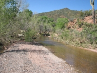
The road turned out to be a fairly rough 4WD track as we climbed over a plateau north of Parry Mesa then down to Houston Creek. We hoped to drive down a rough track next to Squaw Peak to the river, but a sign informed us that the road was closed. It ended at a trail of sorts that led to Houston Creek, then to the Mazatzal Wilderness Area, then on to the Verde in 1½ miles. We decided it was a good place to explore, so we parked the car, ate lunch, and then headed out. Jeff went on his own, since he is much faster than we are on rough ground and he intended to explore the ridges, looking for ruins.
Jim and I followed a faint trail that criss-crossed the creeks but led us through a gate to the wilderness area then down to the river. It was slow going, but not too bad hiking. Returning, we zigged when we shoulda zagged so we lost the trail. We knew we werent too far from the car, so we just bushwhacked through the brush and catclaw. It took us less time to go back, despite losing the trail, than it did going down to the river. Odd.
We did a couple of detours: once to check out a hill covered with poppies, another time for a swim in a deep pool (aaah, wonderful!) We didnt see any wildlife on our hike except a lizard and frog/toad, though we saw a deer and another white frog on the road. There are lots of wildflowers: golden poppies, lupine, wild onion, etc. Its very pretty, especially when the entire hillside is covered with gold or white. Its a pretty area. Squaw Peak is a very distinctive rocky tor that reminded me of Crowsnest Peak in Canada. The hills are covered with scattered juniper and mesquite trees. The creeks we followed were narrow and rocky, but with some nice tree-covered benches, much used for camping. Weve seen no people all day just one car parked along a dirt road and a set of fresh footprints down by the river let us know we arent all alone out here.

Jim and I got back to the car at 4:30 and sat down in the shade to wait for Jeff. When you go out with Jeff on an exploring trip, theres always some waiting. He loses all track of time. Tonight was much worse than usual. We had intended to move elsewhere to camp, but when it began getting dark, we dropped that idea. There was a good camping area 100 yards downhill, so we moved our packs (not easy for Jim with his ribs), lay out our sleeping bags, and began collecting firewood. We were supposed to have steak and potatoes for dinner, so we dropped the potatoes in the hot coals and waited and waited -- and waited. Around 8:30, I opened a can of Spam, stuck it in the coals and Jim and I had dinner. We kept feeding the fire hoping that if Jeff was lost, hed see it or smell it. Finally, at midnight, we let it go out and went to bed. A few minutes later we heard a truck on the road, then some honking. We climbed the hill and there was Jeff, dressed in his boots and underwear nothing else.

Evidently he fell in the river and got soaked. He took off his wet pants and shirt and began hiking out, but missed our ridge and ended up on the main road a couple of miles away. He said he intended to be back around dusk, but misjudged the time it would take to get back after wandering the ridges and down to the river. He found five ruins, but there wasnt time to get back before dark so he ended up bushwhacking through the cactus and brush in the light of the full moon. He was badly torn up. Jeff walked past the turnoff to our camp (he didnt see our fire) and finally got so cold he decided to stop and build a fire. When a truck passed by at 12:30 he flagged it down and got a ride back to the car. We gave him some food and he sat in the car for a while with the engine on to warm up, then we all went to bed. I was really relieved, since wed spent the evening worrying about him and trying to figure out how wed contact search and rescue in the morning. The later it got, the more worried we were. It took a while to get to sleep.
Saturday, March 22: Red Creek

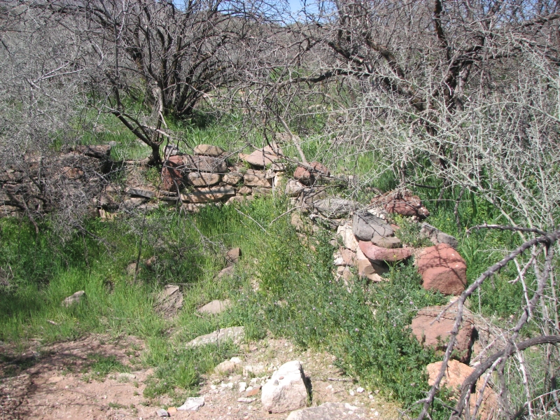
After all the excitement of the previous evening, we slept until the heat woke us up at 9:30. After breakfast we headed out. Very soon we spotted a very large ruin right next to the road. It had 50 or more rooms and lots of pottery and tool chips. Jeff found a broken mano and half a bone bracelet, which he reburied. There were some big pottery pieces and one black and white shard.
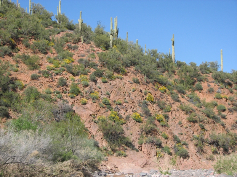
After some time exploring there, we headed to Red Creek to look for a big ruin that Jeff had heard about. The road there was REALLY rough four wheel driving along the creek. We drove as far as we could, then parked and walked along the creek the last mile or so to an airstrip. We watched a plane take off as we approached. There was a very large flat open space good for the airstrip, which had a picnic table and horseshoe pit. Evidently a lot of small planes stop there and people walk to the river or go for a hike. Jeff found a small ruin and some small pottery shards, but not much of interest. We found another small two room ruin on the way back to the car. We drove partway out, past the worst of the rocks, then set up camp in the trees by the stream. It was a beautiful area with dark red rocks, lots of saguaros and abundant flowers. I love the poppies gilding the hills right now.
Sunday, March 23: Happy Easter! Back to Scottsdale.
We enjoyed a peaceful night by the stream. Heading out was mostly easy driving on graded dirt roads past Seven Springs and Cave Creek. Jeff had planned a couple of ruin visits, but after the rough driving the past few days, our gas was very low. As it was, we coasted up to a gas station on fumes. Jeffs luck held, once again. We did make two stops at a couple of ruins right next to the dirt road. Its amazing how many Hohokam ruins there are in this area. Some have stone walls three feet high, some have filled in with sand so only the stone outlines show. We found some pottery shards: mostly red, but one was tri-colored on one side and black and white on the other. There were also several manos and broken metates.

The roads were very busy today, lots of jeeps and ATVs and people camping beside the road. We got home early enough to clean up and change before the rest of the family came over for a good ham dinner.
Our weekend trip was a real mixture: I enjoyed seeing the desert in bloom and camping where we did, but the worry on Friday about Jeffs disappearance and the really rough driving up Red Creek were not a lot of fun. Almost running out of gas didnt help. Jim figured hed hurt almost as much sitting at home as wandering the desert, but he was being optimistic. The rough roads didnt help his ribs any, though he didnt complain. Jeff brought lots of padding, so Jim slept well, but getting up and down was difficult for him. Still it was a good trip. I always enjoy exploring the backcountry with Jeff. Going out with him is always an adventure.
Wednesday, March 26: McDowell Mountain Preserve (5 ½ miles)

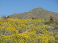
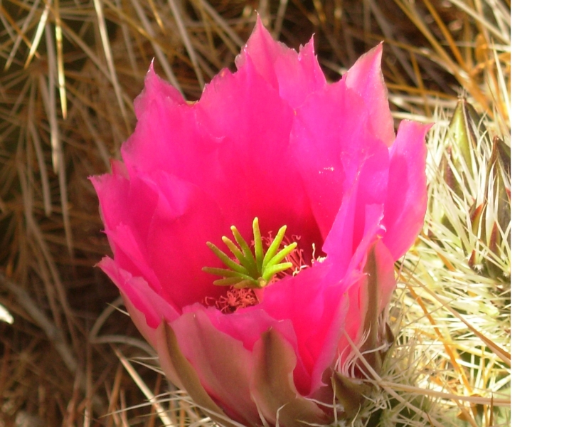
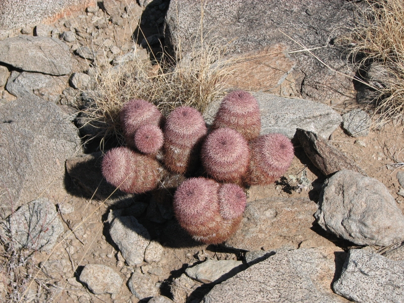
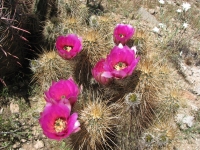
Weve been taking it easy after the excitement of the past week. Mondays highlight was watching Jonathans T-ball game. Tuesday we drove out to my brother Jacks home in Fountain Hills to visit him and his wife Kitty. Wednesday we did a nice hike on the Lost Dog Trail in the McDowell Mountain Preserve, not far from their home. It was warm (85 deg.) but lovely. Spring flowers were abundant, especially the yellow brittlebush and pink hedgehog cactus. There were lots of people enjoying the day. We saw lots of lizards and birds and one rabbit that hopped up the trail toward us. The trees are leafing out and the hills are gilded with the bright yellow bushes. It was really nice to get out and hike. Jim had a harder time than he expected; breathing is still painful at times and hes not sleeping well since every time he tries to roll over in his sleep he wakes up in agony so his energy was low. Still we were both happy to get outside and walk again after several very inactive days.
Jim: The verdict is that a couple ribs are broken about 2" from the spine and separated up front. That'll slow me down for a few weeks. But I can still walk and drive and use a camera --- slowly.
Home | Links| Trail Journals|
The Thruhiking Papers Bun-bun
Created: 1 Jan 2009
Revised: 30 Sept 2016Copyright ©: 2008-2017 Spirit Eagle