May 11 8 ½ miles in the San Rafael Swell camp near Horseshoe Canyon
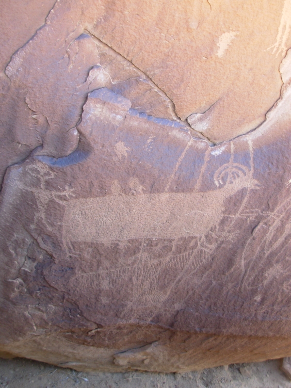
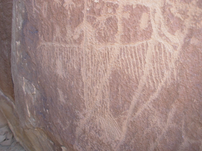
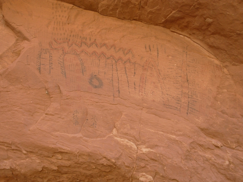
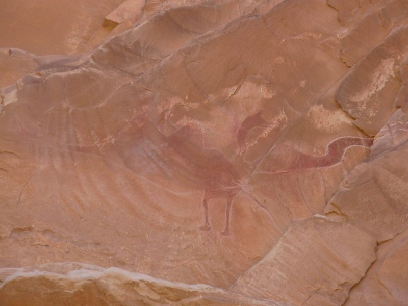
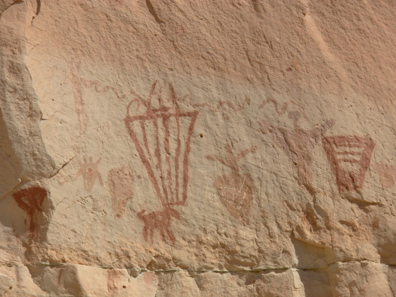
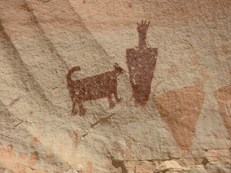
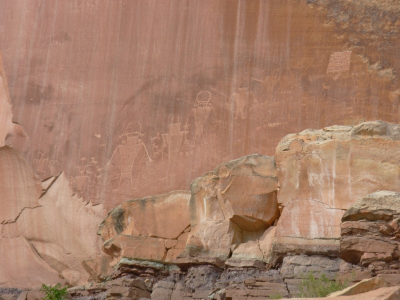
We had a good day wandering in the San Rafael Swell area. Near Green River there are several rock art sites, so we started the day by checking out two: Coal Canyon and Black Dragon Wash. Both had some nice rock art. Coal Canyon had a carved eagle, though that may not have been that old. It looked modern, but that doesnt necessarily mean anything. There were figures/people under an arch/rainbow, a map and the usual ubiquitous bighorns. Black Dragon was a pictograph site with a large dragon, some Barrier-style figures, and a lot of multicolored counting images. What they represented, I have no idea, but it was quite different. Calendars? People? Crop inventory?
| 
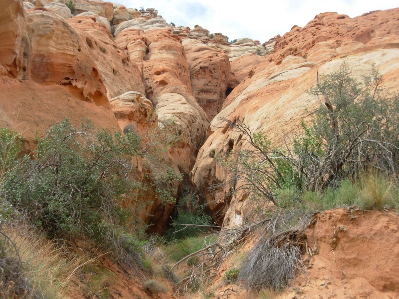
After lunch we headed toward Goblin State Park, intending to camp there. Unfortunately, it was full when we arrived, so instead we headed for the Reef and a hike Id read about: up Little Wild Horse Canyon and down Bell Canyon. Its a very popular slot canyon loop. It was a fun hike, with some very narrow spots, some wet ones, and some easy pour-offs to go up or down. We met lots of family groups and others exploring the slots. It was much easier than I expected. The whole hike (8 or 9 miles, depending on the source) took 3 ¼ hours.
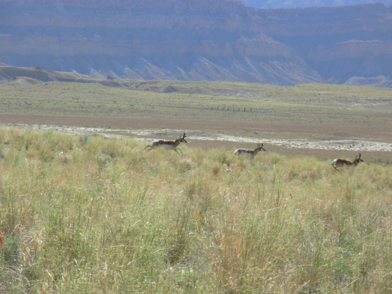
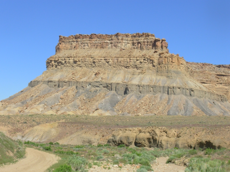
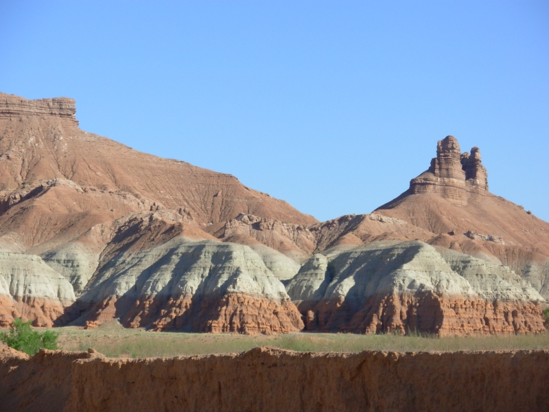
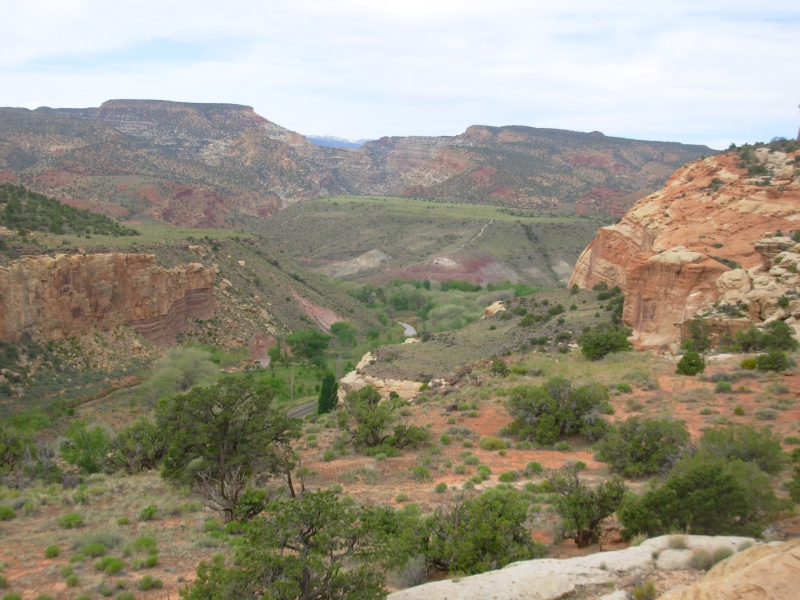
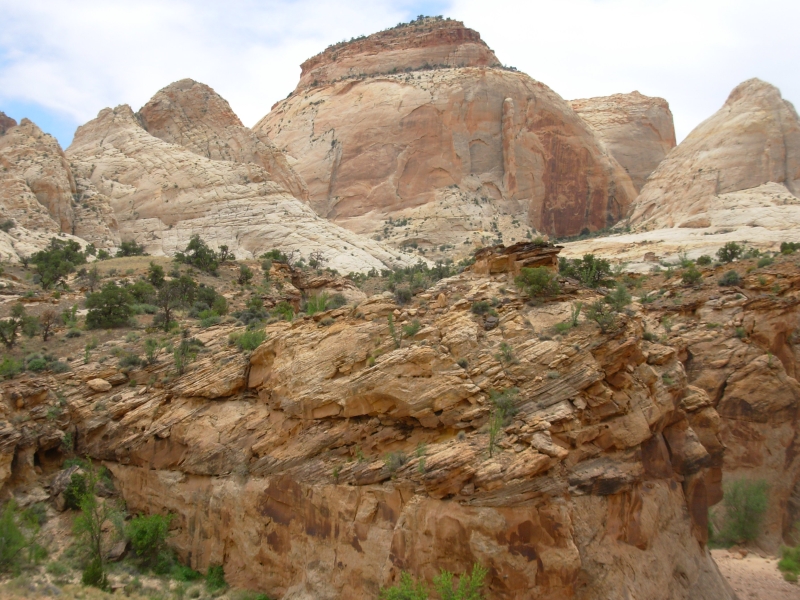
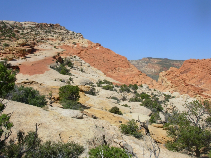
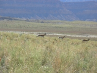
The San Rafael Swell is an interesting area, desolate and beautiful with multi-colored sandstone layers and twisted rock formations. There is a lot of open grassland. We saw five antelope this morning near the Book Cliffs and a whole herd near Goblin State Park. Mostly we saw lots and lots of lizards, as usual. Im sorry to miss Goblin State Park, as it is supposed to be unique, but it will have to wait for another year. I was glad we took time for the Wild Horse Canyon hike. It was a fun scramble. At one point, I was crawling under a rock and had to wiggle to get my hips through. At another spot, someone put a log against the pour-off to make a ladder. It was fun.
Afterwards we headed toward Horseshoe Canyon where we will be hiking tomorrow. It is flat open desert sage and grasslands with no trees, no shade. Its BLM land, so camping is allowed by the side of the road, if we can find a clear spot to park.
Saturday, May 12 7 ½ miles in Horseshoe Canyon aka Barrier Canyon, Motel in Torrey
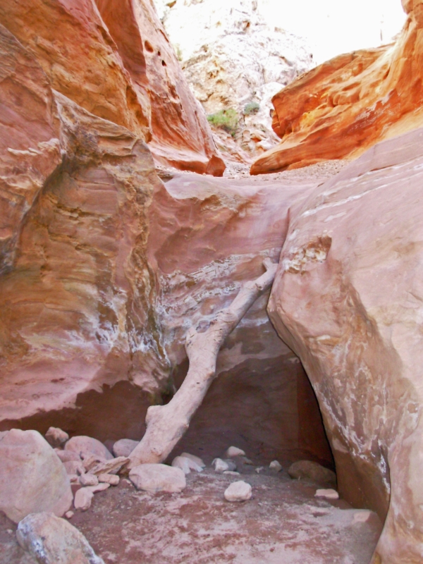
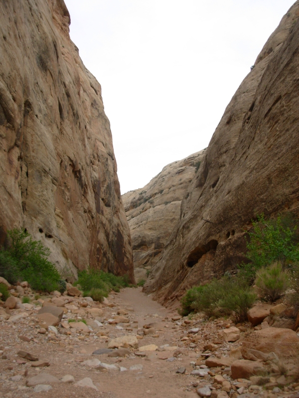
We camped in the shadow of a ridge next to an interesting mesa. It was a peaceful night, though more cars passed by than we expected for a place out in the middle of nowhere. The road is part of Canyonlands Maze District. Horseshoe Canyon/Barrier Canyon is up a 32 mile dirt road, a bit of a washboard, but passable. The rest of the Maze District has a reputation for being impassible to passenger cars. Access is possible by 4WD, motorbike or boat. Despite its isolation, the trail to Horseshoe was popular. At 9:30 a.m. there were already 10 cars at the trailhead. When we left there were at least twice as many.
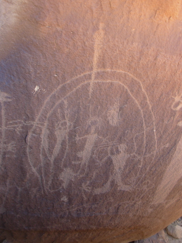
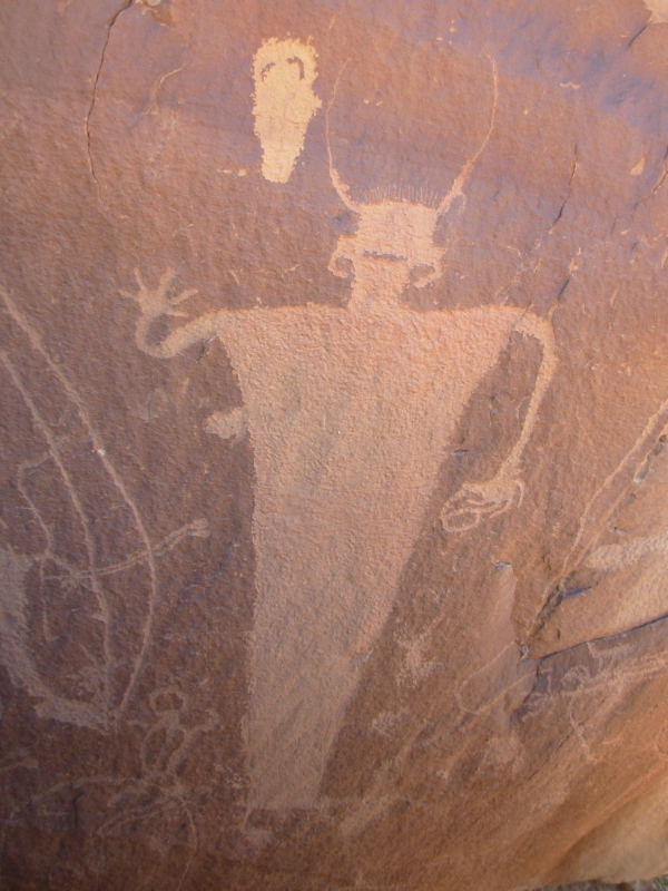
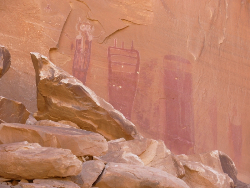
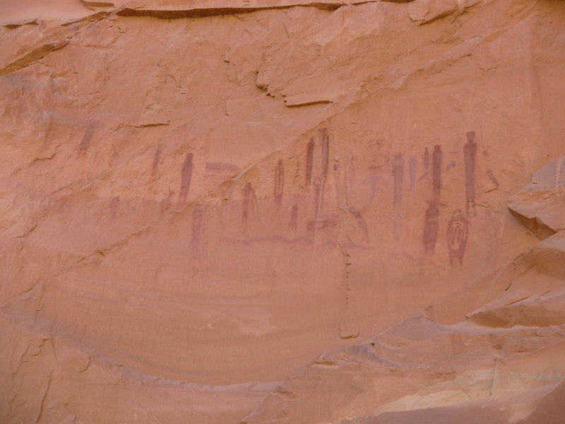
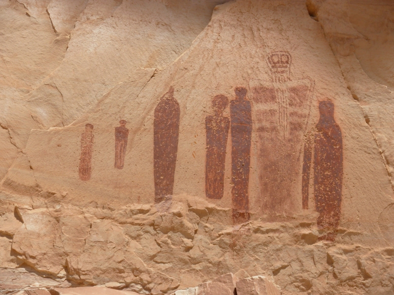
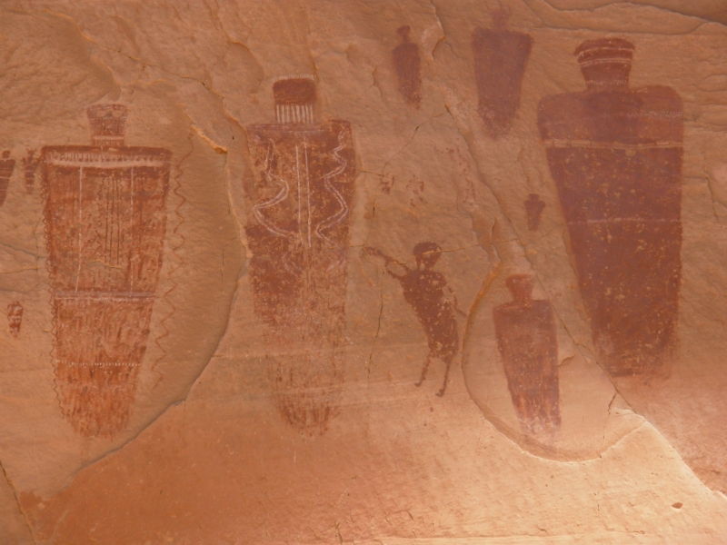
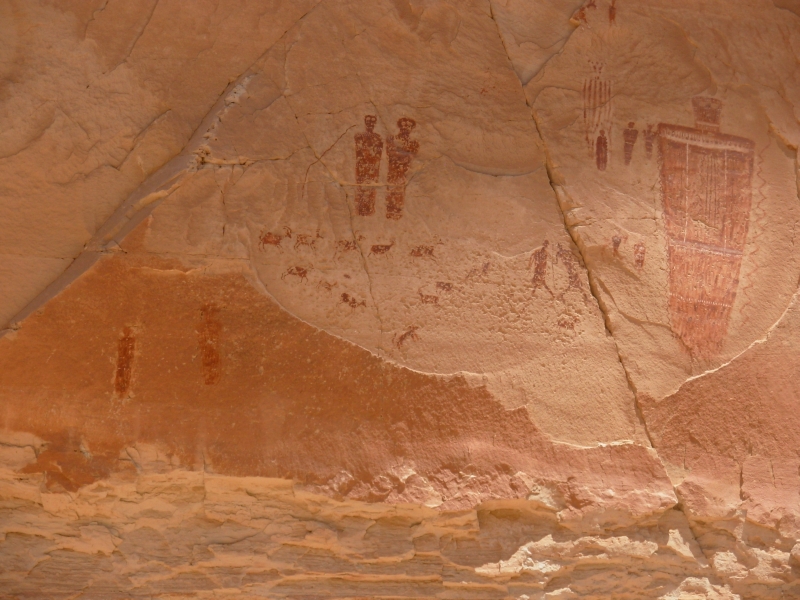
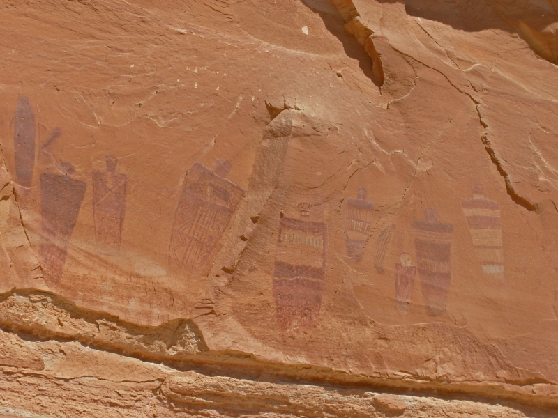
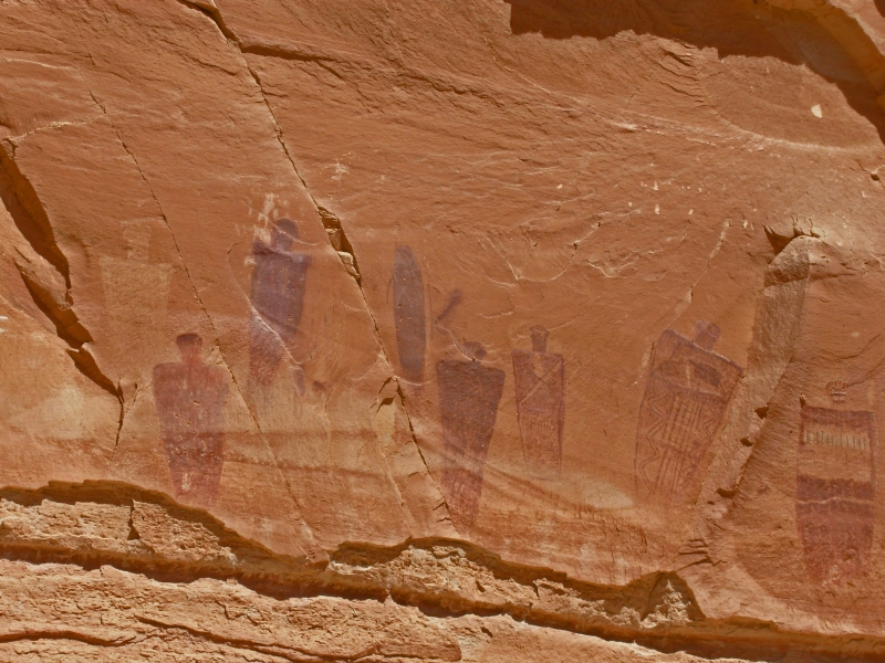
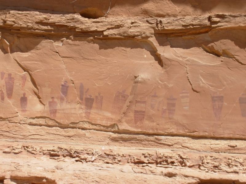
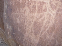
The trail descends 700 into a pretty canyon, then heads downstream past four Barrier pictograph panels that are 4000-9000 years old. The pictures are of strange ghostly figures, men with spears, dogs, bighorns etc. We spent a long time at the Great Gallery which has over 50 figures plus some petroglyphs. There were interesting details: blanket type designs in the figures, tiny birds at the shoulders, a dog herding several bighorns, a man with a line attaching him to a bighorn, human figures with other figures on their chests, etc. It was fascinating. There was a ranger-led group that we ran into at the second panel. The ranger pointed out several details we would have missed on our own. He also told us about a couple of dinosaur tracks on the way back up to the rim, which we found. Talking to the ranger took a long time. We didnt get back to the car until 2:00. It was a good hike, worth the long drive on the rough road.
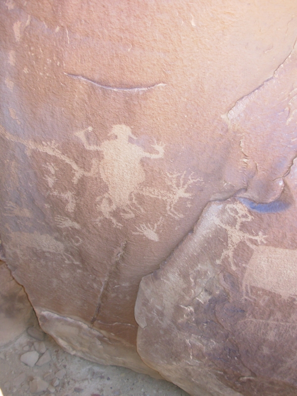
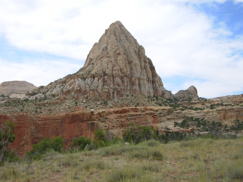
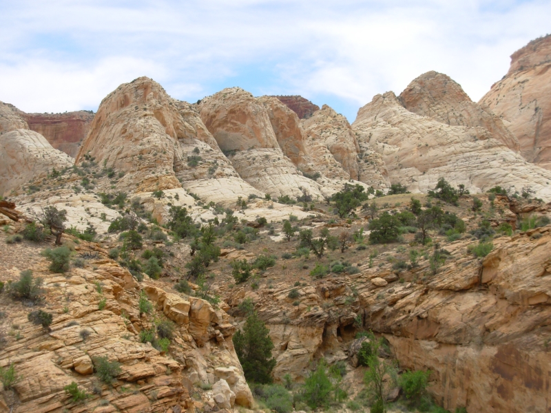
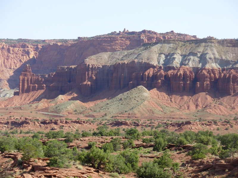
We headed to Capitol Reef from there. The country is weirdly interesting eroded sandstone in various colors. The campground was full, of course, so we headed to the nearest town, Torrey, for an expensive (but delicious) dinner and an even more expensive motel. Getting clean felt good after two hot hikes, but the money was more than I was happy with spending. Tomorrow well explore Capitol Reef National Park. We did stop at a Fremont petroglyph panel along the highway in the park, but that was it. The rest will wait.
Sunday, May 13 8 miles in Capitol Reef
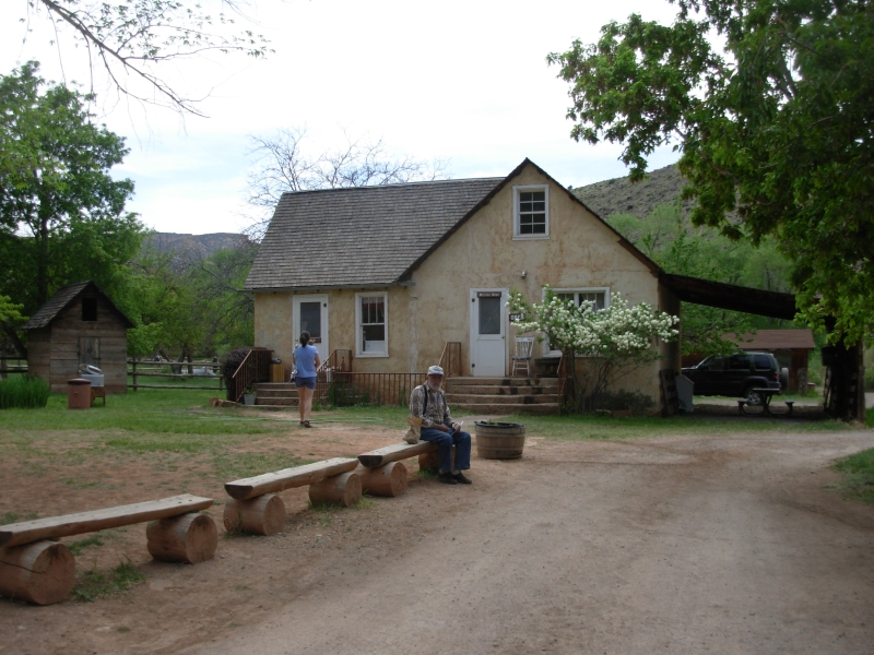
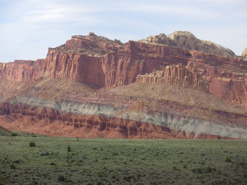
We left town early in hopes of snagging a campsite. Sure enough, people were leaving and we were able to get a nice spot next to an orchard. The park is located on an old Mormon settlement called Fruita. The farmers are gone, but their fruit trees remain. In summer, visitors can pick fruit and in spring they enjoy the flowers. We are right in between the two seasons. There are several remnants of the pioneer past: a farm house, several old wagons, a blacksmith shop, plus the old roads which are now hiking trails. The lush greenness of the orchards contrasts with the arid red landscape above.
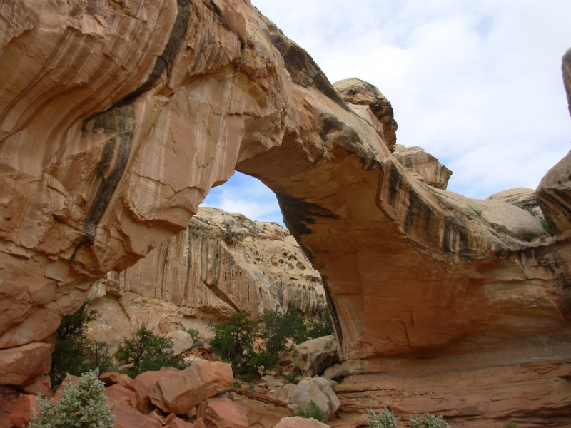
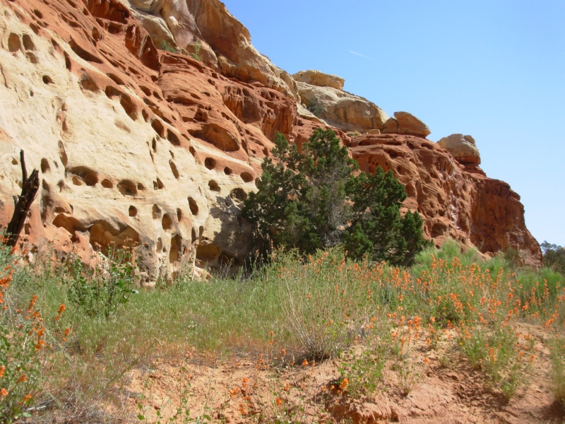
Neither of us slept last night, so we kept our hiking plans modest. First we did a two mile hike to Hickman Bridge, a natural bridge thats 123 feet tall. There were good views of the white Navajo Sandstone domes nearby, including Capitol Dome, for which the park was named. (An alternative name that was proposed was Waynes Wonderland!) Jim went back to the campground and I did a really nice traverse of Cohab Canyon back to the campground. There were several side slot canyons and some of the rocks looked like Swiss cheese, they were so full of holes. It was a pretty hike with a nice view of Fruita before the descent.
Then we drove the Scenic Drive (12 miles each way) through some beautiful canyons. The colors are amazing. Each layer of sandstone is different: white, yellow, red, blue and orange. We hiked the Tanks Trail, another two mile round trip down a dry wash past a small petroglyph panel and a pioneer register that had names and dates from 1883-1912 carved on the wall, then up to some potholes in the creek bed. We turned around at the point where we would have had to wade the creek. On the way back, we stopped at the Gifford Farm, a historic farmhouse where they sell homemade pie and ice cream. Jim and I shared a delicious small cherry pie. That was an unexpected treat.
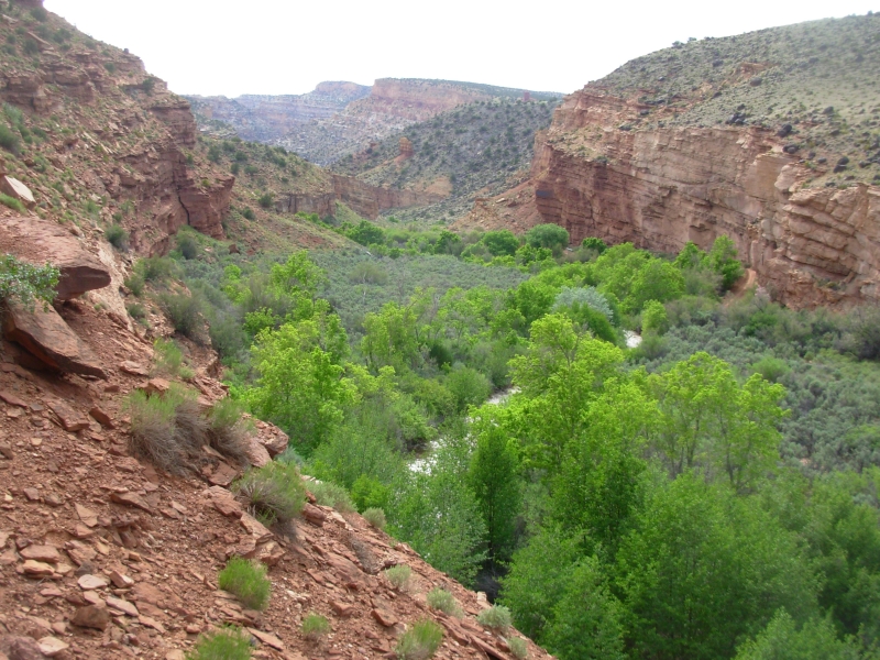
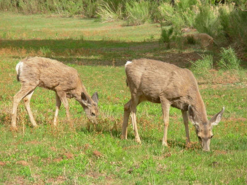
Afterwards I decided to do another short hike before dinner along the Fremont River to an overlook. The climb was steep (800) but the views were terrific. This is a pretty park with a relaxed feel to it. There are lots of hikes we can do here, flowers are abundant, the deer are tame and the campground is shady. I like it. As evening fell, a herd of deer passed through the orchard behind our car. Altogether I saw at least 10 deer today. Nice.
Monday, May 14: 10 miles in Capitol Reef
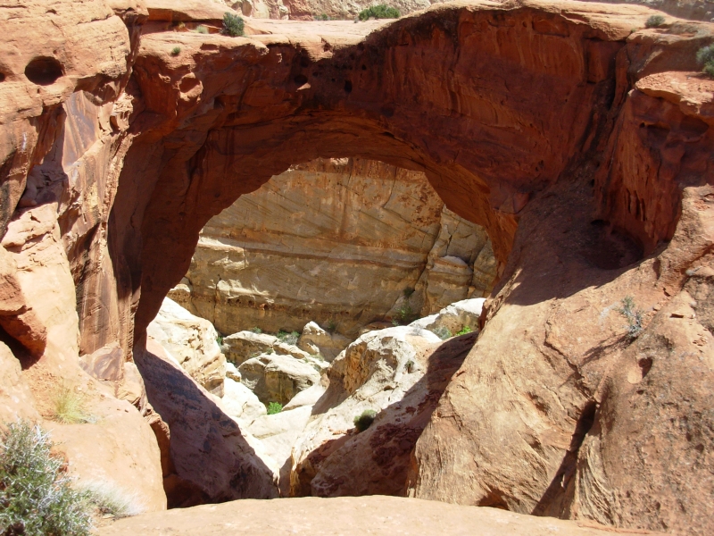
We had a good, though rather strenuous, hike today on the Frying Pan and Grand Wash Trails. First we climbed out of the campground on the Cohab Canyon trail so Jim was able to enjoy that picturesque canyon. Then we continued climbing for another two miles. Views were superb of the multicolored sandstone peaks, domes and cliffs. We did a side hike to Cassidy Arch, a tall fat one, then dropped down to the dry wash. We had the trail to ourselves for the first four miles, but near the arch we began running into a lot of people, including a runner and a guy who misread the sign and walked right past the turn to the arch. We met him a quarter mile later. He asked, Am I almost here? He wasnt. At least he only had an extra ½ mile to hike, Weve done much worse.
The Grand Wash is a nice hike too, with tall smooth cliffs on both sides. It narrows, but not into a real slot. Unfortunately the hike left us out on the highway with a long walk back to the campground. We stuck out our thumbs, but had no luck for a long time. We were prepared to walk all the way back, but preferred not to do that if possible. Its a fairly busy highway. We walked almost two miles before a woman picked us up and dropped us off at Gifford House, where we enjoyed another piece of pie and ice cream. Were both pooped. The sun does take it out of us. This time we were carrying more water, but we still didnt drink enough. We sweat out every drop we take in. Still, it was an enjoyable hike. This is a beautiful area.
Created: 10 November 2007
Revised: 30 Sept 2016
|
Copyright © 2007-2017 Spirit Eagle
|
|