|
 |
 |
 |
 |
|
|
|
|
|
|
May 15 6 miles - Motel in Escalante

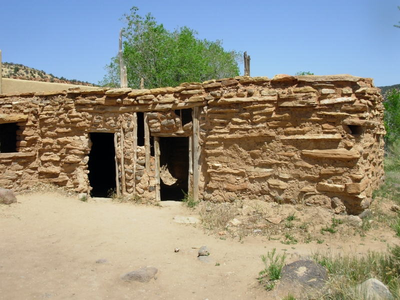
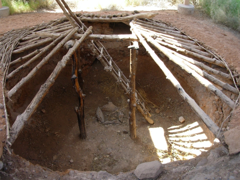
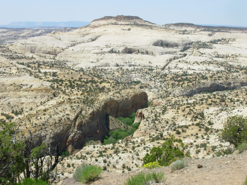
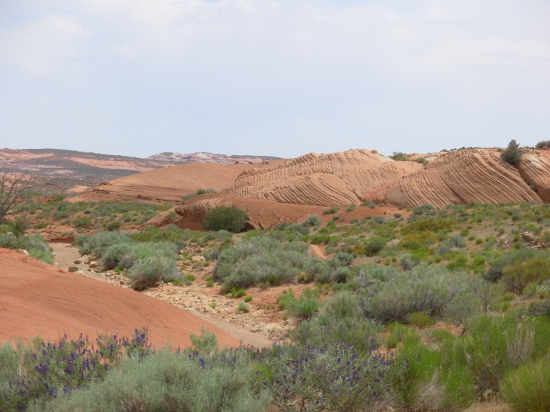
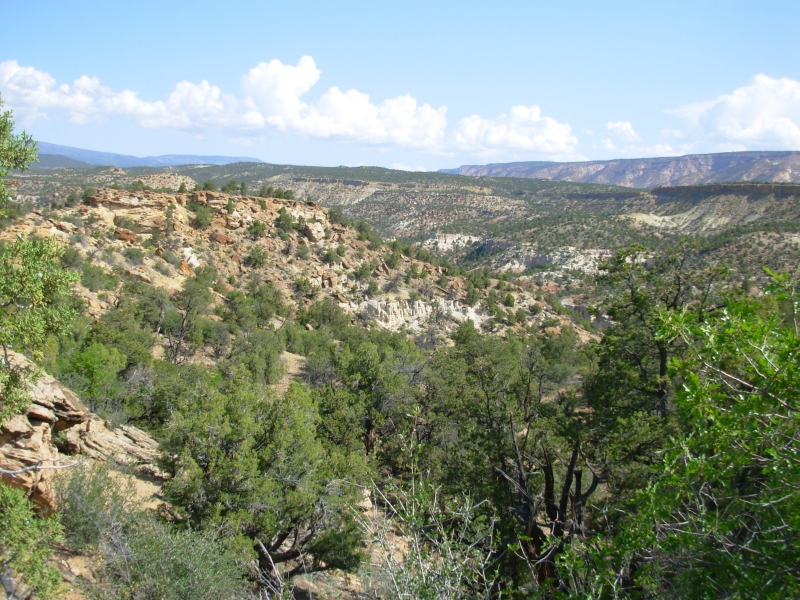
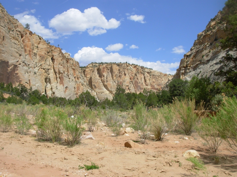
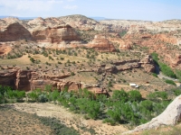
It was a low key travel day as we headed toward the Escalante We bought some very expensive groceries in Torrey, visited a disappointing bookstore there (very limited selection), then slowly wound our way south. The road, Highway 12, is a beautiful drive. We climbed up to 9600 into pine and aspen forests just beginning to leaf out. We stopped at Anasazi State Park, a museum and ruin in the town of Boulder, then enjoyed a good hamburger for lunch. South of Boulder the road winds through sandstone reefs and looks out on miles of domes and slickrock, with Calf Creek and the Escalante providing green contrast below. It's beautiful country.
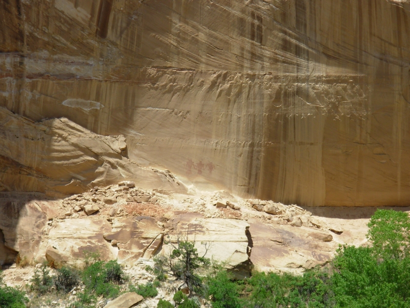
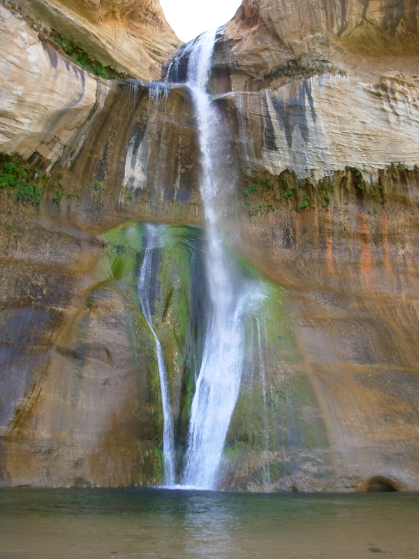
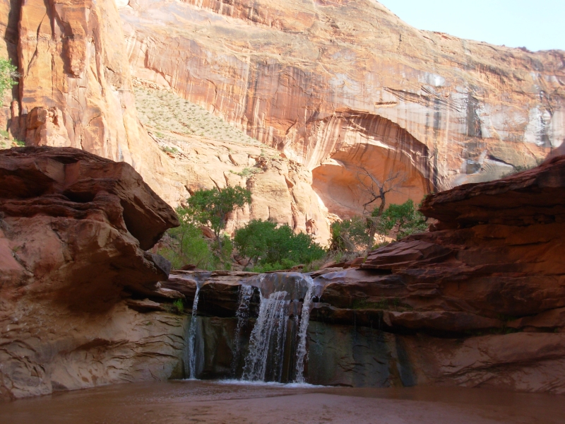
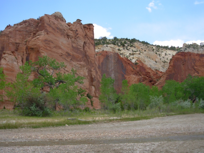
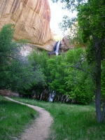
We worked off the calories on a lovely hike up Calf Creek to the 126 waterfall there, passing some pictographs and two granaries on the way. It is a beautiful area, with Navajo sandstone cliffs and domes and a clear creek lined with green cottonwood trees. The campground at Calf Creek was full, so we continued to the next town, Escalante. We intended to camp, but, since were heading out on a backpacking trip tomorrow, we decided to enjoy a shower first. We needed it!
We went to the Escalante-Grand Staircase National Monument Visitors Center, but didnt get a permit because we hadnt discussed our plans before we got there. I knew what I wanted to do, but somehow I forgot to run it by Jim first. We were told we could just sign in at the trailhead, in lieu of a formal permit, so we decided to do that instead of returning to the office tomorrow. I hope the ranger is right. I want to do two backpacking trips in the Escalante first a 2 ½ day trip and then a four day trip. The first, Coyote Gulch, is well known and popular. The second is part of the Hayduke Trail, so Im really psyched about doing it. I would love to hike the entire Hayduke Trail, but Jim has no interest. I think the long waterless stretches are a major turn-off for him understandably so. Still, I think it would be fun to spend two months exploring southern Utah on foot.
Wednesday, May 16 12 miles in Coyote Gulch
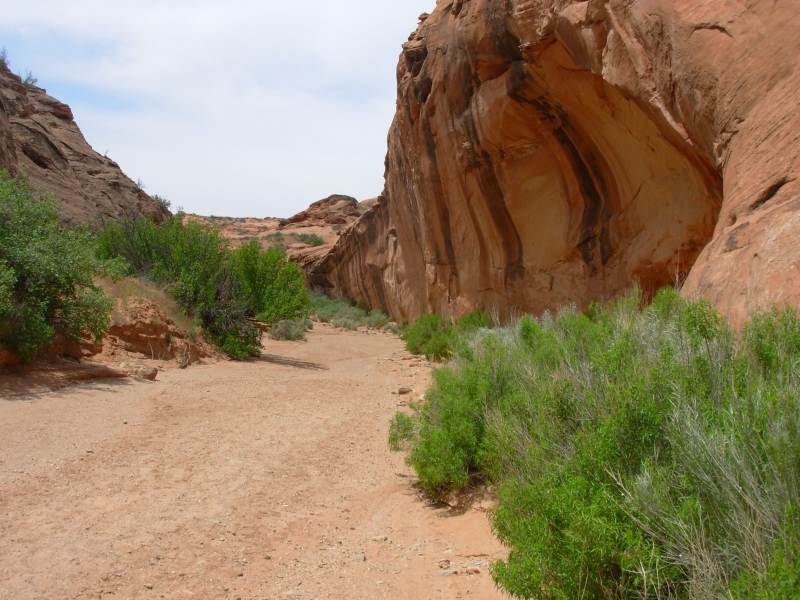
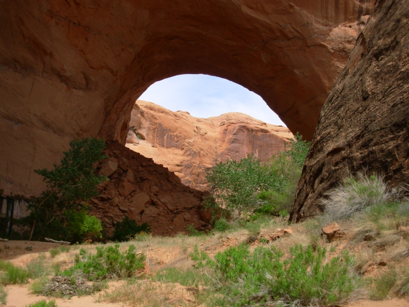
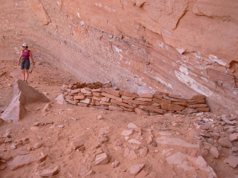
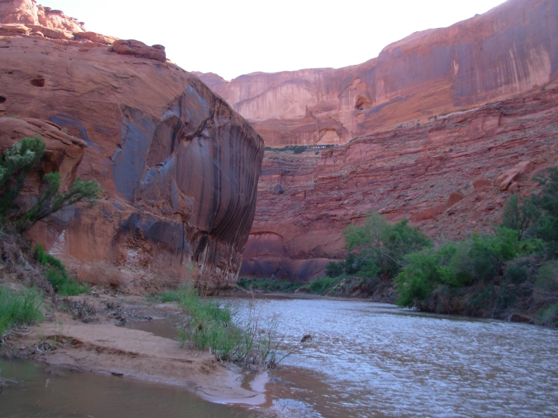
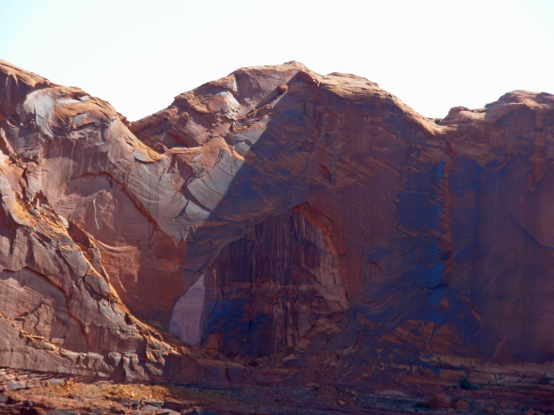
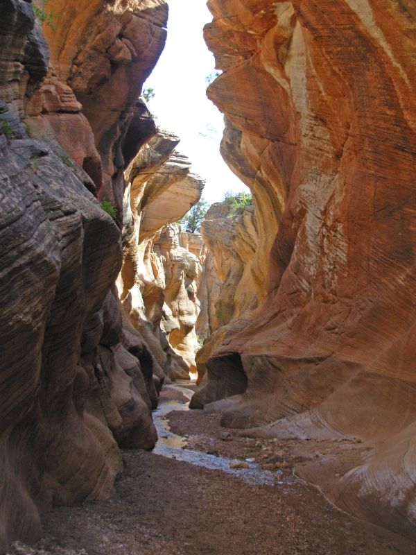
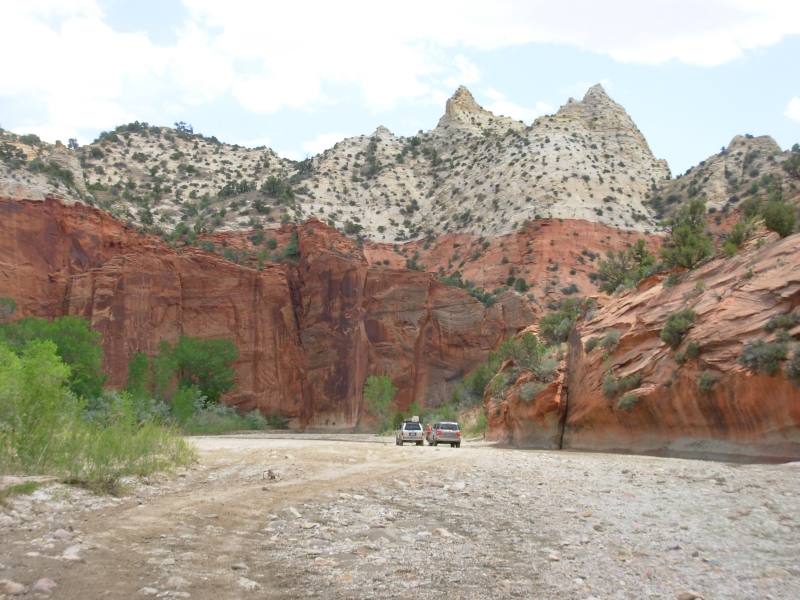
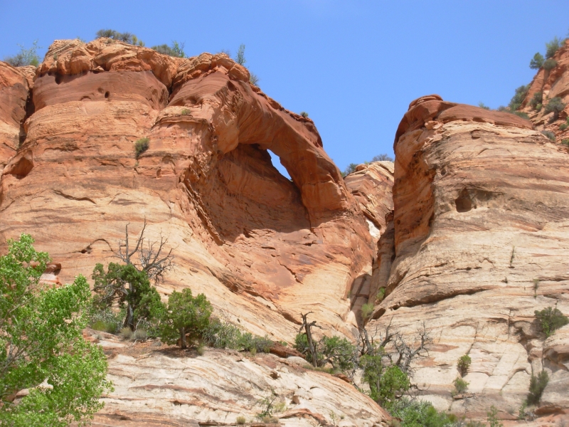
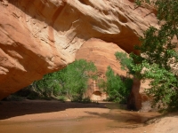
We got a late start after a leisurely breakfast, a quick stop at the grocery to replace some moldy bread, and a long slow drive out the very washboardy Hole-in-the-Rock-Road. We reached the trailhead at 11:30, said hello to a hiker eating his lunch there, then set off down Hurricane Wash. The first miles were very easy as we followed the dry sandy wash. After about three miles, the canyon began to close in, with red sandstone walls about 50 feet high that got taller as the day wore on. A trickle of water appeared after about 4 miles, and at about 5 ½ our route joined the main stream of Coyote Gulch. After that we just followed the water, sometimes wading ankle deep, sometimes walking on the bank, sometimes winding through willows and horsetail ferns. We passed two arches and a natural bridge. Well see another arch tomorrow. Because of our late start and a couple of detours, we didnt go all the way to the Escalante River. Well do that in the morning. Coyote Gulch joins the Escalante just before the river becomes part of Lake Powell.

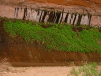
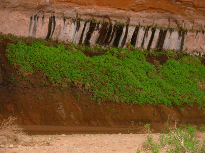
The Gulch is beautiful: red sandstone walls streaked with black varnish. There are many big alcoves where the creek twists and turns. There are hanging gardens on the rock walls where water seeps through the rock. Ferns and columbine are lush in those wall gardens. We got drinking water from a couple of seeps, which was very slow, but the water was good. The creek water looks clear, but is very full of silt. Cows graze upstream so we wont drink it unfiltered and the sandy silt would clog our filter quickly, so getting water from the seeps is a good, but time consuming, idea.
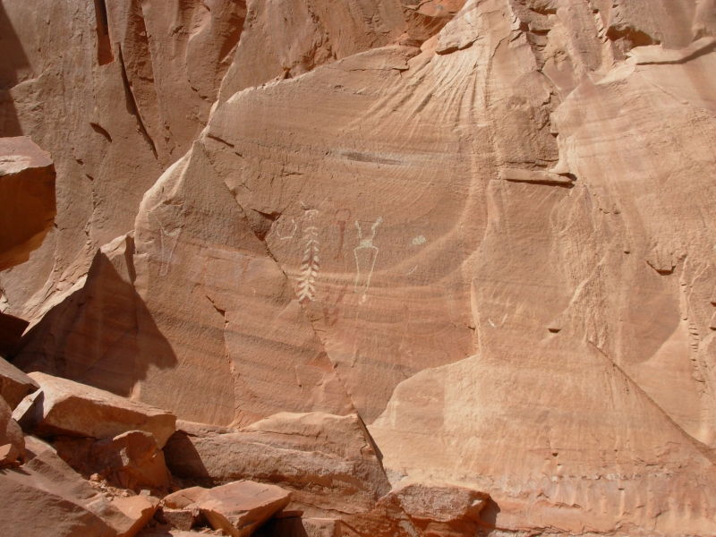
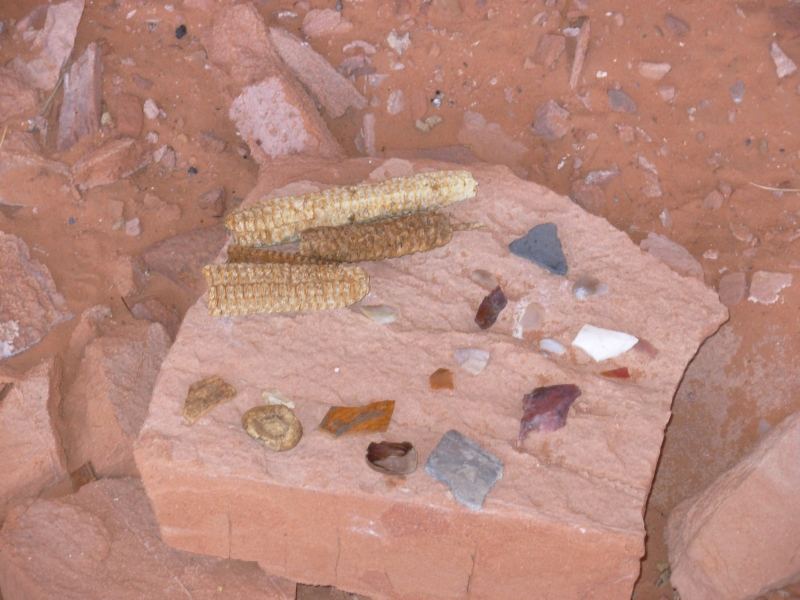
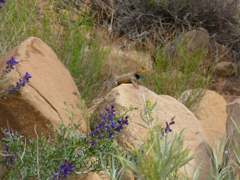
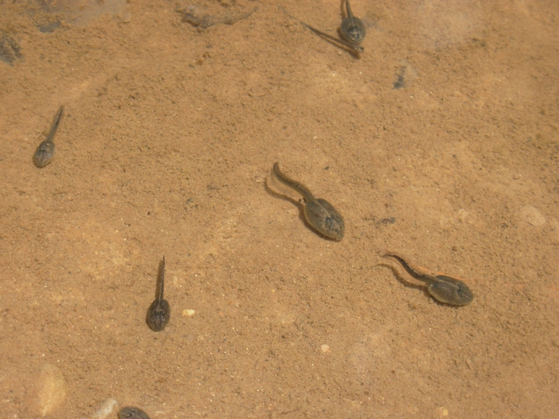
One unexpected pleasure was finding a pictograph site with a ruin nearby. We noticed a trail heading in the wrong direction and were curious. Then we saw the rock art above us. Very cool. Wildlife has been limited: hundreds of lizards, several jackrabbits (one posed for us), a couple of squirrels and chipmunks, frogs and tadpoles and biting flies. Oddly, the only snake Ive seen in Utah was a bull snake held by a little girl at Calf Creek yesterday. They had caught it at Capitol Reef and decided to take it home with them (Yes, I know its illegal, but I didnt say anything because I knew it wouldnt do any good.)

There are lots of people out here. This is the most popular backpacking hike in the Escalante, aside from the Paria, and we saw a bunch of cars at the trailhead, so it wasnt a surprise. The people are spread out though, so it isnt a problem. We saw seven groups today, including a large group of teenagers. The latter part of the hike got a bit challenging as we had to climb around various obstacles, including three small waterfalls. The route wasnt obvious and wasnt always easy. We were happy to stop, even though we hadnt gone as far as we intended. We brought extra food in case we wanted an extra night on the trail, so there was no pressure to keep moving once we found a good campsite. Its windy but warm, very comfortable. Were sleeping under the stars, which we havent done for a while. I like it.
May 17 14 ½ miles in Coyote Gulch
The wind picked up and we ended up trying to go to sleep in the middle of a full blown sandstorm. I used my shorts to shield my eyes and nose, but we didnt sleep until it died down a couple of hours later. I seem to remember a similar strong wind last time we were in the Escalante, when we hiked Harris Wash. At least it quieted down the bullfrogs; they were really noisy.
We continued downstream this morning, following rock ledges as far as the Escalante River, then we turned back. The river was deep and fast so we werent going much farther. Since we couldnt get to Stevens Arch by following the river, unless we wanted to swim, we went back and climbed up a sandy ridge to a spot where we could see the arch across the river. It was worth the climb even though the arch was in shadow. Then we headed back up Coyote Gulch. We ran into several people at the first waterfall, which was really nice since one of the men helped pull me and a German couple behind us up the rocks there. It was a scramble! At a big meander, we took a short cut over the ridge, saving a lot of effort. That section was the first of our obstacles yesterday, the last one today. After that it was an easy walk out.
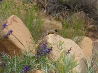
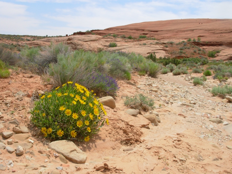
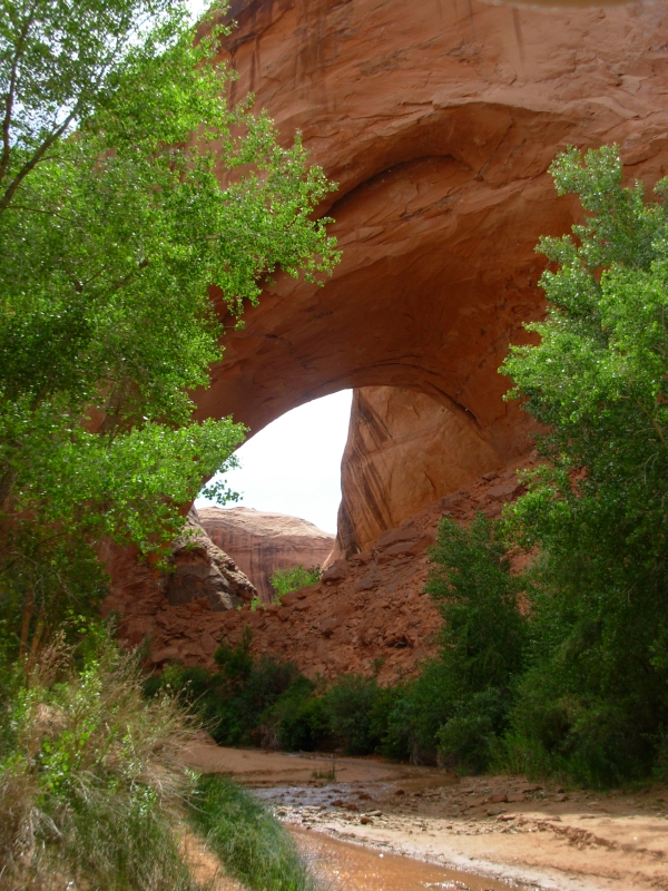
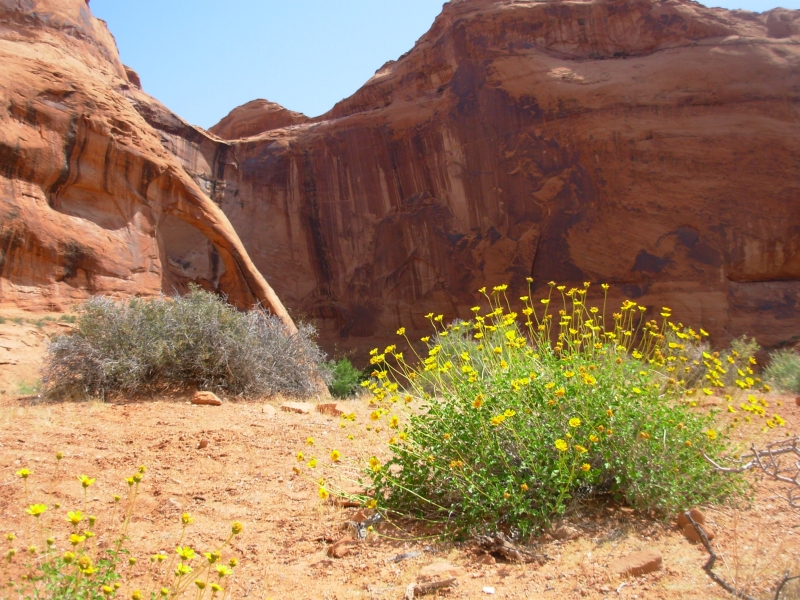
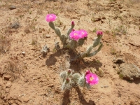
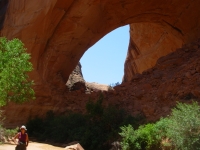
I enjoyed the hike in Coyote Gulch a lot. The canyon was beautiful, with the contrast of orange rock and lush green trees, bushes and ferns. There were a lot of different kinds of flowers. I especially enjoyed an abundant dark blue flower, some sort of lupine or vetch I think, as well as pink prickly pear blossoms and white columbine at the seeps. Coyote Gulch is mostly known for its arches. Few hikes have so many en route. The first arch was tall, part of a meander that was in the process of being cut off. Fallen stone half filled the arch. Eventually the river will cut through the broken rock and cut off the meander completely. Coyote was a natural bridge, where the river had cut through a meander from below. The trail went right through the bridge. Cliff Arch/Jug Handle Arch was high above the canyon, as was Stevens Arch. Because of the morning shadows, we could barely see Stevens, but it was big enough to be impressive even at a distance. It turned out the arch I thought yesterday was Cliff/Jug Handle wasnt. It was another one, or maybe just a cave. Today we saw the arch near our shortcut and it was unmistakable. We also spotted another Indian ruin above the trail. We found a good seep to fill up our water bottles, but got soaked from the water dripping on us. At least it washed off the sand from last nights big blow.
We ended up walking all the way out to the road after all. The trail was easy so we reached the car around 4:30. Dark clouds massed to the north. We drove into town instead of camping at the trailhead for two reasons: 1) the outdoor store sells beer and pizza, both of which we enjoyed, and 2) Escalante State Park has hot showers, which we also enjoyed. After all the trouble weve had at the national parks with full campgrounds, it was a pleasant surprise to find several vacant spots at Escalante. Its a small campground next to a reservoir with a short (1.75 miles) hiking trail. Best of all, showers are included in the camping fee.
May 18 2 miles at Escalante SP
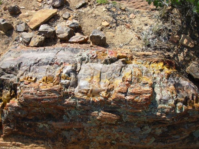
We started the day with a short hike in the state park. There is a lot of petrified wood there and theyve created a nice loop trail up to the plateau above the campground then down a side draw to an area with a lot of petrified wood, then back down to the reservoir again. It was short but steep. I loved all the colors in the wood/rock: red, yellow, white, etc. We drove back to town to an RV Park to do laundry, bought some cheese, ate lunch, then headed west to Cannonville where we were able to find the map we needed for our next hike at the Visitors Center. We had hoped to camp at Kodachrome State Park, but the campground was full, so we headed down a rough dirt road toward the Round Valley Trailhead and parked there. We stopped short of the trail when we realized that the road had washed away so a section was barely wide enough to cross. We might not be able to make it back if the dark clouds deliver any real rain, so we parked on the side of the road before the narrow section. As it is, a dip on the way back may prove troublesome. We have a very long truck. They warned us at the Visitors Center that the road was iffy; they were right.
It has been gray and cloudy all afternoon, but so far weve only gotten scattered drips and a few rumbles of thunder. Since well be following watercourses for the next four days, I hope this storm passes quickly. Our plan is to hike a 49 mile section of the Hayduke Trail and hitch back to the car. The roads are rougher than I remembered, so getting a ride back may be a problem. If so, we might have to add 18 miles to the journey.
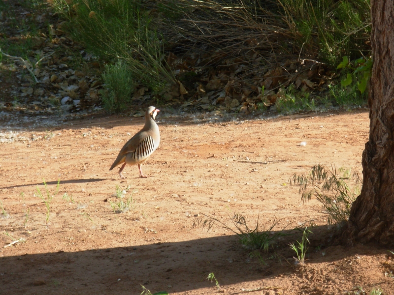
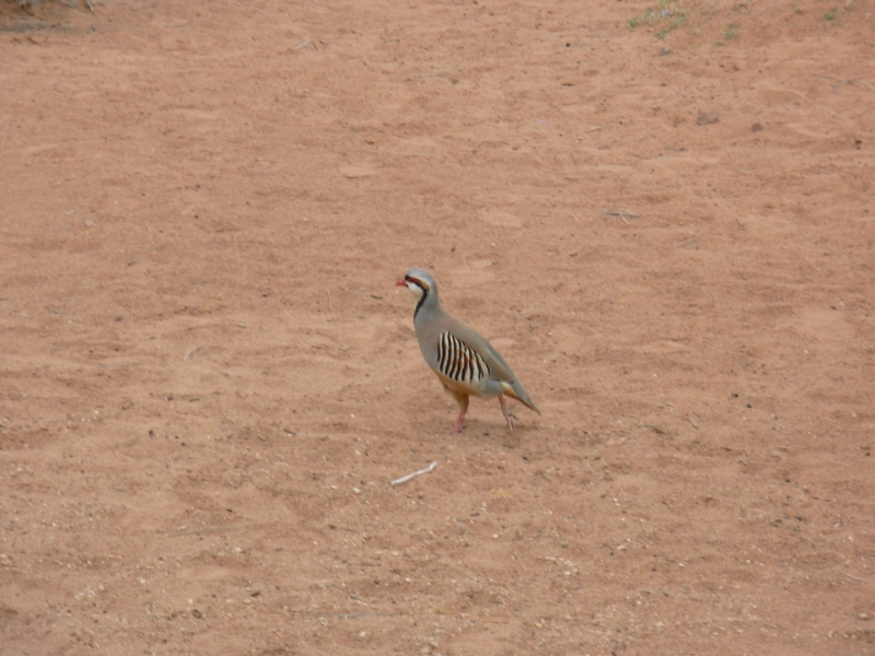
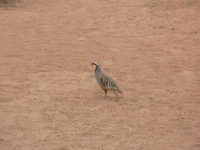
While we were eating breakfast this morning, I noticed an unusual bird at the next campsite. It was a pretty bird, like a grouse or prairie chicken, but with black and white markings. A sign at the bathroom said it was a chukkar. Id never seen one before.
May 19 7 miles in Round Valley Camp at Kodachrome State Park
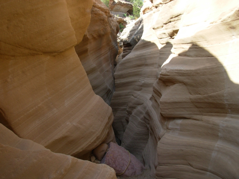
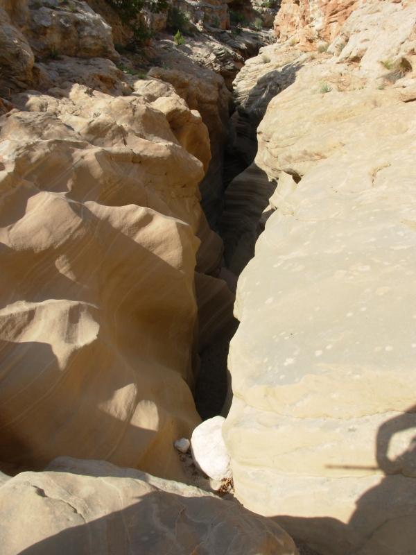
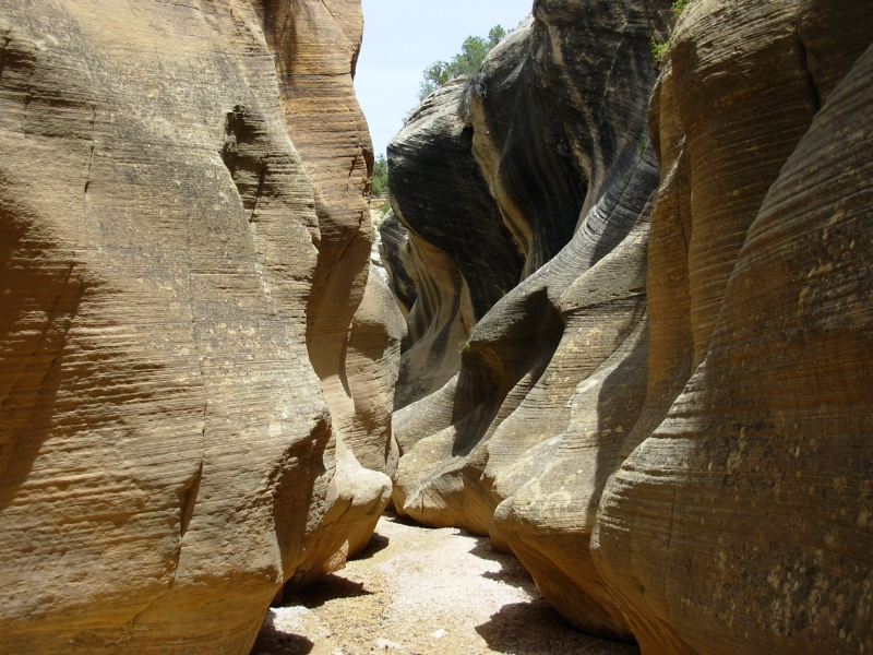
Change of plans. I wimped out. We walked down the valley to the beginning of the Round Valley slot. I wiggled into the slot easily enough and Jim lowered the packs down to me. Then about 10 feet down, there was a 20 drop off. A rock had a 6 foot long rope tied around it, and there was a short log leaning against the wall below to act as a ladder. I couldnt do it. I was worried that even if I got down to the next level, there would be another obstacle beyond that I wouldnt be able to go through, and then I wouldnt be able to climb back up using the short rope. So we headed up the gorge, following the rim of the canyon. I thought wed be able to find another way down to the canyon, but it quickly became very deep and we couldnt find a way down. We checked out several side canyons, and each time we either got rim rocked, cliffed out, or the drop was straight down on loose scree. After a couple of hours, when we were overlooking the junction of Round Valley and Hackberry Canyon and saw it was 200 straight down, we turned around. The bushwhacking above the canyon wasnt difficult, its fairly open piñon forest, but we kept having to detour around side canyons. We also wasted half an hour when Jim lost the maps. They fell out of his pocket and we had to backtrack to find them. Since we were not on trail and it wasnt always easy to follow our tracks, we went too far and then had to turn around to see if we could spot the maps. We drank ½ our water before noon and knew we couldnt afford to play around much longer, so we headed back out to the car. We got the feeling we were in the wrong place at the wrong time. I hate to quit, but sometimes you have to.
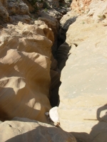
Just for informations sake, we went up the other side of the slot, without packs, to see if we could find an easier way in. There was a place where you could climb down, but we could only see down the first five feet or so. The next 15 were hidden from sight. We decided it wasnt worth the risk. Jim doesnt like going into caves, which is more or less what this was like. I have an exaggerated fear of falling, so uncertain climbs arent my thing. Were both really disappointed though. There are other ways into Hackberry Canyon unmarked and unmaintained jeep tracks or we can go in from the other end, but the excitement is lost. I was so looking forward to doing a whole section of the Hayduke Trail. Failing in the first two miles was a real disappointment. We drove out, carefully, on the bad road. The big dip had us nose into the hill on one side and tail into the hill on the other, but we didnt scrape too badly - just bent a few things a little.
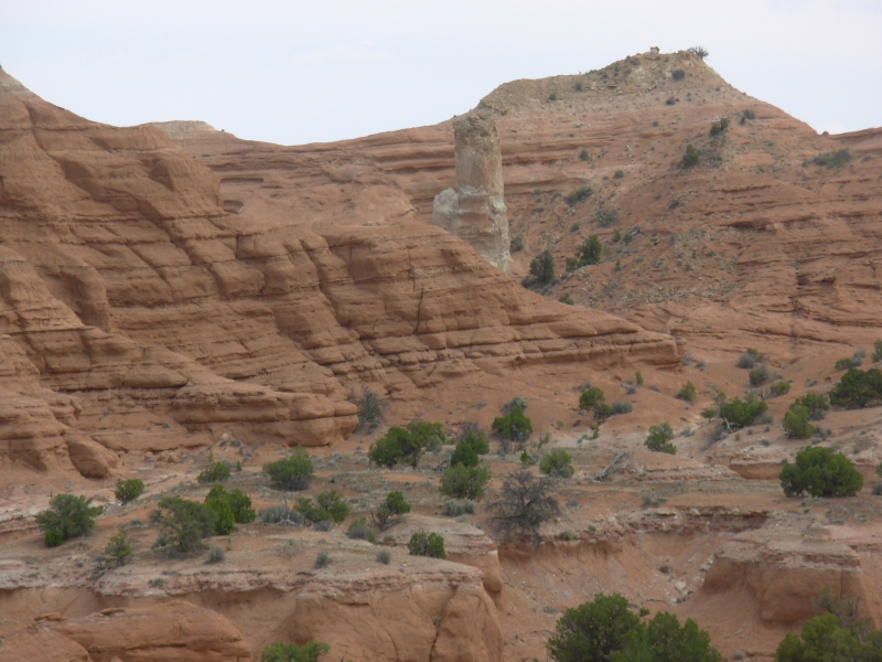
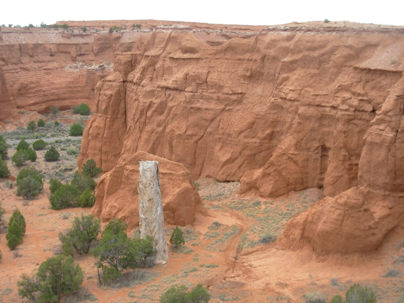
We only drove a few miles to Kodachrome State Park, which we visited last time we were in Utah. Its a pretty park with interesting volcanic pipes forming white towers that contrast against the pink sandstone. We did a short hike, then headed to the campground where we got one of the last sites. The woman at the camp store told me how easy Round Canyon was when she hiked it several years ago. Just what I needed to hear! The campground is noisy with lots of kids, but they have showers and much needed drinking water, so we decided to come here instead of enjoying another quiet night in the wilderness.
I spotted another interesting bird today, a beautiful western tanager: yellow and black with a red head. There were also three chukkars by the bathroom. As beautiful as this place is, I still would rather be backpacking!
May 20 13 miles to Deer Creek
We decided to do the other end of our planned Hayduke Trail backpack. We knew there were slot canyons and petroglyph panels at the far end, so it would be interesting, even without the Round Canyon slot. Sure enough, it was a beautiful hike. We started down Willis Creek, off the Skutumpa Road. Finding the trail was an issue, since the road isnt marked Skutumpa Road, but FR 500. There was another road that went to Sheep Creek that we almost took instead, but this one said that it led to Kanab, and we knew Skutumpa Road goes all the way through the Escalante Grand Staircase Monument, so we took a chance.
The trailhead wasnt marked either, but there was a parking area with a register box and inside the box was a register telling us which trailhead we were at. We had been following the map in the Kelsey guidebook, so we knew approximately where we were, but there are more roads than he shows.
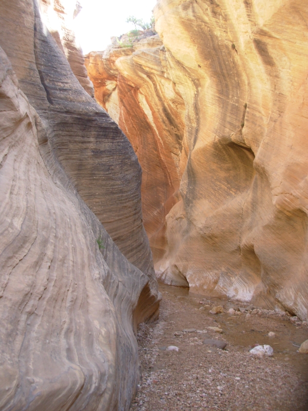
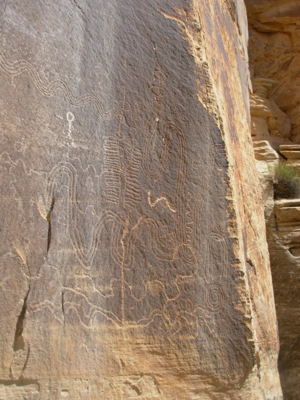
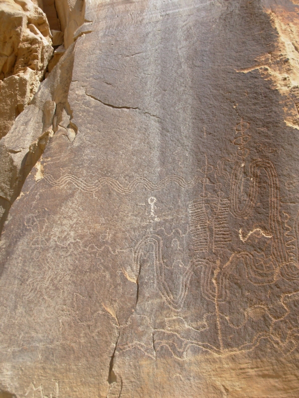
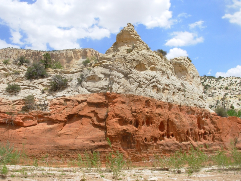
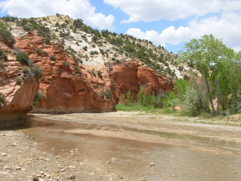
Willis Canyon is a pretty canyon and an easy hike. Theres nothing technical about that slot; its just a narrow canyon with steep walls and a little creek running down it. The trail detours around a small waterfall, but otherwise, its just an easy walk. In 2 ½ miles, we reached Sheep Creek, which is a wider, but taller canyon, and dry for the first few miles. There was a petroglyph panel at the junction of the two canyons. We followed Sheep Creek about six miles to the Paria River, which was wider still and had more water. We filtered some water from a pool in Sheep Creek that was full of tadpoles since we werent sure what water would be ahead. At the Paria we changed rock strata, from white and light orange to dark pink and red. It was very dramatic.
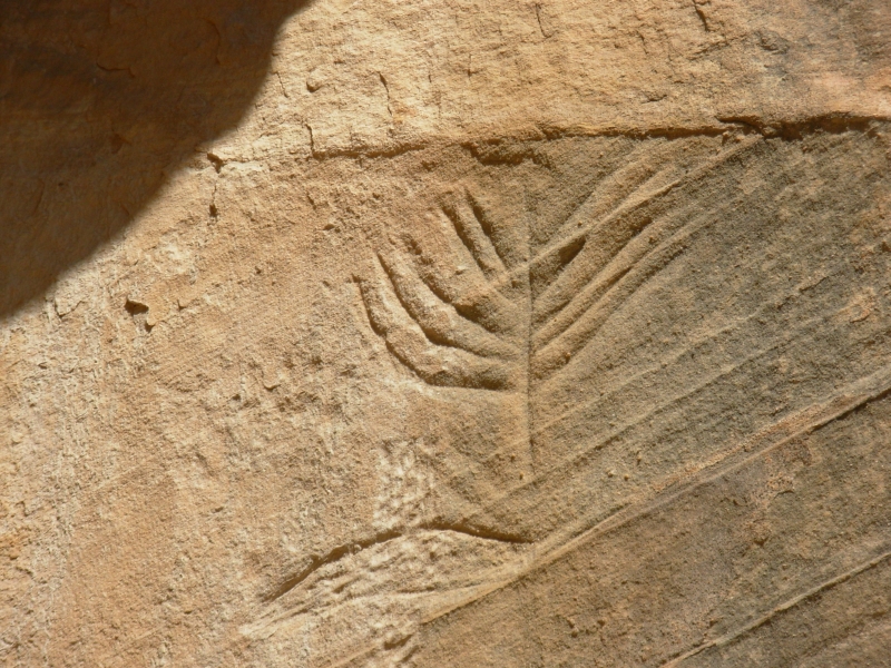
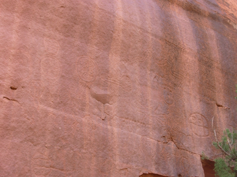
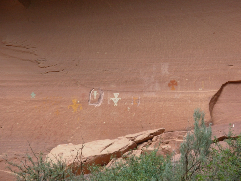
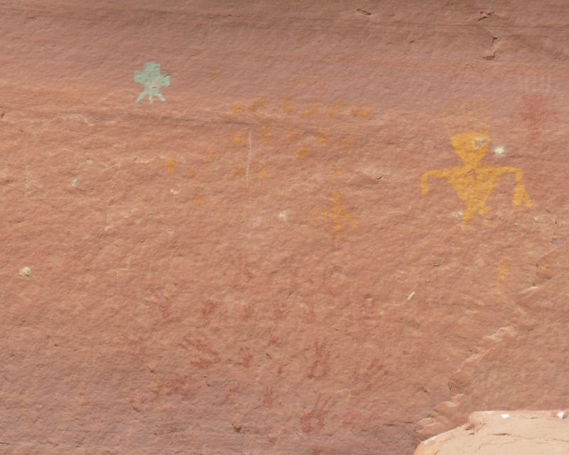
We followed the Paria for 4 ½ miles to a side canyon (Deer Creek) where we found more petroglyphs (very sticklike people, suns, spirals, snakes and bighorns). A quarter mile up canyon there were some pictographs red, gray, yellow and turquoise. We could see some triangular-bodied men, and lots of red hands and what looked like a yellow dog. All the sites had been vandalized, from signatures dated 1929, 1936, etc to Walmart is cool to places where someone tried to hack out the pictures with a chisel, and, of course, lots of initials. Grrr!
I had expected to have the trail to ourselves today, but I was wrong: we ran into two groups of horses, three dayhikers, two jeeps and 2 ATVs. The Paria is a busy river. Then there were the cows that panicked at the sight of us. There are 4WD roads down both Sheep Creek and the Paria. We camped up Deer Creek, away from the road. It should be peaceful as long as the cows dont come back.
Monday, May 21 13 miles Motel in Escalante
Our return hike was fairly straightforward. We intended to loop back via Bull Valley, but when we got to the canyon junction we werent certain it was the right canyon. The map showed two canyons right next to each other. In fact, they were ¾ mile apart. We headed up Bull Valley, but it twisted and turned much more than shown on the map, and we couldnt be sure we were in the right place. It was headed in the wrong direction according to the map, so we just headed back to Willis Creek. Its okay, I enjoyed Willis the second time around as much as I did the first. We reached the car around 2:30 and headed back to Escalante, where we were expecting some mail. It wasnt there. We cleaned up at the motel and enjoyed a good dinner. Well figure out what to do about the missing packages tomorrow.
We passed the three four wheelers we saw yesterday camped by the river this morning. A couple of hours later we met another SUV, whose driver was looking for his missing friends. Evidently they were supposed to return last night, but never showed up. Probably car problems, since they were camped not far from where we saw them yesterday.
Anyhow, Im happy with our short hike, even though it wasnt the Hayduke trek Id planned. Its beautiful country. Finding the rock art was a bonus.
Home | Links| Trail Journals |
The Thruhiking Papers | Bun-bun
Created: 10 November 2007
Revised: 30 Sept 2016Copyright © 2007-2017 Spirit Eagle