|
 |
 |
 |
 |
|
|
|
|
|
|
May 22 Travel to Cedar City
It turned out the Amazon package was sent to General Delivery via UPS, and so was being held at the UPS facility in Cedar City, about 100 miles away from the post office in Escalante. UPS cant deliver to PO boxes or General Delivery. The other package we were looking for was never mailed, so we drove back to Escalante for nothing. Dang! Internet was down today, so we couldnt check to see if UPS had sent the package back to Amazon. Jim hadnt written down the tracking number since he assumed hed be able to go online to get it this morning. Instead, we drove to Cedar City, found the UPS office, and were lucky enough to pick up the package without it. Hurray.
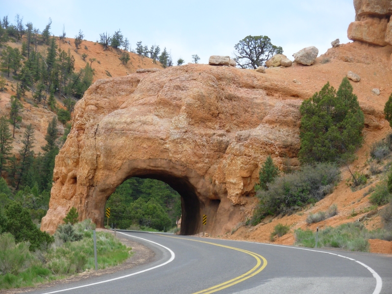
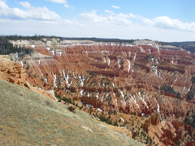
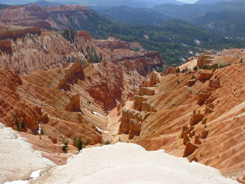
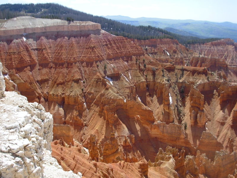
We decided not to stop at Bryce National Park on the way since we spent a couple days hiking there two years ago. We stopped at Ruby Inn, outside the Park, and were totally turned off by the crowds there. Eight buses were parked out front. You can imagine how packed the restaurant and store were. I bought a couple of novels, then we happily escaped the hordes. We enjoyed the drive though. Its a pretty drive through Red Canyon, up to the high country, just beginning to turn green, to Cedar Breaks National Monument. Last time we were here, Cedar Breaks was still closed by 4 to 8 feet of snow. Today there were patches of snow on the ground, and fresh snow on the trees, but the road was open, although the park office was still closed for the season.
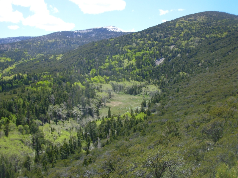
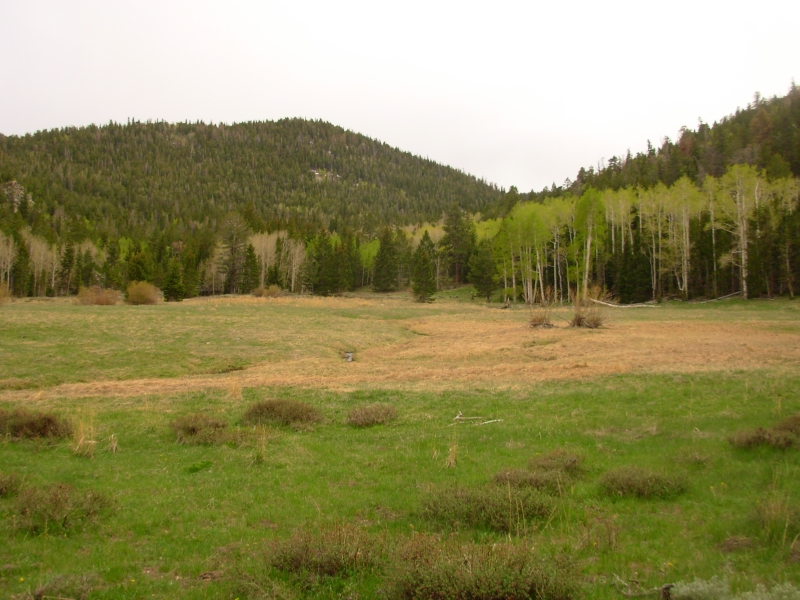
We planned to hike along the rim, but it was very cold and EXTREMELY windy and the trail was slick with snow and thick mud, so we turned around rather than risk sliding off the edge. The views were gorgeous. Its a miniature Bryce, beautiful eroded orange and white sandstone. I really enjoyed the area: 10,000 meadows, green grass, new aspen leaves, ponderosa pines and tumbling springs. It reminded me of Montana in the spring, or the Carson Forest in New Mexico in May. Beautiful!
A storm system has been lingering in the area. Today was gray, windy and significantly cooler. There have been several thundershowers in the past few days, but nothing major so far. One reason we decided to shorten our trip this week was that slot canyons can be dangerous when thunderstorms are in the area because it may not be possible to exit them. Round Canyon, Hackberry and Cottonwood, our planned itinerary, are all slots. I still want to go back to do the hike I planned, but for a lot of reasons, this wasnt the time for it. Im still disappointed, but seeing the gray clouds this morning, I had to agree with Jim that today was not a good day to go back to hike the rest of the loop. Maybe next time?
May 23 3 miles in Great Basin National Park
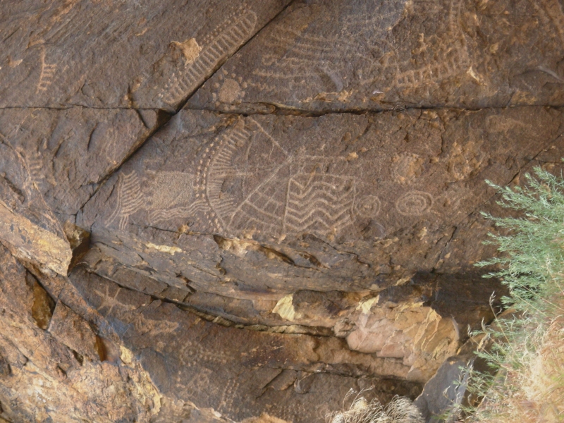
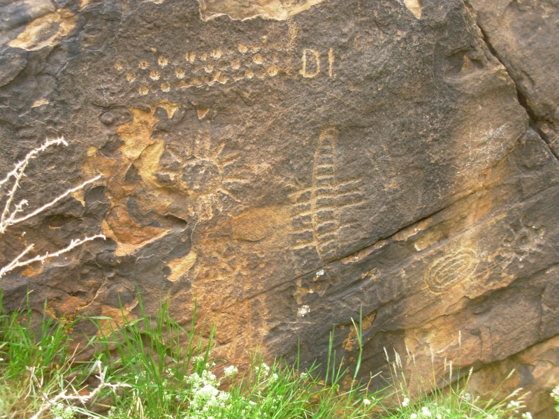
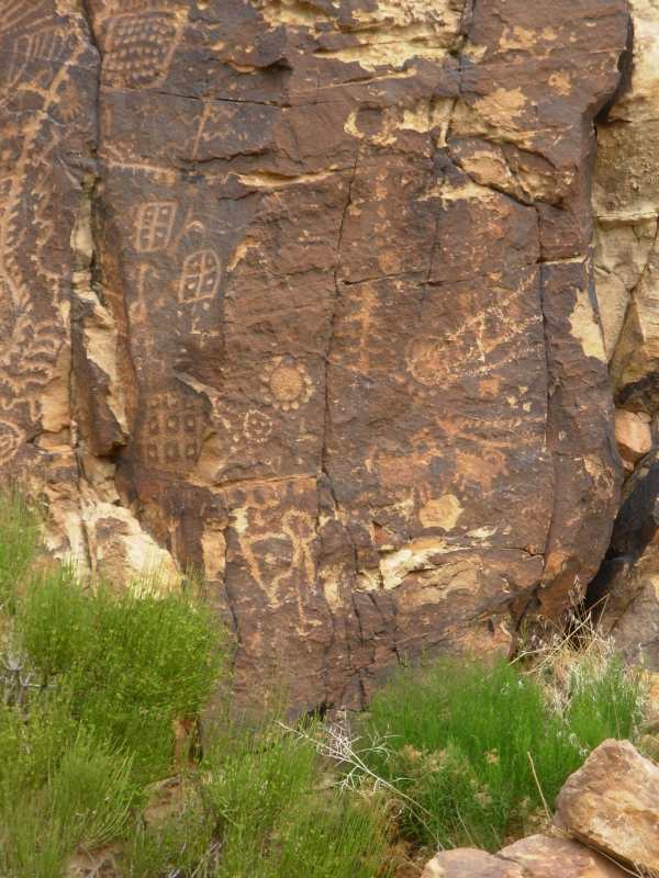
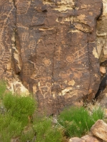
We woke to falling rain, snow and sleet. By the time we finished breakfast, the sun was out, but the mountains around Cedar City were dusted with a layer of fresh snow. We visited a used book store on Main Street, bought a half dozen more novels, then headed to Parowan Gap, a really good petroglyph site about 17 miles north of town. We had been there before, but we both wanted to see it again. We saw a book recently that claims that many of the petroglyphs there relate to astronomical calendars. There are a lot of suns carved on the rocks and counting signs, so he may be right. We left when a couple of vans full of college students from North Carolina showed up. It seems to be a regular stop on the college geology tour. We ran into a group of geology students there two years ago.
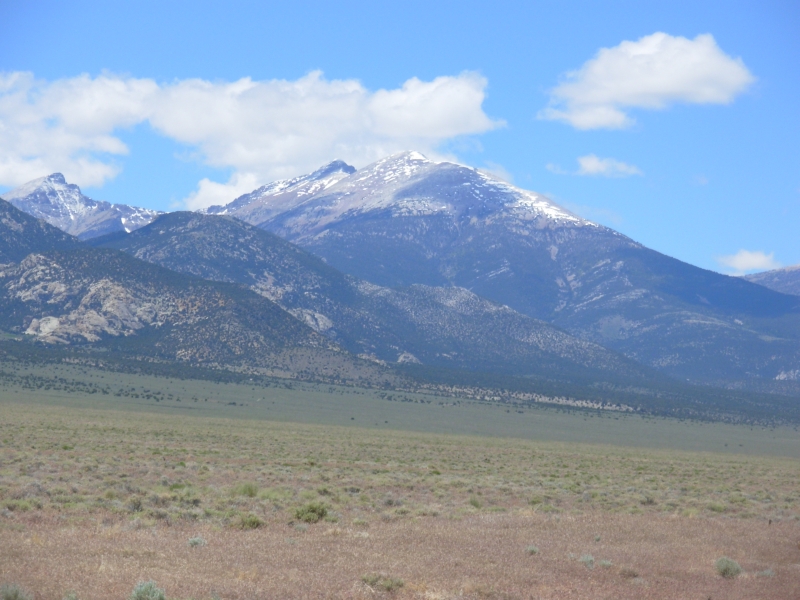
Then we headed northwest through the sage to Great Basin National Park in Nevada. It is a nice drive with few cars and little sign of human presence, just sage, rocky ridges, grass and cows. Route 50 through Nevada is billed as "the loneliest highway in America" - with good reason. It reminded me of Wyoming. We even saw some antelope.
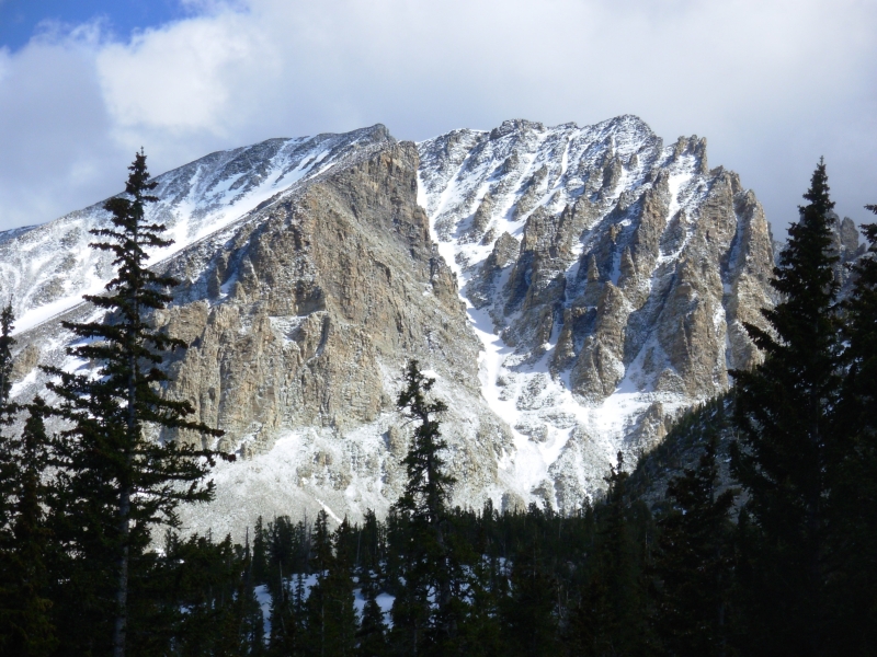
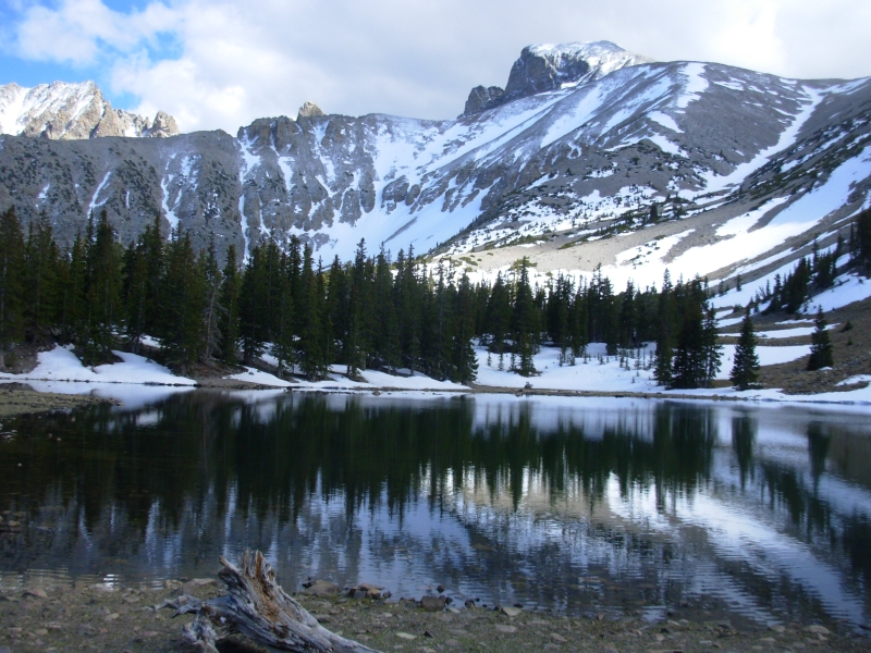
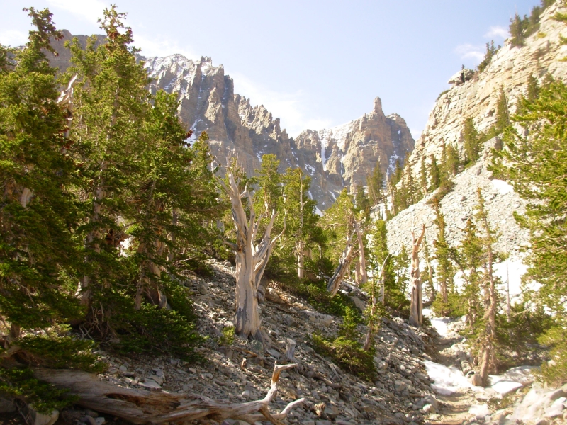
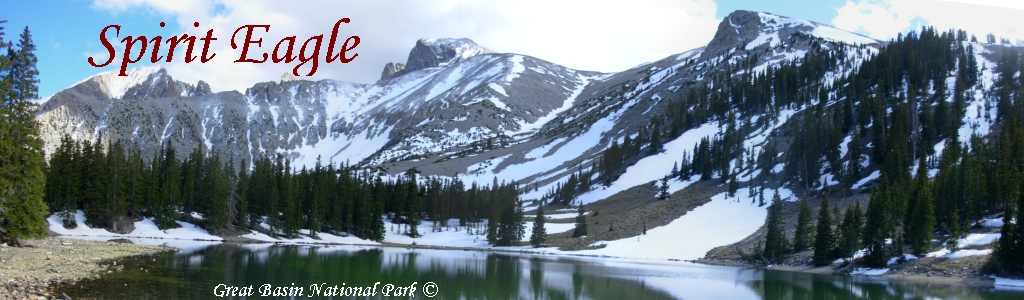
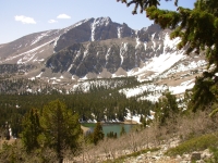
Great Basin was a surprise, in many ways. I hadnt realized how high it is. Our campground is at 7800, another (currently empty) one is at 10,000, Wheeler Peak is at 13,000 and most of the trails climb to or from at least 10,000. The ridge is still mostly snow covered and most of the trails are at least partly buried. We arrived mid-afternoon, watched the park video, found a campsite at one of the four campgrounds, then drove up the Scenic Drive to a trailhead at 9800. We did a beautiful loop hike past two alpine lakes with great views of the snowy peaks above. Snow blocked the trail at several points and occasionally it was difficult to figure out where it went, but we did the loop, plus a short nature trail. We were told the Bristlecone Trail and the Wheeler Peak Trail both require snowshoes. Today it was cold enough the snow was fairly solid so we only broke through knee deep a couple of times, but we were mostly in the trees which is cooler.
Our campsite is nice with a very isolated feel to it. A stream tumbles behind us and no one else is visible from our picnic table. However, it is really cold, somewhere in the 30s I think. Weve gotten spoiled over the last month. Two days ago we were sweating.
May 24 7 miles in Great Basin NP
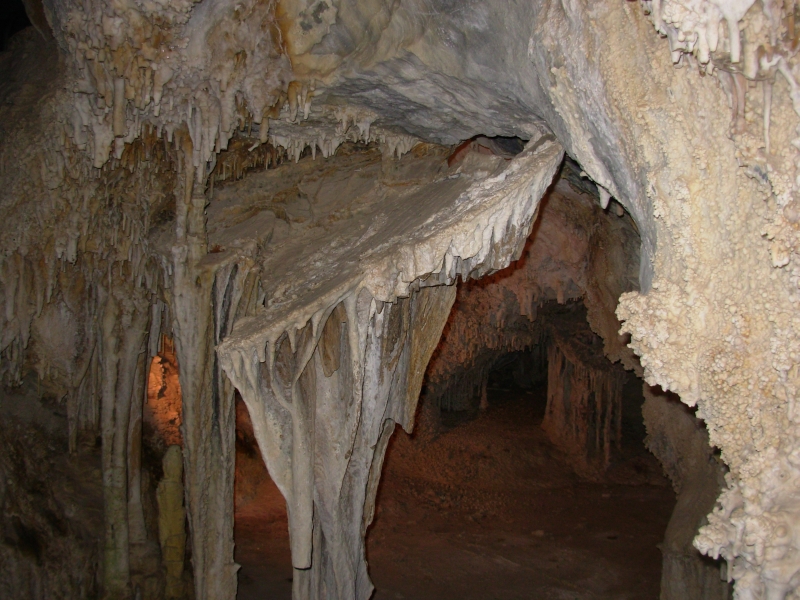
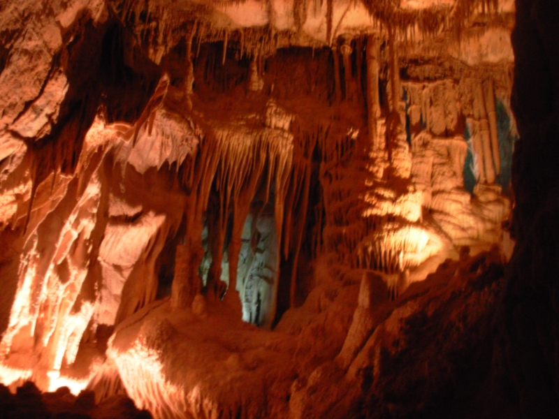
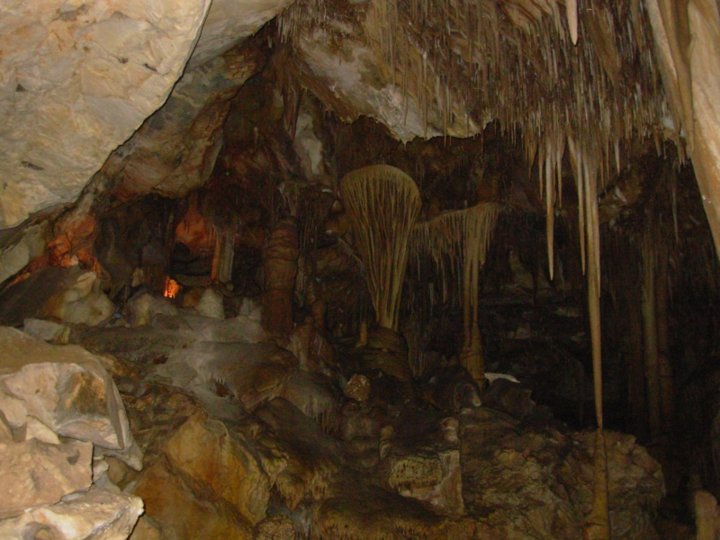
We had a good day touring the park. We started with a 90 minute tour of Lehman Cave. Its a really nice cave, fairly small but with some beautiful cave decorations: stalactites, stalagmites, soda straws, popcorn, draperies and helictites, plus two new (to me) formations: shields and turnips, which are like a soda straw, but very fat in the middle. There was a lot of damage to the cave in the early days - visitors were invited to break off a piece as a souvenir or write their names on the walls or ceiling. They used to hold dances in one room, so most of the overhead features were broken off so they wouldnt get in the way. Even so, it was a pretty cave, with some pink and orange coloring in places. The shields were really interesting. They look like sea creatures.
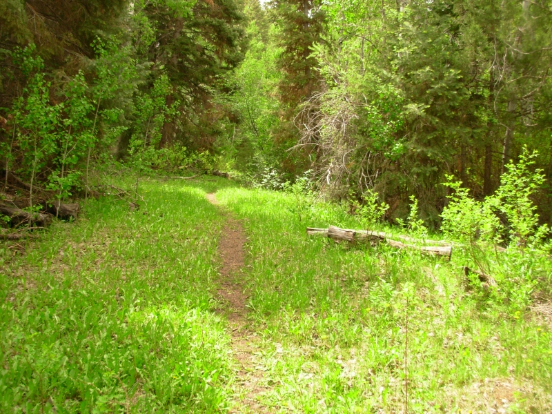
We ate an ice cream, then headed to Pole Creek for a short four mile hike. The trail follows a small creek up through sage to an upper basin with pines and aspen. Along the creek were green cottonwood trees. We were at 8000 so there was no snow, but lots and lots of wildflowers, from lupine and paintbrush in the sage to bluebells along the creek. It was lovely. Then we headed a couple of miles away to Baker Creek where we did a three mile loop along two branches of the creek. We walked mostly in trees going up, but there were open grassy meadows along South Baker on the return. We saw two deer and a lot more flowers. The only person we met was the ranger in charge of the trail. He was very nice and we spoke with him for a while. Both hikes today were good ones, though less spectacular than the hike yesterday in the high country. It was cool and cloudy all day, but the sun appeared from time to time for a few minutes.
We stopped at the pictograph site, but it was a disappointment. The drawings were very faint, just barely visible. I liked the caves behind them though. Great Basin has 43 known caves. One of them had a sign saying Permit needed beyond this point so they must be open to cavers at least sometimes.
May 25 6 ½ - 7 miles in Great Basin NP
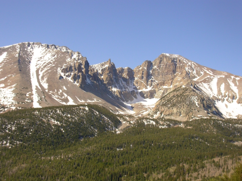
We attempted to climb Wheeler Peak this morning, but didnt manage to make it to the top. We started at 10,000 and climbed to 12,500, then turned around. The peak is at 13,000. There was a lot of snow at a saddle at about 11,000, making navigation difficult, then the way was fairly clear for about 1 ½ miles. We reached a ridge that had snow on one side, where the trail was, and loose rocks on the other. We started to climb, but Jim was feeling the altitude badly and didnt trust his balance or judgment on the loose rocks. I remember his bout with ataxia last summer and knew that this was bad country for feeling lightheaded and uncoordinated. I was just slow and out of breath so I didnt really mind skipping another 500 climb.
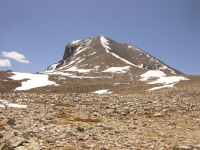
The views were terrific. It was a clear, sunny morning, though clouds moved in mid-afternoon. We only saw two people on the trail, as we neared the bottom. One hiker was ahead of us and probably made it to the peak, but we never saw him, just his tracks. We did see five deer -- four this morning and one after lunch. We also spotted an antelope down near Baker Creek and a squirrel posing on a milepost.
After we finished our hike, we got an ice cream at the Visitors Center, drove to town to check out the brand new Visitors Center (a waste of money, in my opinion) and visited a BLM archaeological site of sorts where they reburied everything, so, aside from the brochure, there wasnt much to see. A couple of years ago they built 6 walls to show where the buried walls were located, but it was an odd non-site.
Then we went to a gas station where we got a nice hot shower for $2.00 each, followed by a burger and a beer at the local café. He had quite a selection of microbrews at a reasonable price. This evening theres a campfire talk at the campground on bird songs which well attend, if I can stay awake long enough.

Despite my disappointment at not reaching the peak, I enjoyed todays hike. Between the altitude and the snow, it was slow hiking, but Wheeler Peak and the basin below it are really gorgeous, especially streaked with snow. Mt. Moriah Wilderness is not far away so there were views of more snowy peaks nearby. Beyond is desert interspersed with green irrigated farmland. I love the beauty of this island in the sky. It is a peaceful place. I think most people visit the cave, head up the scenic drive and then leave. Its nice for those of us who stay to explore a bit; we get the backcountry more or less to ourselves. Today we saw two people in four hours, yesterday only one and the day before none. And weve been doing short hikes, not even real backcountry exploring. In summer there are probably a lot of peak baggers, but the other trails are probably fairly empty. I like it. Id like to come back when snow is less of an issue. Id like to explore Mount Moriah as well. Ive heard good things about that wilderness area.
Home | Links| Trail Journals |
The Thruhiking Papers | Bun-bun
Created: 10 November 2007
Revised: 30 Sept 2016Copyright © 2007-2017 Spirit Eagle