|
 |
 |
 |
 |
|
|
|
|
|
|
May 26 4 1/2 miles motel in Richfield
Today is our eleventh wedding anniversary. It was a happy anniversary all in all.
We did a short hike this morning to the Bristlecone Pine Grove before heading back east to Utah. It was an interesting interpretive display. Some of the trees are 2000-3000 years old. That's incredible. The trail was very icy in spots, so we turned back at the grove. The trail climbs another mile to a glacier, but there was solid snow and ice and it wasn't marked past the grove. The Bristlecone Trail had pink flags marking the way though the snow, not that they were needed since the trail is mostly sidehill and there were footprints all the way through the drifts. Our hike the other day was more uncertain since people had skirted the drifts in the flat areas, leaving no footprints to follow and there was only one pink flag to mark the way.
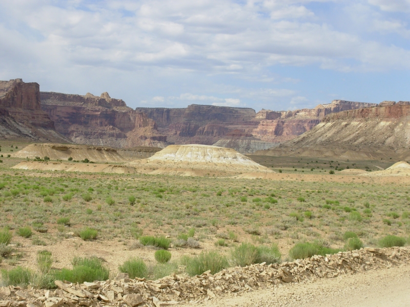
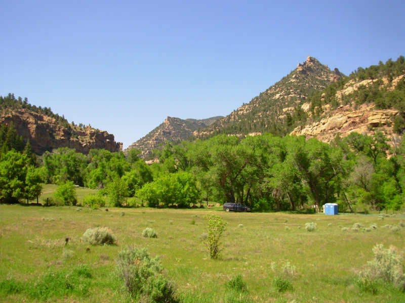
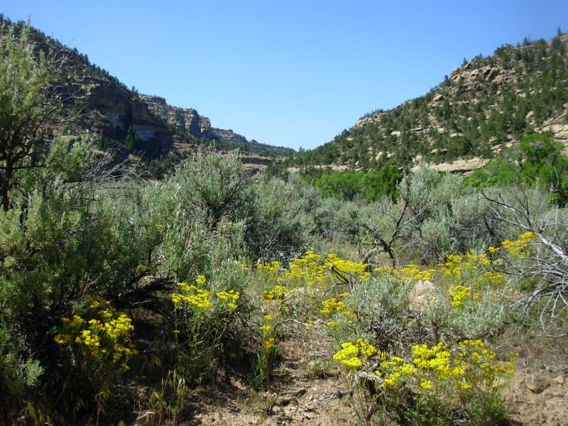
The drive east was a nice one across barren open desert. It was so dry there wasnt even sage, just brown grass. As we approached the mountains the difference was noticeable: it became more green with long grass, sage and trees - very pretty. The mountains still have snow as theyre about 10,000 high. We followed Highway 50 this time, called the loneliest road in America by Life magazine several years ago. I liked the emptiness, but then Im different.
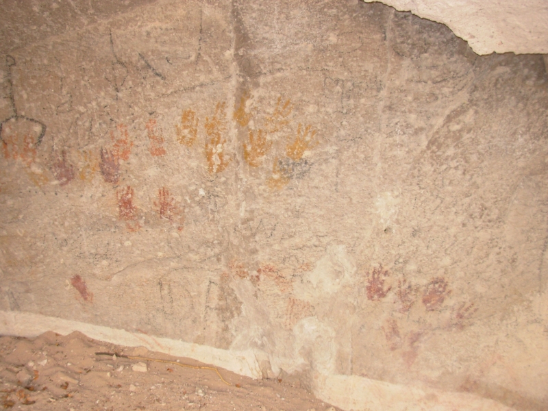
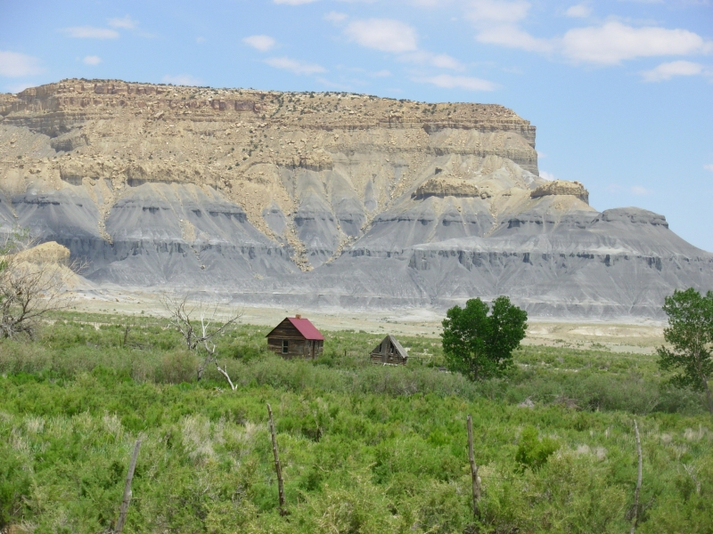
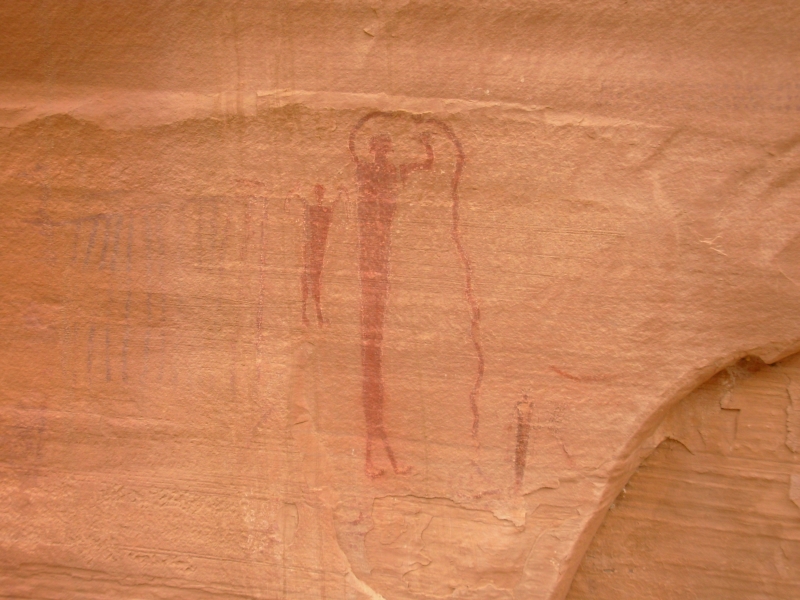
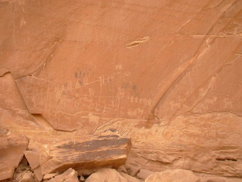
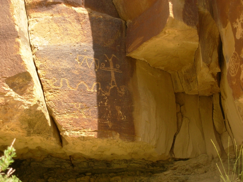
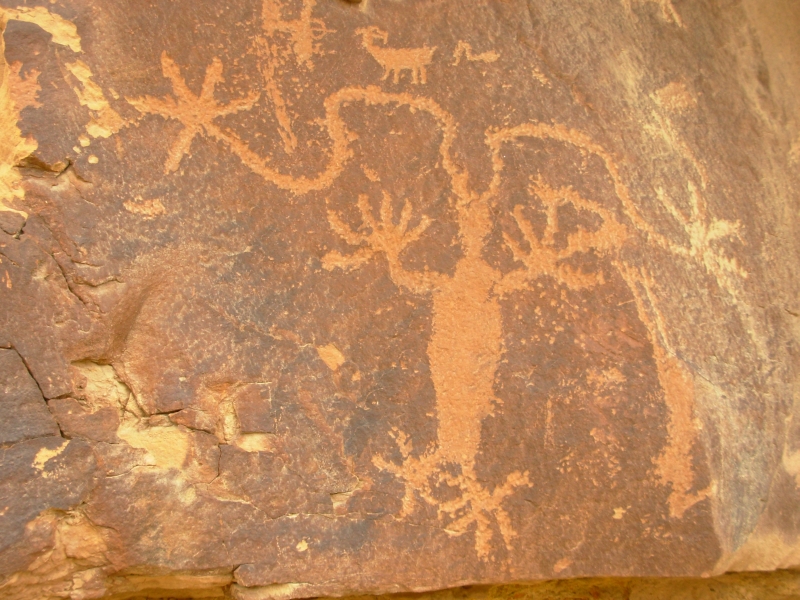
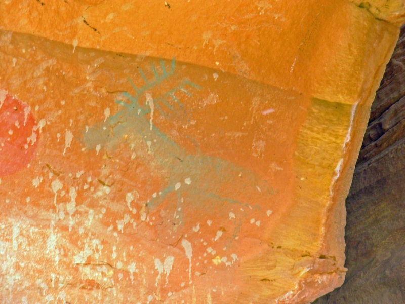
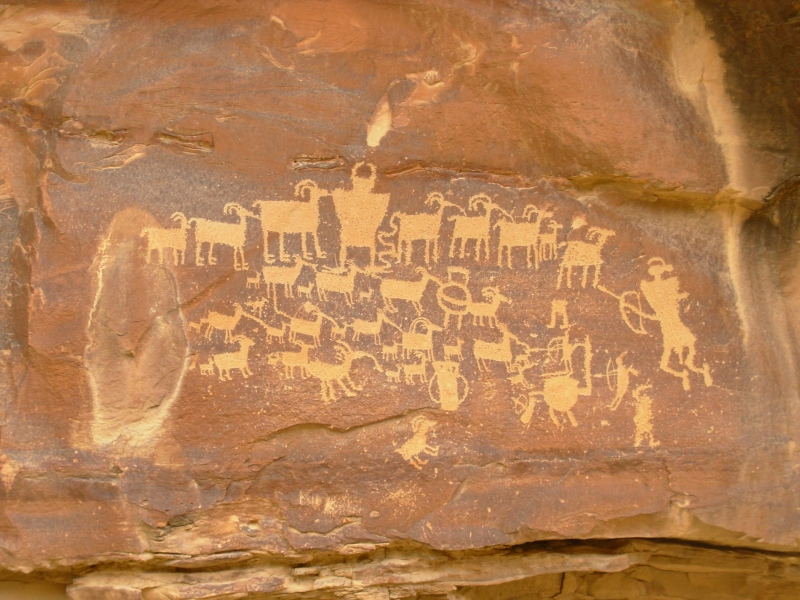
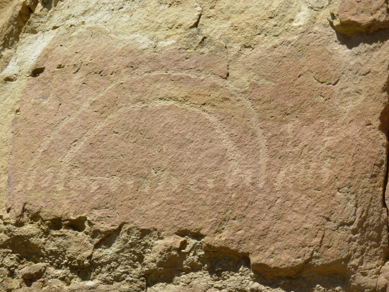
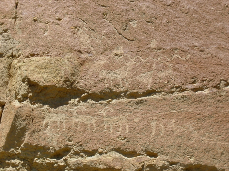
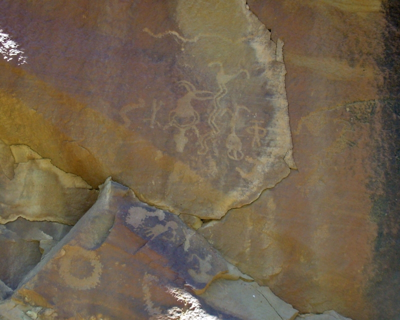
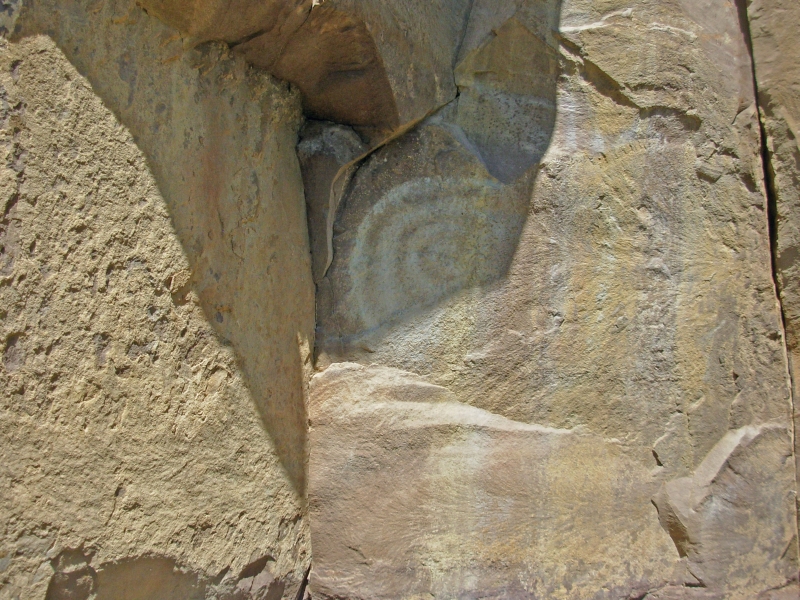
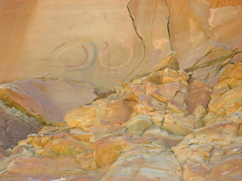
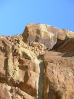
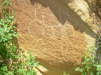
Mid-afternoon we reached Fremont State Park, which was an unexpected treat. Evidently when they built I-70, they destroyed a large Fremont village at Five Finger Mesa. To partially compensate for the destruction, the state of Utah built a park and museum, highlighting the former inhabitants of Clear Creek Valley. The museum had some nice pieces, but more interesting to me was the fact that there are hundreds of petroglyph and pictograph panels along the road. Park literature points out some of the more visible panels. Some were too high to photograph, but with binoculars we could at least see them. There were the usual Fremont figures and hunting scenes, plus figures with shields and a representation of the emergence story. We followed short trails to several of the rock art panels, including a badly defaced Cave of 100 Hands, another where the panel was under the lip of the cave and visible only by a mirror placed inside the cave, a red blanket design that was 4 by 10, another that was a pictoglyph, both carved and painted. We had fun wandering, though some of the panels were very hard to spot. It was late when we got there, so we didnt spend as much time as we needed to see everything, but it was surprising how many panels were located right along the park road.
We drove on to Richfield where we enjoyed a good anniversary dinner of prime rib and filet mignon. We shared a table with a local couple, former fish farmers, who were also celebrating a wedding anniversary. The restaurant was very busy and very slow, so they invited us to join them rather than wait 20 minutes or more for a table to open up. We were happy to accept their invitation and spend some time talking to them.
Sunday, May 27 1 mile - Camp on Cottonwood Wash Road
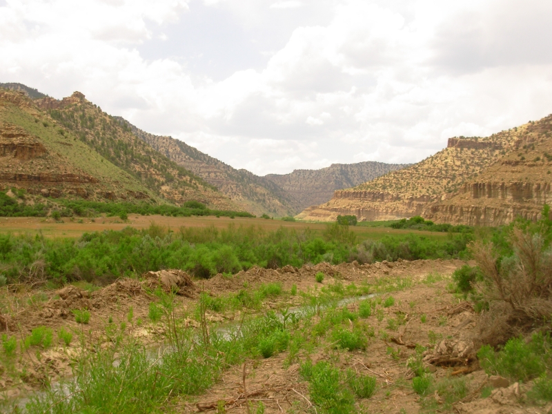
We got a slow start to the day, starting with a breakfast buffet, then laundry, followed by the grocery store and lunch. Finally we headed east on I-70 through some gorgeous country. There were snow-covered mountains, colorful rock layers, creeks with green pastures, grazing horses and cows. It was a lovely drive.
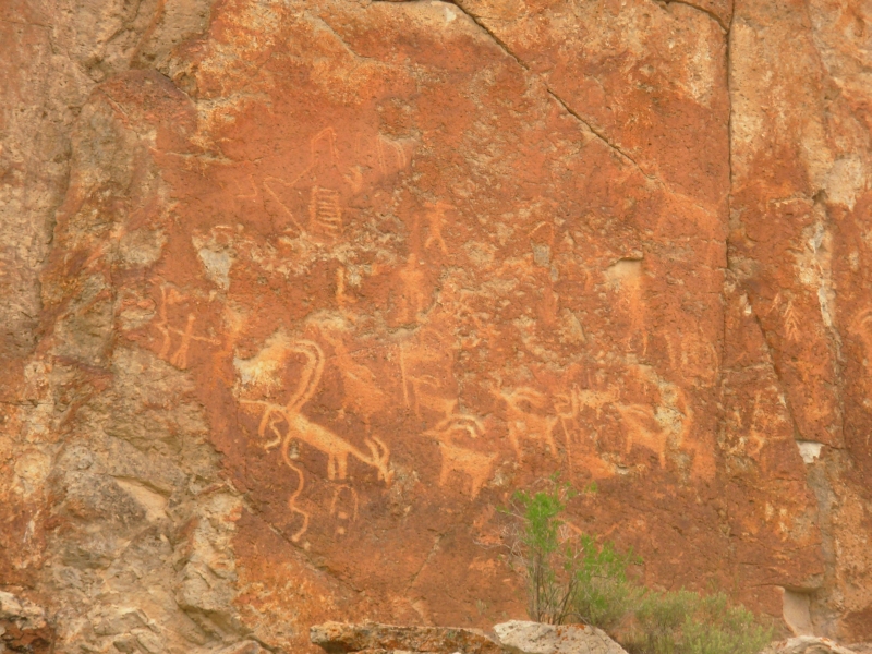
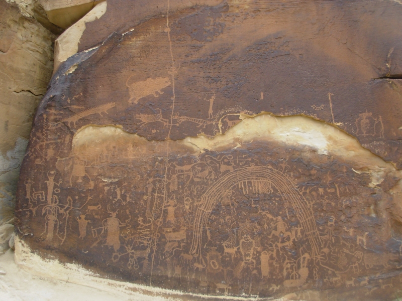
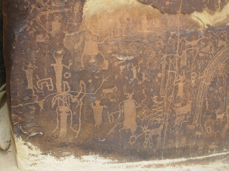
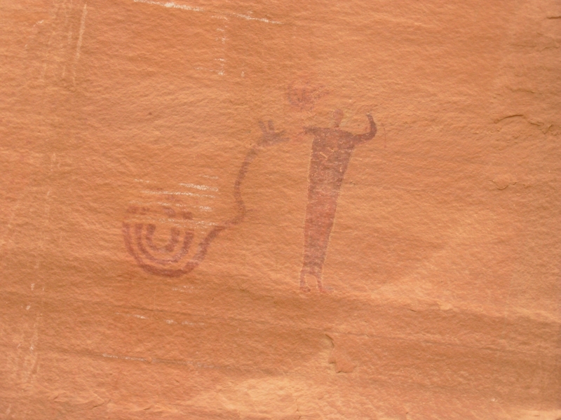
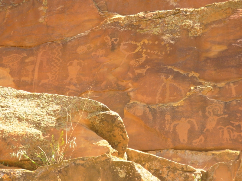
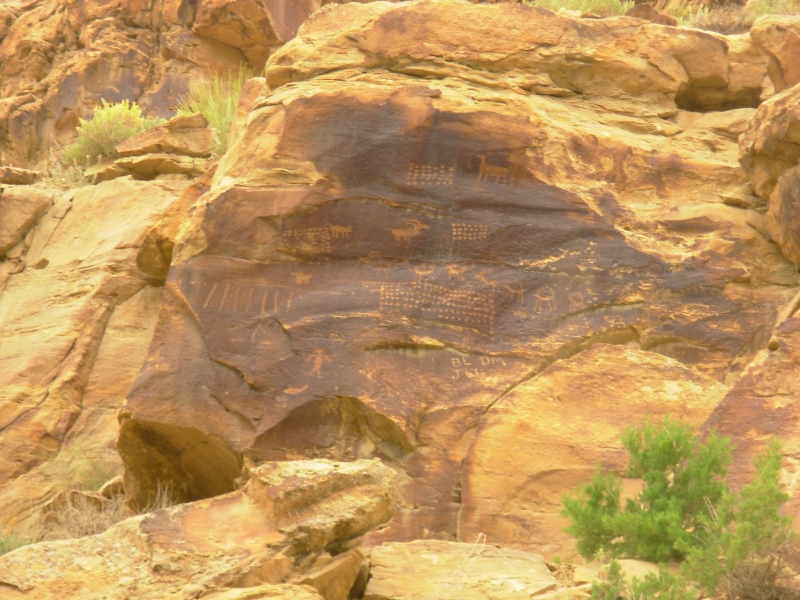
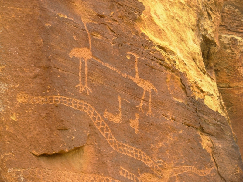
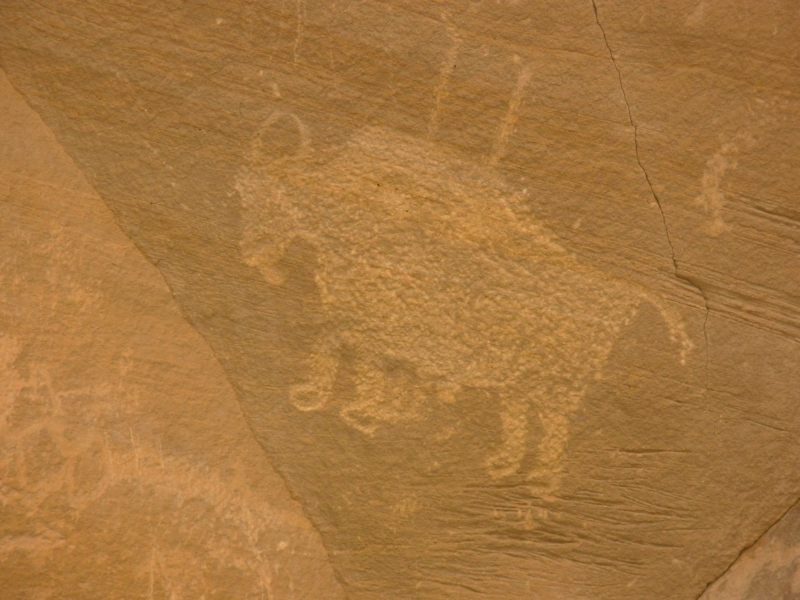
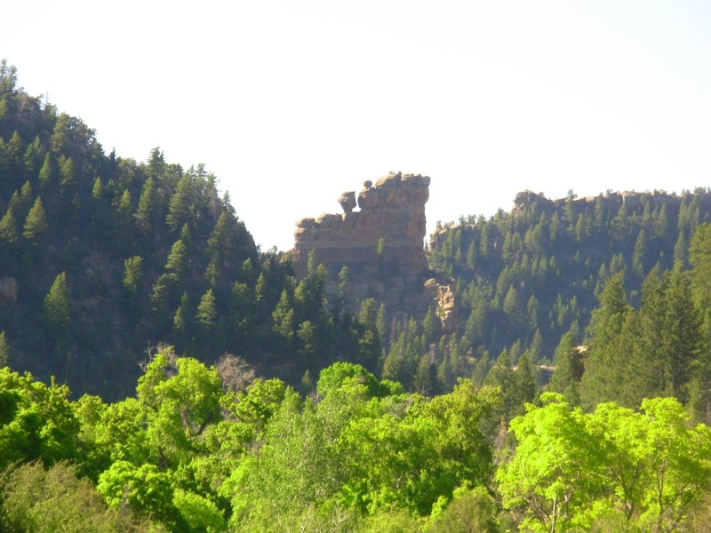
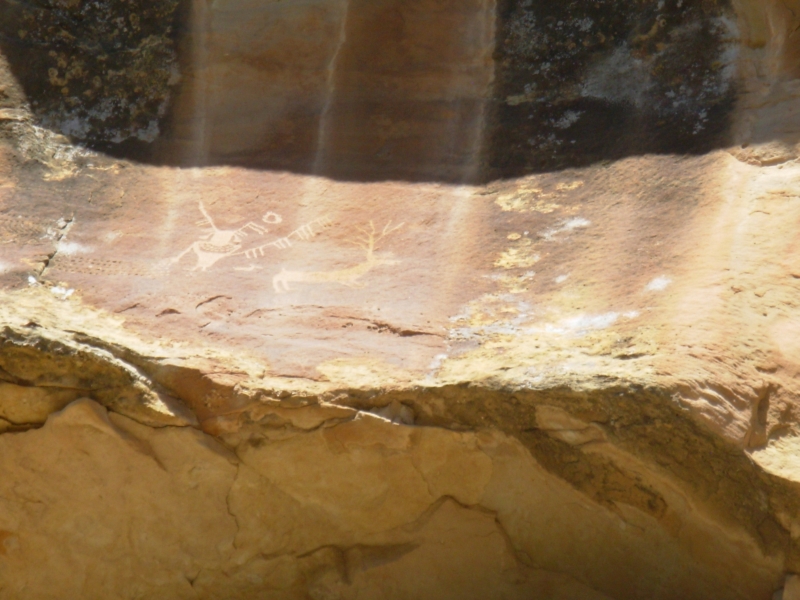
After about 100 miles we headed north up Miller Canyon and enjoyed sandstone bluffs that were black/gray topped with a reddish brown layer of rock. Very dramatic. Our goal was a really good petroglyph panel known as the Rochester Panel, a large rainbow with a lot of Barrier and Fremont figures otherworldly anthromorphs, birds (an owl?), dogs and angry wolves, bears, etc. It was a really cool panel on a rocky ridge about ½ mile from the parking area.
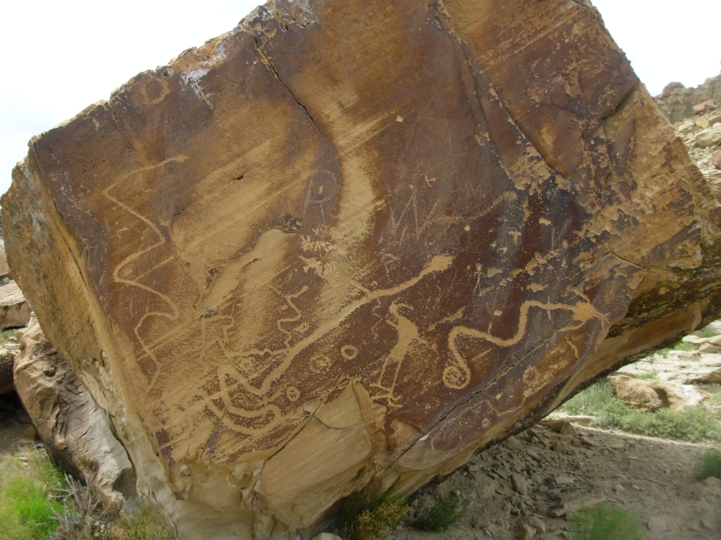
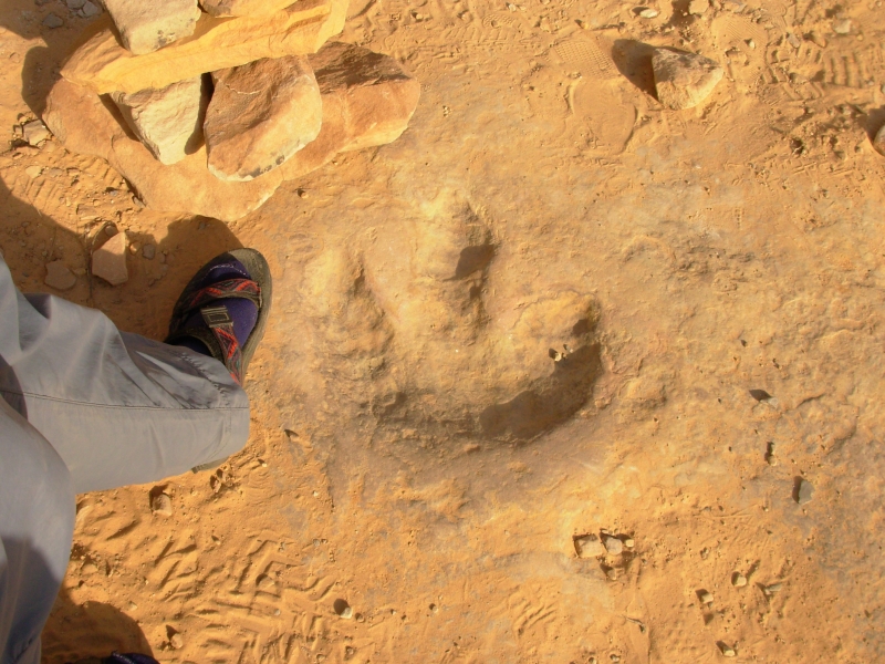
Then we headed to the Moore Cut-off Road, where we found a couple of panels: a ten foot long snake on one and three snakes and a human figure on another. There were dinosaur tracks on a nearby rock but they werent very obvious, just lumps in the sandstone. Ill have to take their word for it that a dinosaur made the marks. The drive was pretty, past some red cliffs and through flower-covered desert. A lot is blooming right now. I love spring in the desert.
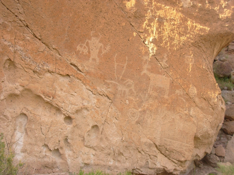
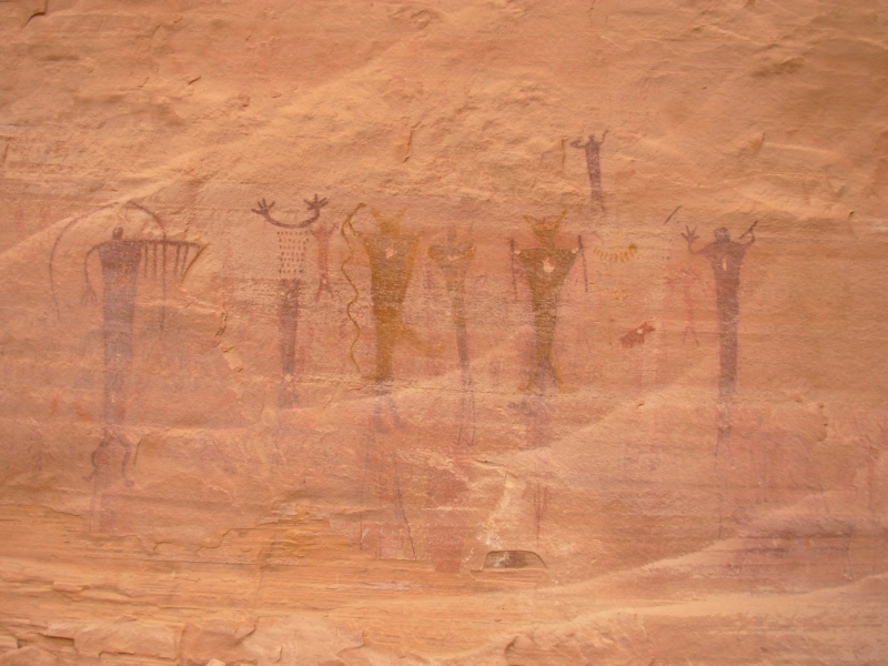
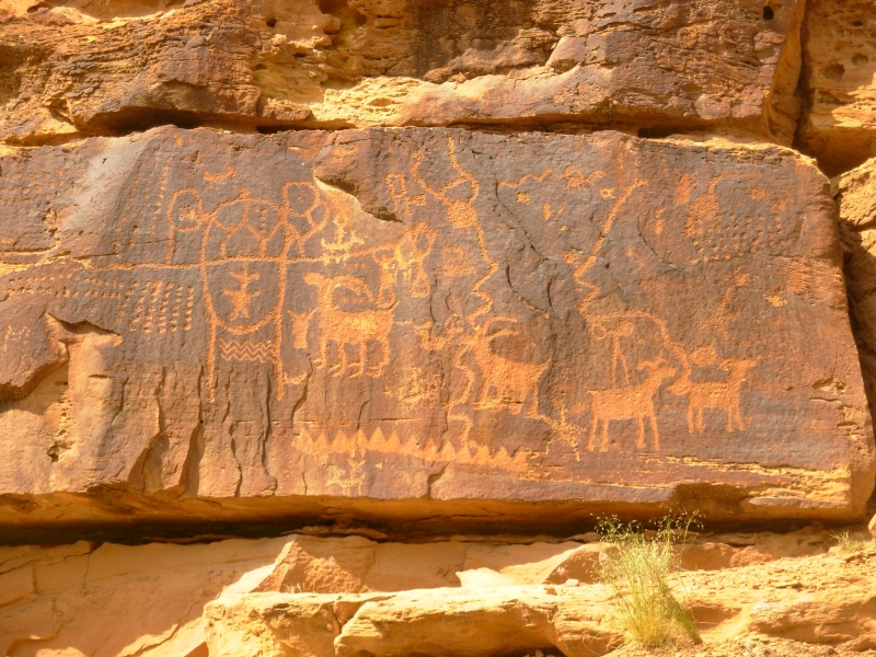
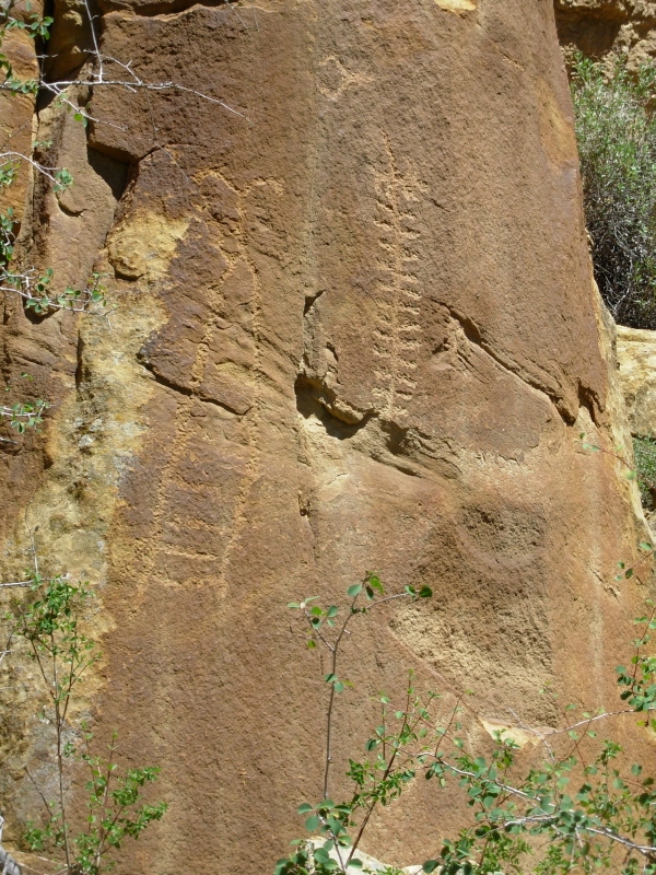
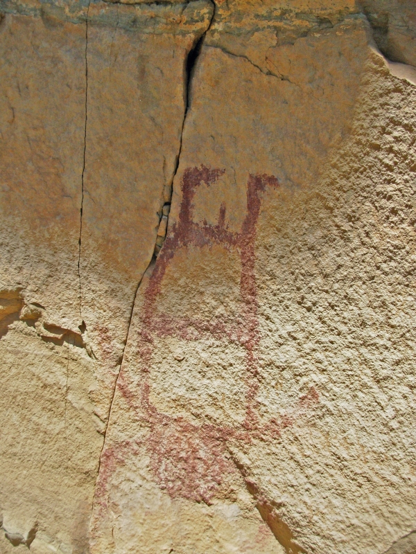
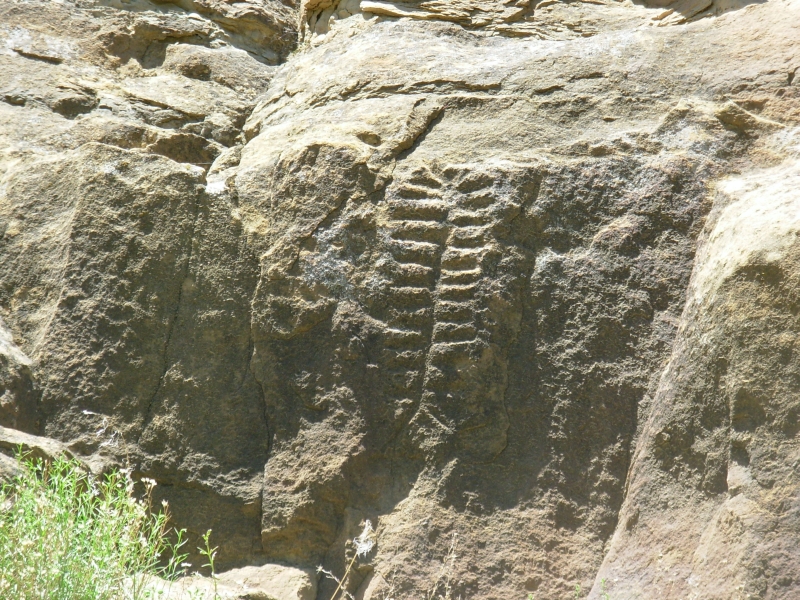
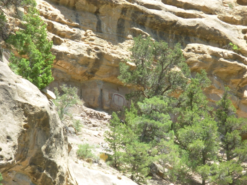
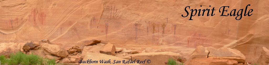
A short drive on I-70 led us north up another dirt road to Cottonwood and Buckhorn Washes. The land soon became quite dramatic, with tall colorful cliffs red, purple and brown. It was rather like driving through the Grand Canyon. Buckhorn has some famous Barrier-style pictographs that are between 1500-3000 years old. The drive itself is spectacular enough to justify the detour; the pictographs are a bonus. The main panel is a good one, about 100 long with many red and yellow painted figures, a lot like those in Horseshoe Canyon. Several of the figures held snakes, some appeared to have wings, though they could have been turkey feather capes.
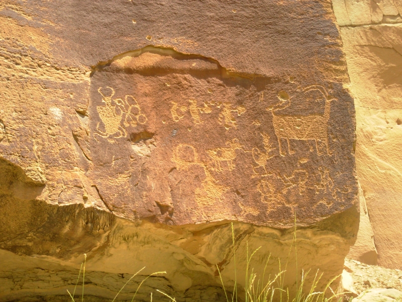
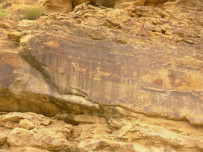
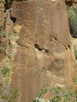
A couple miles farther up the canyon was another petroglyph panel mostly bighorns. Another short drive brought us to an interesting anthromorph (human-like figure, but probably a shaman or mystical figure, not a real person). Unfortunately there was graffiti all around it, some dating from 1886. One idiot shot his initials in the cliff next to the pictures. There was an upside down figure next to it maybe symbolizing a dead person? A little later we found, per the directions, a really clear dinosaur track. It was a big critter.
We picked up a brochure a couple of weeks ago in Green River that describes various scenic drives through the San Rafael Swell, including a few to some of the famous rock art sites. It was very handy today. This is incredibly awesome country.
Monday, May 28 Nine Mile Canyon - 1 mile hike Motel in Price, Utah
We spent a peaceful night parked in the desert on the Buckhorn Cottonwood Road. This morning we drove north to the Visitors Center at the Dinosaur Museum in Price. The first thing I spotted as we entered was a computer with a sign, Range Creek Permits. A couple of weeks ago I saw an ad on PBS about a program they were planning to show entitled, Secrets of the Lost Canyon. The advertisement was intriguing, so I got curious and looked it up on the internet and learned enough about Range Creek to get really interested. Evidently a rancher named Waldo Wilcox had a ranch in a very secluded canyon in the Book Cliffs area in Utah. His family spent 50 years ranching there and protecting a canyon that contains hundreds of pristine Indian archaeological sites. A few years ago, when Mr. Wilcox turned 70, he decided to sell his land to the State of Utah. The Wildlife Department is responsible for controlling access to the land. Archaeologists have had a field day, but it is now also open to hikers and hunters, in limited numbers and with restrictions. Access is limited to day use, foot travel only, and only with a permit. I was excited when I learned that we could go there, even though I understand that we may not actually see much. This is not a developed site. There are no maps or tourist displays, and ruins and granaries can be very hard to spot. But I love the idea of visiting an ancient Fremont site that has not been damaged by vandals or picked over by generations of visitors. The problem was getting the permit. I learned that you can do it online, but you need to print it out and weve had no access to a printer since I learned about Range Creek. I figured wed wait until we found a library with a printer. But here we were in Price and there was the computer just waiting to print out our permits. Of course, it wasnt as simple as it should have been and we ended up with one extra permit because of a glitch and the printer gave us problems so it took a long time, but eventually we had permits to visit Range Creek for two days.
Then we got back to our original reason for stopping at the Visitors Center: we were looking for information on Nine Mile Canyon, our destination today. The brochure they provided was very limited. Fortunately, a couple of weeks ago I wrote down some information I found on-line that included a detailed mileage log and the Kelsey hiking guide weve been using occasionally had a map, so we were in good shape.
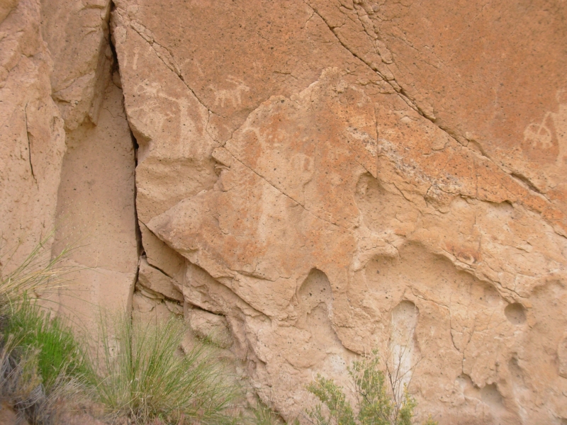
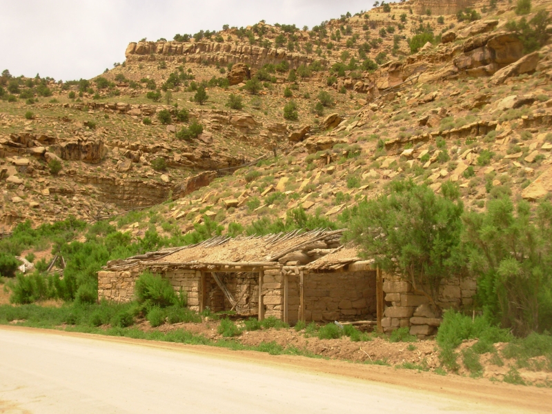
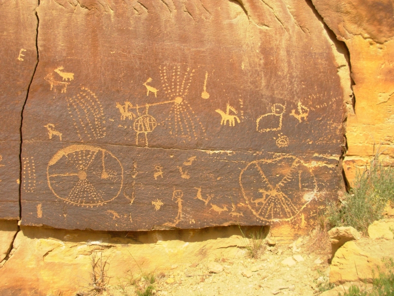
Nine Mile Canyon is actually much longer than nine miles. We drove 50 miles up the canyon, then turned around before reaching the river. It was an all-day excursion and well worth the time. We also visited Cottonwood Canyon and Dry Canyon, which had more good art panels. Nine Mile Canyon is a pretty canyon with a good flowing creek, tall brown cliffs in sedimentary layers, several ranches and old decrepit ranch buildings, as well as several gas wells and a gas refinery. That was a surprise, though the woman at the Visitors Center warned us about watching out for heavy truck traffic. We ran into both commercial traffic and a lot of tourists. All the dust raised by both is likely to destroy the petroglyphs in a few years, which really is a shame. The rock art draws a lot of visitors, especially on a holiday.
We had a lot of fun visiting the canyon. The first site was 26 miles up the road, but after that we stopped about every two miles to look at more panels. There were some really good panels and some really good images. As usual, we saw a lot of bighorns and snakes, but there were many others as well, including some that are utterly incomprehensible like the mouse on skis, octopus man etc. Some were very old, some more modern. There were people on horseback thats post 1600.
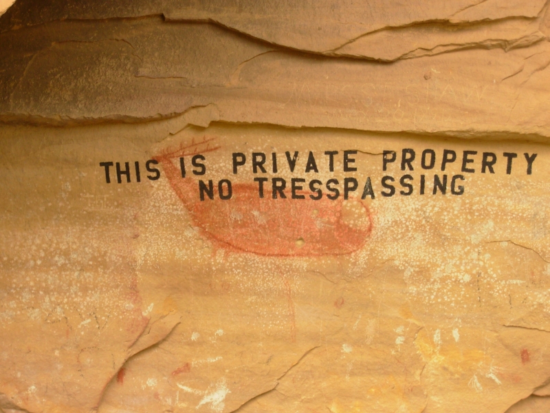
Then there was the historic graffiti. Nine Mile Canyon was a freight route to Fort Duquesne in the 1880s. All the freighters put their names and dates on the walls somewhere up the canyon. Then there was the more modern vandalism names and drawings on top of or next to ancient petroglyphs. That really makes me angry. Worst was at one of the two pictograph sites, a cave, where the landowner painted over a red deer, No Trespassing in bold black paint. Does the fact that he owns the land give him the right to destroy a work of prehistoric art? Evidently it does.
Most of the panels were in pretty good shape. Some were easily visible, right next to the road. Some were 100 above the ground and required good binoculars to find them. Where we could, we climbed up to see the petroglyphs better. We found more panels than were listed in my online guide, just by keeping a sharp eye out for any unusual marks. There were a lot of places that looked like images that turned out to just be scratches, but I feel good about the many panels we did see. One unexpected treat wasnt in the book or on the map: at Daddy Canyon theyve built a half mile trail to several good panels. Both the map and book showed something there, but the extent of the art was impressive and unexpected.
We also stopped to look at a village site basically just a circle of rocks. We had no luck finding a couple of hidden granaries. They blend in so well, and are often so small, they can be really hard to find from 100 below.
Wildlife today was mostly rodents: lots of prairie dogs, squirrels, chipmunks and rabbits, plus one pretty snake. Yesterday we spotted three more antelope in the desert. It was cloudy much of the day and sprinkled on us at the end, but was still a great day for touring.
May 29 Rest Day. Camp at Range Creek
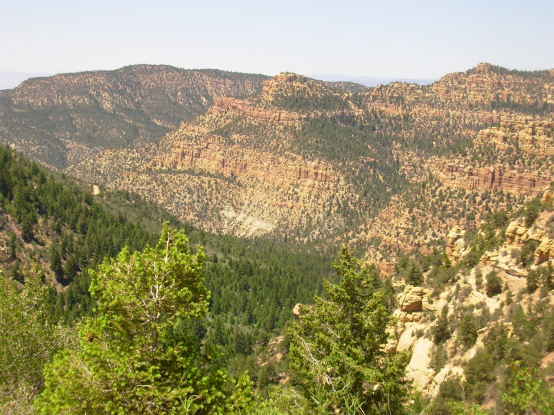
We were concerned about the drive to Range Creek, so decided to take today as mostly a rest day, with a late breakfast and a little grocery shopping, before heading out to Range Creek. Its only about 40 miles from Price, where we stayed last night, but we were warned that the road is very rough and they recommend four wheel drive and high clearance vehicles, neither of which we have. Its not that far though, so we figured that, if necessary, we would park the truck along the road and walk the rest of the way. As it turned out, it was a big climb on a fairly rough road (2800 up and 1600 down) - and few places to park if we'd had trouble. But it was doable with careful driving. The road had been graded fairly recently, so there were only a few boulders we needed to avoid and no serious washouts. Going out will be rougher since the descent is long and steep. It would be easy to burn the brakes.
The canyons were beautiful. Up Horse Canyon, the colors were brilliant. We climbed up to 8600 so the vegetation changed completely, with spruce and fir dominating the high country. Down the other side there are still a lot of conifers and big green cottonwoods along the creek. Its a beautiful place.
We met a Wildlife Conservation Officer, Mike, on the way down. Hes one of three that patrol Range Creek WMA. We all stopped and had a long talk. Mike was very helpful and had a lot of good information on the ranch and the people. There are only a few people living and working in the canyon right now. Summer session starts next week for the archaeology students, so only one or two archaeologists are there now, including a full time caretaker from the University. Mike said well see another ranger tomorrow, but were not likely to run into anyone else. On Saturday the neighboring ranchers will be herding their cows over the mountain via the same road we drove in, then theyll head up another jeep track to high country summer pasture above the creek. Im glad well be gone by then. Im especially glad we drove the road before the cows, and not after. It will really be dusty.
Mike also told us about the wildlife we might see in the canyon, including bears. Its a very pretty peaceful place. There is a big meadow outside the gate to the property with a large camping area and outhouse. No camping is allowed inside Range Creek (except for the archaeology students, presumably.) The road up the canyon is about 12 miles long from the gate to the ranch house. Since we can only dayhike, well only be able to explore the first five or six miles. We could walk farther, but the idea is to explore the archaeological sites, not just get exercise.
Wednesday, May 30 13 miles in Range Creek
We were joined late yesterday by a young couple from Denver. They were just getting up when we left this morning, but we chatted with them a bit last night. Nice people.
We headed up the road around 9:00 and had a rather frustrating morning. The ruins and rock art in Range Creek are not obvious. Although it has been open to the public for a couple of years, it still isnt easy to find anything. We were told to look for places with trails through the grass or that looked like parking spots. Some trails lead a mile or more into side canyons but the rock art is in the first ¼ mile or so, so we spent a lot of time following cow trails but missed most of the petroglyphs. Mike told us yesterday where to find some of the sites, but we still had a hard time seeing anything. We knew there were four granaries on Locomotive Rock, but never saw a single one.

About three miles in we finally found our first petroglyphs up a side canyon. When we went back out to the road we met another Wildlife Conservation Officer, Allen Green, who offered to show us more. First we went back into the canyon we had just left to look at some petroglyphs we had missed, then we visited three other sites, including the Fat Man (who looked like the all American Man we saw in Needles, except he was white instead of red, white and blue). Then there was the Fallen Man a large red upside down pictograph. After a couple of hours, Allen left to look for the Colorado couple so he could help them find some of the sites. He had shown us a few granaries along the road. They are really hard to spot since they tend to be very high and they blend into the rock around them. The people who built them wanted to be very sure that their corn was safe. In the video on Range Creek that I saw, archaeologists had to use technical climbing equipment to reach some of the granaries. They rapelled down from the top rather than climbing up from below. So how did the Fremont do it? After he left, we ate a late lunch then walked to the next canyon where we found one more pictograph. At that point, it was after 3:00 so we turned around. On the return walk we looked, in vain, for the Locomotive Rock pictographs, but we did find a site we missed this morning that had some building remains and a few very simple pictographs.
For the most part the pictures here have been very simple. There were some good petroglyphs bighorns, ladders, corn and people but much of it has been the simple common stuff like spirals, circles and stick figures. There are usually trails to the side sites, the problem is figuring out which trails are deer trails and which actually lead to something interesting. We did a lot of rough bushwhacking through sage, prickly pear and piñon. I saw one elk in a side canyon, but that was all. There were lots of tracks in the dust: a couple of bears, deer, elk and turkey. The ranger said there are also wild bison in the canyon that wandered over from the Ute Reservation.
Bottom line on the canyon: its beautiful hiking, but unless youre with someone knowledgeable, chances are youll walk past most of the rock art and granaries. The pit houses are really obscure, just a circle of rocks or a square, with no walls left and nothing obviously marking a dwelling. Until we met the ranger, we were getting really frustrated, knowing we were walking past all sorts of rock art that we just couldnt see. Tomorrow is likely to be more of the same but well try anyway.
May 31 5 miles in Range Creek
Rather than re-hike the six miles we covered yesterday and then continuing another two or three beyond, with no clue as to what we should look for in those two or three miles, we decided to focus on Locomotive Rock and the granaries and rock art we missed yesterday. The couple from Colorado had climbed up Locomotive Rock, so we decided to do likewise. Sure enough, that was the best way to see the sights (and sites) on top. We climbed 450 up to the ridge; no wonder we couldnt see anything from below! There was a steep path up past four or more pit houses. On top we saw a good granary, the remnants of one (old sticks in the wrong place), and a good petroglyph panel with a figure holding a feathered staff and a deer in an absolutely inaccessible location. How did he carve that? Nearby were some carved snakes. Around the corner, under the broken granary, were two tri-colored circles.
At the bottom of the hill we met Allen, who pointed out two more granaries on the opposite wall and a white shield that we couldnt find on our own even though we were looking in the right area. It was high, next to a big alcove with a lot of white streaking on the walls, and we were focused on the alcove and missed the shield next to it. Earlier we found another pictograph we missed yesterday though again we were looking in the right place. You had to climb up a rocky nose; above it were the remains of a granary and two very faint human figures.
We spoke to Allen for a long time. He had brought pictures of a broken flute he found stuck into a rock while hiking high up a side canyon. Its the only known Fremont flute. It was very cool.
Finally we returned to the campsite for lunch and our final rock art site: two figures (male and female?) one was round and one had three legs, aka Tripod Man. We had looked for it before but they were hiding behind a bush so we missed them. Today we had better luck.
I enjoyed Range Creek and regret only that we werent able to see the south half. The property is 13 miles long; too far to go out and back in one day, not if you want to see any of the sites along the way. The rangers gave us information only on the first 6 miles and even then, without Allens help we would have missed most of the sites. The granaries especially are hard to spot. I almost think the best way to see Range Creek is with a tour -- there are a few commercial companies that are allowed in except that there probably wouldnt be time to climb Locomotive Rock or explore the side canyons. I wonder if they are allowed to drive instead of walk? But then you dont get the character of the canyon, the wild beauty that is there. We were lucky that there were so few of us in the canyon so Allen was able to spend time showing and explaining. The couple from Colorado left early because their dog was really stiff from yesterdays long walk and two couples who were supposed to be there (they had reservations) never arrived. Perhaps they were scared off by the road? It wasnt that bad, really. Weve done much worse. We benefited by their absence.
Home | Links| Trail Journals |
The Thruhiking Papers | Bun-bun
Created: 10 November 2007
Revised: 30 Sept 2016Copyright 2007 - 2017 Spirit Eagle