|
 |
 |
 |
 |
|
|
|
|
|
|
June 1: 1 mile Camp at Steinaker State Park near Vernal
We stopped to visit the museum in Price that we didnt have time to see last week, so didnt get out of town until early afternoon. Its a nice small museum half dinosaur exhibits and half Fremont artifacts and information. Evidently Eastern Utah was home to a lot of different dinosaur species. Theyve found bones in quarries and coal mines of Utahraptors, Alasaurs, etc. Ive never heard of most of them, but I was never into dinosaurs as a kid.
They had a more modern mammoth skeleton too. The Fremont artifacts were good, especially several very detailed clay figurines dressed like some of the more ornate rock art figures and with painted faces. There were clothes, weapons, baskets and pottery too. Someone had quite a collection of arrowheads in all sizes, including a huge Clovis point. There was another big museum in Vernal, but we passed it up. One museum a day is enough. It was a nice drive from Price to Vernal, through a variety of rock strata. Part of the drive was really picturesque, part was just barren.
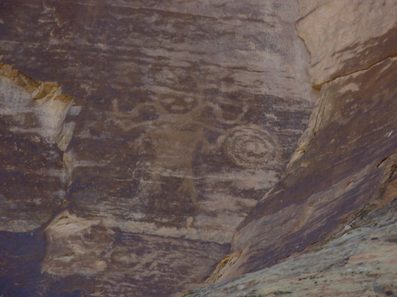
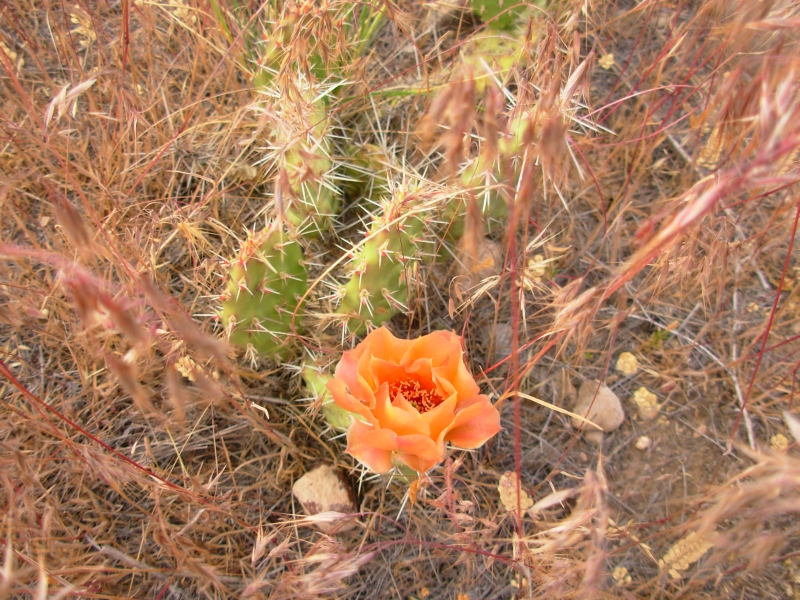
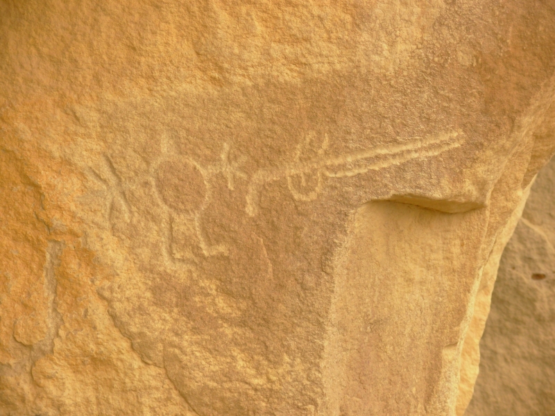
We detoured near Myton to look for more petroglyphs. There were several panels in a big pile of boulders, spread out so we had to wander for a while to find them. It was fun. Some had been vandalized with green spray paint and bullets but most of the panels were in good shape. The shield people were a bit different, not nearly as ornate as the "Vernal style" images.
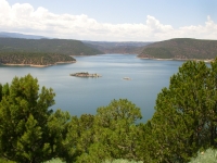
Tomorrow will be another rock art day it should be a good one. We ended up camped by a reservoir in a state park about seven miles from Vernal so we can go wandering early tomorrow. Its a noisy campground, between motorboats and children, but it should settle down around dark. I hope. We were lucky to get an empty spot on a Friday night; there were only a couple left.
June 2 - 2 ½ mile Camp at Dinosaur National Monument
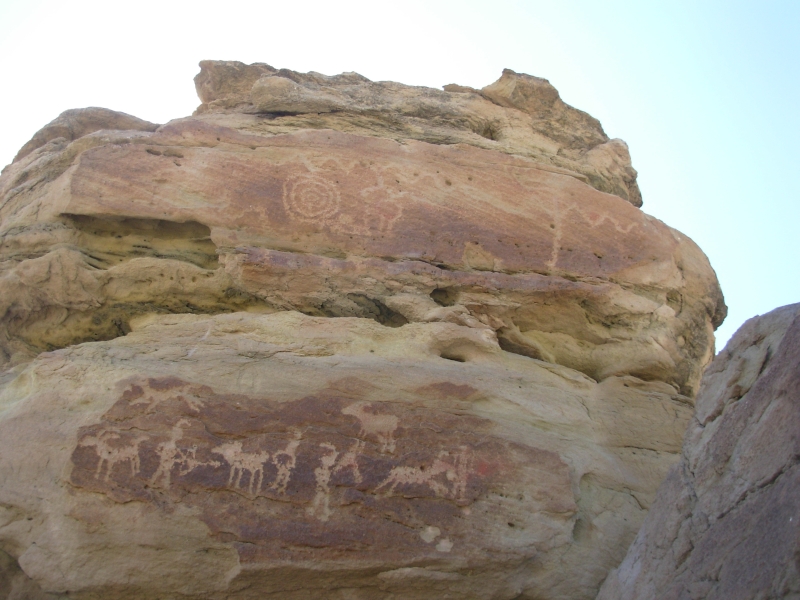
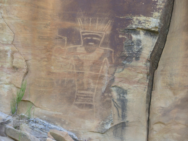
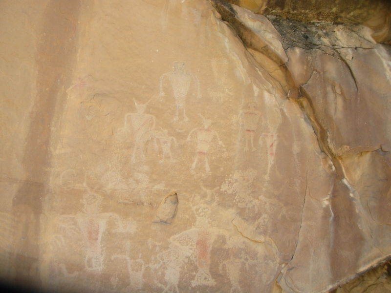
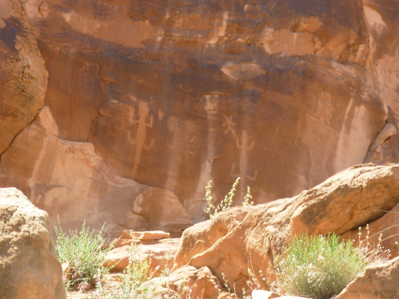
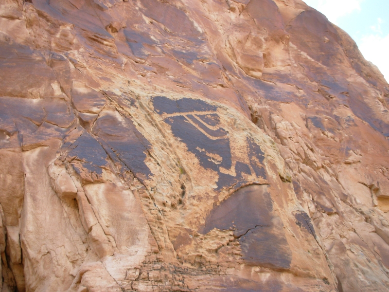
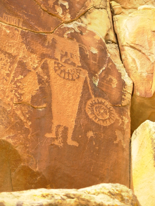
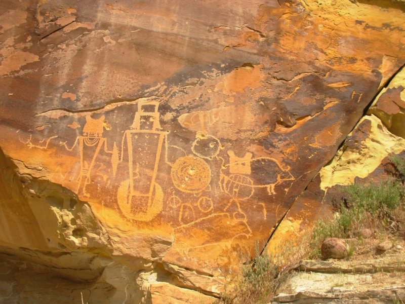
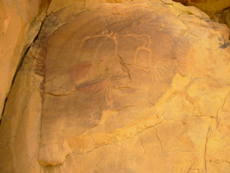
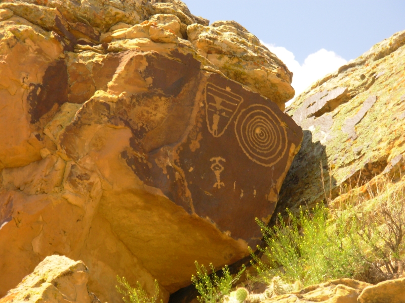
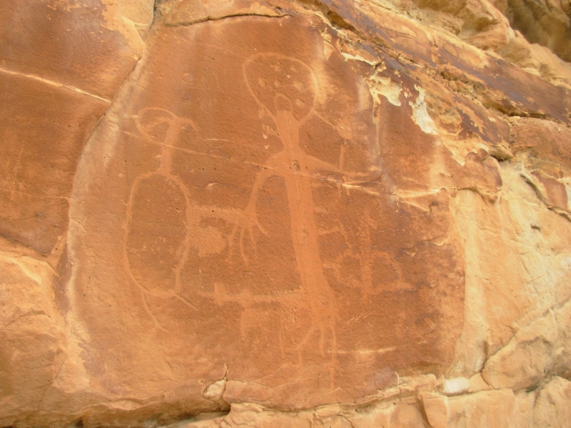
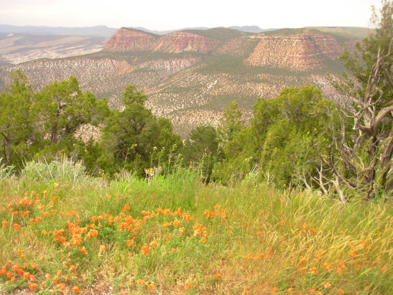
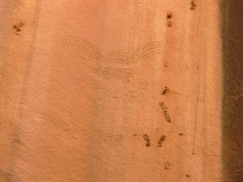
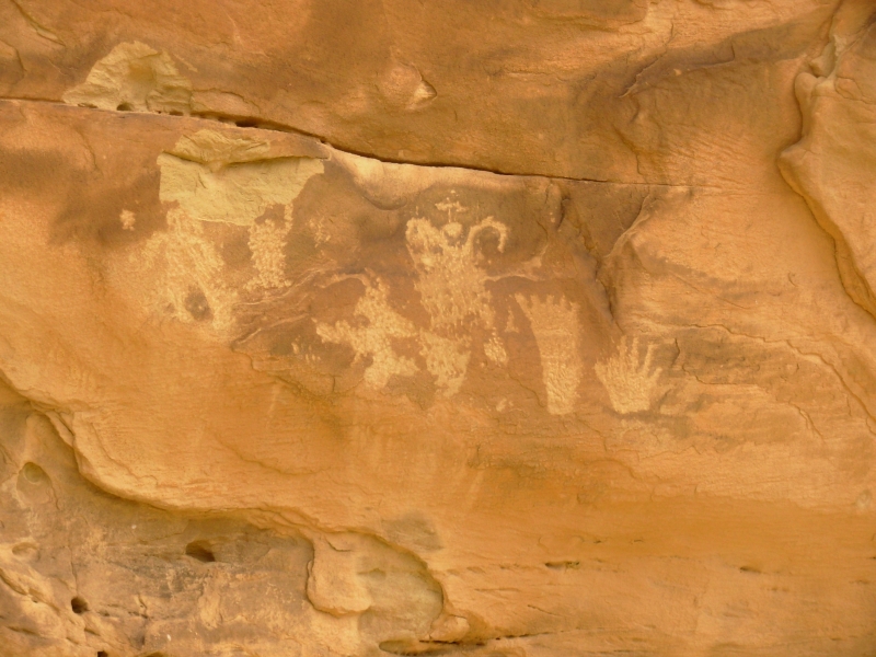
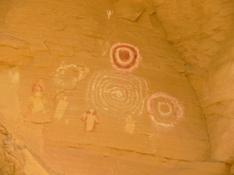
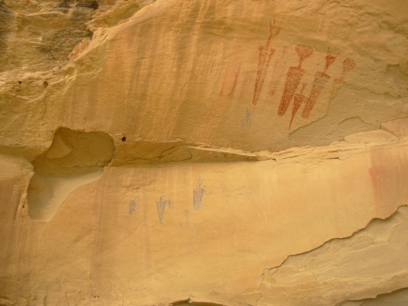
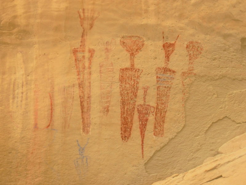
We spent the day wandering through more prehistoric art galleries. About 10 miles north of Vernal is a ranch in Dry Fork, the McConkie Ranch, that is open to visitors and has some incredible rock art. There are tall red cliffs behind the ranch and for about a mile petroglyphs, pictographs and pictoglyphs are frequent. The style of Fremont art here is different. They call it the Vernal style and it consists of large anthropomorphs with very detailed costuming headdresses, necklaces, earbobs, etc. Some have no hands or feet, some have huge ones. Some have shields. The faces are sometimes painted, sometimes barely sketched in. One nice panel high above the valley was called the Three Kings, though there were actually six figures. One was really unique; it looked like a photographic negative. Instead of carving out arms and legs, they cut the background away so the limbs were dark contrasting images. Several panels mixed rock carving and painting pictoglyphs. As usual, many were quite faint, especially the pictographs, but there were some very good ones.
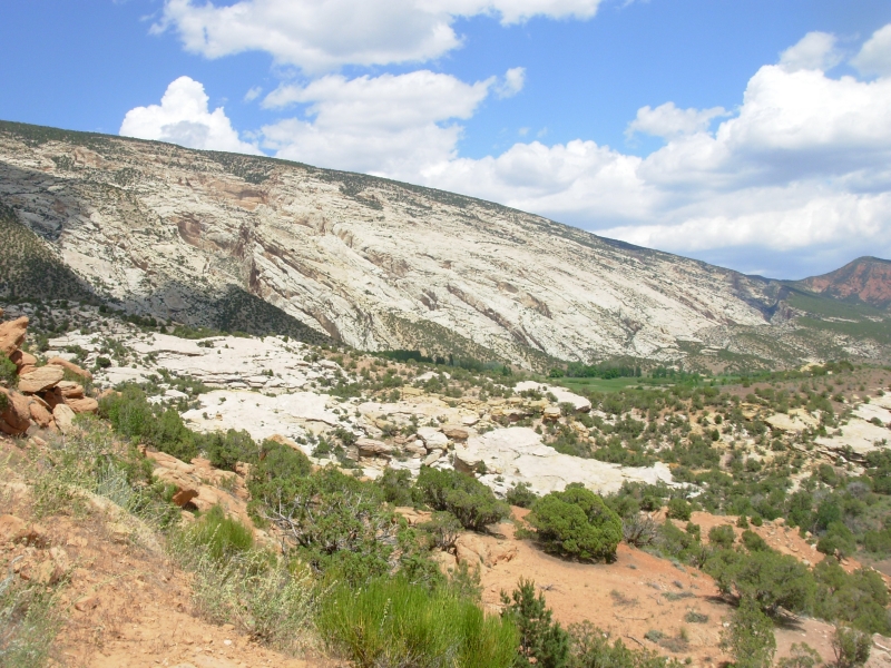
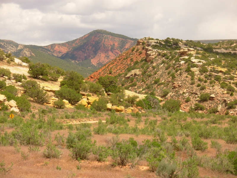
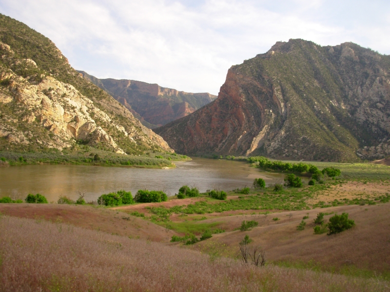
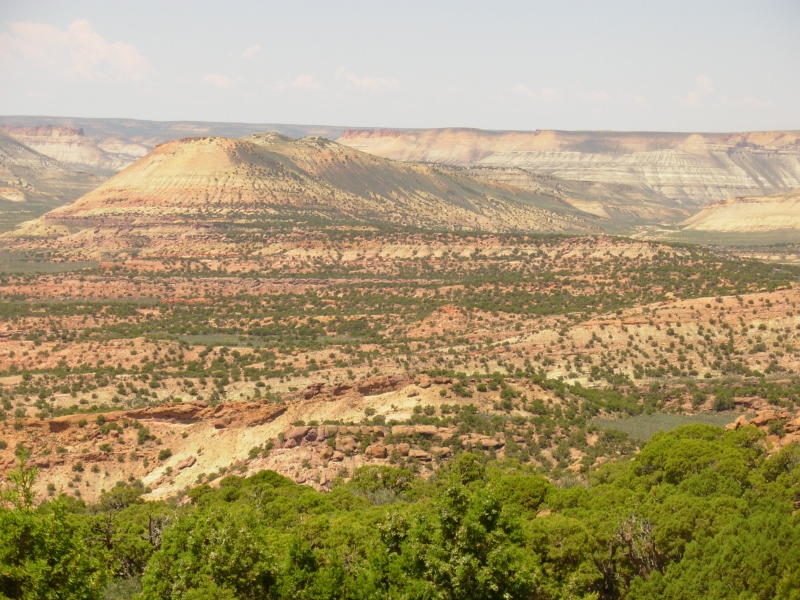
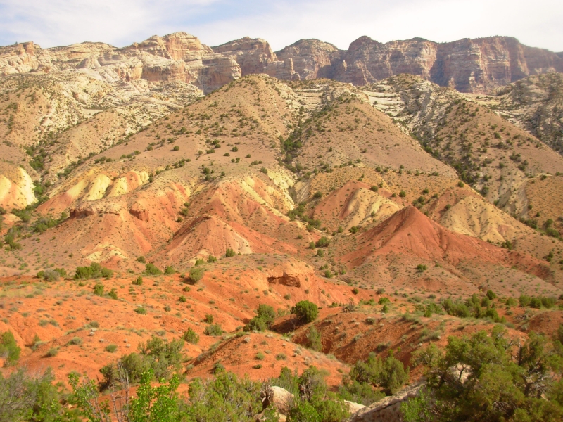
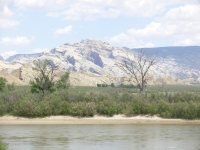
After lunch we headed to Dinosaur National Monument, about 20 miles west of town. Unfortunately, you cant see any dinosaur bones right now; theyve closed the Quarry where most of the bones lie because the building protecting the site isnt safe. There were some very unhappy people there, especially kids who were promised real dinosaurs. One issue was that some people paid a fee at the entrance and didnt know that the quarry was closed until they reached the Visitors Center inside the Park. I dont know if they got their money back or not. We didnt care. We were there to see the Park, with or without bones. Dinosaur NM is a beautiful place, where rivers cut through some very picturesque rock strata. There were ancient white sand dunes and red hills. Beautiful.
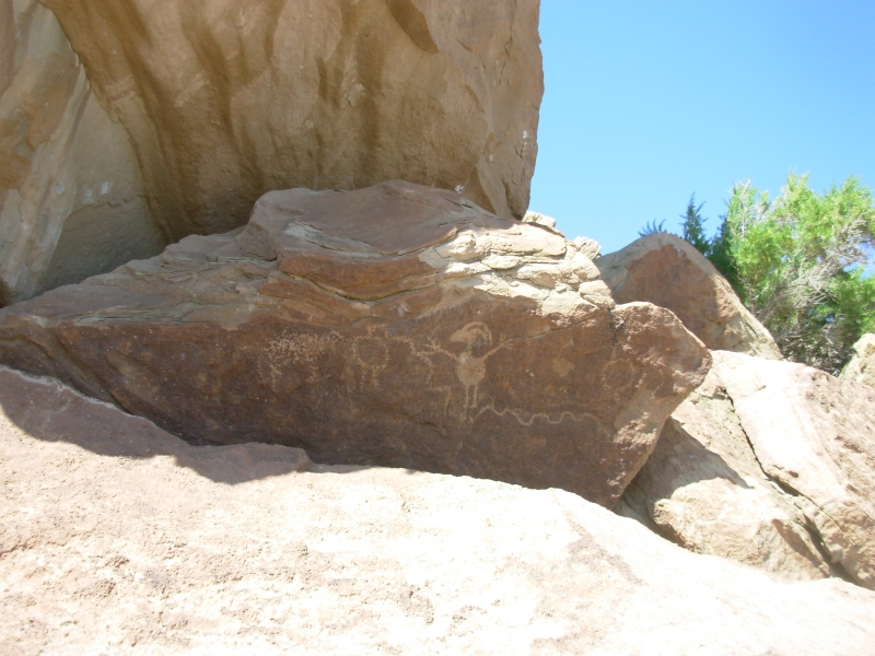
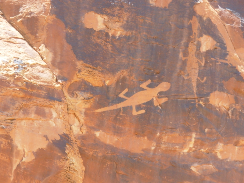
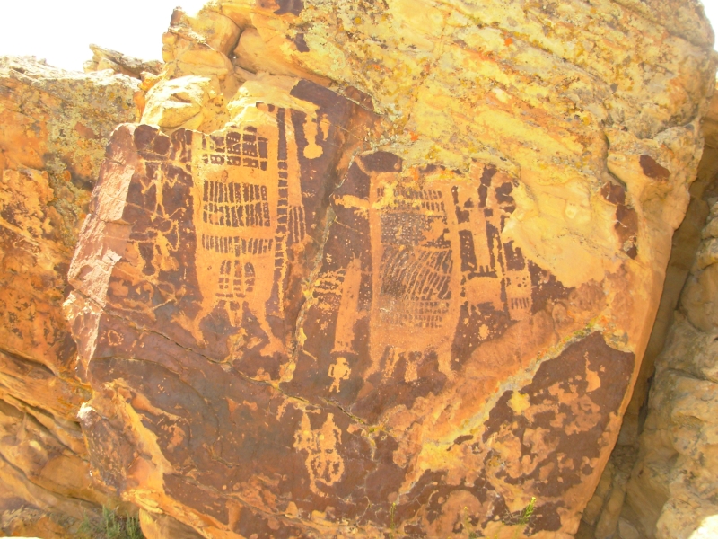
Even better, there are three easily accessible rock art sites: Swelter Shelter, Cub Creek and McKee Springs, twenty miles north. They had several good Vernal style figures, as well as several large lizards climbing a cliff, a couple of buffalo, a Kokopelli, etc. At Dry Creek there was a large bear carving that looked modern. I dont know if it was. Unless theres a horse and rider its hard to tell whether the images are a few hundred years old or a few thousand. If theres an atlatl, then the art is very old, since bows and arrows were adopted around 200 AD. Kokopellis are a later import. Beyond that, unless the paint is tested on a pictograph, its anybodys guess. The Fremont era was 500-1300 AD, but thats a long time. Some of the drawings are very simple stick figures, some are complex shamanic figures, some are solar calendars, some may be maps.
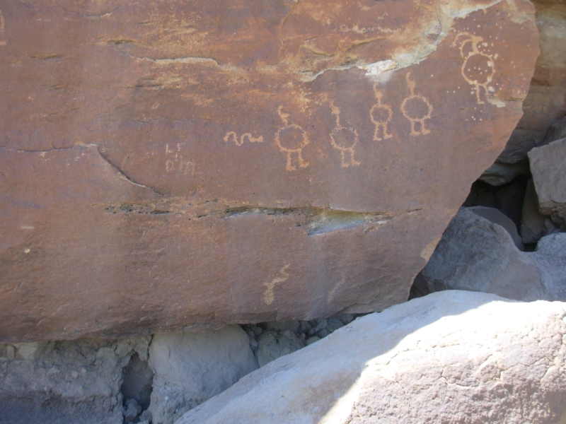
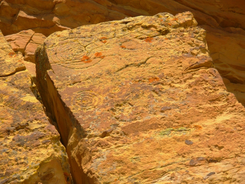
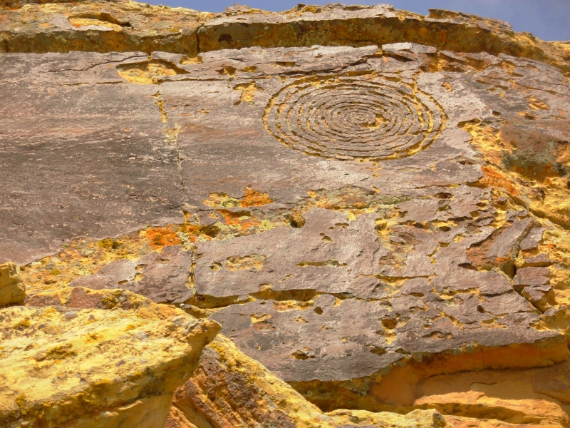
I assume that a simple circle or spiral maze is older than the big shaman, but I could be wrong. There are trapezoidal figures and round figures (i.e. the Fat Man) are they from different eras? There are few obvious females aside from an occasional birth scene, but sometimes there are two figures touching that could be male and female or not. Near Phoenix we saw one site where one hill was covered with male symbols and the next ridge had obviously female symbols, but that has not been the case in Utah. They all look like warriors, shamans or aliens from outer space. One theory is that the shamans carved some of the images while under the influence of hallucinogens - hence the strange images that look so very otherworldly. There were suns and stars today any meaning beyond the obvious? There were few bighorns and deer, so these panels probably had a different purpose than those in Nine Mile Canyon which had so many game animals and hunting scenes. These seemed to be more warlike shields and severed heads what was the history here? No one knows. Most art sites are a mixture of eras, with newer art carved or painted right on top of or next to older figures which really confuses things. Why did they use the same rock face to carve their pictures, when there were empty ones 10 feet away?
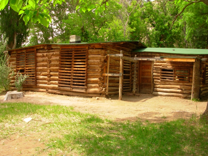
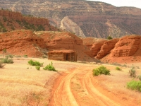
At the end of the scenic drive we stopped at an old cabin where a woman, Josie Morris, homesteaded in 1914. She lived there for several decades with no running water or electricity. There was a pretty good display of what it was like to ranch out here in the early years of the 20th century.
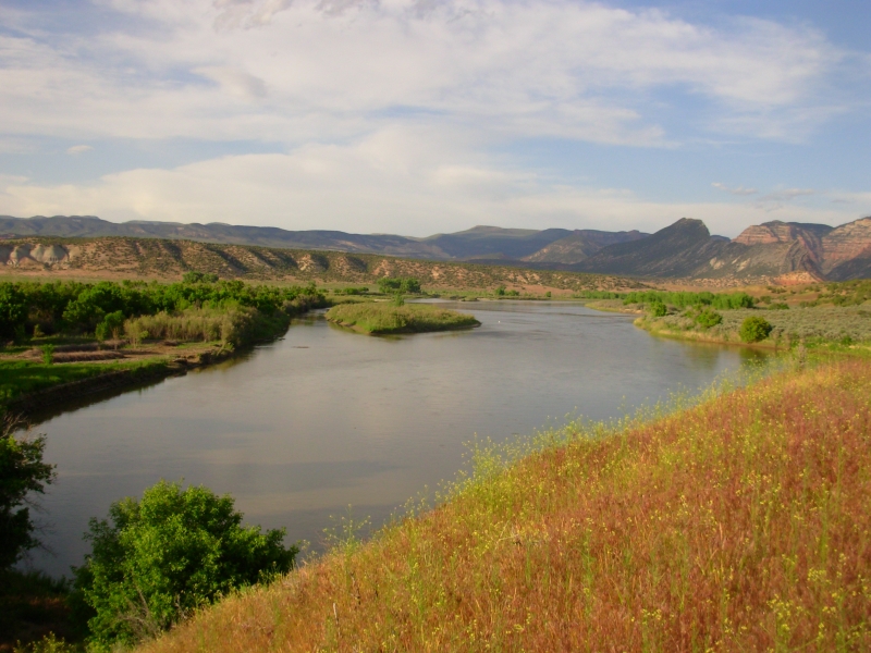
We ended up at a primitive campground on the north side of Dinosaur NM. It is right next to the Green River, and very peaceful. A storm threatened, but only a few drops of rain fell. We did a short walk before dinner in search of a nearby pictograph site we had heard about. We may have found it, but it was faint and far above us, so we arent sure. We did collect thousands of grass seeds in our shoes and socks.
Sunday, June 3 1 ½ miles Dinosaur NM to Green River, Wyoming
Today was a time warp sort of day. We didnt cover a lot of miles, but somehow it took all day. We slept in a bit this morning. Last night our peaceful campsite was disturbed just before dark by a group that set up right next to us. They werent that bad, but even normal talk and laughter gets to be a bother when youre trying to sleep and the folks next to you are too close and busy drinking and cooking. Oh well, it was better than the three groups that set up next to us the night before with a screaming two year old and a couple of hyperactive older kids.
One funny thing at our river site was a hungry and persistent chipmunk that kept jumping up on the table next to us. It even jumped in the car when the door was left open while we were packing up.
Today we headed north along the west side of Flaming Gorge. We did a short walk first at Red Fleet State Park. We passed a sign by the highway that said, Dinosaur Trackway Trailhead which we thought sounded interesting. We turned back after 20 minutes or so because we werent sure how long the trail is. Unfortunately, there are no maps or information at the trailhead explaining the trail. It was nice to stretch our legs but Im sorry we missed the tracks, if there are, in fact, dinosaur tracks there.

Its about 50 miles from the town of Vernal to Manila, where we hoped to find some more rock art. First we called a local rancher who allows people on his working cattle ranch to look at several panels of pictures on his cliffs. When we got there, there was some confusion about where we were supposed to look. The guidebook said one thing, the rancher another. We believed the rancher. We may have missed some figures, but we did find the most famous one a mammoth carving. Since mammoths died out 10,000 years ago, the question arises, why are there occasional pictures of mastodons? There were some other really different figures as well, and lots of spirals. It was a pretty ranch, with green meadows, a waterfall and cliffs. Mr. Briggs has only owned it for nine years but he was raised nearby. We talked to him for a while after we had looked at the panel.
A few miles away, right on the Wyoming border, there are some more petroglyph panels on a cliff on National Forest land near the highway. There was a pictoglyph, some Vernal style figures and some with big stick hands and feet. A couple of hawks were upset by our presence; they flew directly overhead screeching at us. It turned out their nest was right above the panels, so we quickly moved on.
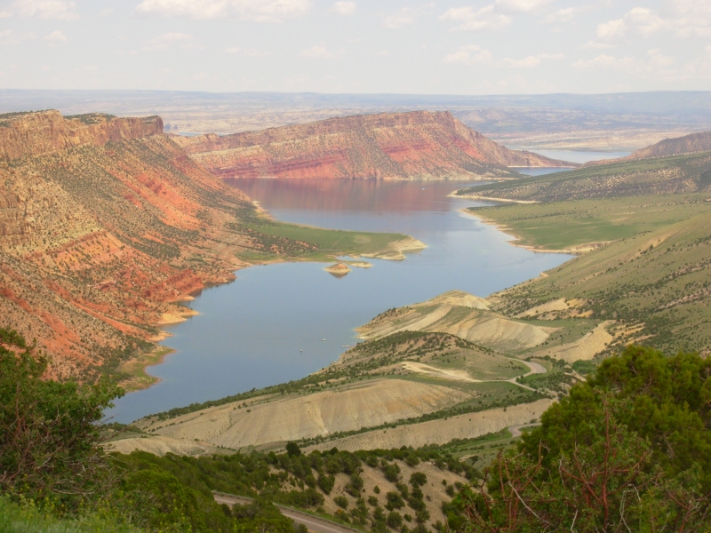
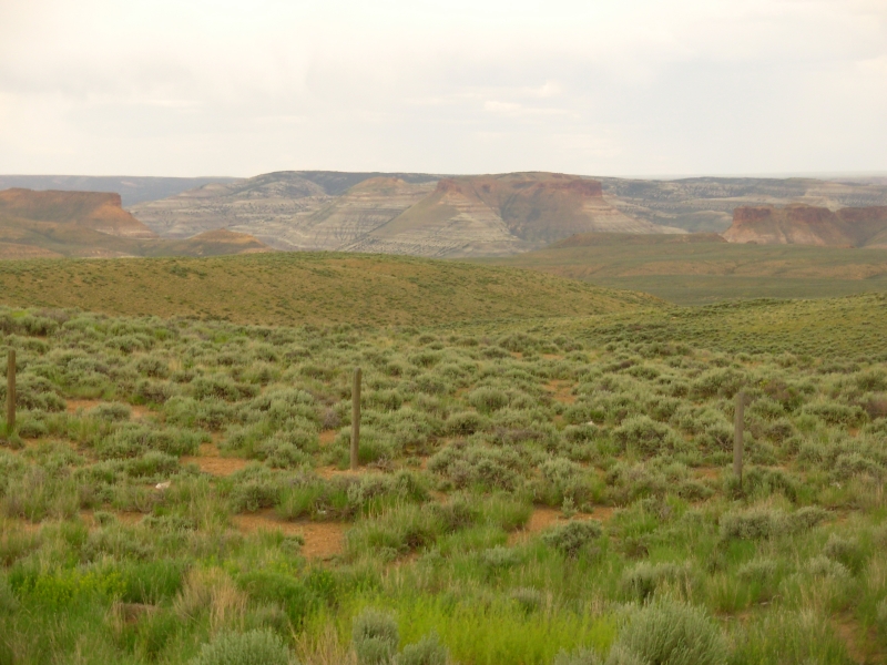
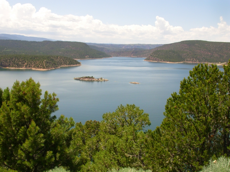
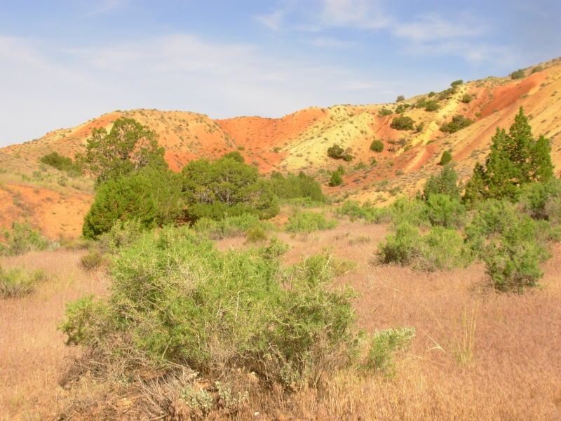
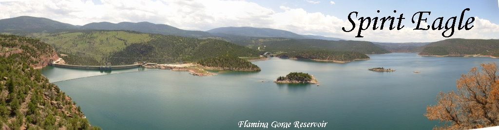
Then we headed up the highway, past the reservoir at Flaming Gorge. We are making a big circle around Flaming Gorge Reservoir just to see what its like. The drive north was a real mixture. The southern part of Flaming Gorge really is red -- Moenkope Formation rocks. The northern part was pure Wyoming desert sage covered hills. The far south was high alpine meadows, with green grass and newly leafed out aspen trees. It was very pretty.
We had planned to camp but decided a shower would be welcome so we got a room at a motel in Green River, Wyoming on the north end of the loop. Tomorrow well drive down the eastern side of the Reservoir. One thing that surprised me was that the road is so far from the Gorge. I thought wed be closer. There were occasional glimpses of water, but mostly we saw desert.
June 4 Green River to Dinosaur
Today was similar to yesterday: late start, pretty drive around Flaming Gorge, and a few chores. The east side of the Gorge was prettier than the west side, with lots of wildlife (antelope, deer and wild horses) and good views. We stopped at the dam but didnt take the tour.
Road construction delayed us for a bit. We talked with the flag lady while we waited. She does not like living in Rock Springs. It reminded me a bit of Rawlins, so I understood. We were hurried away from one view overlook by a mine employee who explained that they were closing the road so they could blast. We were happy to move on. We visited a book store in Rock Springs, the Post Office in Dutch John, did laundry, ate a nice burger in town, then moved on to a campground in Dinosaur NM with a nice view of Split Mountain. It was an easy day with some beautiful country, but we did no walking.
It rained a bit off and on and there were black clouds all around. We saw mammary clouds with a rainbow over Dinosaur. Very nice, but we were moving and couldnt get a good photo. Going for a hike was less than inviting with all the threatening clouds. Of course, it never rained hard enough to get the ground wet. Even so, we had a full day, just not a very active one.
June 5 6 miles Dinosaur NM
We had a peaceful night at a half empty campground next to the Green River in Dinosaur NM. We started the day with a two and a half mile nature trail out of another campground in the park, which was a pretty walk through the sage and boulders. Then we went back to the Visitors Center to do a short fossil walk. There were fish scales in a Mowry Shale deposit, some dinosaur bones and petrified wood in the Morrison Formation and broken clam shells in the Stump Formation. Best, of course, were the femur and spine sticking up out of the rock. It was a short hike, but interesting in its way. There were even a couple of petroglyphs.
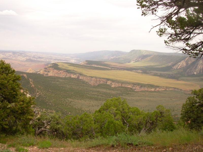
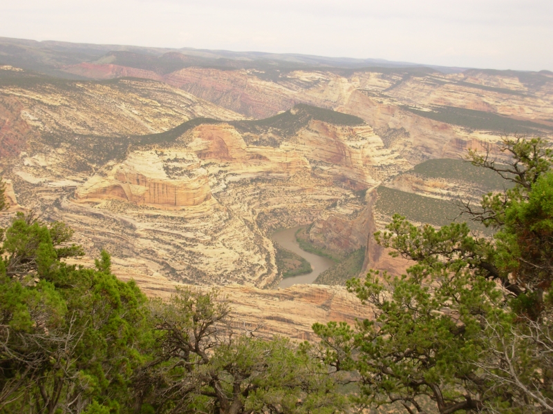
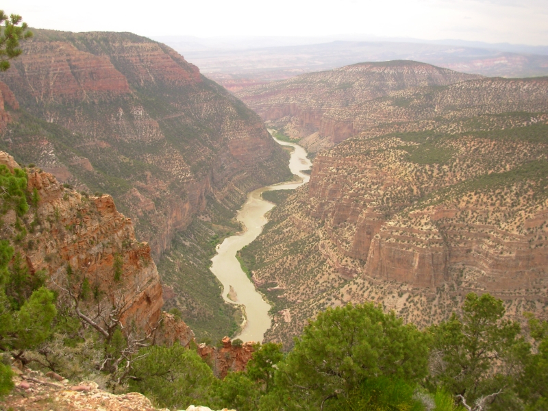
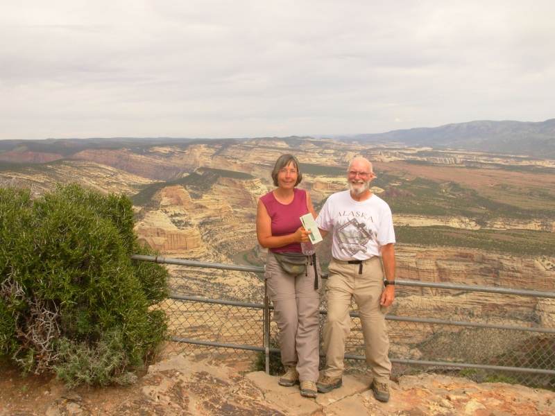
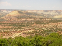
After a quick lunch, we headed west to the Colorado half of Dinosaur NM that contains few dinosaur fossils but instead protects the river corridors. A scenic drive takes you 34 miles to Harpers Corner, a narrow promontory whose trail leads you to an overlook above the confluence of the Yampa and Green Rivers. There are beautiful views along the drive and along the one mile hike out to the point. The rivers are 2300 below the point, and the cliffs, canyons and geologic faults are colorful and interesting. A 50 cent guidebook explains the geology, which I enjoyed. Wildflowers were abundant amidst the sage and pinyon.
It was a gray blustery day, so our photos wont be great, but it was a very scenic drive and hike. The road winds along the crest, giving views to both east (the Green River) and west (Whirlpool Canyon and the snow-covered Uintah Mountains). We saw a handful of antelope in one of the many green meadows below the road. The hills are very green right now. Lupine, larkspur, paintbrush, mule ears, globemallow, penstemon, mariposa and locoweed were abundant.

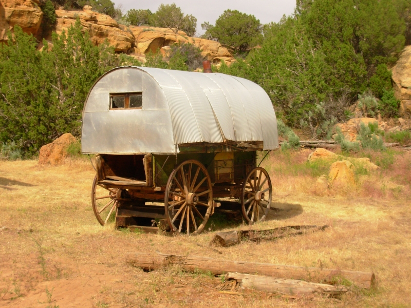
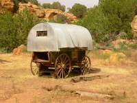
Finally we dropped off the plateau on a dirt road for 13 miles to Echo Park, a campground next to the confluence of the two rivers. Sheer cliffs surround a green meadow with piñon pines and cottonwood trees for shade. Only one other person is camped here, so it should be quiet if the wind dies down. Along the way we passed three interesting sites. The old Chew Ranch was homesteaded 100 years ago and was still actively ranched until the 1970s. There are several log buildings with sod roofs, some corrals and the farmhouse. They werent open to visitors though.
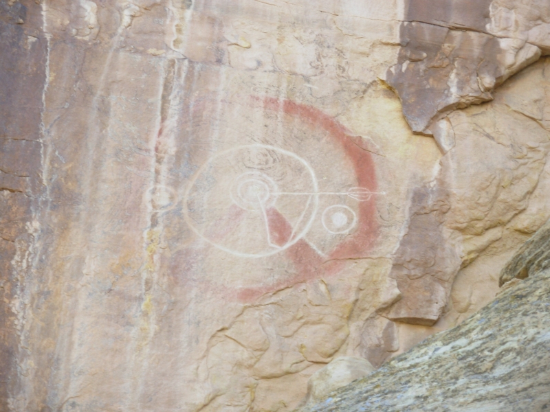
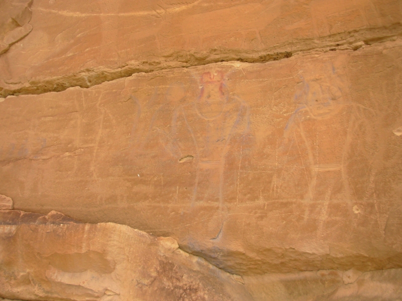
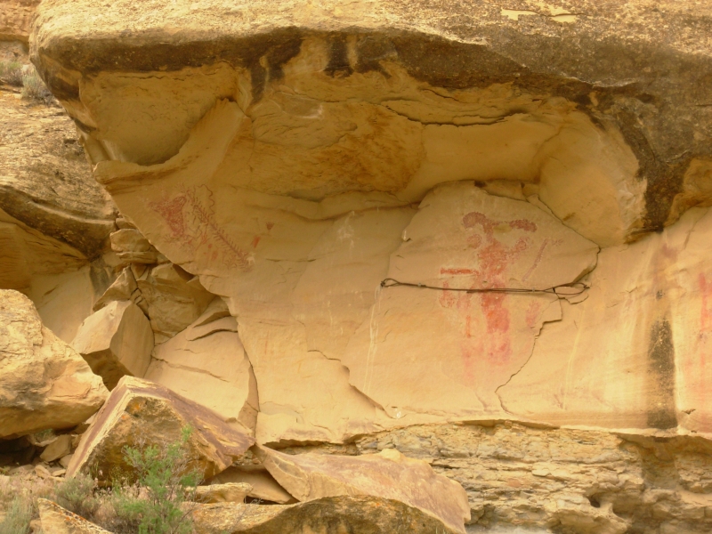
Then we passed a very unusual petroglyph panel. The style was unique and very precise. Like many Fremont (and especially Vernal) images, there were fancy headdresses and necklaces, however thats all that was cut into the rock. The headdresses were pecked dots in rows while the neckpieces were carved with smooth flat plates. It was definitely different. There were 10-20 of these images visible 35 high up on a cliff. As usual the question arose, how did they get up that high to carve the pictures? Most were very hard to see because of weathering of the cliffs. There were lines of black mineral deposits which covered several of the pictures and in places the cliff face had chipped off. Only three or four pictures were really clear.
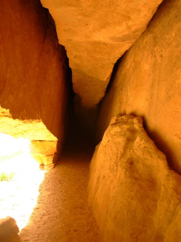
Next we went to Whispering Cave: a shallow (4 ½) but long (30 or so) cave entrance with very cold air coming from unseen depths. The rock above was a slab about 3 feet wide with deep narrow crevasses on each side. We heard nothing, but on a hot day the cold air coming out of the cave probably does whisper.
Then we moved on to the campground. Driving the road was slow because it is very steep (18% grade), but it was recently graded so we ignored the sign saying that 4WD is required to drive it. Its a pretty campground with a very remote feel. Only one other car is at the campground. Not many people visit the Colorado side of the Monument. Most either pass through by river (rafting is very popular) or visit the Dinosaur Quarry when its open. I really enjoyed spending the day here. I wish I could do a river trip too - maybe next year?
June 6 1 ½ miles - Motel in Grand Junction, Colorado
We slept very little last night thanks to a big wind that shook the truck all night. I had the thought at one point that we might get tipped over, it was so strong. Opening the doors was almost enough to have them torn off the hinges. I was very glad we werent in a tent. Ive been in big blows where the tent was picked up and turned inside out. Its funny, but not fun. We woke to the sound of raindrops on the roof. What flashed through both our minds was the warning, Road impassible when wet. The Park recommends not camping at Echo Park if there is any chance of rain. Who knew? We tossed everything in the back and sped off. Our fellow camper left shortly before us. We stopped once to drag a big branch off the road, but made it back to the pavement before the rain got serious. The problem with the road is multiple: it gets very steep, it goes over red clay, it crosses several side streams, and the muddy road bank can and does slide into the road. All are good reasons to avoid Echo Park when its raining.
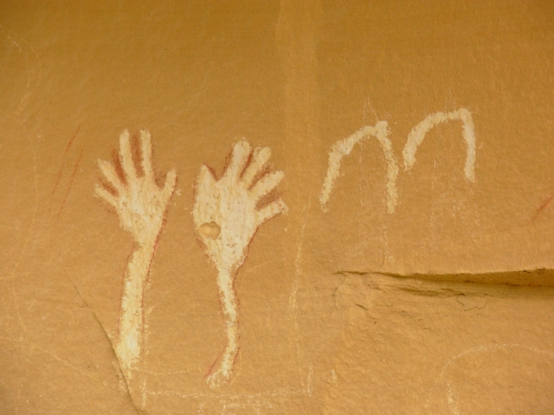
Since we missed breakfast, we stopped at a small café in Dinosaur for a quick bite and some conversation with several locals before heading south. Below Rangely there are two areas that have rock art: Canyon Pintado has five sites and there is a state road nearby that has four panels. None of the panels were particularly good ones, but we had fun wandering around looking for them. One was a solstice marker. Weve seen several of those. A little pamphlet that we picked up at Dinosaur NMs Visitors Center had good directions to the sites. Some of the panels were relatively modern Ute pictures (horses, guns, etc.) but some were quite old Fremont pictures. Some were hard to tell whether they were really old or some punks imitation of Fremont style. The blue figures made me wonder the drawings were not quite right and the color was unusual, but who knows? Maybe they were legitimate. The waving hands were probably fairly modern. There were some horse petroglyphs that were very beautiful flowing lines that formed the horses. That would be hard to do in stone. Whoever carved them was a good artist.
It sprinkled off and on all day and the wind continued to blow cold. As we drove south, the road climbed and climbed over Douglas Pass at 8200. The rain turned to snow not significant snow, but it was unexpected. It was enough to send us to a motel instead of a campground tonight. Besides, after last nights noisy wind, were hoping for a peaceful night tonight.
It was a good day. I enjoyed the treasure hunt aspect of our search for petroglyphs and pictographs, even though most of the pictures were disappointing. We did see a live deer and an antelope today. One of the locals was surprised we hadnt seen any elk in the high country at the monument. I wish. It is the right kind of country for them.
Home | Links| Trail Journals |
The Thruhiking Papers | Bun-bun
Created: 10 November 2007
Revised: 30 Sept 2016Copyright © 2007-2017 Spirit Eagle