Monday, May 7 Day off in Moab

Today was a day for errands: changing the oil in the car, buying new trail shoes and grocery shopping. We changed motels. The new one is a little less expensive, but much noisier.
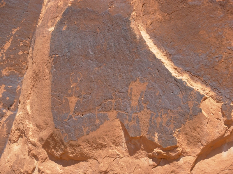
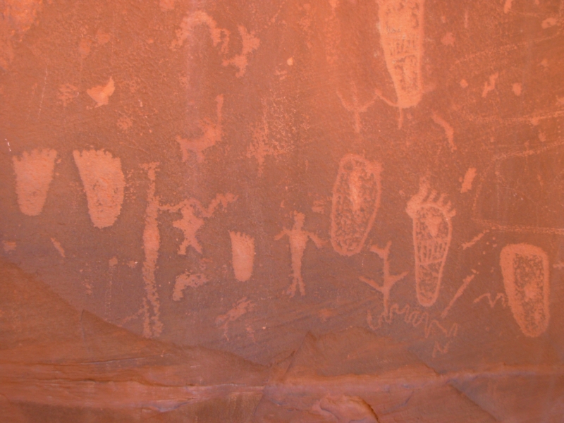
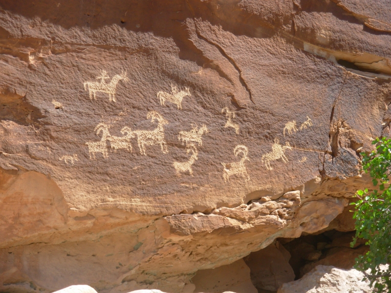
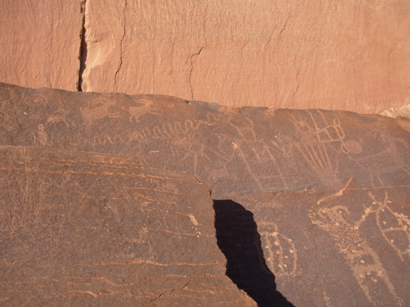
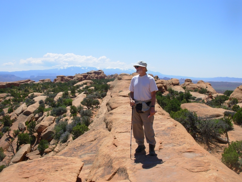
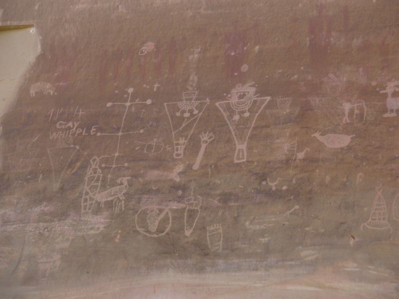
We did a short drive, checking out a few nearby petroglyph sites. The panels had been vandalized (shot at, written on, names carved on the rock) but it was still fun following the directions we were given to find them. It was a treasure hunt, though not as much fun as our backcountry sites. Moabs roads were full of bikes, ATVs and motorbikes. We passed a busy trail area (Kane Creek Road) and I was quite glad not to be hiking there. Im not sure how well Ill handle the crowds at Arches. Fortunately, there are hikes away from the road, which should be less crowded. I want to see the Park, but Id really rather be backpacking again.
May 8 8 miles in Arches, camp on Colorado River
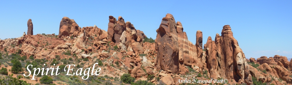
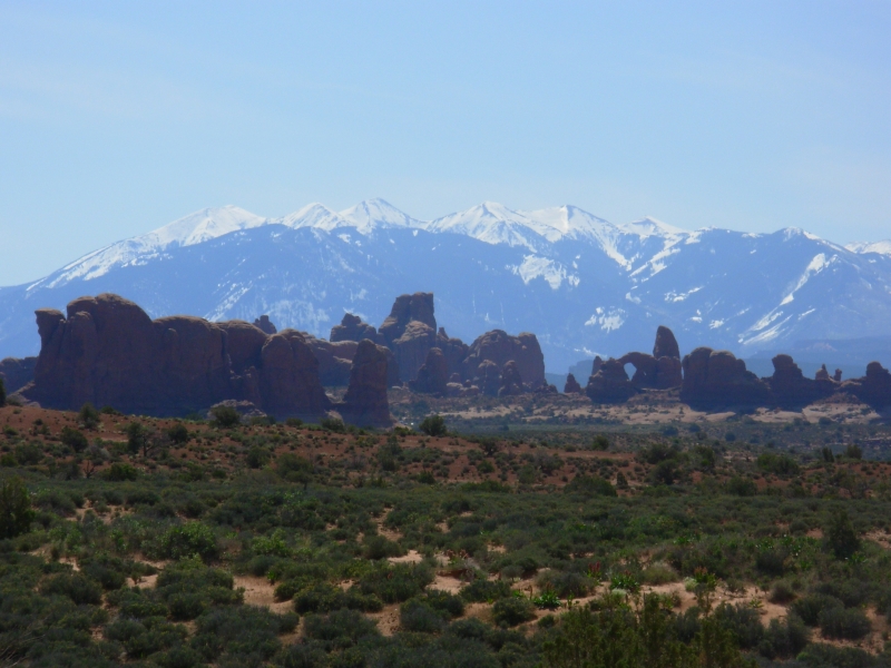
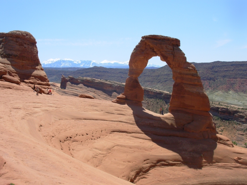
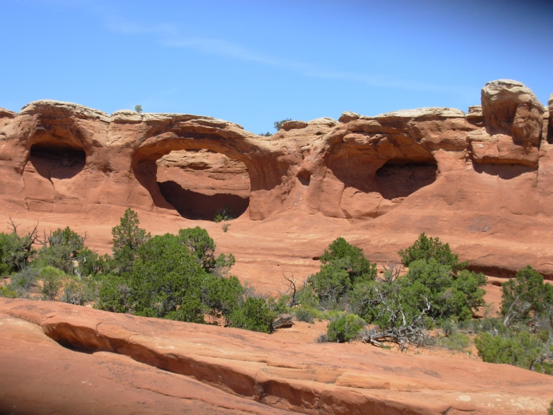
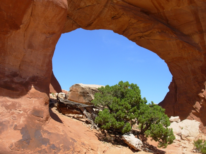
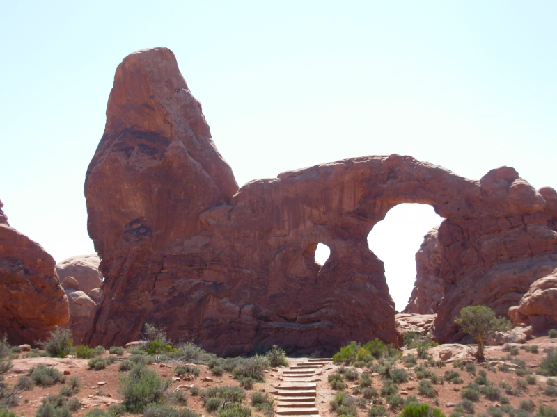
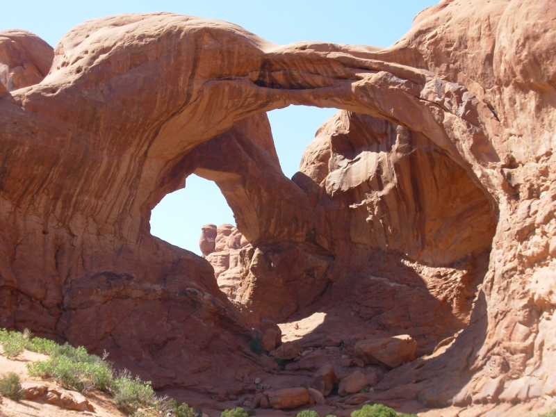
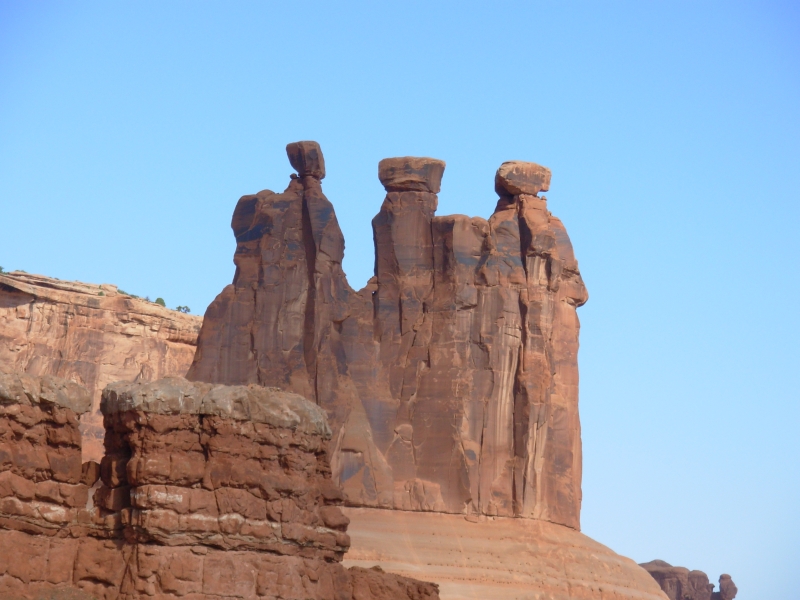
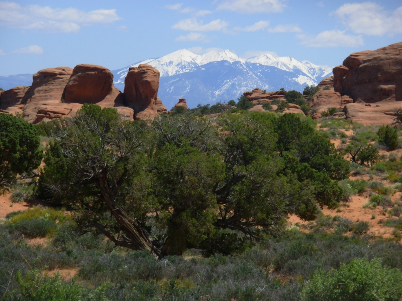
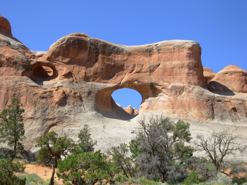
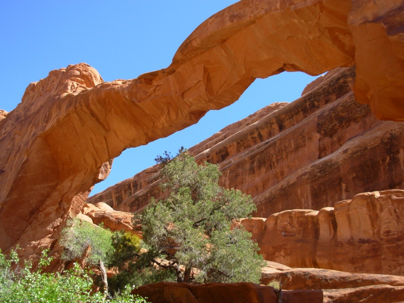
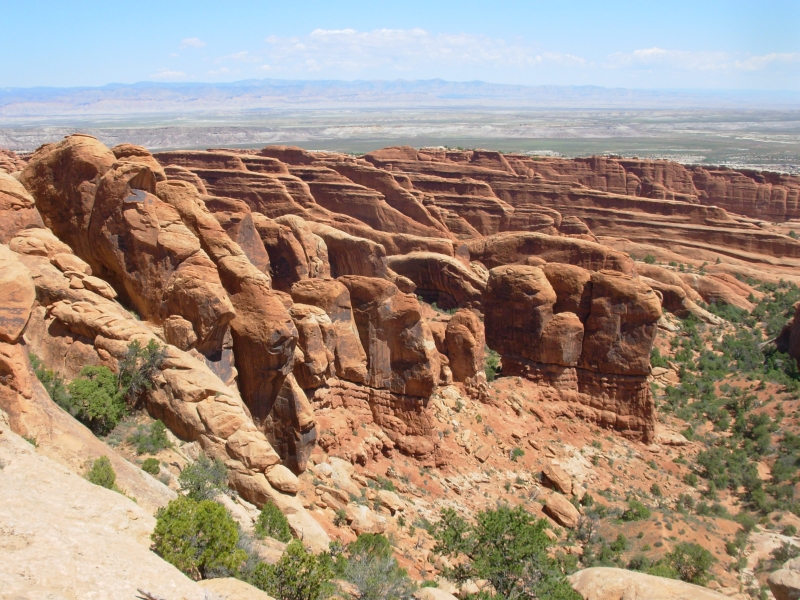
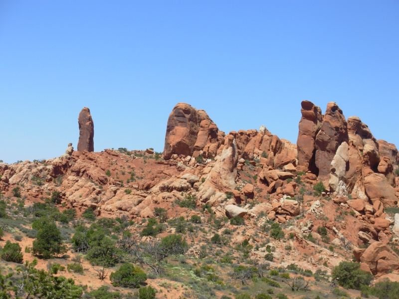
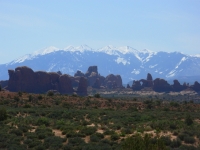
We spent the day hunting arches in Arches National Park. There are a lot of them, 2000 in all. We didnt see that many, but we did spot quite a few. Its red sandstone country, but the land has been fractured and eroded into fins, columns, pillars, balancing rocks, caves and arches. It is beautiful country. We did a lot of short hikes, including the obligatory 3 mile hike to Delicate Arch and others to Sand Dune Arch, Tapestry Arch, Broken Arch, the Windows, Double Arch and the Turret. We also stopped at all the overlooks. Tomorrow well do a longer hike on the north end, then well visit most of the remaining front country arches.
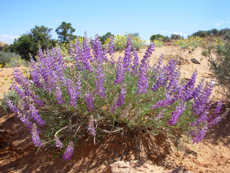
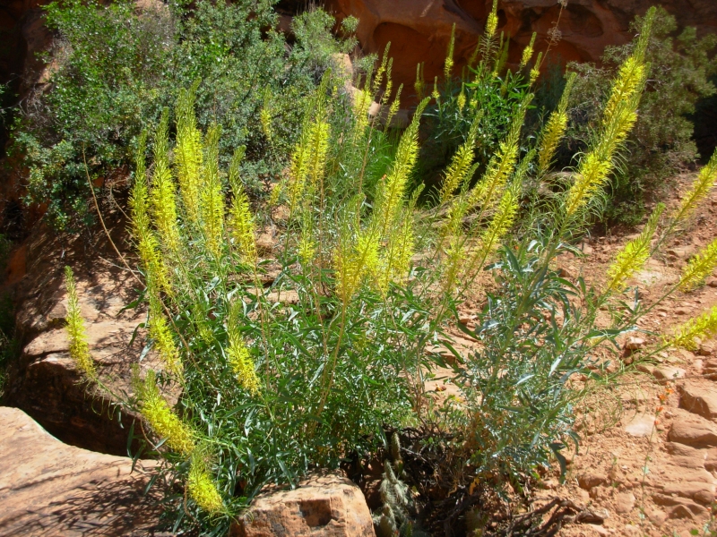
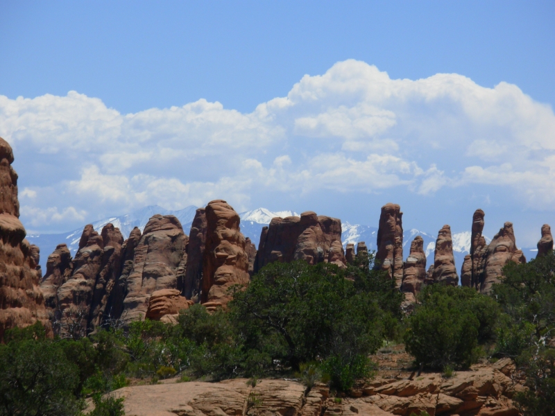
What made it really beautiful were the contrasts: the white peaks of the La Sal mountains above the orange sandstone, the green spring colors, brilliant wildflowers (orange globemallow and yellow Princes Plume were especially showy), some bluish minerals near Delicate Arch, and the clear blue sky.
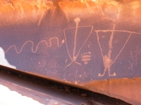
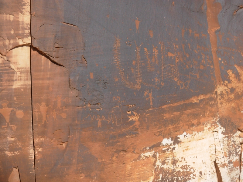
There were hordes of people, as expected, including busloads of school kids and a large tour group that is visiting several of the western parks on a two week loop. I didnt tolerate that all that well. The Devils Garden lot was almost full, which was one of the reasons we put off that hike until tomorrow. I hate hiking through crowds of slow moving people. On the way out of the park we stopped at Courthouse Wash to visit the petroglyphs and pictographs there. They were vandalized 25 years ago (paint thrown on the images) and though they have been cleaned up, many of the pictographs are barely visible. That is too bad as it was a cool site with many Barrier style ghostly figures.
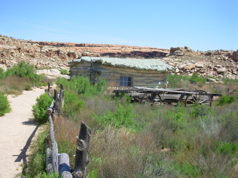
Finding a campsite was more of a problem than we expected. The Park campground filled up at 7:30 am. Not a surprise. Its a very popular park. There are BLM campgrounds along the Colorado River, both developed and undeveloped. We drove through three all full. Finally, about eight miles out, we found an undeveloped camp area right next to the highway with a couple of empty spots. It was ten miles to the next campground so we took what we found. It has an outhouse and fire ring but no tables. Were grilling hamburgers and waiting for the traffic to die down. We cant see the river from here, just steep red canyon walls on both sides, but its pretty.
May 9 7 ½ miles in Arches
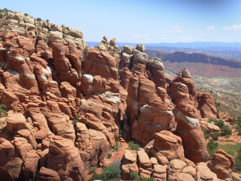
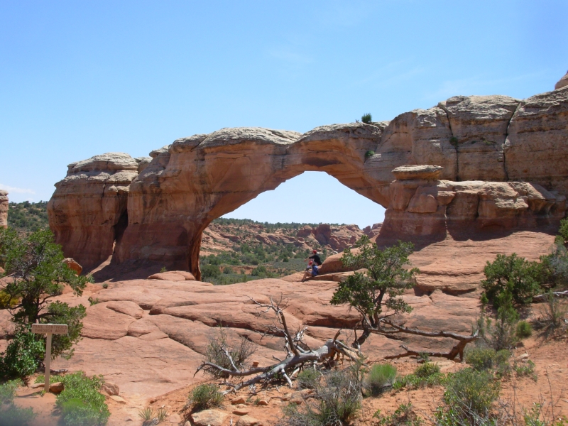
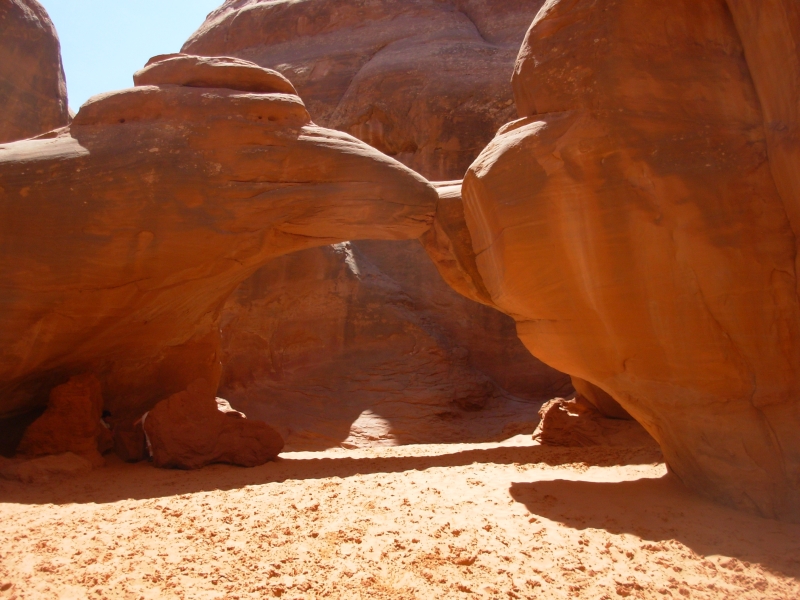
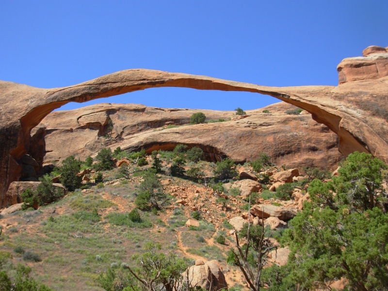
We went back to Arches to hike the longest of the Park Trails, the 7.2 mile Devils Garden Trail. That distance includes side hikes to several off route arches and a primitive trail that made the hike a loop. It was a really nice hike with eight major arches plus a few unnamed smaller ones, some nice walking on slickrock (and some precarious walking too) and lots of pretty scenery: fins, columns, and arches, with distant snowy mountains, blue ridges and green valleys. Wildflowers were abundant. So were the people, though I didnt let it bother me today.
We finished our hike around 2:15, ate lunch and went to town to get ice, ice cream and gas. We considered our options and decided to call it a day. We went back out to the river, where we picked out a better campsite than yesterday's. Its still next to the road, but it has a table and a bit of privacy. Its hot, in the 80s, and lack of water on the hike sapped our energy a bit, so it was nice to just relax and take it easy.
May 10 4 1/2 miles in Canyonlands/Island in the Sky
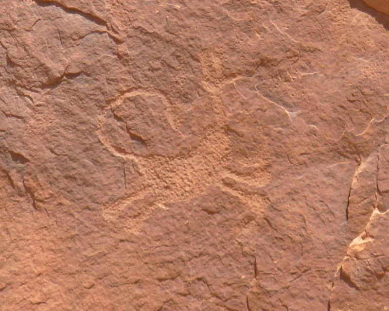
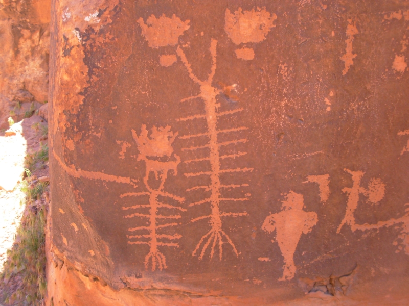
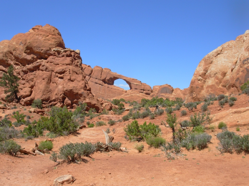
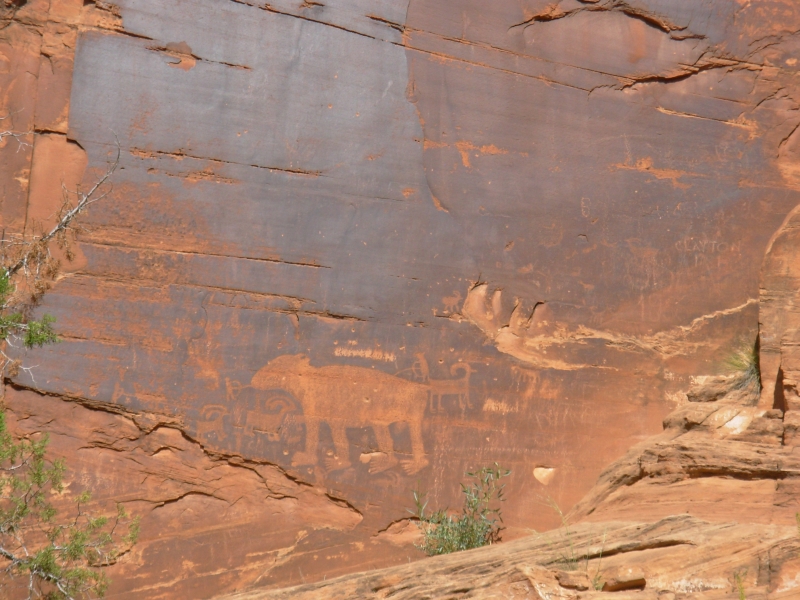
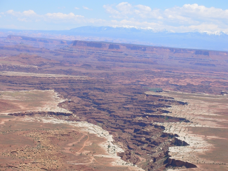
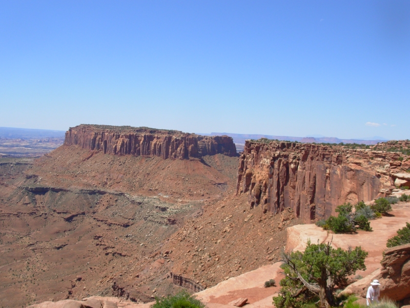
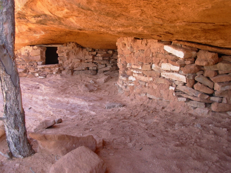
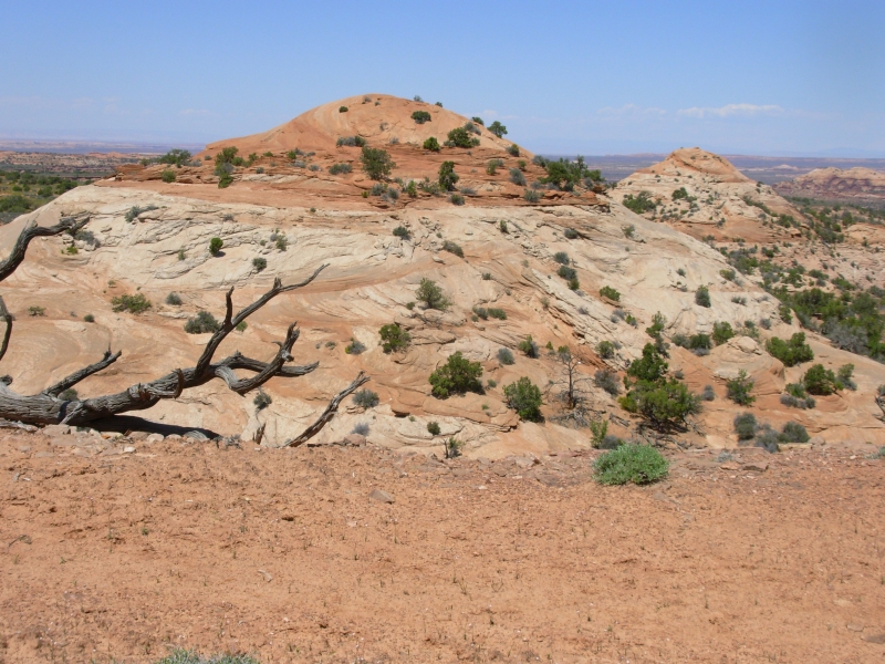
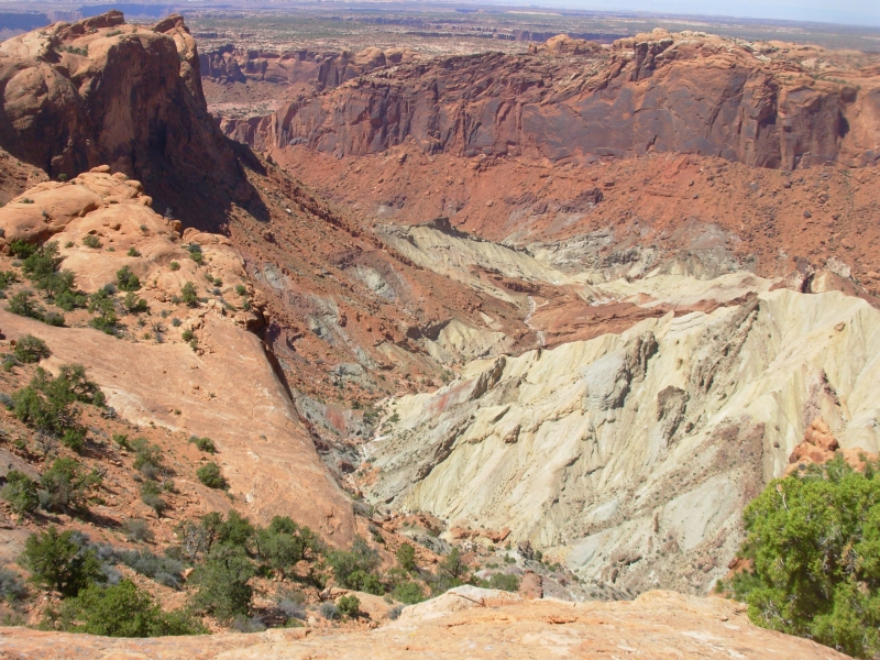
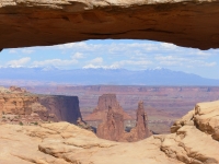
We played tourist again, first seeking out the petroglyphs along Potash Road near Moab (the bear, some Fremont figures, etc.) then drove up to Canyonlands/Islands in the Sky NP where we drove the scenic drive, stopped at all the overlooks and did a few short hikes. Islands in the Sky is a high (6000) grassy plateau . Water has carved canyons all around it. The Colorado River runs on one side and the Green River on the other. About 1500 down there is another plateau, the White Rim, which has a 4WD road that circles the Island for 100 miles. It is very popular among four wheelers and mountain bikers. You can camp on the plateau, but Im not sure theres water. From what we could see from above, its doubtful. I wouldnt drink from the muddy waters of the rivers unless really desperate. The Parks long hiking trails all descend from the upper plateau to the White Rim Road, and occasionally from there to the river. We werent enthused about any of them, so we just did the short hikes out to viewpoints, including one out to a nice little arch with a beautiful view of the canyons and La Sal Mountains beyond, then another to a couple of mesas with ancient granaries in the caves. That was a strenuous climb up slickrock, but fun.
We had planned to go to nearby Deadhorse Point State Park, but the campground there was full and we decided it wasnt worth the time or money just to drive out and look at the view, since we had spent all day looking at similar views for free.
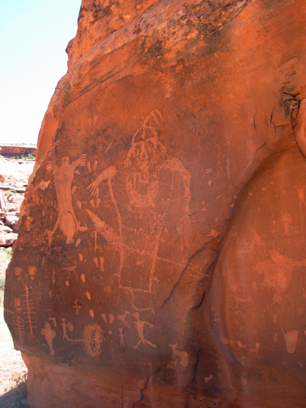
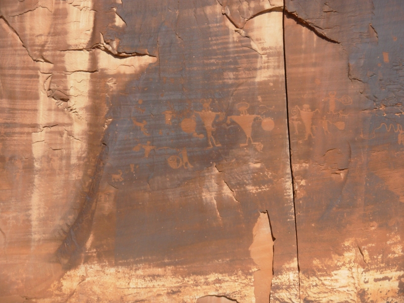
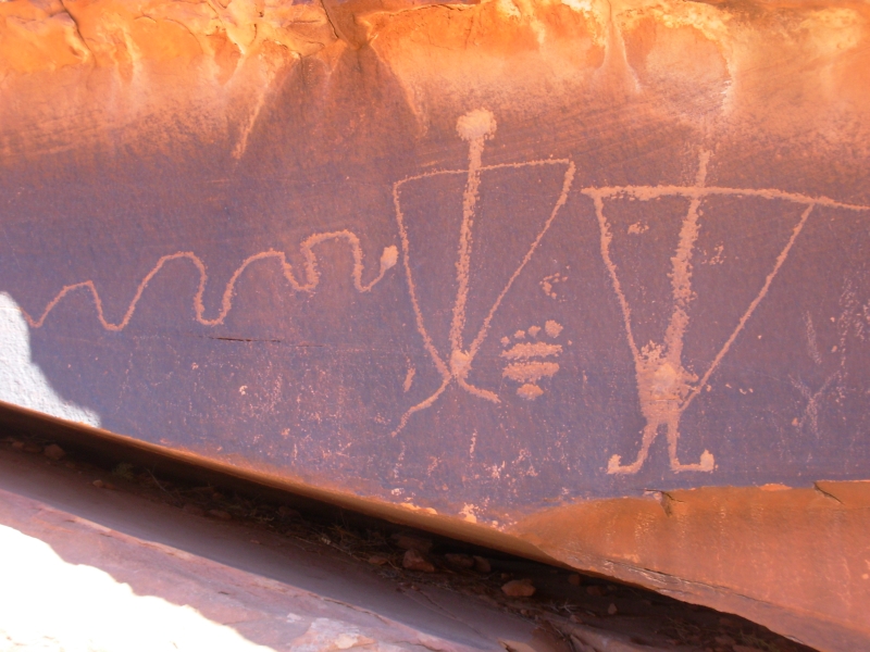
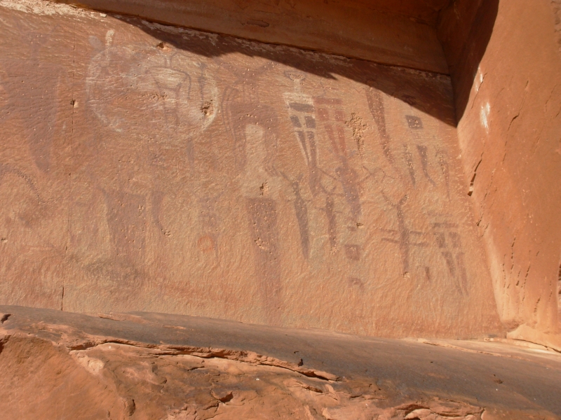
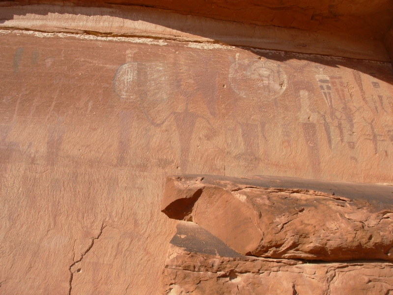
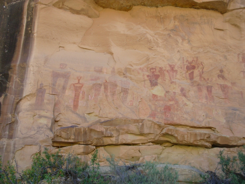
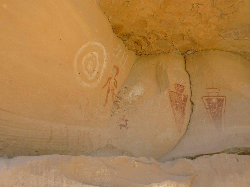
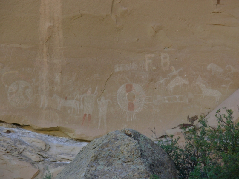
Instead we headed to Thompson Springs and the pictograph/petroglyph panels there. They were nice ones from many different eras, ranging from Barrier-style ghostly figures (2000-7000 BC) to Fremont figures (1-1200 AD) to Ute horses and bison (post 1600). There were five panels, each of a different timeframe, though some of the Fremont carvings overlay red Barrier-style painted figures. It was worth the detour. We ended up at a motel in Green River, a small tourist town on I-70.
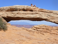
All in all it was a good day. The views at Islands in the Sky were great: red cliffs on top, then gray, then white, then chocolate brown. We saw a bighorn off in the distance near the arch while we were waiting for the group of college kids to finish getting photographed sitting or lying on the top of the span.
Created: 10 November 2007
Revised: 30 Sept 2016
|
Copyright © 2007-2017 Spirit Eagle
|