|
 |
 |
 |
 |
|
|
|
|
|
|
Sunday, April 29 3 miles in Canyon of the Ancients and Hovenweep
We took advantage of being in town to take care of a few necessary chores: laundry, haircut, and ATM. Then we headed a few miles north to Dolores, to the Anasazi Heritage Center, which is an archaeological museum with a couple of 12th century ruins: Escalante and Dominguez. We visited both.

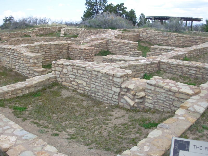
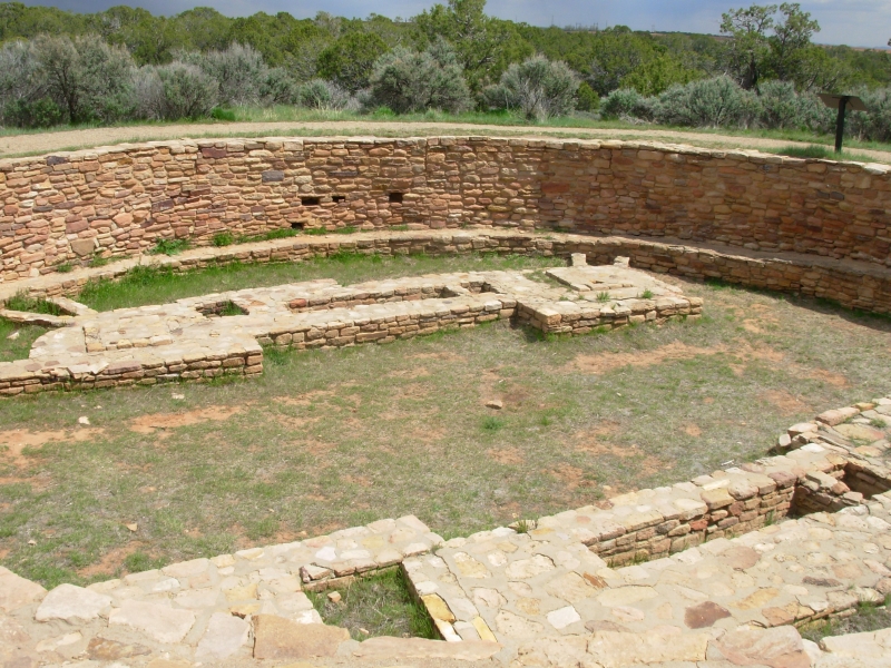
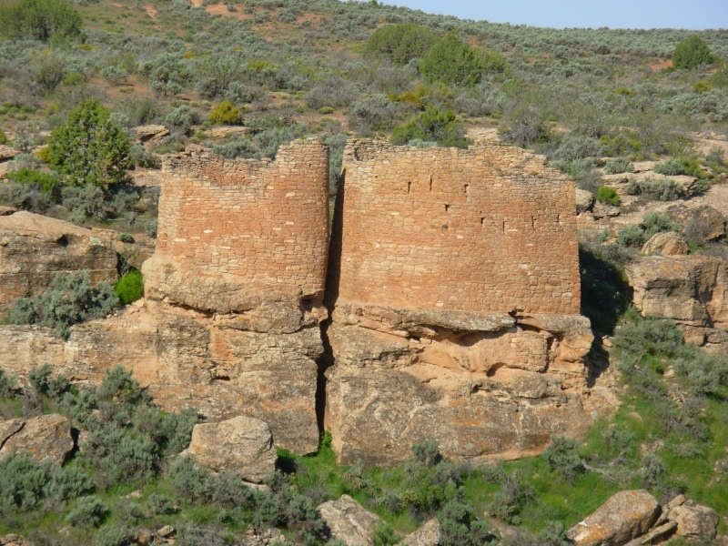
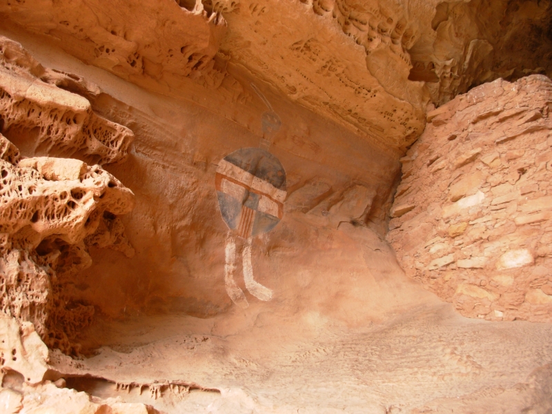
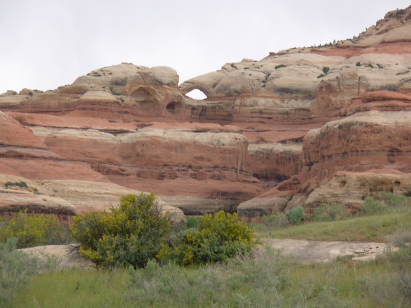
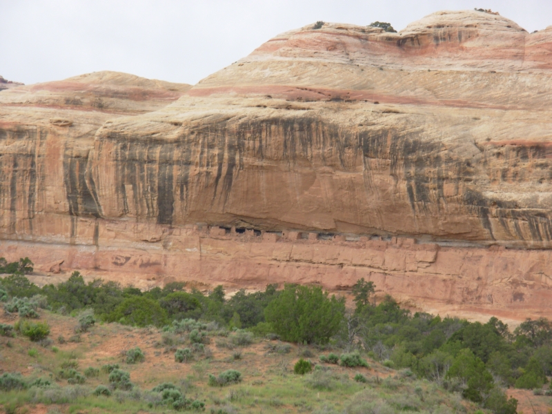
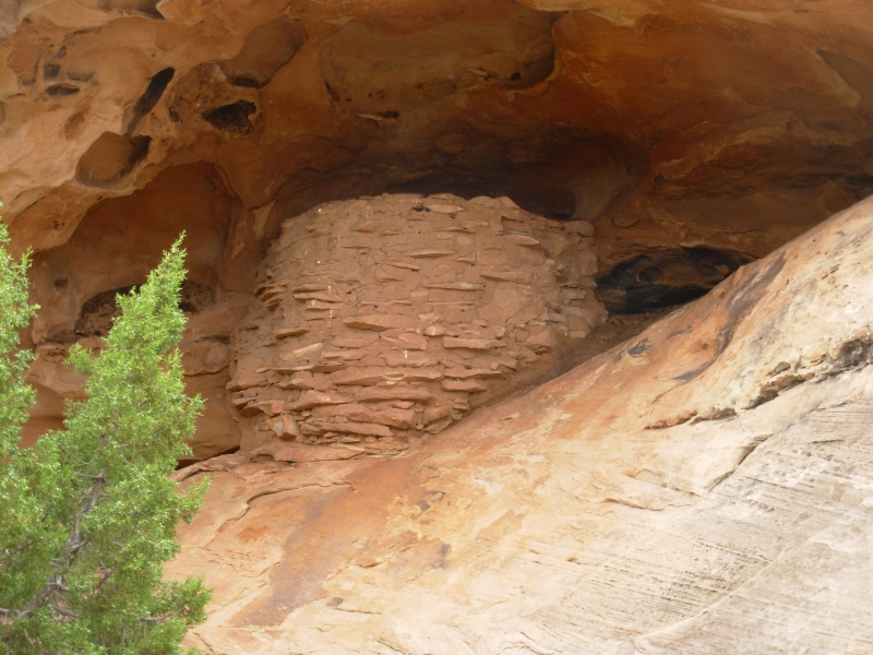
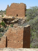
As the sky got increasingly dark, we headed west to Canyon of the Ancients. It is a large new (2000) National Monument containing the densest concentration of ancient ruins in the country. Supposedly there are 100 archaeological sites per square mile in some areas. Only a few have been developed, but there are piles of rocks that used to be villages all over. We stopped at three ruins: Lowry, which was a large 40 room ruin with 8 kivas and a grand kiva. Two of the kivas had designs painted on the walls when they were originally uncovered. Except for a small section which is at the museum, those couldnt be preserved. We moved on to Painted Hand Pueblo, a tower with a couple of petroglyphs and two faint white painted hands on a rock. Just beyond Painted Hand, we hiked to Cutthroat Ruin, which is actually part of Hovenweep National Monument. It has several round towers. We saw a few people at each site, but not Mesa Verdes hordes.
We beat the storm which threatened all afternoon. This area is high plateau, around 5800, with piñon, juniper and sage.
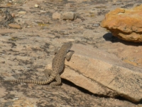
Yesterday was good for wildlife deer and turkeys. Today we saw hawks and lizards, but mostly cows and horses as we drove through the farm country between Dolores and the Monuments. The two National Monuments are adjacent, with Canyon of the Ancients mostly in Colorado and Hovenweep mostly in Utah. Canyon of the Ancients is much larger, but less developed. There is a nice campground at Hovenweep, with views over the plateau, shaded tables and a very peaceful setting.
Monday, April 30 8 miles at Hovenweep
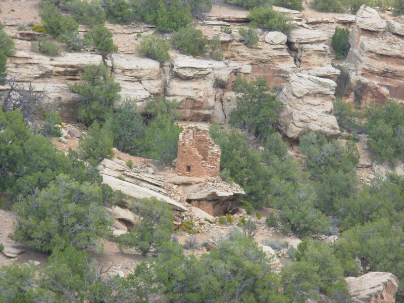
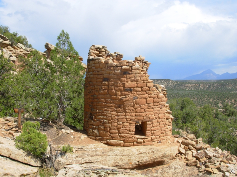
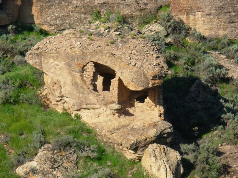
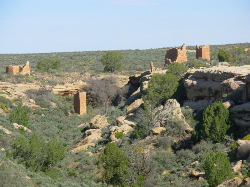
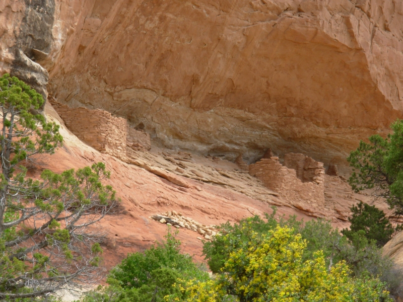
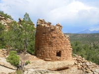
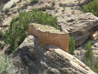
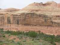
We had a good day wandering through Hovenweep. It has a large complex of ruins near the Visitors Center, Square Tower Ruins, and five outlying ruin complexes. We saw them all. First we did a two mile loop hike around the main complex. On both sides of a dry creek there are towers and fallen buildings. The towers were once three stories high and were square, round, oval and D-shaped. They perched precariously on rocks or on the rim of the canyon, or in one case, inside a hole in a big boulder. At Holly site, a rock tilted, taking down part of the tower that was constructed on top of it. The archaeologists have no idea why the towers were built here, but they look like medieval castles. Sometimes the rocks they were built on were quite small, so the towers were small, but others were quite large. There were also small storage rooms built in holes in the cliff. A lot of the buildings have collapsed and werent excavated, so they can only guess what was there. The bigger ruins housed up to 300 people; others had 100 or less.
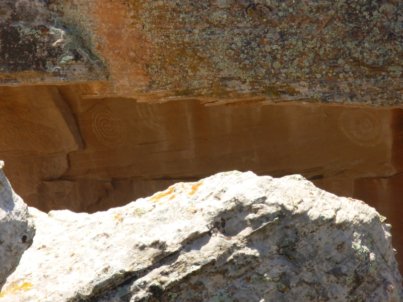
After visiting the main loop, we drove to the outlying ruins that are part of Hovenweep: Cajon in the sage country to the south, then Holly, Hackberry and Horseshoe. We saw the 6th ruin yesterday. There was a one mile trail to Hackberry and Horseshoe. Each of the tower complexes was built near a spring, now seemingly dry. At Holly there was a petroglyph with two spirals that is supposed to be a solstice marker. A shaft of sunlight spears the center of the spiral on the solstice. We could see the spiral, but the photo probably wont turn out since the petroglyph was in a shadowed overhang. When we finished our tour, it was still quite early, so I set out on a short hike. Jim wasnt in the mood, so I went alone.
There is a trail from the campground to Holly Ruin, four miles each way. I hiked out for about an hour, then turned around. I spotted two ruins along the way: one next to the trail that was almost entirely collapsed, and another small retaining wall by a cliffside camp high above the trail. I had the trail to myself, which was nice. It was hotter today, in the low 80s, so I was glad to stop when I did. Sleeping Ute Mountain was covered by black clouds again, but they didnt come near us.
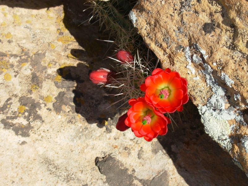
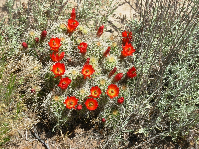
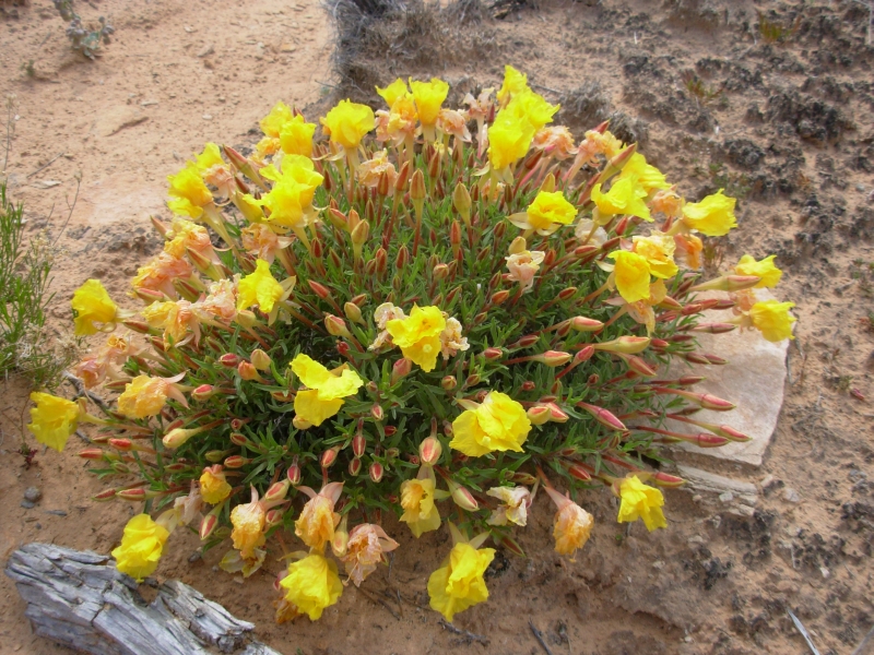
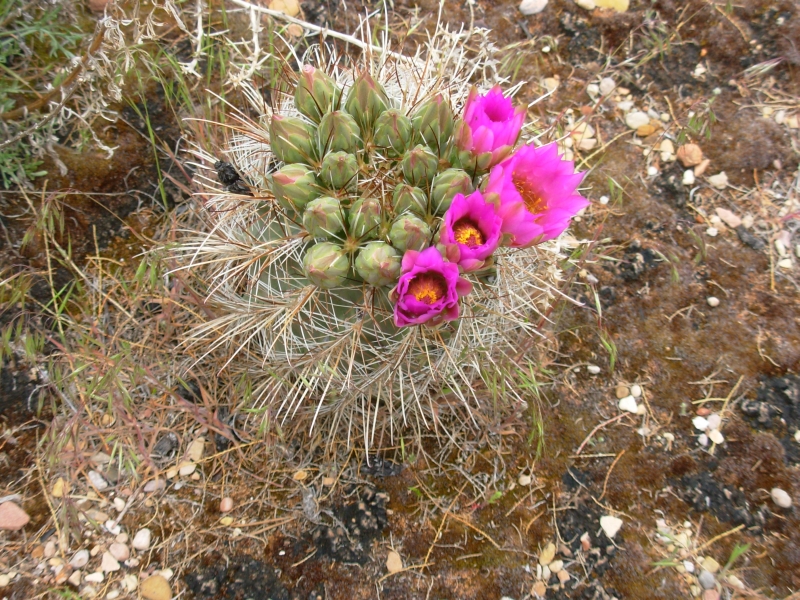
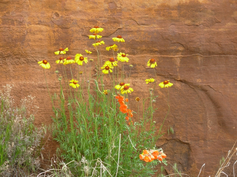
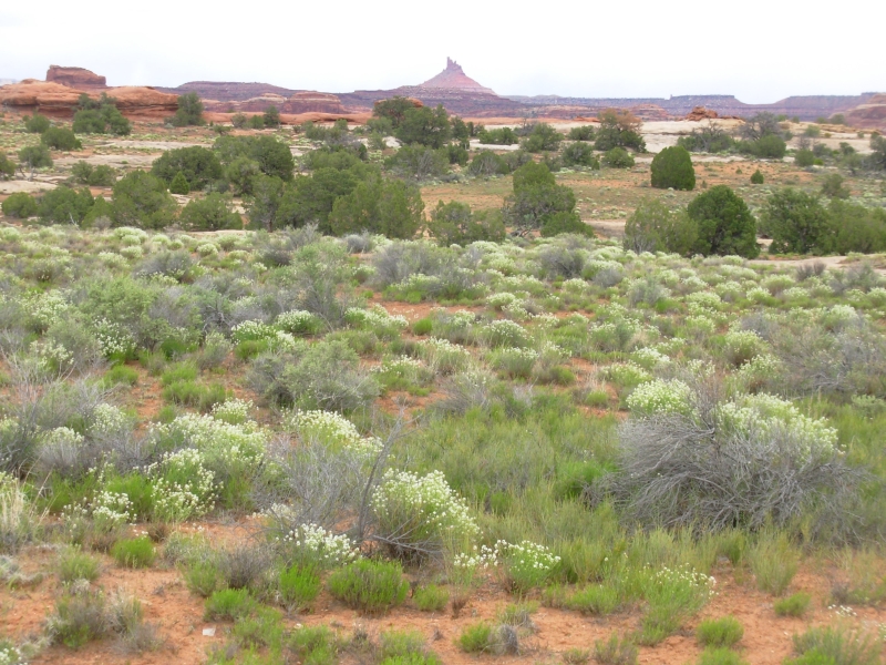
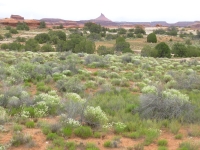
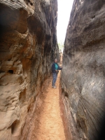
One fun part of the hike was squeezing through a narrow crack right at the beginning as I descended to the dry canyon. There was also a ladder to facilitate climbing out of a steep gully. For the rest, it was just a nice quiet hike through sage and juniper. There are lots of flowers now: white serviceberry, yellow Mormon tea, red paintbrush, blue lupine, purple phacelia and penstemon, red claret cup, pink locoweed, etc. Its a nice time to be here.
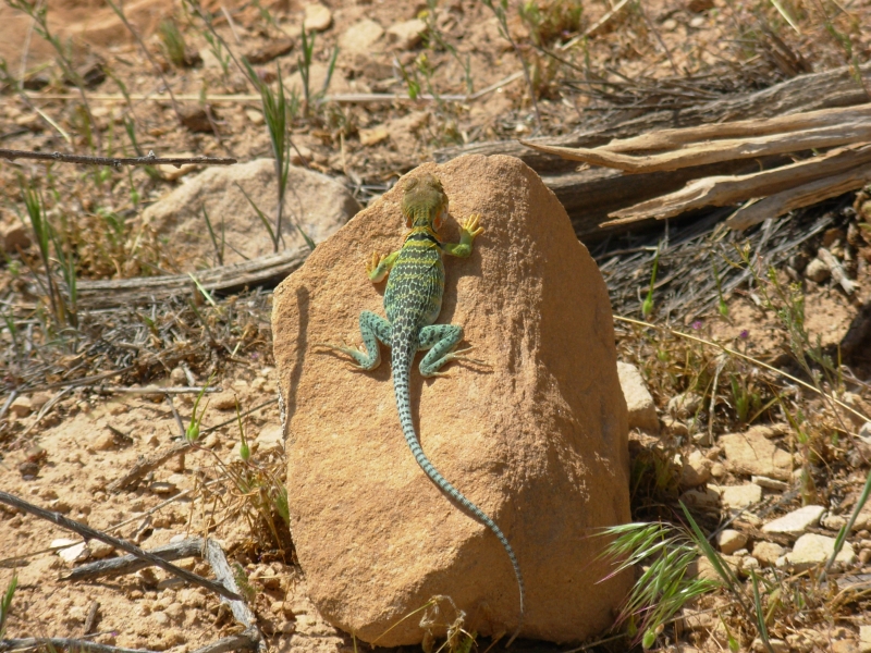
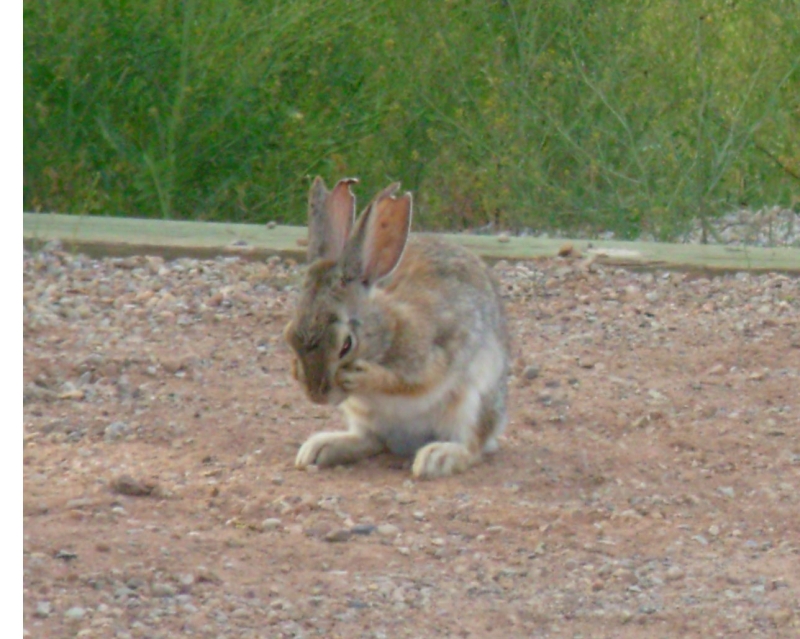
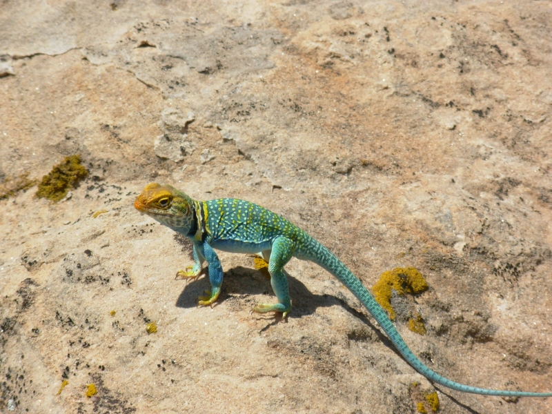
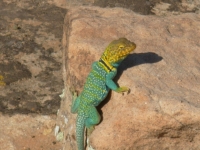
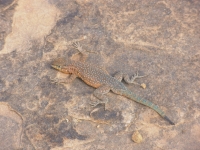
Aside from the main complex, there were few people in the backcountry. We saw two cars near Holly and talked to one person there, but that was it. I think people are put off by the rough dirt roads or maybe they miss the turn indicators. We did see three gorgeous turquoise collared lizards and lots and lots of rabbits. They hop through our campsite every couple of minutes.
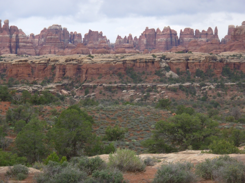
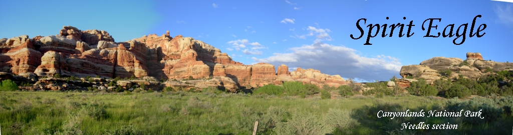
May 1: Canyonlands/Needles 2.5 miles
We had a leisurely day today driving from Hovenweep to Canyonlands National Park. Canyonlands has three totally separate units: Needles, Island in the Sky and the Maze. It is a long distance between each, and they are very different in character. The drive to the Needles District wasnt far, but somehow it took all day. We stopped at the motel and restaurant in Blanding to see if we could find Jims missing dark glasses. No luck. Then we drove around Monticello looking for (and eventually finding) the grocery store. Just in case, we stocked up for several days. (As it turns out, that was a good thing.)
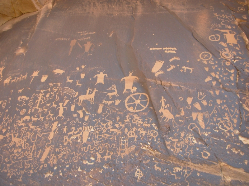
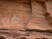
Heading toward Needles, we stopped at Newspaper Rock, a large petroglyph panel that was completely covered with rock art, created over a couple thousand years. It was a good one, almost too good. Many of the glyphs looked too new, as if someone had gone over them to make them more visible, or as if they really were carved recently. Some of the petroglyph sites weve visited have been enhanced by chalk outlines, so it isnt beyond the realm of possibility for some helpful soul to improve the petroglyphs. Grr. A couple of the images were obviously more modern; horses didnt appear here until the 16th century. One cool one was a shaman figure with radiating lines of power. Lots of bear tracks too.

From Newspaper Rock we drove on to the Park. Its rather remote 35 miles off the main highway, with no nearby gateway towns. The closest thing to that is a private campground with a small store and grill just outside the gates. That was good for us since the Park Campground is small, only 26 spaces, and it was full. We could have camped on BLM land a few miles away, but this is closer and they have a nice hot shower.
We stopped at the Backcountry Office to see about a backpacking permit. I was worried as Needles has only a few backcountry areas, but we were able to get a permit for the trail I really wanted to hike. Campsites are reserved, so we had to adjust a bit there. The trip is now five days instead of four, but that may be for the best. I was really happy to get the permit, especially after seeing that the campground was full.
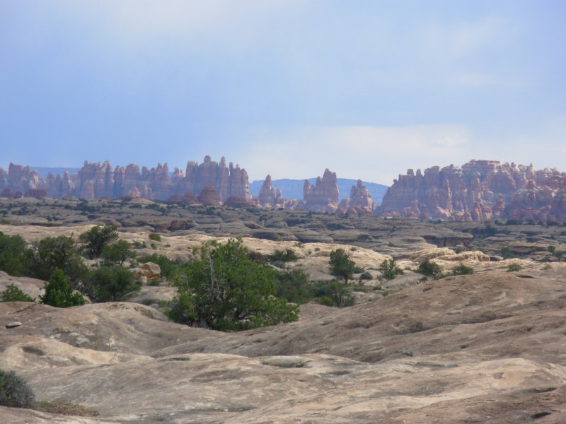
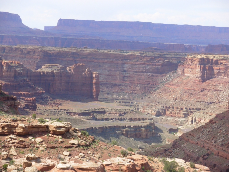
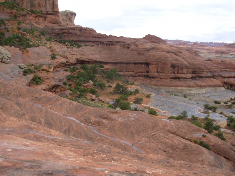
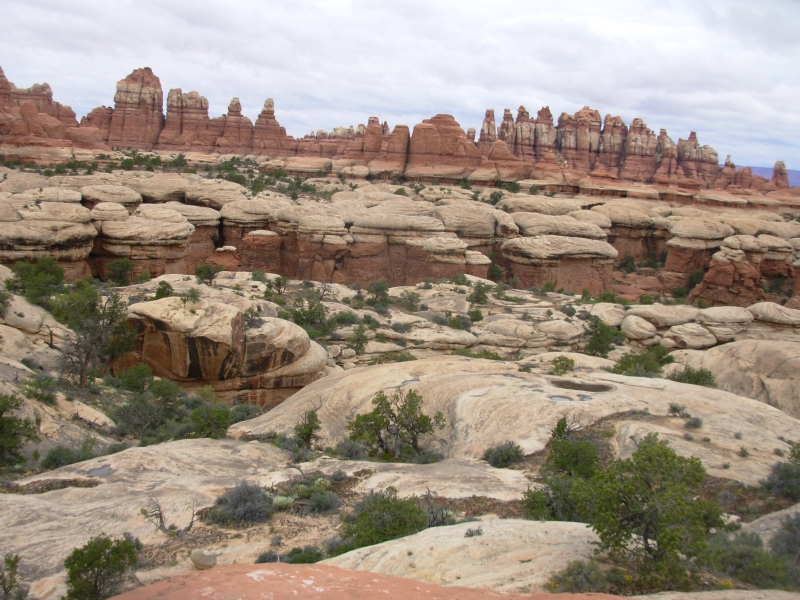
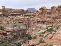
After a late lunch, we drove the short scenic drive, then took a really nice short hike on the Slickrock Trail. It was a very scenic walk with views of beautiful sandstone pillars, cliffs and mushroom rocks. We could see the snowy La Sal Mountains to the east, the Islands in the Sky buttes to the north and the pointed Needles to the south. It is a really beautiful place, very colorful. It rained off and on all afternoon, but never for very long or very hard. At least it kept the wind-blown dust down for a while.
I am very excited about our backpacking trip. After playing tourist for the past ten days, it will be nice to get out of the car and just hike again. The trail should be interesting, with Anasazi ruins and lots of geologic features. Im happy.
May 2 13 miles on Salt Creek, Canyonlands/Needles
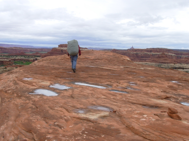
It rained off and on during the night, but the ground was mostly dry when we woke up. The day was dark and cloudy. Sure enough, soon after we started hiking, it began to sprinkle. That continued off and on for a couple of hours. The Peekaboo Trail, which we were following from Squaw Flat Campground, crosses a lot of slickrock in its five mile journey to Salt Creek.
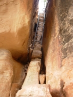
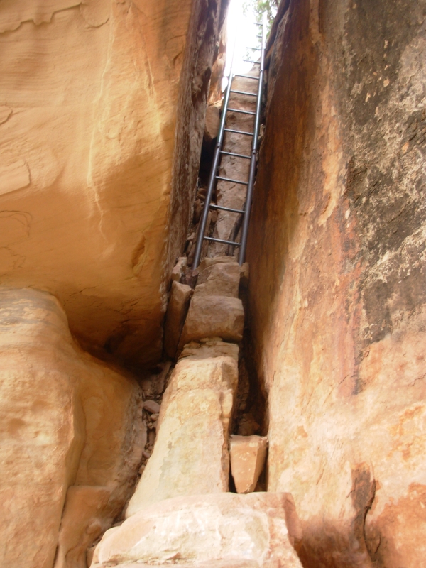
I learned two things: 1. slickrock is much easier when its dry, and 2. its also a lot more fun when youre not carrying a heavy pack. We did a lot of short steep up and down climbing from canyon to canyon. In two places we had to go down metal ladders. A couple of times we climbed up waterfalls. Its beautiful country and spring flowers are abundant, but the morning hike was more challenging than I expected. There was a good drop-off in several stretches, a bit scary when walking on wet rock. We climbed through a hole in a ridge rather than go around one nose. We had the trail mostly to ourselves. We met two men exiting in the first mile or so and two guys at the parking lot doing a different backpacking trip, but that was all.
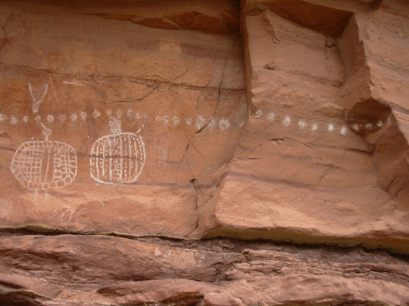
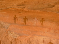
We saw two pictograph panels this morning, one at the Peekaboo campsite, with shield men, lots of hands, a snake and faint archaic (1000-3000 BC) men. The other was at a cave ¼ mile away. That had four small men and some hands.
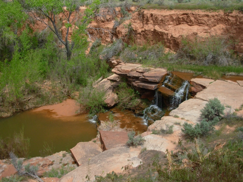
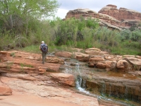
Our afternoon hike followed Salt Creek, crossing it fairly often. The trail followed an old road sometimes, but sometimes the road was washed away so we followed cairns and vague trail. We went astray from time to time, but found the trail again fairly quickly. There were tracks, but we saw no people this afternoon, just a tent. Because of the rain there were lots of frogs. By mid-afternoon it cleared up completely. Mosquitoes were a problem near one stagnant pool, but we were soon past them. Other than that, the canyon was very peaceful.
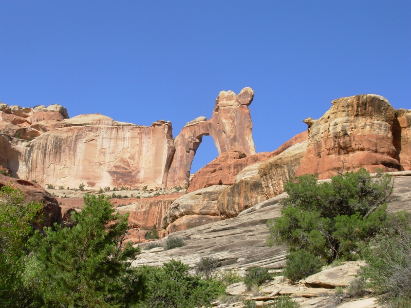
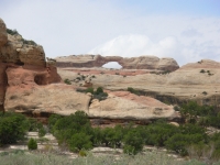
We passed a nice arch, Crescent Arch, but didnt see any ruin sites. There were lots of caves and holes in rocks, and even one mine, but no constructed walls. Finding a campsite was a bit difficult. This section allows dispersed camping, but we saw only a few decent spots and none when we started looking seriously. In the end we found a sandy spot up a dry side dry creek. As long as it doesnt rain hard, well be fine. Were above the creek bed, but not far.
Thursday, May 3: 8 ½ miles in Salt Creek
The wind rattled the tent and pulled out the stakes a couple of times, but eventually it settled down and so did we. We woke to blue skies and sunshine, but a cool wind brought back the black clouds by noon.
We have a short day today, thanks to the reserved campsite system. The campsite near Kirk Cabin that we wanted was taken, so were doing a short day today, then a day hike tomorrow out to Kirk Cabin and back to the same campsite tomorrow night.
I needed this respite from the touring. While learning about the Ancient Puebloans has been fascinating, my brain was overloaded. All the sites are running together in my memory. How do I keep them straight? Hovenweep had towers, Mesa Verde had cliff dwellings, Chaco Culture had Great Houses of unknown purpose, Navajo had the best preserved cliff dwellings, Walnut Canyon had tiny cliff dwellings in multiple caves, Wupatki had the big central village with game fields and many small outlying villages, Homolovi was mostly rubble. Then there are the petroglyph sites. Will I remember them all? I doubt it. Grand Gulch is still clear in my mind. It had better ruins than Salt Creek and more of them, but the canyon itself wasnt as spectacular. It was also more crowded, so had a different feel to it.

We continued up the creek to our designated campsite. Its on an open sage flat under an oak tree, just past the Upper Jump. I worried that that was a slickock pour off wed have to climb, but it turned out to be next to the trail, not on it. More difficult was an eroded gully we had to slide into and climb out of. The trail was gone. There were also some stream crossings that were a bit difficult. People had made stick bridges across the water, but some were more effective than others. I fell at one, just sat down in the water, still on the bridge, and couldnt get up as it was all soft mud underneath. I took off my pack and scooted back, off the sticks. The creek is rarely wide or deep, but were trying to avoid wading because of the soft mud, which means looking for rocks to hop or logs to cross, and sometimes sticks to balance on in the mud. The trail is very overgrown.
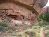
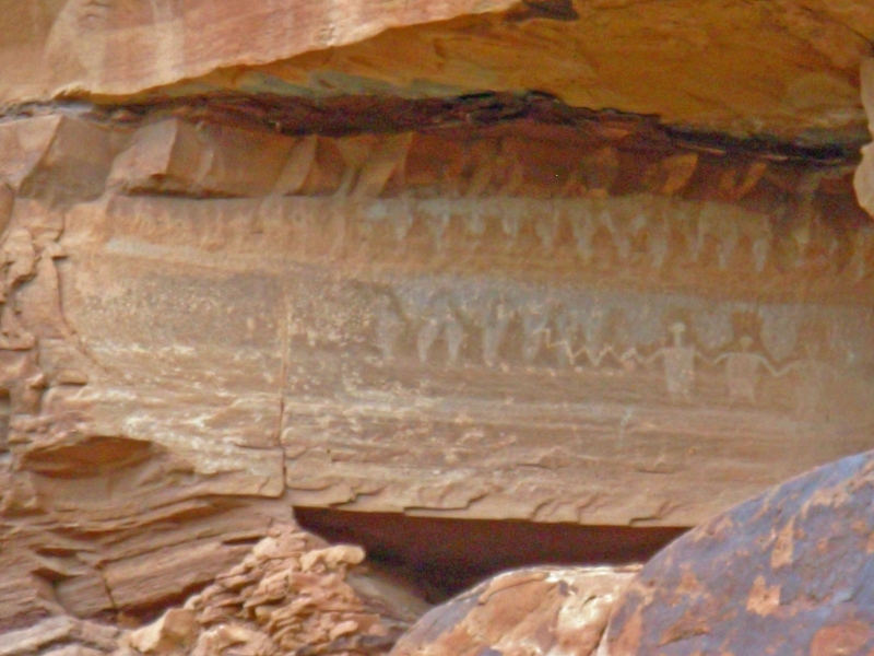
This afternoon we climbed above the creek to a sandy plateau covered with sage, which was easier than the willow tangles by the creek. In a few places the plateau has eroded all the way to the trail, making walking a bit dicey. We had to be very careful, since the edges were crumbling. We spotted another big set of ruins with many small rooms under the cliff. There was a petroglyph panel with three people holding hands and lines leading from them. Kinship or power lines? Another looked like a map, but it was too far to see clearly.
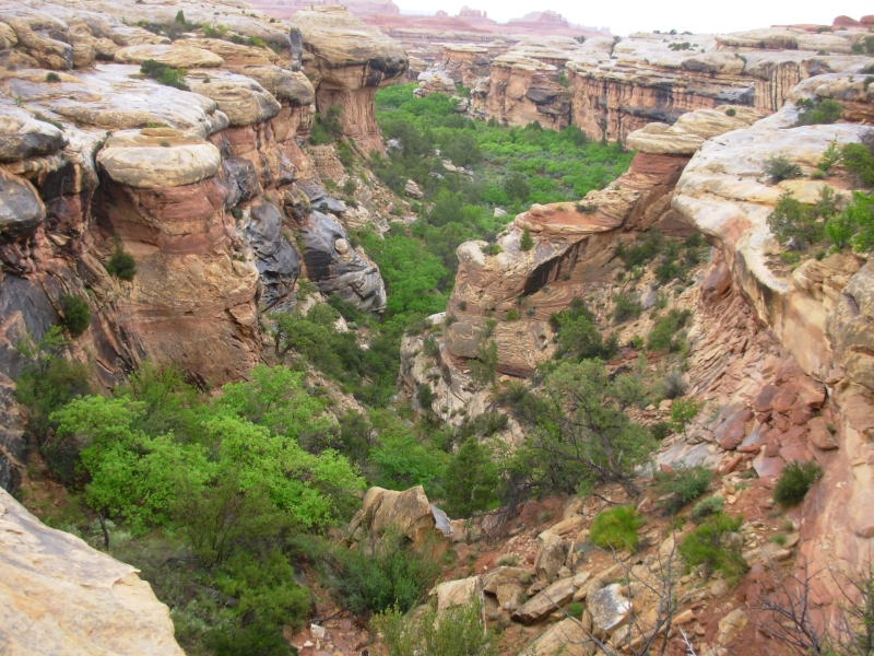
We took our time today. We did the side trail to Angel Arch, which was worth the extra miles. Weve seen a few ruin sites. One had pictographs, though we didnt climb up to it to see if there were more than the two obvious ones. Salt Creek is a pretty canyon, with red, white and orange rock and lots of green vegetation. The trail mostly follows the creek, but it is very overgrown. We pass through a lot of willow and salt cedar. In some places the cliffs rise smoothly for 100 or more. There are columns and pinnacles and balancing rocks. Aside from the wind and the birds, it is very quiet and peaceful. We didnt see a soul all day today. I really enjoy that.
May 4 10 miles to Kirk Cabin and back
We had an enjoyable hike out to Kirk Cabin, despite gray skies and occasional drips. We ran into a couple of rangers and the Park biologist who was doing bat research. They told us that the forecast is for rain/snow this weekend. Drat!
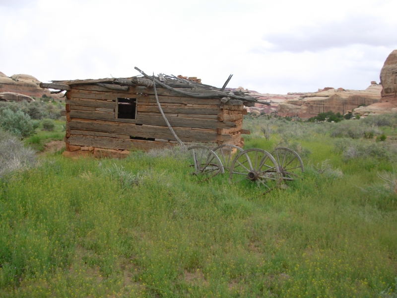
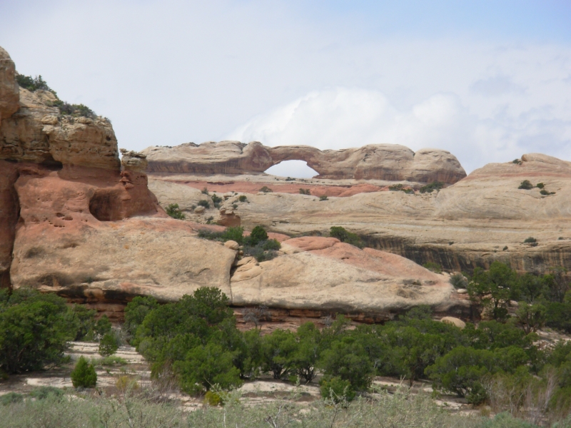
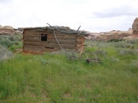
We passed a half-dozen arches and even more ruin sites. The biggest ruin was across the valley and inaccessible. Three of the ruins had pictographs. The first had several faces in red and turquoise and other interesting signs. There were also some very faint pictures. Best was the All American Man, a red, white and blue shield man in a cave, high above the trail, with handprints beside him. According to a trail register there, some archaeologists thought that the image had to be modern, but radiocarbon dating proved that the paint was from about 1200. The next cave had negative hands and white dots, counting what? There was a lot to see in that five mile stretch. We turned around at an old cabin, the Kirk Ranch. There was an old wagon out front, some rusty buckets inside and lots of antlers, but not much else.

We didnt see any wildlife aside from a pretty white hawk with black wingtips that looked almost like a gull and several swifts by the cabin. On the way back I counted seven arches, six ruins, one alcove with a few bits of pottery and a few places that might be archaeological sites but I couldnt be sure.
We went into a cave that was actually big boulders a couple of feet apart that made a slot. The light coming from above made a large white cross on the ground. Another interesting spot was a steep narrow climb up a rocky slot through a hole, larger than yesterdays hole fortunately.
Although it threatened rain off and on, and dripped a couple of times, we managed to get back to our campsite without getting wet. Given the forecast, I wish we could move on a few miles but this campsite is the one we reserved and my impression of the ranger we met is that she wouldnt be amenable to changes, even if we went five miles to the dispersed camping section. We passed the rangers on the way to the campsite, so theyll be passing this way to check on us sooner or later.
It has been fun doing such a leisurely hike. We stop and look, take lots of pictures, and still get to camp early. The only problem is my book wont last. Tomorrow Ill start Jims book.
Saturday, May 5 19 miles on Salt Creek
We fell asleep to the din of a thunderstorm, woke to the pitter patter of rain on the tent. We waited about an hour for the storm to pass, but finally gave up and packed up in the rain. That was a good thing, as it only got worse. About an hour up the trail it began to snow and sleet. We decided to push the pace and finish our hike today instead of tomorrow. Around noon the rain/snow stopped, but the dark clouds remained, so we kept moving.
We saw a couple of arches we missed coming in, but otherwise the hike was mostly memorable only for the weather. There were a few funny moments: when I tried to climb a very muddy steep hill, I kept sliding backwards. I grabbed a sage bush which got me part way up, but then I was stuck. Every time I tried to move forward I ended up sliding backwards. Finally I dropped to my knees and crawled up the hill. Jim went around, so had less trouble. Later we watched a squirrel cross the stream using the same rocks we had used to cross it. He leapt from rock to rock, keeping his feet dry. That was funny.
We ran into a few groups that were camped, waiting out the weather. Only the rangers were moving and we passed them early. Their heavy loads made them very slow. We took a different trail out of the canyon for the last few miles since I didnt want to cross the slickrock of the Peekaboo Trail in the rain again. Instead we followed the creek to a different trailhead. There is a 4WD road that follows the creek literally. Hikers either splash through the shallow water or follow along the bank where possible. Basically it was a bushwhack. Although it is theoretically possible to drive to Peekaboo campsite, the last person to try that had to leave his jeep there. He got in but couldnt get out again. The rangers said that was last fall. Evidently theres a lot of quicksand in the creek. We did run into fresh tire tracks a little farther out though. Eventually we reached a gravel road which we followed out to the paved Park drive. We got a ride back to our car with the second car that passed, a nice couple from Wyoming. The first car stopped, but didnt have room for us and our packs. They just wanted to apologize for not picking us up. That was unusual.
We headed back to Canyonlands Needles Outpost, the campground where we stayed before our hike. We ate a burger at the grill and drank a couple of beers. Jim finished up with an ice cream cone but I was too full. Finally we headed for the hot showers that were my motivation for pushing so hard all day. It was a cold wet day. Because the bushes were drenched, we never did dry off, even after the rain stopped. The frequent stream crossings kept our feet soaked. We werent miserable, but it wasnt nearly as nice as yesterdays hike past all the ruins. Im glad we did the hike, but I was very happy to reach the car and know that dry clean clothes were waiting and that the burger and beer were only a few miles away. We considered driving on to Moab, but wed like to do a little more exploring here, so were staying at least one more night.
The ridge to the south is white with snow. Im glad we stayed low enough to avoid most of it. The snow only tried to stick for a few minutes, then it melted. It is beautiful to see the snow-capped peaks, but not what I expected in the desert.
Sunday, May 6 7 ½ miles Motel in Moab

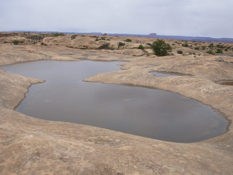
We woke to gray skies and a cold wind. We decided not to get too ambitious in our hiking plans, given the uncertainty about the weather. We headed out on the Chesler Park Trail through the heart of the Needles. It was a beautiful hike, though a short one just three miles out and then back again. There were a lot of stone steps, but some great views. Then we did the other short hikes in the park: a slickrock hike past lots of potholes, the Cave Spring trail that has pictographs and two ladders, and a very short hike to an ancient granary. Although there are other possible hikes, we decided it was time to move on, so we headed to the town of Moab.
Moab is a very busy place. We stopped at the visitors center, got a motel room, ate dinner and did laundry now Im exhausted. I cant wait to get back into the woods. However, the next week or so will be spent playing tourist. Theres a lot to see and do in this area: Arches NP, Islands in the Sky, Dead Horse Point, etc. Well do lots of short hikes, but no backcountry travel. Since weve never been here before, well do the tourist bit first, then see how we can get into the mountains again. The weather is supposed to improve over the next few days, which will be welcome. Todays high was only 45. Still, hiking in 90 degrees would be much harder.
Home | Links| Trail Journals |
The Thruhiking Papers | Bun-bun
Created: 10 November 2007
Revised: 30 Sept 2016Copyright © 2007-2017 Spirit Eagle