|
 |
 |
 |
 |
April 25 – 1 ˝ miles – Campground at Chaco Culture NHP
We slept late, enjoyed a big breakfast at Dennys, then headed south to Chaco Culture National Historic Park, arriving around noon. Because of its size (numerous villages and great houses, with several trails to outlying sites), we decided to stay put for a couple of days and take our time exploring.
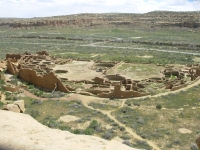
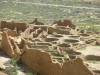
We visted Una Vida, Casa Bonita, Chetro Ketl and Casa Rinconada this afternoon. Then we took the ranger-led tour of the biggest ruin, Casa Bonita, which was really interesting because of all the questions he raised. They still don’t know why the Great Houses were built or how they functioned. Was it a religious or social hierarchy or even a slave system? Some of the local tribes have stories of enslavement.
Most of the rooms were not intended for habitation – they have no windows and no place for a fire, and are sometimes several layers inside the outer walls. The buildings were complex and huge. Thousands of wooden beams were brought in from 50 miles away to build this complex. Why? How? Chaco was the hub of civilization for 300 years, then it all fell apart. Why? Central priesthood? Trade center? Food redistribution center? There are lots of unanswered questions. They don’t even know how many people lived here full time. There are few hearths, very few bodies (only 130 skeletons were found), and very little trash for such a huge building. Was it even lived in, aside from the builders? Was it simply a place for twice annual solstice ceremonies?
Jim had the thought that maybe the buildings were built for the Gods to inhabit. They wouldn’t need windows or hearths. There are numerous small villages around the area that were inhabited, but not Chaco. Chaco was hugely significant, they just don’t know why. Modern Indians – Zuni, Hopi and Navajo – all claim the site had significance to their ancestors. They reject the word “abandoned” since their ancestors left intending to return.
What we see while wandering around are many round kiva-like rooms, tall broken walls, incredible masonry of several distinct styles, occasional petroglyphs and lots of barely visible stone walls. Much has fallen in and been filled in with sand over the centuries. Some areas that have been excavated by archaeologists have later been filled in again to preserve them. Some areas were never excavated because they expect that future scientists will have new methods or technology that will allow for greater understanding of the sites. Early archaeologists just collected the big items and tossed the rest into the riverbed in wheelbarrows. A lot was lost. At Casa Bonita we saw three story walls that were braced to keep them from falling, but sand does a better job. One section was destroyed by rock falling from the cliff above.
We only walked a short way today, but our brains were filled with information from the tour guide and the trail brochures I tried to read as we walked. Tomorrow we’ll do more walking, but I think it will be just as informationally dense. Jim is feeling brain overload. I’m just feeling the need for a brisk walk or run. Instead we’ll eat dinner and call it a day.
The campground has its own small ruin. There are few trees and half of it is closed off because of some septic issues. Our neighbors are quiet, older folks for the most part. At dusk a ranger came with his telescope to let us look at the stars in this dark corner of the country. Unfortunately, the moon was up and there were some light clouds, so we couldn’t see a lot, but I did get to see the moon, Saturn’s rings and a couple of its moons, a couple of double stars, Venus and M3 (a globular cluster or fuzzy ball). It was fun.
Thursday, April 26 – 9 miles in Chaco Culture NHP
Today was a combination of playing tourist and hiking. We took the Penasco Blanco Trail out and back for a total of seven miles, passing three Great Houses along the way. There were a half dozen petroglyph panels, containing ancient spirals and bighorns as well as modern graffiti and horses. There was a clear pictograph panel on an overhang with a moon, star and hand, which are believed to represent the 1054 supernova and there's a faint comet on the wall beside it. One of the mesa's has a solstice marker, but it wasn't on today's route.
The hike was down the open canyon. The cliffs aren’t very tall, only 150’ or so. We ate lunch at the car, then I went back up another trail to an overlook over Pueblo Bonito. I was glad to see the big picture of the Pueblo. When you walk through it, you don’t get a good idea of its entirety. Jim’s knees are acting up, giving him a lot of pain. He decided against the steep climb up to the overlook. I’m glad I went anyway. It was warm enough today that I was quite happy to stop when I did. Two days ago we hiked in snow. Today it was over 80.
What makes Chaco different is that they had a grand plan which was followed even when the building took centuries to complete. Each of the ruins has certain distinctive features, but there are similarities too. The D shape was followed in several. Many were 3-5 stories tall. The buildings were not meant to be lived in, but they were meant to be used. No one knows for what.
Last night we listened to the coyotes sing as we fell asleep. The previous day two coyotes crossed the road in front of us. In one of the ruins we saw a big bull snake. There are lots of birds singing in the brush. It’s a peaceful place. But it may not stay that way. They are planning to pave the road into the Park. Right now it’s a long somewhat rough drive on dirt roads to get here. Only those who are truly interested will make the effort. Our guide yesterday said that when they finish paving the road, he will quit because it will change the nature of the park, just as paving Arches changed its character. He doesn’t want Chaco Culture to become the busy hectic over-regulated place that Mesa Verde has become.
April 27 – 3 miles – Motel in Cortez


We did a short three mile hike along the Wijiji Trail before leaving Chaco this morning. The pictographs we hoped to view were in a restricted area due to bird nesting, so we stopped, reluctantly, at the ruin and turned around. It was a flat easy walk up the canyon, very peaceful.
We left around 10:00, stopped for an early lunch at Bloomfield, then went a few more miles to Aztec, site of another Great House influenced by both Chaco and Mesa Verde. They’ve recreated a Great Kiva there and I got the feeling of being in a church, which I was. Aztec is partly restored and partly natural ruins.
The Hopi believe all these ruins should be left to deteriorate – to return to the earth from whence they came. I understand the sentiment, but don’t agree. I enjoy learning about the past and it comes alive at a restored site, much more than when all I see are a pile of stones.
After a couple more stops to look for stove fuel and groceries, we passed through Durango on the way to Mesa Verde. The valleys are green; the mountains are still covered with snow. It is quite beautiful. Durango has changed – for the worse. It’s much more yuppified – bigger and busier. It used to be a real town, one I considered for a future home, now it looks like a tourist trap, expensive and ugly. I hate condos!
We intended to camp at Mesa Verde and tour the park tomorrow, but the campground is still closed for the winter. Darn! Rather than stay at a nearby RV park, we drove 10 miles to Cortez where we got a motel, showered and ate lasagna for dinner.
April 28 – 5 miles at Mesa Verde
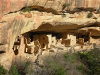
It turns out the campground wasn’t the only thing still closed. The road to Wetherill Mesa is closed until June. Balcony House, one of the ranger-led tours, opens up tomorrow. Oh well. There was more than enough to see. It took all day to do what we did: tour the public sites on Chapin Mesa, take the ranger tour through Cliff Palace and hike to Balcony House Overlook and along the Petroglyph Trail. It was a good day and a very full one.
We had been to Mesa Verde before, but after visiting so many Anasazi sites, we saw it differently. One thing I appreciated was that there were ruins and artifacts from the earlier, pre-pueblo period. There were pit houses and single room houses and small pueblos from 900 CE as well as the massive cliff houses built between 1100-1200. The architecture was slightly different from what we saw south of here, especially the masonry.


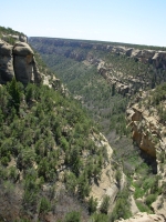
There were a lot of towers whose function is unknown. Many were connected by tunnel to kivas. There were many scattered ruins in alcoves in the canyons, like those we saw at Walnut Canyon in Arizona. Many more ruins were on the mesa top. One area, Far View, had 50 ruins within a half mile. At its height, 3000-5000 people lived on the mesa, though the cliff houses generally didn’t hold all that many people. Cliff Palace only had about 100 people living there, though it had 31 kivas. Like Chaco, it may have been a religious/ceremonial center rather than a residential one.
They’ve done a lot of work to restore the ruins. There are only three cliff houses you can visit, two with ranger tours and one where the rangers stand by and provide information when requested. Wetherill has two ranger-led tours. As Ranger Cornucopia at Chaco said, Mesa Verde is highly restricted. There are only a few hikes allowed, mostly around the campground.
There were hordes of people everywhere. Our tour had about 50 people. There were bus loads of school kids that we leapfrogged all day. The petroglyph hike was a good one along the edge of the canyon, except for the yells of the kids racing by. The panel was an interesting one describing the ancestral migration, according to modern Hopi who have studied it. There were clan symbols, whipping kachinas, bighorns, hands and spirals – lots of images. The museum was also nice, though small, with some good exhibits.
Home | Links| Trail Journals |
The Thruhiking Papers | Bun-bun
Created: 10 November 2007
Revised: 30 Sept 2016Copyright © 2007-2017 Spirit Eagle