|
 |
 |
 |
 |
|
|
|
|
|
|
April 7-12 - Sunset Crater & Wupatki
We spent a few relaxing days with my oldest brother Jack, and his wife, Kitty, in Fountain Hills, east of Phoenix. Jim went to the dermatologist, got several spots frozen, and was told that the spot that worried us wasnt serious (unless it grows back). That was a relief. After Jims squamous cell scare least year, we werent willing to ignore another sore that didnt heal. It was a nice visit, but I was ready to get on the road again. We werent getting any exercise, which is hard on me, both physically and emotionally. Besides, we didnt want to wear out our welcome.
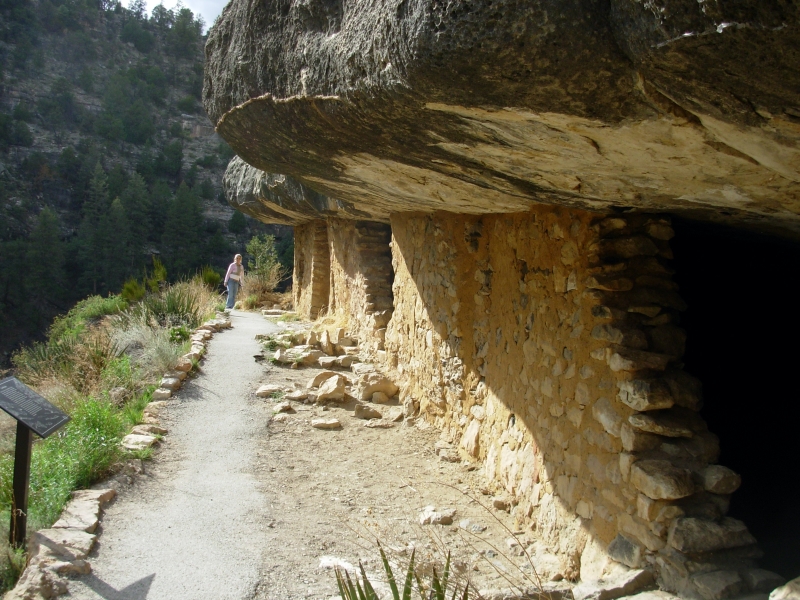
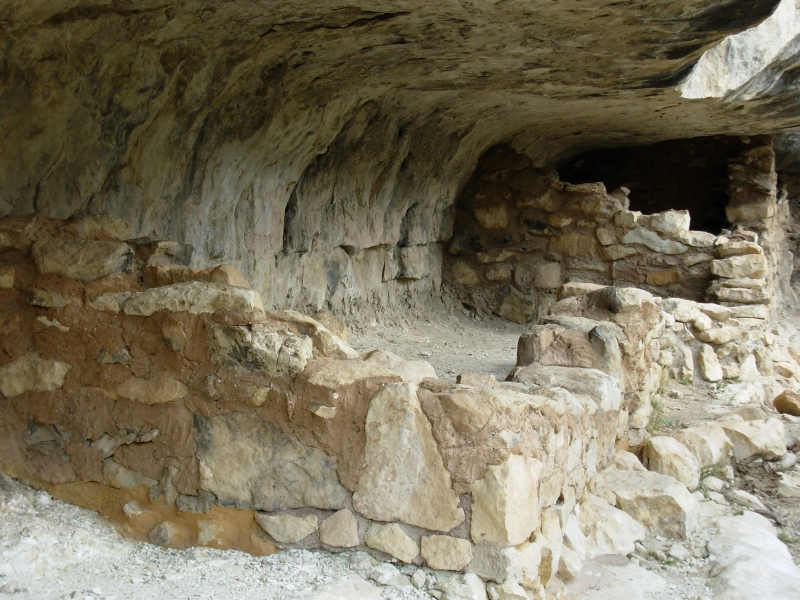
So on Wednesday afternoon we headed north to Flagstaff. Like most roads in Arizona, its a pretty drive, rising gradually from the desert to the high country. Last fall we visited Sedona, Montezumas Castle and Montezumas Well, so this year we wanted to visit places that Jim hadnt seen. I spent a couple of weeks wandering in Arizona about 20 years ago, so had some familiarity but only vague memories of some of the places we visited. We stopped to tour the Sinagua Anasazi ruins at Walnut Canyon National Monument. There are dozens of ruins you can see and one section of the canyon, the Island, has a trail where you walk through and past a series of old stone walls. I enjoyed looking up the canyon to see how many other ruins I could see in the many caves and alcoves. I remember doing that at Mesa Verde as well. Almost every alcove had a stone wall of some sort.
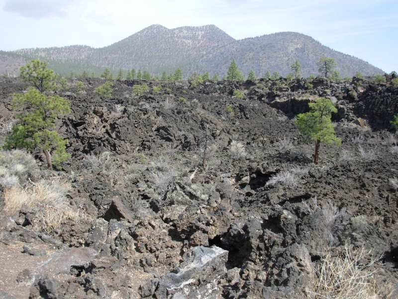
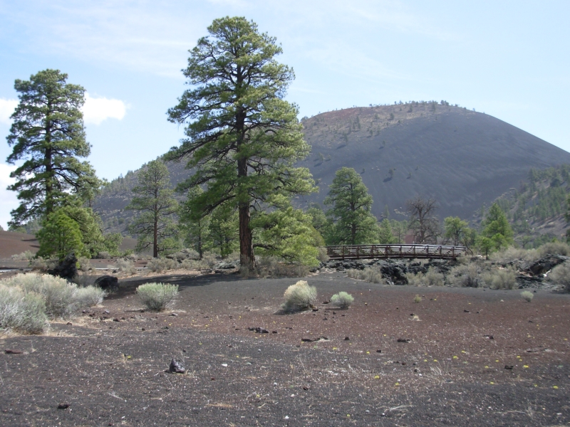
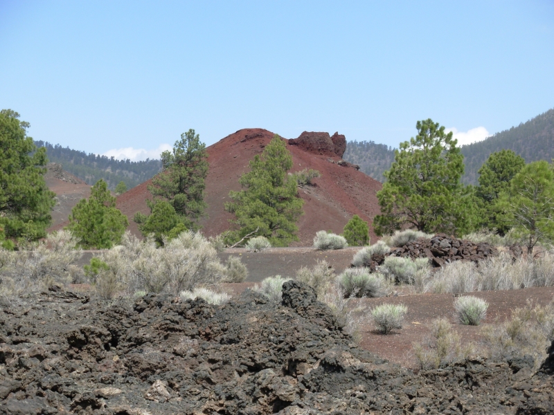
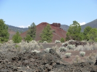
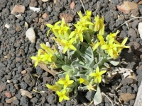
We spent the night in Flagstaff, then headed up Highway 89 today. We did a short hike at Sunset Crater National Monument through the lave floes. A thousand years ago the volcano was active. Geologically, thats recent. It was beautiful, in a weird way. Northern Arizona has dozens of volcanic cones, from the San Francisco Peaks to Sunset Crater to OLeary, etc. The lava cones were sometimes red and sometimes black. There were little yellow flowers scattered all over.
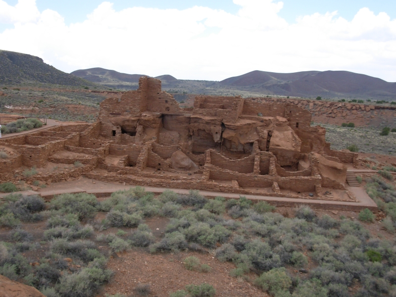
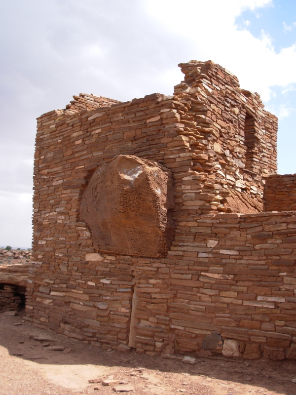
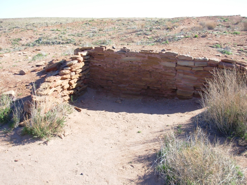
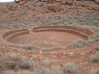
From there we continued north to Wupatki National Monument a few miles away. There are several Kayenta Anasazi ruins you can visit, some of which are very impressive. Two of them were three stories high. One had a large round game field, a square kiva and hundreds of small rooms. The game field is very unusual north of Mexico. I enjoyed the way they build around the big rocks and boulders, incorporating them into their walls.

I think the ruins are fascinating because there was a flowering of civilization in several parts of the country around 900-1000 AD that lasted 200-400 years, as seen in the construction of large villages, huge burial or ceremonial mounds, cliff houses and Great Houses, and cultural centers that influenced hundreds of miles of territory. Very little is known about the people who built them as each culture built impressive monuments, spread, and then vanished.
In the Midwest, the Mississippian Culture emerged at this time. In the southwest, the Anasazi (Ancestral Puebloans in PC parlance) built multi-story cliff palaces and Great Houses. In northern Utah the Fremont painted and carved beautiful rock art depicting elaborately dressed shamans and spirit beings. Many of the buildings were only occupied for a short period before they were abandoned.
The main Wupatki village had to be important in its time and there were dozens of outlying houses within a days walk whose inhabitants probably gathered at the great houses for ceremonial purposes. But they were all abandoned. Why?
Current thought is long lasting drought combined with more warlike neighbors moving in, and internal unrest because of the continuing lack of rain. (It's hard to believe in your shaman's powers when his prayers don't bring much needed rain.) It is believed that the Ancestral Puebloans joined with other tribes which became the modern Pueblo cultures (Hopi, Zuni etc.) because their villages were larger and more secure and near better watered areas. But no one knows for sure.
It was an interesting morning.

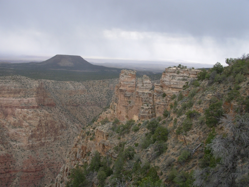
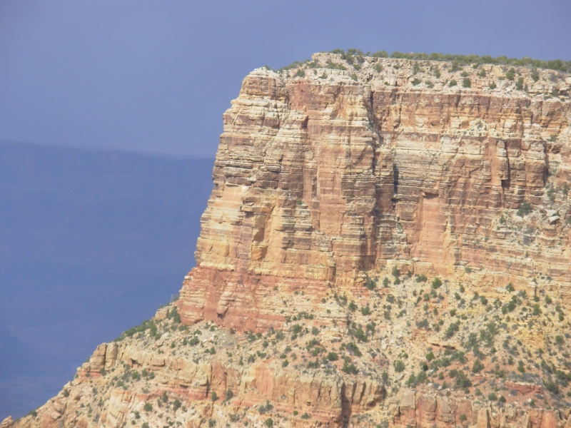
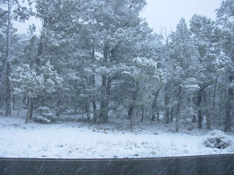
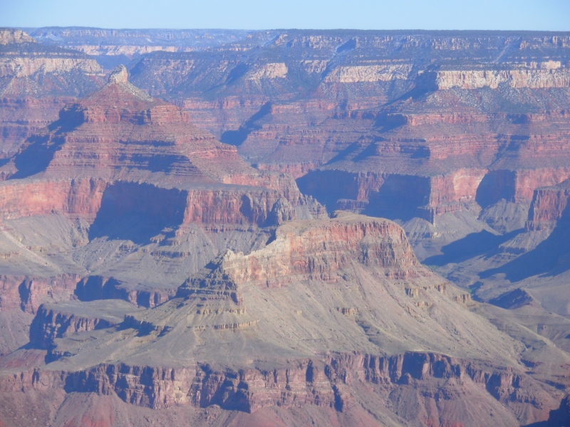
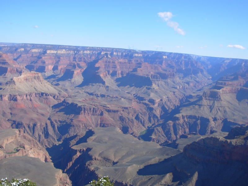
The wind picked up and clouds rolled in as we headed toward the Grand Canyon. Jim wanted to get some digital photos of the Canyon since our previous visits were pre-digital. It was too cloudy and hazy for good photos, but we tried. Then it began to snow, heavily. The flakes were fat wet ones. We sat in a parking lot waiting for it to pass, but it just snowed harder and soon began to accumulate. We gave up and headed out. The Canyon was invisible. There was nothing to see and it was too wet to walk, so we headed to Tusayan, a town just outside the Park. We didnt want to drive 90 miles to Flagstaff in that kind of weather, so we looked for a motel. A lot of people had the same idea, including many who were reserved at the campground, so it took three stops before we found a room at a reasonable rate. But we got a nice warm dry room then went for dinner, followed by the IMAX film on the Canyon. We figured, if we cant see the Canyon ourselves, at least well get some nice movies of it. The film was pretty good, especially the river running scenes. Having run the river two years ago, a lot of it was familiar.
Tomorrow well go back to the Park, do some hiking and attempt once again to take a few pictures. Were in no hurry. Weve done some thinking about the next few weeks. I want to do a lot of hiking in Southern Utah. Since were playing this by ear, we might have problems with permits. Paria Canyon, which Id really like to see, is booked for the next two months, but there are a lot of other places to explore. We visited Zion and Bryce two years ago. This year well stop at Arches, Canyonlands, Grand Gulch, etc. Im looking forward to spending time there. It is beautiful country. It can teach me a lot, I think.
April 13 5 miles at Grand Canyon NP Camp at Homolovi State Park
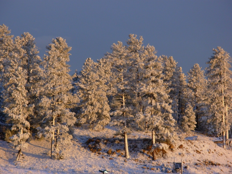
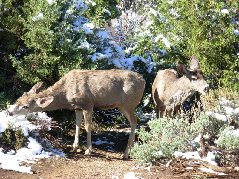
The weather cleared overnight, so we returned to the Grand Canyon this morning. The snow melted quickly, but gave pleasure to a lot of kids who collected what remained for snowball fights. We walked along the Rim Trail for about 5 miles, taking pictures at every turn. It was really beautiful. The Colorado River was green, not the muddy brown we experienced two years ago. Some tame park deer ignored the hordes of tourists taking their picture. A hungry ground squirrel went farther: he didnt move even when someone almost stepped on him.

We went all the way out to Hermits Rest in a combination of walking and shuttle bus, then took the shuttles back to our car. There are now three buses, each covering a part of the Park. You can drive to the village, but parking can be difficult, so they encourage shuttle use even in the areas where you can drive. We didnt see any condors, but we met a biologist who was monitoring them via radio collars. He said they nest right near the Village. One had done a small circle earlier today. We just saw several ravens, dancing in the sky. Tis mating season, evidently. I loved seeing the canyon on such a fine day. Yesterdays haze and clouds were a real disappointment.
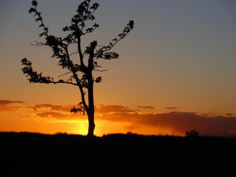
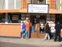
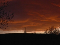
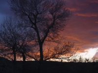
We left the Park at 2:00, drove through Flagstaff without stopping, except to admire and photograph the snow-covered San Francisco Peaks, then wandered through Winslow looking for a grocery store. We also stopped to stand on the corner in Winslow Arizona per the song, then drove a few more miles to Homolovi State Park which has some ruins and petroglyphs as well as an open campground. There was a beautiful sunset over the San Francisco Peaks as we ate our hamburgers. It was cold and windy. The sand dune behind our campsite wasnt much protection against the wind blowing across the open sage grasslands. Still it was a nice quiet site, with only a dozen or so RVs all spread out.
April 14 2 miles Motel in Holbrook
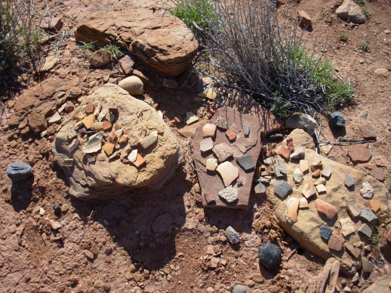
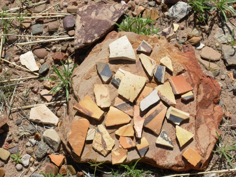
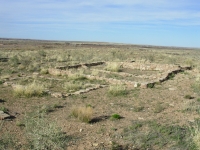
We started the day by visiting two of the Homolovi ruin sites. One had around 200 rooms, according to the sign. They were occupied around 1300-1400 AD. The sites werent restored, just excavated and then filled in, but you can see outlines of where the rooms were located and a few good walls. Everywhere there were pottery shards, lots of different kinds from plain brown to red to yellow to multi-colored painted ones to a kind that looks like basket weaving. I really enjoyed seeing that. The petroglyphs were disappointing very faint and simple. They are very old and Im sure we missed some because they were so faint. The oldest were just holes pecked into the rock, significance unknown. The better petroglyphs are at Site IV which is now closed except to ranger-led groups by appointment. I would have liked to see the Kokopelli figure there.
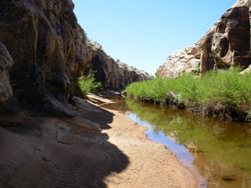
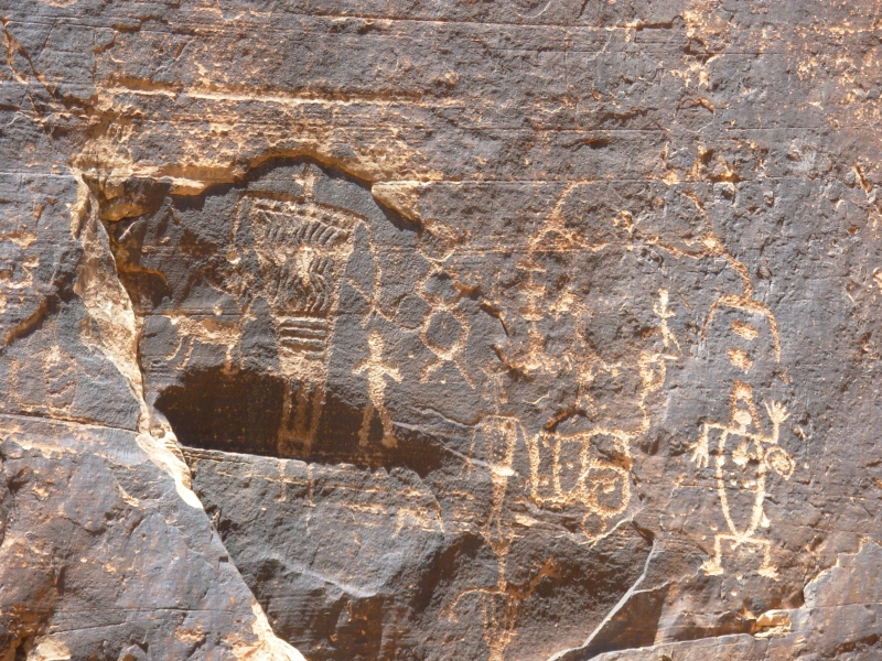
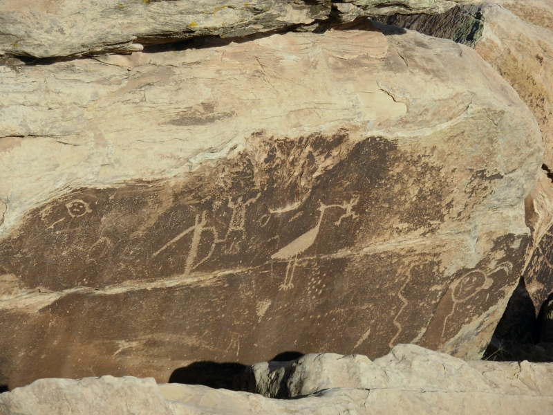
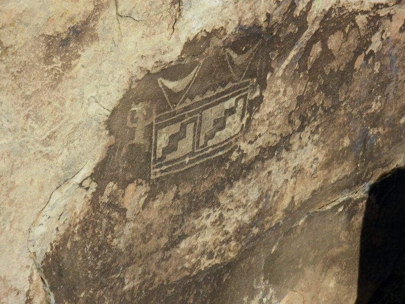
However, we were able to get hold of the owner of Rock Art Ranch. There is a private ranch near Winslow with some great rock panels in Chevelon Canyon. Visiting is by appointment only. Fortunately the phone number was in a book we have about rock art sites. We met Mr. Baird at the locked gate and he let us in and showed us the set up, then went back to his ranch, after handing us the key to the gate and instructions on where to leave it when we left. It was a very nice site, with a covered picnic pavilion, cool and shady, a water tank turned into a bathroom, with running water and a flush toilet. We invited us to camp there if we wished.
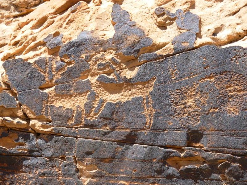
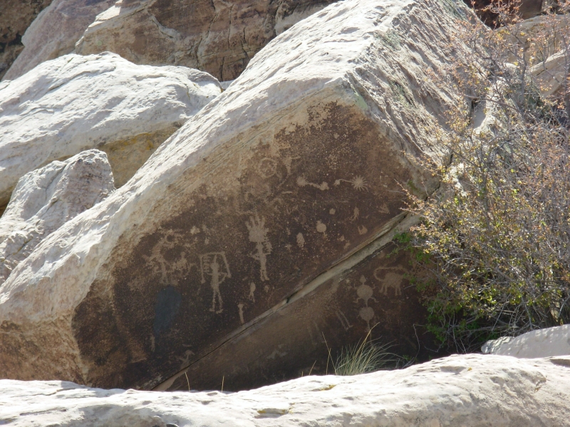
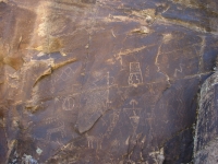
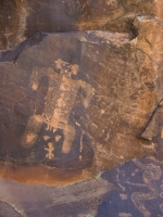
Chevelon Canyon is a narrow green oasis with a running stream and steep 50 high sandstone cliffs. Into the varnish were carved about 5000 petroglyphs. Archaeologists date some at 6000-8000 years old, though there are some from many different eras. Some were very faint, the more recent ones were very clear. There were dots and zigzags, many deer and people, kachinas, a beaver, tracks of birds, bears and people, a sun and many unknown objects. Some of the people carried shields or a scythe. One person had zigzags on his chest. There was a birth scene.
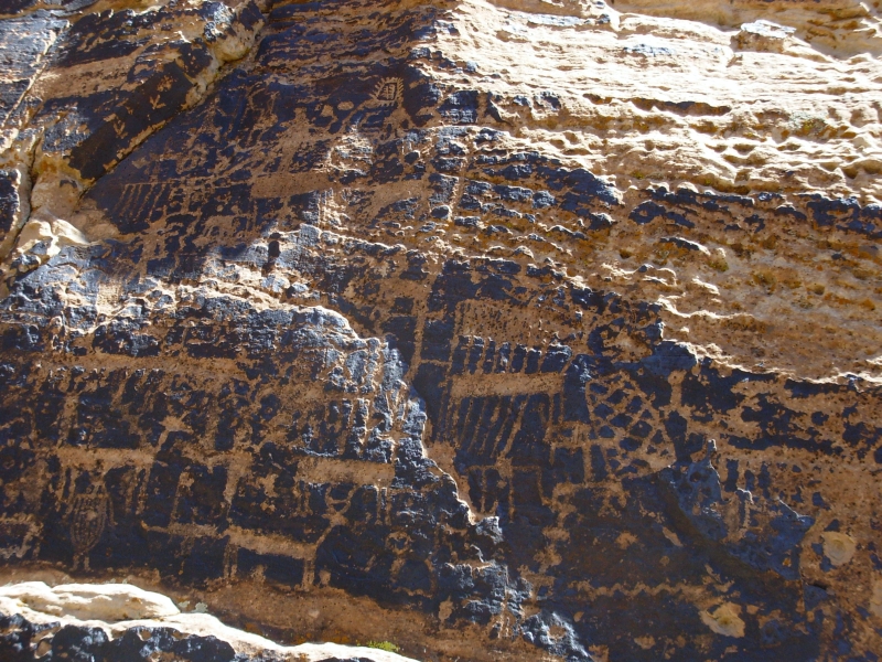
It was a lot of fun going up and down the stream, looking at the panels on both sides. What is really amazing is how concentrated the site is. All the petroglyphs are within a quarter mile. Some were high up the walls. How did they climb up there to carve them? Some walls were completely covered with pictures, while some right next to them were bare. We spent two hours looking and taking pictures. A baby rattlesnake froze at sight of us and a few lizards darted across the rocks; otherwise we had the place to ourselves.


The ranch also has a museum which is supposed to be a good one, but Mr. Baird warned us they were heading to town this afternoon and sure enough, when we got there the gate was locked. Im sorry because he has quite a collection of artifacts. He told us, Anywhere you can ride a horse, you will find ruins or artifacts.
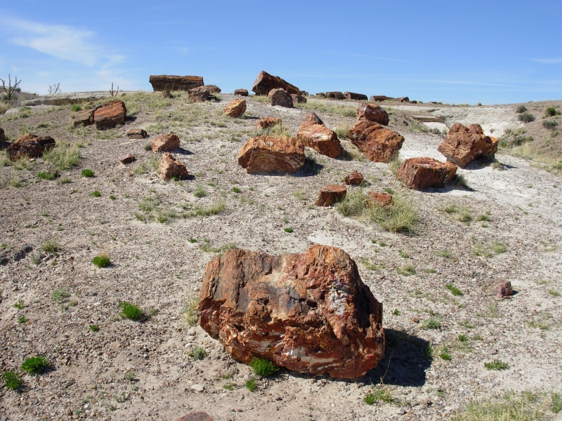
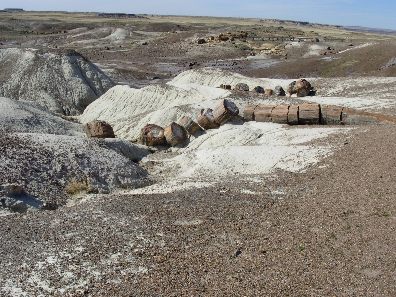
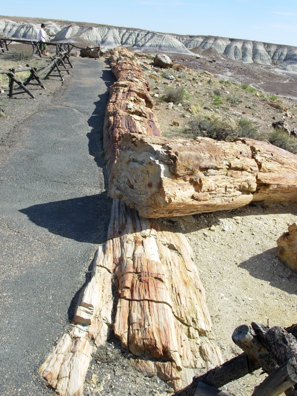
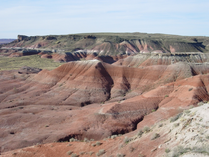
Afterwards we headed to Petrified Forest/Painted Desert National Park. It was a nice drive. We didnt do much hiking there, but we saw lots of beautiful multi-colored petrified logs in the stops we did make, plus we visited the Puerco Ruin, a 100 room village from 1200-1400 CE which had some very nice petroglyphs. From there we continued north to several overlooks of the Painted Desert, with beautiful orange sands. The Teepees were formations of purple-gray and white sandstone. Farther north the badlands were more colorful.

At the end of the day, we found ourselves with no place to camp, so we headed back to Cholla Lake, west of Holbrook. Our guidebook mentioned some rock art not far from the campground by the power plant. The campground there was closed, so we went looking for the petroglyphs that are supposed to be nearby. That was frustrating since the map in the guidebook was way off scale and the explanation on where the panels are located was very vague. We found a few images, but not the main panel. Sunset was imminent, so we turned back and headed to Holbrook to look for a room for the night. There werent any National Forests nearby, so we couldnt just camp freely. The Reservation isnt quite as hospitable to people camping by the side of the road as the National Forests.
April 15: 3 miles in Canyon de Chelly
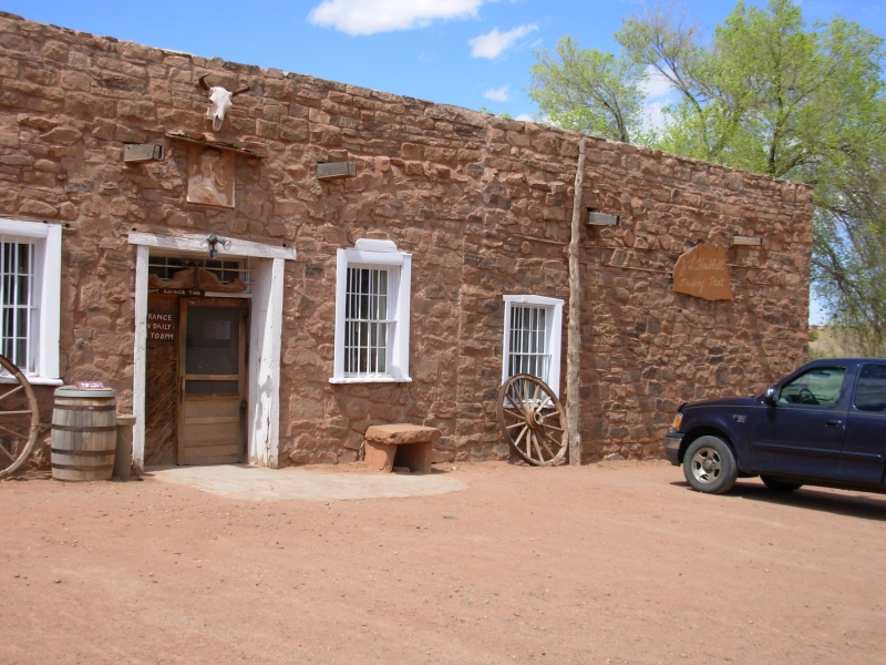
It was another blustery day. Clouds threatened, but no rain fell. We drove onto the Navajo Reservation, with a stop at the Hubble Trading Post, the oldest trading post still in operation. They had some nice woven blankets, but we werent in the market to buy so I just admired them and moved on.
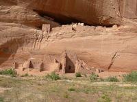
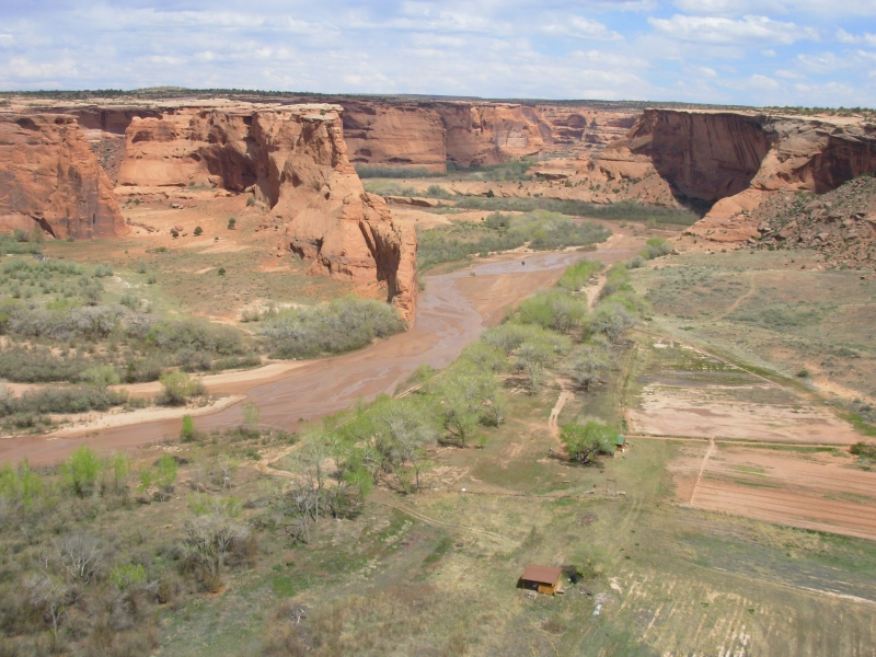
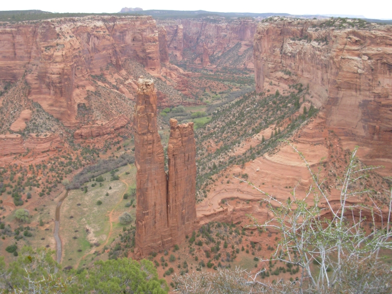
Then we drove on to Canyon de Chelly, a beautiful red rock canyon. Tourists cant enter the canyon except at one spot unless accompanied by a (paid) guide, but there is a rim drive with many overlooks so we could see the beauty of the Canyon and many of the Anasazi Ruins. I've been to the Canyon before, but wanted to come back because I remembered that it was really incredible. I love colored canyons! Wind threatened to toss us off the edge so we had to be extra careful. The Canyon is 700 deep with sheer red sandstone walls. At the bottom is a green watered valley, inhabited by many Navajo families who farm the land. The plateau is piñon-juniper and sage grasslands.
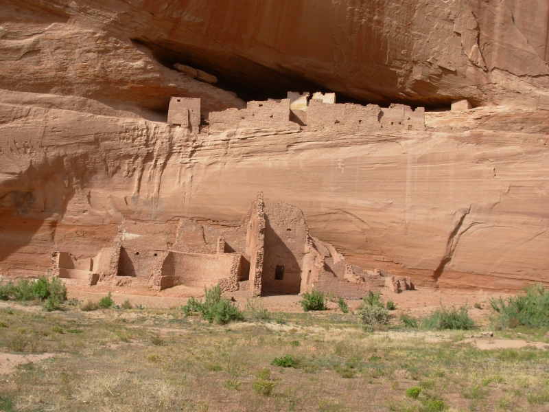
We did the one legal (guide not required) hike to the White House Ruins. A good trail drops 500 in a little over a mile, then heads across the canyon to some fenced off ruins. It was pretty down there. Being Sunday afternoon, the place was very busy with Navajo families and lots of kids doing the short hike. It was a nice walk, and the ruins were worth a visit. Next time Id like to take one of the jeep tours that go along the canyon bottom and thus closer to the ruins, but this time I wasnt willing to spend the money.
We decided it was too windy to cook at the campground so ended up at the lodges cafeteria. It was expensive, but the food wasnt bad. Most interesting to me was a woman who came in carrying her baby in a wooden backboard. I didnt know those were still in use. It looked pretty uncomfortable.
We only drove half the Rim Drive due to a late start this morning and an ambling pace all day. Tomorrow well do the northern half. The lighting is supposed to be better in the morning for that drive anyway. It was a good day, despite the wind and the slow pace. The Canyon is even more beautiful than I remembered. White House Ruin was nice and we spotted seven pictographs there. There were several ruins tucked into caves and crevasses visible from the overlooks. Looking for them was fun.
Home | Links| Trail Journals |
The Thruhiking Papers | Bun-bun
Created: 10 November 2007
Revised: 30 Sept 2016Copyright © 2007-2017 Spirit Eagle