|
 |
 |
 |
 |
|
|
|
|
|
|
Saturday, March 31
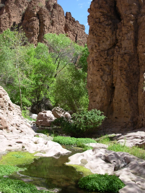
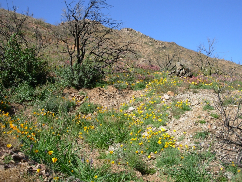
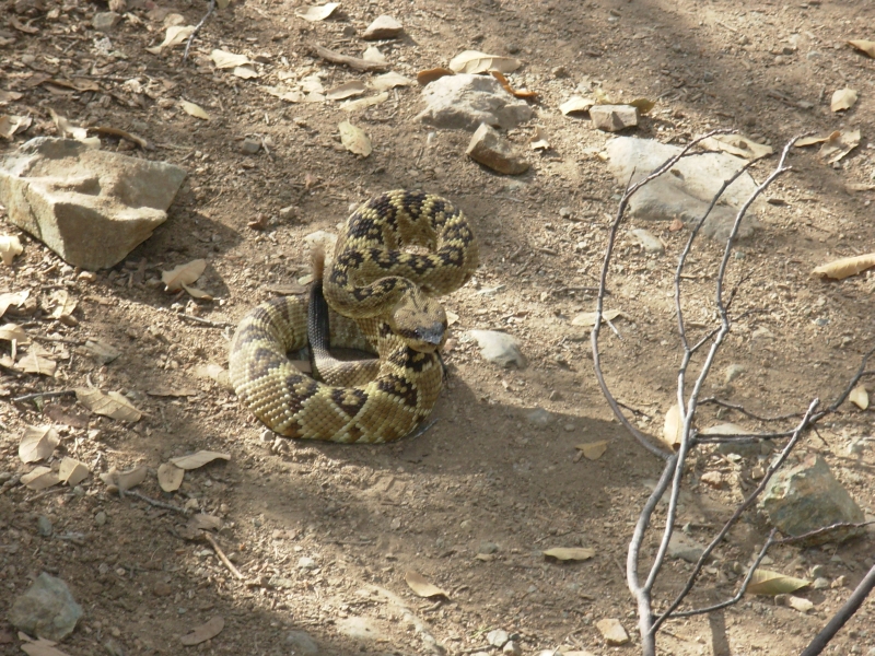
We called my brother Jeff to come pick us up in Mammoth. We took a very round-about backcountry route back to Phoenix. First we drove to the Dripping Springs area, where we hiked up a streambed through a slot canyon for a couple of miles. It was lush, green and beautiful. We saw a rattlesnake in the brush there.
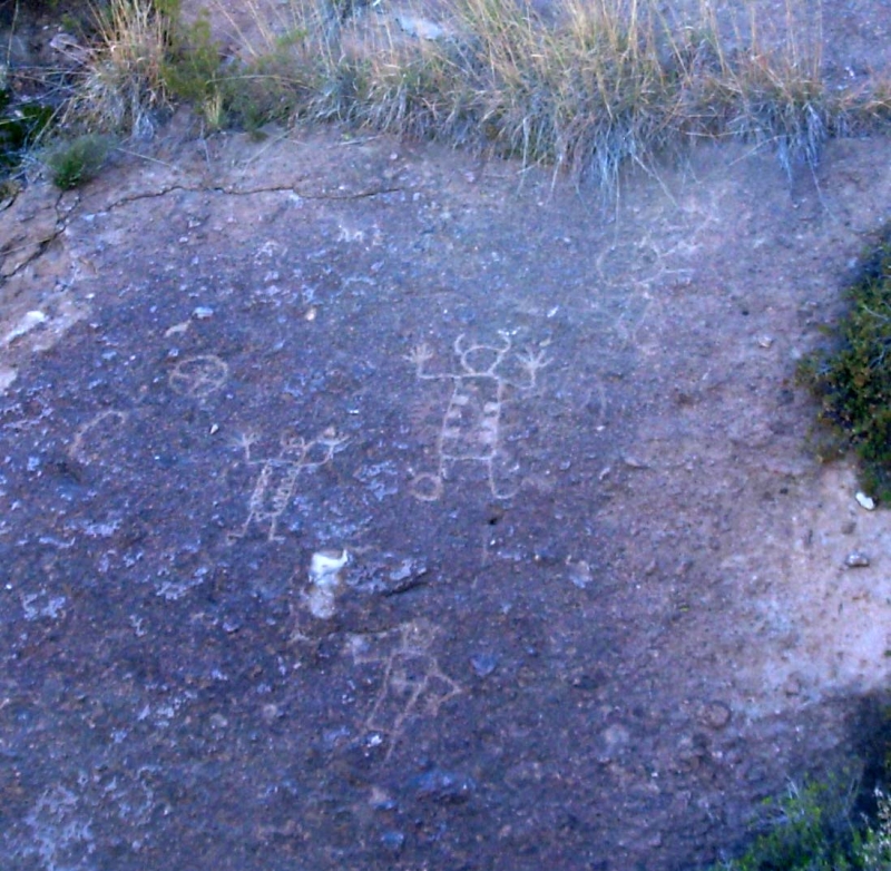
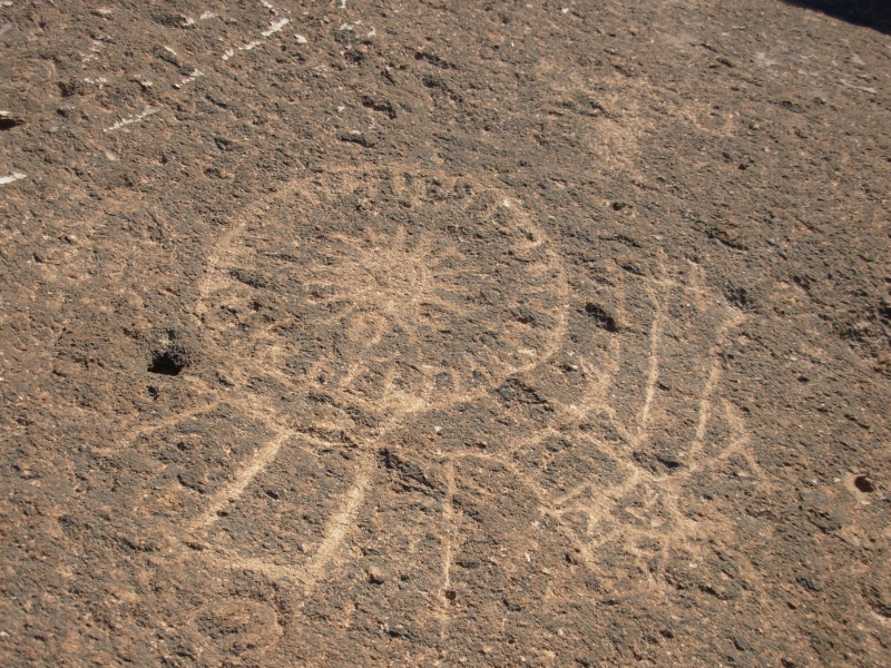
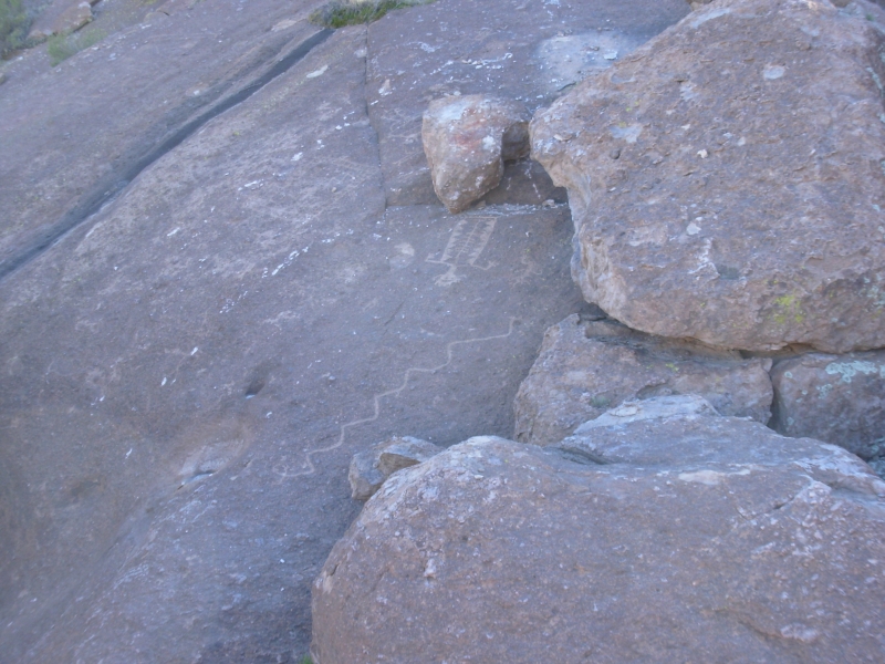
Then we went looking for some petroglyphs Jeff remembered visiting 20 years ago. We wandered around for a while, then ran into the landowner who told us how to get up to the rocks we were seeking. It was late afternoon so we took few photos since the light was wrong, but they were definitely nice petroglyphs. We went back down to the stream and made a campfire and heated some barbeque chicken and rice that Jeff had brought for dinner. It was a very relaxing and pleasant day.

Jim and I woke up early this morning, but Jeff slept in so we read and listened to the birds and water until he got up. We drove a back road to Globe that was a bit rough, but not as bad as the road up to the petroglyphs. We climbed to 6000 and were in cool Ponderosa pines for a while, then we dropped to huge blue Roosevelt Lake, which was very busy on a fine Saturday afternoon.
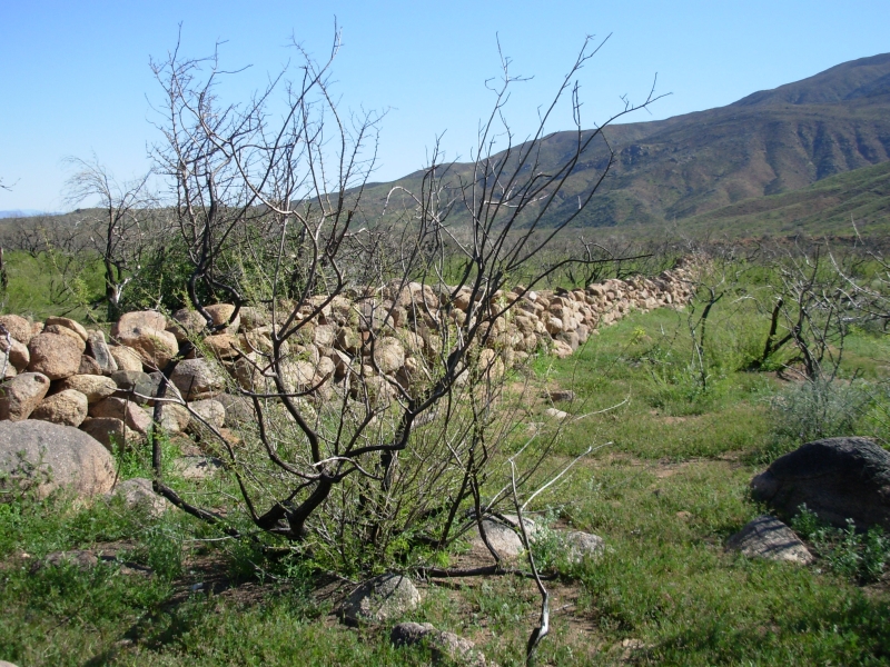
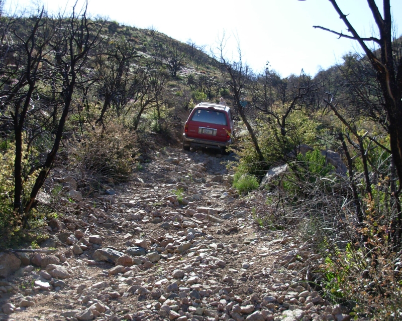
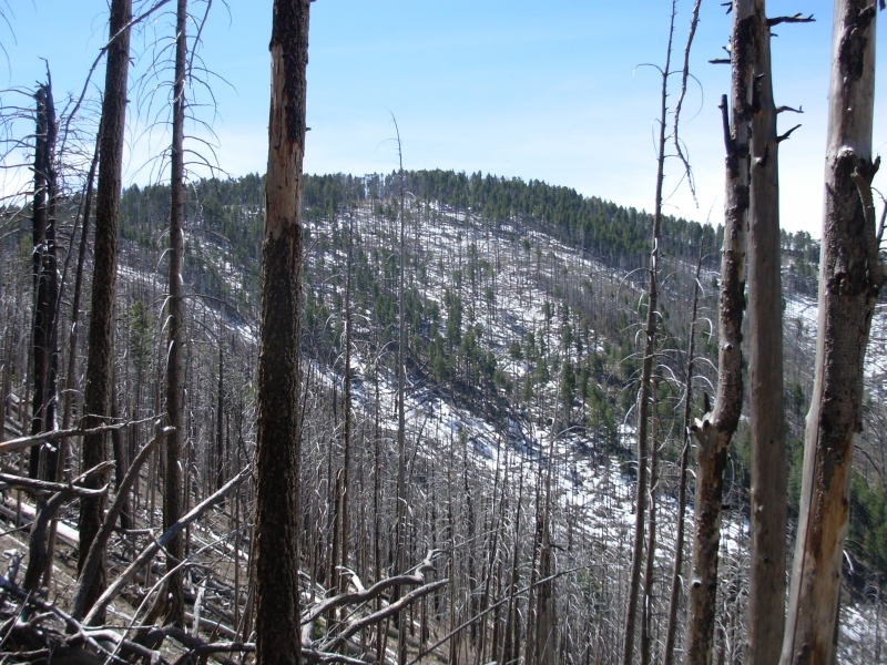
We decided to go over the mountains on an old jeep road. First we stopped at the site of Fort Reno (1868-1870) which had only a few foundations and a long stone wall, as well as a spring. Then we took a very, very rough 4WD road over the mountains. It was hard slow driving through an area that was burned a year or two ago. Jeff does a lot of four-wheeling, so was able to do things that I would never have imagined doing, but there were some very close calls and his car got bent a bit. When we reached the far side of the mountain we discovered that the road out to the highway was closed and the gate locked. No way were we going back up and over the mountain again! We got lucky though: there was an Arizona Trail crew camped by the road, and they told us where we could find a Forest Service ranger in charge of the crew camped about 5 miles away. Jeff headed off in search of a key to the gate while we visited with the trail crew. At first the ranger said no, but finally he relented and let us out. There was no indication on the far side that the road was closed on the west side. We got back to town in time for my nephews 27th birthday party and even had time for a shower first, but we were definitely wondering whether we would have to spend the night there.
Jim and I are exhausted and not sure of our next steps. I dont want to impose on my brother any longer than we must. Bad enough we showed up again six weeks early. But Jim needs to see a doctor and Im not sure how thats going to work. Usually dermatologists are hard to see at short notice. Ours requires a 2 month wait to see him. I really dont want to stay in Phoenix any longer than we must.
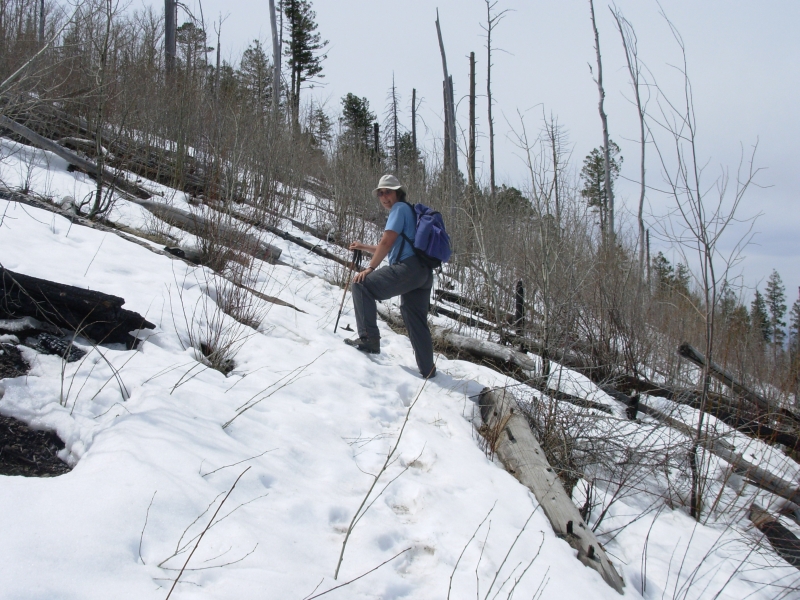
I cant help but wonder if we did the right thing, giving up. At the same time, we were both agreed that the time wasnt right to hike the GET this year. My feet were a mess and neither of our hearts was really in it, despite the beauty that surrounded us. It was like our PCT experience: we just werent eager for the discipline of another long hike so soon after the last one. Well see how the next stage goes.
Wednesday, April 4 8 ½ miles in Chiricahua National Monument
We took a couple days to rest and get cleaned up before heading out again. Jim made an appointment to see a dermatologist next week. So we decided to spend this week wandering around Southeastern Arizona. First, we had to return to Mammoth to pick up the hiking poles we left behind the door at the motel. Then we stopped in Superior to see if Sly had arrived yet (he hadnt). Next, we headed to Safford to pick up the box of maps we had mailed there. The post office closed 15 minutes before we arrived, so we headed up into the mountains above town and ended up camped at a nice campground in the pines called Acadia. The road across the mountains was still closed for the season and only three cars were camped at Acadia. There was snow on the ridge, but not at 6500 where we camped. It was a peaceful night.

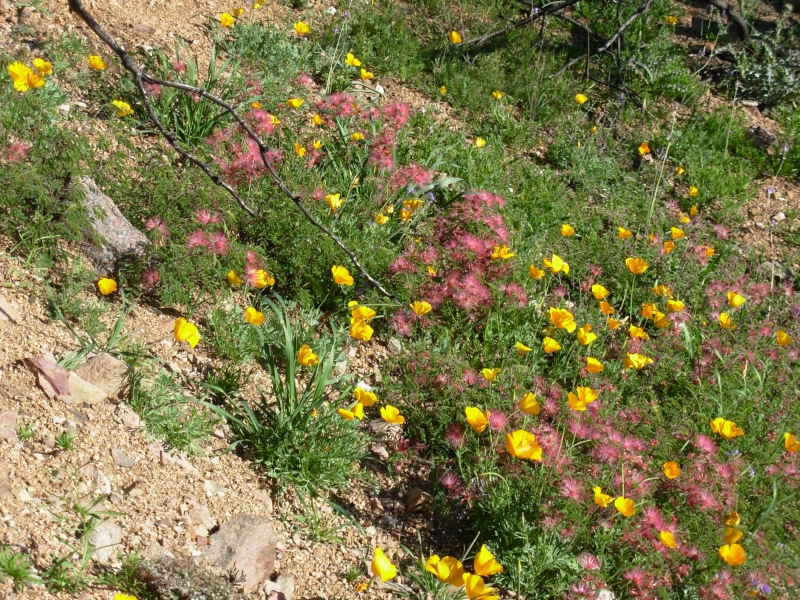
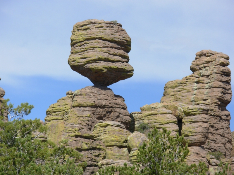
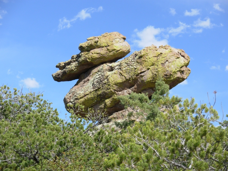
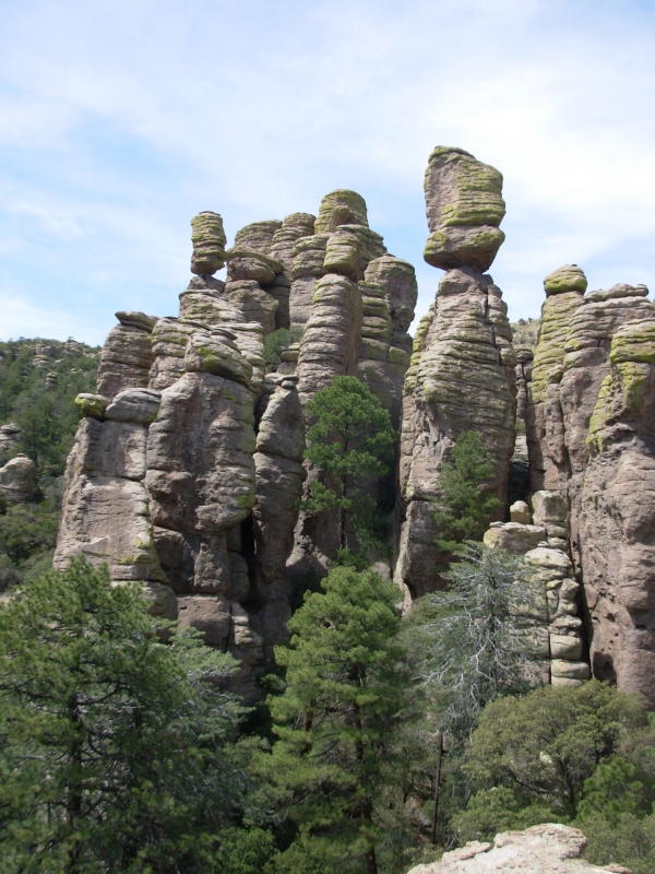
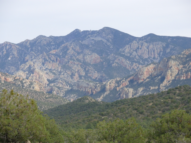
We wanted to hike this morning, but the first trail we tried was closed and the second vanished in a fire zone 100 yards out. So we returned to Safford, picked up our box and headed south to Chiricahua National Monument, arriving around noon. After a quick sandwich, we began a long loop hike down Echo Canyon, then up to the Heart of Rocks Trail, past Big Balanced Rock and Mushroom Rock and back to the parking lot. It was a nice hike with a lot of rhyolite rock formations spires, columns, balanced rocks, etc. Very dramatic. It reminded me of Bryce Canyon, though the rock is different (gray volcanic rhyolite vs. orange sedimentary sandstone). I wasnt feeling well, but I still enjoyed the hike. Afterwards we headed into the mountains, found a primitive campground and sat down to dinner in the pines again at 6900. It was a good day. Well do some hiking in the high country of the Chiricahuas (9000) tomorrow.
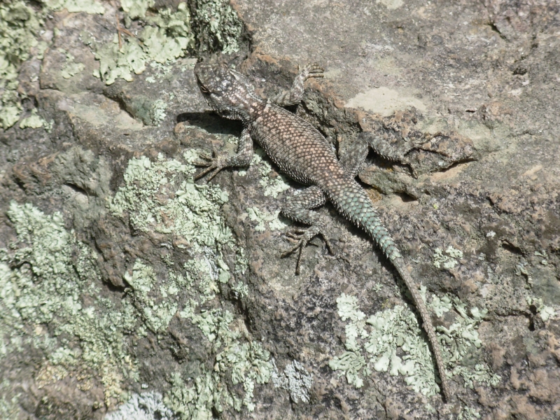
We spotted three deer as we were leaving the monument and several collared lizards in the rocks. I rarely see them, so that was a treat. We saw a lot of bluebirds in the monument, bold as gray jays. We have this campground to ourselves, but there are a lot of places to camp in the forest, so its not surprising. I was able to clean up a little in the cold creek, which was welcome, albeit painful.
Thursday, April 5 11 miles in the Chiricahuas Motel in Tombstone
It was chilly last night. When we ate breakfast the temperature was in the high 40s. The day stayed cool and cloudy nice hiking weather. We drove to Rucker Campground at the top of the range and climbed along the Crest Trail to Chiricahua Peak. Much of the trail was burned but there were views and ponderosa pines in the wooded areas. There was a lot of snow on the peaks and intermittent patches on the trail. It was a good hike, gently climbing around the knobs and over the shoulder of the mountain from side to side. The peaks were on side trails. Like the PCT, the Crest Trail wasnt on the crest, but it was still a nice walk.
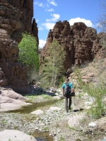
We drove down the back side to spectacular Cave Creek, which has big colorful sandstone cliffs with lots of caves. It was really pretty. Id like to spend more time there. We drove clear around the Chiricahuas, down to Douglas then up to Bisbee. That was an interesting town. There are old mines all around, but the old town has been fixed up to be an artsy tourist site. It was fun to visit, though we only stayed long enough to get dinner, then went on to Tombstone.
Friday, April 6 4 miles in Cochise Stronghold
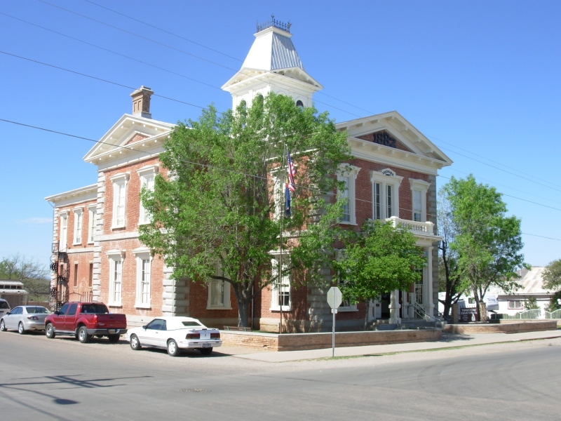
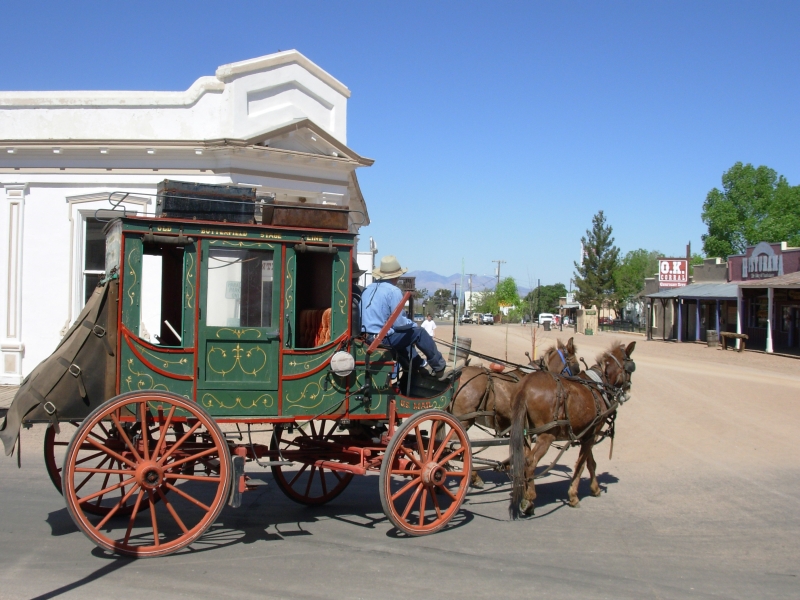
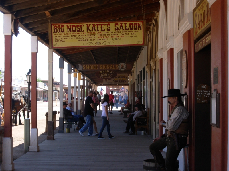
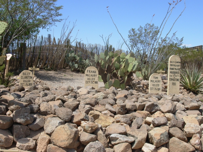
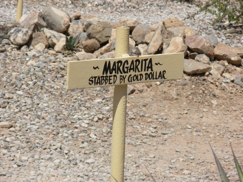
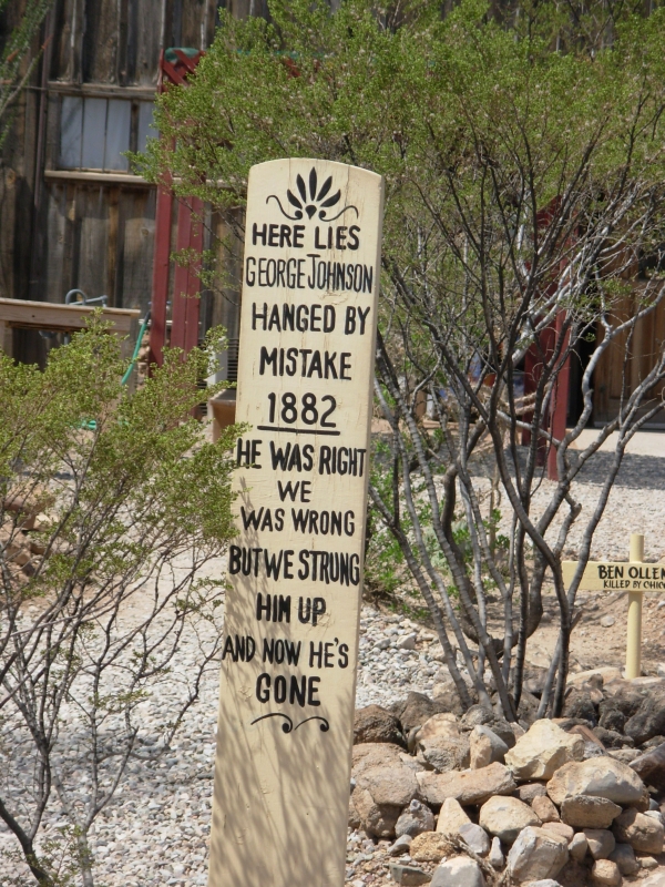
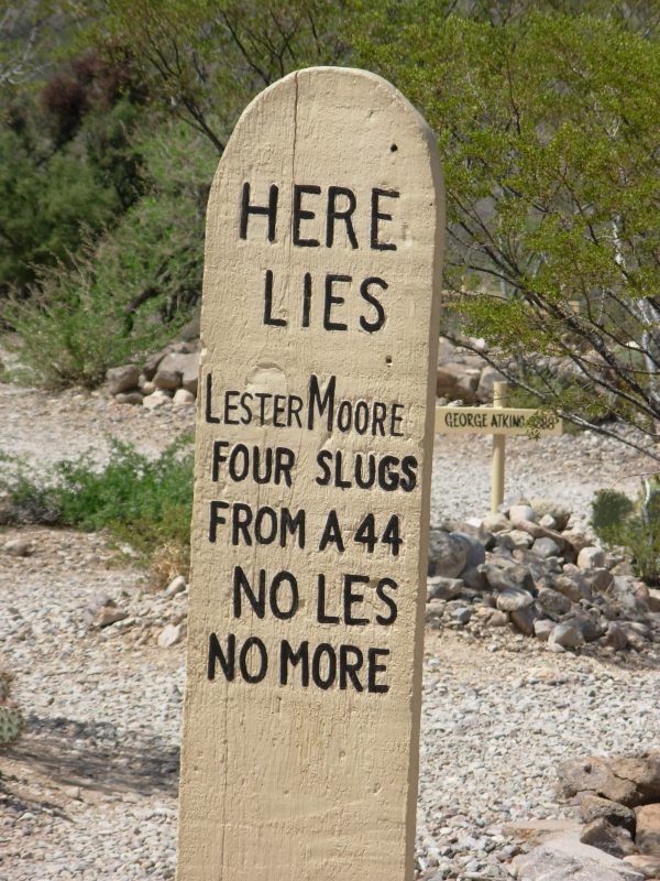
We played tourist this morning in Tombstone. While you have to pay to go into most of the exhibits, the main street (Rex T. Allen Street) is open to all, with shops, restaurants and saloons. We bought a book, admired the colorful western characters (gunslingers and saloon girls) that added atmosphere, then went to Boot Hill where I was amazed at how high the death toll was in such a short period. It was a violent time. Most were shot, hanged, stabbed, etc. It was an interesting stop though. I havent been to Tombstone in at least 40 years, and it is much more commercial than it used to be, but still we enjoyed it.


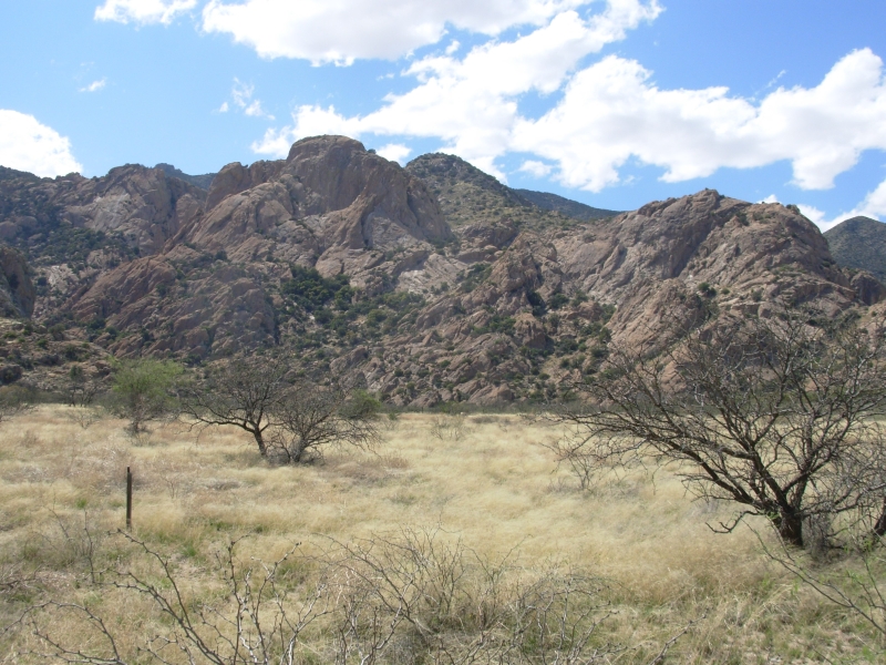
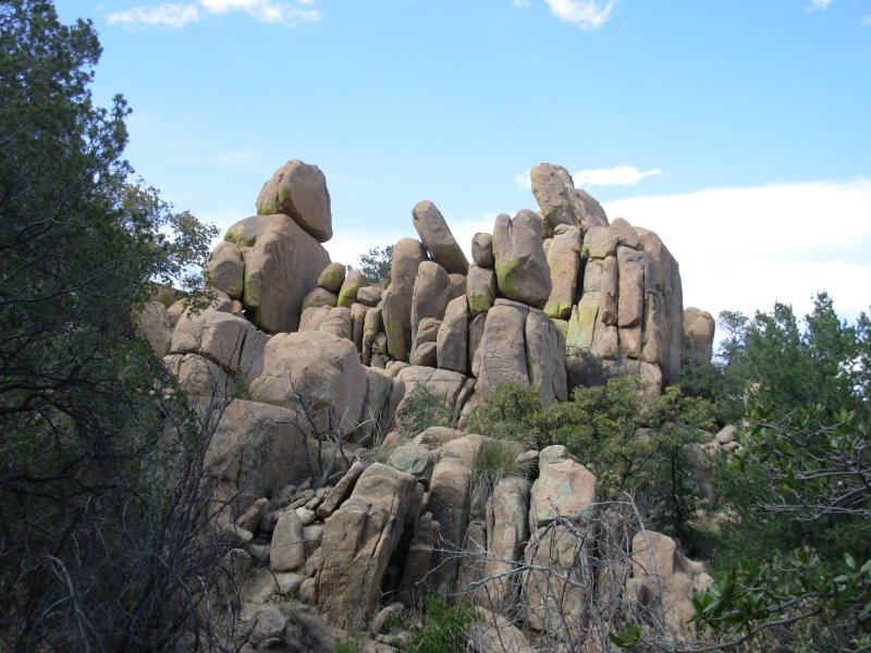
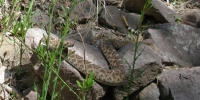
From there we went grocery shopping in Benson, then on to the Dragoon Mountains where we ended up in a very noisy and crowded small campground. Its Friday, so the families are out. We headed up the trail through the big granite boulders that comprise Cochise Stronghold. We didnt get as far as wed hoped because a big rattlesnake refused to move off the trail. Rather than try to climb around it, we turned back and looked at the historical exhibits about Cochise and the Chiricahua Apaches near the campground. The hike was only four miles, but pleasant. Its oak country, so the trail was fairly shady nice on a warm day. The snake was very belligerent. Another hiker tried for 10 minutes to get it to move. So did we. A woman out with her family kept saying, Dont harass the wildlife! All we wanted was to move him off the trail, but he wasnt interested. When we tried to go around, the snake moved toward us, so we decided it was better to turn back.
April 7 1 mile on the Mogollon Rim
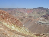
Today was a roundabout driving day through some very varied country. We started in the desert, passed the huge active Clifton-Morenci copper mines (385,000 tons of rock removed each day!) then climbed on Highway 191 through the mountains up to around 9200 where the side roads were still closed by snow. We skipped Springerville, but passed through Showlow, Pinetop and Lakeside to the open high plateau country on the Apache Reservation. There is still snow at the ski runs, but it didnt look like anyone was skiing. We did pass a large group of bicyclists on the winding mountain road. The public campgrounds were right next to the highway or in developed areas, so we followed a forest road a couple of miles back away from the highway and pulled up next to the road in the national forest. It should be quieter than last night anyway. Our only exercise was a one mile nature trail along the Mogollan Rim, which was a nice walk but short. The winding roads through the mountains were very slow, but pretty.
Home | Links| Trail Journals |
The Thruhiking Papers | Bun-bun
Created: 10 November 2007
Revised: 30 Sept 2016Copyright © 2007-2017 Spirit Eagle