|
 |
 |
 |
 |
|
|
|
|
|
|
June 17 1 1/2 mile Camp at Black Canyon of the Gunnison National Park
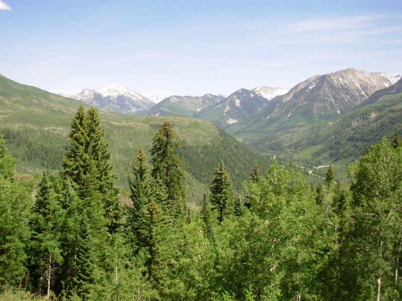
Today was another long travel day, this time through central Colorado. It was a pretty drive with views of the snow-capped San Juan Mountains and the Sangre de Christos range to the east. We got a late start because we hoped to visit a bookstore and an outdoor store in Pagosa Springs. Unfortunately, one was closed and the other didnt open until noon on Sunday. By the time we found that out, we had already lost most of the morning.
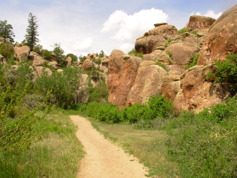
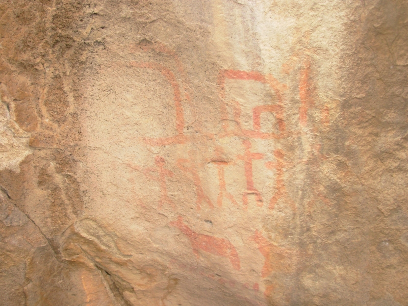
We detoured to Penitente Canyon to look for some rock art we had read about in one of the guidebooks. Penitente is an area with large boulders that is very popular with rock climbers. We saw a lot of climbers today. We only saw one pictograph panel, plus a modern painting of the Virgin Mary up on a cliff, but we enjoyed a short hike through the boulders as we looked, in vain, for other rock art that is supposed to be scattered among the rocks.
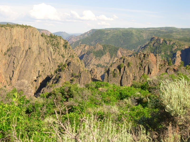
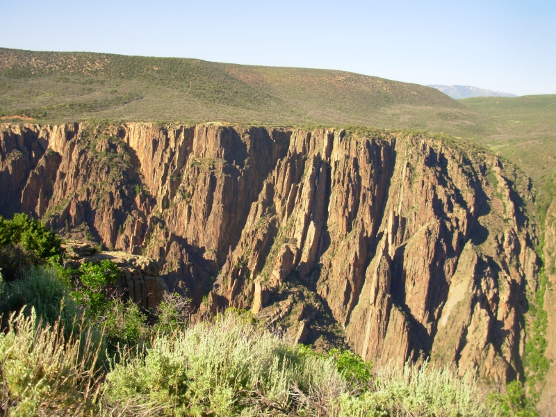
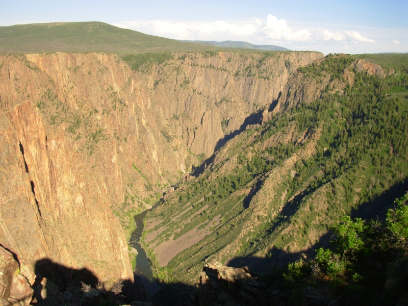
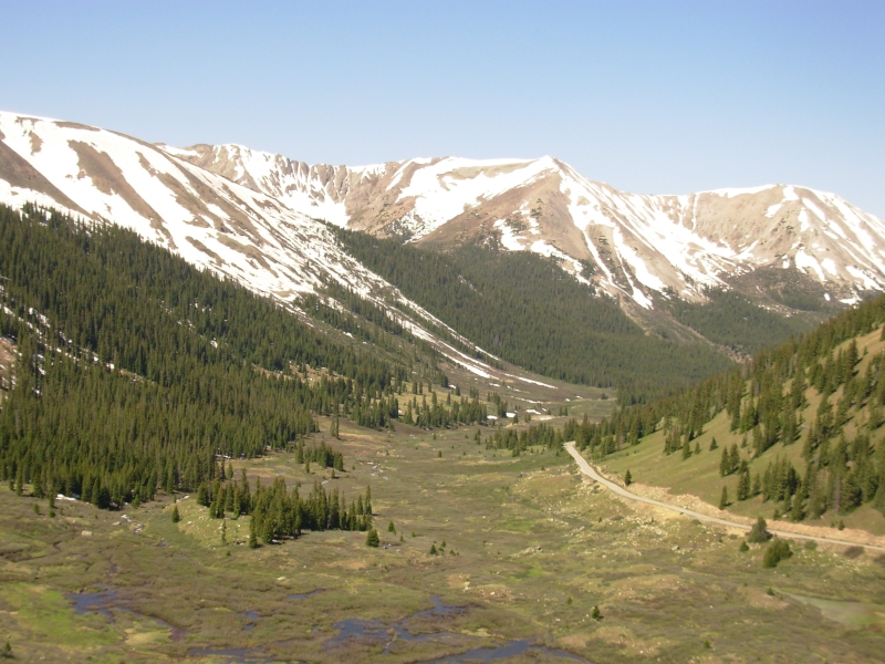
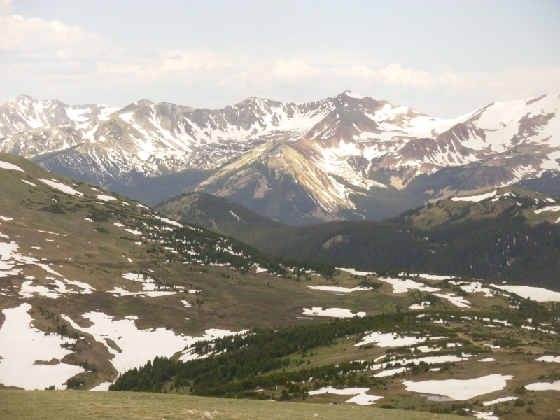
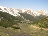
It was a long drive through Saguache to Gunnison to the National Park along the Gunnison River. It is a beautiful park with sheer canyon walls up to 2700 deep. The canyon is very narrow with jagged rock spires. It was late when we reached the park, so we just stopped at a few of the overlooks before heading to the campground. Shadows were already filling the gorge so we decided it would be better to try again in the morning.
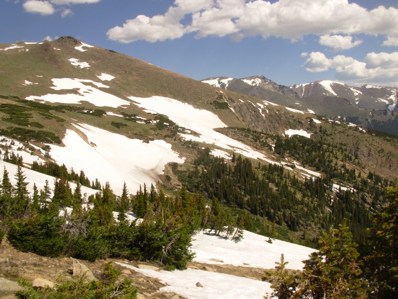
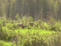
I enjoyed the drive today, even though it was a long one. Much of the land was covered in sage, with green aspen in the draws. We crossed the CDT twice, first at Wolf Creek Pass and again at North Pass in the Cochetopa. I felt very homesick for the trail. I really envy those thruhiking right now, though given the amount of snow still visible in the high country, they are probably not having an easy time. We saw more than a dozen antelope along the road mostly in a fresh cut alfalfa field and five elk in a green meadow. Happiness is!
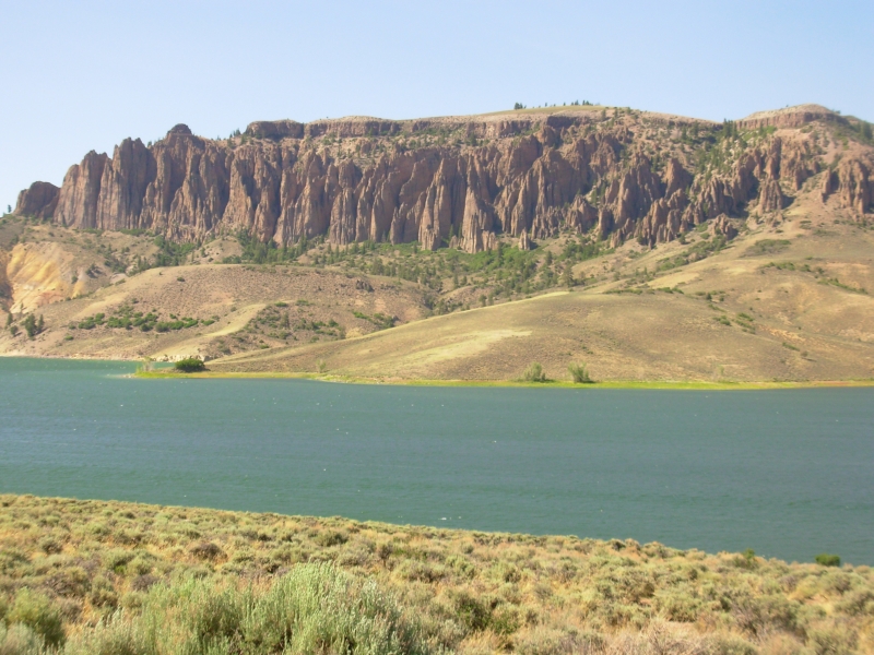
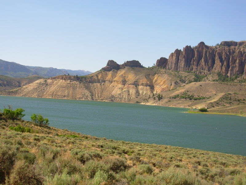
We passed Curicante Recreation Area, a large cliff-lined reservoir created by dams on the Gunnison River. It was windy, so there were only a few boats out on the water, but it was pretty.
Black Canyon of the Gunnison National Park consists of scenic drives on both sides of the canyon with many overlooks peering down into the depths. It takes a couple of hours to get from one side to the other, or you can drive an all day loop to really see the country. Were only visiting one side this time. The campgrounds are on top of the plateau. There is a boat launch by the river, but much of the river is impassible thanks to the steepness of the canyon and its narrowness. The river drops 96 per mile thats a lot for a big river. There are big boulders in the river, making navigation even more hazardous. Still, it is beautiful in a very harsh and jagged rocky sort of way. Earlier today I was enjoying rounded hills and green meadows a different sort of beauty. Its all good.
I havent talked about it, except to Jim, but I have really enjoyed the wide variety of explorations we have done this year. Arizonas lush desert, Utahs brilliantly colored canyons, Colorados snowy mountains all are beautiful. The rock art hunting has led to us to many places we wouldnt have seen otherwise and it has been fascinating. Weve done little serious hiking and not nearly enough backpacking, but our short hikes have been fun and a good introduction to the land. Well be back for a more in-depth exploration later. I feel very blessed that weve been able to do as much as we have. Jim feels weve rushed about too much, attempting to see and do too much in a short period of time. I feel like we havent done enough. Weve missed so many places, hiked so little of the backcountry that fascinates me. It would take years to really explore this country and we dont have years, only a few short weeks. So much time is wasted by the mundane groceries, laundry, gas, driving... Today we walked only one mile and drove over 200 but it took all day. Id like to walk more and drive less, but it is a long way to get anywhere in this country.
June 18 4 ½ miles Black Canyon of the Gunnison
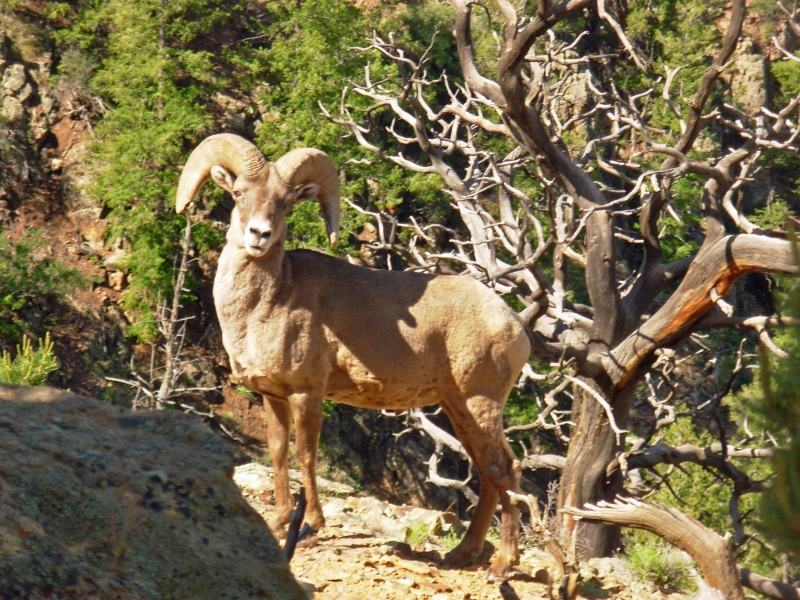
We had an unusual close encounter with wildlife today: we were charged by a bighorn ram. There were two sheep out on the tip of Warner Point, a hike at the end of the scenic drive. When we spotted them, one stood still while the other ran straight at us. I got off the trail and it swerved, dropping off the point. We continued toward the overlook. The other bighorn lay down under a tree about 25 away. The first ram then came back, running full tilt past us to the other sheep, which then stood up. We decided to leave, since our presence was definitely upsetting the ram. We wondered though. Was the quiet one sick or had it just given birth? Was it a female in heat, thus explaining the males protectiveness? It was a bit scary when he charged right at us. At the Visitors Center we were told theyve been hanging around the point all week and had totally ignored the tourists passing by, until today.
We did two short hikes in the park. First there was the 1 ½ mile hike to Warner Point and then a two mile loop on the Rim Trail and Uplands Trail. We also stopped at several overlooks and walked out to the viewpoints at each end, so we got some exercise today. The canyon is beautiful, dark and jagged, with light pink-white veins of quartz and feldspar intruding into the dark schist and gneiss. There are some trails down to the river, but they are hidden, not shown on the park maps or signs. Evidently, if you want to visit the backcountry you need to do your research ahead of time.
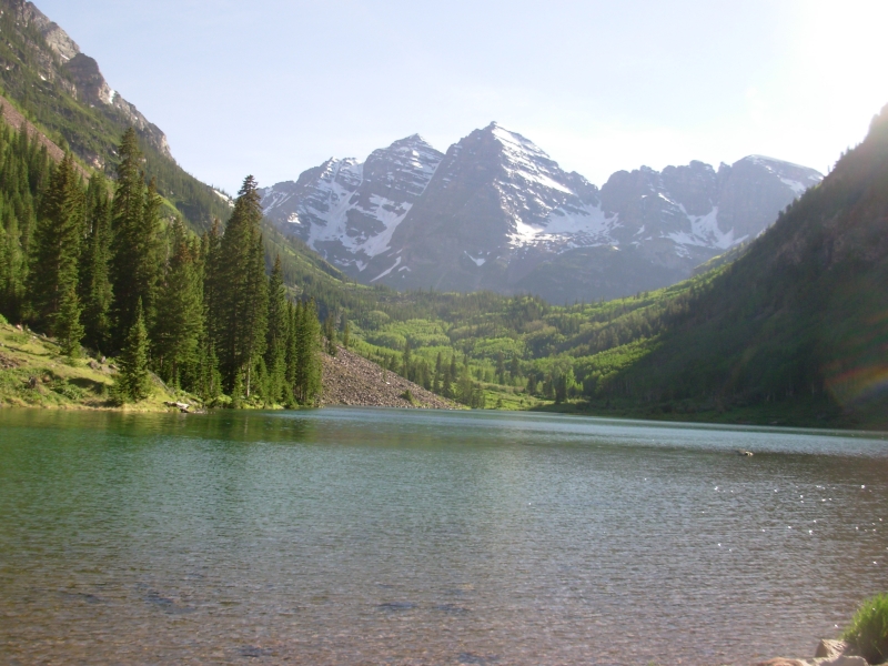
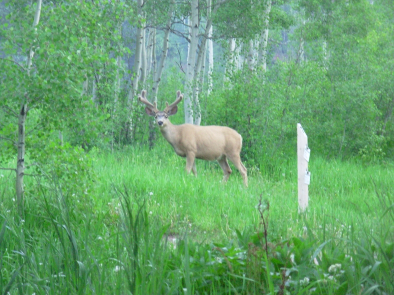
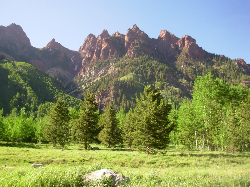
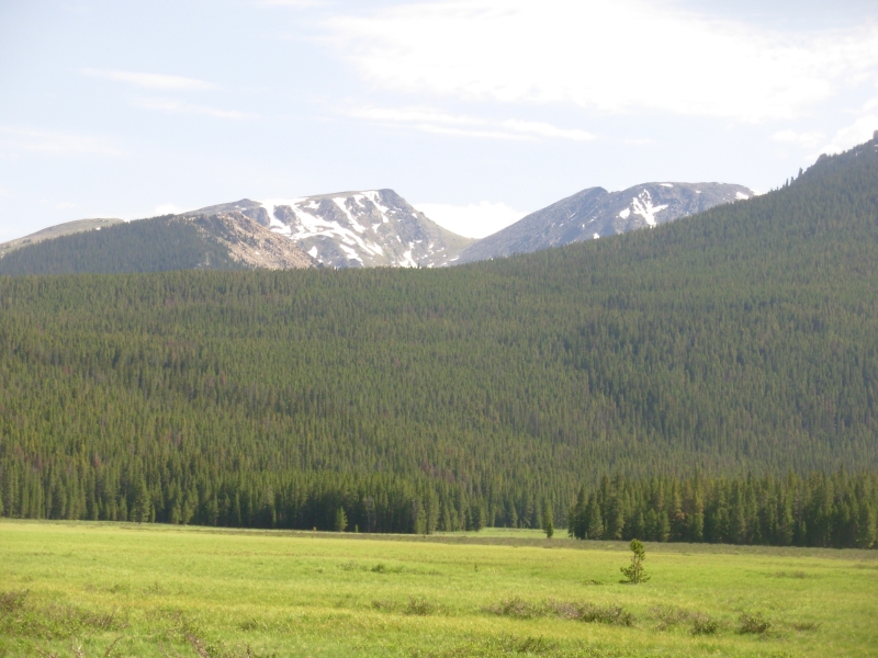
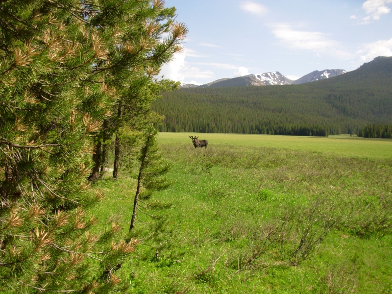
We drove east on two lane highways through some beautiful green Colorado hills, ending the day on the edge of the Maroon Bells Wilderness Area. Id like to backpack this area someday, but for now I am content to see the famous peaks and camp along the creek at one of the campgrounds. Our timing wasnt good for photography, though we did get nice views of the red mountains around the lake and the snow covered peaks beyond. We saw one elk on our drive. The area was more congested than I expected, with lots of summer homes, a few coal mines in full production and busy little towns. We barely touched the town of Aspen before heading into the mountains, but we did see some huge houses along the way. As we ate dinner, a beautiful buck grazed near our campsite, utterly unafraid.
June 19 drive to Leadville
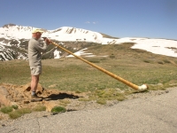
Today was mostly a rest day in beautiful Leadville, Colorado. We drove through incredibly congested downtown Aspen, then through the mountains to beautiful Independence Pass. The road was a bit scary as it kept narrowing down to one lane, often in places where you couldnt see on-coming traffic. The road was busy with motorbikes, cars, trucks and three Ferraris that raced up to the pass. I enjoyed seeing the man checking out the acoustics for his Swiss horn that hes playing at a wedding at the pass this weekend. It would be a wonderful spot for a wedding.
We reached Leadville by noon, after a brief stop in Twin Lakes where we saw a thruhikerTarn--and heard that two others had passed through this morning. It was fun to spot a CDT hiker on our way through town. Tarn was talking on his cell phone so we didnt linger. We just said hello and told him the restaurant had just opened for lunch.
Despite all the snow still in the high country, I envy those out thruhiking. They have so much good country ahead of them. I know, so do I. But I know what theyll see. Im not sure about our trails. We still intend to be in Canada in three weeks or so. There's a new guidebook for the Great Divide Trail, but I haven't seen it yet as it just came out. I ordered it from Amazon, but it hasn't managed to catch up to us yet. Until we get the new guidebook, we cant make reservations since we dont know if the mileage has changed. I had the book sent to Arizona and havent been able to get it forwarded yet. Soon.
We stayed at the Leadville hostel again. Its a peaceful place. There were only two other people staying the night, a Danish couple. On the weekend it will get busy again and soon Colorado Trail and CDT hikers will begin to show up, as well as hordes of peak baggers. Mt. Elbert and Mt. Massive, two 14'ers, are both near Leadville. The peaks are still white, though Bill said there have already been several climbs that he knows about.
June 20: Camp at Rocky Mountain National Park

Another travel day. We didnt go far, but somehow it took all day, thanks to several unplanned stops: the post office, grocery, outdoor store in Dillon (Jim bought new boots), new bookstore, used bookstore, etc. The roads we took, aside from a brief stint on I-70, were slow winding mountain roads. There are more people than I expected living along the base of the Rockies. We passed lots of little towns tucked in along the highways and rivers. Colorado would be terrific if it had about a quarter of the current population. As it is, its just too crowded for me.
We stopped early on the east side of Rocky Mountain National Park (RMNP) at a campground in the pines. It was too late to go hiking, so we drove to Sheep Lake, hoping to see an elk or bighorns, then on to the alluvial fan where a burst dam in 1982 flooded the valley all the way to Estes Park, killing a couple of campers. We only saw the creek and the alluvial fan, the former dam was far upstream. We saw no wildlife, but it was a nice drive.
June 21 3 miles in Rocky Mountain National Park
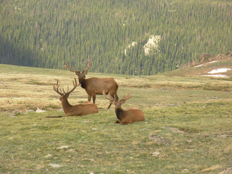
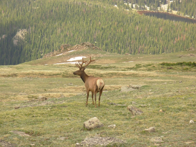
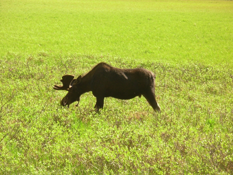
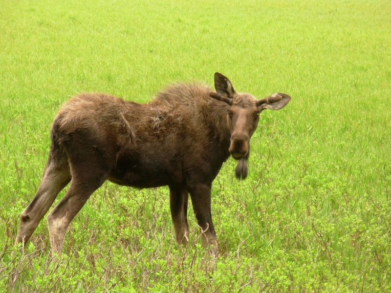
It was a mixed day, really good and really disappointing. On the positive side were beautiful mountains and lots of wildlife. We saw at least a half dozen herds of elk. The last one, in the meadow near our campground, had 30-40 elk spread out all over the hills. We got a few really good pictures of bull elk. They are beautiful. We also saw a herd of 14 bighorns high on a ridge above our trail and another raced across the road while we were sitting at an overlook eating lunch. A couple of deer wandered through the campground and I may have gotten a glimpse of a moose, but it was just a glimpse so Im not positive. I love seeing wildlife like that, even if it is tame national park wildlife.

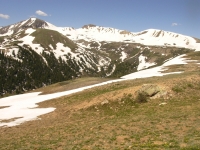
We planned to do an eight mile hike today on the Ute Trail. We started up and immediately ran into snow. We kept going until the footprints ran out about 100 yards. The snow was soft, so the walking was post-holing with every step. We turned back. Across the road was another shorter trail so we headed up it. We were still post-holing knee deep, but we had footsteps to follow when the trail disappeared in the trees, so we kept going anyway. We met the people who made the tracks and they said they reached the top, so we felt fairly reassured that we wouldnt end up going in circles. The softness of the snow made hard going, as did the fairly steep climb. Altitude was definitely affecting me. I was breathless and nauseous, but determined to keep going because the family we met said they saw bighorns on top. So did we and it was worth the climb. We learned later that the trail is supposed to be closed because the sheep are calving, but there were no signs indicating a closure. We turned around once we saw them in any case. I doubt they saw us as we were a LONG way off.
We stopped at the Visitors Center to get a backcountry permit for a trip on the CDT through RMNP. The trail makes an odd loop in the park that weve never done. It heads east and returns 30 miles later, only a mile or so from the starting point. Few thruhikers, including us, take the time to do the loop, but it is supposed to be beautiful, so we wanted to check it out to see for ourselves. Unfortunately the trail is still closed. The ranger said there is still too much snow and the switchbacks are buried, making for a dangerous situation. I was really disappointed. The main reason we came to RMNP this year was to hike that section. Now what do we do?

Next we headed to town to pick up our new GDT guidebook. Guess what, they forgot, again, to mail it. I really felt frustrated.
We bought an ice cream then headed back up the road to the National Park campground. Its a big one with over 100 sites. We took a walk to a nearby meadow that used to be home to a dude ranch from the 1920s to the 1950s. The homestead is still standing as are some of the resort buildings. Thats when we spotted a large herd of elk way out on the meadow. Two bulls were near the trail but still too far to photograph well.
Final note, the tree die off we noticed last year near Grand Lake has gotten worse. The pine and spruce beetles are killing all the trees. The whole mountain above Grand Lake is dead. Its shocking. It looks like a fire came through. Soon that will happen, with so many dead trees as fuel. If I owned a house in Grand Lake, Id be worried. Parts of RMNP were okay, but near Grand Lake all the forest is brown.
June 22 10 ½ miles in RMNP
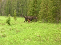
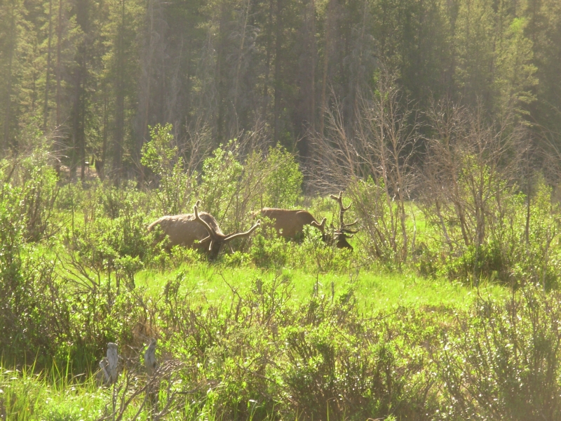
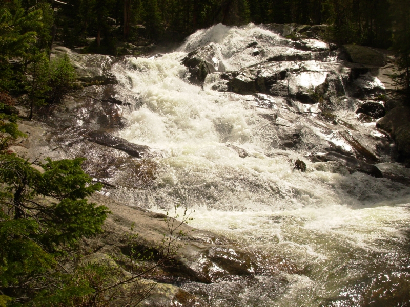
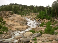
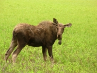
We decided to do a day hike on part of the CDT route we had intended to backpack, from the Green Mountain Trailhead to Granite Falls. It turned out to be a good hike, uphill all the way, but not steep. Most of it was a woods walk, with occasional views of green grassy meadows and one mile followed the edge of Big Meadow, which was something of a moose haven. We saw a beautiful bull moose, its antlers still in velvet, on the way up. On the return trip we saw a cow with calf and a young male moose, just barely growing antlers, then another cow in a smaller meadow. Then there were two elk and two dark spots that may have been more moose. I couldnt be sure. Still, five moose in 10 miles was really good. The waterfall that was our destination, Granite Falls, was a big one wide and powerful. It was worth the climb and the mosquitoes.
Thunder rumbled for about half the hike, but never got close, and we only felt a few drops of rain while we were eating lunch. There were lots of people on the trail, including a large group of girls backpacking and a Korean group of dayhikers as well as a couple of family groups, among others. We finished our hike around 1:00 and headed north in the rain to Wyoming.
The rain didnt last long so we enjoyed the drive north to Rawlins. We crossed the CDT again at Willow Creek Pass, still an obscure trailhead, even when we know what to look for. There is a lot of snow still in the mountains. Parkview and the Mt. Zirkel Wilderness would be impassible still, I think.
Southern Wyoming was beautiful really green, totally unlike last years parched brown. We spotted 25 or so antelope and hundreds of prairie dogs racing across the highway. Traffic was light and the driving peaceful through rolling green ranch country with mountains on both sides of the road.
Home | Links| Trail Journals |
The Thruhiking Papers | Bun-bun
Created: 10 November 2007
Revised: 30 Sept 2016Copyright © 2007-2017 Spirit Eagle